Items Similar to Large Custom Framed 1857 U.S. Coast Survey of the Chesapeake Bay
Want more images or videos?
Request additional images or videos from the seller
1 of 10
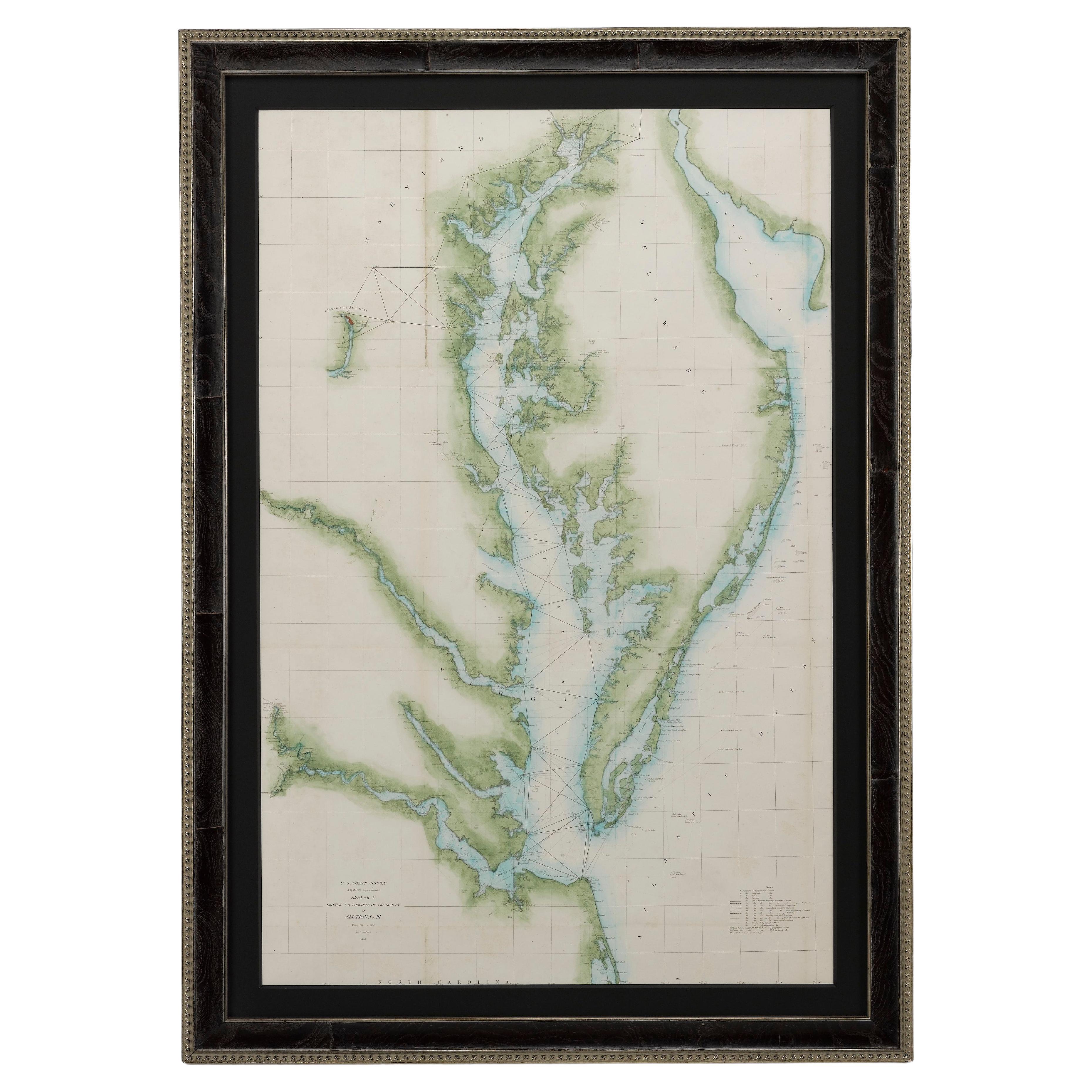
Large Custom Framed 1857 U.S. Coast Survey of the Chesapeake Bay
About the Item
An antique 1850's nautical map with hand-painted color accents entitled “Chesapeake Bay; Sheet no. 2: Head of the Bay to the Mouth of the Potomac River”. Created by the United States Coast Survey. Presented under glass in a large custom gilt frame with line embossed Olive liner.
Frame measures 44.5” W x 37” H x 1” D.
Sight measures 36.5” W x 29” H
Condition: Expected and acceptable age related discoloration and fold lines to map, a few minor losses and chips to the frame, mentioned for accuracy as the Map presents exceptionally well.
- Dimensions:Height: 37 in (93.98 cm)Width: 44.5 in (113.03 cm)Depth: 1 in (2.54 cm)
- Style:American Classical (Of the Period)
- Materials and Techniques:
- Place of Origin:
- Period:
- Date of Manufacture:1857
- Condition:Wear consistent with age and use. Minor losses.
- Seller Location:Bridgeport, CT
- Reference Number:
About the Seller
5.0
Vetted Seller
These experienced sellers undergo a comprehensive evaluation by our team of in-house experts.
1stDibs seller since 2015
1,601 sales on 1stDibs
Typical response time: <1 hour
- ShippingRetrieving quote...Ships From: Bridgeport, CT
- Return PolicyThis item cannot be returned.
More From This SellerView All
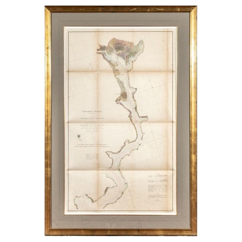
- 1864 U.S. Coast Survey of the Potomac River, from Indian Head to GeorgetownLocated in Bridgeport, CTAn antique nautical map with hand-painted color accents entitled "Potomac River (in four sheets): Sheet no. 4, from Indian Head to Georgetown". Created b...Category
Antique 19th Century American Classical Maps
MaterialsPaper
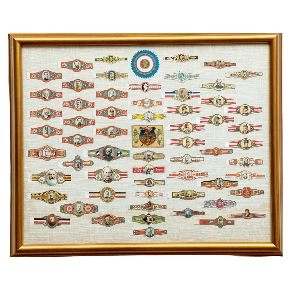
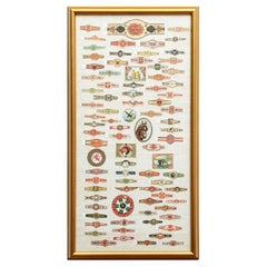
- Fine Collection of Custom Framed Vintage Cigar LabelsLocated in Bridgeport, CTA collection of various multi-colored and gilt cigar bands all with portrait heads. Including- Franz Joseph I, and other rulers. Along with a serrated round label with a bust in prof...Category
20th Century Hollywood Regency Tobacco Accessories
MaterialsLinen, Glass, Wood, Paper
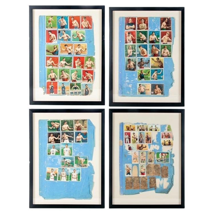
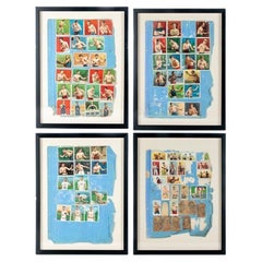
- Rare Set of Four Framed Antique Boxing and Sports Collectible CardsLocated in Bridgeport, CTFour groups of colored paper collectible sports cards mounted on blue paper pierced in the margin for placing in a notebook. Now mounted on off white card and custom framed. The cards include images of boxers Al Kaufman, Mike Sullivan, Gans and Nelson and many others. Along with images of track and field and swim athletes. Some faded black printed faded paper ones with portraits of boxers e.g Jack...Category
Early 20th Century American Classical Sports Equipment and Memorabilia
MaterialsPaper
- Framed Large Collection Of Vintage Cigar BandsLocated in Bridgeport, CTVarious brands including one with a collie, one with a horse, an eagle (Turkish), cows (Turkish), birds (Egyptian Deities, and others). A large one at top for La Reclama, Havana Ciga...Category
20th Century Hollywood Regency Tobacco Accessories
MaterialsLinen, Wood, Paper, Glass
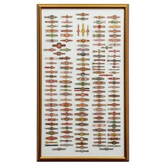
- Large Collection Of Framed Vintage Cigar BandsLocated in Bridgeport, CTMulticolored and gilt bands of different types. Including some Egyptian, Habana and Turkish (upper right ones with a steam ship and a river landscape). Mounted on white linen in a gi...Category
20th Century Tobacco Accessories
MaterialsWood, Paper, Glass, Linen
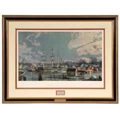
- J. Stobart Lithograph "Mystic Seaport. "The Charles L. Morgan" at Chubb's WharfBy John StobartLocated in Bridgeport, CTMarked mystic seaport Member's Edition #136/736 on the frame's plaque. Celebrating the 150th anniversary of the ship. Includes a framed swatch of the sh...Category
20th Century American Classical Nautical Objects
MaterialsWood

You May Also Like
- 1856 U.S. Coast Survey Map of Chesapeake Bay and Delaware BayLocated in Colorado Springs, COPresented is U.S. Coast Survey nautical chart or maritime map of Chesapeake Bay and Delaware Bay from 1856. The map depicts the region from Susquehanna, Maryland to the northern Outer Banks in North Carolina. It also shows from Richmond and Petersburg, Virginia to the Atlantic Ocean. The map is highly detailed with many cities and towns labeled throughout. Rivers, inlets, and bays are also labeled. Various charts illustrating more specific parts of the region are marked on the map using dotted lines. The lines form boxes, and the corresponding chart number and publication date are given. Extensive triangulation surveys were conducted the length of Chesapeake Bay and are illustrated here. Hampton Roads, Virginia is labeled, along with the James, York, and Rappahannock Rivers, which were all extensively surveyed. The chart was published under the supervision of A. D. Bache, one of the most influential and prolific figures in the early history of the U.S. Coast Survey, for the 1856 Report of the Superintendent of the U.S. Coast Survey. Alexander Dallas Bache (1806-1867) was an American physicist, scientist, and surveyor. Bache served as the Superintendent of the U.S. Coast Survey from 1843 to 1865. Born in Philadelphia, Bache toured Europe and composed an important treatise on European Education. He also served as president of Philadelphia's Central High School and was a professor of natural history and chemistry at the University of Pennsylvania. Upon the death of Ferdinand Rudolph Hassler, Bache was appointed Superintendent of the United States Coast Survey. The Office of the Coast Survey, founded in 1807 by President Thomas Jefferson and Secretary of Commerce Albert Gallatin...Category
Antique 1850s American Maps
MaterialsPaper
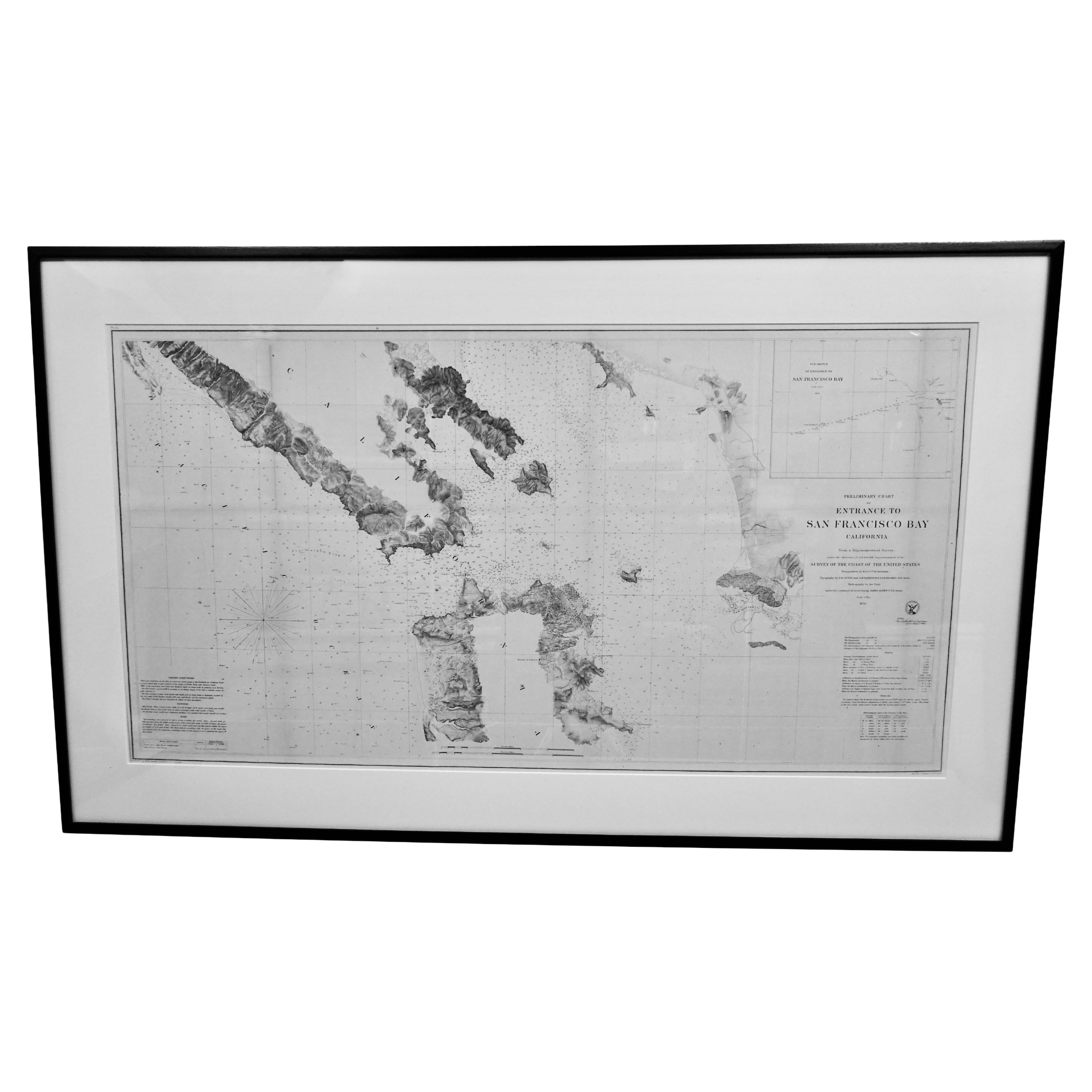
- Scarce U.S. Coast Survey Map Depicting Entrance to San Francisco Bay Dated 1856Located in San Francisco, CAA fine example of the 1856 U.S. Coast lithographic survey nautical chart of the entrance to San Francisco bay and the city. Published in 1856 by the Office of the Coast Survey the of...Category
Antique Mid-19th Century American Maps
MaterialsPaper
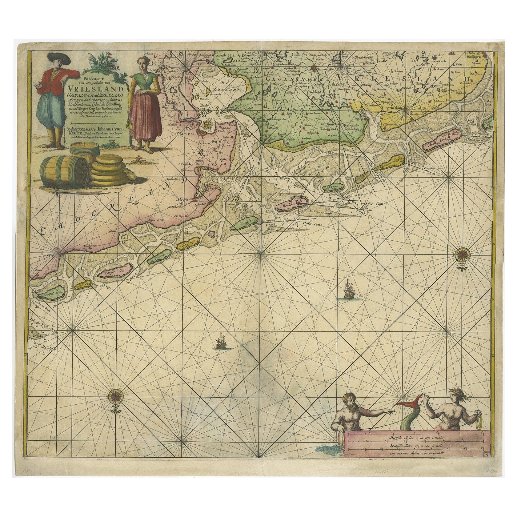
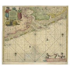
- Old Decorative & Highly Detailed Sea Chart of the North Dutch-German Coast, 1681Located in Langweer, NLAntique map titled 'Paskaart van een gedeelte van Vriesland, Groeninger, en Emderland. Met zyn onderhoorige Eylanden; Strekkende van't Eylant der Schelling'. Decorative and highl...Category
Antique 1680s Maps
MaterialsPaper
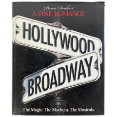
- Fine Romance Hollywood Broadway: the Magic, the Mayhem, Hardcover Table BookLocated in North Hollywood, CAA Fine Romance Hollywood Broadway: The Magic, The Mayhem, The Musicians By Denkert, Darcie. New York: Watson-Guptill Publications, 2005. 360 pages. Darcie covers the love/hate rel...Category
20th Century American American Classical Books
MaterialsPaper
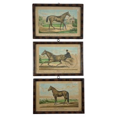
- Framed Race Horse Champions Original Chromolithographs Printed in 1882, Set /3Located in Philadelphia, PAA set of three framed original Race Horse Chromolithographs originally published in the “Illustrated Stock Doctor and Livestock Encyclopedia” in 1882. In hand-painted wood frames secured with small nails, with metal hanging rings. Captioned as follows: “Black’s Hambletonian” One of the finest and best blooded trotting stallions of the day. Property of S. Baxter Black, Compassville, Pa. Cost when a weanling colt $3500. Sired by “Rysdyk’s Hambletonion”; dam “Long Island Black Hawk” “Maud S." The Queen of the Turf. Record 2.10 1/4. The fastest trotter the world has yet known. Owned by William H. Vanderbilt Esq. who has refused a cash offer of $100.000 for her. Foaled at Woodburn Farm, Ky. March 28, 1874. Trainer and driver W.W. Bair. “Iroquois” Winner of the Derby. (Epsom Derby...Category
Antique Late 19th Century American American Classical Historical Memorab...
MaterialsWood, Paper
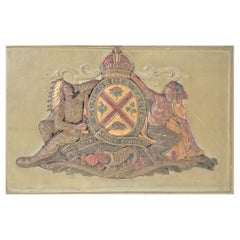
- Mid-Century Royal Trust Company Framed Wall Plaque with Indigenous ChiefLocated in Hamilton, OntarioThis wall plaque is unsigned with respect to the maker, but it is presumed to have been made in Canada in approximately 1950 in a traditional style. The plaque is composed of a very ...Category
Mid-20th Century Canadian American Classical Decorative Art
MaterialsSpelter


Recently Viewed
View AllMore Ways To Browse
Foldable Glasses Frames
Bay Antique Furniture
Antique Survey
Antique Bay
1850s American
Sheets Of Antique Glass
Framed Map United States
U S Map
Antique Surveying
Antique Map Paint
Survey Map
Antique American Nautical
Large Framed Maps
Large Framed Antique Maps
Hand Painted Antique Map
Nautical Map
Nautical Maps
Antique Nautical Map