Items Similar to 1864 U.S. Coast Survey of the Potomac River, from Indian Head to Georgetown
Want more images or videos?
Request additional images or videos from the seller
1 of 10
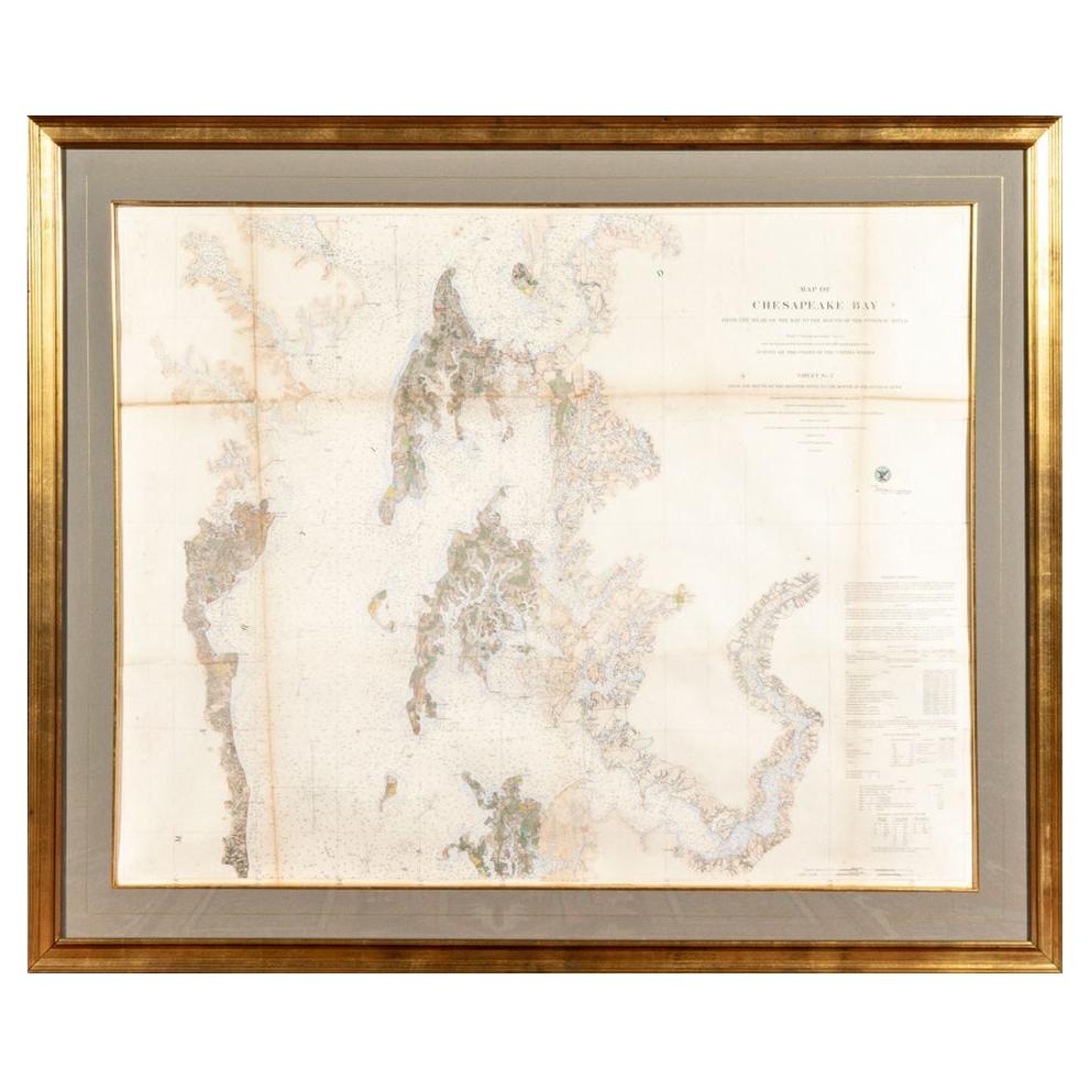
1864 U.S. Coast Survey of the Potomac River, from Indian Head to Georgetown
About the Item
An antique nautical map with hand-painted color accents entitled "Potomac River (in four sheets): Sheet no. 4, from Indian Head to Georgetown". Created by the United States Coast Survey and notable figures Alexander Dallas Bache (1806-1867) and Alexander Medina Harrison (1829-1881). Presented under glass in a large gilt tone wood frame.
Frame measures 33” W x 49.5” H.
Sight measures 23.25” W x 39.5” H x 1” D.
Condition: Please see all detail photos. There is age-related and expected discoloration and fold lines to the map and some marks and slight scratches and gilt loss to the frame however the presentation is authentic and very good.
- Dimensions:Height: 49.5 in (125.73 cm)Width: 33 in (83.82 cm)Depth: 1 in (2.54 cm)
- Style:American Classical (Of the Period)
- Materials and Techniques:
- Period:
- Date of Manufacture:19th Century
- Condition:Wear consistent with age and use. Minor losses.
- Seller Location:Bridgeport, CT
- Reference Number:
About the Seller
5.0
Vetted Seller
These experienced sellers undergo a comprehensive evaluation by our team of in-house experts.
1stDibs seller since 2015
1,593 sales on 1stDibs
Typical response time: <1 hour
- ShippingRetrieving quote...Ships From: Bridgeport, CT
- Return PolicyThis item cannot be returned.
More From This SellerView All
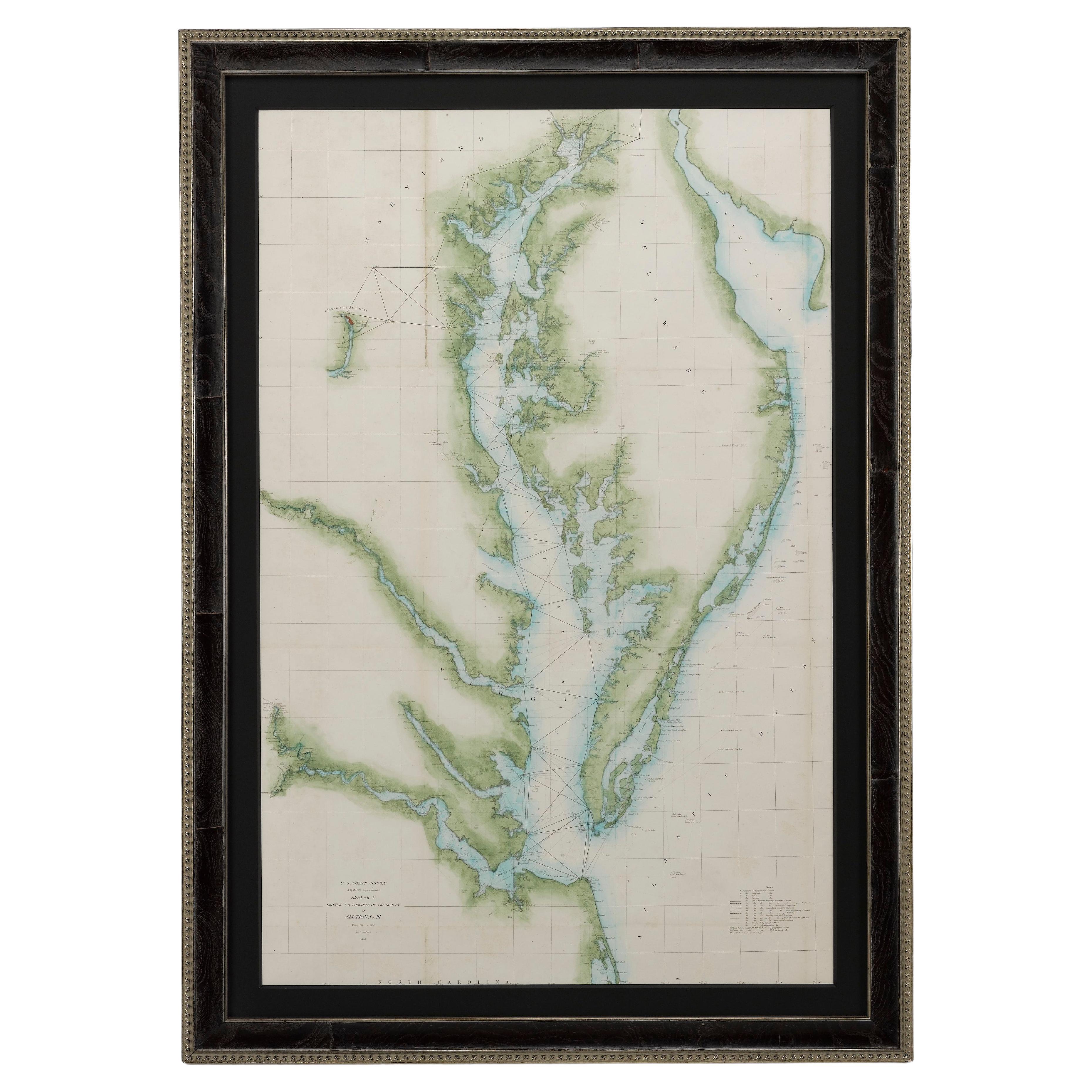
- Large Custom Framed 1857 U.S. Coast Survey of the Chesapeake BayLocated in Bridgeport, CTAn antique 1850's nautical map with hand-painted color accents entitled “Chesapeake Bay; Sheet no. 2: Head of the Bay to the Mouth of the Potomac River”....Category
Antique 1850s American American Classical Maps
MaterialsPaper
- J. Stobart Lithograph "Mystic Seaport. "The Charles L. Morgan" at Chubb's WharfBy John StobartLocated in Bridgeport, CTMarked mystic seaport Member's Edition #136/736 on the frame's plaque. Celebrating the 150th anniversary of the ship. Includes a framed swatch of the sh...Category
20th Century American Classical Nautical Objects
MaterialsWood
- Rare Set of Four Framed Antique Boxing and Sports Collectible CardsLocated in Bridgeport, CTFour groups of colored paper collectible sports cards mounted on blue paper pierced in the margin for placing in a notebook. Now mounted on off white card and custom framed. The cards include images of boxers Al Kaufman, Mike Sullivan, Gans and Nelson and many others. Along with images of track and field and swim athletes. Some faded black printed faded paper ones with portraits of boxers e.g Jack...Category
Early 20th Century American Classical Sports Equipment and Memorabilia
MaterialsPaper
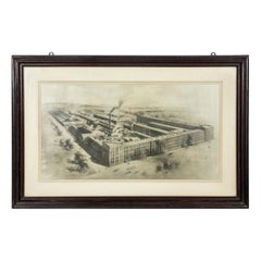
- Antique Rendering of a Photo of Yale Locks-Hardware, Stamford ConnecticutLocated in Bridgeport, CTAntique circa 1897 rendering of an Aerial photograph view of the huge complex of the manufacturing company formerly residing in Stamford, Connecticut. Image measures 18 3/4 x 34 1/4...Category
Antique Late 19th Century American Industrial Historical Memorabilia
MaterialsWood
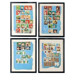
- Framed Large Collection Of Vintage Cigar BandsLocated in Bridgeport, CTVarious brands including one with a collie, one with a horse, an eagle (Turkish), cows (Turkish), birds (Egyptian Deities, and others). A large one at top for La Reclama, Havana Ciga...Category
20th Century Hollywood Regency Tobacco Accessories
MaterialsLinen, Wood, Paper, Glass
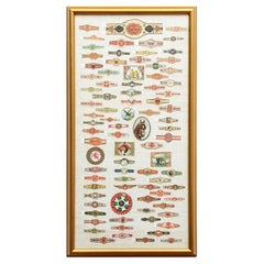
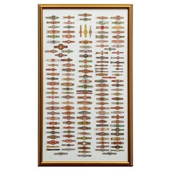
- Large Collection Of Framed Vintage Cigar BandsLocated in Bridgeport, CTMulticolored and gilt bands of different types. Including some Egyptian, Habana and Turkish (upper right ones with a steam ship and a river landscape). Mounted on white linen in a gi...Category
20th Century Tobacco Accessories
MaterialsWood, Paper, Glass, Linen

You May Also Like
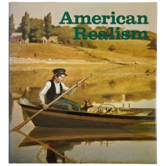
- American Realism A Pictorial Survey from the Early 18th Century to the 1970sLocated in North Hollywood, CAAmerican Realism, a pictorial survey from the early 18th century to the 1970s. Mathey, François Published by Portland House, 1987 Title: American Realism: A pictorial survey from....Category
Late 20th Century American American Classical Books
MaterialsPaper
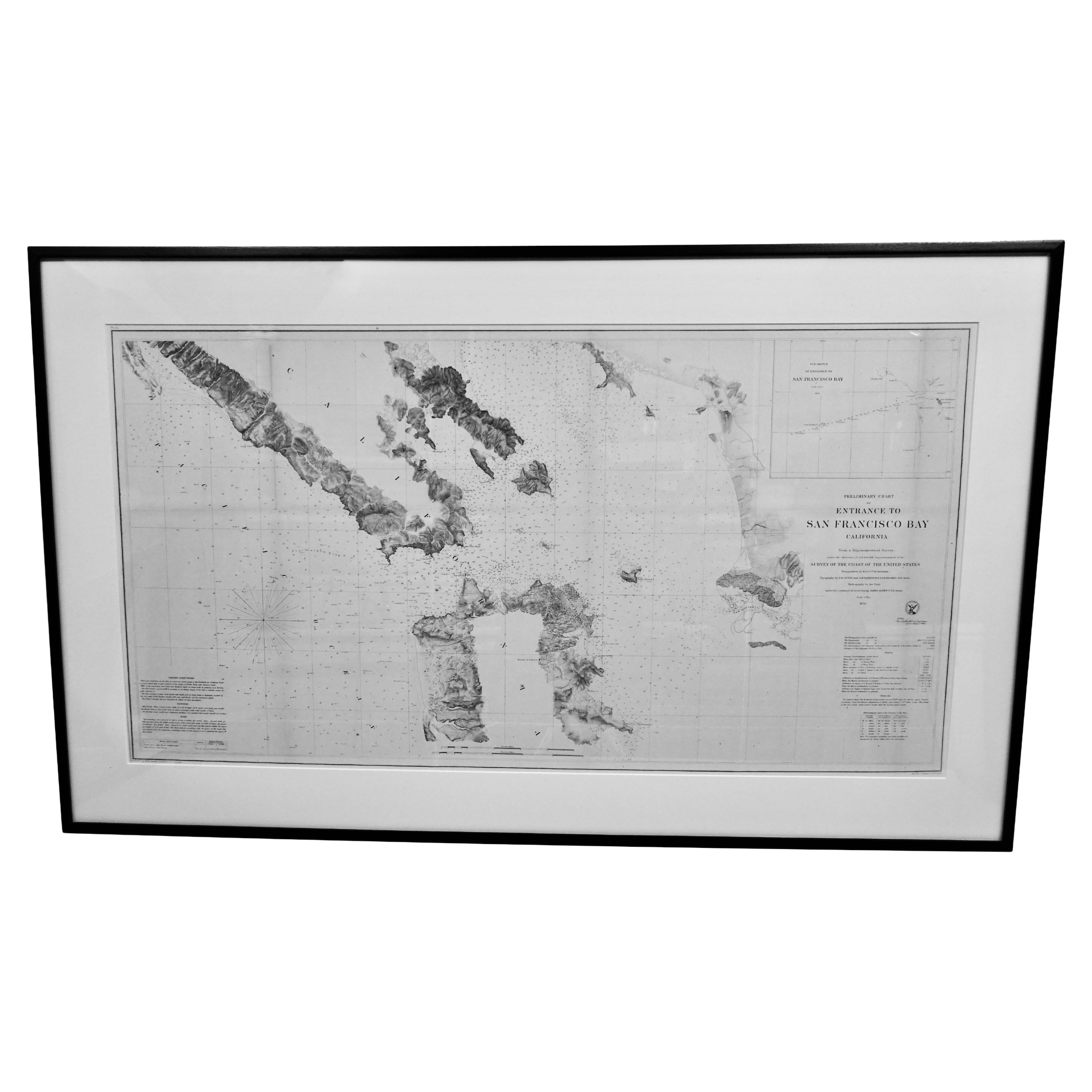
- Scarce U.S. Coast Survey Map Depicting Entrance to San Francisco Bay Dated 1856Located in San Francisco, CAA fine example of the 1856 U.S. Coast lithographic survey nautical chart of the entrance to San Francisco bay and the city. Published in 1856 by the Office of the Coast Survey the of...Category
Antique Mid-19th Century American Maps
MaterialsPaper
- 1856 U.S. Coast Survey Map of Chesapeake Bay and Delaware BayLocated in Colorado Springs, COPresented is U.S. Coast Survey nautical chart or maritime map of Chesapeake Bay and Delaware Bay from 1856. The map depicts the region from Susquehanna, Maryland to the northern Oute...Category
Antique 1850s American Maps
MaterialsPaper
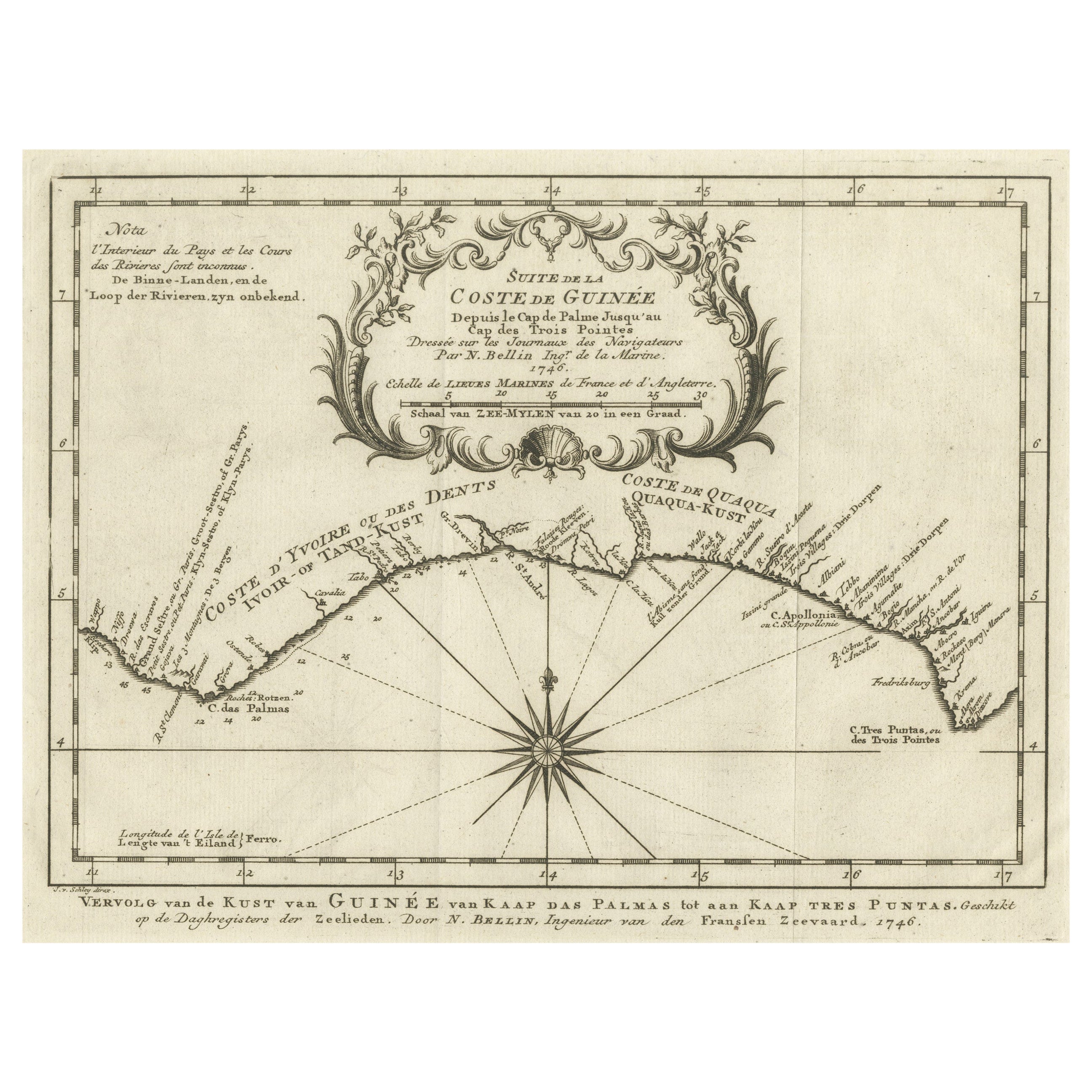
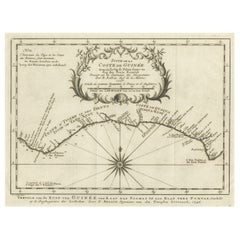
- Antique Map of the Coast of Guinea from, Cape Apollonia to the Volta RiverLocated in Langweer, NLAntique map titled 'Suite de la Coste de Guinée (..) - Vervolg van de Kust van Guinée (..)'. Decorative map of the coast of Guinea from, Cape Apollonia to the Volta River. Engraved b...Category
Antique Mid-18th Century Maps
MaterialsPaper
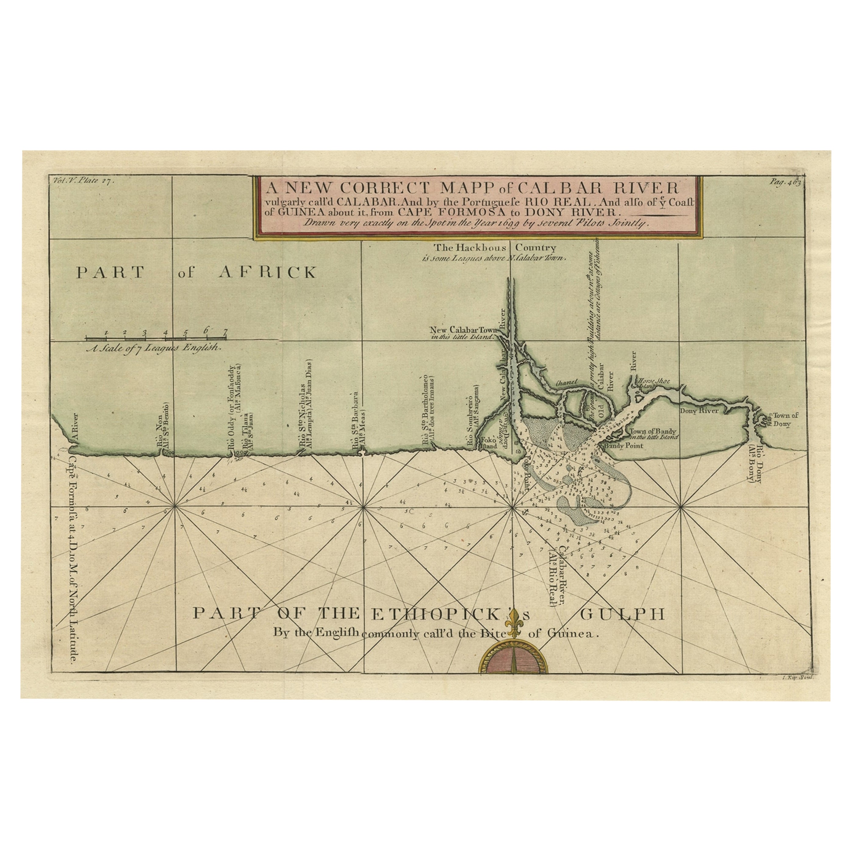
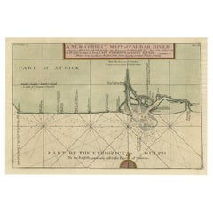
- Authentic Map of the Coast from Cape Formosa to the Dony River, Africa, 1732Located in Langweer, NLAntique map titled 'The New Correct Mapp of Calbar River vulgarly call'd Calabar (..)'. An interesting map of the coast from Cape Formosa to the Dony River stated on the map to be ...Category
Antique 1730s Maps
MaterialsPaper
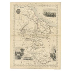
- Antique Map of British Guayana with Insets of Georgetown, Devil's Rock Etc, 1851Located in Langweer, NLAntique map titled ‘British Guayana’. Includes decorative vignettes titled Georgetown, Christmas Cataract River Berbice, New Amsterdam and Ataraipu or the Devil’s Rock. Originates fr...Category
Antique 19th Century Maps
MaterialsPaper


Recently Viewed
View AllMore Ways To Browse
Head Scratcher
Antique Survey
Sheets Of Antique Glass
Antiques In Dallas
U S Map
Dallas Antiques
Harrison Antique Furniture
Harrisons Antiques
Nautical Map
Nautical Maps
Antique Indian Maps
Georgetown Used Furniture
Antique Nautical Map
Antique Nautical Maps
Large Medina
Georgetown Map
Medina Glass
Antique Style Atlas