Items Similar to Scarce U.S. Coast Survey Map Depicting Entrance to San Francisco Bay Dated 1856
Want more images or videos?
Request additional images or videos from the seller
1 of 12
Scarce U.S. Coast Survey Map Depicting Entrance to San Francisco Bay Dated 1856
About the Item
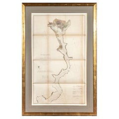
A fine example of the 1856 U.S. Coast lithographic survey nautical chart of the entrance to San Francisco bay and the city. Published in 1856 by the Office of the Coast Survey the official chart maker of the United States.
An interesting and visually attractive historical document by Alexander Bache. Custom framed and glazed.
- Dimensions:Height: 28 in (71.12 cm)Width: 46 in (116.84 cm)Depth: 1.5 in (3.81 cm)
- Materials and Techniques:
- Place of Origin:
- Period:
- Date of Manufacture:1856
- Condition:Wear consistent with age and use. Now framed. Some toning as shown in pictures.
- Seller Location:San Francisco, CA
- Reference Number:
About the Seller
5.0
Recognized Seller
These prestigious sellers are industry leaders and represent the highest echelon for item quality and design.
Gold Seller
These expertly vetted sellers are highly rated and consistently exceed customer expectations.
Established in 1982
1stDibs seller since 2008
312 sales on 1stDibs
Typical response time: 1 hour
Associations
The Art and Antique Dealers League of AmericaAntiques Associations Members
- ShippingRetrieving quote...Ships From: San Francisco, CA
- Return PolicyA return for this item may be initiated within 7 days of delivery.
More From This SellerView All
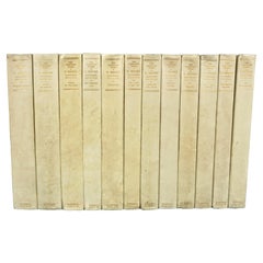
- The Complete Works of O. Henry, Manuscript Edition Limited to 125 CopiesLocated in San Francisco, CAThe complete works of O. Henry, manuscript edition, limited to 125 copies in 12 volumes bound in original half vellum. Published by Doubleday, Page & Company, Garden City New York, 1...Category
Early 20th Century American Books
MaterialsPaper
- Letters of the Earl of Chesterfield to His Son in 4 Volumes Published 1787Located in San Francisco, CAEarl of Chesterfield's letters to his son and luminaries of the day in 4 volumes in their original full leather bindings, published London J. Dodsley 1787. The spines have raised ban...Category
Antique Late 18th Century English George III Books
MaterialsPaper, Leather
- O. Henry 'William Sydney Porter' Complete Works in 13 Leatherbound VolumesLocated in San Francisco, CAHenry, O. (William Sydney Porter). Published by Doubleday, Doran & Company, Inc. Thirteen volumes, small octavo, blue three-quarter morocco and cloth boards, raised bands, gilt toole...Category
Vintage 1920s American Books
MaterialsLeather, Paper
- Walnut Neoclassical Style Table Cabinet with Mirrored Interior and DrawersLocated in San Francisco, CAA very well-detailed figured walnut table cabinet in the neoclassical taste with an elaborate metal filigree door opening to reveal a beveled mirror above 2 small drawers, surmounted...Category
Antique Late 19th Century European Victorian Architectural Models
MaterialsWalnut, Mirror
- The Works of Edmund Burke in Eight Leatherbound Volumes Published 1808Located in San Francisco, CAThe Works of the Right Honorable Edmund Burke in 8 volumes published for F.C. and J. Rivington, St. Paul's Yard, England by Luke Hanfard and Sons, near Lincoln's-Inn Fields. This att...Category
Antique Early 19th Century English Books
MaterialsLeather, Paper
- Signed 19th Century Mahogany and Brass Telescope on Custom Oak Wall MountLocated in San Francisco, CAAn English mahogany and brass single draw telescope made and signed by William Bruce, Kings Head Court Shoe Lane London, circa 1830. This handsom...Category
Antique 1830s English Georgian Scientific Instruments
MaterialsBrass


You May Also Like
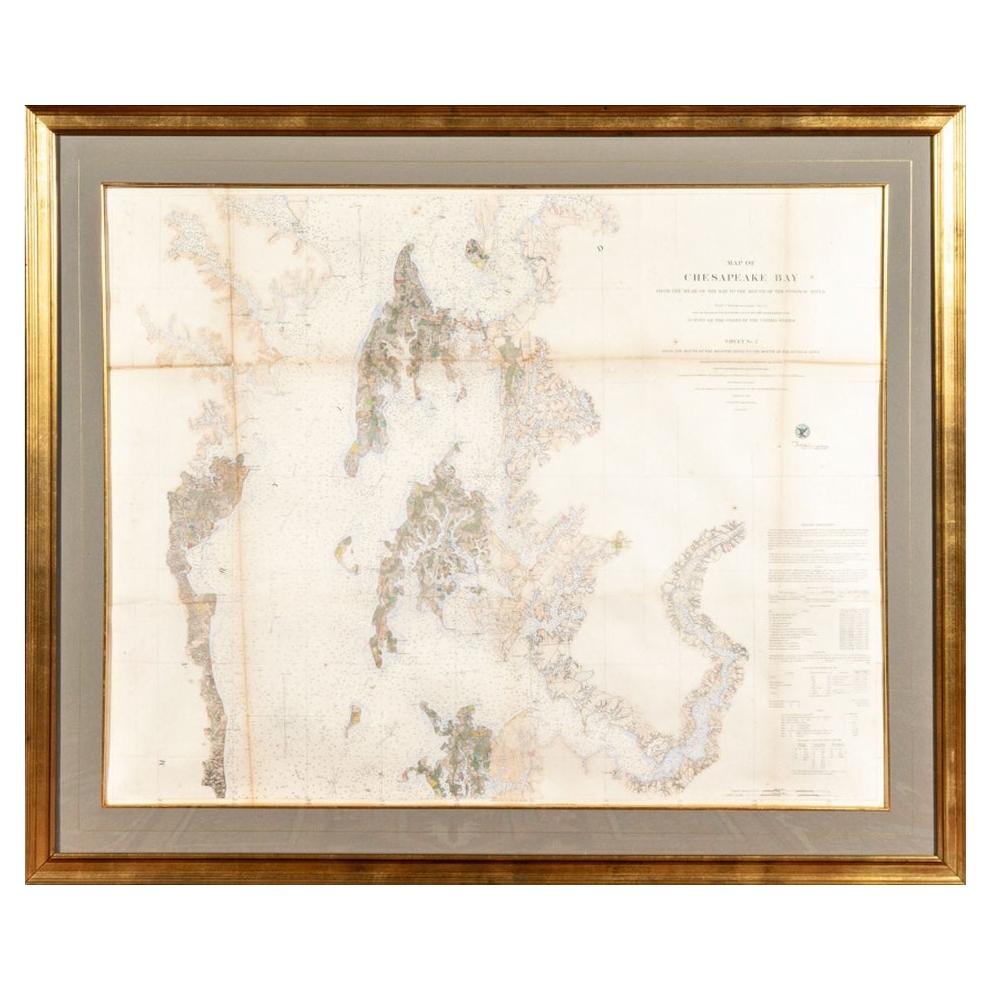
- 1856 U.S. Coast Survey Map of Chesapeake Bay and Delaware BayLocated in Colorado Springs, COPresented is U.S. Coast Survey nautical chart or maritime map of Chesapeake Bay and Delaware Bay from 1856. The map depicts the region from Susquehanna, Maryland to the northern Oute...Category
Antique 1850s American Maps
MaterialsPaper
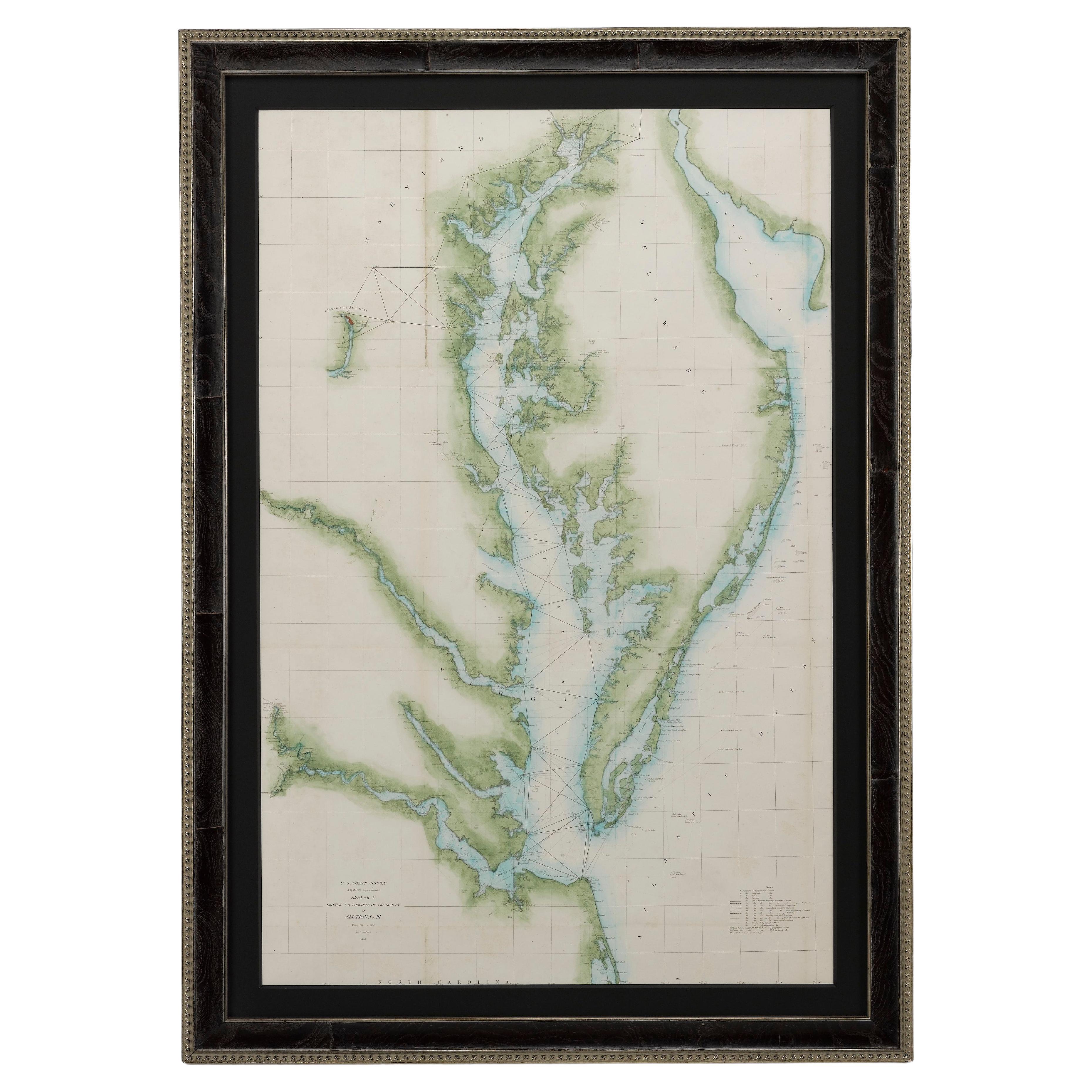
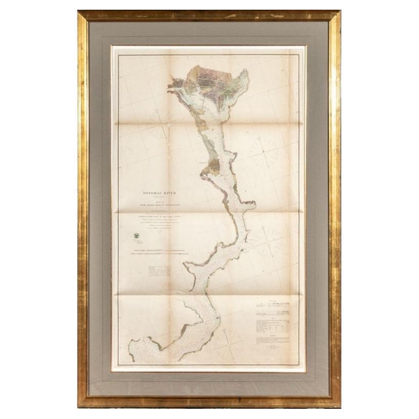
- Large Custom Framed 1857 U.S. Coast Survey of the Chesapeake BayLocated in Bridgeport, CTAn antique 1850's nautical map with hand-painted color accents entitled “Chesapeake Bay; Sheet no. 2: Head of the Bay to the Mouth of the Potomac River”....Category
Antique 1850s American American Classical Maps
MaterialsPaper
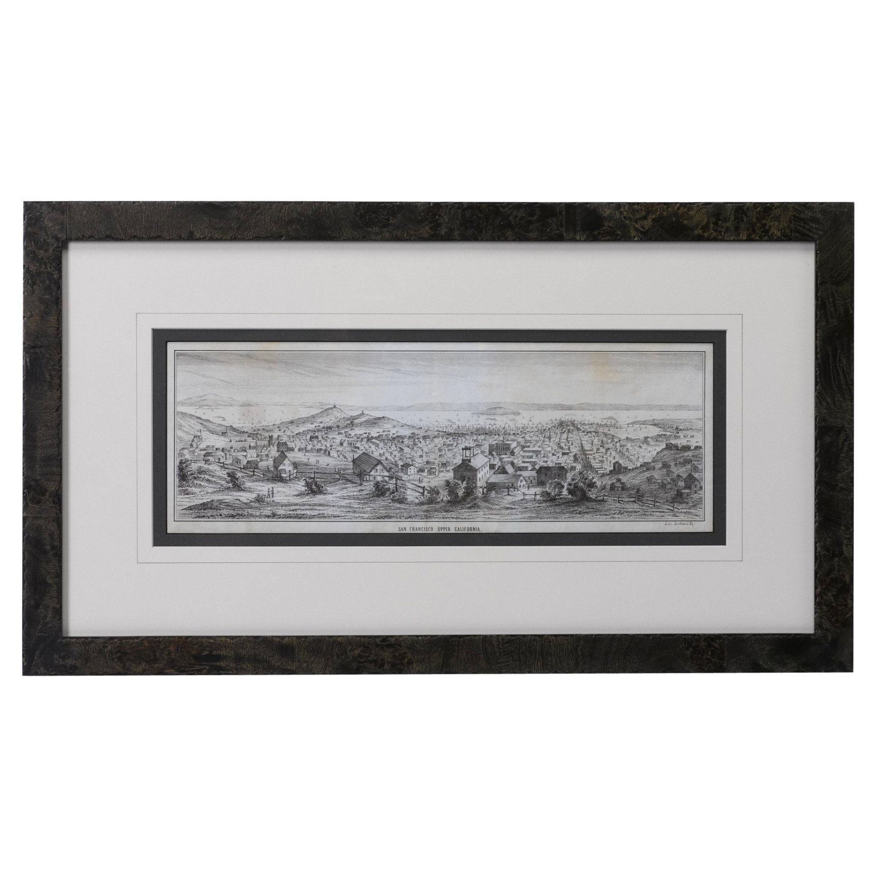
- "San Francisco, Upper California” 1851 Antique Map of San FranciscoLocated in Colorado Springs, COThis is a pictorial lettersheet view of the city and harbor of San Francisco. This lithograph was printed on grey wove paper, across a double sheet, by famed lithographers Britton & ...Category
Antique 1850s American Prints
MaterialsPaper
- 1864 U.S. Coast Survey of the Potomac River, from Indian Head to GeorgetownLocated in Bridgeport, CTAn antique nautical map with hand-painted color accents entitled "Potomac River (in four sheets): Sheet no. 4, from Indian Head to Georgetown". Created b...Category
Antique 19th Century American Classical Maps
MaterialsPaper
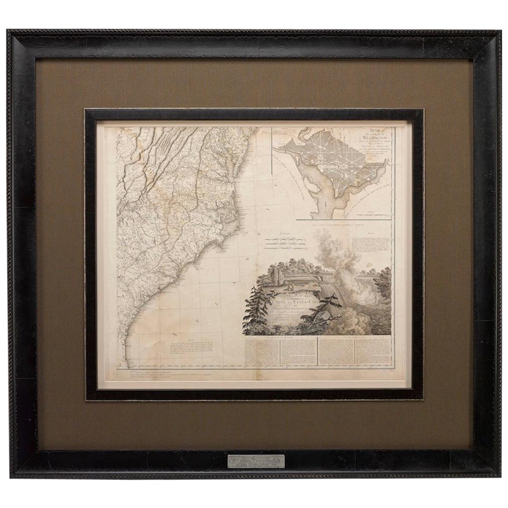
- 1812 United States Map, by Pierre Tardieu, Antique French Map Depicting the U.S.By Pierre François TardieuLocated in Colorado Springs, CO1812 "United States of Nth America -- Carte des Etats-Unis De L'Amerique Septentrionale" Two-Sheet Map by Tardieu This attractive map, published in Paris in 1812, is one of the most rare large format maps from the period. It features a view of the East Coast of the U.S. from Maryland to just below South Carolina. Additionally, Ellicott’s plan for the City of Washington D.C. is included at the top right and an illustration of Niagara Falls is shown at the bottom right with a description in both French and English. This extremely detailed map not only depicts the mountainous regions of the southeastern U.S., but also includes names of regions, rivers, and towns. Based on the first state of Arrowsmith’s 4-sheet map of the United States, this map is completely engraved by Tardieu in Paris and showcases high quality engravings. This detailed map of the recently independent United States includes one of the largest and earliest examples of the Ellicott plan of Washington DC. The artist, Pierre François Tardieu (PF Tardieu) was a very well-known map engraver, geographer, and illustrator. Awarded a bronze medal by King Louis-Phillipe for the accuracy and beauty of his map-making, Tardieu produced many fine works including maps of Louisiana...Category
Antique 1810s French Maps
MaterialsPaper
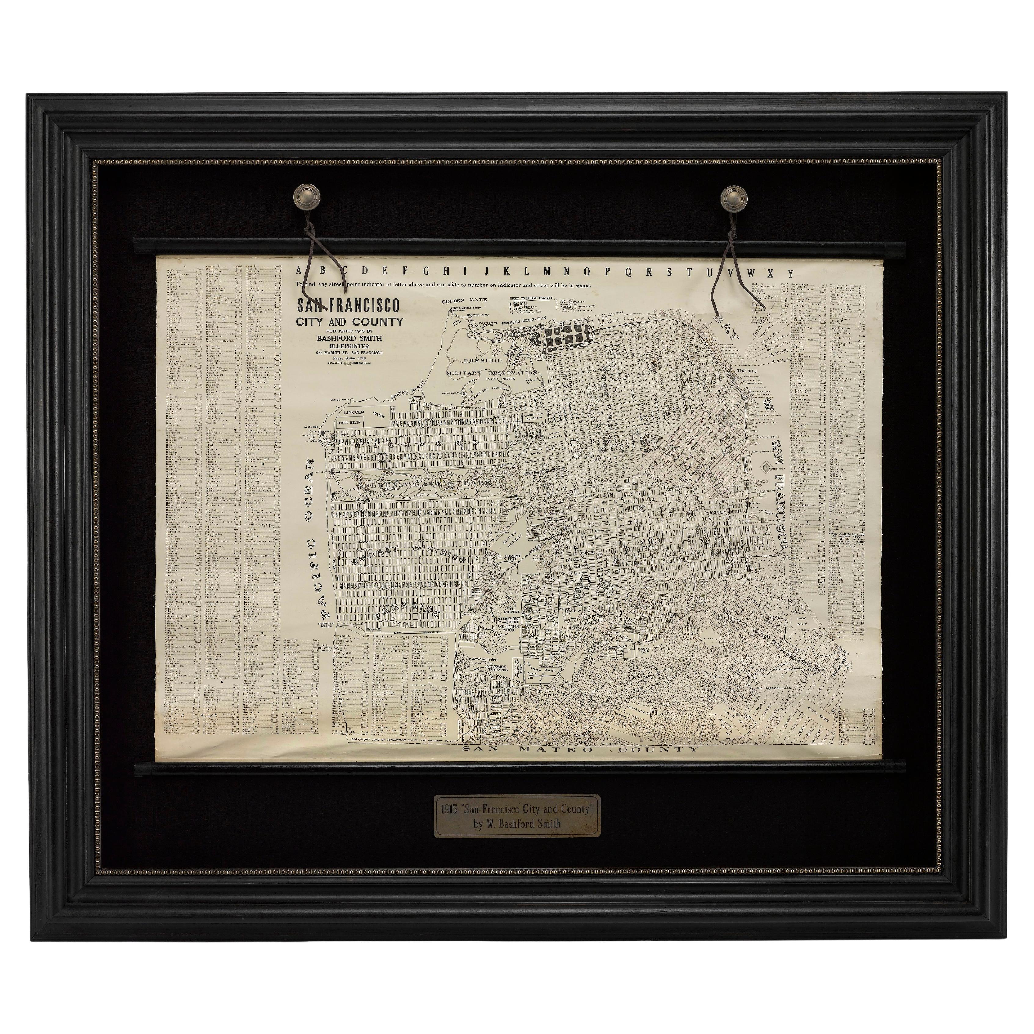
- 1915 "San Francisco City and County" Hanging Map by W. Bashford SmithLocated in Colorado Springs, COPresented is a rare wall map of San Francisco by W. Bashford Smith. Published in San Francisco in 1915, this map indicates streets and city districts, and, most notably, shows the si...Category
Vintage 1910s American Art Deco Maps
MaterialsWood, Paper