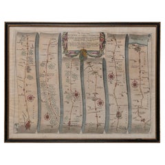
Large Framed Maps

1
229
6
2
to
25
172
65
237
235
237
11
9
8
6
5
5
4
3
3
2
1
1
1
55
87
87
8
24
36
14
4
3
3
8
6
6
8
4
4
2
155
49
19
19
11
106
95
95
51
27
3
3
2
2
2
Sort By
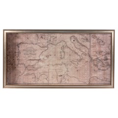
Large Framed Map of the Mediterranean
Located in New York, NY
Large map/chart chart of The Mediterranean and the Grecian Archipelago showing Italy, Sardinia
Category

20th Century French Mid-Century Modern Maps

Large Framed Map of the Mediterranean
H 36 in W 67 in D 0.75 in
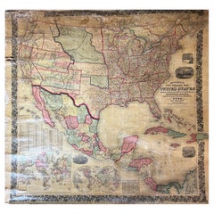
Large Antique 1859 Map of North America
Located in Sag Harbor, NY
This Map was made by Augustus Mitchell in 1859 It is in amazing condition for being 163 years old
Category

Antique Mid-19th Century American Maps

Materials

Canvas, Paper

Large Antique 1859 Map of North America
Free Shipping
H 65 in W 65 in D 0.01 in
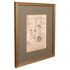
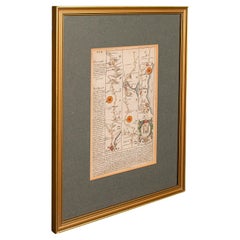
Antique Coaching Road Map, South Devon, English, Framed, Cartography, Georgian
Located in Hele, Devon, GB
This is an antique coach road map of South Devon. An English, framed lithograph engraving of
Category

Antique Early 18th Century British Georgian Maps

Materials

Wood

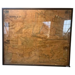
Framed Mid-19th Century Wall Map of Long Island, the Hamptons
Located in Sag Harbor, NY
A Framed museum quality find. This large wall map dates to the mid-1800s. Detailed inset maps of
Category

Antique Mid-19th Century American Maps

Materials

Linen, Paper

Antique Coach Road Map, East Devon, English, Framed, Cartography, Georgian, 1720
Located in Hele, Devon, GB
This is an antique coach road map of East Devon. An English, framed lithograph engraving of
Category

Antique Early 18th Century British Georgian Maps

Materials

Wood

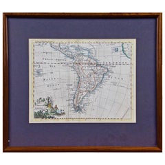
South America: Hand-colored 18th Century Framed Map by Thomas Jefferys
By Thomas Jefferys
Located in Alamo, CA
This detailed hand-colored map of South America by Thomas Jefferys was published in London in 1750
Category

Antique Mid-18th Century English Maps

Materials

Paper

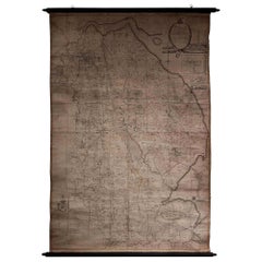
Large Scale Antique Scroll Map of Lincolnshire, England, Dated 1778
Located in St Annes, Lancashire
paper laid on canvas Original ebonized wood frame with lovely turned finials The map can be rolled
Category

Antique 1770s English Georgian Maps

Materials

Wood, Paper

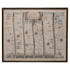
Road Map John Ogilby No 75 Kings Lyn Harwich, Britannia Framed Wallhanging
By John Ogilby
Located in BUNGAY, SUFFOLK
English countryside. Fortunately, his maps were printed in relatively large numbers for the period, so
Category

Antique 1670s European Baroque Maps

Materials

Paper

Map Road John Ogilby Britannia No 74 Ipswich to Norwich Cromer Framed
By John Ogilby
Located in BUNGAY, SUFFOLK
fascinating record of the English countryside. Fortunately, his maps were printed in relatively large numbers
Category

Antique 1670s English Baroque Maps

Materials

Paper

Road Map John Ogilby London St David's Britannia No 15 Abingdon Monmouth Framed
By John Ogilby
Located in BUNGAY, SUFFOLK
John Ogilby (British 1600-1676) Cosmographer and Geographick Printer to Charles II. A road map from
Category

Antique 1670s English Baroque Maps

Materials

Paper

Road Map Britannia No 32 the Road from London to Barnstable John Ogilby Framed
By John Ogilby
Located in BUNGAY, SUFFOLK
collector with no 15 London to St Davids. Framed as a pair. Measures: Black Linear Border around Map
Category

Antique Late 17th Century English Charles II Maps

Materials

Paper

Road Map Britannia No 15 London to St Davids John Ogilby Brown Gilt Frame
By John Ogilby
Located in BUNGAY, SUFFOLK
. Fortunately, his maps were printed in relatively large numbers for the period, so individual sheets are
Category

Antique Late 17th Century British Charles II Maps

Materials

Paper

"Clason's Guide Map of Montana" by The Clason Map Company, Circa 1920s
Located in Colorado Springs, CO
locations throughout Montana, each circled in navy. On the right hand side of the map is a large index, to
Category

Vintage 1920s American Art Deco Maps

Materials

Paper

Road Map Britannia No 25 London to the Lands End, John Ogilby Brown Gilded Frame
By John Ogilby
Located in BUNGAY, SUFFOLK
Senan in Cornwall. By John Ogilby His Majesties Cosmographer. A road map from Britannia, 1675/6. No 25
Category

Antique Late 17th Century British Charles II Maps

Materials

Paper

Road Map Britannia 1675/6 No 5 Road London to Barwick, London Stilton Grey Frame
By John Ogilby
Located in BUNGAY, SUFFOLK
John Ogilby (British 1600-1676) cosmographer and geographick printer to Charles II. A road map from
Category

Antique Late 17th Century British Charles II Maps

Materials

Paper

Antique Map of Scotland With an Inset Map of the Shetland Islands, 1854
Located in Langweer, NL
Stunning Map of Scotland that will look beautiful in any setting framed on the wall. Description
Category

Antique 1850s Maps

Materials

Paper

1812 United States Map, by Pierre Tardieu, Antique French Map Depicting the U.S.
By Pierre François Tardieu
Located in Colorado Springs, CO
Map by Tardieu This attractive map, published in Paris in 1812, is one of the most rare large
Category

Antique 1810s French Maps

Materials

Paper

Large 17th Century Hand Colored Map of England and the British Isles by de Wit
By Frederick de Wit
Located in Alamo, CA
A large hand colored 17th century map of England and the British Isles by Frederick de Wit entitled
Category

Antique Late 17th Century Dutch Maps

Materials

Paper

1875 "North America" Map by J. Bartholomew
Located in Colorado Springs, CO
measures 14 10/16” x 10 1/2”. Map has been artfully framed to archival standards, with acid-free mats
Category

Antique 1870s Scottish Maps

Materials

Paper

Large Custom Framed 1857 U.S. Coast Survey of the Chesapeake Bay
Located in Bridgeport, CT
. Presented under glass in a large custom gilt frame with line embossed Olive liner. Frame measures 44.5” W
Category

Antique 1850s American American Classical Maps

Materials

Paper

Antique Map Depicting Burma, Siam, Annam (Vietnam) and Japan, 1882
Located in Langweer, NL
the bottom left corner shows the "Loo-Choo Islands" (Ryukyu Islands) on a larger scale. Both maps are
Category

Antique 1880s Maps

Materials

Paper

Antique Coaching Road Map, Devon, English, Regional Cartography, Georgian, 1720
Located in Hele, Devon, GB
This is an antique coaching road map of Devon. An English, framed lithograph engraving of regional
Category

Antique Early 18th Century British Georgian Maps

Materials

Wood

1866 Ensign & Bridgman's Rail Road Map of the United States
Located in Colorado Springs, CO
Presented is an 1866 issue of “Ensign & Bridgeman’s Rail Road Map of the United States, showing
Category

Antique 1860s American Late Victorian Maps

Materials

Paper

Road Map, John Ogilby, No 54, London, Yarmouth, Britannia
By John Ogilby
Located in BUNGAY, SUFFOLK
English countryside. Fortunately, his maps were printed in relatively large numbers for the period, so
Category

Antique 1670s English Baroque Maps

Materials

Paper

Italian Parchment Map of the City of Pisa Dated, 1640
By Matthäus Merian the Elder
Located in Roma, IT
An antique map of the Tuscan city of Pisa engraved for The 'Itinerarium Italiæ Nov-antiquæ' by
Category

Antique 1640s Italian Maps

Materials

Paper

Plan of Paris, France, by A. Vuillemin, Antique Map, 1845
Located in Colorado Springs, CO
This large and detailed plan of Paris was published by Alexandre Vuillemin in 1845. The map conveys
Category

Antique 1840s American Maps

Materials

Paper

Antique Map of the Distribution of Vegetation throughout the World '1851'
Located in Langweer, NL
of plants. This map originates from 'Physikalischer Atlas' by H. Berghaus, 1851. Frame included
Category

Antique Mid-19th Century Maps

Materials

Paper

Antique Map of Leicester and Rutland by Tinney & Sayer, 'circa 1756'
Located in Langweer, NL
Antique map titled 'An Accurate Map of the Counties of Leicester and Rutland (..)'. Large map of
Category

Antique Mid-18th Century Maps

Materials

Paper

Two Impressive and Huge Midcentury World Map Wall Globes, Austria, 1950s
Located in Vienna, AT
We proudly offer this outstanding pair of very large wall-mounted modernist globes / world maps
Category

Mid-20th Century Austrian Mid-Century Modern Maps

Materials

Aluminum, Iron

1915 "San Francisco City and County" Hanging Map by W. Bashford Smith
Located in Colorado Springs, CO
and white and is surrounded by a large index of city street names. Based on OCLC records, this map was
Category

Vintage 1910s American Art Deco Maps

Materials

Wood, Paper

1840 Map of the City of Washington Published by William M. Morrison
Located in Colorado Springs, CO
This map, printed in 1840, is a detailed representation of Washington, D.C. in the mid-19th century
Category

Antique 1840s American Federal Maps

Materials

Paper

An Old Illustrated Tallis Map of Central America with Volcanic Vignettes, 1851
Located in Langweer, NL
This map of Central America, part of John Tallis & Company's series from "The British Colonies" by
Category

Antique 1850s Maps

Materials

Paper

1859 "Map of the United States of America..." by J. H. Colton
By J.H. Colton
Located in Colorado Springs, CO
. The large hand-colored engraved case map depicts the United States in the mid-19th century, before the
Category

Antique 1850s American Maps

Materials

Paper

1859 "Colton's New Map of the State of Texas..." by Johnson & Browning
Located in Colorado Springs, CO
Presented is "Colton's New Map of the State of Texas Compiled from De Cordova's Large Map
Category

Antique 1850s American Maps

Materials

Paper

Antique Map of the Provinces of Gelderland and Overijssel by Kaerius, 1617
Located in Langweer, NL
Overijssel in the Netherlands. Large cartouche with coat of arms and sailing ship on the Zuyderzee. This map
Category

Antique 17th Century Maps

Materials

Paper

Antique Map of Africa, Cartouche with Elephant Tusks and Horned Serpent, 1737
Located in Langweer, NL
the map is the large title cartouche that is framed by elephant tusks and a horned serpent. In the
Category

Antique 18th Century Maps

Materials

Paper

1873 "Map of the States of California and Nevada" by Chas. Drayton Gibbes
Located in Colorado Springs, CO
is considered to be one of the finest large-scale maps of California to appear in the second half of
Category

Antique 1870s American Maps

Materials

Paper

Map Road Strip Britannia Sheet 2 John Ogilby London Aberistwith Islip Bramyard
By John Ogilby
Located in BUNGAY, SUFFOLK
framer, print seller, Oxford. Annotated. The second of 100 sheets of strip maps made for John Ogilby
Category

Antique 17th Century English Baroque Maps

Materials

Paper

Persia, Armenia & Adjacent Regions: A 17th Century Hand-colored Map by De Wit
By Frederick de Wit
Located in Alamo, CA
A large 17th century hand colored copperplate engraved map entitled "Novissima nec non
Category

Antique Late 17th Century Dutch Maps

Materials

Paper

Antique Map of the Spice Islands 'Moluccas', Indonesia by W. Blaeu, circa 1640
By Willem Blaeu
Located in Langweer, NL
Islands (Moluccas) published by W. Blaeu (circa 1640). This map features a large inset of the Island of
Category

Antique Mid-17th Century Maps

Materials

Paper

Road Map No43 London to Kings Lynn, Royston to Downham, John Ogilby, Britannia
By John Ogilby
Located in BUNGAY, SUFFOLK
. Fortunately, his maps were printed in relatively large numbers for the period, so individual sheets are
Category

Antique Late 17th Century British Charles II Maps

Materials

Paper

18th Century French Map and City View of Joppe/Jaffa 'Tel Aviv' by Sanson
By Nicolas Sanson
Located in Alamo, CA
condition. Another map of the "Holy Land" (by Claes Visscher in 1663), with an identical style frame and
Category

Antique Early 18th Century French Maps

Materials

Paper

FRAME DRIVING SCHOOL 70 S 20th Century
By Europa Antiques
Located in Madrid, ES
Large Globe 50S THE GLOBE IS IN PLASTIC AND THE FOOT IN WOOD. 1950s. IT HAS LIGHT. GOOD CONDITION
Category

20th Century English Modern Maps

Materials

Plastic, Wood

Early 19th Century Original Framed Land Indenture, England, 1810
Located in Lambertville, NJ
A large hand written land indenture document England, 1810, framed. The beautifully hand written
Category

Antique 1810s English Regency Maps

Materials

Giltwood, Parchment Paper, Glass

Neatly Framed Decorative Hand-Colored View of Zierikzee, the Netherlands, 1858
Located in Langweer, NL
the latin school in Gouda, but he seemed to experience a larger calling to become an author.
Category

Antique 1850s Maps

Materials

Paper

1864 U.S. Coast Survey of the Potomac River, from Indian Head to Georgetown
Located in Bridgeport, CT
glass in a large gilt tone wood frame. Frame measures 33” W x 49.5” H. Sight measures 23.25” W x 39.5
Category

Antique 19th Century American Classical Maps

Materials

Paper

Large French Paris Metro Map 1960s
Located in North Hollywood, CA
Large French Paris Metro Map 1960s. A large Vintage French framed map of the Parisian Metro from
Category

Mid-20th Century French Industrial Prints

Materials

Wood, Paper

Large French Paris Metro Map 1960s
H 30.5 in W 37.75 in D 1 in
Large Vintage France Map, Continental, Historical Cartography, Late 20th Century
Located in Hele, Devon, GB
This is a large vintage map of France. A Continental, framed example of historical cartography
Category

Late 20th Century European Mid-Century Modern Prints

Materials

Glass, Wood, Paper

1861 Topographical Map of the District of Columbia, by Boschke, Antique Map
Located in Colorado Springs, CO
maps, a large four sheet map of the city in 1857 and this highly detailed map of the whole District of
Category

Antique 1860s American Historical Memorabilia

Materials

Paper

Original WWII Illustrated Map Poster - Time And Tide Map Of The Atlantic Charter
By "Leslie MacDonald ""Max"" Gill"
Located in London, GB
Original vintage illustrated map poster in Spanish by the notable graphic designer, cartographer
Category

Vintage 1940s British Posters

Materials

Paper

Original Vintage Illustrated Map Poster Afrique Equatoriale Francaise Cameroon
Located in London, GB
Original vintage illustrated map poster for Cameroun AOF Afrique Occidentale Francaise / Cameroon
Category

Vintage 1950s French Posters

Materials

Paper

Original Vintage Poster London Town Pictorial Map Southern Railway Underground
By Kerry Lee
Located in London, GB
decorative illustrations framing the map including flags and coat of arms with people from the Commonwealth
Category

Vintage 1930s British Posters

Materials

Paper

Original Vintage Poster Illustrated Map Madagascar French Colony Industry Travel
Located in London, GB
illustrated map showing the various places on a road route, the cities and towns marked with the highlands and
Category

Vintage 1930s French Posters

Materials

Paper

Original Vintage Poster Union Of South Africa Map Natural & Industrial Resources
Located in London, GB
image of a larger map of Africa marking South Africa in front of the Union flag of South Africa framing
Category

Vintage 1940s British Posters

Materials

Paper

Original Vintage Poster Pictorial Map Of Yorkshire British Railways Train Travel
Located in London, GB
Original vintage train travel poster - Pictorial Map of Yorkshire by British Railways - featuring a
Category

Vintage 1950s British Posters

Materials

Paper

Original Vintage Travel By Train London Town Pictorial Map Poster Kerry Lee
By Kerry Lee
Located in London, GB
decorative illustrations framing the map including flags and coat of arms with people from the Commonwealth
Category

Vintage 1950s British Posters

Materials

Paper

Giovanni battista piranesi large copper plate etching
By Giovanni Battista Piranesi
Located in Allentown, PA
presented in a custom frame and Matt boards. The frame is black and gold, and the map boards are faux marble
Category

1990s Italian Neoclassical Prints

Materials

Paper

Large Decorative Brass Magnifying Glass Lens and Paper Weight
Located in London, GB
Large decorative magnifier lens with domed glass magnification, encased in eye shape brass cast
Category

Early 2000s Paperweights

Materials

Brass

Large Vintage Green Pink Yellow Blue Silk Scarf California America Themes
Located in Belfast, Northern Ireland
Large vintage green pink yellow blue silk scarf California America themes Beautiful and rare
Category

Mid-20th Century American Mid-Century Modern Tapestries

Materials

Silk

Pocket Globe, Nicholas Lane, London, post 1779
By Nicholas Lane
Located in Milano, IT
the North Pacific Ocean, above the Tropic of Cancer, the globe bears a cartouche framed with small
Category

Antique 1780s English Other Models and Miniatures

Materials

Leather, Wood, Paper

  • 1
Get Updated with New Arrivals
Save "Large Framed Maps", and we’ll notify you when there are new listings in this category.

Large Framed Maps For Sale on 1stDibs

An assortment of large framed maps is available at 1stDibs. Each of these unique large framed maps was constructed with extraordinary care, often using paper, wood and glass. Large framed maps have been made for many years, and versions that date back to the 18th Century alongside those produced as recently as the 20th Century. Large framed maps bearing Mid-Century Modern or Neoclassical hallmarks are very popular at 1stDibs. There have been many well-made large framed maps over the years, but those made by Herman Moll are often thought to be among the most beautiful.

How Much are Large Framed Maps?

Prices for large framed maps can differ depending upon size, time period and other attributes — at 1stDibs, large framed maps begin at $750 and can go as high as $12,000, while the average can fetch as much as $2,863.

Read More

Pamela Shamshiri Shares the Secrets behind Her First-Ever Book and Its Effortlessly Cool Interiors

The sought-after designer worked with the team at Hoffman Creative to produce a monograph that beautifully showcases some of Studio Shamshiri's most inspiring projects.

Moroccan Artworks and Objects Take Center Stage in an Extraordinary Villa in Tangier

Italian writer and collector Umberto Pasti opens the doors to his remarkable cave of wonders in North Africa.

Montecito Has Drawn Royalty and Celebrities, and These Homes Are Proof of Its Allure

Hollywood A-listers, ex-pat aristocrats and art collectors and style setters of all stripes appreciate the allure of the coastal California hamlet — much on our minds after recent winter floods.

Whaam! Blam! Pow! — a New Book on Pop Art Packs a Punch

Publishing house Assouline and writer Julie Belcove have teamed up to trace the history of the genre, from Roy Lichtenstein, Andy Warhol and Yayoi Kusama to Mickalene Thomas and Jeff Koons.

The Sparkling Legacy of Tiffany & Co. Explained, One Jewel at a Time

A gorgeous new book celebrates — and memorializes — the iconic jeweler’s rich heritage.

What Makes a Gem-Encrusted Chess Set Worth $4 Million?

The world’s most opulent chess set, weighing in at 513 carats, is literally fit for a king and queen.

Tauba Auerbach’s Geometric Pop-Up Book Is Mighty Rare, Thanks to a Hurricane

This sculptural art book has an epic backstory of its own.

Step inside the Storied Mansions of Palm Beach’s Most Effervescent Architect

From Spanish-style courtyards to fanciful fountains, these acclaimed structures abound in surprising and elegant details.