Items Similar to Antique Map of the Namen or Namur Region in Wallonia, Belgium


Want more images or videos?
Request additional images or videos from the seller
1 of 6
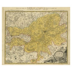
Antique Map of the Namen or Namur Region in Wallonia, Belgium
About the Item
Description: Antique map titled 'Namurcum Comitatus' A map of the Namen/Namur region in Wallonia, Belgium. It is the capital of the province Namur and hosts the Walloon Parliament. This includes the cities Namur, Dinant and Huy, along the river Meuse (Maas). Luxemburg in the lower right corner. Latin text on reverse.
From the 1608/1612 Latin edition of Ortelius' "Theatrum Orbis Terrarum". Dated 1579 in the cartouche. Ref: Van den Broecke Ort 68.1 : 1608/1612L46.
Artists and Engravers: Abraham Ortelius (1527 -1598) was a Flemish cartographer, cosmographer, geographer and publisher and a contemporary of Gerard Mercator, with whom he travelled through Italy and France. Although it is Mercator who first used the word "Atlas" as a name for a collection of maps, it is Ortelius who is remembered as the creator of the first modern atlas. Theatrum Orbis Terrarum was the first systematically collated set of maps by different map makers in a uniform format. Three Latin editions as well as a Dutch, French and German edition of Theatrum Orbis Terrarum were published by 1572 and a further 25 editions printed before Ortelius' death in 1598. Several more were subsequently printed until around 1612. Ortelius is said to have been the first person to pose the question of the continents once being a single land mass before separating into their current positions.
- Dimensions:Height: 17.8 in (45.2 cm)Width: 21.34 in (54.2 cm)Depth: 0 in (0.02 mm)
- Materials and Techniques:Paper,Engraved
- Period:1610-1619
- Date of Manufacture:ca.1610
- Condition:Repaired: Paper separation in the lower middle fold, backed with acid-free archival tape. General age-related toning and/or occasional minor defects from handling. Good, given age. Original middle fold, as issued. Creasing in the lower right quarter of the sheet. A printer's crease in the top right corner of the image. Margins a little browned. Two small nicks in the left margin. Dampstains outside image.
- Seller Location:Langweer, NL
- Reference Number:
About the Seller
5.0
Platinum Seller
These expertly vetted sellers are 1stDibs' most experienced sellers and are rated highest by our customers.
Established in 2009
1stDibs seller since 2017
1,922 sales on 1stDibs
Typical response time: <1 hour
- ShippingRetrieving quote...Ships From: Langweer, Netherlands
- Return PolicyA return for this item may be initiated within 14 days of delivery.
More From This SellerView All
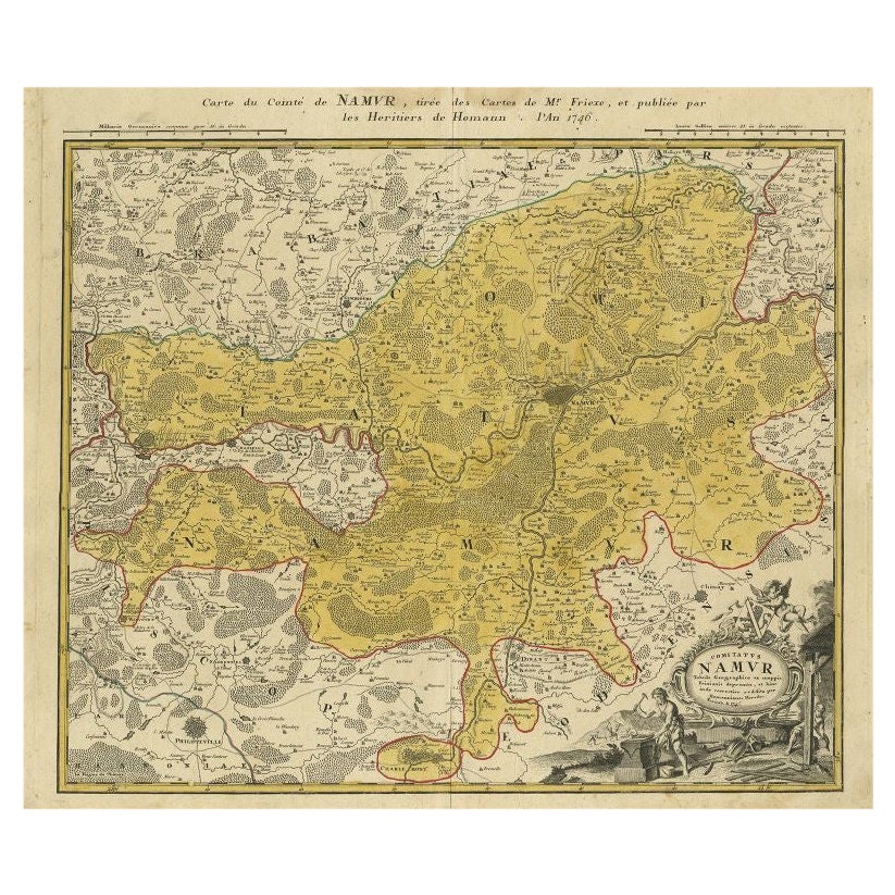
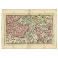
- Antique Map of the Region of Namen by Homann, 1746By Johann Baptist HomannLocated in Langweer, NLAntique map titled 'Comitatus Namur Tabula Geographica ex mappis Frixianis'. Regional map of Namen, Belgium. Artists and Engravers: Homann Heirs was a German publishing firm tha...Category
Antique 18th Century Maps
MaterialsPaper
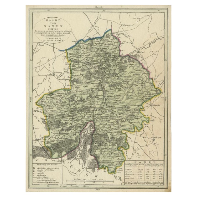
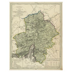
- Antique Map of the Region of Namen by Veelwaard, c.1840Located in Langweer, NLAntique map titled 'Kaart van Namen'. Original antique map of the region of Namen (Namur), Belgium. Source unkown, to be determined. Published circa 1840. Artists and Engravers:...Category
Antique 19th Century Maps
MaterialsPaper
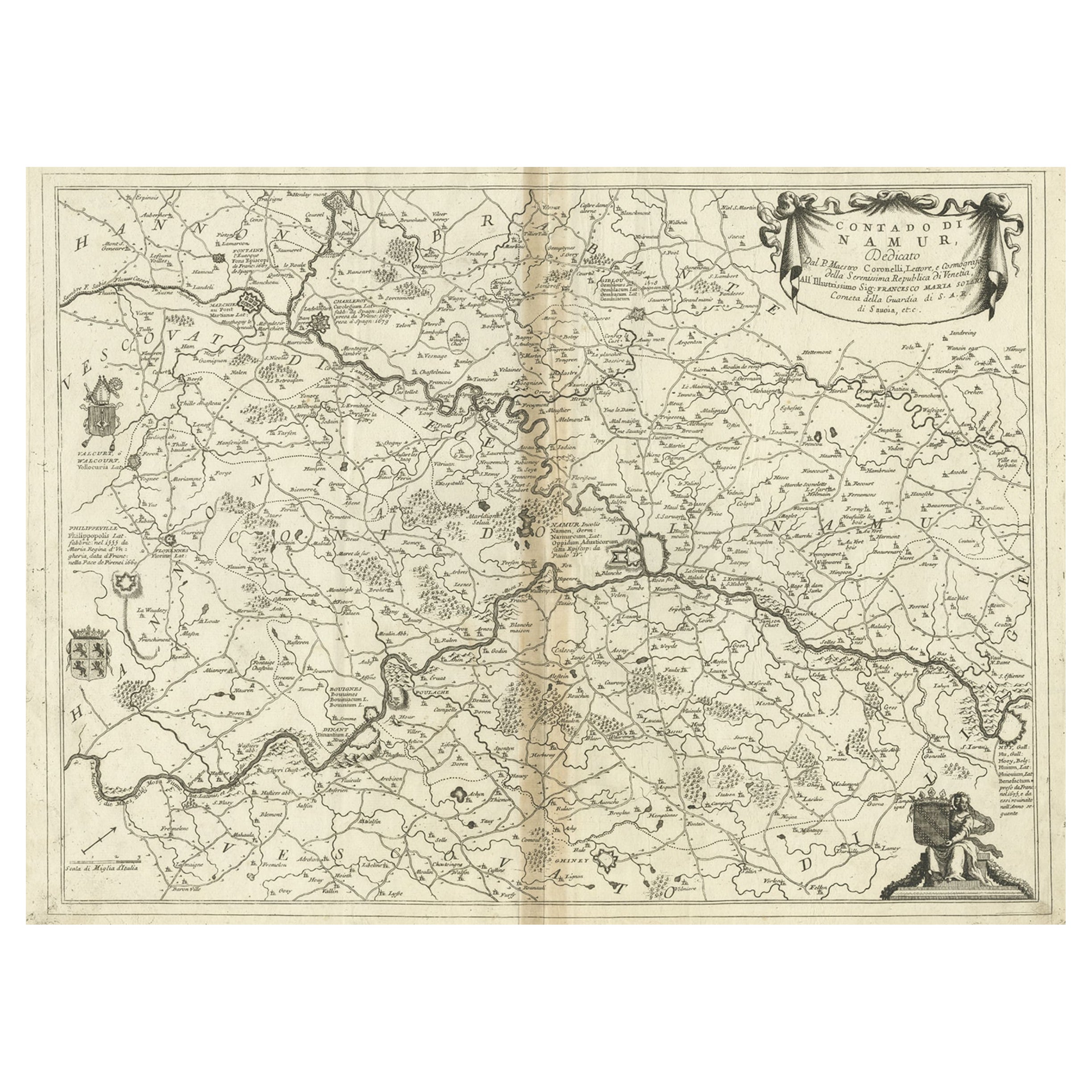
- Antique Map of the Namur Region in France by Coronelli, c.1695By Vincenzo CoronelliLocated in Langweer, NLAntique map titled 'Contado di Namur (..)'. Old map of the Namur region in central Belgium. Includes several coats of arms. Artists and Engravers: The remarkable Vincenzo Coronell...Category
Antique 17th Century Maps
MaterialsPaper
- Antique Map of the Region of Namur by De Lat, 1737Located in Langweer, NLUntitled map of the region of Namur, Charlemont, Rochefort and surroundings, Belgium. This map originates from 'Nieuw en beknopt Kaart-Boekje vertoonende de XVII. Nederlandse Provint...Category
Antique 18th Century Maps
MaterialsPaper
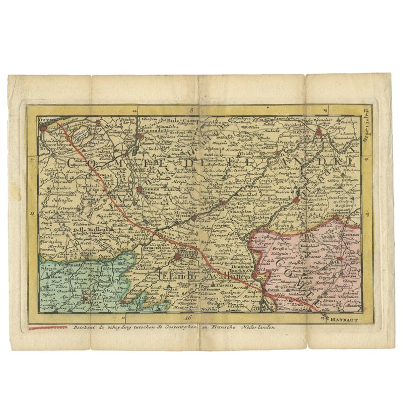
- Antique Map of the Region of Flanders in Belgium, 1737Located in Langweer, NLUntitled map of the region of Flanders, Belgium. This map originates from 'Nieuw en beknopt Kaart-Boekje vertoonende de XVII. Nederlandse Provintien (..)'. Artists and Engravers: A...Category
Antique 18th Century Maps
MaterialsPaper
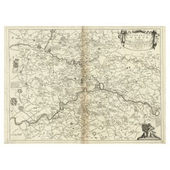
- Antique Map of the Namur Region 'France' by F. de Wit, circa 1680Located in Langweer, NLAntique map titled 'Comitatus Namurci Tabula in Lucem Edita'. Large map of the Namur region, France. Published by F. de Wit, circa 1680.Category
Antique Late 17th Century Maps
MaterialsPaper


You May Also Like
- 17th Century Hand Colored Map of the Liege Region in Belgium by VisscherBy Nicolaes Visscher IILocated in Alamo, CAAn original 17th century map entitled "Leodiensis Episcopatus in omnes Subjacentes Provincias distincté divisusVisscher, Leodiensis Episcopatus" by Nicolaes Visscher II, published in Amsterdam in 1688. The map is centered on Liege, Belgium, includes the area between Antwerp, Turnhout, Roermond, Cologne, Trier and Dinant. This attractive map is presented in a cream-colored mat measuring 30" wide x 27.5" high. There is a central fold, as issued. There is minimal spotting in the upper margin and a tiny spot in the right lower margin, which are under the mat. The map is otherwise in excellent condition. The Visscher family were one of the great cartographic families of the 17th century. Begun by Claes Jansz Visscher...Category
Antique Late 17th Century Dutch Maps
MaterialsPaper
- 1594 Maurice Bouguereau Map of the Region Limoges, France, Ric0015Located in Norton, MA1594 Maurice Bouguereau map of the region Limoges, France, entitled "Totivs Lemovici et Confinium Pro Uinciarum Quantum ad Dioecefin Lemo Uicenfen Fpectant," Hand Colored Ric0015 Jean IV Le Clerc...Category
Antique 16th Century Dutch Maps
MaterialsPaper
- 1861 Topographical Map of the District of Columbia, by Boschke, Antique MapLocated in Colorado Springs, COPresented is an original map of Albert Boschke's extremely sought-after "Topographical Map of the District of Columbia Surveyed in the Years 1856 ...Category
Antique 1860s American Historical Memorabilia
MaterialsPaper
- The Normandy Region of France: A 17th C. Hand-colored Map by Sanson and JaillotBy Nicolas SansonLocated in Alamo, CAThis large hand-colored map entitled "Le Duché et Gouvernement de Normandie divisée en Haute et Basse Normandie en divers Pays; et par evêchez, avec le Gouvernement General du Havre ...Category
Antique 1690s French Maps
MaterialsPaper
- 17th Century Hand-Colored Map of a Region in West Germany by JanssoniusBy Johannes JanssoniusLocated in Alamo, CAThis attractive highly detailed 17th century original hand-colored map is entitled "Archiepiscopatus Maghdeburgensis et Anhaltinus Ducatus cum terris adjacentibus". It was published ...Category
Antique Mid-17th Century Dutch Maps
MaterialsPaper
- 1752 Vaugoundy Map of Flanders : Belgium, France, and the Netherlands, Ric.a002Located in Norton, MALarge Vaugoundy Map of Flanders: Belgium, France, and the Netherlands Colored -1752 Ric.a002 Description: This is a 1752 Didier Robert de Vaugondy map of Flanders. The map de...Category
Antique 17th Century Unknown Maps
MaterialsPaper


Recently Viewed
View AllMore Ways To Browse
Bolivian Antique
St Thomas Cross
Map Of Liverpool
Georgetown Antique
Map Of Gulf Of Mexico
Authentic Pirate
Historic Map Virginia
Map Of Indonesia
United States Antique Map
Antique Map Coats Of Arms
Antique Book Map France
Old Maps England
Map Sumatra
Scotland Coat Of Arms
Malaysia Antique
Map Of Siam
Antique Map Of Sri Lanka
Globes Antique Terrestre