Items Similar to Antique Map of the Region of Namen by Veelwaard, c.1840

Want more images or videos?
Request additional images or videos from the seller
1 of 5
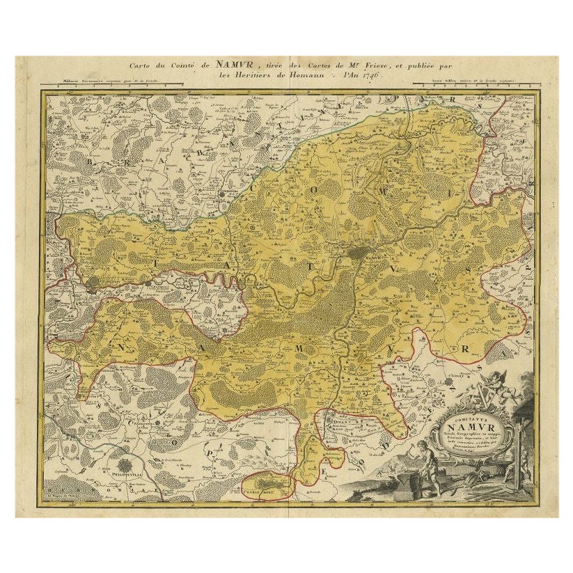
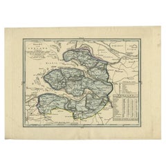
Antique Map of the Region of Namen by Veelwaard, c.1840
About the Item
Antique map titled 'Kaart van Namen'. Original antique map of the region of Namen (Namur), Belgium. Source unkown, to be determined. Published circa 1840.
Artists and Engravers: Engraved by D. Veelwaard. Published by Erven F. Bohn.
Condition: Good, general age-related toning. Minor wear, blank verso. Please study image carefully.
Date: c.1840
Overall size: 21 x 27 cm.
Image size: 20 x 26 cm.
We sell original antique maps to collectors, historians, educators and interior decorators all over the world. Our collection includes a wide range of authentic antique maps from the 16th to the 20th centuries. Buying and collecting antique maps is a tradition that goes back hundreds of years. Antique maps have proved a richly rewarding investment over the past decade, thanks to a growing appreciation of their unique historical appeal. Today the decorative qualities of antique maps are widely recognized by interior designers who appreciate their beauty and design flexibility. Depending on the individual map, presentation, and context, a rare or antique map can be modern, traditional, abstract, figurative, serious or whimsical. We offer a wide range of authentic antique maps for any budget.
- Dimensions:Height: 10.63 in (27 cm)Width: 8.27 in (21 cm)Depth: 0 in (0.01 mm)
- Materials and Techniques:
- Period:
- Date of Manufacture:circa 1840
- Condition:
- Seller Location:Langweer, NL
- Reference Number:
About the Seller
5.0
Platinum Seller
These expertly vetted sellers are 1stDibs' most experienced sellers and are rated highest by our customers.
Established in 2009
1stDibs seller since 2017
1,957 sales on 1stDibs
Typical response time: <1 hour
- ShippingRetrieving quote...Ships From: Langweer, Netherlands
- Return PolicyA return for this item may be initiated within 14 days of delivery.
More From This SellerView All
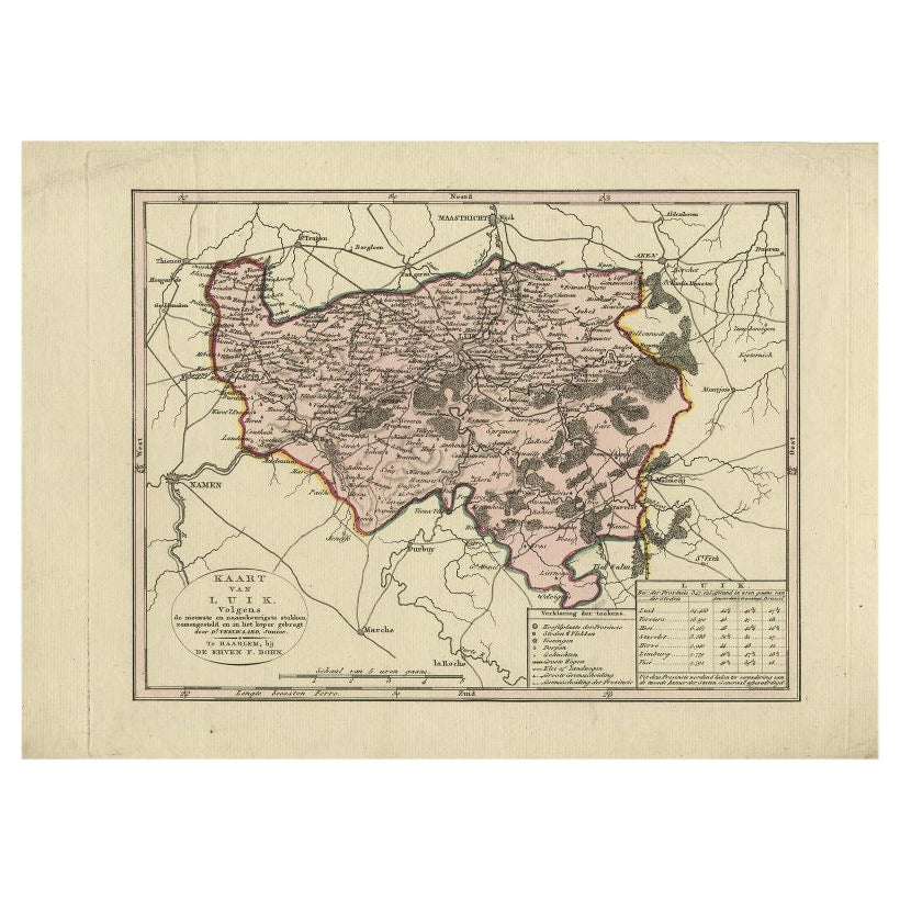
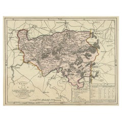
- Antique Map of the Region of Luik by Veelwaard, C.1840Located in Langweer, NLAntique map titled 'Kaart van Luik'. Original antique map of the region of Luik (Liege), Belgium. Source unkown, to be determined. Published circa 1840. Artists and Engravers: E...Category
Antique 19th Century Maps
MaterialsPaper
- Antique Map of the Region of Luik by Veelwaard, c.1840Located in Langweer, NLAntique map titled 'Kaart van Luik'. Original antique map of the region of Luik (Liege), Belgium. Source unkown, to be determined. Published circa 1840. Artists and Engravers: E...Category
Antique 19th Century Maps
MaterialsPaper
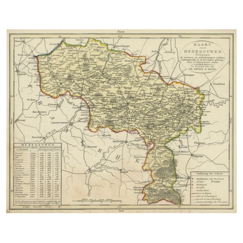
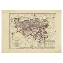
- Antique Map of the Region of Henegouwen by Veelwaard, C.1840Located in Langweer, NLAntique map titled 'Kaart van Henegouwen'. Original antique map of the region of Henegouwen (Hainaut), Belgium. Source unkown, to be determined. Published circa 1840. Artists and...Category
Antique 19th Century Maps
MaterialsPaper
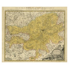
- Antique Map of the Region of Namen by Homann, 1746By Johann Baptist HomannLocated in Langweer, NLAntique map titled 'Comitatus Namur Tabula Geographica ex mappis Frixianis'. Regional map of Namen, Belgium. Artists and Engravers: Homann Heirs was a German publishing firm tha...Category
Antique 18th Century Maps
MaterialsPaper
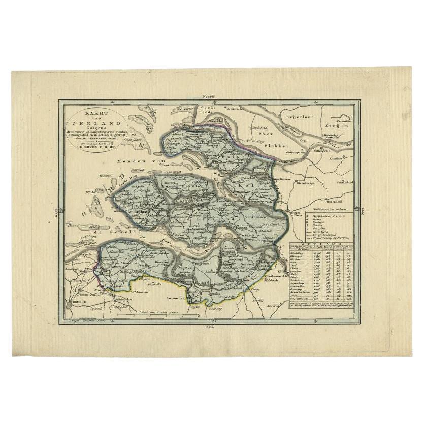
- Antique Map of the Province of Zeeland by Veelwaard, C.1840Located in Langweer, NLAntique map titled 'Kaart van Zeeland (..).' Uncommon map showing the province of Zeeland in the Netherlands. Source unkown, to be determined. Published circa 1840. Artists and E...Category
Antique 19th Century Maps
MaterialsPaper
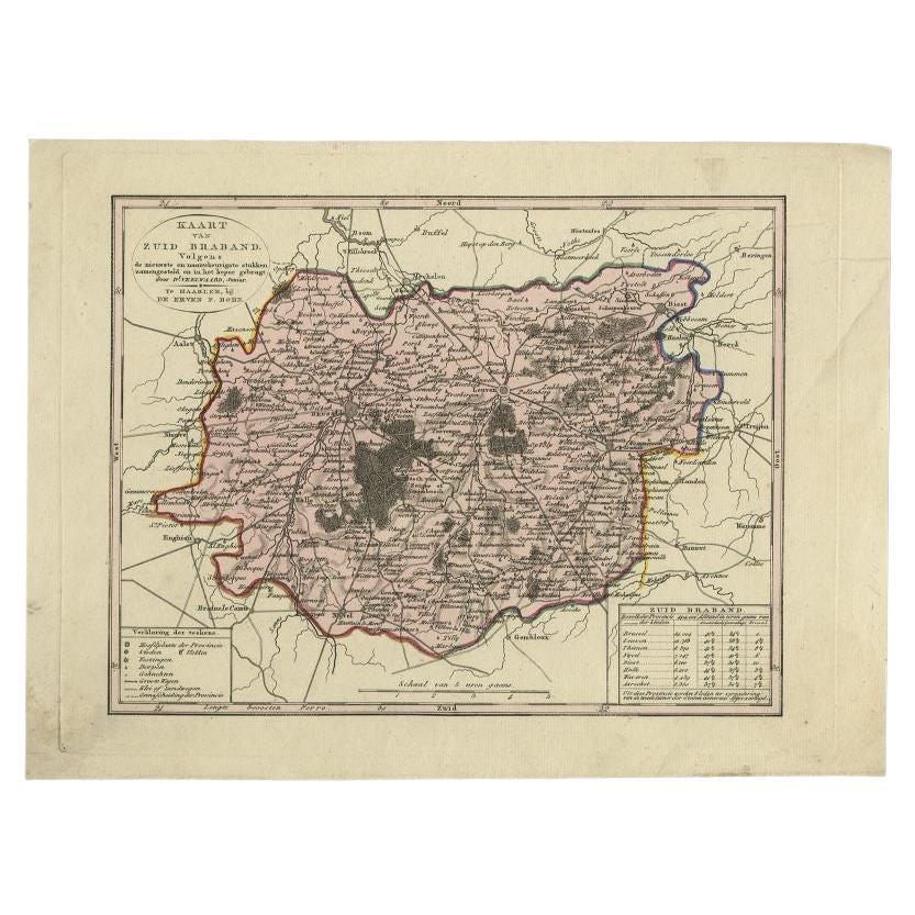
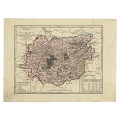
- Antique Map of the Province of Brabant in Belgium by Veelwaard, C.1840Located in Langweer, NLAntique map titled 'Kaart van Zuid Braband (..).' Uncommon map showing the province of Zuid-Brabant in Belgium. Source unknown, to be determined. Artists and Engravers: Daniel Vee...Category
Antique 19th Century Maps
MaterialsPaper

You May Also Like
- Original Antique Map of Ireland- Kerry. C.1840Located in St Annes, LancashireGreat map of Kerry Steel engraving Drawn under the direction of A.Adlard Published by How and Parsons, C.1840 Unframed.Category
Antique 1840s English Maps
MaterialsPaper
- 1840 Map of the City of Washington Published by William M. MorrisonLocated in Colorado Springs, COThis map, printed in 1840, is a detailed representation of Washington, D.C. in the mid-19th century. The map shows block numbers, wards, and government buildings as well as details o...Category
Antique 1840s American Federal Maps
MaterialsPaper
- Original Antique Map of South East Asia by Becker, circa 1840Located in St Annes, LancashireGreat map of South East Asia Steel engraving with original color outline Engraved by Becker Published by Virtue, circa 1840. Unframed.Category
Antique 1840s English Other Maps
MaterialsPaper
- Original Antique Map of Ireland- Tipperary and Waterford. C.1840Located in St Annes, LancashireGreat map of Tipperary and Waterford Steel engraving Drawn under the direction of A.Adlard Published by How and Parsons, C.1840 Unframed.Category
Antique 1840s English Maps
MaterialsPaper
- 1861 Topographical Map of the District of Columbia, by Boschke, Antique MapLocated in Colorado Springs, COPresented is an original map of Albert Boschke's extremely sought-after "Topographical Map of the District of Columbia Surveyed in the Years 1856 ...Category
Antique 1860s American Historical Memorabilia
MaterialsPaper
- 1594 Maurice Bouguereau Map of the Region Limoges, France, Ric0015Located in Norton, MA1594 Maurice Bouguereau map of the region Limoges, France, entitled "Totivs Lemovici et Confinium Pro Uinciarum Quantum ad Dioecefin Lemo Uicenfen Fpectant," Hand Colored Ric0015 Jean IV Le Clerc...Category
Antique 16th Century Dutch Maps
MaterialsPaper


