Items Similar to Map of Duchy of Brabant Centered on Fortress of Louvain or Leuven, Belgium, 1720
Want more images or videos?
Request additional images or videos from the seller
1 of 5
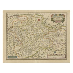
Map of Duchy of Brabant Centered on Fortress of Louvain or Leuven, Belgium, 1720
About the Item
Antique map titled 'Ducatus Brabantiae Nova Tabula in qua Lovanii Bruxellarum March S. Impreii Sylvae Ducis et Merchliniae Dominia.'
This fully engraved copperplate map covers important Duchy of Brabant and is centered on the large fortress of Louvain, site of the first university in the Low Countries. Also delineated are the walled and fortified cities of Antwerp, Brussels, Niville, Mechelen, Sandvliet, Breda, Megen, Eindhoven, and Tilmont. The very decorative figurative title cartouche features the coat of arms, soldiers and putti. Source unknown, to be determined.
Artists and Engravers: Made by an anonymous engraver after 'Johann Baptist Homann'. The Homann family became the most important map publishers in Germany in the eighteenth century, the business being founded by J.B. Homann in Nuremberg about the year 1702. Soon after publishing his first atlas in 1707 he became a member of the Berlin academy of Sciences and in 1715 he was appointed Geographer to the Emperor. After the founder's death in 1724, the firm was continued under the direction of his son until 1730 and was then bequeathed to his heirs on the condition that it trades under the name of Homann Heirs. The firm remained in being until the next century and had a wide influence on map publishing in Germany. Apart from the atlases the firm published a very large number of individual maps. The Homanns produced a Neuer Atlas in 1714, a Grosser Atlas in 1737, and an Atlas Maior with about 300 maps in 1780. They also issued a special Atlas of Germany with full sized plans of principal cities, school atlases and an Atlas of Silesia in 1750 with 20 maps.
- Dimensions:Height: 23.63 in (60 cm)Width: 20.87 in (53 cm)Depth: 0 in (0.02 mm)
- Materials and Techniques:
- Period:1720-1729
- Date of Manufacture:circa 1720
- Condition:Condition: Good. Margins with several small tears, not affecting image. One larger tear top left extending 1 cm into image; backed. A few small unimportant creases, mainly near the edges. Good impression with vivid colours. Middle fold as issued.
- Seller Location:Langweer, NL
- Reference Number:
About the Seller
5.0
Platinum Seller
These expertly vetted sellers are 1stDibs' most experienced sellers and are rated highest by our customers.
Established in 2009
1stDibs seller since 2017
1,919 sales on 1stDibs
Typical response time: <1 hour
- ShippingRetrieving quote...Ships From: Langweer, Netherlands
- Return PolicyA return for this item may be initiated within 14 days of delivery.
More From This SellerView All
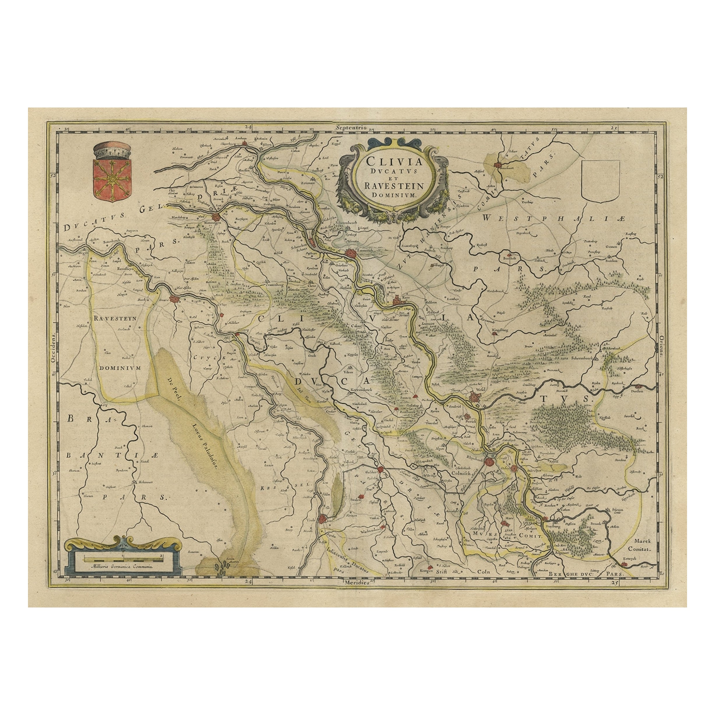
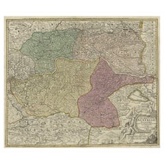
- Map of the Duchy Clivia & Ravestein, Brabant in The Netherlands & Germany, 1635Located in Langweer, NLAntique map titled 'Clivia Ducatus et Ravestein Dominium.' Map of the Duchy Clivia and Ravestein, part of Brabant in The Nethe...Category
Antique 1630s Maps
MaterialsPaper
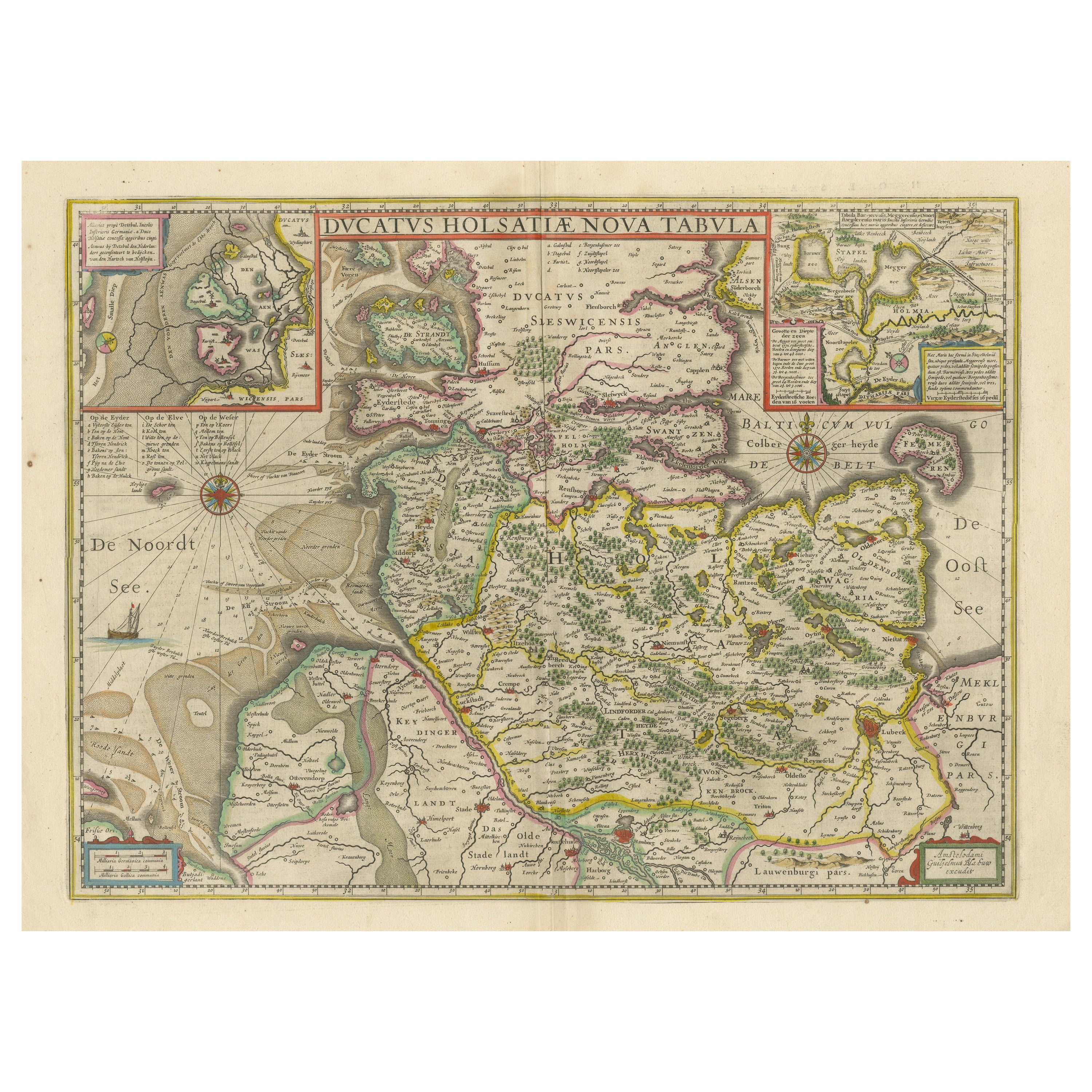
- Original Antique Map of the Duchy of HolsteinBy Willem BlaeuLocated in Langweer, NLAntique map titled 'Ducatus Holsatiae Nova Tabula'. Original old map of the Duchy of Holstein, the northernmost territory of the Holy Roman Empire, from the mid-17th Century. To the ...Category
Antique Mid-17th Century Maps
MaterialsPaper
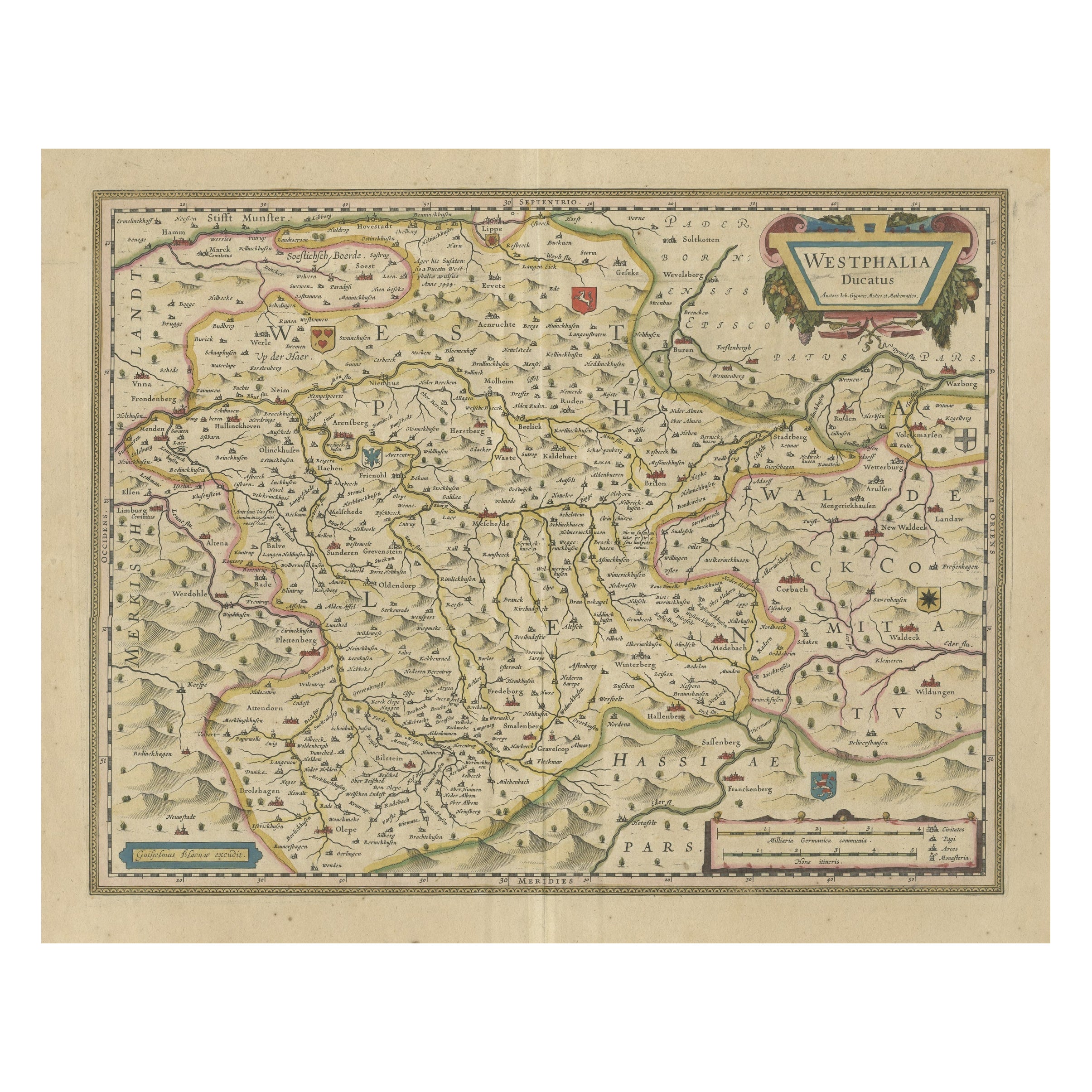
- Antique Map of the Duchy of Westphalia, GermanyLocated in Langweer, NLOriginal antique map titled 'Westphalia Ducatus'. Fine map of the Duchy of Westphalia, Germany. The map is centered on Meschede and includes Arensberg, Beelick, and Brilon. Published...Category
Antique Mid-17th Century Maps
MaterialsPaper
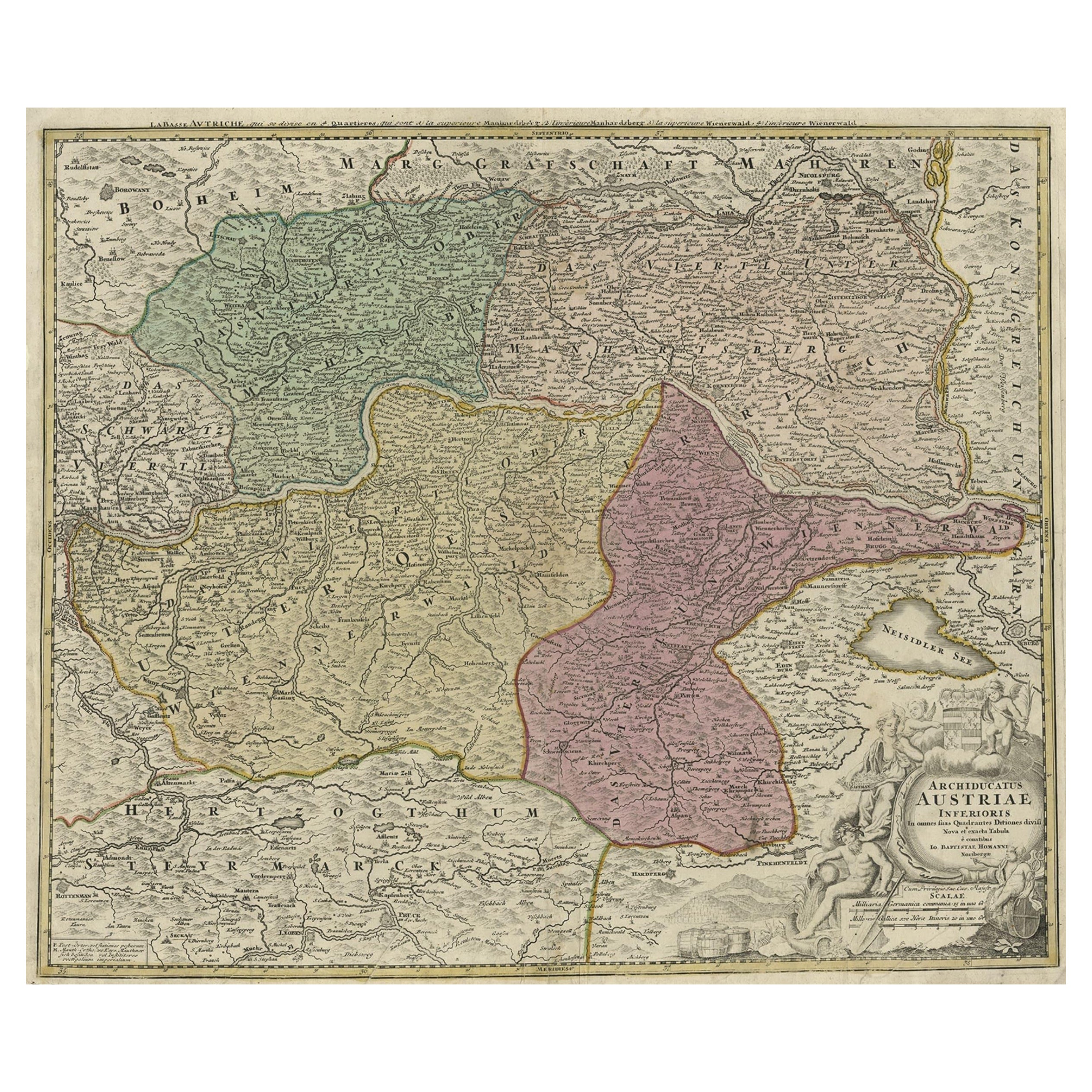
- Old Decorative Map of Austria, Centered on the Danube River and Vienna, Ca.1720Located in Langweer, NLAntique map titled 'Archiducatus Austriae inferioris (..).' Decorative map of Austria, centered on the course of the Danube River and Vienna. Shows the region from Enss and Steyr to ...Category
Antique 1720s Maps
MaterialsPaper
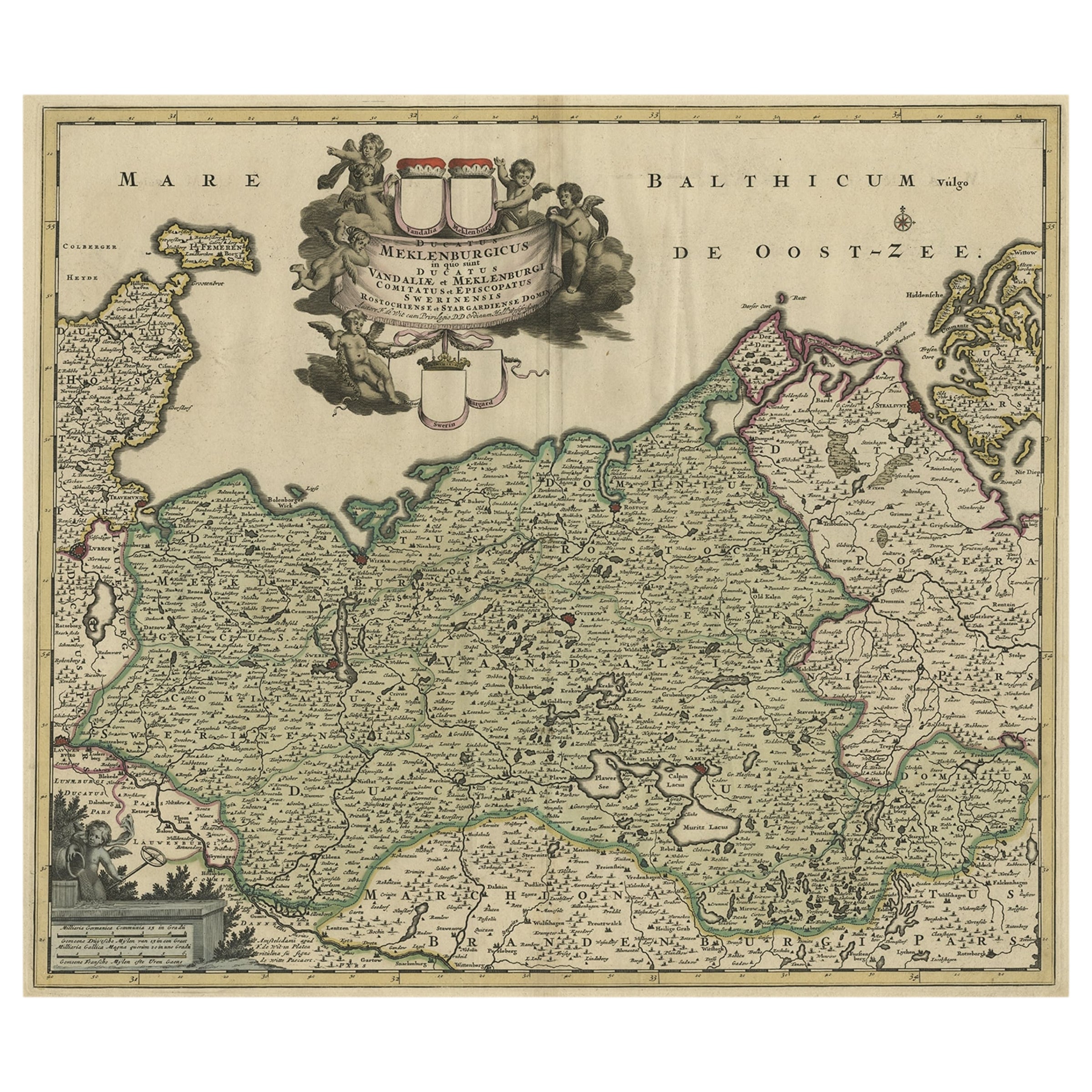
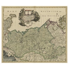
- A Handsome & Detailed Map of the Duchy of Mecklenburg & Pomerania, Germany, 1680Located in Langweer, NLAntique map titled 'Ducatus Meklenburgicus in quo sunt Ducatus Vandaliae et Meklenburgi Ducatus et Comitatus Swerinensis.' A handsome and detailed map of the Duchy of Mecklenburg...Category
Antique 1680s Maps
MaterialsPaper
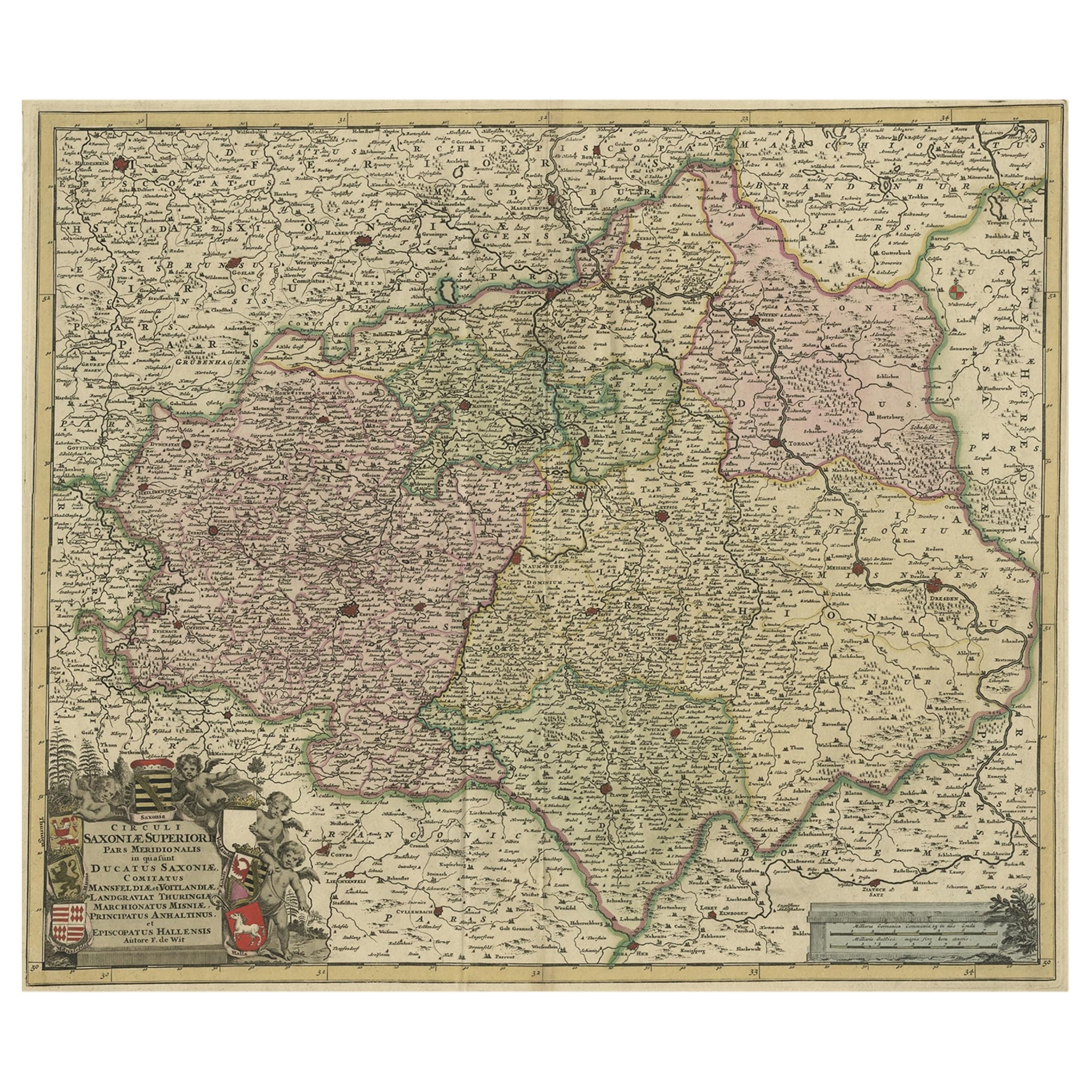
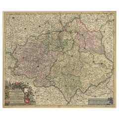
- Old Detailed Map of the Historical Regions of the Duchy of Saxony, Germany, 1680Located in Langweer, NLAntique map titled 'Circuli Saxoniae Superior Pars Meridionalis in qua sunt Ducatus Saxoniae, Comitatus Mansfeldiae, et Voitlandiae, Landgraviat Thuringiae, Marchionatus Misniae Prin...Category
Antique 1680s Maps
MaterialsPaper
You May Also Like
- Original Antique Map of Belgium by Tallis, Circa 1850Located in St Annes, LancashireGreat map of Belgium Steel engraving Many lovely vignettes Published by London Printing & Publishing Co. ( Formerly Tallis ), C.1850 Origin...Category
Antique 1850s English Maps
MaterialsPaper
- Vintage "View of the Center of Paris Taken from the Air" Lithograph MapLocated in San Diego, CAA very stylish "View of the Center of Paris Taken from the Air" lithograph map published by the Paris Ministry of Tourism, circa early 1950s. The piece measures 27" x 43" and shows...Category
20th Century French Mid-Century Modern Prints
MaterialsPaper
- Antique 1630 Colored Belgium Map Flandria Gallica Flanders Henricus HondiusLocated in Dayton, OH"Antique hand colored map of Flanders, Belgium, circa 1630, engraved by Henricus Hondius. “Henricus Hondius II (1597 – 16 August 1651) was a Dutch eng...Category
Antique Early 17th Century Renaissance Maps
MaterialsPaper
- 17th Century Hand Colored Map of the Liege Region in Belgium by VisscherBy Nicolaes Visscher IILocated in Alamo, CAAn original 17th century map entitled "Leodiensis Episcopatus in omnes Subjacentes Provincias distincté divisusVisscher, Leodiensis Episcopatus" by Nicolaes Visscher II, published in Amsterdam in 1688. The map is centered on Liege, Belgium, includes the area between Antwerp, Turnhout, Roermond, Cologne, Trier and Dinant. This attractive map is presented in a cream-colored mat measuring 30" wide x 27.5" high. There is a central fold, as issued. There is minimal spotting in the upper margin and a tiny spot in the right lower margin, which are under the mat. The map is otherwise in excellent condition. The Visscher family were one of the great cartographic families of the 17th century. Begun by Claes Jansz Visscher...Category
Antique Late 17th Century Dutch Maps
MaterialsPaper
- Map of the Republic of GenoaLocated in New York, NYFramed antique hand-coloured map of the Republic of Genoa including the duchies of Mantua, Modena, and Parma. Europe, late 18th century. Dimension: 25...Category
Antique Late 18th Century European Maps
- Antique Map of Principality of MonacoBy Antonio Vallardi EditoreLocated in Alessandria, PiemonteST/619 - "Old Geographical Atlas of Italy - Topographic map of ex-Principality of Monaco" - ediz Vallardi - Milano - A somewhat special edition ---Category
Antique Late 19th Century Italian Other Prints
MaterialsPaper


