Items Similar to A Handsome & Detailed Map of the Duchy of Mecklenburg & Pomerania, Germany, 1680

Want more images or videos?
Request additional images or videos from the seller
1 of 5
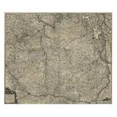
A Handsome & Detailed Map of the Duchy of Mecklenburg & Pomerania, Germany, 1680
About the Item
Antique map titled 'Ducatus Meklenburgicus in quo sunt Ducatus Vandaliae et Meklenburgi Ducatus et Comitatus Swerinensis.'
A handsome and detailed map of the Duchy of Mecklenburg and Pomerania in Germany. The map is fully engraved with towns, political boundaries, rivers, and forests. The map is embellished with a title cartouche with putti and coats of arms. Below another cartouche with scale and putti. Source unknown, to be determined.
Artists and engravers: Made by 'Frederick de Wit' after an anonymous artist. Frederik/Frederick de Wit (Amsterdam 1630-1706), was a famous engraver and publisher in Amsterdam. He acquired many of the printing plates of Blaeu and Janssonius when it came to auction. His map were very popular because of the quality of the engravings and the beautiful colouring. After his death his work was re-issued by Pieter Mortier and Covens & Mortier.
- Dimensions:Height: 21.03 in (53.4 cm)Width: 24.22 in (61.5 cm)Depth: 0 in (0.02 mm)
- Materials and Techniques:
- Period:1680-1689
- Date of Manufacture:circa 1680
- Condition:Condition: Good. Edges browned and a few spots in the margins. Vertical creases left and right of middle fold. Small soft crease bottom right corner. Original middle fold as issued. General age-related toning and/or occasional minor handling defects.
- Seller Location:Langweer, NL
- Reference Number:
About the Seller
5.0
Platinum Seller
These expertly vetted sellers are 1stDibs' most experienced sellers and are rated highest by our customers.
Established in 2009
1stDibs seller since 2017
1,932 sales on 1stDibs
Typical response time: <1 hour
- ShippingRetrieving quote...Ships From: Langweer, Netherlands
- Return PolicyA return for this item may be initiated within 14 days of delivery.
More From This SellerView All
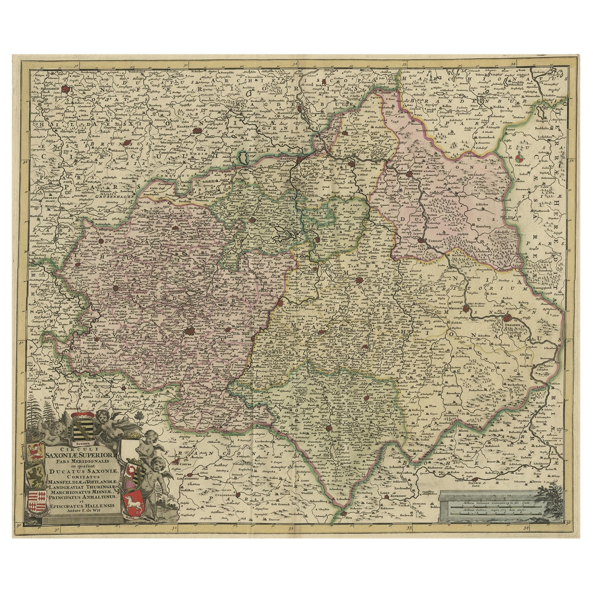
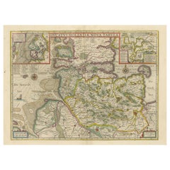
- Old Detailed Map of the Historical Regions of the Duchy of Saxony, Germany, 1680Located in Langweer, NLAntique map titled 'Circuli Saxoniae Superior Pars Meridionalis in qua sunt Ducatus Saxoniae, Comitatus Mansfeldiae, et Voitlandiae, Landgraviat Thuringiae, Marchionatus Misniae Prin...Category
Antique 1680s Maps
MaterialsPaper
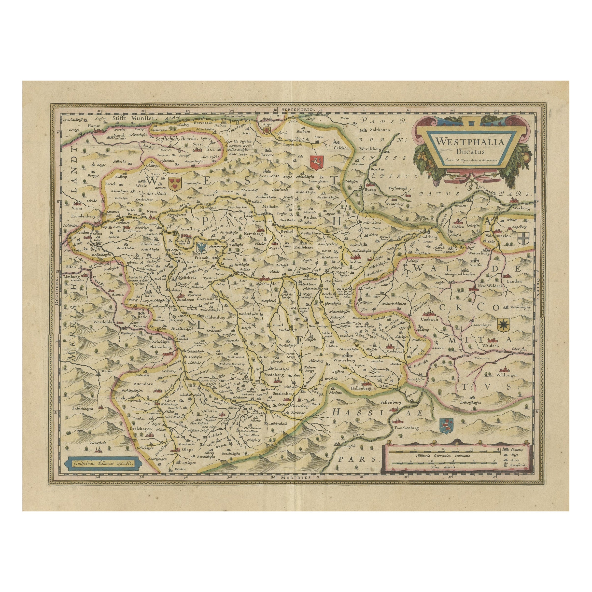
- Antique Map of the Duchy of Westphalia, GermanyLocated in Langweer, NLOriginal antique map titled 'Westphalia Ducatus'. Fine map of the Duchy of Westphalia, Germany. The map is centered on Meschede and includes Arensberg, Beelick, and Brilon. Published...Category
Antique Mid-17th Century Maps
MaterialsPaper
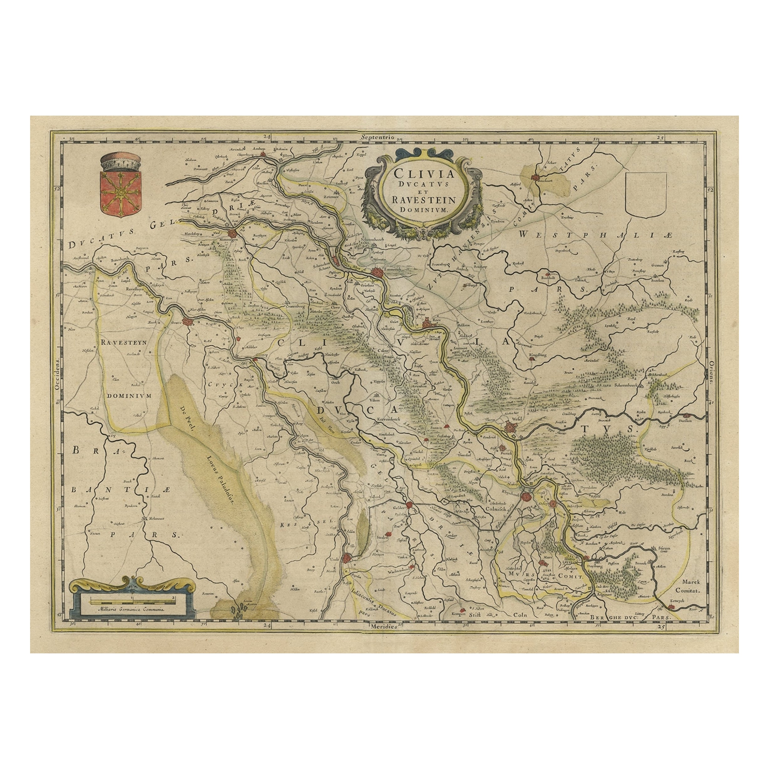
- Map of the Duchy Clivia & Ravestein, Brabant in The Netherlands & Germany, 1635Located in Langweer, NLAntique map titled 'Clivia Ducatus et Ravestein Dominium.' Map of the Duchy Clivia and Ravestein, part of Brabant in The Nethe...Category
Antique 1630s Maps
MaterialsPaper
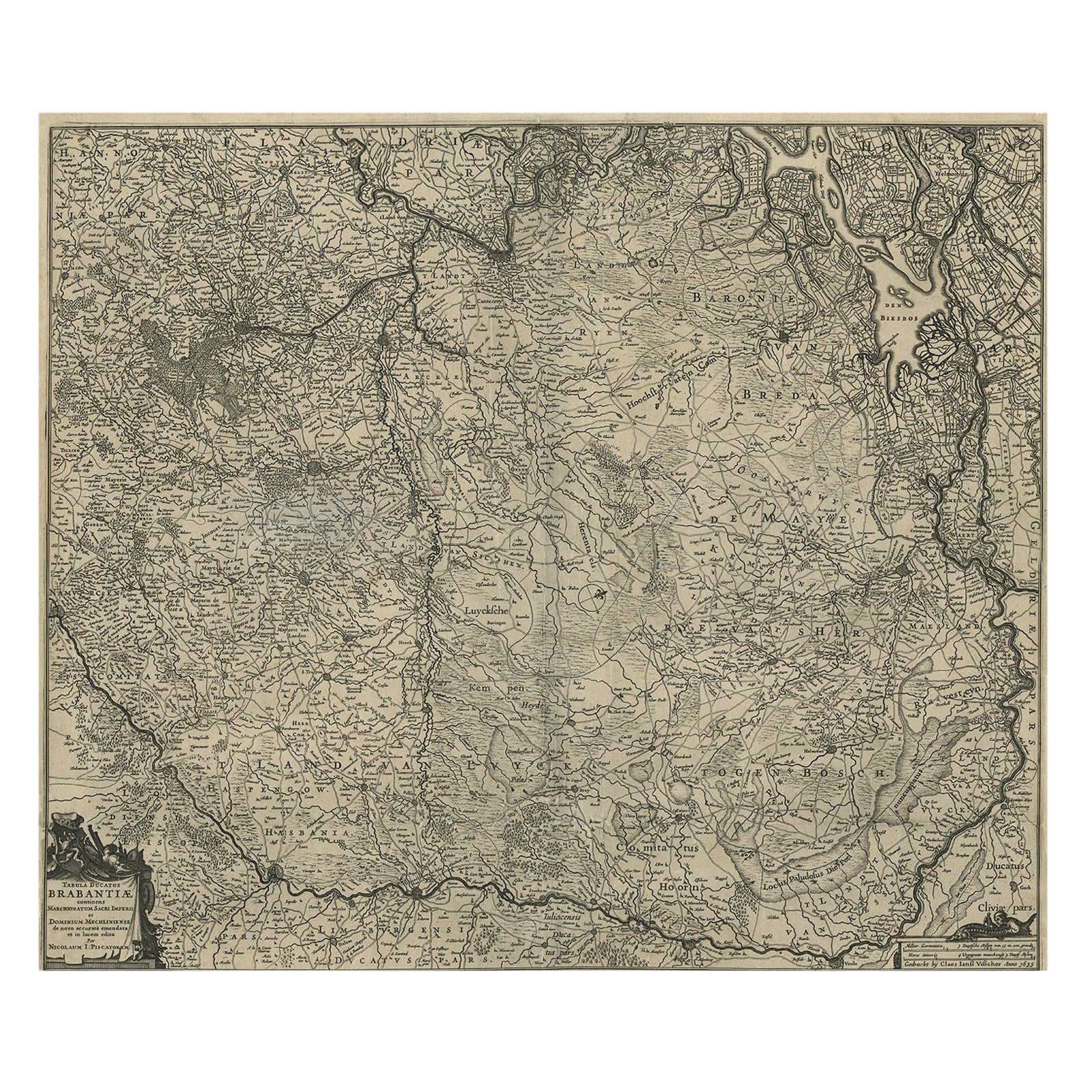
- Detailed Map of the South of the The Netherlands & The North of Belgium, ca.1680Located in Langweer, NLAntique map titled 'Tabula Ducatus Brabantiae.' - Detailed map of the southern part of The Netherlands and the northern part of Belgium with Antwerp and Brussels. In the corner top l...Category
Antique 1680s Maps
MaterialsPaper
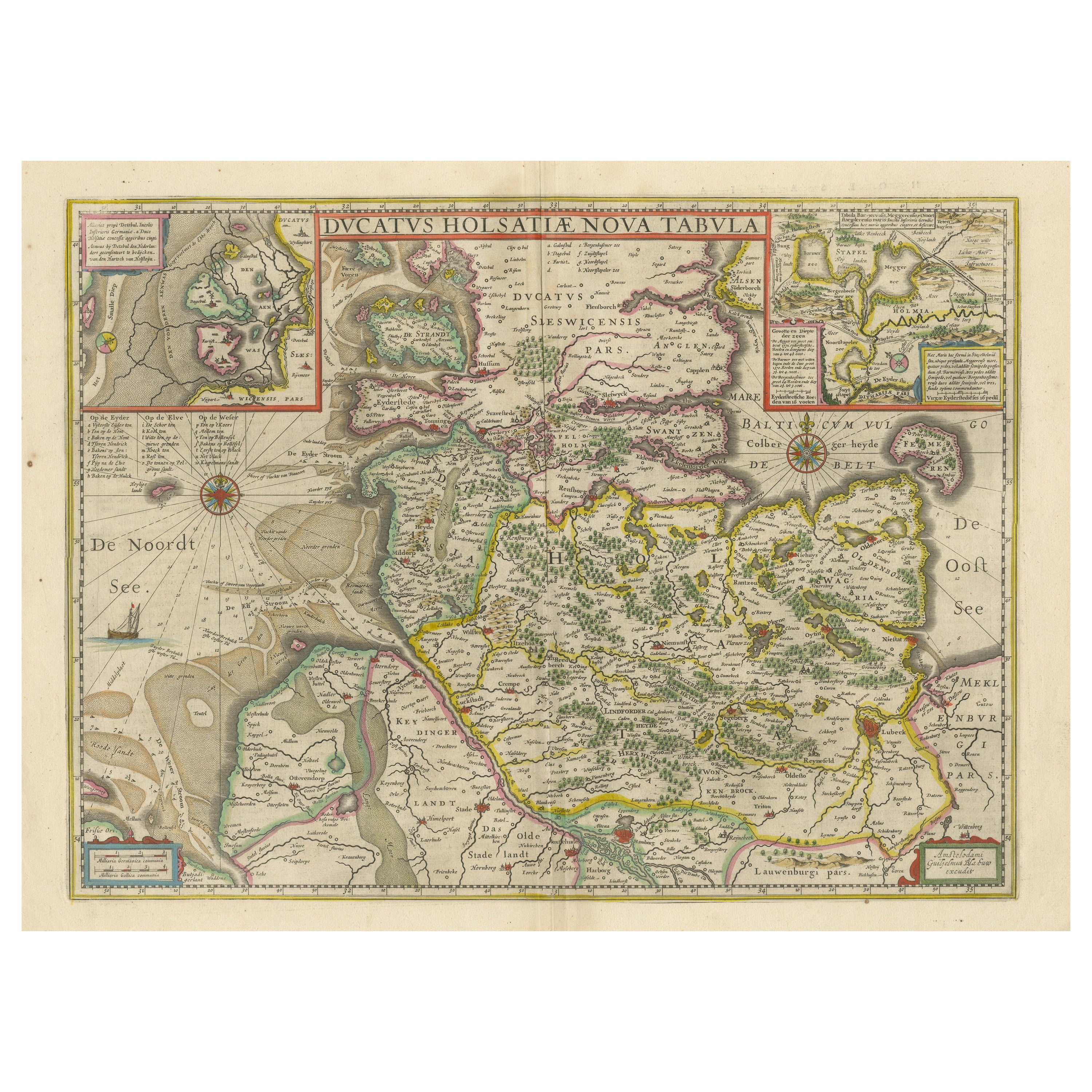
- Original Antique Map of the Duchy of HolsteinBy Willem BlaeuLocated in Langweer, NLAntique map titled 'Ducatus Holsatiae Nova Tabula'. Original old map of the Duchy of Holstein, the northernmost territory of the Holy Roman Empire, from the mid-17th Century. To the ...Category
Antique Mid-17th Century Maps
MaterialsPaper
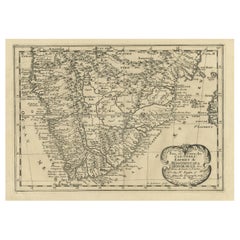
- Original Copperplate Engraved Detailed Map of South Africa, ca.1680Located in Langweer, NLAntique map titled 'Pays et Coste des Caffres Empires de Monomotapa (..)'. Detailed map of South Africa. Engraved by Antoine d'Winter for a Dutch edition of Sanson's pocket atlas...Category
Antique 1680s Maps
MaterialsPaper
You May Also Like
- Map of the Republic of GenoaLocated in New York, NYFramed antique hand-coloured map of the Republic of Genoa including the duchies of Mantua, Modena, and Parma. Europe, late 18th century. Dimension: 25...Category
Antique Late 18th Century European Maps
- Map "Estuary- Mouth of the Thames"Located in Alessandria, PiemonteST/426 - Antique French Map of the estuary of the Thames, map dated 1769 - "Mape of the entrance of the Thames. Designed by filing of Navy cards fo...Category
Antique Mid-18th Century French Other Prints
MaterialsPaper
- Germany West of the Rhine: A Hand-colored 18th Century Map by de WitBy Frederick de WitLocated in Alamo, CAThis original 18th century hand-colored map of the county of Moers, Germany entitled "Illustrissimo Celsissmo Principi GUILIELMO HENRICO D.G. Arausionum Principi Domino suo Clementis...Category
Antique Early 18th Century Dutch Maps
MaterialsPaper
- Vintage "View of the Center of Paris Taken from the Air" Lithograph MapLocated in San Diego, CAA very stylish "View of the Center of Paris Taken from the Air" lithograph map published by the Paris Ministry of Tourism, circa early 1950s. The piece measures 27" x 43" and shows...Category
20th Century French Mid-Century Modern Prints
MaterialsPaper
- 17th Century Hand-Colored Map of a Region in West Germany by JanssoniusBy Johannes JanssoniusLocated in Alamo, CAThis attractive highly detailed 17th century original hand-colored map is entitled "Archiepiscopatus Maghdeburgensis et Anhaltinus Ducatus cum terris adjacentibus". It was published ...Category
Antique Mid-17th Century Dutch Maps
MaterialsPaper
- 18th Century Hand-Colored Homann Map of Germany, Including Frankfurt and BerlinBy Johann Baptist HomannLocated in Alamo, CAAn 18th century hand-colored map entitled "Tabula Marchionatus Brandenburgici et Ducatus Pomeraniae quae sunt Pars Septentrionalis Circuli Saxoniae Superioris" by Johann Baptist Homa...Category
Antique Early 18th Century German Maps
MaterialsPaper


Recently Viewed
View AllMore Ways To Browse
Auctions Of Antique Furniture
Coat Of Arms Plates
Antique German Scales
Antique German Scale
Coat Of Arms Engraving
Blaeu Maps
Map Blaeu
Coat Of Arms German
German Putti
Political Map
Amsterdam Coat Of Arms
Mortier Antique
18th Century Southern Antiques
Antique French Globe
Antique Furniture South Africa
South African Antique Furniture
Used Bookseller
Used Booksellers