Items Similar to Old Decorative Map of Austria, Centered on the Danube River and Vienna, Ca.1720

Want more images or videos?
Request additional images or videos from the seller
1 of 6
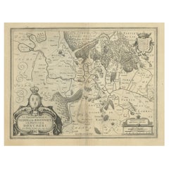
Old Decorative Map of Austria, Centered on the Danube River and Vienna, Ca.1720
About the Item
Antique map titled 'Archiducatus Austriae inferioris (..).' Decorative map of Austria, centered on the course of the Danube River and Vienna. Shows the region from Enss and Steyr to Presburg and Altenburg. Title cartouche with scale and coat of arms. Source unknown, to be determined.
Artists and Engravers: Made by an anonymous engraver after 'Johann Baptist Homann'. The Homann family became the most important map publishers in Germany in the eighteenth century, the business being founded by J.B. Homann in Nuremberg about the year 1702. Soon after publishing his first atlas in 1707 he became a member of the Berlin academy of Sciences and in 1715 he was appointed Geographer to the Emperor. After the founder's death in 1724, the firm was continued under the direction of his son until 1730 and was then bequeathed to his heirs on the condition that it trades under the name of Homann Heirs. The firm remained in being until the next century and had a wide influence on map publishing in Germany. Apart from the atlases the firm published a very large number of individual maps. The Homanns produced a Neuer Atlas in 1714, a Grosser Atlas in 1737, and an Atlas Maior with about 300 maps in 1780. They also issued a special Atlas of Germany with full sized plans of principal cities, school atlases and an Atlas of Silesia in 1750 with 20 maps.
- Dimensions:Height: 20.87 in (53 cm)Width: 24.02 in (61 cm)Depth: 0 in (0.02 mm)
- Materials and Techniques:
- Period:1720-1729
- Date of Manufacture:circa 1720
- Condition:Repaired: repaired tears in the margins,. Wear consistent with age and use. Condition: Fair. Several imperfections such as creases, staining, slight paper loss left and bottom right margin; backed. Original middle fold as issued. General age-related toning and/or occasional minor defects.
- Seller Location:Langweer, NL
- Reference Number:
About the Seller
5.0
Platinum Seller
These expertly vetted sellers are 1stDibs' most experienced sellers and are rated highest by our customers.
Established in 2009
1stDibs seller since 2017
1,928 sales on 1stDibs
Typical response time: <1 hour
- ShippingRetrieving quote...Ships From: Langweer, Netherlands
- Return PolicyA return for this item may be initiated within 14 days of delivery.
More From This SellerView All
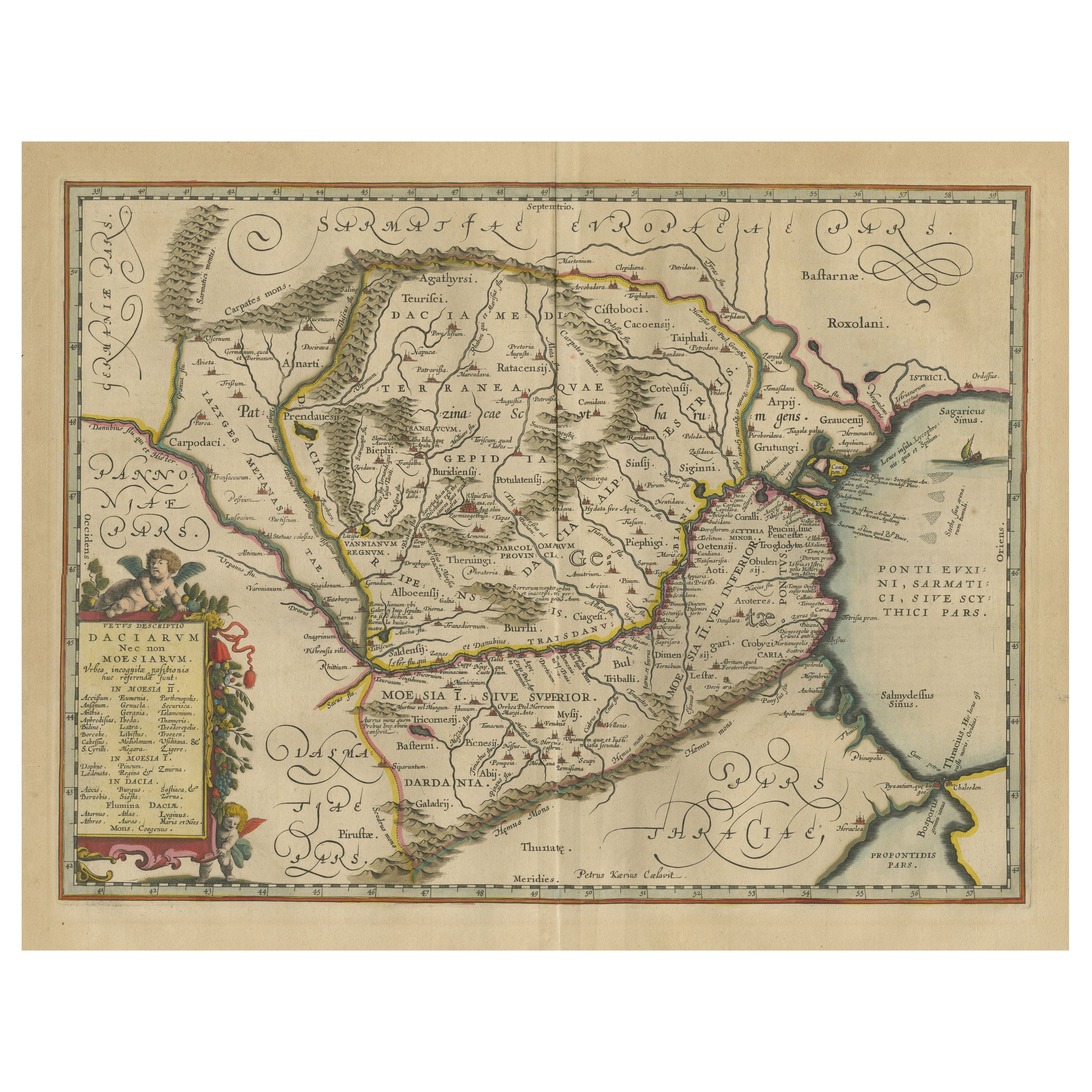
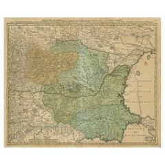
- Antique Map of Romania and Bulgaria Centered on the Danube RiverLocated in Langweer, NLAntique map titled 'Vetus descriptio Daciarum nec non Moesiarum'. Impressive map of the area of Romania and Bulgaria centered on the Danube River. The map is based on Ortelius' map o...Category
Antique Mid-17th Century Maps
MaterialsPaper
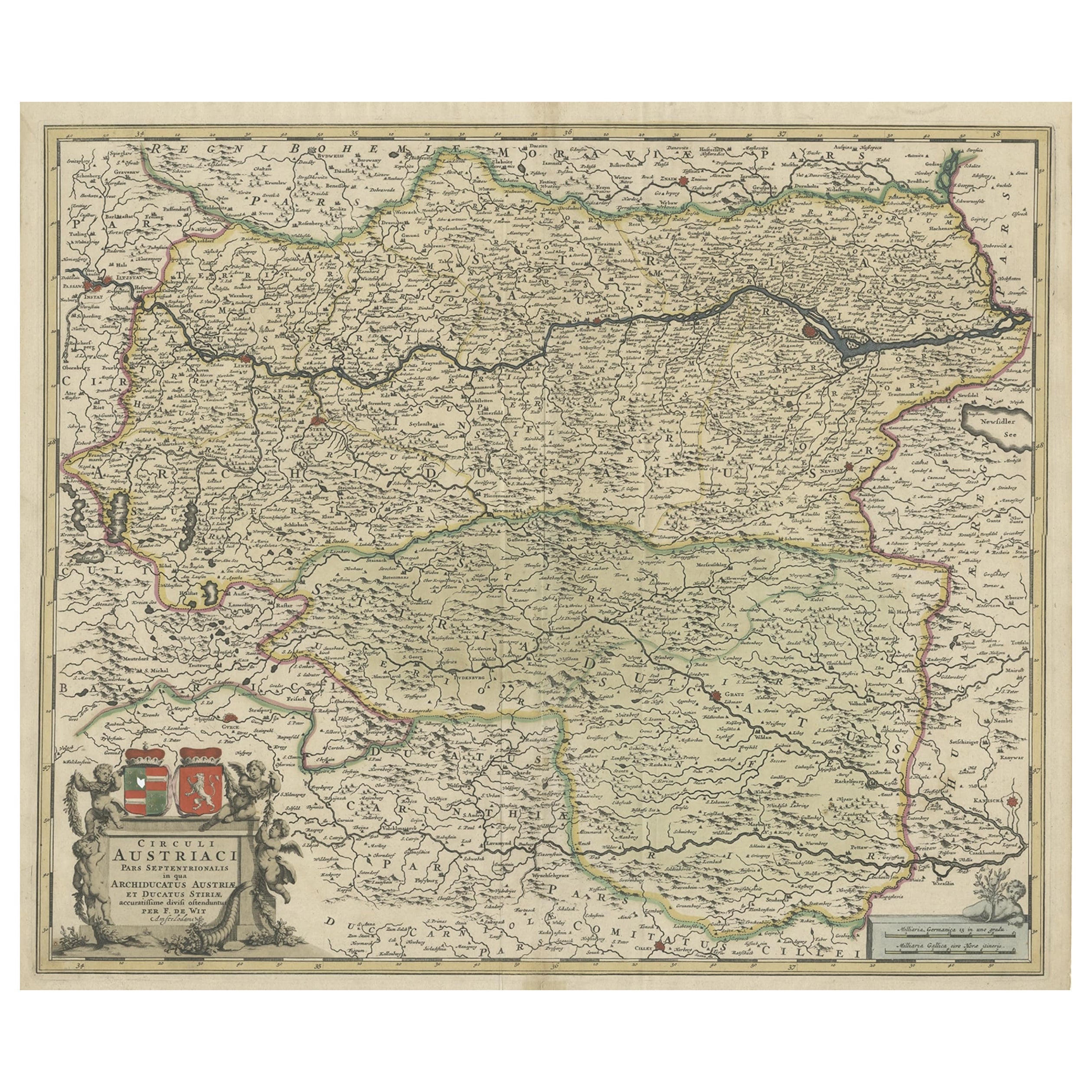
- Antique Map of Austria, Centered Around the Danube from Passau to Vienna, C.1690Located in Langweer, NLAntique map of Austria titled 'Circuli Austriaci pars septentrionalis in quia archiducatus Austriae et Ducatus Stiriae accuratissime divisi ostenduntur per F. de Wit'. Detailed m...Category
Antique 1690s Maps
MaterialsPaper
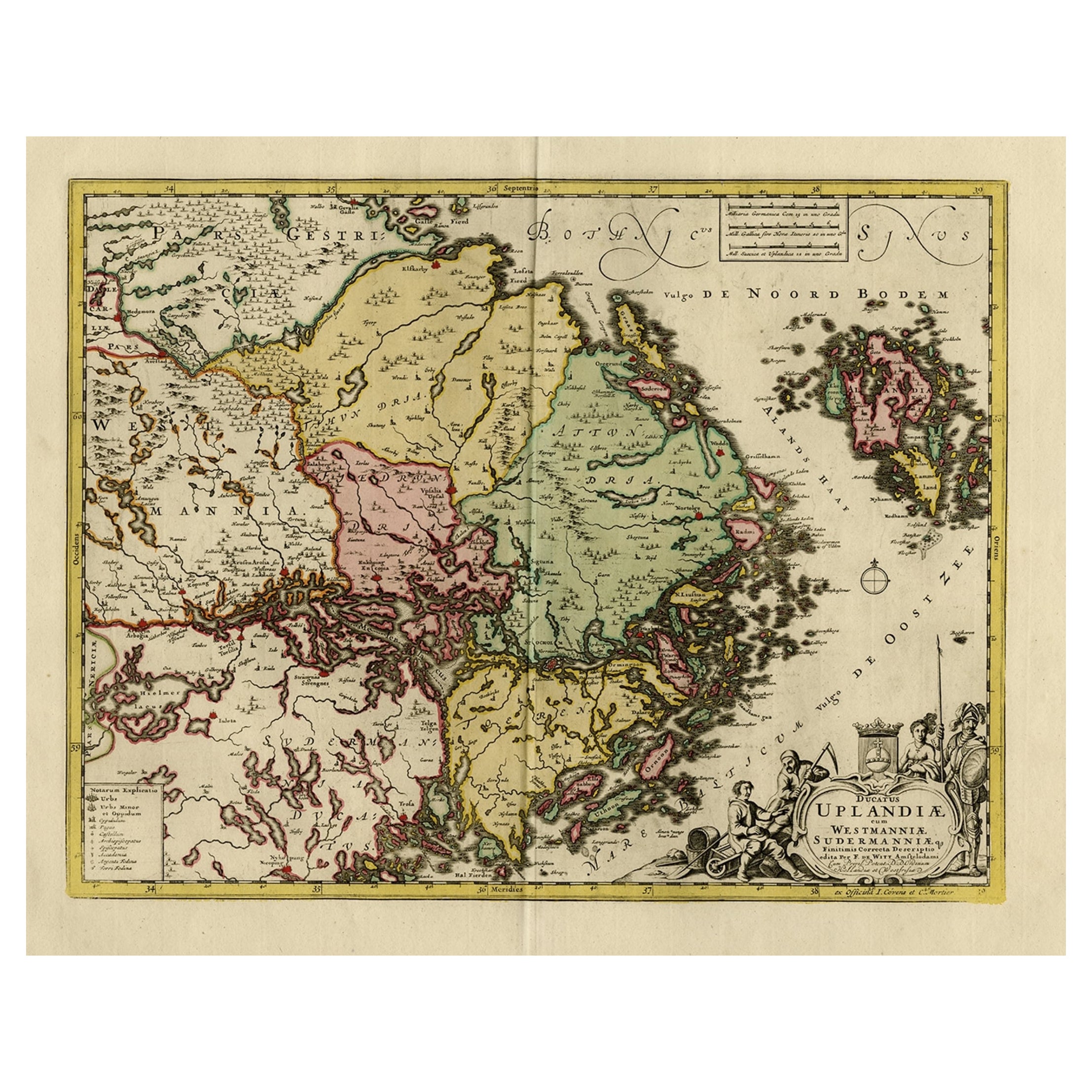
- Original and Decorative Antique Engraved Map of Finland and Sweden, ca.1720Located in Langweer, NLAntique map titled 'Ducatus Uplandiae cum Westmanniae Sudermanniae (..)' This map shows parts of Finland and Sweden. Originally published by Frederick de Wit in the late 1600's. ...Category
Antique 1720s Maps
MaterialsPaper
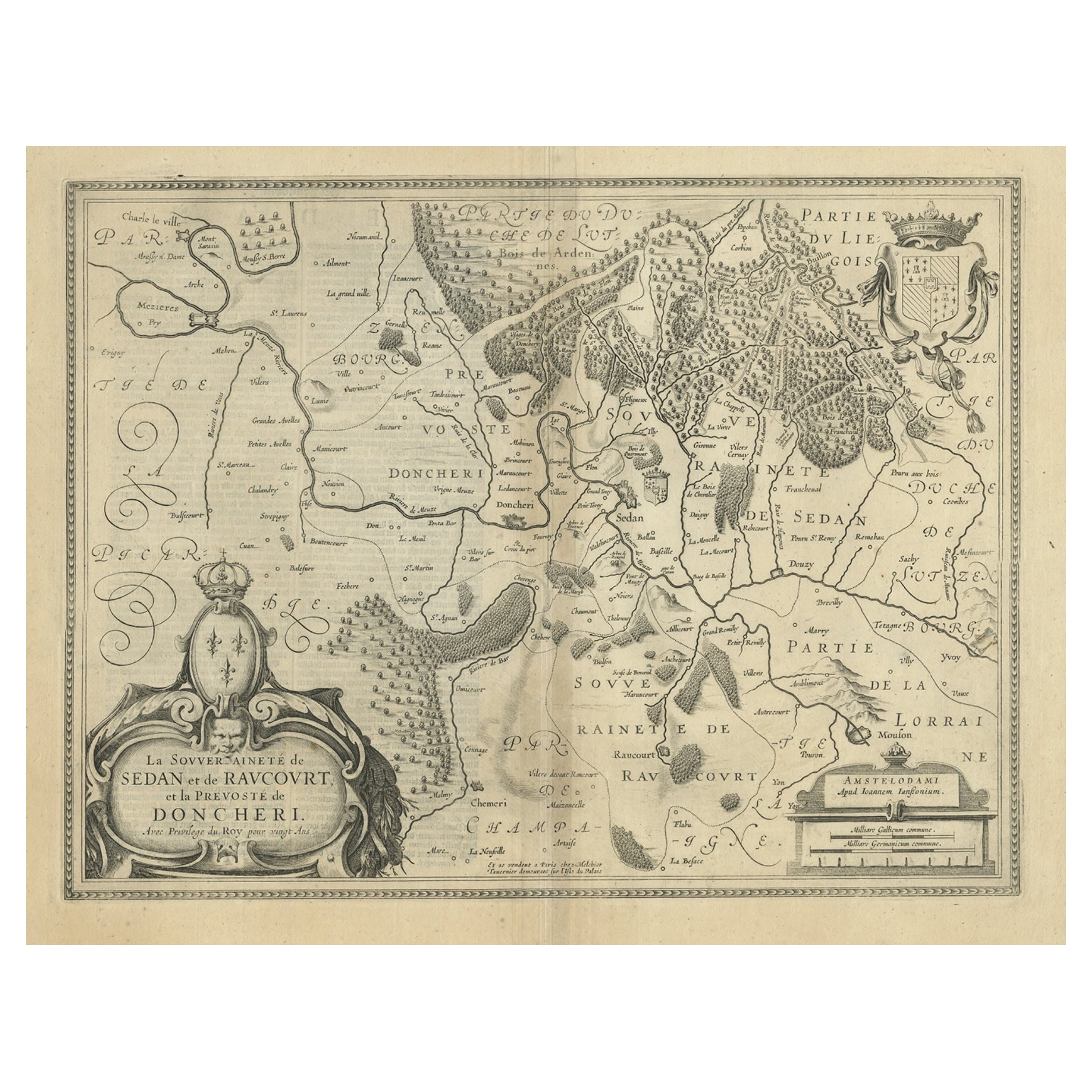
- Lovely Antique Map Centered on Sedan and Doncheri and the Meuze River, ca.1650Located in Langweer, NLOriginal antique map with title: 'La Souveraineté de Sedan et de Raucourt, et la prevosté de Doncheri', is an antique map centered on Sedan and Doncheri, along with the Meuze River ...Category
Antique 1650s Maps
MaterialsPaper
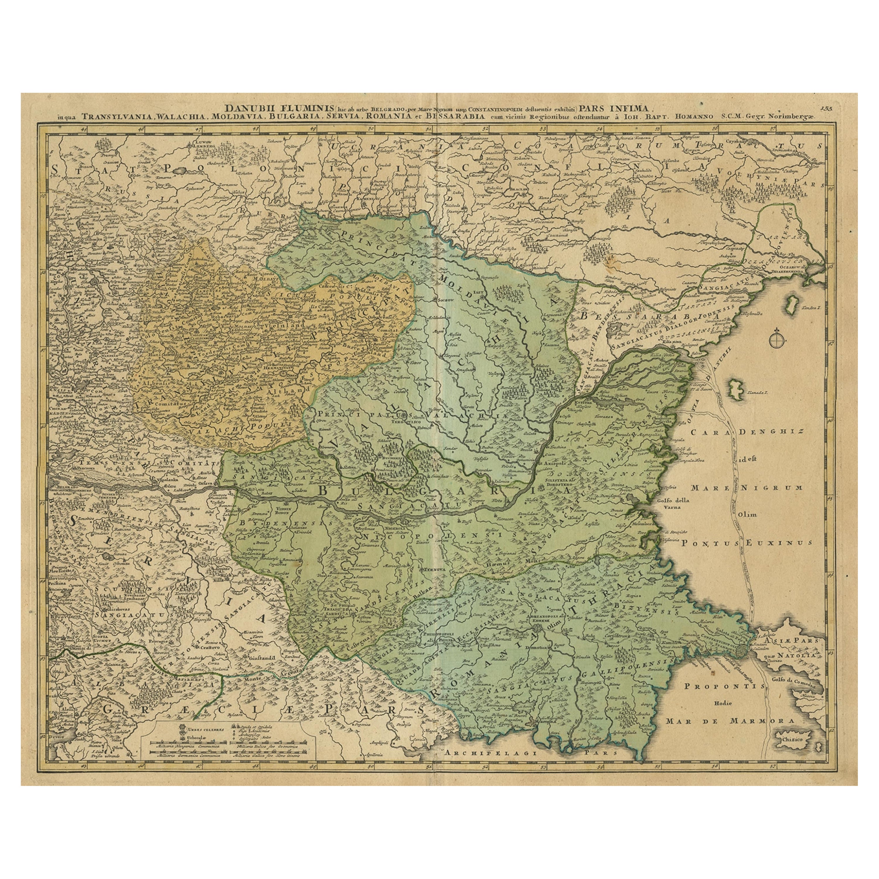
- Danube River Incl Serbia, Moldavia, Transylvania, Romania, Bulgaria Etc, ca.1720Located in Langweer, NLAntique map titled 'Danubii Fluminis (..)'. Regional map of the Donau river, Shows the Danube river from Belgrade in Serbia, along the border between ...Category
Antique 1720s Maps
MaterialsPaper
- Antique Map of Greece with an Inset Map of the Upper Danube Region, c.1720Located in Langweer, NLAntique map titled 'Fluviorum in Europa principis Danubii cum adiacentibus Regnis.' Detailed map of Greece, the Balkans and contiguous parts of the Adriatic and Aegean Seas. The ma...Category
Antique 18th Century Maps
MaterialsPaper

You May Also Like
- Hand Colored 18th Century Homann Map of Austria Including Vienna and the DanubeBy Johann Baptist HomannLocated in Alamo, CA"Archiducatus Austriae inferioris" is a hand colored map of Austria created by Johann Baptist Homann (1663-1724) and published in Nuremberg, Germany in 1728 shortly after his death. ...Category
Antique Early 18th Century German Maps
MaterialsPaper
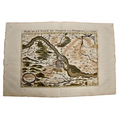
- Vienna, Austria: A Large 17th Century Hand-Colored Map by Sanson and JaillotBy Nicolas SansonLocated in Alamo, CAThis large 17th century hand-colored map of Vienna, Austria and the surrounding countryside and villages entitled "Plan de la Ville de Vienne en Austrich...Category
Antique 1690s French Maps
MaterialsPaper
- Hand-Colored 18th Century Homann Map of the Danube, Italy, Greece, CroatiaBy Johann Baptist HomannLocated in Alamo, CA"Fluviorum in Europa principis Danubii" is a hand colored map of the region about the Danube river created by Johann Baptist Homann (1663-1724) in his 'Atlas Novus Terrarum', publish...Category
Antique Early 18th Century German Maps
MaterialsPaper
- Vintage "View of the Center of Paris Taken from the Air" Lithograph MapLocated in San Diego, CAA very stylish "View of the Center of Paris Taken from the Air" lithograph map published by the Paris Ministry of Tourism, circa early 1950s. The piece measures 27" x 43" and shows...Category
20th Century French Mid-Century Modern Prints
MaterialsPaper
- Old Nautical Map of CorsicaLocated in Alessandria, PiemonteST/556/1 - Old map of Corsica isle, surveyed by Captain Hell, of the French Royal Navy in 1824, engraved and published on 1874, with additions and corre...Category
Antique Early 19th Century English Other Prints
MaterialsPaper
- Old Horizontal Map of EnglandBy TassoLocated in Alessandria, PiemonteST/520 - Old rare Italian map of England, dated 1826-1827 - by Girolamo Tasso, editor in Venise, for the atlas of M.r Le-Sage.Category
Antique Early 19th Century Italian Other Prints
MaterialsPaper


Recently Viewed
View AllMore Ways To Browse
Large Scale Map
Austrian And German Antique Furniture
Antique German Scales
Antique German Scale
Large City Maps
Coat Of Arms German
On The Danube
Antique School Map
Antique School Maps
Map Austria
Map Of Austria
Large Antique City Maps
City Antique Vienna
Vienna Map
Map Of Vienna
Map Berlin
Berlin Maps
Old School Maps