Items Similar to Lovely Antique Map Centered on Sedan and Doncheri and the Meuze River, ca.1650


Want more images or videos?
Request additional images or videos from the seller
1 of 5
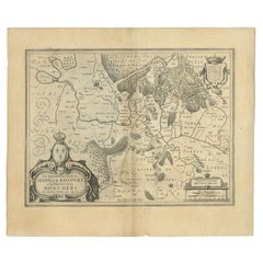
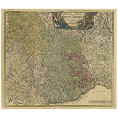
Lovely Antique Map Centered on Sedan and Doncheri and the Meuze River, ca.1650
About the Item
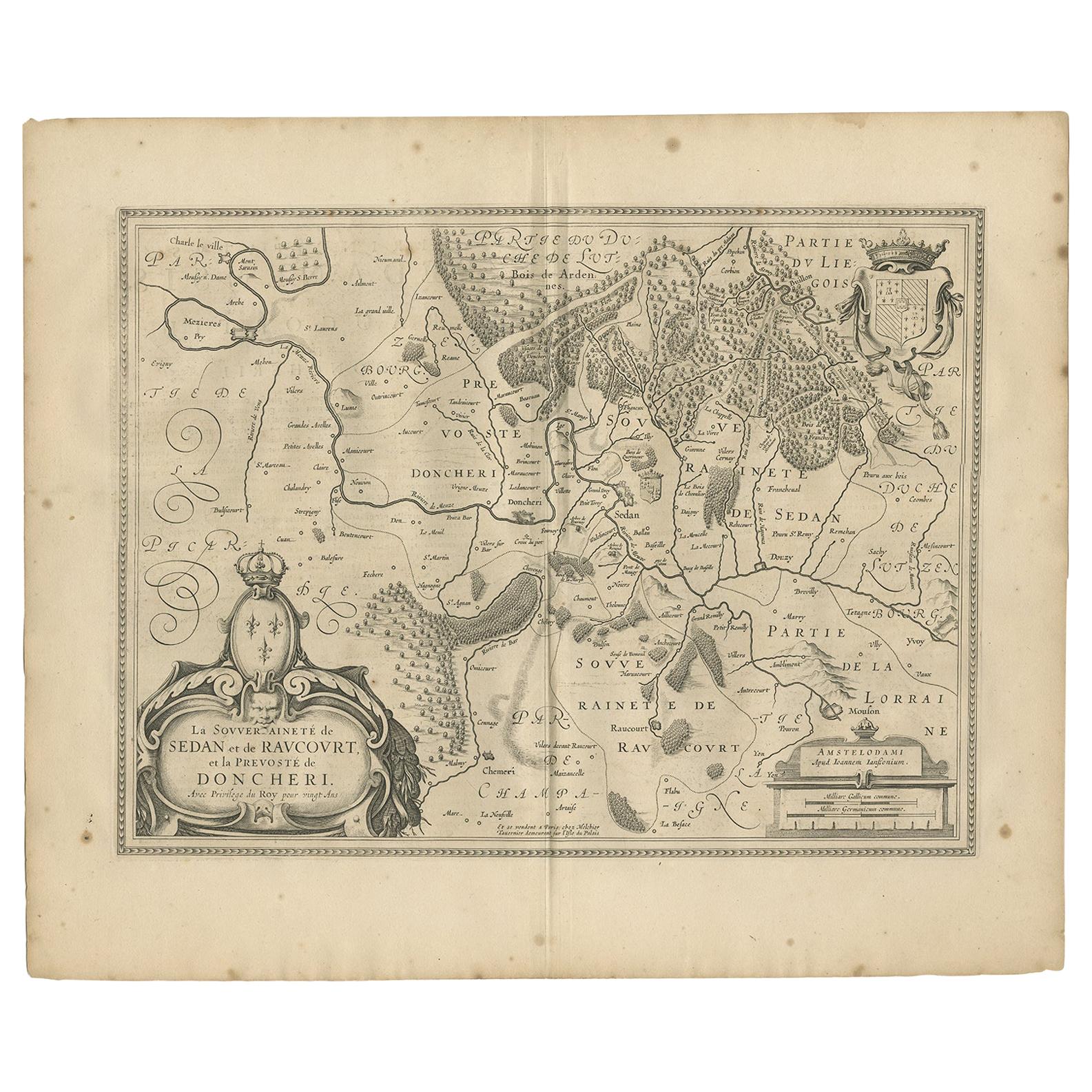
Original antique map with title: 'La Souveraineté de Sedan et de Raucourt, et la prevosté de Doncheri', is an antique map centered on Sedan and Doncheri, along with the Meuze River from Charleville and Mezieres to Mosuon and Yvoy. This map is a significant historical artifact, offering insights into the geography and cartographic style of the period.
Johannes Janssonius, also known as Jan Jansson (1588-1664), was the artist and engraver behind this map. Born in Arnhem, Netherlands, Janssonius came from a background steeped in the world of books and maps. His father was a bookseller and publisher, and Janssonius himself entered the world of map-making and publishing after marrying the daughter of the notable cartographer Jodocus Hondius. This marriage not only brought him into a prominent cartographic family but also provided him the opportunity to establish his own business as a book publisher in Amsterdam.
Janssonius published his first map in 1616, and about 15 years later, he formed a partnership with his brother-in-law Hondius. Together, they issued further editions of the Mercator/Hondius atlas, which was a significant work in the field of cartography. These editions would have continued the legacy of Gerard Mercator, a renowned geographer, and Jodocus Hondius, further establishing the importance of their work in the history of map-making.
After Janssonius's death, his heirs continued to publish several maps, indicating the lasting impact of his work and the continued relevance of his maps. Many of his plates were later acquired by Pieter Schenk and Gerard Valk, two other notable figures in the history of cartography. This transfer of plates suggests that Janssonius's work remained influential and valuable long after his death, contributing to the cartographic knowledge and map production in the subsequent years.
Overall, the map 'La Souveraineté de Sedan et de Raucourt, et la prevosté de Doncheri' is not just a depiction of a geographic area but also a piece of cartographic history, reflecting the skill, artistry, and influence of Johannes Janssonius in the world of map-making.
- Dimensions:Height: 19.69 in (50 cm)Width: 23.23 in (59 cm)Depth: 0 in (0.02 mm)
- Materials and Techniques:
- Period:1650-1659
- Date of Manufacture:circa 1650
- Condition:Wear consistent with age and use. Good. Wear consistent with age and use.
- Seller Location:Langweer, NL
- Reference Number:
About the Seller
5.0
Platinum Seller
These expertly vetted sellers are 1stDibs' most experienced sellers and are rated highest by our customers.
Established in 2009
1stDibs seller since 2017
1,932 sales on 1stDibs
Typical response time: <1 hour
- ShippingRetrieving quote...Ships From: Langweer, Netherlands
- Return PolicyA return for this item may be initiated within 14 days of delivery.
More From This SellerView All
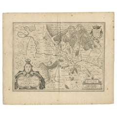
- Antique Map of the Region of Sedan and Doncheri in France by Janssonius, c.1650By Johannes JanssoniusLocated in Langweer, NLAntique map of France titled 'La Souveraineté de Sedan et de Raucourt, et la prevosté de Doncheri'. Lovely map centered on Sedan and Doncheri and the Meuze River from Charleville and...Category
Antique 17th Century Maps
MaterialsPaper
- Antique Map of the Region of Sedan and Doncheri by Janssonius, 1657By Johannes JanssoniusLocated in Langweer, NLAntique map of France titled 'La Souveraineté de Sedan et de Raucourt, et la prevosté de Doncheri'. Lovely map centered on Sedan and Doncheri and the Meuze River from Charleville and...Category
Antique Mid-17th Century Maps
MaterialsPaper
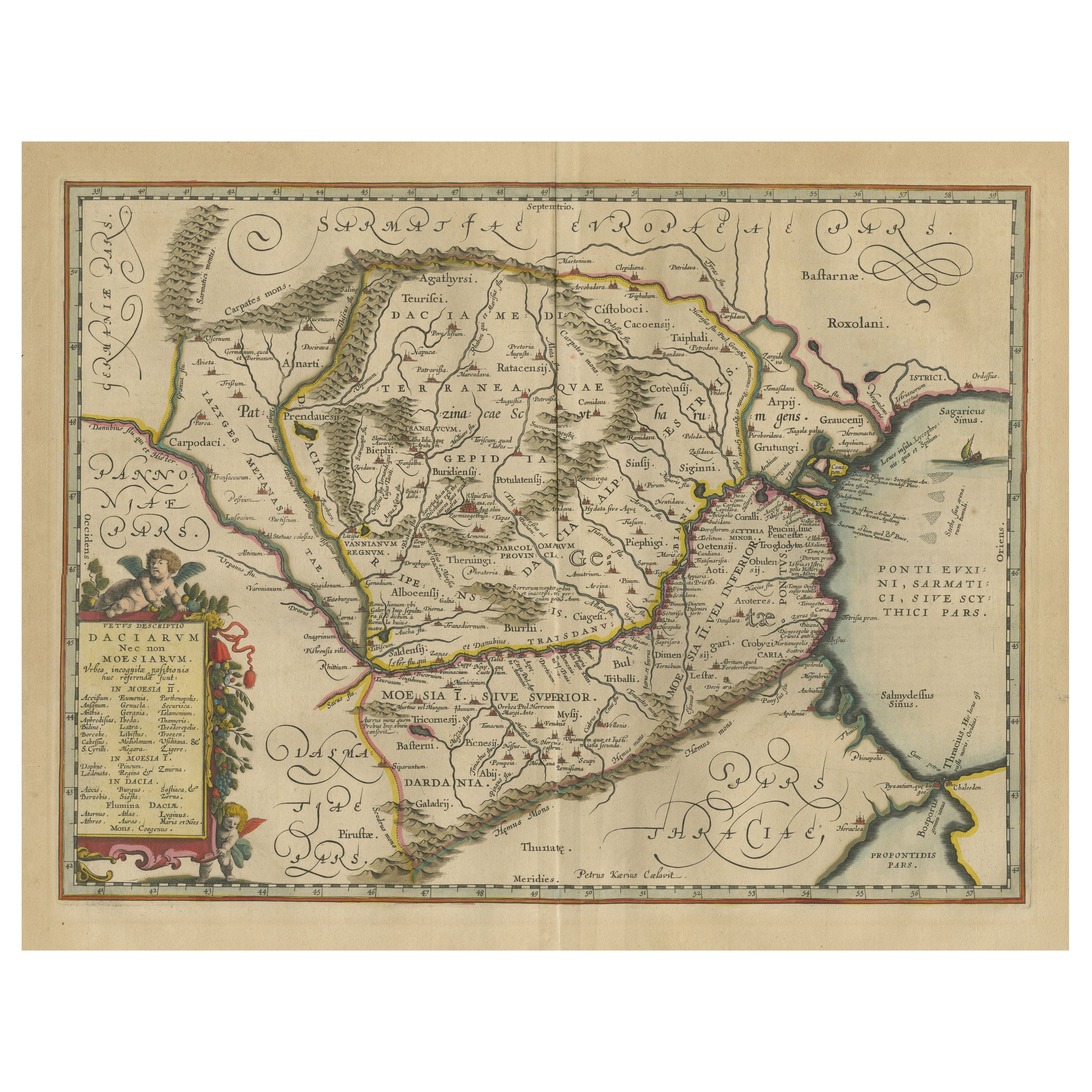
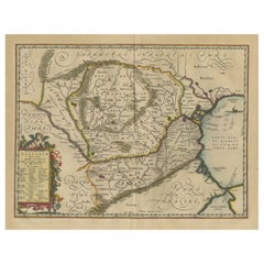
- Antique Map of Romania and Bulgaria Centered on the Danube RiverLocated in Langweer, NLAntique map titled 'Vetus descriptio Daciarum nec non Moesiarum'. Impressive map of the area of Romania and Bulgaria centered on the Danube River. The map is based on Ortelius' map o...Category
Antique Mid-17th Century Maps
MaterialsPaper
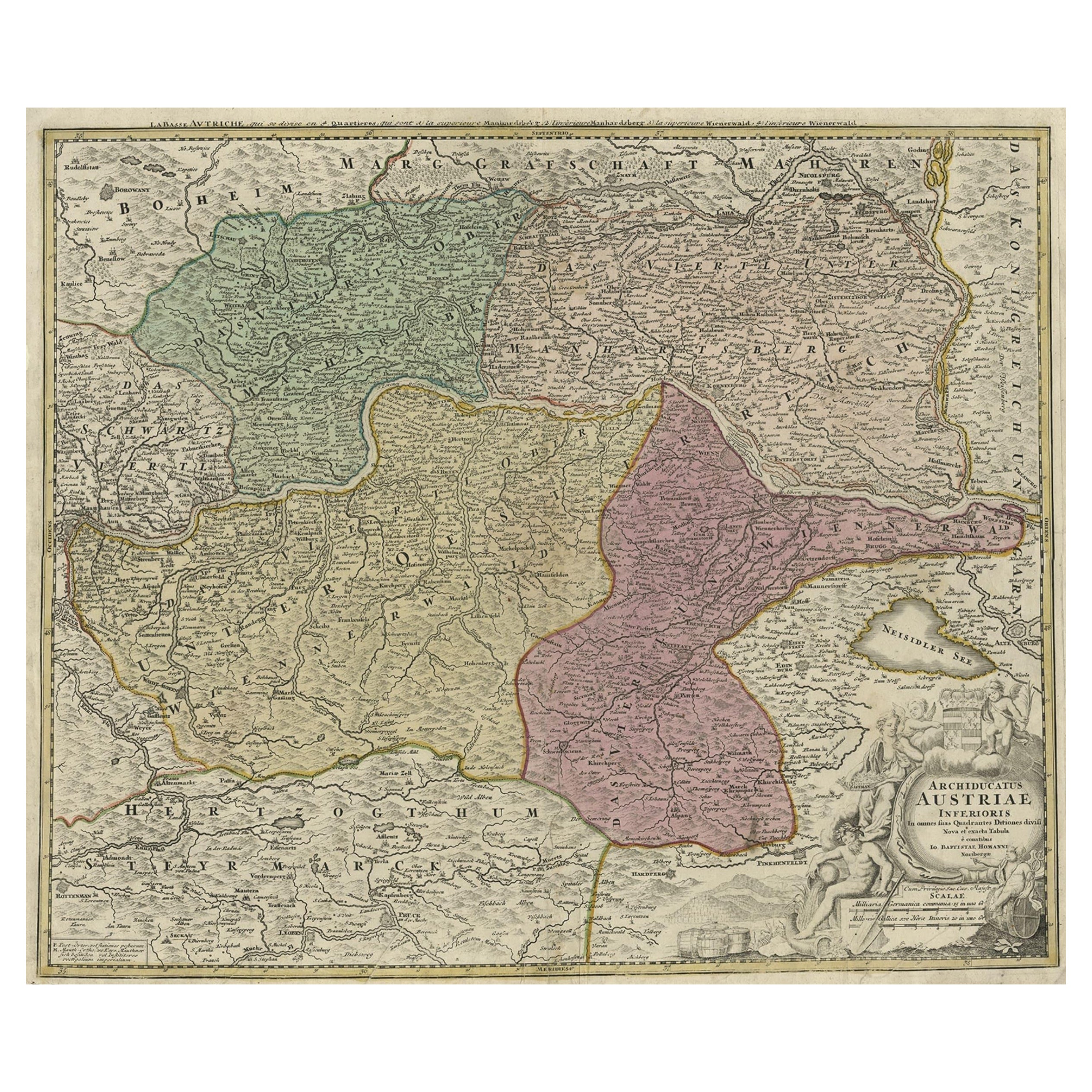
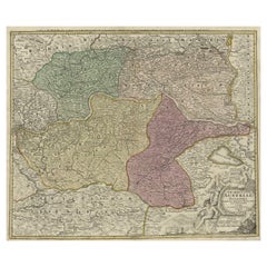
- Old Decorative Map of Austria, Centered on the Danube River and Vienna, Ca.1720Located in Langweer, NLAntique map titled 'Archiducatus Austriae inferioris (..).' Decorative map of Austria, centered on the course of the Danube River and Vienna. Shows the region from Enss and Steyr to ...Category
Antique 1720s Maps
MaterialsPaper
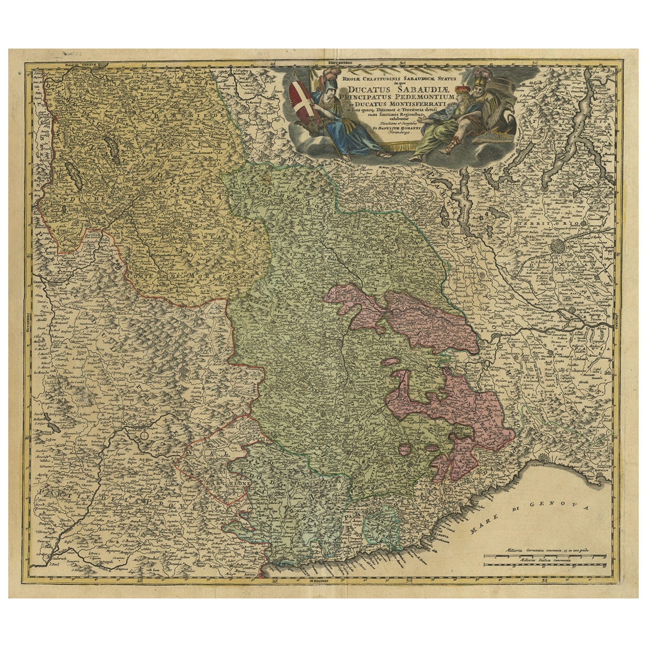
- Antique Map of the Savoy and Piedmont Regions, Centered on Torino, ca.1735Located in Langweer, NLAntique map titled 'Ducatus Sabaudiae, Principatus Pedemontium et ducatis Montisferrati (..).' Map of the Savoy and Piedmont regions, centered on Torino. The map coverage extends...Category
Antique 1730s Maps
MaterialsPaper
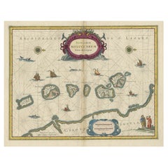
- Beautiful Antique Map of the Moluccas or Spice Islands, Indonesia, ca.1650Located in Langweer, NLAntique map titled 'Insularum Moluccarum Nova Descriptio.' Beautiful map of the Moluccas. The famous Spice Islands, the cornerstone of the Dutc...Category
Antique 1650s Maps
MaterialsPaper
You May Also Like
- Vintage "View of the Center of Paris Taken from the Air" Lithograph MapLocated in San Diego, CAA very stylish "View of the Center of Paris Taken from the Air" lithograph map published by the Paris Ministry of Tourism, circa early 1950s. The piece measures 27" x 43" and shows...Category
20th Century French Mid-Century Modern Prints
MaterialsPaper
- Original Antique Map of The World by Thomas Clerk, 1817Located in St Annes, LancashireGreat map of The Eastern and Western Hemispheres On 2 sheets Copper-plate engraving Drawn and engraved by Thomas Clerk, Edinburgh. Published by Mackenzie And Dent, 1817 ...Category
Antique 1810s English Maps
MaterialsPaper
- Lithographic print on paper, depicting the atlas of the hand, France 1850 ca.Located in Milan, ITAn anatomical lithographic print on paper, depicting the anatomical atlas of the hand. Black lacquered fir wood frame with golden ramin wood batting. N. H. Ja...Category
Antique Mid-19th Century French Prints
MaterialsGlass, Wood, Paper
- Original Antique Map of The Netherlands, Sherwood, Neely & Jones, Dated 1809Located in St Annes, LancashireGreat map of The Netherlands Copper-plate engraving by Cooper Published by Sherwood, Neely & Jones. Dated 1809 Unframed.Category
Antique Early 1800s English Maps
MaterialsPaper
- Original Antique Map of The Netherlands, Engraved by Barlow, Dated 1807Located in St Annes, LancashireGreat map of Netherlands Copper-plate engraving by Barlow Published by Brightly & Kinnersly, Bungay, Suffolk. Dated 1807 Unframed.Category
Antique Early 1800s English Maps
MaterialsPaper
- Map of the Republic of GenoaLocated in New York, NYFramed antique hand-coloured map of the Republic of Genoa including the duchies of Mantua, Modena, and Parma. Europe, late 18th century. Dimension: 25...Category
Antique Late 18th Century European Maps


Recently Viewed
View AllMore Ways To Browse
Jan Book
Antique Booksellers
Antique Bookseller
Mercator Antique
Atlas Book
Antique Map Set
Sedan Used
Antique Map Schenk
Sedan Antique
Wood Carvings Of Ships
Compass Rose
Classroom Furniture Used
Fine Antique Maps
Orbis Map
17th Century World Map
Book Of Antique Maps
18th Century Southern Antiques
Antique French Globe