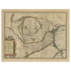
Items Similar to Danube River Incl Serbia, Moldavia, Transylvania, Romania, Bulgaria Etc, ca.1720

Want more images or videos?
Request additional images or videos from the seller
1 of 5
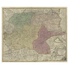
Danube River Incl Serbia, Moldavia, Transylvania, Romania, Bulgaria Etc, ca.1720
About the Item
Antique map titled 'Danubii Fluminis (..)'.
Regional map of the Donau river, Shows the Danube river from Belgrade in Serbia, along the border between Romania and Bulgaria up to the mouth in the Black Sea. Lower right the Bosporus with Istanbul (Constantinople).
Artists and engravers: Homann Heirs was a German publishing firm that enjoyed a major place in the European map market throughout the eighteenth century. Founded in 1702 by Johann Baptist Homann, the business passed to his son, Christoph, upon Johann’s death in 1724. Christoph died in 1730, aged only 27, and the firm was inherited by subsequent Homann heirs. This altered the name of the company, which was known as Homann Erben, or Homann heirs. The firm continued in business until 1848.
- Dimensions:Height: 20.08 in (51 cm)Width: 24.41 in (62 cm)Depth: 0 in (0.02 mm)
- Materials and Techniques:
- Period:1720-1729
- Date of Manufacture:circa 1720
- Condition:Wear consistent with age and use. Condition: Very good, general age-related toning. Please study image carefully.
- Seller Location:Langweer, NL
- Reference Number:
About the Seller
5.0
Platinum Seller
These expertly vetted sellers are 1stDibs' most experienced sellers and are rated highest by our customers.
Established in 2009
1stDibs seller since 2017
1,933 sales on 1stDibs
Typical response time: <1 hour
- ShippingRetrieving quote...Ships From: Langweer, Netherlands
- Return PolicyA return for this item may be initiated within 14 days of delivery.
More From This SellerView All
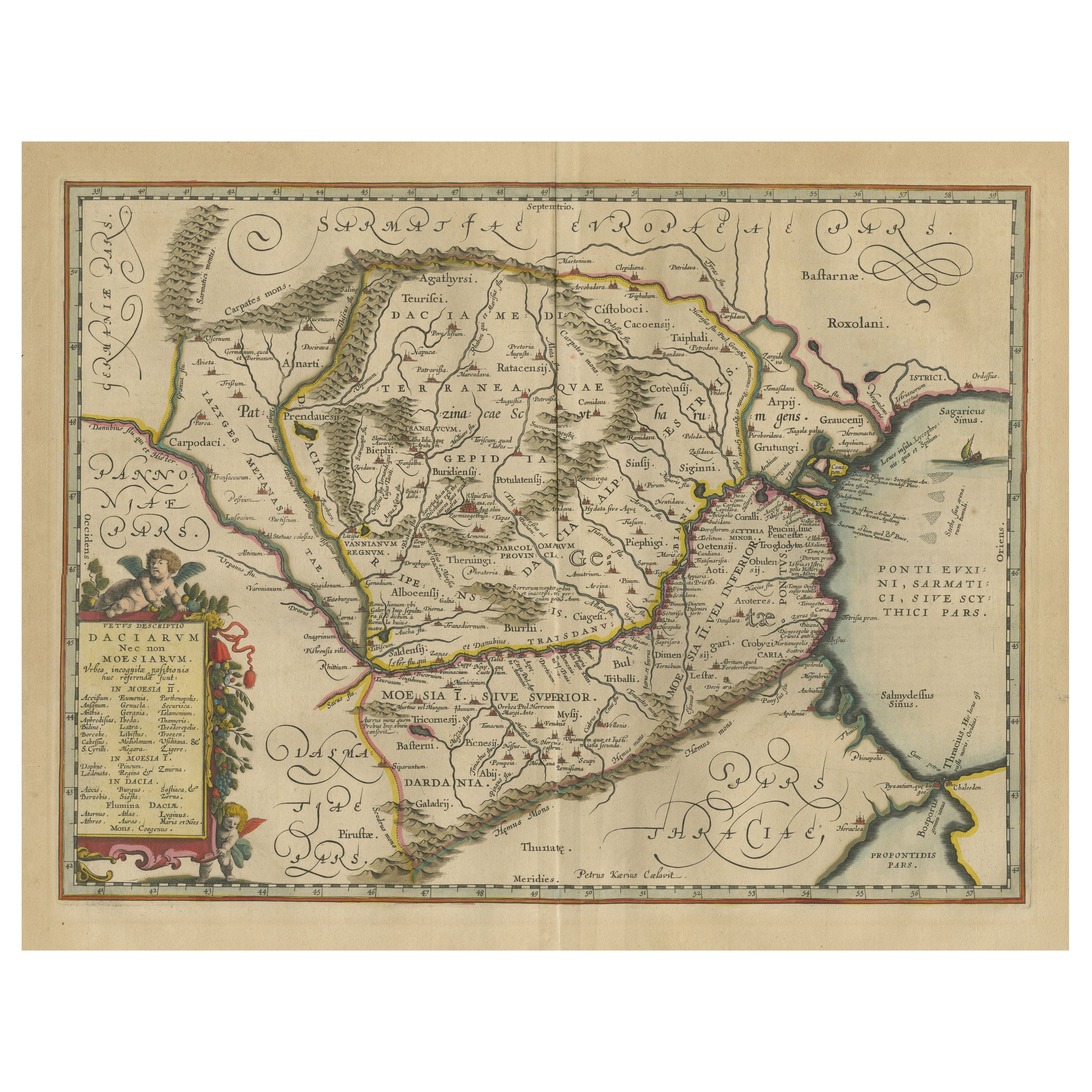
- Antique Map of Romania and Bulgaria Centered on the Danube RiverLocated in Langweer, NLAntique map titled 'Vetus descriptio Daciarum nec non Moesiarum'. Impressive map of the area of Romania and Bulgaria centered on the Danube River. The map is based on Ortelius' map o...Category
Antique Mid-17th Century Maps
MaterialsPaper
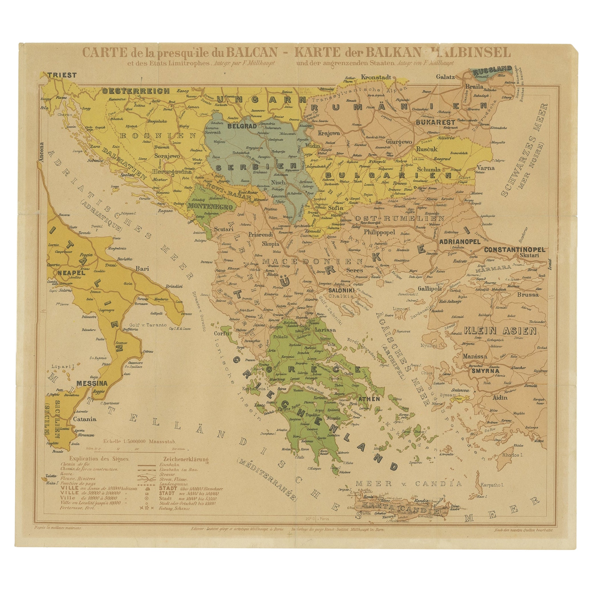
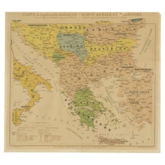
- Old Map of the Balkans Incl Greece, Turkey, Serbia, Montenegro, Bulgaria, C.1900Located in Langweer, NLAntique map titled 'Carte de la presqu-île du Balcan - Karte der Balkan Halbinsel'. Original antique map of the Balkans including Greece, Turkey, Serbia, Montenegro, Bulgaria and...Category
Antique Early 1900s Maps
MaterialsPaper
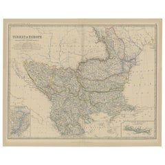
- Old Map of Turkey in Europe, incl Romania, Servia, Montenegro & Bulgaria, 1882Located in Langweer, NLAntique map titled 'Turkey in Europe'. Old map of Turkey in Europe, also depicting part of Romania, Servia, Montenegro and Bulgaria. With inset maps of the Bosphorus, Constantino...Category
Antique 1880s Maps
MaterialsPaper
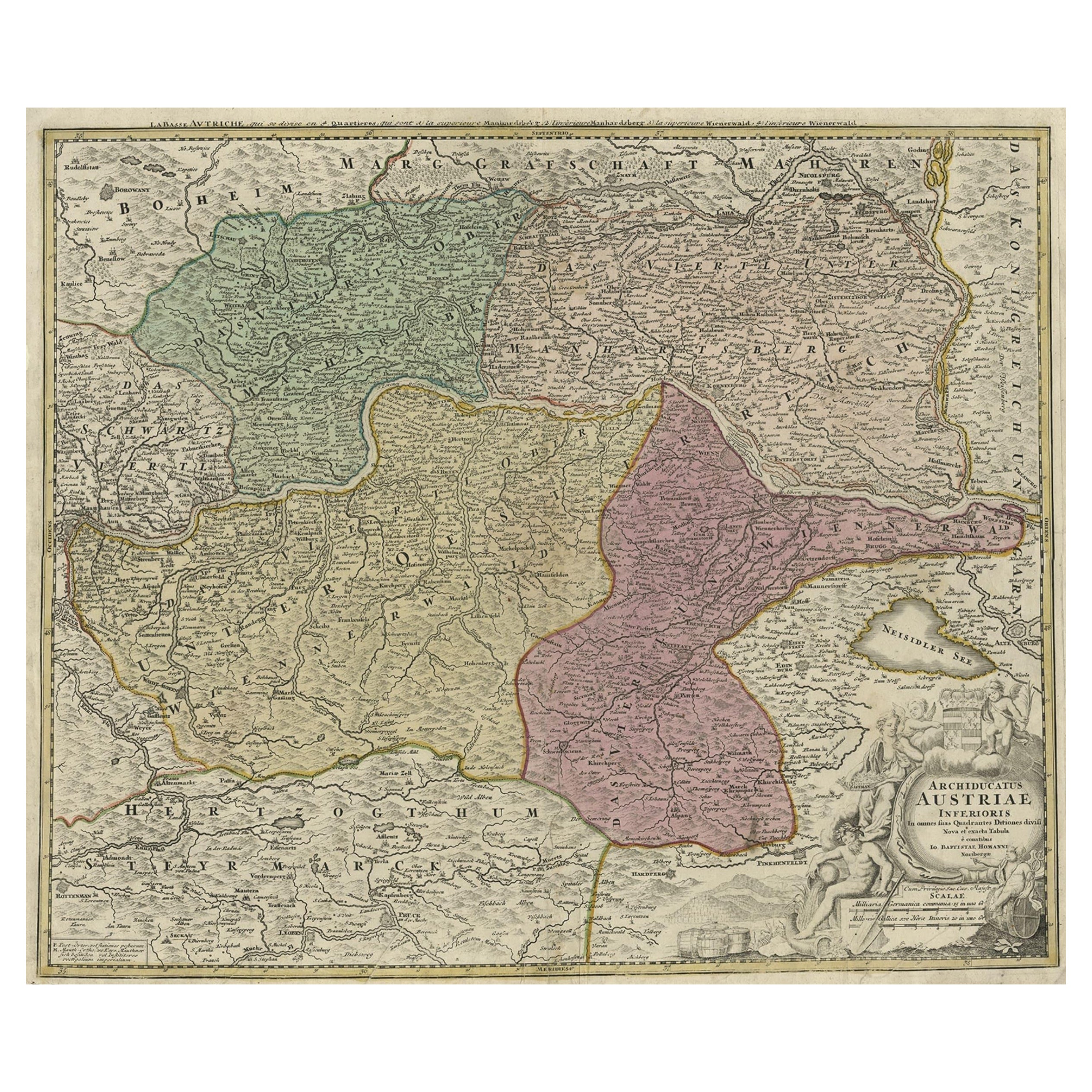
- Old Decorative Map of Austria, Centered on the Danube River and Vienna, Ca.1720Located in Langweer, NLAntique map titled 'Archiducatus Austriae inferioris (..).' Decorative map of Austria, centered on the course of the Danube River and Vienna. Shows the region from Enss and Steyr to ...Category
Antique 1720s Maps
MaterialsPaper
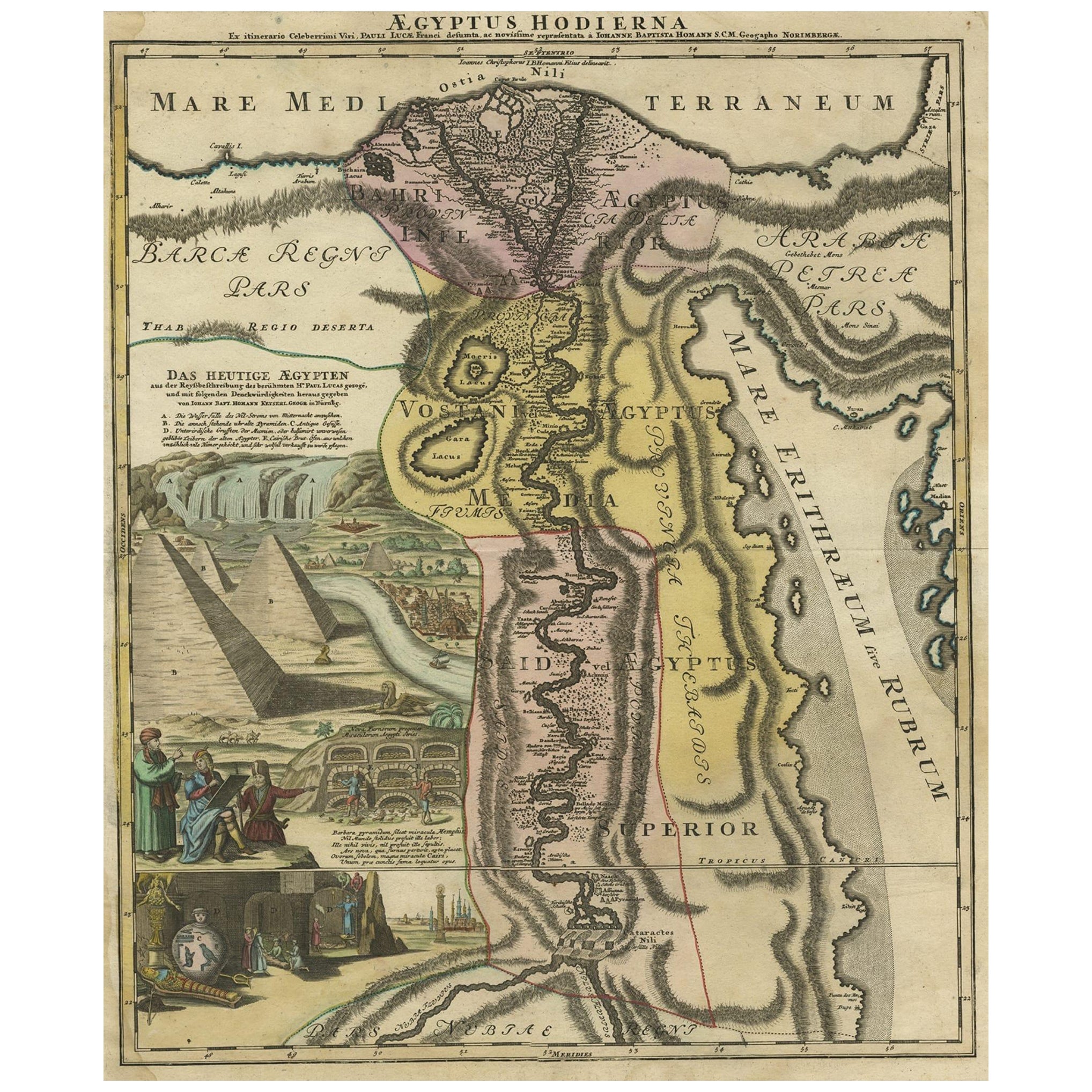
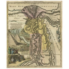
- Antique Map of Egypt and the Nile River with Sphinx, Pyramids, Etc, c.1720Located in Langweer, NLAntique map titled 'Aegyptus Hodierna Ex itinerario Celeberrimi (..)'. Original antique map of Egypt, focused on the Nile River Valley from the Mediterr...Category
Antique 18th Century Maps
MaterialsPaper
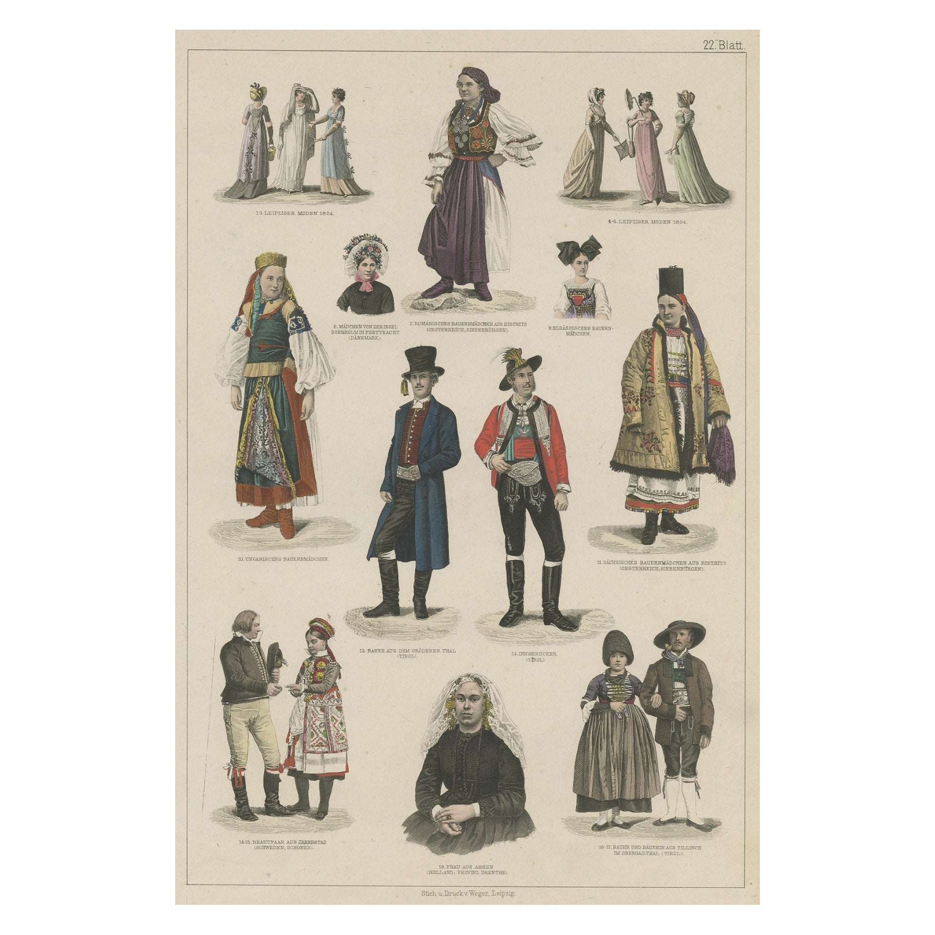
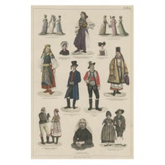
- Old Prints of Costumes of Hungary, Tyrol, Sweden, Romania, Holland, Etc., Ca1875Located in Langweer, NLAntique costume print including many different costumes including costumes of Hungary, Tyrol, Sweden and others. This print originates from 'Blätter für Kostümkunde. Historische ...Category
Antique 1870s Prints
MaterialsPaper
You May Also Like
- Prussia, Poland, N. Germany, Etc: A Hand-colored 17th Century Map by JanssoniusBy Johannes JanssoniusLocated in Alamo, CAThis is an attractive hand-colored copperplate engraved 17th century map of Prussia entitled "Prussia Accurate Descripta a Gasparo Henneberg Erlichensi", published in Amsterdam by Joannes Janssonius in 1664. This very detailed map from the golden age of Dutch cartography includes present-day Poland, Latvia, Lithuania, Estonia and portions of Germany. This highly detailed map is embellished by three ornate pink, red, mint green and gold...Category
Antique Mid-17th Century Dutch Maps
MaterialsPaper
- Catalogue of Engraved Views, Plans, Etc., Of New York City, 1st EdLocated in valatie, NYA catalogue of engraved views, plans, etc., Of New York City, (The Collection of Percy R. Pyne II). Privately Printed by The De Vinne Press, New York, 1912. Limited to 100 copies. Gr...Category
Early 20th Century American Books
MaterialsPaper
- Hand-Colored 18th Century Homann Map of the Danube, Italy, Greece, CroatiaBy Johann Baptist HomannLocated in Alamo, CA"Fluviorum in Europa principis Danubii" is a hand colored map of the region about the Danube river created by Johann Baptist Homann (1663-1724) in his 'Atlas Novus Terrarum', publish...Category
Antique Early 18th Century German Maps
MaterialsPaper
- Hand Colored 18th Century Homann Map of Austria Including Vienna and the DanubeBy Johann Baptist HomannLocated in Alamo, CA"Archiducatus Austriae inferioris" is a hand colored map of Austria created by Johann Baptist Homann (1663-1724) and published in Nuremberg, Germany in 1728 shortly after his death. ...Category
Antique Early 18th Century German Maps
MaterialsPaper
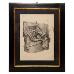
- Lithographic Print on Paper, Depicting the Male Genital System, France 1850 CaLocated in Milan, ITAn anatomical lithographic print on paper, depicting the male genital system. Black lacquered fir wood frame with golden ramin wood batting. N. H. Jacob, Pari...Category
Antique Mid-19th Century French Prints
MaterialsGlass, Wood, Paper
- Lithographic print on paper, depicting the atlas of the hand, France 1850 ca.Located in Milan, ITAn anatomical lithographic print on paper, depicting the anatomical atlas of the hand. Black lacquered fir wood frame with golden ramin wood batting. N. H. Ja...Category
Antique Mid-19th Century French Prints
MaterialsGlass, Wood, Paper


Recently Viewed
View AllMore Ways To Browse
Furniture Romania
Bulgaria Antique
Romanian Antique Furniture
Romanian Artist
Constantinople Antique
Antique Istanbul
Istanbul Antique
Bulgarian Artists
Danube River
Bulgarian Antiques
Bulgaria Map
Serbian Artist
Map Of Constantinople
Constantinople Map
Map Danube
Romania Antique Map
Bulgaria Antique Map
Romania Map