
Old School Maps

2
143
1
to
12
130
14
144
143
143
12
3
2
1
1
1
1
29
47
67
1
3
35
27
1
1
7
1
6
9
13
1
116
52
51
42
8
65
45
6
6
5
4
2
1
1
1
Sort By
XL Old School Map of Belgium 'Printed by Procure', 1950s
Located in Oostende, BE
XL Old school map of Belgium (Printed by Procure). Presumably from around 1950-1960.
Category

Vintage 1950s Belgian Mid-Century Modern Maps

Materials

Metal

School Chart or Pull Down Map of Geography of the Netherlands, 1950s
Located in Hemiksem, VAN
A beautiful old school map of the Netherlands, painted on linen. The map shows the 3 different
Category

Vintage 1950s Belgian Mid-Century Modern Maps

Materials

Linen, Paint

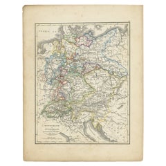
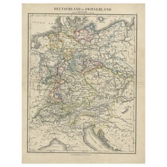
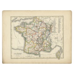
Antique Map of France from an Old Dutch School Atlas, 1852
Located in Langweer, NL
Antique map titled 'Frankrijk'. Map of France. This map originates from 'School-Atlas van alle
Category

Antique 19th Century Maps

Materials

Paper

Antique Map of Europe from an Old Dutch School-Atlas, 1852
Located in Langweer, NL
Antique map titled 'Europa'. Map of Europe. This map originates from 'School-Atlas van alle deelen
Category

Antique 19th Century Maps

Materials

Paper

Antique Map of Greece from an Old French School Atlas, 1880
Located in Langweer, NL
Antique map titled 'Grèce Moderne '. Old map of Greece and surroundings. This map originates from
Category

Antique 19th Century Maps

Materials

Paper

Original Antique Map of Austria from an Old Dutch School Atlas, 1852
Located in Langweer, NL
Antique map titled 'Het Keizerrijk Oostenrijk'. Map of the Austrian Empire. This map originates
Category

Antique 1850s Maps

Materials

Paper

Antique Map of North America from an Old Dutch School Atlas, 1852
Located in Langweer, NL
Antique map titled 'Noord-Amerika'. Map of North America. This map originates from 'School-Atlas
Category

Antique 19th Century Maps

Materials

Paper

Antique Map of Germany and Switzerland from an Old Dutch School Atlas, 1852
Located in Langweer, NL
Antique map titled 'Duitschland en Zwitersland'. Map of Germany and Switzerland. This map
Category

Antique 19th Century Maps

Materials

Paper

Antique Map of Germany and Switzerland from an Old Dutch School Atlas, c.1873
Located in Langweer, NL
Antique map titled 'Deutschland en Zwitserland'. Old map depicting Germany and Switzerland. This
Category

Antique 19th Century Maps

Materials

Paper

Vintage Swedish School Map of Vastergötland, Made in Sweden 1920
Located in Los Angeles, CA
Vintage Swedish School Map of Vastergötland, Made in Sweden 1920 Västergötland also known as
Category

Vintage 1920s Swedish Maps

Materials

Linen, Wood, Paper

Antique Map of Asia from a German School Atlas, c.1870
Located in Langweer, NL
Antique map titled 'Asien'. Old map of the Asian continent. This map originates from 'H. Kiepert's
Category

Antique 19th Century Maps

Materials

Paper

Antique Map of the Asian Continent from a German School Atlas, 1862
Located in Langweer, NL
Antique map titled 'Asien Politische Ubersicht'. Old map of the Asian continent. Originates from
Category

Antique 19th Century Maps

Materials

Paper

Old Map of the Pacific, Incl Australia, Polynesia, Melanesia and Malaysia, 1872
Located in Langweer, NL
Antique map Oceania titled 'Map of Oceanica exhibiting its various divisions, island groups & c
Category

Antique 1870s Maps

Materials

Paper

Old Map of Region Champagne-Ardenne with Reims, Troyes & Épernay in France, 1759
Located in Langweer, NL
Antique map titled 'Tabula Geographica Campaniae (..).' Detailed map of the Champagne region in
Category

Antique 1750s Maps

Materials

Paper

Original Old Map East of Stockholm, the Island Ljusterö and Värmdö, Sweden, 1720
Located in Langweer, NL
Antique map titled 'Accurate Carte der Upländischen Scheren mit der Situation und Gegend umb die
Category

Antique 1720s Maps

Materials

Paper

Detailed Old Map of the Seven Provinces of the Belgian/Dutch Federation, ca.1748
Located in Langweer, NL
Antique map titled 'Septem Provinciae seu Belgium Foederatum quod generliter Hollandia
Category

Antique 18th Century Maps

Materials

Paper

Old Decorative Map of Austria, Centered on the Danube River and Vienna, Ca.1720
Located in Langweer, NL
Antique map titled 'Archiducatus Austriae inferioris (..).' Decorative map of Austria, centered on
Category

Antique 1720s Maps

Materials

Paper

Antique Map of Russia in Europe and Poland from an d Old Dutch Atlas, 1852
Located in Langweer, NL
Poland. This map originates from 'School-Atlas van alle deelen der Aarde' by Otto Petri. Artists and
Category

Antique 1850s Maps

Materials

Paper

Antique Map of Overijssel by Bachiene, 1758
Located in Langweer, NL
Geography at the 'Illustere School'. This map was engraved by Jacobus Harrewijn-Harrewyn (1660-1727) after I
Category

Antique 18th Century Maps

Materials

Paper

Antique Map of South America by Petri, 1852
By Thomas Kitchin
Located in Langweer, NL
Antique map titled 'Zuid-Amerika'. Map of South America. This map originates from 'School-Atlas van
Category

Antique 19th Century Maps

Materials

Paper

Antique Map of Southern Palestine by Bachiene, 1763
Located in Langweer, NL
"Antique map of the south part of Palestine. This simplified map shows the most important cities of
Category

Antique 18th Century Maps

Materials

Paper

Antique Mercator Projection World Map by Petri, c.1873
Located in Langweer, NL
Antique world map titled 'Wereldkaart naar Mercator's Projectie'. Old map of the world. This map
Category

Antique 19th Century Maps

Materials

Paper

Antique Map of South America by Petri, c.1873
By Thomas Kitchin
Located in Langweer, NL
Antique map titled 'Zuid-Amerika'. Old map depicting South America, with an inset map of the
Category

Antique 19th Century Maps

Materials

Paper

Antique Map of Northern Germany by Petri, c.1873
Located in Langweer, NL
Antique map titled 'Noord-Duitschland'. Old map depicting northern Germany. This map originates
Category

Antique 19th Century Maps

Materials

Paper

Antique Map of Russia and Poland by Petri, 1852
Located in Langweer, NL
Antique map titled 'Europeesch Rusland en Polen'. Map of Russia in Europe and Poland. This map
Category

Antique 19th Century Maps

Materials

Paper

Antique Map of the Austrian Empire by Petri, 1852
Located in Langweer, NL
Antique map titled 'Het Keizerrijk Oostenrijk'. Map of the Austrian Empire. This map originates
Category

Antique 19th Century Maps

Materials

Paper

Antique Map of Sweden and Norway by Petri, 1852
Located in Langweer, NL
Antique map titled 'Zweden en Noorwegen'. Map of Sweden and Norway. This map originates from
Category

Antique 19th Century Maps

Materials

Paper

Antique Map of Spain and Portugal by Petri, 1852
Located in Langweer, NL
Antique map titled 'Spanje en Portugal'. Map of Spain and Portugal. This map originates from
Category

Antique 19th Century Maps

Materials

Paper

Antique Map of Spain and Portugal by Thomson, 1815
Located in Langweer, NL
Antique map titled 'Spain & Portugal.' Map of Spain and Portugal. From Thomson's 'New General Atlas
Category

Antique 19th Century Maps

Materials

Paper

Antique Map of Turkey and Greece by Petri, c.1873
Located in Langweer, NL
Antique map titled 'Europisch Turkije en Griekenland'. Old map depicting Turkey in Europe and
Category

Antique 19th Century Maps

Materials

Paper

Antique Map of the United Kingdom and Ireland, c.1873
Located in Langweer, NL
Antique map titled 'Groot Brittanje en Ierland'. Old map depicting the United Kingdom and Ireland
Category

Antique 19th Century Maps

Materials

Paper

Antique Map of Russia in Europe by Petri, c.1873
Located in Langweer, NL
Antique map titled 'Rusland in Europa'. Old map depicting Russia in Europe. This map originates
Category

Antique 19th Century Maps

Materials

Paper

Antique Map of Spain and Portugal by Petri, c.1873
Located in Langweer, NL
Antique map titled 'Spanje en Portugal'. Old map depicting Spain and Portugal. This map originates
Category

Antique 19th Century Maps

Materials

Paper

Antique Map of Sweden and Norway by Petri, c.1873
Located in Langweer, NL
Antique map titled 'Zweden en Noorwegen'. Old map depicting Sweden and Norway. This map originates
Category

Antique 19th Century Maps

Materials

Paper

Antique Map of the Austrian Empire by Petri, c.1873
Located in Langweer, NL
Antique map titled 'Het Keizerrijk Oostenrijk'. Old map depicting the Austrian Empire. This map
Category

Antique 19th Century Maps

Materials

Paper

Antique Map of Northern Italy by Homann Heirs, c.1730
Located in Langweer, NL
Antique map titled 'Domini Veneti cum vicinis Parmae Mutinae, Matuae et Mirandol (..).' Detailed
Category

Antique 18th Century Maps

Materials

Paper

Antique Map of the Beaujolais Region by Homann Heirs, 1762
Located in Langweer, NL
cities, school atlases and an Atlas of Silesia in 1750 with 20 maps. Artist: Following the long period
Category

Antique 18th Century Maps

Materials

Paper

Antique Map of Asia Showing the European Language Areas, c.1873
Located in Langweer, NL
Antique map titled 'Asia'. Old map depicting the Asian continent. This map originates from 'School
Category

Antique 19th Century Maps

Materials

Paper

Antique Map of the Baltic Region by Homann Heirs, c.1730
Located in Langweer, NL
Antique map titled 'Regnum Borussiae gloriosis auspicijs Seerenissimi et Potentissimi Princip
Category

Antique 18th Century Maps

Materials

Paper

Antique Map of the Netherlands, Belgium and Luxembourg by Petri, c.1873
Located in Langweer, NL
Antique map titled 'De Nederlanden, Luxemburg en België'. Old map depicting the Netherlands
Category

Antique 19th Century Maps

Materials

Paper

Antique Map of Biblical Palestine with Inset of Israel's 12 Tribes, 1758
Located in Langweer, NL
Antique map titled 'De IIIde Landkaart 't land Kanaan en Gilead onder de XII stammen Israëls
Category

Antique 18th Century Maps

Materials

Paper

Antique Map of the Biblical Kingdom of Israel by Lindeman, c.1758
Located in Langweer, NL
Antique map titled 'De IVde Landkaart vertoonende het Koningryk Israels benevens deszelfs
Category

Antique 18th Century Maps

Materials

Paper

Antique Map of the Biblical Land of Canaan by Lindeman, c.1758
Located in Langweer, NL
Antique map titled 'De IIde Landkaart verbeeldende t'Land Kanaan nog bewoond door deszelfs eerste
Category

Antique 18th Century Maps

Materials

Paper

Antique Map of London Showing the Area from Essex to Surrey, England, 1741
Located in Langweer, NL
cities, school atlases and an Atlas of Silesia in 1750 with 20 maps. Artist: Made by 'Homann Heirs' after
Category

Antique 18th Century Maps

Materials

Paper

Antique Map of Denmark with Insets of Iceland and the Faroe Islands, c.1873
Located in Langweer, NL
Antique map titled 'Denemarken, Sleeswijk-Holstein en Lauenburg'. Old map depicting Denmark, with
Category

Antique 19th Century Maps

Materials

Paper

Large Africa School Map, circa 1950
Located in Meulebeke, BE
Geographical vintage school wall card Africa. The school poster is in a good vintage condition with
Category

Vintage 1950s German Mid-Century Modern Posters

Materials

Canvas, Wood, Paper

Large Africa School Map, circa 1950
H 82.68 in W 78.75 in D 0.79 in
Old Vintage Look Pull Down Map Wall Chart Poster South America
Located in Berghuelen, DE
The wall map shows South America in a combination of physical and political map with the emphasis
Category

Mid-20th Century German Country Prints

Materials

Canvas, Wood, Paper

Naive School Portrait Of A Man With A Map, Original Antique Oil Painting
Located in Bristol, GB
a characterful face in a curly wig with a flouncy collar and sleeves. He is pointing at a map on his
Category

Antique 18th Century Folk Art Paintings

Materials

Canvas

Picture Poster Old Testament Rollable Wall Chart Religious Mural Israel Map
Located in Berghuelen, DE
A traditional pull-down wall chart illustrating picutres of the old testament, published by Ewald
Category

Mid-20th Century German Country Prints

Materials

Canvas, Wood, Paper

Great Britain Scandinavia Northern France Netherland Germany Mural Map
Located in Berghuelen, DE
The vintage pull-down cottagecore mural map illustrates the North Sea countries with Great Britain
Category

Vintage 1970s German Country Posters

Materials

Canvas, Wood, Paper

Europe Map Vintage Rollable Mural Countrystyle Wall Chart Decoration
Located in Berghuelen, DE
The vintage pull-down map shows the European continent / Europe. Published by Haack-Painke, Justus
Category

Vintage 1970s German Country Prints

Materials

Canvas, Wood, Paper

Vintage Rollable Map Mediterranean Countries Wall Chart Mural Poster
Located in Berghuelen, DE
A decorative countrycore pull-down map depiciting countries surrounding the Mediterranean sea
Category

Vintage 1970s German Country Prints

Materials

Canvas, Wood, Paper

Vintage Rollable Map Southeast Asia China Japan Wall Chart
Located in Berghuelen, DE
A classical pull-down school map showing the popular region of Southeast Asia with China and Japan
Category

Late 20th Century German Country Prints

Materials

Canvas, Wood, Paper

Vintage German Map Rhineland Rollable Wall Chart Poster Print
Located in Berghuelen, DE
A country core vintage pull-down map illustrating the popular German region of the Rhineland
Category

Vintage 1960s German Country Prints

Materials

Canvas, Wood, Paper

North America Map Economy Wall Chart Rollable Poster Vintage Mural
Located in Berghuelen, DE
A vintage pull-down map showing the economy of North America, published by Harms. Colorful print on
Category

Late 20th Century German Country Prints

Materials

Canvas, Wood, Paper

Cottagecore Wall Chart Spain Landscape Culture Souvenir Rollable Map Poster
Located in Berghuelen, DE
A countrycore vintage pull-down wall chart depicting Spain with a map and coloful pictures of
Category

Vintage 1960s German Country Prints

Materials

Canvas, Wood, Paper

Vintage Rollable Map Northern Germany Poland Seaside Wallchart Baltic Sea
Located in Berghuelen, DE
The large impressive cottagecore pull-down map illustrates Northern Germany, Poland and parts of
Category

Late 20th Century German Country Prints

Materials

Canvas, Wood, Paper

Vintage Pull-Down Map Germany BRD / DDR History Wall Chart
Located in Berghuelen, DE
A classical rollable vintage wall chart illustrating a map of Germany (Federal Republic of Germany
Category

Mid-20th Century German Country Prints

Materials

Canvas, Wood, Paper

Antique 1901 National Publishing Company's Road Map of New Jersey Geological
Located in Dayton, OH
to 1 inch. This map has been mounted to board with old hinge marks seen along the right edge
Category

Antique Early 1900s Victorian Prints

Materials

Paper

Countrycore Mural Vintage Map Wall Chart Rollable Poster Central South Africa
Located in Berghuelen, DE
The cottagecore pull-down mural map depicts Middle and South Africa. Published by Westermann
Category

Vintage 1970s German Country Posters

Materials

Canvas, Wood, Paper

  • 1
Get Updated with New Arrivals
Save "Old School Maps", and we’ll notify you when there are new listings in this category.

Old School Maps For Sale on 1stDibs

There is a range of old school maps for sale on 1stDibs. The range of distinct old school maps — often made from paper, wood and fabric — can elevate any home. Old school maps have been made for many years, and versions that date back to the 18th Century alongside those produced as recently as the 20th Century. Old school maps bearing mid-century modern or Art Deco hallmarks are very popular at 1stDibs. Old school maps have been a part of the life’s work for many furniture makers, but those produced by Antonio Vallardi Editore, Thomas Kitchin and Pierre Mortier are consistently popular.

How Much are Old School Maps?

Prices for old school maps start at $102 and top out at $42,568 with the average selling for $244.