Items Similar to Antique Map of the Biblical Kingdom of Israel by Lindeman, c.1758
Want more images or videos?
Request additional images or videos from the seller
1 of 5
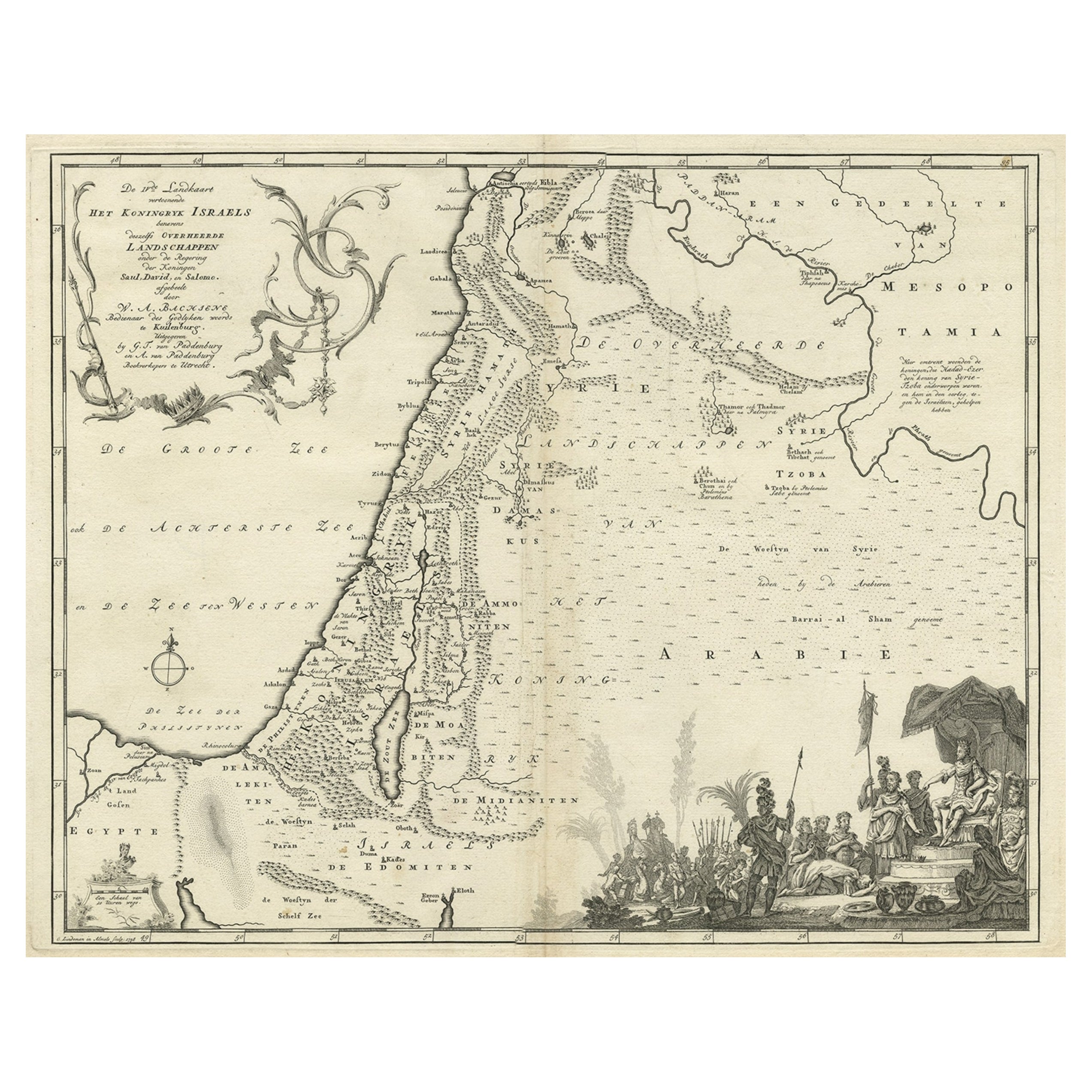
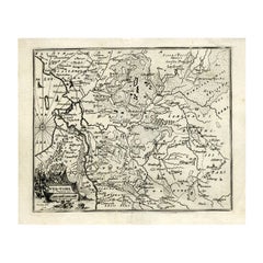
Antique Map of the Biblical Kingdom of Israel by Lindeman, c.1758
About the Item
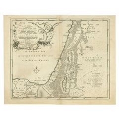
Antique map titled 'De IVde Landkaart vertoonende het Koningryk Israels benevens deszelfs overheerde Landschappen (..).' Map of the biblical Kingdom of Israel under the Kings Saul, David and Solomon. Published by A. van Paddenburg, Netherlands c. 1758. Artists and Engravers: Made by 'O. Lindeman' after 'Willem Albert Bachiene'. Author: Willem Albert Bachiene (Leerdam 1712 - Maastricht 1783). He was a Clergyman in the army and in Namen, Belgium and Kuilenburg (Culemborg). From 1759 he was Clergyman in Maastricht and also Professor in Astronomy and Geography at the 'Illustere School'.
Artist: Made by 'O. Lindeman' after 'Willem Albert Bachiene'. Author: Willem Albert Bachiene (Leerdam 1712 - Maastricht 1783). He was a Clergyman in the army and in Namen, Belgium and Kuilenburg (Culemborg). From 1759 he was Clergyman in Maastricht and also Professor in Astronomy and Geography at the 'Illustere School'.
Condition: Good, given age. Slight discolouration near middle fold. Some minor crinkles. A few small spots. Original middle fold as issued. General age-related toning and/or occasional minor defects from handling. Please study image carefully.
Date: c.1758
Overall size: 49 x 38.5 cm.
Image size: 0.001 x 41.7 x 33.2 cm.
Antique prints have long been appreciated for both their aesthetic and investment value. They were the product of engraved, etched or lithographed plates. These plates were handmade out of wood or metal, which required an incredible level of skill, patience and craftsmanship. Whether you have a house with Victorian furniture or more contemporary decor an old engraving can enhance your living space. We offer a wide range of authentic antique prints for any budget.
- Dimensions:Height: 15.16 in (38.5 cm)Width: 19.3 in (49 cm)Depth: 0 in (0.01 mm)
- Materials and Techniques:
- Period:
- Date of Manufacture:circa 1758
- Condition:
- Seller Location:Langweer, NL
- Reference Number:
About the Seller
5.0
Platinum Seller
These expertly vetted sellers are 1stDibs' most experienced sellers and are rated highest by our customers.
Established in 2009
1stDibs seller since 2017
1,922 sales on 1stDibs
Typical response time: <1 hour
- ShippingRetrieving quote...Ships From: Langweer, Netherlands
- Return PolicyA return for this item may be initiated within 14 days of delivery.
More From This SellerView All
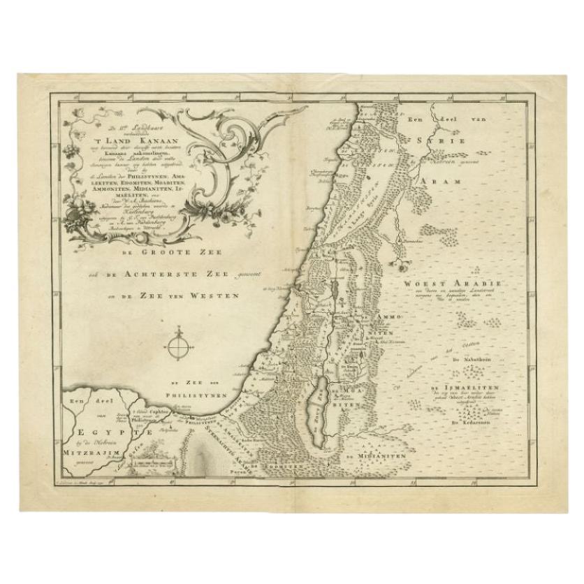
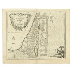
- Antique Map of the Biblical Land of Canaan by Lindeman, c.1758Located in Langweer, NLAntique map titled 'De IIde Landkaart verbeeldende t'Land Kanaan nog bewoond door deszelfs eerste bezitters (..).' - Map of the biblical Land of Canaan. With large title cartouche, c...Category
Antique 18th Century Maps
MaterialsPaper
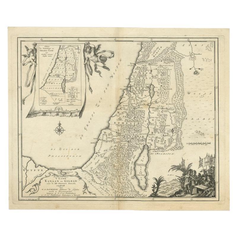
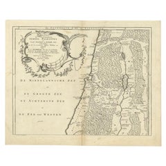
- Antique Map of Biblical Palestine with Inset of Israel's 12 Tribes, 1758Located in Langweer, NLAntique map titled 'De IIIde Landkaart 't land Kanaan en Gilead onder de XII stammen Israëls verdeelt.' Map of biblical Palestine. Inset map of the land of Israel divided in 12 tribes...Category
Antique 18th Century Maps
MaterialsPaper
- The Biblical Kingdom of Israel under the Kings Saul, David and Solomon, Ca.1758Located in Langweer, NLAntique map titled 'De IVde Landkaart vertoonende het Koningryk Israels benevens deszelfs overheerde Landschappen (..).' Map of the biblical Kingdom of Israel under the Kings Sau...Category
Antique 1750s Maps
MaterialsPaper
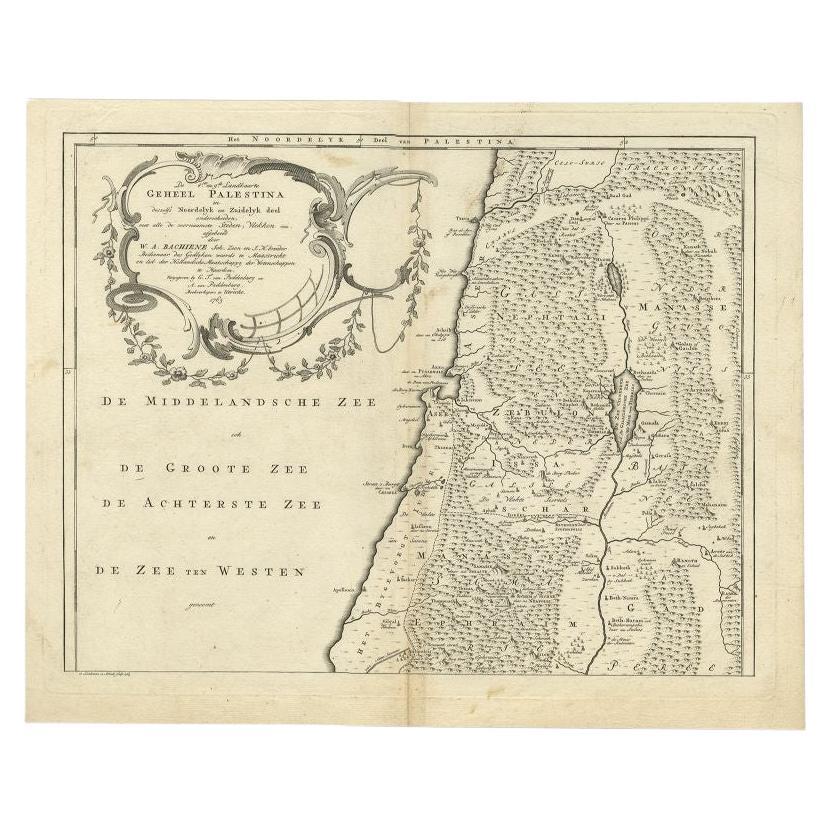
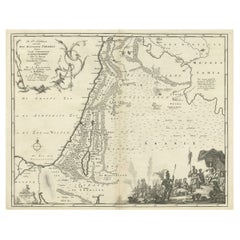
- Antique Map of the Northern Part of Biblical Palestine by Lindeman, c.1763Located in Langweer, NLAntique map titled 'De 8ste en 9de Landkaarte Geheel Palestina (..).' Map of the northern part of Biblical Palestine. With large title cartouche. Published by A. van Paddenburg, Neth...Category
Antique 18th Century Maps
MaterialsPaper
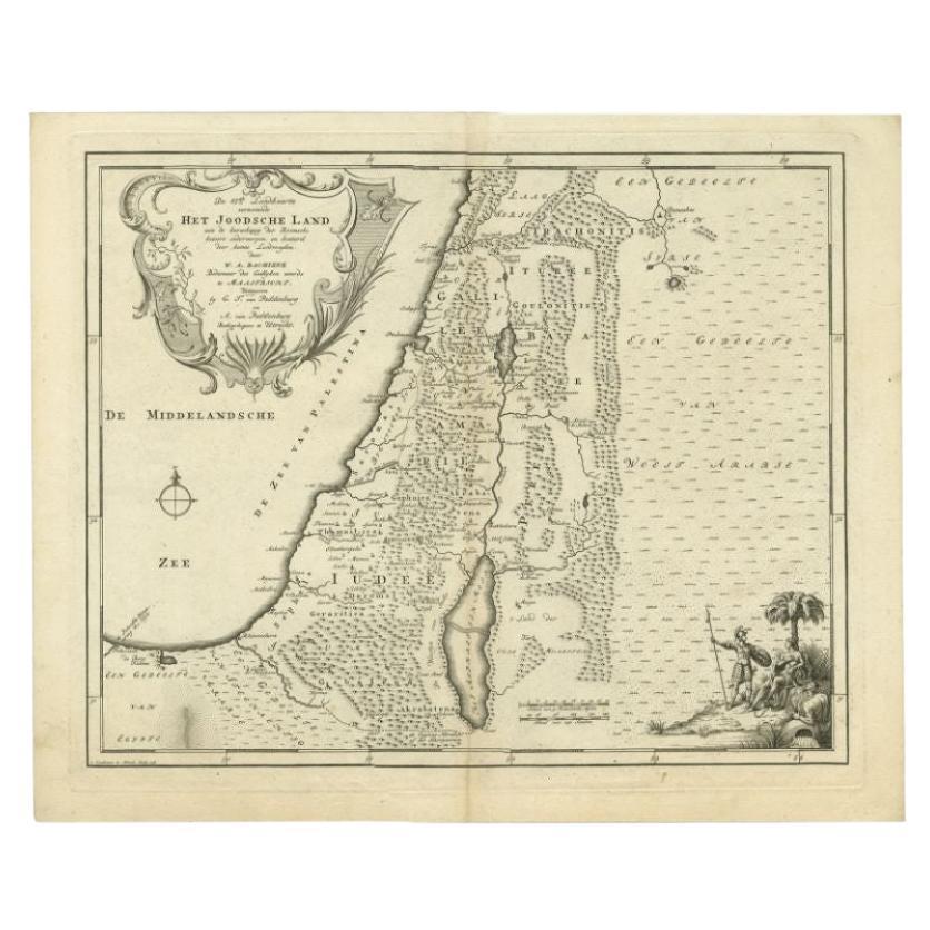
- Antique Map of the Jewish Land by Lindeman, 1761Located in Langweer, NLAntique map titled 'De VIde Landkaart Verbeeldende Het Joodsche Land (..).' Map of the Jewish Land during the reign of the Roman Emperor. Published by A. van Paddenburg, Netherlands ...Category
Antique 18th Century Maps
MaterialsPaper
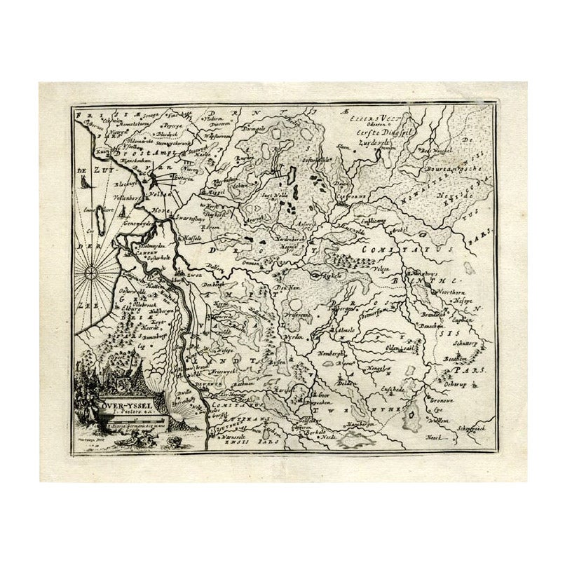
- Antique Map of Overijssel by Bachiene, 1758Located in Langweer, NLAntique map titled 'Over-Yssel'. Map of the Overijssel, the Netherlands. This map originates from 'Kort begrip der Oude en Nieuwe Staatkundige Geographie', by W.A. Bachiene, publishe...Category
Antique 18th Century Maps
MaterialsPaper

You May Also Like
- Map of the Kingdom of Sardinia and Part of the Kingdom of Genoa, RomeBy Giovanni Maria CassiniLocated in Hamilton, Ontario18th century map by Italian engraver Giovanni Maria Cassini (Italy 1745-1824). Map of Part of the Kingdom of Sardinia and Part of the Kingdom of Genoa: Rome. This is a hand colored a...Category
Antique 18th Century Italian Maps
MaterialsPaper
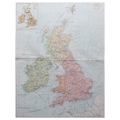
- Large Original Vintage Map of The United Kingdom, circa 1920Located in St Annes, LancashireGreat map of The United Kingdom Original color. Published by Alexander Gross Unframed.Category
Vintage 1920s English Maps
MaterialsPaper
- Large Original Vintage Map of the United Kingdom, circa 1920Located in St Annes, LancashireGreat map of The United Kingdom Unframed Original color By John Bartholomew and Co. Edinburgh Geographical Institute Published, circa 1920 Free shipping.Category
Vintage 1920s British Maps
MaterialsPaper
- 1861 Topographical Map of the District of Columbia, by Boschke, Antique MapLocated in Colorado Springs, COPresented is an original map of Albert Boschke's extremely sought-after "Topographical Map of the District of Columbia Surveyed in the Years 1856 ...Category
Antique 1860s American Historical Memorabilia
MaterialsPaper
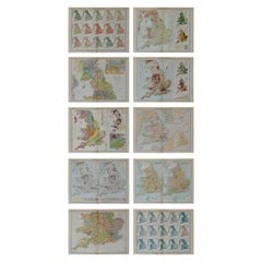
- Set of 10 Large Scale Vintage Maps of The United Kingdom, circa 1900Located in St Annes, LancashireGreat set of maps of the UK Lithographs. By John Bartholomew & Co. Published by The Edinburgh Geographical Institute Unframed. The measurement ...Category
Antique Early 1900s English Maps
MaterialsPaper
- Original Antique Map of The World by Thomas Clerk, 1817Located in St Annes, LancashireGreat map of The Eastern and Western Hemispheres On 2 sheets Copper-plate engraving Drawn and engraved by Thomas Clerk, Edinburgh. Published by Mackenzie And Dent, 1817 ...Category
Antique 1810s English Maps
MaterialsPaper