Items Similar to Antique Map of the Northern Part of Biblical Palestine by Lindeman, c.1763

Want more images or videos?
Request additional images or videos from the seller
1 of 5
Antique Map of the Northern Part of Biblical Palestine by Lindeman, c.1763
About the Item
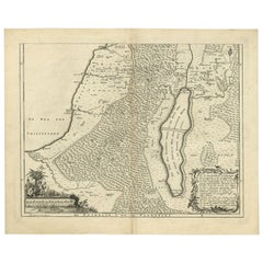
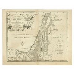
Antique map titled 'De 8ste en 9de Landkaarte Geheel Palestina (..).' Map of the northern part of Biblical Palestine. With large title cartouche. Published by A. van Paddenburg, Netherlands c.1763.
Artists and Engravers: Made by 'O. Lindeman' after 'Willem Albert Bachiene'. Author: Willem Albert Bachiene (Leerdam 1712 - Maastricht 1783). He was a Clergyman in the army and in Namen, Belgium and Kuilenburg (Culemborg). From 1759 he was Clergyman in Maastricht and also Professor in Astronomy and Geography at the 'Illustere School'.
We sell original antique maps to collectors, historians, educators and interior decorators all over the world. Our collection includes a wide range of authentic antique maps from the 16th to the 20th centuries. Buying and collecting antique maps is a tradition that goes back hundreds of years. Antique maps have proved a richly rewarding investment over the past decade, thanks to a growing appreciation of their unique historical appeal. Today the decorative qualities of antique maps are widely recognized by interior designers who appreciate their beauty and design flexibility. Depending on the individual map, presentation, and context, a rare or antique map can be modern, traditional, abstract, figurative, serious or whimsical. We offer a wide range of authentic antique maps for any budget.
- Dimensions:Height: 15.16 in (38.5 cm)Width: 19.02 in (48.3 cm)Depth: 0 in (0.01 mm)
- Materials and Techniques:
- Period:
- Date of Manufacture:circa 1763
- Condition:Condition: Good, given age. Discolouration of middle fold. Some minor crinkles. A few spots. Original middle fold as issued. General age-related toning and/or occasional minor defects from handling. Please study image carefully.
- Seller Location:Langweer, NL
- Reference Number:
About the Seller
5.0
Platinum Seller
These expertly vetted sellers are 1stDibs' most experienced sellers and are rated highest by our customers.
Established in 2009
1stDibs seller since 2017
1,933 sales on 1stDibs
Typical response time: <1 hour
- ShippingRetrieving quote...Ships From: Langweer, Netherlands
- Return PolicyA return for this item may be initiated within 14 days of delivery.
More From This SellerView All
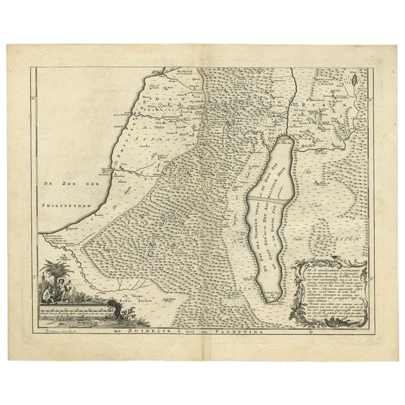
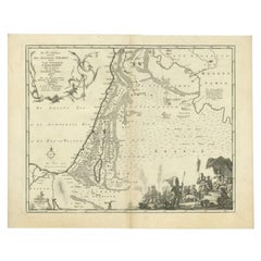
- Antique Map of Southern Palestine by Bachiene, 1763Located in Langweer, NL"Antique map of the south part of Palestine. This simplified map shows the most important cities of the Jewish Land. Source unknown, to be determined. Artists and Engravers: Made by ...Category
Antique 18th Century Maps
MaterialsPaper
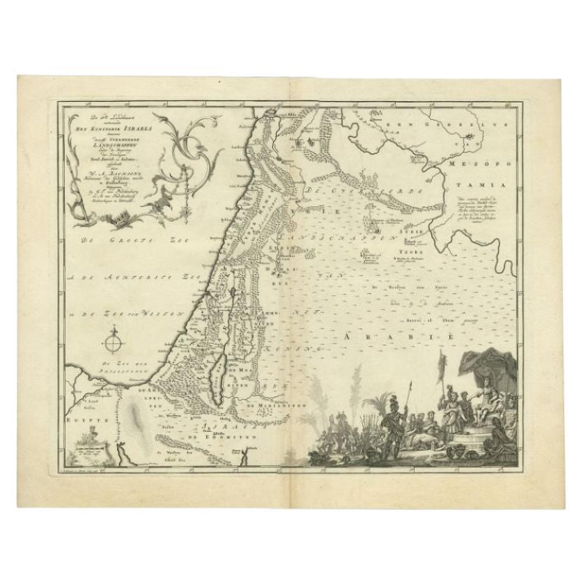
- Antique Map of the Biblical Kingdom of Israel by Lindeman, c.1758Located in Langweer, NLAntique map titled 'De IVde Landkaart vertoonende het Koningryk Israels benevens deszelfs overheerde Landschappen (..).' Map of the biblical Kingdom of Israel under the Kings Saul, D...Category
Antique 18th Century Maps
MaterialsPaper
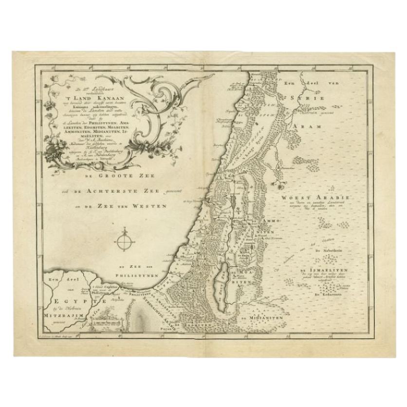
- Antique Map of the Biblical Land of Canaan by Lindeman, c.1758Located in Langweer, NLAntique map titled 'De IIde Landkaart verbeeldende t'Land Kanaan nog bewoond door deszelfs eerste bezitters (..).' - Map of the biblical Land of Canaan. With large title cartouche, c...Category
Antique 18th Century Maps
MaterialsPaper
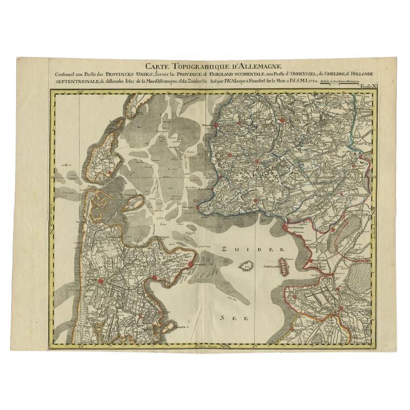
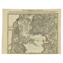
- Antique Map of the Northern Part of the Netherlands by Jaeger, 1784Located in Langweer, NLAntique print, titled: 'Carte topographique d'Allemagne contenant une partie des Provinces Unies, savoir la province de Friesland occidentale : une partie d'Overyssel, de Gueldre, d'...Category
Antique 18th Century Maps
MaterialsPaper
- Antique Map of the Northern Part of Scotland by Black '1854'Located in Langweer, NLAntique map titled 'Scotland'. Original map of the northern part of Scotland. With an inset map of the Orkney Isles. This map originates from 'General Atlas Of The World: Containing ...Category
Antique Mid-19th Century Maps
MaterialsPaper
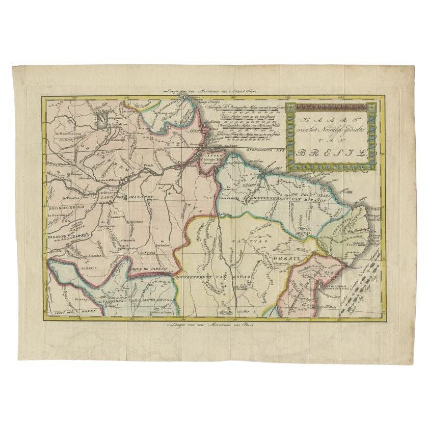
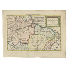
- Antique Map of the Northern Part of Brazil by Raynal, 1784Located in Langweer, NLAntique map titled 'Kaart van het Noordlijk gedeelte van Bresil'. Rare antique map of the northern part of Brazil, with the basin of the Amazon and the cities of Manaus, Recife and S...Category
Antique 18th Century Maps
MaterialsPaper

You May Also Like
- New Map of North America from the Latest Discoveries, 1763Located in Philadelphia, PAA fine antique 18th century map of the North American seaboard. Entitled "A New Map of North America from the Latest Discoveries 1763". By the Cartographer/Engraver - John Spil...Category
Antique Mid-18th Century English Georgian Maps
MaterialsPaper
- 1861 Topographical Map of the District of Columbia, by Boschke, Antique MapLocated in Colorado Springs, COPresented is an original map of Albert Boschke's extremely sought-after "Topographical Map of the District of Columbia Surveyed in the Years 1856 ...Category
Antique 1860s American Historical Memorabilia
MaterialsPaper
- Map of the Kingdom of Sardinia and Part of the Kingdom of Genoa, RomeBy Giovanni Maria CassiniLocated in Hamilton, Ontario18th century map by Italian engraver Giovanni Maria Cassini (Italy 1745-1824). Map of Part of the Kingdom of Sardinia and Part of the Kingdom of Genoa: Rome. This is a hand colored a...Category
Antique 18th Century Italian Maps
MaterialsPaper
- 1868 Map of the Upper Part of the Island of Manhattan Above 86th StreetBy Wm. Rogers Mfg. Co.Located in San Francisco, CAThis wonderful piece of New York City history is over 150 years old. It depicts 86th street and above. It was lithographed by WC Rogers and company. It was made to show what was the Battle of Harlem during the Revolutionary war...Category
Antique 1860s American American Colonial Maps
MaterialsPaper
- 1844 Map "Russia in Eurpoe, Part II to Part VIII", 7 Maps Ric.r023Located in Norton, MA1844 Map "Russia in Eurpoe, Part II to Part VIII" 7 Maps Ric.r023 Fine, original, steel-engraved Map of Russia in Europe Part II t oPart VIII, by the Society for the Diffusion of Useful Knowledge. Detailed map of the regions to the northeast of Moscow. Including Arkhangel, Vologda, Viatka, Perm, Olonetz, Iaroslavl. The SDUK began its map publishing project under the leadership of Captain Francis Beaufort R.N. in 1829, and published the maps in parts, haltingly, over the next 15 years, completing the series in 1844, finally permitting the publication of a whole atlas. Many of the maps were actually drawn by Beaufort, who at the time was the Hydrographer to the Royal Navy, and all were closely supervised by him. J. & C. Walker worked closely with Beaufort in engraving the maps. Finely engraved, carefully researched, the maps set...Category
Antique 19th Century Unknown Maps
MaterialsPaper
- 1840 "New Map of the City of New York With Part of Brooklyn & Williamsburg"Located in Colorado Springs, COPresented is a hand-colored, engraved folding map titled "New Map of the City of New York With Part of Brooklyn & Williamsburg" by J. Calvin Smith. The map was issued bound in the bo...Category
Antique 1840s American Maps
MaterialsPaper


