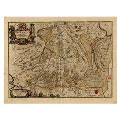
Large Map Of The Netherlands
2
to
15
111
88
126
58
47
45
23
18
15
14
14
11
10
10
9
8
6
6
4
4
4
4
4
3
3
2
2
2
2
2
2
2
1
1
1
1
1
1
1
1
1
1
1
1
1
1
1
22
8
7
4
4
Sort By
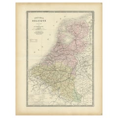
Decorative Antique Map of the Netherlands and Belgium, ca.1875
Located in Langweer, NL
Antique map titled 'Pays-Bas Belgique (..)'. Large map of the Netherlands and Belgium. This map
Category
Antique Late 19th Century Maps
Materials
Paper
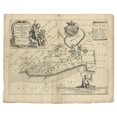
Antique Map of the Region of Gaasterland, Friesland, The Netherlands, 1664
Located in Langweer, NL
Antique map titled 'De Grietenie van Gaesterlandt (..)'. Map of the region of Gaasterland in
Category
Antique 17th Century Maps
Materials
Paper
H 11.82 in W 14.77 in D 0 in
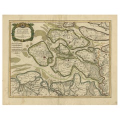
Antique Map of Zeeland, The Netherlands, by Jaillot, 1693
Located in Langweer, NL
Antique map titled 'Le Comte de Zeelande (..).' Detailed map of the province of Zeeland, The
Category
Antique 17th Century Maps
Materials
Paper
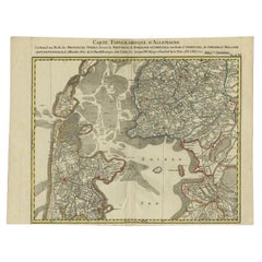
Antique Map of the Northern Part of the Netherlands by Jaeger, 1784
Located in Langweer, NL
septentrionale, de differentes isles de la meer d'Allemagne, et du Zuider See.' Large and detailed map of the
Category
Antique 18th Century Maps
Materials
Paper
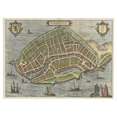
Beautiful Decorative Antique Map of the City of Dordrecht, the Netherlands, 1581
Located in Langweer, NL
Antique map titled 'Dordrecht'.
Map of the city of Dordrecht, the Netherlands. Bird's-eye plan
Category
Antique 16th Century Maps
Materials
Paper
H 15.16 in W 20.08 in D 0 in
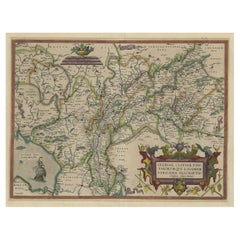
Superb Antique Map of the Province of Gelderland, the Netherlands, ca.1575
Located in Langweer, NL
Antique map titled 'Gelriae, Cliviae, Finitimorumque Locorum Verissima Descriptio Christiano Schrot
Category
Antique 16th Century Maps
Materials
Paper
H 16.86 in W 21.97 in D 0 in
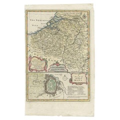
Antique Map of the Netherlands and Belgium by Bowen, 1747
By Emanuel Bowen
Located in Langweer, NL
map of South of the Netherlands and Belgium. With large inset of the city of Mons, Bergen. Originates
Category
Antique 18th Century Maps
Materials
Paper
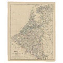
Antique Map of Belgium and the Netherlands by Johnston, 1882
By Alexander Keith Johnston
Located in Langweer, NL
Antique map titled 'Belgium and the Netherlands'. Old map of Belgium and the Netherlands. This map
Category
Antique 19th Century Maps
Materials
Paper
Antique Map of Drenthe, a Province in The Netherlands, 1658
Located in Langweer, NL
, a province in the Netherlands. Large cartouche with coats of arms. This map is made by J. Janssonius
Category
Antique 17th Century Maps
Materials
Paper
Beautiful Antique Map of the Province of Noord-Holland, the Netherlands, Ca.1730
Located in Langweer, NL
original antique map of the province of Noord-Holland, the Netherlands. Two large elaborate cartouches, one
Category
Antique 1730s Maps
Materials
Paper
No Reserve
H 24.41 in W 20.87 in D 0 in
Antique Map of the Seventeen Provinces of Netherlands, Belgium, Luxembourg, 1748
By Homann Heirs
Located in Langweer, NL
very large number of individual maps. The Homanns produced a Neuer Atlas in 1714, a Grosser Atlas in
Category
Antique 18th Century Maps
Materials
Paper
H 21.07 in W 25.01 in D 0 in
Beautiful Map of Arnhem and the Veluwe Region, Gelderland, The Netherlands, 1690
Located in Langweer, NL
Antique map titled 'Ducatus Geldriae tetrachia Arnhemiensis sive Velavia'.
Beautiful map of the
Category
Antique 1690s Maps
Materials
Paper
H 20.67 in W 24.41 in D 0 in
Antique Map of the City of Bolsward, Friesland in The Netherlands, c.1598
Located in Langweer, NL
Antique map titled ‘Bolzvardia vetus in Frisia Foederis (..)’. Old map of the city of Bolsward
Category
Antique 16th Century Maps
Materials
Paper
H 9.45 in W 10.63 in D 0 in
Map of the Duchy Clivia & Ravestein, Brabant in The Netherlands & Germany, 1635
Located in Langweer, NL
Antique map titled 'Clivia Ducatus et Ravestein Dominium.'
Map of the Duchy Clivia and
Category
Antique 1630s Maps
Materials
Paper
H 16.86 in W 22.05 in D 0 in
Map of East Friesland, The Netherlands & the Area Emden & Norden, Germany, 1635
Located in Langweer, NL
and Norden. Large inset map of the mouth of the Amasis River. The map is decorated with a large title
Category
Antique 1630s Maps
Materials
Paper
H 20.48 in W 24.34 in D 0 in
Antique Map of Friesland ‘The Netherlands’ by N. Visscher, circa 1670
By Nicolaes Visscher II
Located in Langweer, NL
This large copper engraved map details the coastline of Friesland and Terschelling. At east is a
Category
Antique Late 17th Century Maps
Materials
Paper
H 20.48 in W 24.02 in D 0.02 in
1752 Vaugoundy Map of Flanders : Belgium, France, and the Netherlands, Ric.a002
Located in Norton, MA
Large Vaugoundy Map of Flanders:
Belgium, France, and the Netherlands
Colored -1752
Ric.a002
Category
Antique 17th Century Unknown Maps
Materials
Paper
H 51.5 in W 66 in D 1 in
Antique Latin Map of the Netherlands & Germany, Incl Roman Forts, Etc., 1631
Located in Langweer, NL
.'
A Latin map of the Netherlands and Germany, showing all the major rivers as well as large towns and
Category
Antique 1630s Maps
Materials
Paper
H 13.71 in W 15.95 in D 0 in
Original Antique Map of Utrecht in the Netherlands by Blaeu, C.1645
Located in Langweer, NL
Antique map titled 'Ultraiectum Dominium'. Old map of the province of Utrecht, the Netherlands
Category
Antique 17th Century Maps
Materials
Paper
Antique Decorative Map of the Low Countries, '17 Provinces, Netherlands', c.1680
Located in Langweer, NL
.'
Map of the low countries (17 provinces, Netherlands). The map is dedicated to Theodoro Munter
Category
Antique 1680s Maps
Materials
Paper
H 21.26 in W 24.89 in D 0 in
Original Antique Map of Zuid-Holland in the Netherlands by Blaeu, C.1645
Located in Langweer, NL
Netherlands. This map originates from 'Theatrum Orbis Terrarum (..)'.
Artists and Engravers: Willem
Category
Antique 17th Century Maps
Materials
Paper
H 20.48 in W 24.81 in D 0 in
Antique Map of the Coast of France, 1710
By Jacobus Harrewijn
Located in Langweer, NL
, together, show a very large part of the Southern Netherlands.
Category
Antique Early 18th Century Maps
Materials
Paper
Large 17th Century Hand Colored Map of England and the British Isles by de Wit
By Frederick de Wit
Located in Alamo, CA
A large hand colored 17th century map of England and the British Isles by Frederick de Wit entitled
Category
Antique Late 17th Century Dutch Maps
Materials
Paper
H 35 in W 30.5 in D 2 in
Large Antique Map of Delfland by Cruquius, 1712
Located in Langweer, NL
Map no. 20 of a large wall map of Delfland, The Netherlands. The map covers the region of Pijnacker
Category
Antique 18th Century Maps
Materials
Paper
Antique Map of the Region of Wonseradeel by Schotanus, 1664
By B. Schotanus
Located in Langweer, NL
Antique map titled 'De Grietenije van Wonsera-deel (..).' Map of the Grietenij of Wonseradeel
Category
Antique 17th Century Maps
Materials
Paper
Antique Map of the Low Countries by Cary, 1813
Located in Langweer, NL
Antique map of the Netherlands titled 'A New Map of the United Provinces comprehending Holland
Category
Antique 19th Century Maps
Materials
Paper
Antique Map of the Siege of Groningen by Le Clerc, 1730
Located in Langweer, NL
1594.) This plate shows the fortified city of Groningen, The Netherlands. With legend. This attractive
Category
Antique 18th Century Maps
Materials
Paper
Detailed Old Map of the Seven Provinces of the Belgian/Dutch Federation, ca.1748
Located in Langweer, NL
atlases the firm published a very large number of individual maps. The Homanns produced a Neuer Atlas in
Category
Antique 18th Century Maps
Materials
Paper
H 25.2 in W 21.07 in D 0 in
Antique Map of the City of Dokkum by Blaeu, c.1650
Located in Langweer, NL
Antique map titled 'Dockum'. Large map of the city of Dokkum, Friesland, The Netherlands
Category
Antique 17th Century Maps
Materials
Paper
Antique Map of the Hennaarderadeel Township 'Friesland' by Halma, 1718
Located in Langweer, NL
Friesland, the Netherlands. This map depicts the region of Hennaarderadeel and includes cities and villages
Category
Antique 18th Century Maps
Materials
Paper
Extremely Large Hand-Drawn Manuscript Map of Surinam, 1830, History of Slavery
Located in Amsterdam, NL
A unique large hand-drawn map of Surinam by Albrecht Helmut Hiemcke (German, 1760-1839
Category
Antique Mid-19th Century Surinamer Maps
Materials
Paper
Free Shipping
H 34.85 in W 97.05 in D 0.08 in
Antique Map of the Seventeen Provinces by Homann Heirs, 1748
By Homann Heirs
Located in Langweer, NL
on map publishing in Germany. Apart from the atlases the firm published a very large number of
Category
Antique 18th Century Maps
Materials
Paper
Decorative Antique Map of the Dutch Province of Noord-Brabant, ca.1640
Located in Langweer, NL
'.
Highly detailed original antique map of the province of Noord-Brabant, the Netherlands. It shows the
Category
Antique 1640s Maps
Materials
Paper
Antique Map of the Provinces of Gelderland and Overijssel by Kaerius, 1617
Located in Langweer, NL
Overijssel in the Netherlands. Large cartouche with coat of arms and sailing ship on the Zuyderzee. This map
Category
Antique 17th Century Maps
Materials
Paper
H 15.75 in W 20.67 in D 0 in
Antique Map of the Bildt Township 'Friesland' by Halma, 1718
Located in Langweer, NL
The map depicts the historical region of 't Bildt in Friesland, with notable places such as St
Category
Antique 18th Century Maps
Materials
Paper
Neatly Framed Decorative Hand-Colored View of Zierikzee, the Netherlands, 1858
Located in Langweer, NL
Antique print titled 'Zierikzee'.
View of the city of Zierikzee, the Netherlands. This print
Category
Antique 1850s Maps
Materials
Paper
H 11.93 in W 13.47 in D 0 in
Large Antique Wall Map of Friesland by Vegelin van Claerbergen, 1739
Located in Langweer, NL
. Heeren Gedeputeerde Staeten'.
Rare and large attractive wall map of Friesland, the so-called 'Vegelin
Category
Antique 18th Century Maps
Materials
Paper
Free Shipping
H 46.07 in W 50.01 in D 0 in
Antique Map of the Biblical Land of Canaan by Lindeman, c.1758
Located in Langweer, NL
bezitters (..).' - Map of the biblical Land of Canaan. With large title cartouche, compass rose and scale
Category
Antique 18th Century Maps
Materials
Paper
Antique Map of the City of Dordrecht by Braun & Hogenberg, c.1581
Located in Langweer, NL
Antique map titled 'Dordrecht'. Map of the city of Dordrecht, the Netherlands. Bird's-eye plan view
Category
Antique 16th Century Maps
Materials
Paper
Antique Map of the Old Land of Batavia and Friesland by Halma, 1718
Located in Langweer, NL
, the Netherlands. This map depicts the old land of Batavia and Friesland. Originates from 'Uitbeelding
Category
Antique 18th Century Maps
Materials
Paper
Antique Map of the Holy Land by Van Luchtenburg, c.1720
Located in Langweer, NL
Antique map titled 'Heylige Land verdeeld in de Twaalf Stammen Israels (..).' Highly detailed map
Category
Antique 18th Century Maps
Materials
Paper
Antique Map of the Northern Part of Biblical Palestine by Lindeman, c.1763
Located in Langweer, NL
Biblical Palestine. With large title cartouche. Published by A. van Paddenburg, Netherlands c.1763
Category
Antique 18th Century Maps
Materials
Paper
H 15.16 in W 19.02 in D 0 in
1654 Joan Blaeu Map the Sutherland, Scotland, Entitled "Southerlandia, "Ric0007
Located in Norton, MA
1654 Joan Blaeu map of the
Sutherland, Scotland, entitled
"Southerlandia,"
Hand Colored
Category
Antique 17th Century Dutch Maps
Materials
Paper
H 20.36 in W 23.23 in D 0.4 in
Antique Map of the Region of Vermandois and Cappelle, France by Janssonius, 1657
By Johannes Janssonius
Located in Langweer, NL
Antique map of France titled 'Descriptio Veromanduorum - Gouvernement de la Cappelle'. Two detailed
Category
Antique 17th Century Maps
Materials
Paper
H 19.69 in W 23.63 in D 0 in
Antique Map of Asia by Sanson, circa 1705
By Nicolas Sanson
Located in Langweer, NL
Dutch edition of Sanson's map of Asia. Shows a large, dramatic version of Terre de Jesso, drawn
Category
Antique Early 18th Century Dutch Maps
Materials
Paper
Highly Detailed Antique Map of the Holy Land Showing 12 Tribes of Israel, c.1720
Located in Langweer, NL
map of the Holy Land divided into 12 tribes of Israel. With beautiful large title cartouche, vignette
Category
Antique 1720s Maps
Materials
Paper
Free Shipping
H 17.72 in W 20.28 in D 0 in
Antique Map of Delfland by Cruquius, 1712
Located in Langweer, NL
Map no. 25 of a large wall map of Delfland, The Netherlands. The map covers the region of Polder
Category
Antique 18th Century Maps
Materials
Paper
Antique Map of Belgium and Surroundings, 1692
Located in Langweer, NL
with large parts of Zeeland and Brabant, the Netherlands. Originates from 'Mercurio Geografico overo
Category
Antique 17th Century Maps
Materials
Paper
Antique Map of Stavoren by Coronelli, 1706
Located in Langweer, NL
Antique map titled 'Staveren'. Rare antique map of the city of Stavoren, Friesland, the Netherlands
Category
Antique 18th Century Maps
Materials
Paper
17th Century Hand-Colored Map of West Africa by Mercator/Hondius
Located in Alamo, CA
Ethiopicus Ocean (the Gulf of Guinea). A large inset map in the left corner depicts the Island of Isle of
Category
Antique Mid-17th Century Dutch Maps
Materials
Paper
England, Scotland & Ireland: A Hand Colored Map of Great Britain by Tirion
By Isaak Tirion
Located in Alamo, CA
location of publication.
The map is printed in laid chain-linked paper with a large fleur-de-lys and
Category
Antique Mid-18th Century Dutch Maps
Materials
Paper
H 17 in W 20.75 in D 0.07 in
Antique Map of France by Covens & Son, c.1790
Located in Langweer, NL
divisée en 83 Departements (..)'
**Date**: Circa 1790
**Description**: This large map of France, notable
Category
Antique 18th Century Maps
Materials
Paper
Original Copper Engraving of a Map of Syria and Lebanon, 1698
Located in Langweer, NL
Antique map titled 'Syriae, sive Soriae, Nova et Accurata Descriptio.'
Map of Syria and Lebanon
Category
Antique 1690s Maps
Materials
Paper
Free Shipping
H 12.41 in W 14.45 in D 0 in
Antique Map of Western Europe by H. Kiepert, circa 1870
By Heinrich Kiepert
Located in Langweer, NL
Antique map titled 'Gallia, Britannia, Germania'. This map depicts a large part of Western Europe
Category
Antique Late 19th Century Maps
Materials
Paper
Original Antique Map of Friesland in Decorative Hand-Colouring, 1600
Located in Langweer, NL
descriptio'. Original antique map of the province of Friesland, the Netherlands. This map originates from
Category
Antique 17th Century Maps
Materials
Paper
1657 Janssonius Map of Vermandois and Cappelle, Ric. A-004
Located in Norton, MA
, Preone, Lafere, Channi, and Noyon, among other larger towns in the region. The Cappelle map is centered
Category
Antique 17th Century Unknown Maps
Materials
Paper
1633 Map Entitled "Beauvaisis Comitatus Belova Cium, Ric.0002
Located in Norton, MA
1633 map entitled
"Beauvaisis Comitatus Belova Cium,"
Hand Colored
Ric.0002
Description
Category
Antique 17th Century Dutch Maps
Materials
Paper
1571-1638 Willem Blaeu map entitled, "Ilcadorino, " Hand Colored Ric0009
Located in Norton, MA
Willem Blaeu map entitled,
"Ilcadorino,".
Hand colored.
Description: large, unusual, and
Category
Antique 16th Century Dutch Maps
Materials
Paper
H 20.28 in W 23.63 in D 0.4 in
Antique Map of Friesland, Groningen and German East Friesland by Ortelius, 1603
Located in Langweer, NL
: Descriptio. 1568.' Detailed map of Friesland, the Netherlands. Includes a larger compass rose, sailing ships
Category
Antique 17th Century Maps
Materials
Paper
H 17.52 in W 22.45 in D 0 in
1643 Willem&Joan Blaeu Map NW Flanders "Flandriae Teutonicae Pars Prientalior
Located in Norton, MA
1643 Willem and Joan Blaeu map of northwest Flanders, entitled
"Flandriae Teutonicae Pars
Category
Antique 17th Century Dutch Maps
Materials
Paper
H 19.3 in W 22.45 in D 0.4 in
- 1
Get Updated with New Arrivals
Save "Large Map Of The Netherlands", and we’ll notify you when there are new listings in this category.
Large Map Of The Netherlands For Sale on 1stDibs
Find a variety of large map of the Netherlands available on 1stDibs. The range of distinct large map of the Netherlands — often made from paper, glass and wood — can elevate any home. Find 107 antique and vintage large map of the Netherlands at 1stDibs now, or shop our selection of 21 modern versions for a more contemporary example of this long-cherished furniture. There are all kinds of large map of the Netherlands available, from those produced as long ago as the 18th Century to those made as recently as the 21st Century. modern, Art Deco and Baroque large map of the Netherlands are consistently popular styles. Large map of the Netherlands have been a part of the life’s work for many furniture makers, but those produced by Maarten Vrolijk, Jacques-Nicolas Bellin and Johannes Janssonius are consistently popular.
How Much are Large Map Of The Netherlands?
The average selling price for at 1stDibs is $930, while they’re typically $99 on the low end and $250,000 highest priced.
