Antique Maps Finland

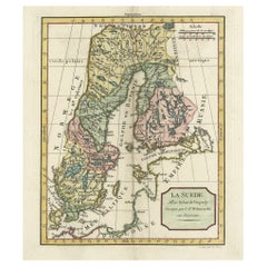
Decorative Antique Map of Sweden and Part of Finland, 1806
Located in Langweer, NL
Antique map titled 'La Suede.' Decorative map of Sweden and part of Finland by Robert de
Category

Early 1800s Antique Maps Finland

Materials

Paper

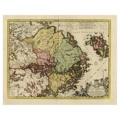
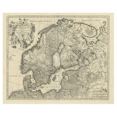
Original and Decorative Antique Engraved Map of Finland and Sweden, ca.1720
Located in Langweer, NL
of Finland and Sweden. Originally published by Frederick de Wit in the late 1600's. This map was
Category

1720s Antique Maps Finland

Materials

Paper

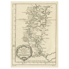
Original Antique Map of the Region of Torneå 'Tornio' in Northern Finland, 1759
Located in Langweer, NL
Antique map titled 'Carte des Environs de Tornea'. Original antique map of the region of Torneå
Category

1750s Antique Maps Finland

Materials

Paper

1849 Map of "Europaische Russland", 'Meyer Map of European Russia', Ric. R017
Located in Norton, MA
1849 Map of "Europaische Russland" ( Meyer Map of European Russia) Ric.r017 A lovely map of
Category

19th Century Unknown Antique Maps Finland

Materials

Paper

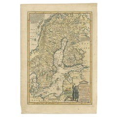
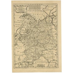
Antique Map of Sweden by Bowen, 1747
Located in Langweer, NL
Antique map titled 'A New & Accurate Map of Sweden'. This map covers Sweden and Finland (shown as
Category

18th Century Antique Maps Finland

Materials

Paper

Antique Map of Sweden by Bowen, 1747
H 14.57 in W 10.24 in D 0 in
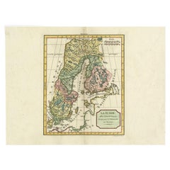
Antique Map of Sweden by Delamarche, 1806
Located in Langweer, NL
Antique map titled 'La Suede.' Decorative map of Sweden and part of Finland by Robert de Vaugondy
Category

19th Century Antique Maps Finland

Materials

Paper

Antique Map of Sweden by Delamarche, 1806
H 11.19 in W 15.08 in D 0 in
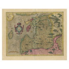
Original Antique Map of the Northern Baltic Region
Located in Langweer, NL
northern Strait between Finland and Latvia. Notably, Stockholm and Gotland are also featured on the map
Category

Early 17th Century Antique Maps Finland

Materials

Paper

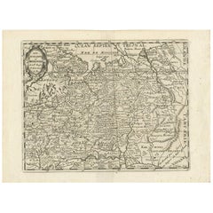
Antique Map of Russia by N. Sanson, 1705
Located in Langweer, NL
A strongly engraved map of European Russia showing its political divisions, major topographical
Category

Early 18th Century Antique Maps Finland

Materials

Paper

Antique Map of Russia by N. Sanson, 1705
H 8.82 in W 11.97 in D 0.02 in
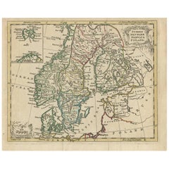
Antique Map of Scandinavia by T. Jefferys, circa 1750
Located in Langweer, NL
Antique map titled 'Sweden, Denmark, Norway & Finland'. An original mid-18th century copper
Category

Mid-18th Century Antique Maps Finland

Materials

Paper

Antique Map of Moscovy 'Russia' by E. Bowen, 1747
Located in Langweer, NL
European portion of Russia extending from the Gulf of Finland to the Ural Mountains. The map offers
Category

Mid-18th Century Antique Maps Finland

Materials

Paper

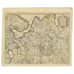
Antique Map of Western Russia by Covens & Mortier, 1740
Located in Langweer, NL
Ladoga and portions of southern Finland. This map exists of two separate sheets which can be joined
Category

Mid-18th Century Antique Maps Finland

Materials

Paper

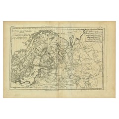
Antique Map of Northern Europe by Bonne, c.1780
Located in Langweer, NL
Antique map titled 'Le Nord de L'Europe, Contenant Le Danemark, La Norwege; La Suede et La Laponie
Category

18th Century Antique Maps Finland

Materials

Paper

Antique Map of Scandinavia by Van der Aa 'circa 1710'
Located in Langweer, NL
with two maps on one sheet. The upper map depicts Northern Scandinavia with Norway, Sweden and Finland
Category

Early 18th Century Antique Maps Finland

Materials

Paper

1790 Thomas Stackhouse Map, Entitled "Russia in Europe, " , Ric.a004
Located in Norton, MA
1790 Thomas Stackhouse map, entitled "Russia in Europe" Ric.a004 Stackhouse, Thomas Russia
Category

17th Century Unknown Antique Maps Finland

Materials

Paper

Antique Map of Northern Europe and European Russia, ca.1780
Located in Langweer, NL
Antique map titled 'Le Nord de L'Europe, Contenant Le Danemark, La Norwege; La Suede et La Laponie
Category

1780s Antique Maps Finland

Materials

Paper

Antique Map of Scandinavia and the Baltic Region by Valk, circa 1690
Located in Langweer, NL
Antique map titled 'Sueciae Magnae, totius orbis regni antiquissimi (..)'. Map of Scandinavia and
Category

Late 17th Century Antique Maps Finland

Materials

Paper

Original Antique Map of the Northwestern Part of Russia in Europe, 1753
Located in Langweer, NL
Antique map titled 'Partie septentrionale de la Russie Européenne'. Detailed map of the
Category

1750s Antique Maps Finland

Materials

Paper

Persia, Armenia & Adjacent Regions: A 17th Century Hand-colored Map by De Wit
By Frederick de Wit
Located in Alamo, CA
attractive map of Scandinavia, which includes the Baltic Sea, Norway, Sweden, Finland, Denmark and portions
Category

Late 17th Century Dutch Antique Maps Finland

Materials

Paper

Antique Map of the Shores of The Baltic Sea by W. G. Blackie, 1859
Located in Langweer, NL
Antique map titled 'The shores of The Baltic sea and of the Gulfs of Bothnia & Finland'. Original
Category

Mid-19th Century Antique Maps Finland

Materials

Paper

Antique Map of the Surroundings of the Baltic Sea by A.K. Johnston, 1865
Located in Langweer, NL
Antique map titled 'Basin of the Baltic'. Depicting, Denmark, Sweden, Finland, Estonia, Poland
Category

Mid-19th Century Antique Maps Finland

Materials

Paper

Antique Map of the Gulf of Bothnia, the Northernmost Arm of the Baltic, 1759
Located in Langweer, NL
Antique map titled 'Suite du Golphe de Bothnie'. Original antique map of the Gulf of Bothnia
Category

1750s Antique Maps Finland

Materials

Paper

Old Map of the Gulf of Bothnia, the Northernmost Arm of the Baltic Sea, 1759
Located in Langweer, NL
Antique map titled 'Carte du Golphe de Bothnie'. Original antique map of the Gulf of Bothnia
Category

1750s Antique Maps Finland

Materials

Paper

Large Antique Chart of The White Sea, Russa 1854
Located in Langweer, NL
Antique map titled 'The White Sea Index Chart'. Large uncommon map of the White Sea with a smaller
Category

19th Century Antique Maps Finland

Materials

Paper

Russia in Europe with Poland and Finland. Century Atlas antique vintage map
Located in Melbourne, Victoria
'The Century Atlas. Russia in Europe with Poland and Finland' Original antique map, 1903. Central
Category

Early 20th Century Victorian Antique Maps Finland

Materials

Lithograph

People Also Browsed

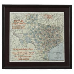
1908 "Map of Texas" by The Kenyon Company
Located in Colorado Springs, CO
Presented is an antique map of the state of Texas, printed as a pocket map in 1908 by The Kenyon Company. The state map is brightly colored by county, with principal cities and towns...
Category

Early 1900s American Antique Maps Finland

Materials

Paper

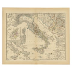
Antique Map of Italy with Insets of Rome and Major Cities, Published in 1880
Located in Langweer, NL
The map titled "ITALIA" depicts the Italian peninsula along with Sicily, Sardinia, and Corsica, labeled with regions such as "Etruria" and cities like "Roma" and "Syracuse". Insets h...
Category

1880s Antique Maps Finland

Materials

Paper

Antique Map of Silesia centered on Glogau
Located in Langweer, NL
Antique map titled 'Ducatus Silesiae Glogani vera delineatio'. This decorative map shows the Odra River valley based on the Silesian cartographer, Jonas Scultetus. The map is oriente...
Category

Mid-17th Century Antique Maps Finland

Materials

Paper

Antique Map of Silesia centered on Glogau
H 19.97 in W 23.51 in D 0.02 in
Antique Map of American Cities, Vignette of New York City, circa 1920
Located in St Annes, Lancashire
Great maps of American Cities Unframed Original color By John Bartholomew and Co. Edinburgh Geographical Institute Published, circa 1920
Category

1920s British Antique Maps Finland

Materials

Paper

Antique Map of the United States with inset map of the region of Mexico City
Located in Langweer, NL
Antique map titled 'Verein-Staaten von Nord-America, Mexico, Yucatan u.a.'. Very detailed map of the United States of America showing the Caribbean. With an inset map of the surround...
Category

Mid-19th Century Antique Maps Finland

Materials

Paper

Original Antique Map of Spain and Portugal, 1882
Located in Langweer, NL
Embark on a historical voyage with an original Antique Map of Spain and Portugal from the esteemed 'Comprehensive Atlas and Geography of the World,' meticulously crafted in 1882. Thi...
Category

1880s Antique Maps Finland

Materials

Paper

Historical Map Depicting the Continent of Asia, 1882
Located in Langweer, NL
This 1882 map presents a meticulously detailed representation of the continent of Asia, a testament to the cartographic skills of the era. Published as a part of 'Comprehensive Atlas...
Category

1880s Antique Maps Finland

Materials

Paper

Antique Map of the North Sea and Dunkirk
Located in Langweer, NL
Untitled map of the North Sea, top left a large compass rose, bottom right Dunkirk (Duinkerke / Dunkerque), France. Part of a bundled collection of plans of battles and cities renown...
Category

Early 18th Century Antique Maps Finland

Materials

Paper

Antique Map of the North Sea and Dunkirk
H 20.95 in W 24.14 in D 0.02 in
Original Antique Map of Russia in Europe, 1882
Located in Langweer, NL
Embark on an enthralling journey with an original Antique Map of European Russia from the esteemed 'Comprehensive Atlas and Geography of the World,' meticulously crafted in 1882. Thi...
Category

1880s Antique Maps Finland

Materials

Paper

Original Antique Map of The Austrian Empire, 1882
Located in Langweer, NL
Step into the past with an original Antique Map of The Austrian Empire from the esteemed 'Comprehensive Atlas and Geography of the World,' meticulously crafted in 1882. This intricat...
Category

1880s Antique Maps Finland

Materials

Paper

Antique Map Colton's United States of America
Located in Langweer, NL
Antique map titled 'Colton's United States of America'. Show railroads, canals, state capitals, major cities and towns, military posts, historic trails, Pony Express and U.S. mail ro...
Category

Mid-19th Century Antique Maps Finland

Materials

Paper

Antique Map Colton's United States of America
H 17.45 in W 27.45 in D 0.02 in
Original Antique Map of Switzerland, 1882
Located in Langweer, NL
Embark on a historical journey with an original Antique Map of Switzerland from the renowned 'Comprehensive Atlas and Geography of the World,' meticulously crafted in 1882. This exqu...
Category

1880s Antique Maps Finland

Materials

Paper

Original Antique Map of Switzerland, 1882
H 14.97 in W 22.45 in D 0 in
Antique Map of the City of Materan 'Indonesia' by P. van der Aa, circa 1725
By Pieter Van Der Aa
Located in Langweer, NL
Antique map titled 'La Ville de Materan, capitale de Roiaume de meme nom, avec ses environs. Le tout environne de Montagnes qui lui serve de murailles.' The city of Materan, capital ...
Category

Early 18th Century Antique Maps Finland

Materials

Paper

1875 "North America" Map by J. Bartholomew
Located in Colorado Springs, CO
Presented is an original 1875 map of “North America.” The map was issued in Volume 1 of the Ninth Edition of the Encyclopædia Britannica, published in Edinburgh. The map was drawn by...
Category

1870s Scottish Antique Maps Finland

Materials

Paper

Antique Map of the City of Antwerpen ‘Belgium’ by A. Deur, 1729
Located in Langweer, NL
Copper-engraving by A. Deur. Published by I. van der Kloot in Den Haag, 1729. With French and Dutch title-cartouches and explanatory notes, several ships on the Scheldt river and ins...
Category

Early 18th Century Antique Maps Finland

Materials

Paper

Antique Map of the City of Dokkum, Friesland by Blaeu, c.1650
Located in Langweer, NL
Antique map titled ?Dockum?. Plan of Dokkum in Friesland, the Netherlands. A cartouche with two coats of arms. Originates from the town atlas 'Toneel der Steden', published by Joan B...
Category

17th Century Antique Maps Finland

Materials

Paper

Recent Sales

Great Old Map of Scandinavia Incl Finland, Eastern Russia and the Baltics, C1680
Located in Langweer, NL
Norvegiae Regna'. Beautiful map of Scandinavia including Finland, Eastern Russia and the Baltics. Large
Category

1680s Antique Maps Finland

Materials

Paper

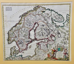
A Hand Colored 17th Century Map of Scandinavia by Frederick de Wit
By Frederick de Wit
Located in Alamo, CA
attractive map of Scandinavia, which includes the Baltic Sea, Norway, Sweden, Finland, Denmark and portions
Category

Late 17th Century Old Masters Antique Maps Finland

Materials

Engraving

Antique Silver Gilt Porcelain Figural Cupid Memorial Box Case, Sweden
Located in Montreal, QC
, translates to: "Gift from Gustav 111 to Jack who made the Swedish surveyor map of Finland. Sold to R.E.W. by
Category

19th Century Swedish Victorian Antique Maps Finland

Materials

Porcelain

Pair of Monumental Louis Revival Ormolu and Porphyry Candelabra 19th Century
Located in London, GB
second-century map, was described first by Strabo and is still known as the Via Porphyrites (the Porphyry
Category

1860s Antique Maps Finland

Materials

Porphyry, Ormolu

Original Antique Map of Sweden, Norway, Denmark and Finland, circa 1790
Located in St Annes, Lancashire
Super map of Scandinavia Copper plate engraving by A.Bell Published, circa 1790. Unframed.   
Category

1790s English Other Antique Maps Finland

Materials

Paper

Antique Map of the northern Baltic region by H. Hondius, 1627
Located in Langweer, NL
Antique map titled 'Livonia'. Detailed map of the northern Baltic region, here as re-issued by
Category

Early 17th Century Antique Maps Finland

Materials

Paper

Antique Map of Sweden and Norway by R. Morden, circa 1699
Located in Langweer, NL
Antique map of Sweden, Norway, Finland and the Baltics by Robert Morden. Robert Morden issued a
Category

Late 17th Century Antique Maps Finland

Scandinavia a Hand Colored 17th Century Map by Frederick de Wit
By Frederick de Wit
Located in Alamo, CA
attractive map of Scandinavia, which includes the Baltic Sea, Norway, Sweden, Finland, Denmark and portions
Category

Late 17th Century European Antique Maps Finland

Materials

Paper

1735 Johan Homann Hand Colored Scandinavian Map Extremely Rare
By Johann Baptist Homann
Located in Drottningholm, SE
Sueciae, Dania, Norwegiae Regna" The map depicts both Denmark, Norway, Sweden, Finland and the
Category

1730s German Antique Maps Finland

Get Updated with New Arrivals
Save "Antique Maps Finland", and we’ll notify you when there are new listings in this category.

Antique Maps Finland For Sale on 1stDibs

At 1stDibs, there are many versions of the ideal antique maps finland for your home. An antique maps finland — often made from paper — can elevate any home. Your living room may not be complete without an antique maps finland — find older editions for sale from the 18th Century and newer versions made as recently as the 19th Century.

Finding the Right collectibles-curiosities for You

Antique and vintage collectibles and curiosities can bring whimsy and wonder to any interior. 

Decorating with old scientific instruments, historical memorabilia and vintage musical instruments, as well as other authentic collectibles and curiosities that can be found on 1stDibs, presents an opportunity to create a unique, natural history museum-like atmosphere in your home that can provoke conversation as often as it pays tribute to how far we’ve come in understanding our world. 

And bringing collectibles and curiosities into your space is actually on trend — Wunderkammern, or curiosity cabinets, were all the rage in Europe during the 1500s and continued to have adherents there and in the U.S. in the following centuries. Today, however, they’re experiencing a real surge in popularity and influencing how many interior designers are furnishing and decorating homes — combining contemporary with antique, scientific with tribal, earthly with extraterrestrial, Les Lalanne tables with Flemish tapestries.

The original Wunderkammern were entire rooms filled with objects demonstrating their owners’ worldly knowledge: A proper one included artificiala or preciosa (objets d’art); naturalia (such as skeletons, shells, minerals); exotica (taxidermy or dried plants); and scientifica (scientific instruments), frequently alongside religious relics and ancient artifacts.

Pay tribute to a history of rich and diverse musical traditions that have taken shape all over the world by decorating your home with a collection of antique and vintage musical instruments — with a little help from strong hanging wire or some wall hooks, vintage brass instruments such as a gong, French horn or trumpet can help elevate a home office or complement the efforts you’ve made to ensure a welcoming vibe in your home’s entryway. Bells or antique wind instruments can add provocative metallic contrasts to dark woods as tabletop decorative objects.  

Create an intriguing focal point with Georgian scientific instruments, such as stick barometers with mahogany cases or lacquered brass telescopes. These items stem from an era named for the monarchies of the four King Georges, who ruled England in succession starting in 1714 (plus King William’s reign, which lasted until 1837). Just as there was beautiful jewelry produced during the period that today is coveted by collectors, there is much to be found in the collectibles and curiosities realm too.

Wanderlust, nostalgia and a shared love of good design are contributing factors to certain trends in decorating — just as vintage trunks and luggage have reappeared as furniture or home accents in a bedroom or foyer, decorating with globes, maps or nautical objects is similarly rooted in the allure of travel and a penchant for the stylish finishing touch that collectibles bring to our homes.

Find a wide range of antique and vintage collectibles and curiosities on 1stDibs.

Read More

Pamela Shamshiri Shares the Secrets behind Her First-Ever Book and Its Effortlessly Cool Interiors

The sought-after designer worked with the team at Hoffman Creative to produce a monograph that beautifully showcases some of Studio Shamshiri's most inspiring projects.

Moroccan Artworks and Objects Take Center Stage in an Extraordinary Villa in Tangier

Italian writer and collector Umberto Pasti opens the doors to his remarkable cave of wonders in North Africa.

Montecito Has Drawn Royalty and Celebrities, and These Homes Are Proof of Its Allure

Hollywood A-listers, ex-pat aristocrats and art collectors and style setters of all stripes appreciate the allure of the coastal California hamlet — much on our minds after recent winter floods.

Whaam! Blam! Pow! — a New Book on Pop Art Packs a Punch

Publishing house Assouline and writer Julie Belcove have teamed up to trace the history of the genre, from Roy Lichtenstein, Andy Warhol and Yayoi Kusama to Mickalene Thomas and Jeff Koons.

The Sparkling Legacy of Tiffany & Co. Explained, One Jewel at a Time

A gorgeous new book celebrates — and memorializes — the iconic jeweler’s rich heritage.

What Makes a Gem-Encrusted Chess Set Worth $4 Million?

The world’s most opulent chess set, weighing in at 513 carats, is literally fit for a king and queen.

Tauba Auerbach’s Geometric Pop-Up Book Is Mighty Rare, Thanks to a Hurricane

This sculptural art book has an epic backstory of its own.

Step inside the Storied Mansions of Palm Beach’s Most Effervescent Architect

From Spanish-style courtyards to fanciful fountains, these acclaimed structures abound in surprising and elegant details.