Items Similar to Antique Map of the Gulf of Bothnia, the Northernmost Arm of the Baltic, 1759
Want more images or videos?
Request additional images or videos from the seller
1 of 5
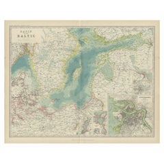
Antique Map of the Gulf of Bothnia, the Northernmost Arm of the Baltic, 1759
About the Item
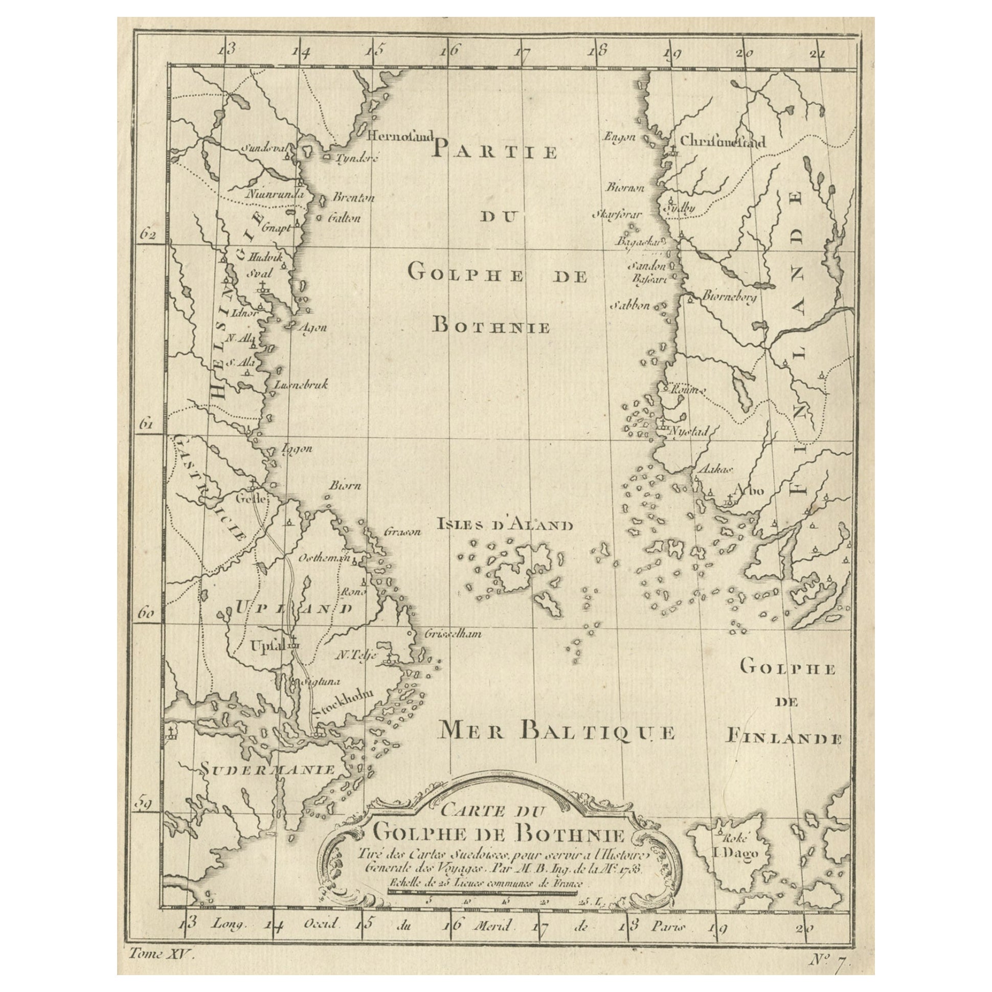
Antique map titled 'Suite du Golphe de Bothnie'.
Original antique map of the Gulf of Bothnia, the northernmost arm of the Baltic Sea. It is situated between Finland's west coast (Ostrobothnia) and Sweden's east coast (Westrobothnia and North Bothnia). This print originates from volume 19 of 'Histoire generale des voyages (..)' by Antoine Francois Prevost d'Exile.
Artists and Engravers: Published by Didot.
- Dimensions:Height: 9.85 in (25 cm)Width: 7.49 in (19 cm)Depth: 0 in (0.02 mm)
- Materials and Techniques:
- Period:1750-1759
- Date of Manufacture:1759
- Condition:Condition: Very good, general age-related toning. Minor wear and soiling, blank verso. Please study image carefully.
- Seller Location:Langweer, NL
- Reference Number:
About the Seller
5.0
Platinum Seller
These expertly vetted sellers are 1stDibs' most experienced sellers and are rated highest by our customers.
Established in 2009
1stDibs seller since 2017
1,929 sales on 1stDibs
Typical response time: <1 hour
- ShippingRetrieving quote...Ships From: Langweer, Netherlands
- Return PolicyA return for this item may be initiated within 14 days of delivery.
More From This SellerView All
- Old Map of the Gulf of Bothnia, the Northernmost Arm of the Baltic Sea, 1759Located in Langweer, NLAntique map titled 'Carte du Golphe de Bothnie'. Original antique map of the Gulf of Bothnia, the northernmost arm of the Baltic Sea. It is situated between Finland's west coast ...Category
Antique 1750s Maps
MaterialsPaper
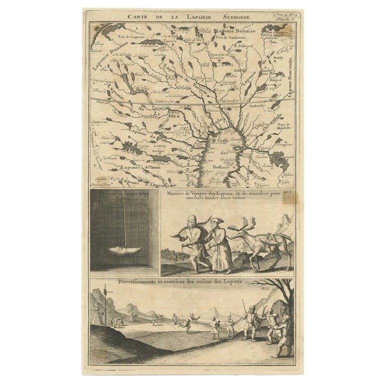
- Antique Map of Lapland Covering all of Sweden around the Gulf of Bothnia, 1714Located in Langweer, NLAntique map titled 'Carte de la Laponie Suedoise (..)'. Includes an inset map of Lapland covering all of Sweden around the Gulf of Bothnia. A series of ...Category
Antique 18th Century Maps
MaterialsPaper
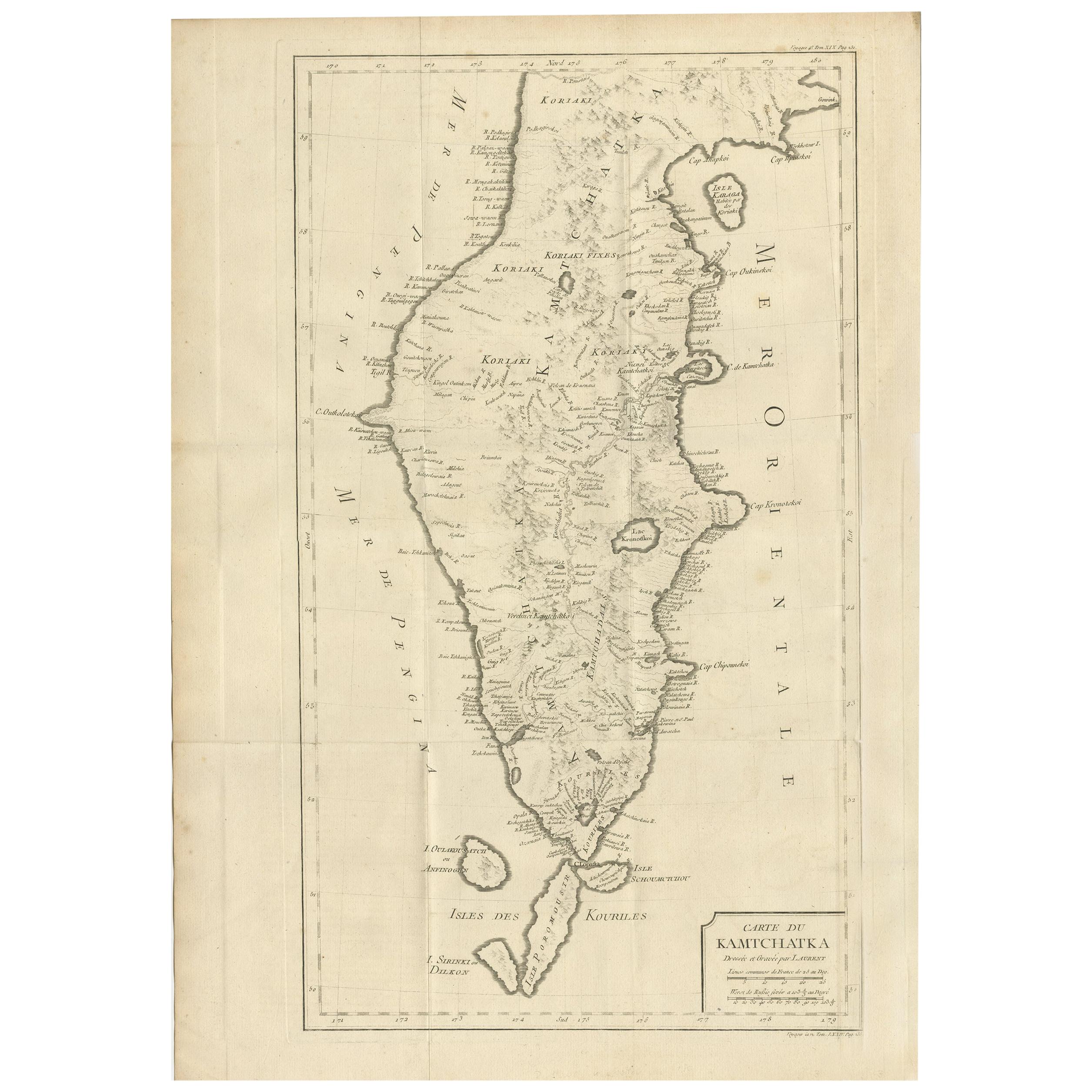
- Antique Map of Kamtchatka by Didot, '1759'Located in Langweer, NLAntique map titled 'Carte du Kamtchatka'. Antique map of the Kamchatka Peninsula. The map includes the island of Ouiakous Atch ou Anfinogen, Schoumctchou, and Sirinki ou Dilkon. Orig...Category
Antique Mid-18th Century Maps
MaterialsPaper
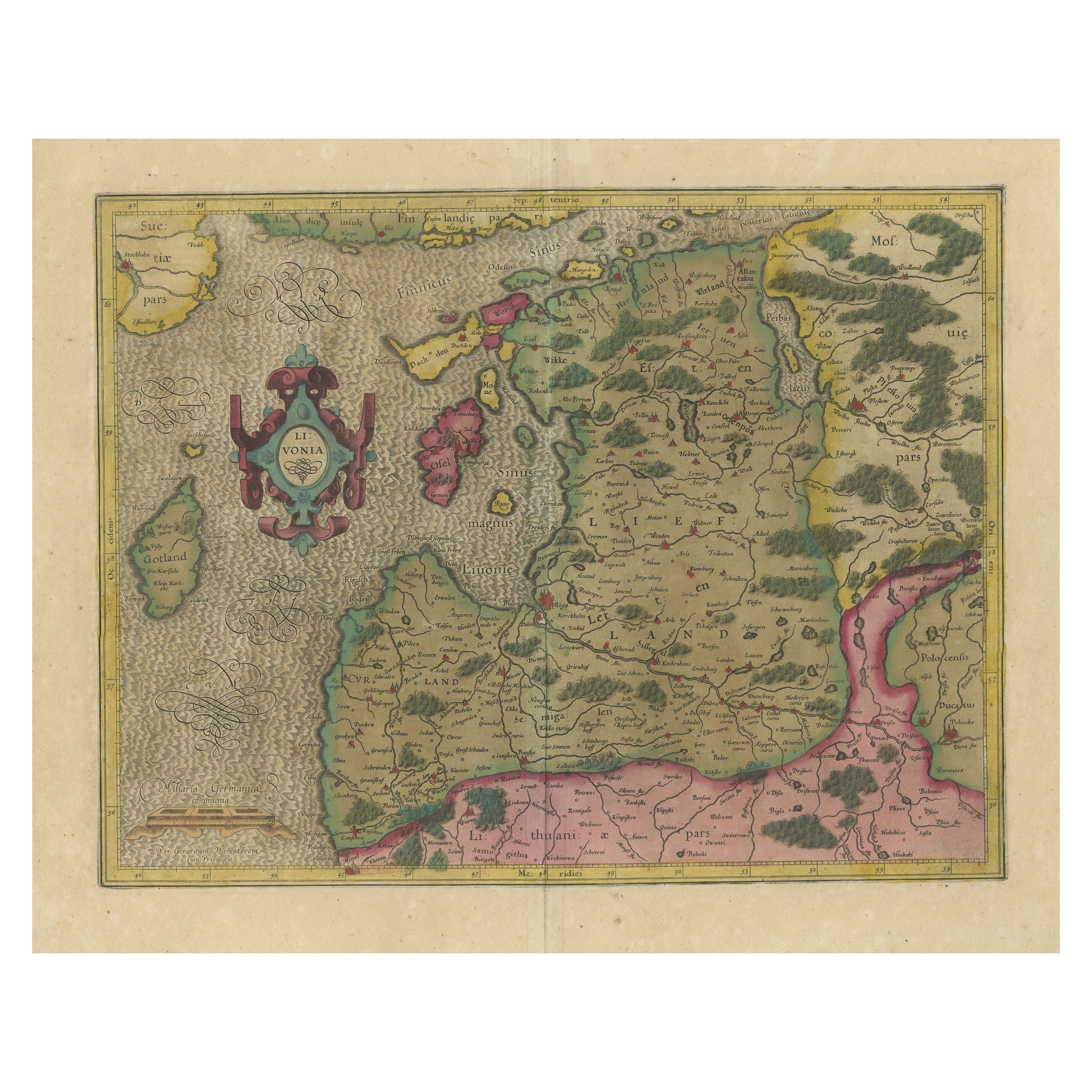
- Original Antique Map of the Northern Baltic RegionLocated in Langweer, NLTitle: "Livonia: Antique Map of the Northern Baltic Region" Description: This antique map, titled "Livonia," is a detailed representation of the northern Baltic region. Centered on ...Category
Antique Early 17th Century Maps
MaterialsPaper
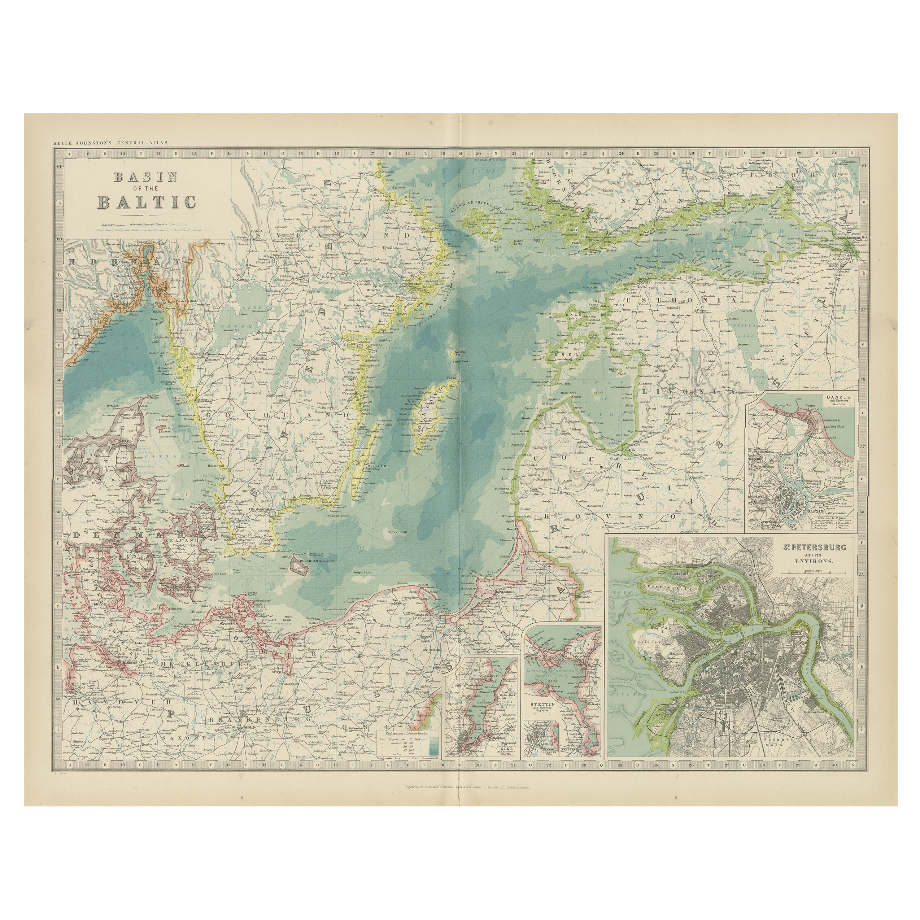
- Antique Map of the Baltic Sea by Johnston, '1909'Located in Langweer, NLAntique map titled 'Basin of the Baltic'. Original antique map of Baltic Sea. With inset maps of Kiel, Stettin, Danzig and St Petersburg. This map originate...Category
Early 20th Century Maps
MaterialsPaper
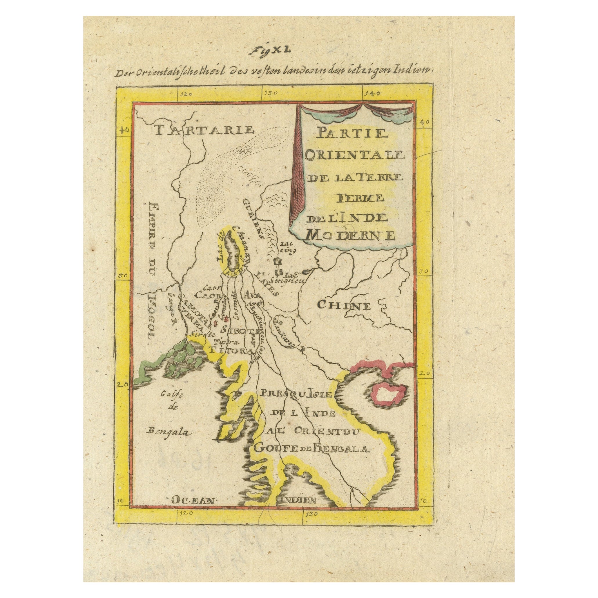
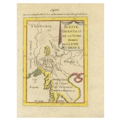
- Antique Map of India and the Gulf of Bengal by Mallet, c.1686Located in Langweer, NLAntique map titled ?Partie Orientale de la Terre Ferme de l'Inde Moderne. Small map of India and the Gulf of Bengal. This map originates from a German edition of 'Description de l' Univers'. Artists and Engravers: Alain Manesson Mallet (1630-1706) was a French cartographer and engineer. He started his career as a soldier in the army of Louis XIV, became a Sergeant-Major in the artillery and an Inspector of Fortifications. He also served under the King of Portugal, before returning to France, and his appointment to the court of Louis XIV. His military engineering and mathematical background led to his position teaching mathematics at court. His 'Description de L'Universe' contains a wide variety of information, including star maps...Category
Antique 17th Century Maps
MaterialsPaper


You May Also Like
- Original Antique Map of Ancient Greece, Phocis, Gulf of Corinth, 1787Located in St Annes, LancashireGreat map of Ancient Greece. Showing the region of Phocis, including the Gulf of Corinth Drawn by J.D. Barbie Du Bocage Copper plate engraving by P.F Tardieu Original hand c...Category
Antique 1780s French Other Maps
MaterialsPaper
- Hand-Colored 18th Century Homann Map of Denmark and Islands in the Baltic SeaBy Johann Baptist HomannLocated in Alamo, CAAn 18th century copper plate hand-colored map entitled "Insulae Danicae in Mari Balthico Sitae utpote Zeelandia, Fionia, Langelandia, Lalandia, Falstria, Fembria Mona" created by Joh...Category
Antique Early 18th Century German Maps
MaterialsPaper
- Map of the Republic of GenoaLocated in New York, NYFramed antique hand-coloured map of the Republic of Genoa including the duchies of Mantua, Modena, and Parma. Europe, late 18th century. Dimension: 25...Category
Antique Late 18th Century European Maps
- Antique Map of Principality of MonacoBy Antonio Vallardi EditoreLocated in Alessandria, PiemonteST/619 - "Old Geographical Atlas of Italy - Topographic map of ex-Principality of Monaco" - ediz Vallardi - Milano - A somewhat special edition ---Category
Antique Late 19th Century Italian Other Prints
MaterialsPaper
- Original Antique Map of The World by Thomas Clerk, 1817Located in St Annes, LancashireGreat map of The Eastern and Western Hemispheres On 2 sheets Copper-plate engraving Drawn and engraved by Thomas Clerk, Edinburgh. Published by Mackenzie And Dent, 1817 ...Category
Antique 1810s English Maps
MaterialsPaper
- Antique 18th Century Map of the Province of Pensilvania 'Pennsylvania State'Located in Philadelphia, PAA fine antique of the colony of Pennsylvania. Noted at the top of the sheet as a 'Map of the province of Pensilvania'. This undated and anonymous map is thought to be from the Gentleman's Magazine, London, circa 1775, although the general appearance could date it to the 1760's. The southern boundary reflects the Mason-Dixon survey (1768), the western boundary is placed just west of Pittsburgh, and the northern boundary is not marked. The map has a number of reference points that likely refer to companion text and appear to be connected to boundaries. The western and southern boundaries are marked Q, R, S, for example. A diagonal line runs from the Susquehanna R to the Lake Erie P. A broken line marked by many letters A, B, N, O, etc., appears in the east. There are no latitude or longitude markings, blank verso. Framed in a shaped contemporary gilt wooden frame and matted under a cream colored matte. Bearing an old Graham Arader Gallery...Category
Antique 18th Century British American Colonial Maps
MaterialsPaper


Recently Viewed
View AllMore Ways To Browse
Antique Office Suite
Antique Finland
Baltic Sea
East Coast Antiques
Antique Baltic
Map Of Sweden
Map Sweden
Sweden Antique Map
Map Baltics
Finland Map
Map Of Finland
Antique Maps Finland
Wood Carvings Of Ships
Classroom Furniture Used
Fine Antique Maps
17th Century World Map
Book Of Antique Maps
Antique French Globe