Items Similar to Antique Map of Lapland Covering all of Sweden around the Gulf of Bothnia, 1714

Want more images or videos?
Request additional images or videos from the seller
1 of 5
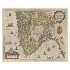
Antique Map of Lapland Covering all of Sweden around the Gulf of Bothnia, 1714
About the Item
Antique map titled 'Carte de la Laponie Suedoise (..)'. Includes an inset map of Lapland covering all of Sweden around the Gulf of Bothnia. A series of small vignettes in the lower section of the plate depicts the customs of the Lapps, their nomadic existence and their favorite pastimes. Artists and Engravers: Henri Abraham Chatelain (1684-1743) was a Huguenot pastor of Parisian origins. Chatelain proved a successful businessman, creating lucrative networks in London, The Hague, and then Amsterdam. He is most well known for the 'Atlas Historique', published in seven volumes between 1705 and 1720.
Artist: Henri Abraham Chatelain (1684-1743) was a Huguenot pastor of Parisian origins. Chatelain proved a successful businessman, creating lucrative networks in London, The Hague, and then Amsterdam. He is most well known for the 'Atlas Historique', published in seven volumes between 1705 and 1720.
Condition: Good, toning of tape on verso. Please study image carefully.
Date: 1714
Overall size: 22 x 37 cm.
Image size: 21 x 35.5 cm.
- Dimensions:Height: 8.67 in (22 cm)Width: 14.57 in (37 cm)Depth: 0 in (0.01 mm)
- Materials and Techniques:
- Period:
- Date of Manufacture:1714
- Condition:Condition: Good, toning of tape on verso. Please study image carefully.
- Seller Location:Langweer, NL
- Reference Number:
About the Seller
5.0
Platinum Seller
These expertly vetted sellers are 1stDibs' most experienced sellers and are rated highest by our customers.
Established in 2009
1stDibs seller since 2017
1,940 sales on 1stDibs
Typical response time: <1 hour
- ShippingRetrieving quote...Ships From: Langweer, Netherlands
- Return PolicyA return for this item may be initiated within 14 days of delivery.
More From This SellerView All
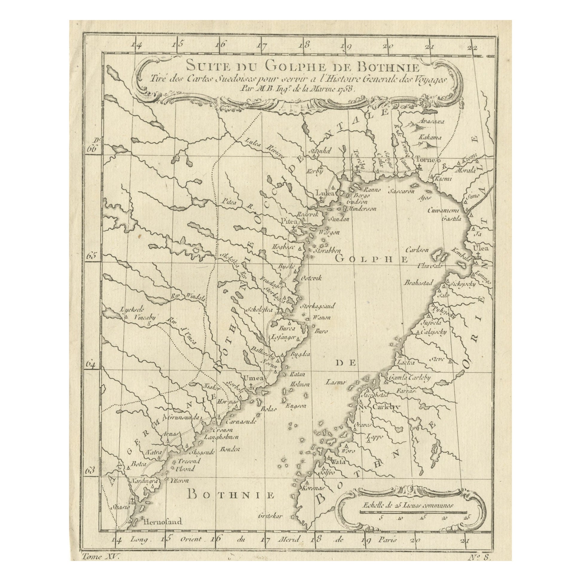
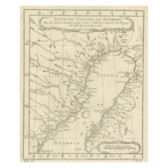
- Antique Map of the Gulf of Bothnia, the Northernmost Arm of the Baltic, 1759Located in Langweer, NLAntique map titled 'Suite du Golphe de Bothnie'. Original antique map of the Gulf of Bothnia, the northernmost arm of the Baltic Sea. It is situated between Finland's west coast ...Category
Antique 1750s Maps
MaterialsPaper
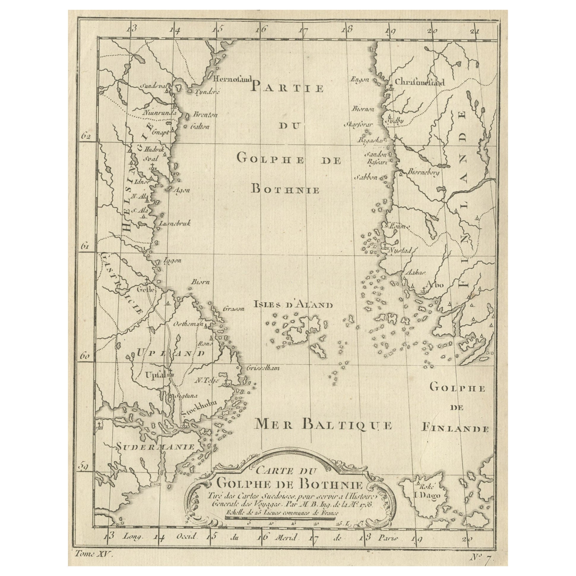
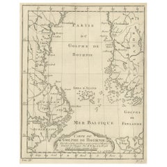
- Old Map of the Gulf of Bothnia, the Northernmost Arm of the Baltic Sea, 1759Located in Langweer, NLAntique map titled 'Carte du Golphe de Bothnie'. Original antique map of the Gulf of Bothnia, the northernmost arm of the Baltic Sea. It is situated between Finland's west coast ...Category
Antique 1750s Maps
MaterialsPaper
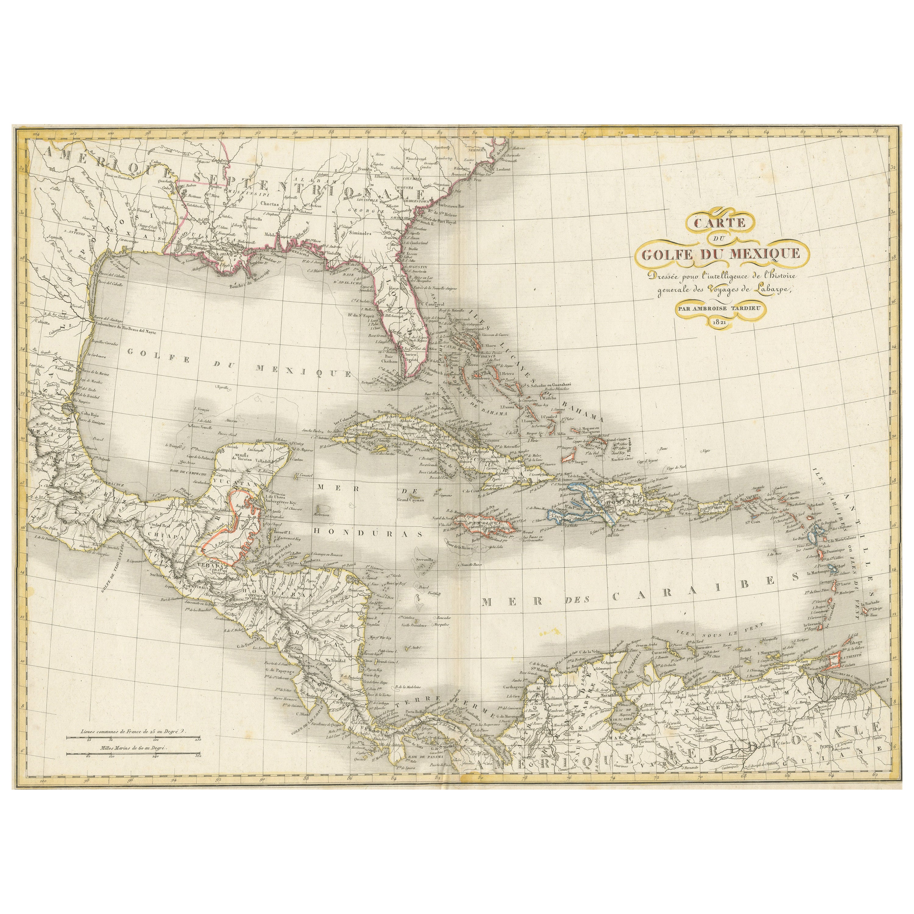
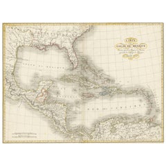
- Antique Map of the Gulf of Mexico and all the islands of the West IndiesLocated in Langweer, NLAntique map titled 'Carte du Golfe du Mexique'. This uncommon map depicts the Gulf of Mexico and all the islands of the West Indies. It also includes ni...Category
Antique Early 19th Century Maps
MaterialsPaper
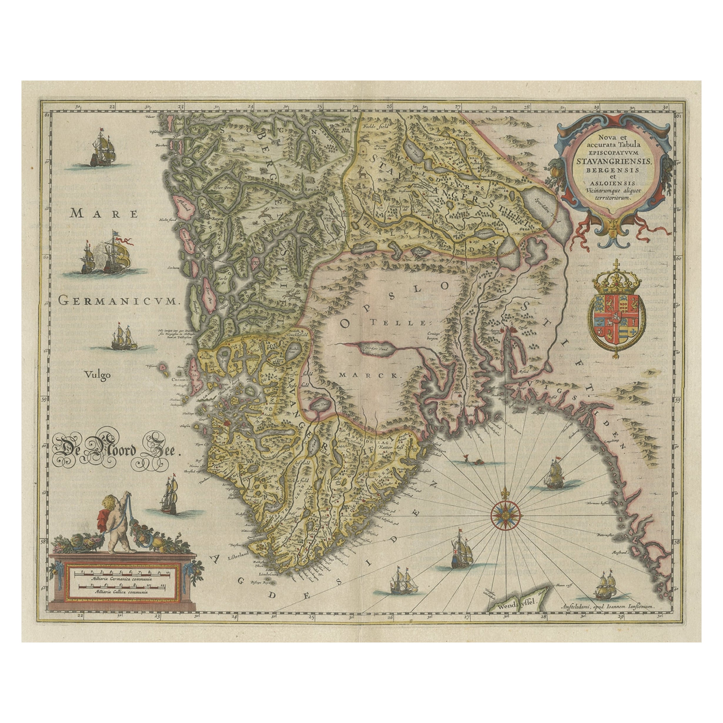
- Old Map of The Southern Part of Norway, Covering the Region Around Bergen, c1650Located in Langweer, NLAntique map titled 'Nova et Accurata Tabula Episcopatuum Stavangriensis et Asloiensis'. Old map of the southern part of Norway, it covers the region around Bergen. Decorated with...Category
Antique 1650s Maps
MaterialsPaper
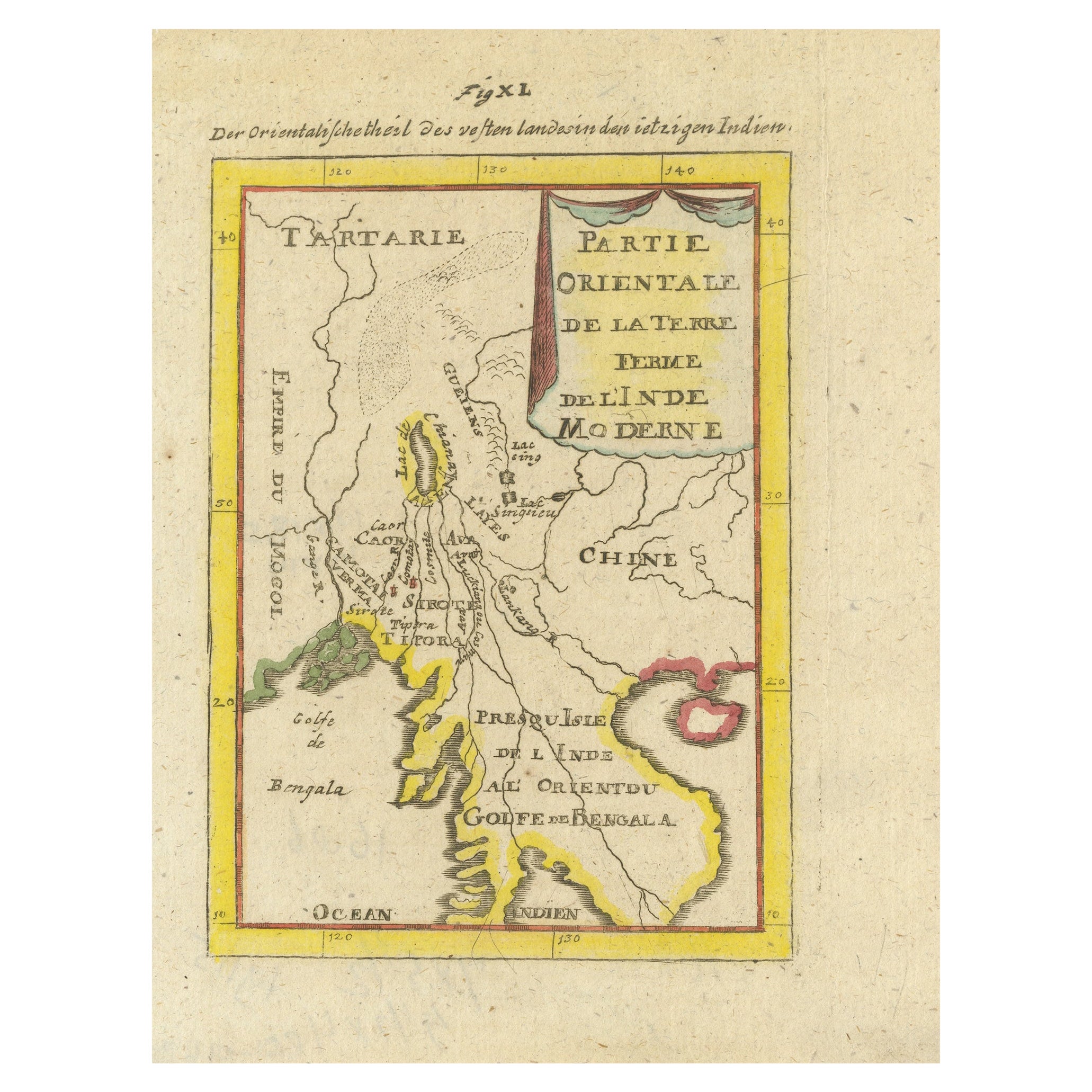
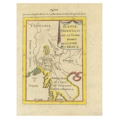
- Antique Map of India and the Gulf of Bengal by Mallet, c.1686Located in Langweer, NLAntique map titled ?Partie Orientale de la Terre Ferme de l'Inde Moderne. Small map of India and the Gulf of Bengal. This map originates from a German edition of 'Description de l' Univers'. Artists and Engravers: Alain Manesson Mallet (1630-1706) was a French cartographer and engineer. He started his career as a soldier in the army of Louis XIV, became a Sergeant-Major in the artillery and an Inspector of Fortifications. He also served under the King of Portugal, before returning to France, and his appointment to the court of Louis XIV. His military engineering and mathematical background led to his position teaching mathematics at court. His 'Description de L'Universe' contains a wide variety of information, including star maps...Category
Antique 17th Century Maps
MaterialsPaper
- Antique Map of the Gulf of Bengal by J.N. Bellin, circa 1760Located in Langweer, NLBeautiful chart of the Gulf of Bengal. The map extends from Malabar to Sumatra and today Phuket area in Thailand. Including Pegu, Ceylon, and the Andaman and Nicobar Islands. Numerou...Category
Antique Mid-18th Century Maps
MaterialsPaper

You May Also Like
- Original Antique Map of Sweden, Engraved by Barlow, 1806Located in St Annes, LancashireGreat map of Sweden Copper-plate engraving by Barlow Published by Brightly & Kinnersly, Bungay, Suffolk. 1806 Unframed.Category
Antique Early 1800s English Maps
MaterialsPaper
- Map of the Republic of GenoaLocated in New York, NYFramed antique hand-coloured map of the Republic of Genoa including the duchies of Mantua, Modena, and Parma. Europe, late 18th century. Dimension: 25...Category
Antique Late 18th Century European Maps
- Original Antique Map of Sweden and Norway, Grattan and Gilbert, 1843Located in St Annes, LancashireGreat map of Sweden and Norway Drawn and engraved by Archer Published by Grattan and Gilbert Original color Unframed.Category
Antique 1840s English Other Maps
MaterialsPaper
- Antique Map of Principality of MonacoBy Antonio Vallardi EditoreLocated in Alessandria, PiemonteST/619 - "Old Geographical Atlas of Italy - Topographic map of ex-Principality of Monaco" - ediz Vallardi - Milano - A somewhat special edition ---Category
Antique Late 19th Century Italian Other Prints
MaterialsPaper
- Antique 18th Century Map of the Province of Pensilvania 'Pennsylvania State'Located in Philadelphia, PAA fine antique of the colony of Pennsylvania. Noted at the top of the sheet as a 'Map of the province of Pensilvania'. This undated and anonymous map is thought to be from the Gentleman's Magazine, London, circa 1775, although the general appearance could date it to the 1760's. The southern boundary reflects the Mason-Dixon survey (1768), the western boundary is placed just west of Pittsburgh, and the northern boundary is not marked. The map has a number of reference points that likely refer to companion text and appear to be connected to boundaries. The western and southern boundaries are marked Q, R, S, for example. A diagonal line runs from the Susquehanna R to the Lake Erie P. A broken line marked by many letters A, B, N, O, etc., appears in the east. There are no latitude or longitude markings, blank verso. Framed in a shaped contemporary gilt wooden frame and matted under a cream colored matte. Bearing an old Graham Arader Gallery...Category
Antique 18th Century British American Colonial Maps
MaterialsPaper
- Original Antique Map of The World by Thomas Clerk, 1817Located in St Annes, LancashireGreat map of The Eastern and Western Hemispheres On 2 sheets Copper-plate engraving Drawn and engraved by Thomas Clerk, Edinburgh. Published by Mackenzie And Dent, 1817 ...Category
Antique 1810s English Maps
MaterialsPaper


Recently Viewed
View AllMore Ways To Browse
18th Century Small Swedish
A La Carte
Antique Map Series
Antique Swedish Plates
Map Of Sweden
Map Sweden
Sweden Antique Map
Antique Map Of Lapland
Amsterdam Map
Map Of Amsterdam
Antique Old Map Of The World
18th Russian Furniture
Furniture Russian 18th Century
Space Map
Antique Maps Of States
Antique South Africa
Antique Map Of Paris
Antique Maps Of Paris