Items Similar to Antique Map of the Baltic Sea by Johnston, '1909'


Want more images or videos?
Request additional images or videos from the seller
1 of 5
Antique Map of the Baltic Sea by Johnston, '1909'
About the Item
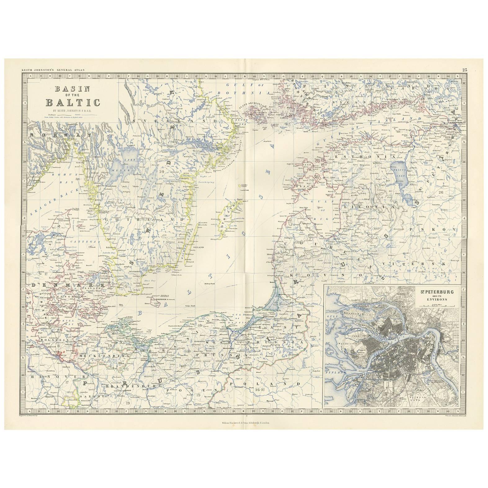
Antique map titled 'Basin of the Baltic'. Original antique map of Baltic Sea. With inset maps of Kiel, Stettin, Danzig and St Petersburg. This map originates from the ‘Royal Atlas of Modern Geography’. Published by W. & A.K. Johnston, 1909.
- Dimensions:Height: 19.49 in (49.5 cm)Width: 24.41 in (62 cm)Depth: 0.02 in (0.5 mm)
- Materials and Techniques:
- Period:
- Date of Manufacture:1909
- Condition:Minor fading. General age-related toning, some foxing. Please study image carefully.
- Seller Location:Langweer, NL
- Reference Number:
About the Seller
5.0
Platinum Seller
These expertly vetted sellers are 1stDibs' most experienced sellers and are rated highest by our customers.
Established in 2009
1stDibs seller since 2017
1,916 sales on 1stDibs
Typical response time: <1 hour
- ShippingRetrieving quote...Ships From: Langweer, Netherlands
- Return PolicyA return for this item may be initiated within 14 days of delivery.
More From This SellerView All
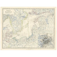
- Antique Map of the Surroundings of the Baltic Sea by A.K. Johnston, 1865Located in Langweer, NLAntique map titled 'Basin of the Baltic'. Depicting, Denmark, Sweden, Finland, Estonia, Poland, Prussia and more. With an inset map of St. Peterburg and environments. This map origin...Category
Antique Mid-19th Century Maps
MaterialsPaper
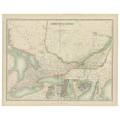
- Antique Map of Canada by Johnston '1909'Located in Langweer, NLAntique map titled 'Dominion of Canada'. Original antique map of Canada. With inset maps of Niagara, Montreal, Quebec. This map originates from t...Category
Early 20th Century Maps
MaterialsPaper
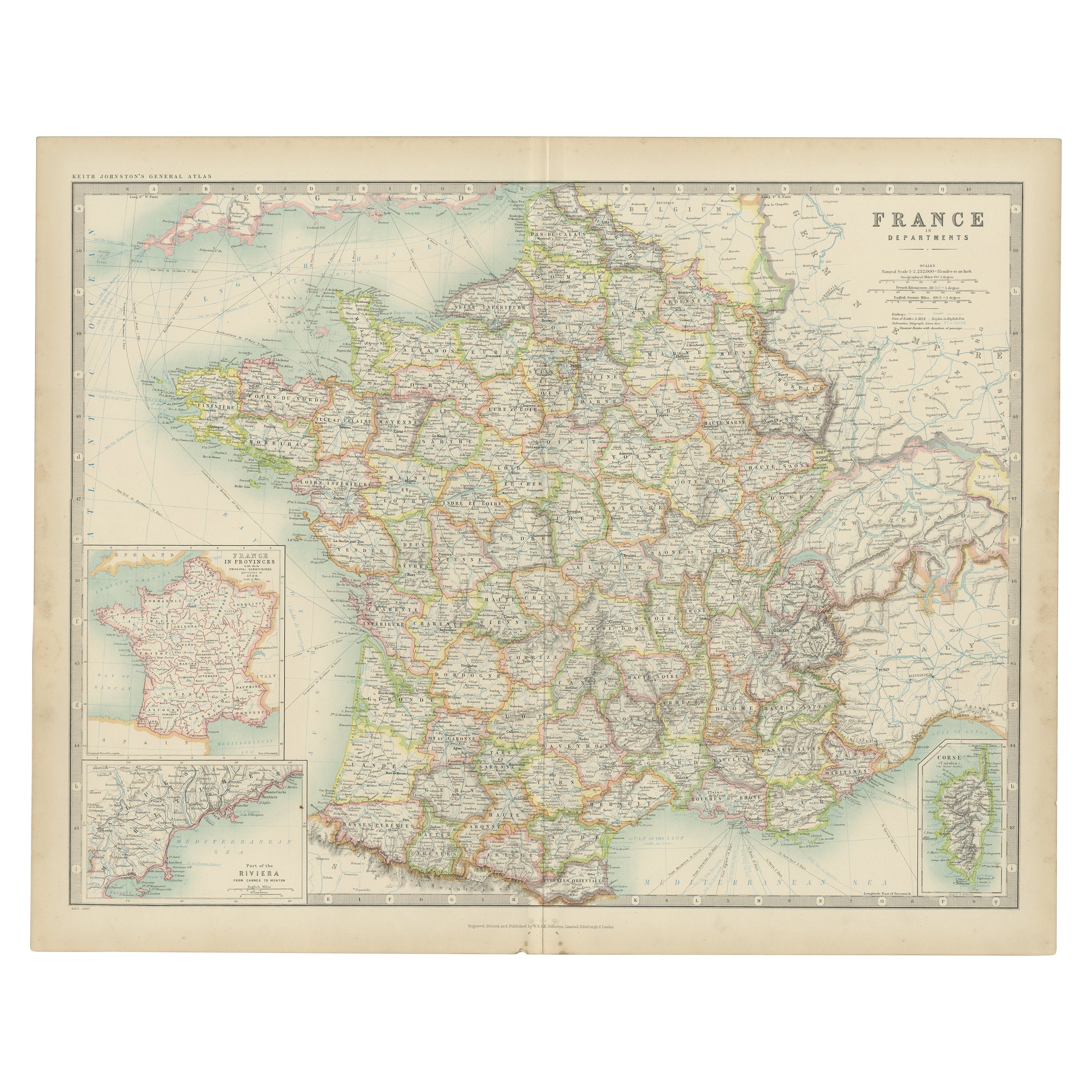
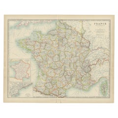
- Antique Map of France by Johnston (1909)Located in Langweer, NLAntique map titled 'France'. Original antique map of France. With inset maps of France in provinces, part of the Riviera and Corsica. This map or...Category
Early 20th Century Maps
MaterialsPaper
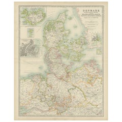
- Antique Map of Denmark by Johnston '1909'Located in Langweer, NLAntique map titled 'Denmark'. Original antique map of Denmark. With inset maps of Iceland, Faroe Island, and Copenhagen. This map originates from the ‘Royal Atlas of Modern Geography...Category
Early 20th Century Maps
MaterialsPaper
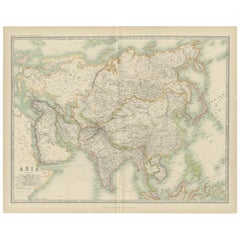
- Antique Map of Asia by Johnston '1909'Located in Langweer, NLAntique map titled 'Asia'. Depicting China, Japan, Indonesia, India, Arabia and more. This map originates from the ‘Royal Atlas of Modern Geography’. Published by W. & A.K. Johnston,...Category
Early 20th Century Maps
MaterialsPaper
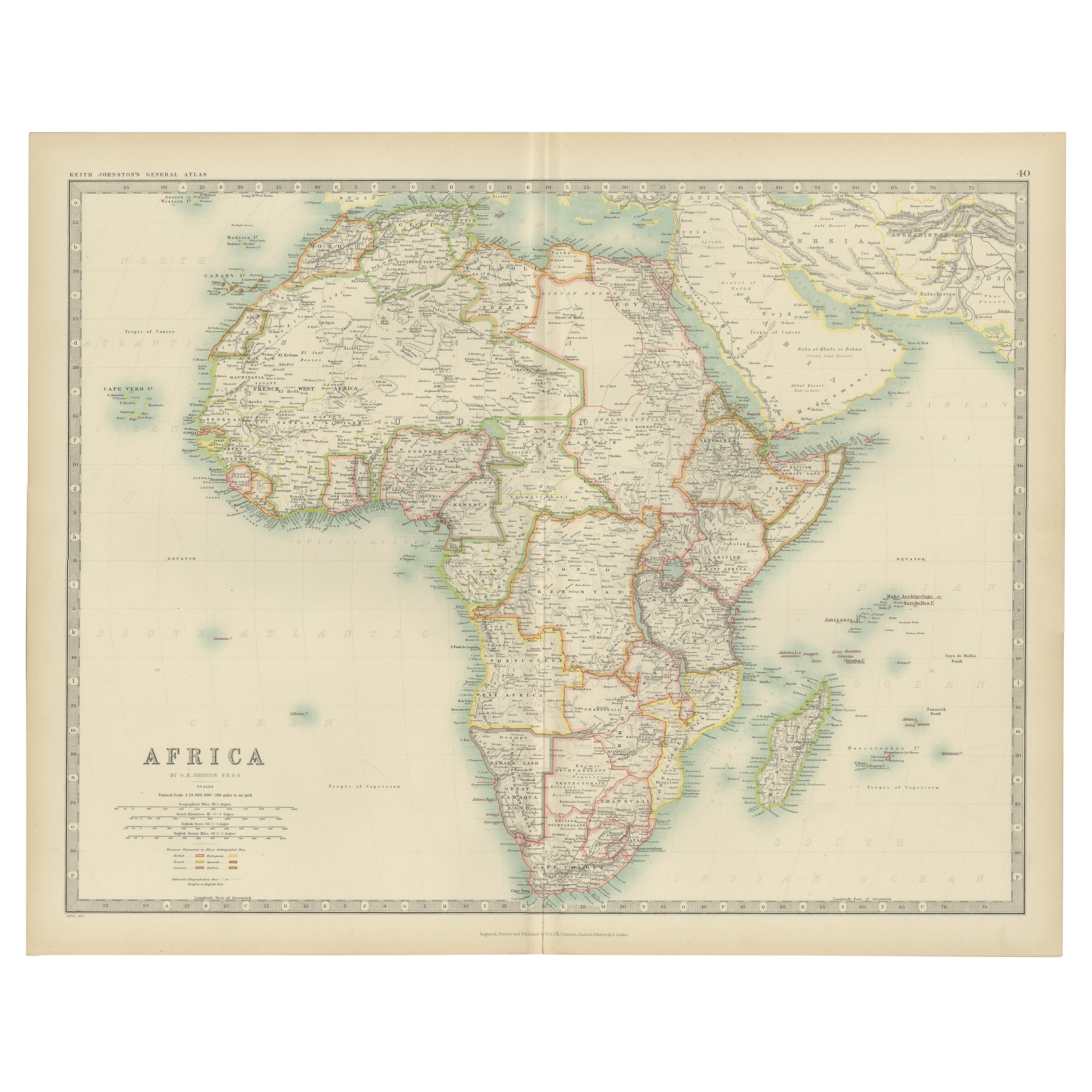
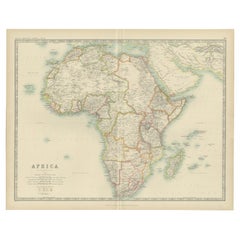
- Antique Map of Africa by Johnston (1909)Located in Langweer, NLAntique map titled 'Africa'. Original antique map of Africa. This map originates from the ‘Royal Atlas of Modern Geography’. Published by W. & A....Category
Early 20th Century Maps
MaterialsPaper
You May Also Like
- Hand-Colored 18th Century Homann Map of Denmark and Islands in the Baltic SeaBy Johann Baptist HomannLocated in Alamo, CAAn 18th century copper plate hand-colored map entitled "Insulae Danicae in Mari Balthico Sitae utpote Zeelandia, Fionia, Langelandia, Lalandia, Falstria, Fembria Mona" created by Joh...Category
Antique Early 18th Century German Maps
MaterialsPaper
- Original Antique Map of The Netherlands, Engraved by Barlow, Dated 1807Located in St Annes, LancashireGreat map of Netherlands Copper-plate engraving by Barlow Published by Brightly & Kinnersly, Bungay, Suffolk. Dated 1807 Unframed.Category
Antique Early 1800s English Maps
MaterialsPaper
- Map of the Republic of GenoaLocated in New York, NYFramed antique hand-coloured map of the Republic of Genoa including the duchies of Mantua, Modena, and Parma. Europe, late 18th century. Dimension: 25...Category
Antique Late 18th Century European Maps
- Antique Map of Italy by Andriveau-Goujon, 1843By Andriveau-GoujonLocated in New York, NYAntique Map of Italy by Andriveau-Goujon, 1843. Map of Italy in two parts by Andriveau-Goujon for the Library of Prince Carini at Palazzo Carini i...Category
Antique 1840s French Maps
MaterialsLinen, Paper
- Antique Map of Principality of MonacoBy Antonio Vallardi EditoreLocated in Alessandria, PiemonteST/619 - "Old Geographical Atlas of Italy - Topographic map of ex-Principality of Monaco" - ediz Vallardi - Milano - A somewhat special edition ---Category
Antique Late 19th Century Italian Other Prints
MaterialsPaper
- Original Antique Map of Russia By Arrowsmith. 1820Located in St Annes, LancashireGreat map of Russia Drawn under the direction of Arrowsmith Copper-plate engraving Published by Longman, Hurst, Rees, Orme and Brown, 1820 Unframed.Category
Antique 1820s English Maps
MaterialsPaper


