Items Similar to Antique Map of the Old Land of Batavia and Friesland by Halma, 1718

Want more images or videos?
Request additional images or videos from the seller
1 of 5
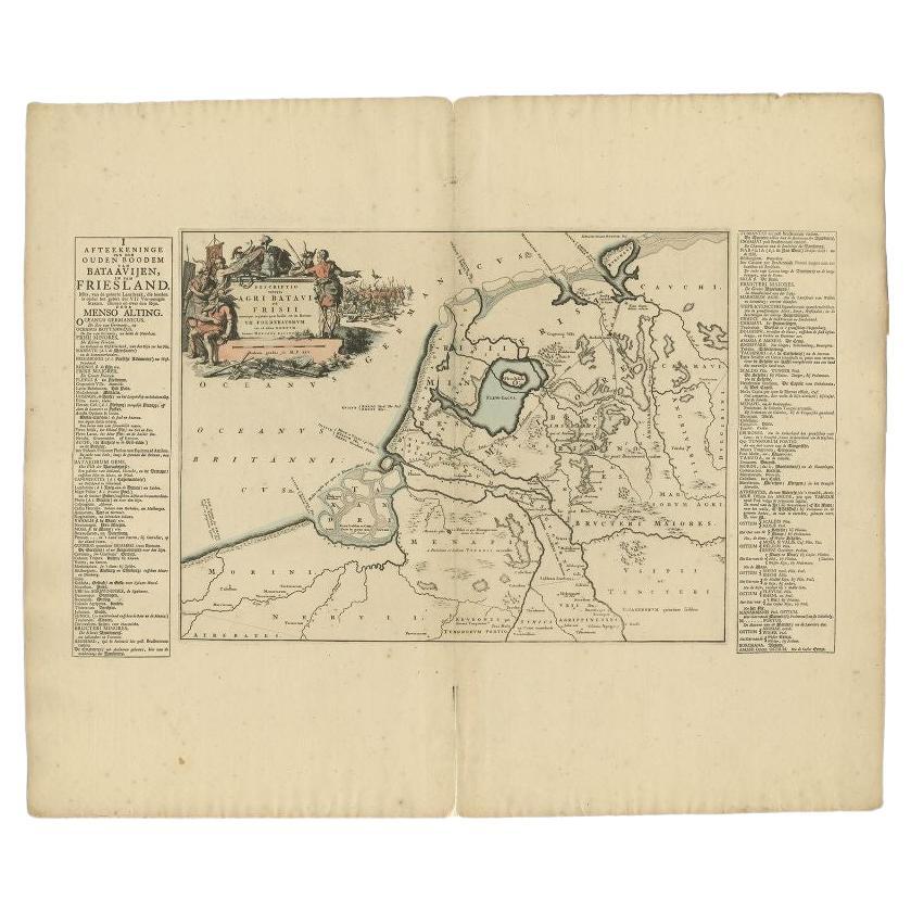
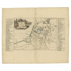
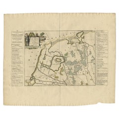
Antique Map of the Old Land of Batavia and Friesland by Halma, 1718
About the Item
Antique map Friesland titled 'Descriptio veteris Agri Batavi et Frisii (..)'. Old map of Friesland, the Netherlands. This map depicts the old land of Batavia and Friesland. Originates from 'Uitbeelding van de Heerlijkheid van Friesland' by Bernardus Schotanus à Sterringa. This atlas is considered the best atlas of Friesland, the Netherlands.
Artists and Engravers: Published by F. Halma, Leeuwarden.
Condition: Good, general age-related toning. Minor wear, blank verso. Some large creases and foxing. Please study image carefully.
Date: 1718
Overall size: 66 x 55 cm.
Image size: 42 x 32 cm.
We sell original antique maps to collectors, historians, educators and interior decorators all over the world. Our collection includes a wide range of authentic antique maps from the 16th to the 20th centuries. Buying and collecting antique maps is a tradition that goes back hundreds of years. Antique maps have proved a richly rewarding investment over the past decade, thanks to a growing appreciation of their unique historical appeal. Today the decorative qualities of antique maps are widely recognized by interior designers who appreciate their beauty and design flexibility. Depending on the individual map, presentation, and context, a rare or antique map can be modern, traditional, abstract, figurative, serious or whimsical. We offer a wide range of authentic antique maps for any budget.
- Dimensions:Height: 21.66 in (55 cm)Width: 25.99 in (66 cm)Depth: 0 in (0.01 mm)
- Materials and Techniques:
- Period:
- Date of Manufacture:1718
- Condition:
- Seller Location:Langweer, NL
- Reference Number:
About the Seller
5.0
Platinum Seller
These expertly vetted sellers are 1stDibs' most experienced sellers and are rated highest by our customers.
Established in 2009
1stDibs seller since 2017
1,933 sales on 1stDibs
Typical response time: <1 hour
- ShippingRetrieving quote...Ships From: Langweer, Netherlands
- Return PolicyA return for this item may be initiated within 14 days of delivery.
More From This SellerView All
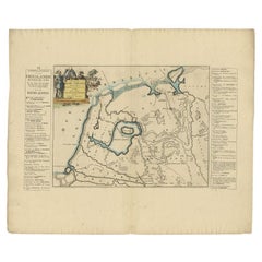
- Antique Map of the Old Land of Batavia and FriesLand by Halma, 1718Located in Langweer, NLAntique map Friesland titled 'Descriptio veteris Agri Batavi et Frisii (..)'. Old map of Friesland, the Netherlands. This map depicts the old land of Batavia and Friesland. Originate...Category
Antique 18th Century Maps
MaterialsPaper
- Antique Map of the Old Land of Batavia and Friesland by Halma, 1718Located in Langweer, NLAntique map Friesland titled 'Descriptio veteris Agri Batavi et Frisii (..)'. Old map of Friesland, the Netherlands. This map depicts the old land of Batavia and Friesland. Originate...Category
Antique 18th Century Maps
MaterialsPaper
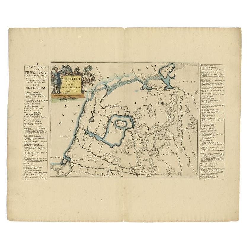
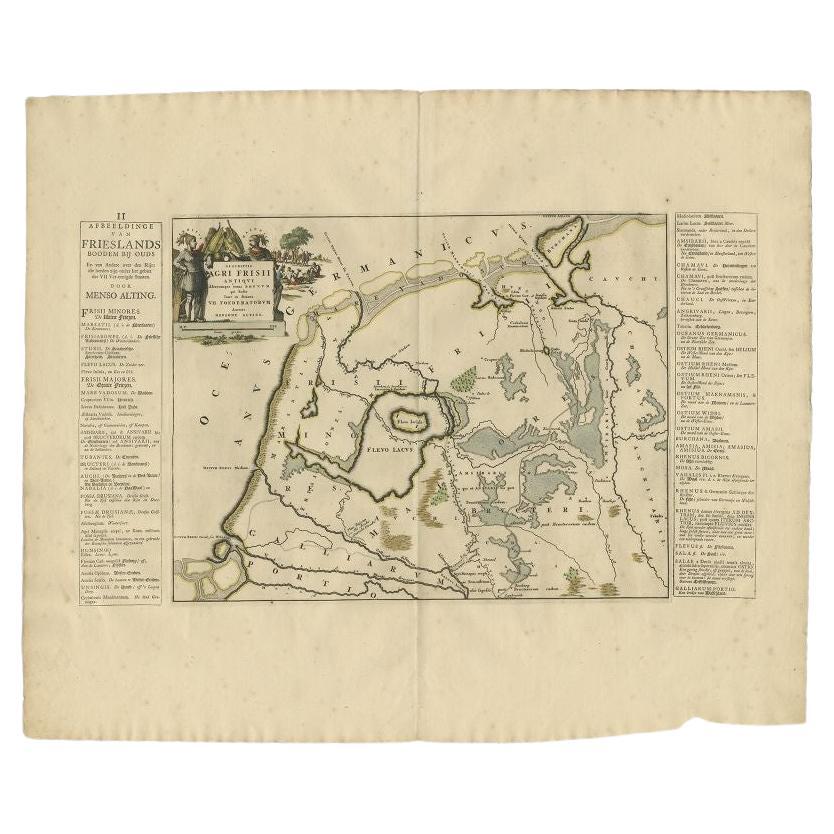
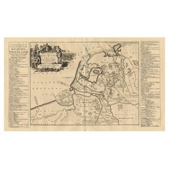
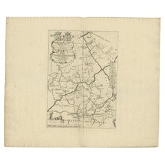
- Antique Map of the Old Lands of Friesland by Halma, 1718Located in Langweer, NLAntique map Friesland titled 'Descriptio Agri Frisii (..)'. Old map of Friesland, the Netherlands. This map depicts the old lands of Friesland. Originates from 'Uitbeelding van de He...Category
Antique 18th Century Maps
MaterialsPaper
- Antique Map of the Old Lands of FriesLand by Halma, 1718Located in Langweer, NLAntique map Friesland titled 'Descriptio Agri Frisii (..)'. Old map of Friesland, the Netherlands. This map depicts the old lands of Friesland. Originates from 'Uitbeelding van de He...Category
Antique 18th Century Maps
MaterialsPaper
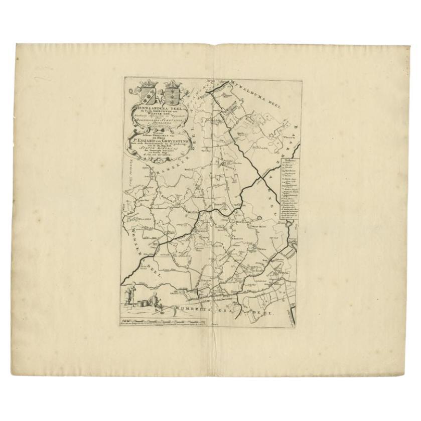
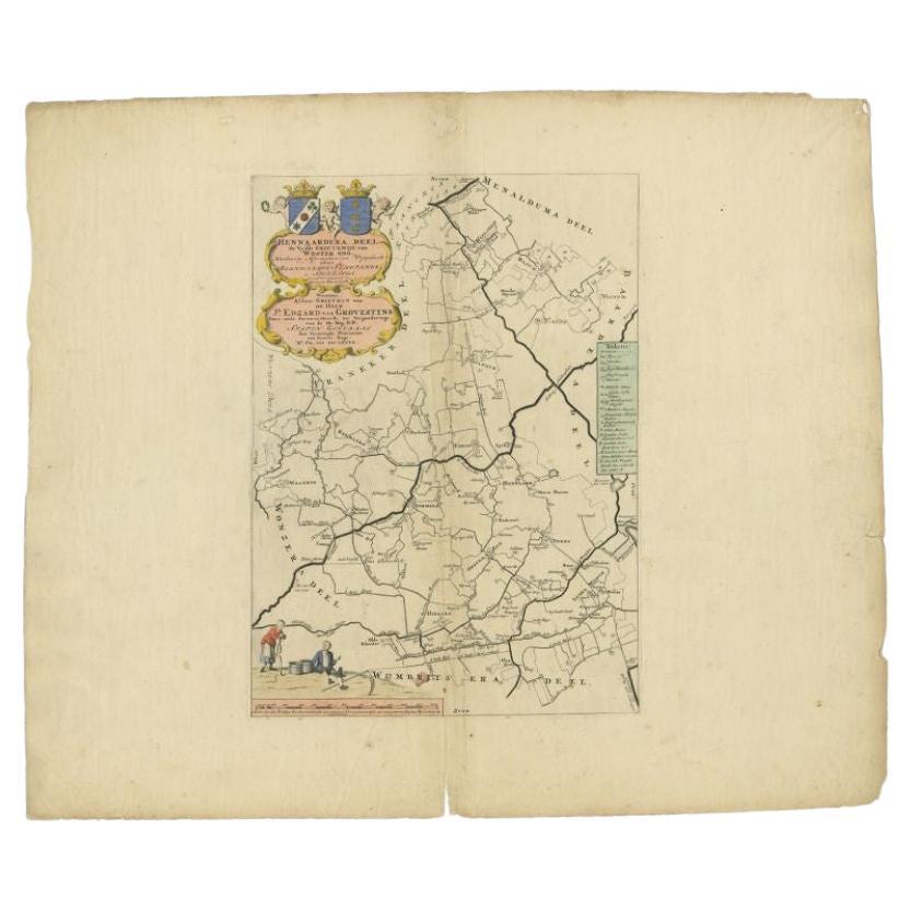
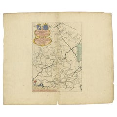
- Antique Map of the Hennaarderadeel Township 'Friesland' by Halma, 1718Located in Langweer, NLAntique map Friesland titled 'Hennaardera Deel de Vyfde Grietenije van Wester Goo (..)'. Old map of Friesland, the Netherlands. This map depicts the region of...Category
Antique 18th Century Maps
MaterialsPaper
You May Also Like
- 1861 Topographical Map of the District of Columbia, by Boschke, Antique MapLocated in Colorado Springs, COPresented is an original map of Albert Boschke's extremely sought-after "Topographical Map of the District of Columbia Surveyed in the Years 1856 ...Category
Antique 1860s American Historical Memorabilia
MaterialsPaper
- The Holy Land at the Time of Jesus: A 17th Century Dutch Map by VisscherBy Nicolaes Visscher IILocated in Alamo, CAThis detailed Dutch map entitled "Het Beloofe de Landt Canaan door wandelt van onsen Salichmaecker Iesu Christo, nessens syne Apostelen" by Nicolaes Visscher was published in Amsterd...Category
Antique Mid-17th Century Dutch Maps
MaterialsPaper
- Old Nautical Map of CorsicaLocated in Alessandria, PiemonteST/556/1 - Old map of Corsica isle, surveyed by Captain Hell, of the French Royal Navy in 1824, engraved and published on 1874, with additions and corre...Category
Antique Early 19th Century English Other Prints
MaterialsPaper
- Old Horizontal Map of EnglandBy TassoLocated in Alessandria, PiemonteST/520 - Old rare Italian map of England, dated 1826-1827 - by Girolamo Tasso, editor in Venise, for the atlas of M.r Le-Sage.Category
Antique Early 19th Century Italian Other Prints
MaterialsPaper
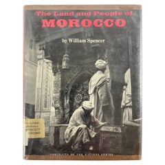
- The Land and People of Morocco by William Spencer, 1973Located in North Hollywood, CAThe land and people of Morocco (Portraits of the nations series) Hardcover – January 1, 1973 by William Spencer (Author) Introduces the land, histo...Category
20th Century Moroccan Moorish Books
MaterialsPaper
- Map of the Holy Land "Carte de la Syrie et de l'Egypte" by Pierre M. LapieBy Pierre M. LapieLocated in Alamo, CAAn early 19th century map of ancient Syria and Egypt entitled "Carte de la Syrie et de l'Egypte anciennes/dressée par M. Lapie, Colonel d'Etat Major, et...Category
Antique Early 19th Century French Maps
MaterialsPaper


Recently Viewed
View AllMore Ways To Browse
Batavia Furniture
Large Map Of The Netherlands
Batavia Map
Medieval Plate
Antique Depot
Kings Court
Large Framed Maps
Ships Log
Royal Carriage
Antique Map Australia
Australia Antique Map
Antique Australian Maps
Antique Maps Of Australia
Antique Map Of Australia
Antique Australia Map
Antique Australian Map
Antique Furniture In The Philippines
Large Framed Antique Maps