Items Similar to Neatly Framed Decorative Hand-Colored View of Zierikzee, the Netherlands, 1858
Want more images or videos?
Request additional images or videos from the seller
1 of 6
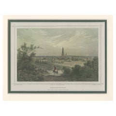
Neatly Framed Decorative Hand-Colored View of Zierikzee, the Netherlands, 1858
About the Item
Antique print titled 'Zierikzee'.
View of the city of Zierikzee, the Netherlands. This print originates from 'Het koningrijk der Nederlanden voorgesteld in eene reeks van 136 naar de natuur geteekende schilderachtige gezigten' authored by J. L. Terwen and published by G.B. van Goor in Gouda, 1858.
Artists and engravers: Johannes Leonardus Terwen (1813-1873). Terwen enjoyed a good education to become a teacher. On July 14, 1840 he became the principal of the 'Bijzondere School' in Gouda. Later he was a teacher at the latin school in Gouda, but he seemed to experience a larger calling to become an author.
- Dimensions:Height: 11.93 in (30.3 cm)Width: 13.47 in (34.2 cm)Depth: 0 in (0.02 mm)
- Materials and Techniques:
- Period:
- Date of Manufacture:1858
- Condition:Condition: Very good, general age-related toning. Frame included, lightly used. Please study image carefully.
- Seller Location:Langweer, NL
- Reference Number:
About the Seller
5.0
Platinum Seller
These expertly vetted sellers are 1stDibs' most experienced sellers and are rated highest by our customers.
Established in 2009
1stDibs seller since 2017
1,929 sales on 1stDibs
Typical response time: <1 hour
- ShippingRetrieving quote...Ships From: Langweer, Netherlands
- Return PolicyA return for this item may be initiated within 14 days of delivery.
More From This SellerView All
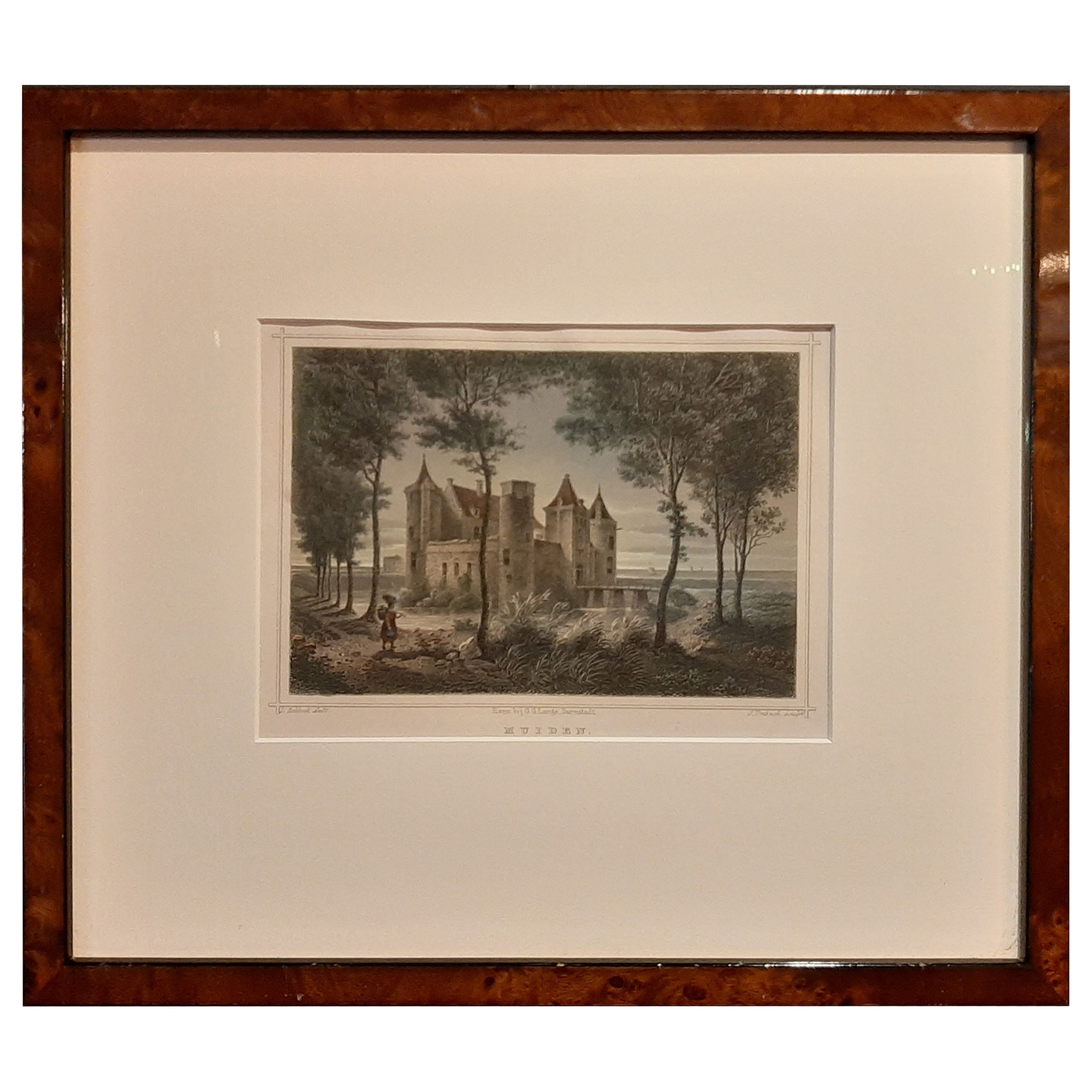
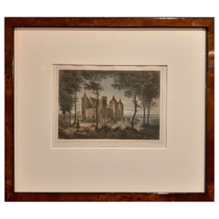
- Nicely Framed View of Muiden Castle, the Netherlands, 1858Located in Langweer, NLAntique print titled 'Muiden'. View of Muiden Castle, the Netherlands. This print originates from 'Het koningrijk der Nederlanden voorgesteld in eene reeks van 136 naar de natuur get...Category
Antique 1850s Prints
MaterialsPaper
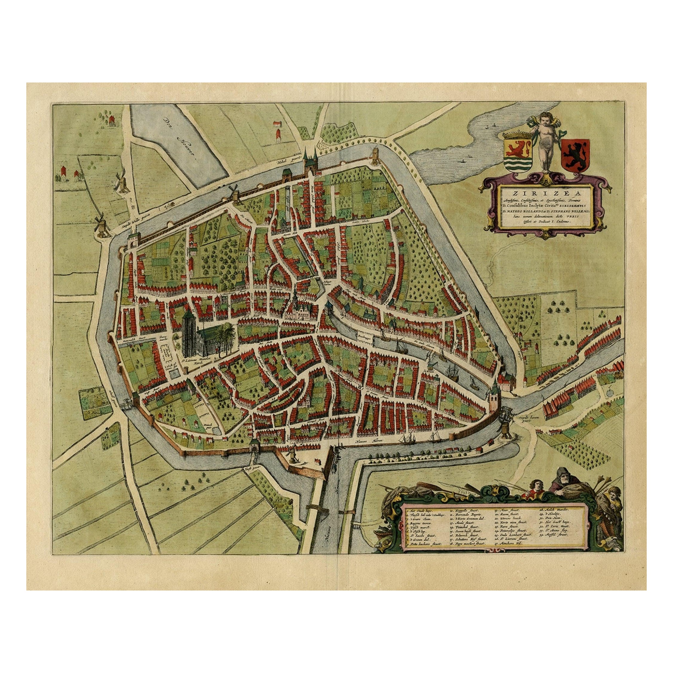
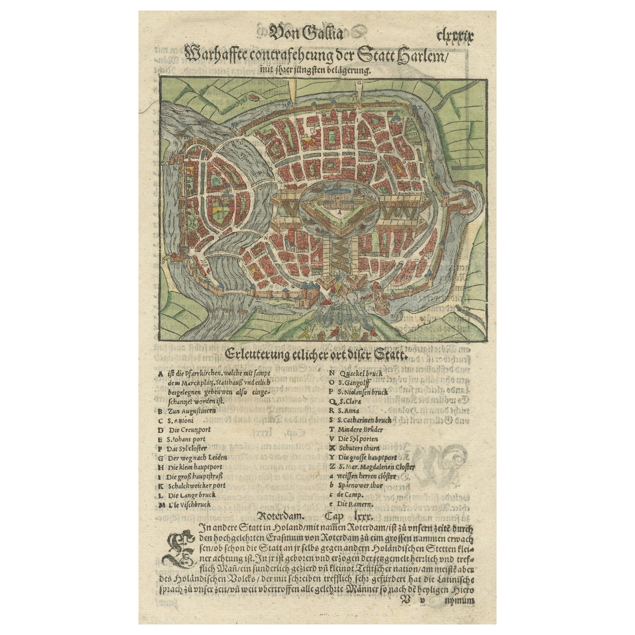
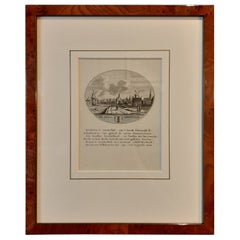
- Antique Bird's-eye View Plan of Zierikzee in Zeeland, The Netherlands, 1649Located in Langweer, NLAntique print, titled: 'Zirizea.' - A bird's-eye view plan of Zierikzee in The Netherlands, with key to locations and coats of arms. After Matheo Rollando and Stephano Bellemo. Latin tekst on verso. From the city Atlas: 'Toneel der Steeden' published by Joan Blaeu...Category
Antique 1640s Maps
MaterialsPaper
- Nicely Hand-Colored View of the City of Amersfoort, The Netherlands, 1858Located in Langweer, NLAntique print titled 'Amersfoort van den Appelenweg gezien'. View of the city of Amersfoort, the Netherlands. This print originates from 'Het koningrijk der Nederlanden voorgeste...Category
Antique 1850s Prints
MaterialsPaper
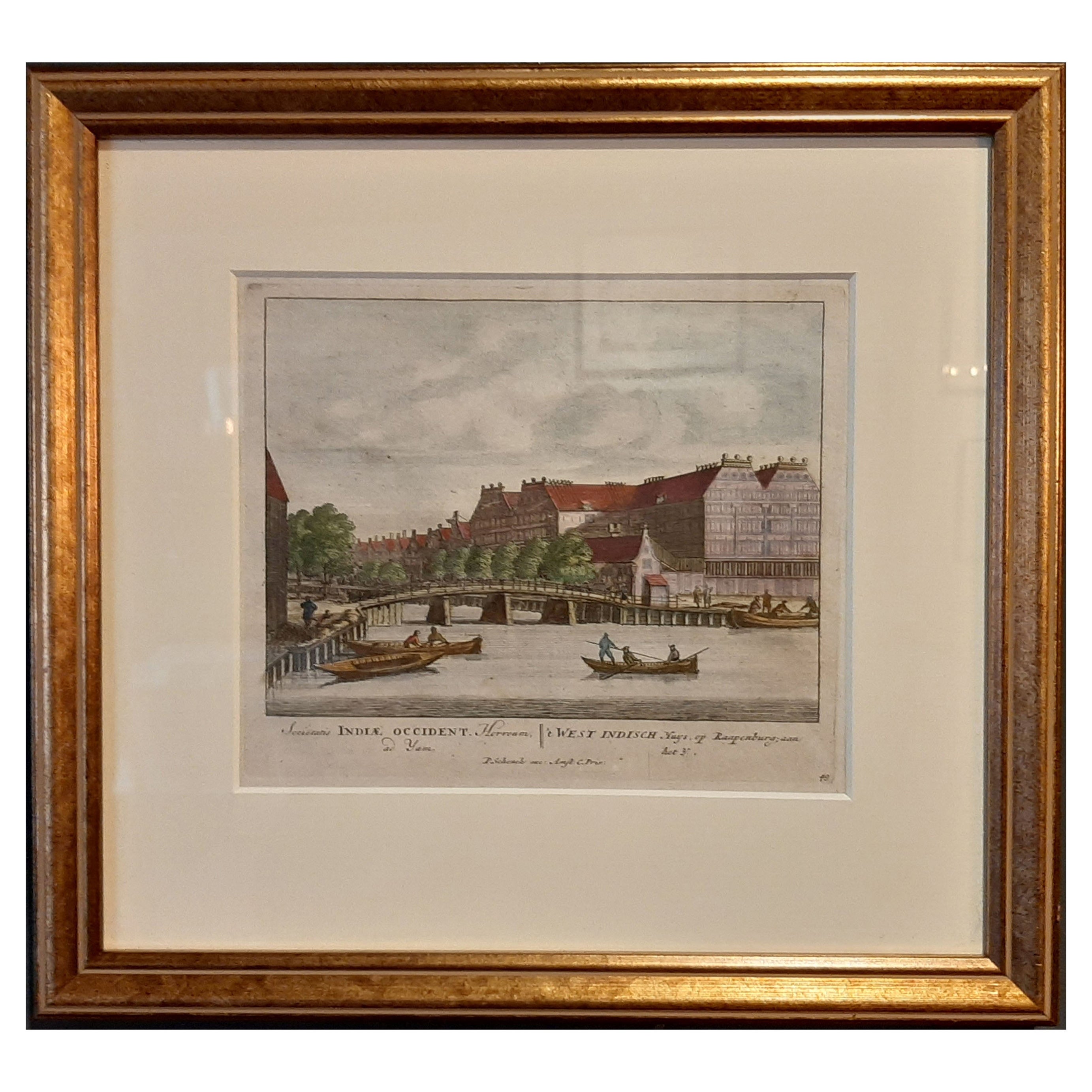
- Framed View of the Brouwersgracht in Amsterdam, the Netherlands, 1708Located in Langweer, NLAntique print titled 'Societatis Indiae Occident (..) - West Indisch Huys op Raapenburg (..)'. Despite the title suggesting this print is a view of the West-Indisch House in Amst...Category
Antique Early 1700s Maps
MaterialsPaper
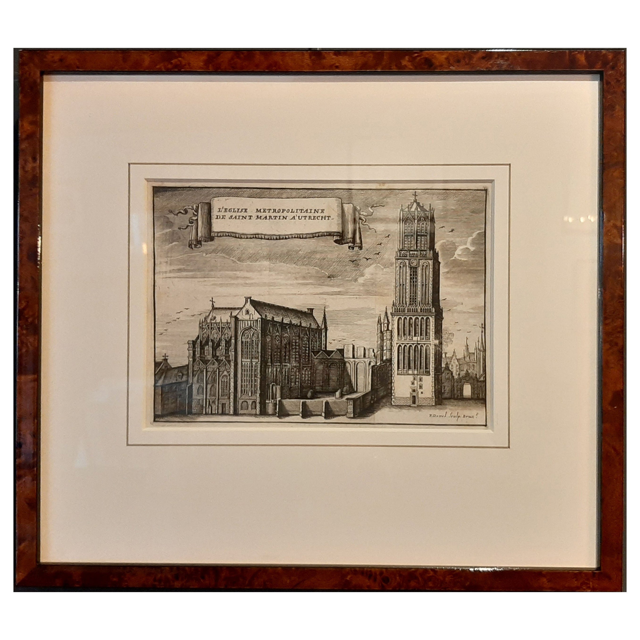
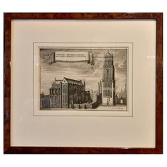
- Framed View of St. Martin's Cathedral or Domkerk, Utrecht, The Netherlands, 1770Located in Langweer, NLAntique print titled 'L'Eglise Metropolitaine de Saint Martin a' Utrecht'. View of St. Martin's Cathedral in Utrecht, also known as 'Domkerk'. Artists and Engravers: Publishe...Category
Antique 1770s Prints
MaterialsPaper
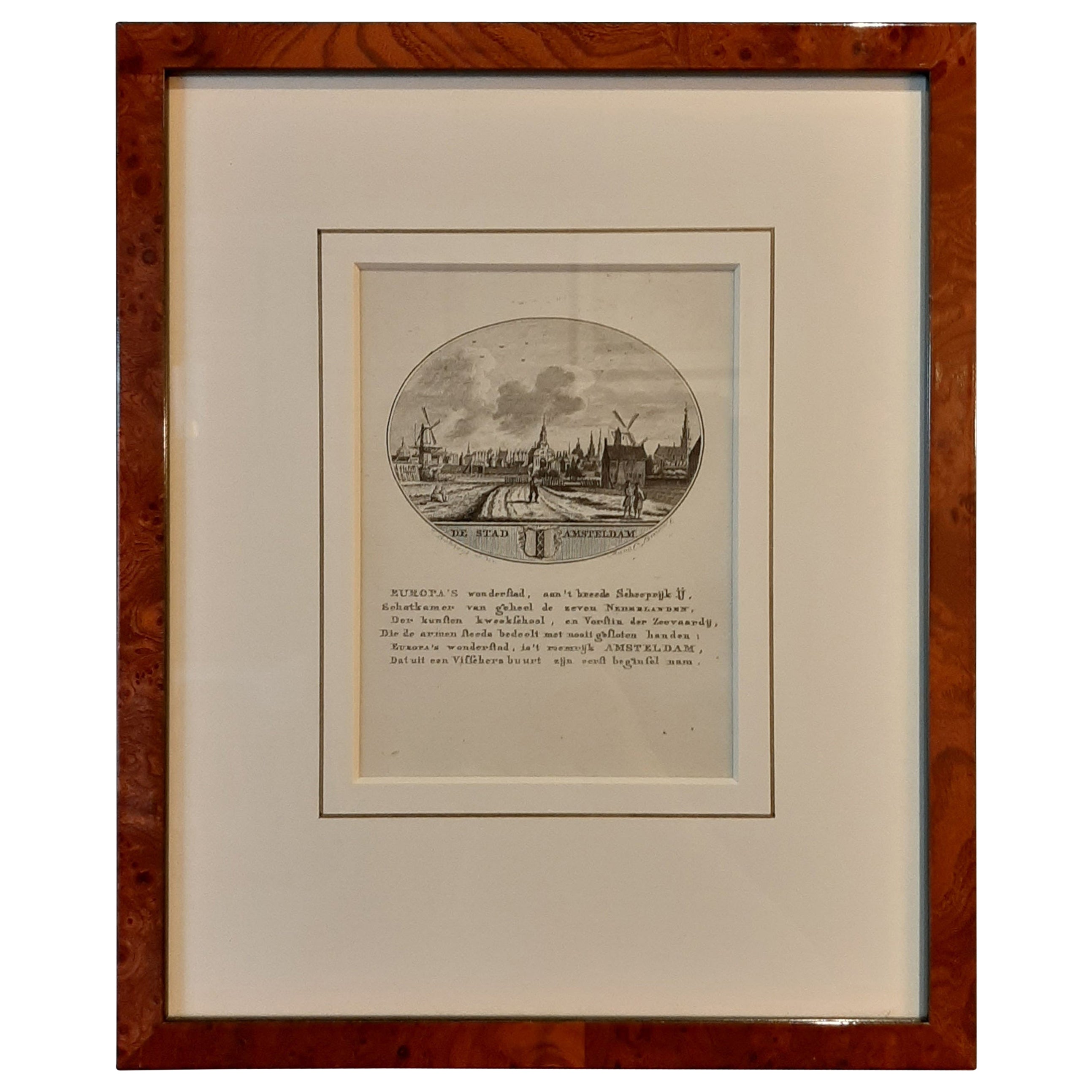
- Nicely Framed View on the 'Spaarndammerdijk' in Amsterdam, the Netherlands, 1795Located in Langweer, NLAntique print titled 'De Stad Amsteldam'. View on the 'Spaarndammerdijk' in the city of Amsterdam, the Netherlands. This print originates from 'De Nederlandsche stad- en dorp-besc...Category
Antique 1790s Prints
MaterialsPaper

You May Also Like
- N.E. View of the United States Capitol, Washington, DC Antique Proof Print 1858Located in Colorado Springs, COThis engraved print shows a view of the United States Capitol Building, in Washington, D.C. The print depicts the neoclassical building from the northeast orientation, with a bustling street scene in front. The steel engraving is a proof printing, drawn and engraved by Henry Sartain and published in 1858. Plans began in May 1854 to build a new cast-iron dome for the United States Capitol. The then-architect of the Capitol Thomas Walter and his team were sold on the aesthetics of a new dome, as well as the utility of a fire-proof one. A year later, on March 3, 1855, President Franklin Pierce...Category
Antique 1850s American Prints
MaterialsPaper
- City View of Nuremberg, Germany: An 18th Century Hand-Colored Map by M. SeutterBy Matthew SeutterLocated in Alamo, CAAn 18th century hand-colored city view of Nuremburg, Germany entitled "Geometrischer Grundris der des Heiligen Römischen Reichs Freyen Stadt Nürnberg" by Matthaus Seutter from his "A...Category
Antique Mid-18th Century German Maps
MaterialsPaper
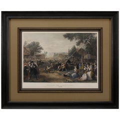
- "Raising the Liberty Pole" Hand-Colored Antique Print, 1875Located in Colorado Springs, COThis nineteenth-century engraving shows a liberty pole being raised in a town square in 1776, while a sign bearing the face of King George III is removed in the background. The rioto...Category
Antique 1870s American Historical Memorabilia
MaterialsPaper
- Hand-Colored 18th Century Homann Map of the Danube, Italy, Greece, CroatiaBy Johann Baptist HomannLocated in Alamo, CA"Fluviorum in Europa principis Danubii" is a hand colored map of the region about the Danube river created by Johann Baptist Homann (1663-1724) in his 'Atlas Novus Terrarum', publish...Category
Antique Early 18th Century German Maps
MaterialsPaper
- South America: Hand-colored 18th Century Framed Map by Thomas JefferysBy Thomas JefferysLocated in Alamo, CAThis detailed hand-colored map of South America by Thomas Jefferys was published in London in 1750. The map shows countries, early colonial possessions, towns, rivers, mountains, and...Category
Antique Mid-18th Century English Maps
MaterialsPaper
- The Kingdom of Naples and Southern Italy: A Hand-Colored 18th Century Homann MapBy Johann Baptist HomannLocated in Alamo, CA"Novissima & exactissimus Totius Regni Neapolis Tabula Presentis Belli Satui Accommo Data" is a hand colored map of southern Italy and the ancient Kingdom of Naples created by Johann...Category
Antique Early 18th Century German Maps
MaterialsPaper


Recently Viewed
View AllMore Ways To Browse
J B G
Antique School Map
Antique School Maps
Large Framed Maps
Large Framed Antique Maps
Large Antique City Maps
Large Map Of The Netherlands
18th Century Southern Antiques
Antique French Globe
South African Antique Furniture
Antique Furniture South Africa
Used Booksellers
Used Bookseller
Antique British Maps
Antique 17th Century World Map
Scotland Map
General Empire
Wood And Sons Plate