Items Similar to Beautiful Decorative Antique Map of the City of Dordrecht, the Netherlands, 1581

Want more images or videos?
Request additional images or videos from the seller
1 of 5
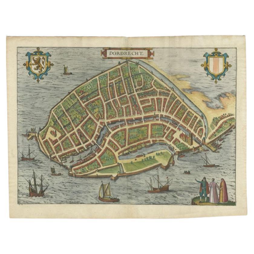
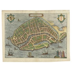
Beautiful Decorative Antique Map of the City of Dordrecht, the Netherlands, 1581
About the Item
Antique map titled 'Dordrecht'.
Map of the city of Dordrecht, the Netherlands. Bird's-eye plan view of the city, with many ships and two coats of arms in upper corners. This map originates from 'Civitates Orbis Terrarum' by Braun & Hogenberg.
Artists and Engravers: The Civitates Orbis Terrarum, or the "Braun & Hogenberg", is a six-volume town atlas and the greatest book of town views and plans ever published: 363 engravings, sometimes beautifully coloured. It was one of the best-selling works in the last quarter of the 16th century. Georg Braun wrote the text accompanying the plans and views on the verso. A large number of the plates were engraved after the original drawings of Joris Hoefnagel (1542-1600), who was a professional artist. The first volume was published in Latin in 1572, the sixth volume in 1617. Frans Hogenberg created the tables for volumes I through IV, and Simon Van Den Neuwel created those for volumes V and VI. Other contributors were cartographer Daniel Freese, and Heinrich Rantzau. Works by Jacob van Deventer, Sebastian Münster, and Johannes Stumpf were also used. Translations appeared in German and French.
- Dimensions:Height: 15.16 in (38.5 cm)Width: 20.08 in (51 cm)Depth: 0 in (0.02 mm)
- Materials and Techniques:
- Period:
- Date of Manufacture:circa 1581
- Condition:Repaired: Repair on folding line. Condition: Good, general age-related toning. Shows minor wear and some creasing. Latin text on verso, please study image carefully.
- Seller Location:Langweer, NL
- Reference Number:
About the Seller
5.0
Platinum Seller
These expertly vetted sellers are 1stDibs' most experienced sellers and are rated highest by our customers.
Established in 2009
1stDibs seller since 2017
1,922 sales on 1stDibs
Typical response time: <1 hour
- ShippingRetrieving quote...Ships From: Langweer, Netherlands
- Return PolicyA return for this item may be initiated within 14 days of delivery.
More From This SellerView All
- Antique Map of the City of Dordrecht by Braun & Hogenberg, c.1581Located in Langweer, NLAntique map titled 'Dordrecht'. Map of the city of Dordrecht, the Netherlands. Bird's-eye plan view of the city, with many ships and two coats of arms in upper corners. This map orig...Category
Antique 16th Century Maps
MaterialsPaper
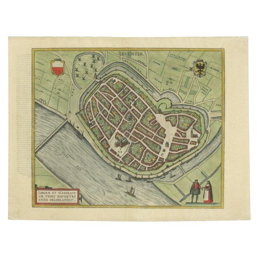
- Antique Original Map of the City of Deventer, the Netherlands, 1588Located in Langweer, NLAntique map titled 'Liberae et Hanseaticae urbis Daventriensis delineatio'. Original bird's eye plan of the Dutch hanseatic city Deventer, on the situated IJssel river. This map ...Category
Antique 16th Century Maps
MaterialsPaper
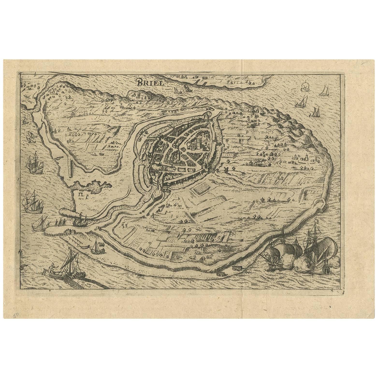
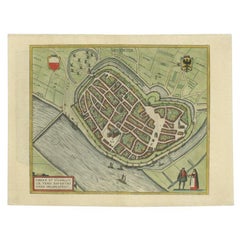
- Antique Map of the City of Brielle 'The Netherlands' by L. Guicciardini, 1625Located in Langweer, NLPlan of Brielle, Briel, Den Briel in the Province of Zuid-Holland, The Netherlands, Holland. This map originates from the 1625 edition of 'Discrittione di tutti i Paesi Bassi', by L....Category
Antique Early 17th Century Maps
MaterialsPaper
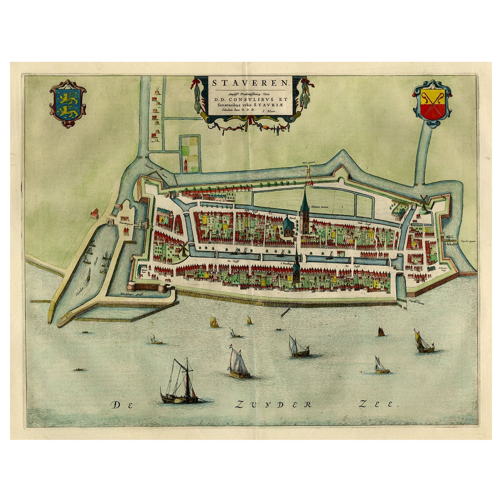
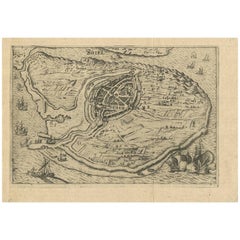
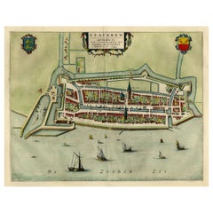
- Original Antique Map of the City of Stavoren, Friesland, The Netherlands, 1649Located in Langweer, NLAntique map titled 'Staveren'. Original antique map of the city of Stavoren, Friesland, The Netherlands. This map originates from 'Toonneel der Steden van de Vereenighde Nederlanden'...Category
Antique 1640s Maps
MaterialsPaper
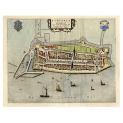
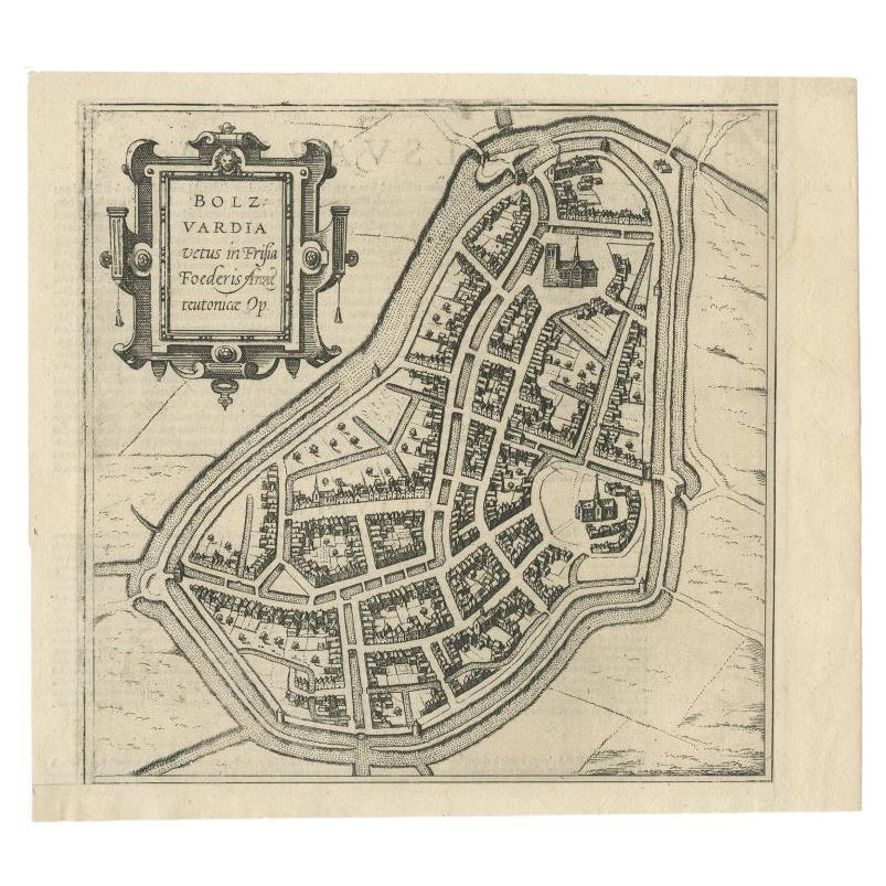
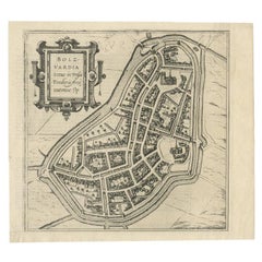
- Antique Map of the City of Bolsward, Friesland in The Netherlands, c.1598Located in Langweer, NLAntique map titled ‘Bolzvardia vetus in Frisia Foederis (..)’. Old map of the city of Bolsward, Friesland. Originally part of a sheet together with the cities of Stavoren, Harlingen ...Category
Antique 16th Century Maps
MaterialsPaper
You May Also Like
- Original Antique Map of The Netherlands, Sherwood, Neely & Jones, Dated 1809Located in St Annes, LancashireGreat map of The Netherlands Copper-plate engraving by Cooper Published by Sherwood, Neely & Jones. Dated 1809 Unframed.Category
Antique Early 1800s English Maps
MaterialsPaper
- Original Antique Map of The Netherlands, Engraved by Barlow, Dated 1807Located in St Annes, LancashireGreat map of Netherlands Copper-plate engraving by Barlow Published by Brightly & Kinnersly, Bungay, Suffolk. Dated 1807 Unframed.Category
Antique Early 1800s English Maps
MaterialsPaper
- Original Antique Map / City Plan of Brussels by Tallis, circa 1850Located in St Annes, LancashireGreat map of Brussels. Steel engraving. Published by London Printing & Publishing Co. (Formerly Tallis), C.1850 Free shipping.Category
Antique 1850s English Maps
MaterialsPaper
- Map of the Republic of GenoaLocated in New York, NYFramed antique hand-coloured map of the Republic of Genoa including the duchies of Mantua, Modena, and Parma. Europe, late 18th century. Dimension: 25...Category
Antique Late 18th Century European Maps
- Antique Map of Principality of MonacoBy Antonio Vallardi EditoreLocated in Alessandria, PiemonteST/619 - "Old Geographical Atlas of Italy - Topographic map of ex-Principality of Monaco" - ediz Vallardi - Milano - A somewhat special edition ---Category
Antique Late 19th Century Italian Other Prints
MaterialsPaper
- Original Antique Map of The World by Thomas Clerk, 1817Located in St Annes, LancashireGreat map of The Eastern and Western Hemispheres On 2 sheets Copper-plate engraving Drawn and engraved by Thomas Clerk, Edinburgh. Published by Mackenzie And Dent, 1817 ...Category
Antique 1810s English Maps
MaterialsPaper


Recently Viewed
View AllMore Ways To Browse
Antique City Views
16th Century Plate
Coat Of Arms Plates
French 16th Table
French Table 16th Century
Antique City Plans
Antique 16th Century Tables
Antique Table Plans
Table With Coat Of Arms
Antique 16th Century Plates
Johannes Engravings
Coat Of Arms Engraving
Large City Maps
Coat Of Arms German
Latin Book
Vans Coat Of Arms
Plate Heinrich
Large Antique City Maps