Items Similar to Map of East Friesland, The Netherlands & the Area Emden & Norden, Germany, 1635


Want more images or videos?
Request additional images or videos from the seller
1 of 6
Map of East Friesland, The Netherlands & the Area Emden & Norden, Germany, 1635
About the Item
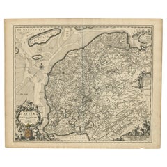
Antique map titled 'Typus Frisiae Orientalis.'
Map of East Friesland and the area around Emden and Norden. Large inset map of the mouth of the Amasis River. The map is decorated with a large title cartouche and two large coats of arms, plus elegant border details around the inset, sailing ships and a compass rose.. Text in Dutch on verso. This map originates from a Dutch edition if the 'Atlas Novus...' published in Amsterdam by W. Blaeu ca. 1635.
Artists and engravers: Made by 'Willem Janszoon Blaeu' after an anonymous artist. Willem Janszoon Blaeu was born 1571 in Alkmaar. He was trained from 1594 to 1596 by the famous danish astronomer Tycho Brahe. 1599 he went to Amsterdam and founded a business as globe maker. Later he started producing map and sea charts, including his first world map in 1605. In 1633 he was appointed Hydrographer for the Dutch East India Company (VOC). His most famous work was the "Atlas Novus" or "Theatrum Orbis Terrarum sive Atlas Novus" of 1635, which was published until 1655 in total six volumes. After Blaeu's death in 1638 his sons Joan and Cornelis continued the businees and finished the "Atlas Novus" and started an even larger work, the "Atlas Maior", which reached 12 volumes. In 1672 a fire destroyed the printing house and a year later Joan died. Some of the surviving plates where bought by F. de Wit and Schenk & Valk. The business was closed finally in 1695.
- Dimensions:Height: 20.48 in (52 cm)Width: 24.34 in (61.8 cm)Depth: 0 in (0.02 mm)
- Materials and Techniques:
- Period:1630-1639
- Date of Manufacture:1635
- Condition:Condition: Good, given age. A few small spots in the margins. Edges browned with the odd tiny tear. Middle fold as issued. Remains of attachment to matting to the top edge verso. General age-related toning and/or minor defects from handling.
- Seller Location:Langweer, NL
- Reference Number:
About the Seller
5.0
Platinum Seller
These expertly vetted sellers are 1stDibs' most experienced sellers and are rated highest by our customers.
Established in 2009
1stDibs seller since 2017
1,929 sales on 1stDibs
Typical response time: <1 hour
- ShippingRetrieving quote...Ships From: Langweer, Netherlands
- Return PolicyA return for this item may be initiated within 14 days of delivery.
More From This SellerView All
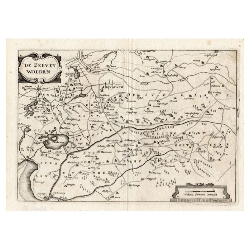
- Antique Map of the Region of Zevenwouden in Friesland, The Netherlands, 1635Located in Langweer, NLAntique map titled 'De Zeeven Wolden'. Map of the region of Zevenwouden (or Zevenwolden) in Friesland, the Netherlands. This region include the villages of Langweer, Echtenerbrug, Le...Category
Antique 17th Century Maps
MaterialsPaper
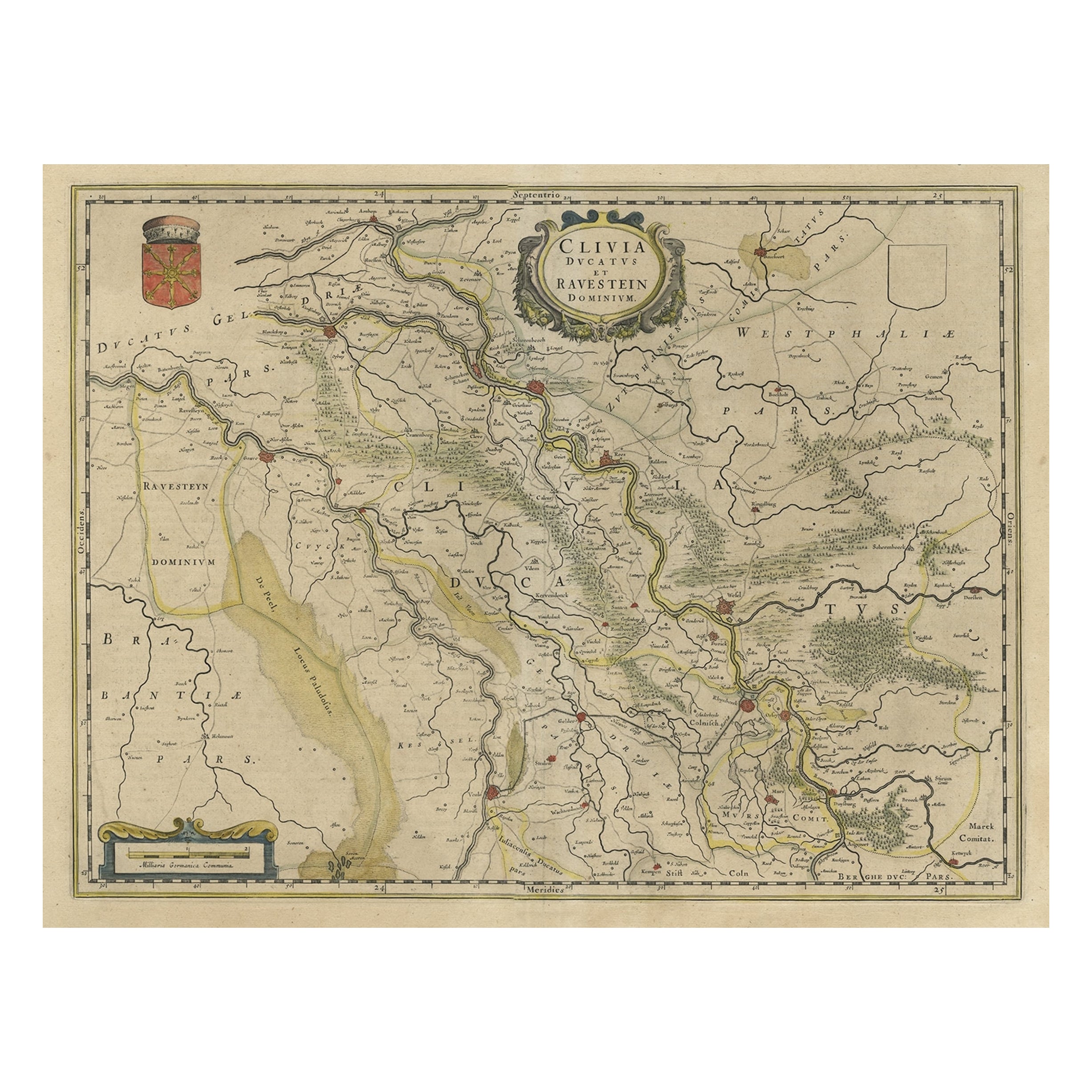
- Map of the Duchy Clivia & Ravestein, Brabant in The Netherlands & Germany, 1635Located in Langweer, NLAntique map titled 'Clivia Ducatus et Ravestein Dominium.' Map of the Duchy Clivia and Ravestein, part of Brabant in The Nethe...Category
Antique 1630s Maps
MaterialsPaper
- Antique Map of Leeuwarderadeel in Friesland, The Netherlands, 1868Located in Langweer, NLAntique map titled 'Provincie Friesland - Gemeente Leeuwarderadeel'. Map of the township of Leeuwarderadeel including Friesland's Capital Leeuwarden and furthermore: Wirdum, Wytg...Category
Antique 19th Century Maps
MaterialsPaper
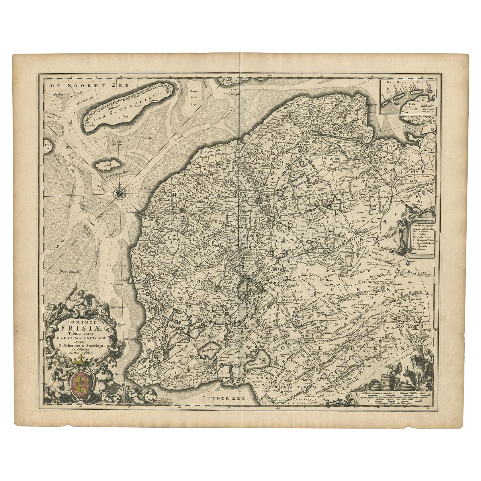
- Beautiful First State Map of Friesland, the Netherlands, c.1665Located in Langweer, NLAntique map titled 'Dominii Frisiae Tabula, inter Flevum et Lavicam'. Beautiful first state map of Friesland, the Netherlands. With small inset map of the Frisian Wadden islands Vlie...Category
Antique 17th Century Maps
MaterialsPaper
- Antique Map of Gaasterland, Friesland in the Netherlands, 1868Located in Langweer, NLAntique map titled 'Provincie Friesland - Gemeente Gaasterland'. Map of the township of Gaasterland including Balk, Bakhuizen, Wijckel, Sloten and many other villages. This map origi...Category
Antique 19th Century Maps
MaterialsPaper
- Antique Map of Gaasterland in Friesland, the Netherlands, 1718Located in Langweer, NLAntique map titled 'Gaasterland. De zevende Grietenije van de Zevenwolden (..)'. Original antique map of Gaasterland, Friesland, the Netherlands. Originates from 'Uitbeelding van de ...Category
Antique 18th Century Maps
MaterialsPaper


You May Also Like
- Original Antique Map of The Netherlands, Sherwood, Neely & Jones, Dated 1809Located in St Annes, LancashireGreat map of The Netherlands Copper-plate engraving by Cooper Published by Sherwood, Neely & Jones. Dated 1809 Unframed.Category
Antique Early 1800s English Maps
MaterialsPaper
- Original Antique Map of The Netherlands, Engraved by Barlow, Dated 1807Located in St Annes, LancashireGreat map of Netherlands Copper-plate engraving by Barlow Published by Brightly & Kinnersly, Bungay, Suffolk. Dated 1807 Unframed.Category
Antique Early 1800s English Maps
MaterialsPaper
- Original Antique Map of South East Asia, Arrowsmith, 1820Located in St Annes, LancashireGreat map of South East Asia Drawn under the direction of Arrowsmith Copper-plate engraving Published by Longman, Hurst, Rees, Orme and Brown, 1820 Unframed.Category
Antique 1820s English Maps
MaterialsPaper
- East German MapBy VEB Hermann HaackLocated in Baltimore, MDA brilliantly colourful map of the Leipzig, Karl Marx Stadt and Dresden area in the former German Democratic Republic by VEB Hermann Haack of Gotha.Category
Vintage 1970s German Maps
- Map of the Republic of GenoaLocated in New York, NYFramed antique hand-coloured map of the Republic of Genoa including the duchies of Mantua, Modena, and Parma. Europe, late 18th century. Dimension: 25...Category
Antique Late 18th Century European Maps
- Original Antique Map of South East Asia by Becker, circa 1840Located in St Annes, LancashireGreat map of South East Asia Steel engraving with original color outline Engraved by Becker Published by Virtue, circa 1840. Unframed.Category
Antique 1840s English Other Maps
MaterialsPaper


Recently Viewed
View AllMore Ways To Browse
Used Furniture In The Area
Antique Globes Of The World
Large Coat Of Arms
East India Company
Antique Map Border
Compass Map
Large World Map
Dutch East India Company
World Map Globe
Dutch East India
Antique Compass Rose
Compass Rose Antique
Large Antique World Map
Antique World Map Large
Large Antique World Maps
Compass Antique Map
Antique Map Compass
Antique Compass Map