Items Similar to Antique Map of the Region of Zevenwouden in Friesland, The Netherlands, 1635


Want more images or videos?
Request additional images or videos from the seller
1 of 5
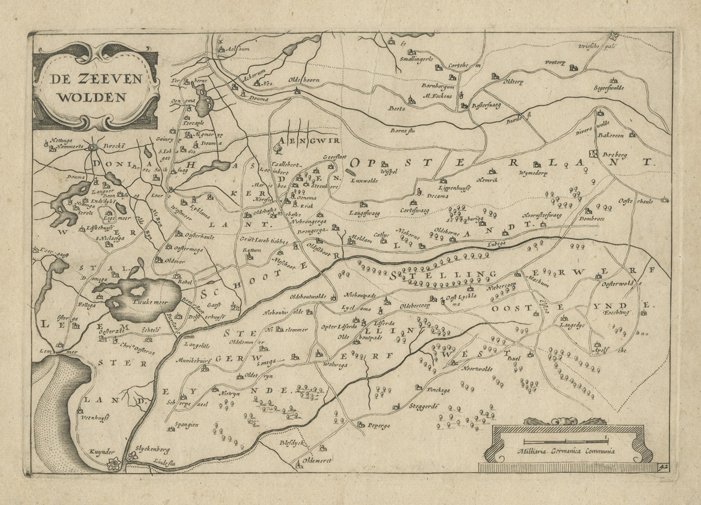
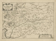
Antique Map of the Region of Zevenwouden in Friesland, The Netherlands, 1635
About the Item
Antique map titled 'De Zeeven Wolden'. Map of the region of Zevenwouden (or Zevenwolden) in Friesland, the Netherlands. This region include the villages of Langweer, Echtenerbrug, Lemmer, Heerenveen, Jubbega, Wolvega and many others. This map originates from 'Vyerige Colom verthonende de 17 Nederlandsche Provintien.', published by Jacob Aertsz. Colom, Amsterdam, 1635.
Artists and Engravers: Jacob Aertz. Colom (also Kalom or Calom, 1599-1673) was a printer, publisher, bookseller, geographer, cartographer and poet from Dordrecht, The Netherlands.
Condition: Excellent; General age related toning and occasional light staining as clearly visible on scanned image. Paper edges with minimal chipping. Please study image carefully.
Date: 1635
Overall size: 25.5 x 20 cm.
Image size: 22.5 x 15.5 cm.
We sell original antique maps to collectors, historians, educators and interior decorators all over the world. Our collection includes a wide range of authentic antique maps from the 16th to the 20th centuries. Buying and collecting antique maps is a tradition that goes back hundreds of years. Antique maps have proved a richly rewarding investment over the past decade, thanks to a growing appreciation of their unique historical appeal. Today the decorative qualities of antique maps are widely recognized by interior designers who appreciate their beauty and design flexibility. Depending on the individual map, presentation, and context, a rare or antique map can be modern, traditional, abstract, figurative, serious or whimsical. We offer a wide range of authentic antique maps for any budget.
- Dimensions:Height: 7.88 in (20 cm)Width: 10.04 in (25.5 cm)Depth: 0 in (0.01 mm)
- Materials and Techniques:
- Period:
- Date of Manufacture:1635
- Condition:Condition: Excellent; General age related toning and occasional light staining as clearly visible on scanned image. Paper edges with minimal chipping. Please study image carefully.
- Seller Location:Langweer, NL
- Reference Number:
About the Seller
5.0
Platinum Seller
These expertly vetted sellers are 1stDibs' most experienced sellers and are rated highest by our customers.
Established in 2009
1stDibs seller since 2017
1,933 sales on 1stDibs
Typical response time: <1 hour
- ShippingRetrieving quote...Ships From: Langweer, Netherlands
- Return PolicyA return for this item may be initiated within 14 days of delivery.
More From This SellerView All
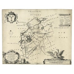
- Antique Map of the Region of Zevenwouden, Friesland, The Netherlands, 1660Located in Langweer, NLAntique map titled 'De Zeeven Wolden'. Map of the region of Zevenwouden (or Zevenwolden) in Friesland, the Netherlands. This region include the villages of Langweer, Echtenerbrug...Category
Antique 17th Century Maps
MaterialsPaper
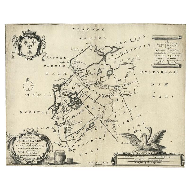
- Antique Map of the Region of Utingeradeel in Friesland, The Netherlands, 1664By B. SchotanusLocated in Langweer, NLAntique map titled 'De Grietenye van Utingeradeel (..)'. Map of the Grietenij of Utingeradeel, Friesland, The Netherlands. Multiple cartouches, key and coat of arms. "Beschrijvinge e...Category
Antique 17th Century Maps
MaterialsPaper
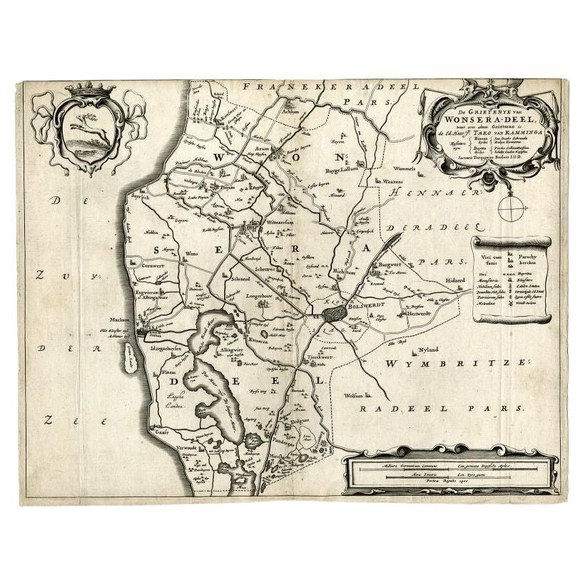
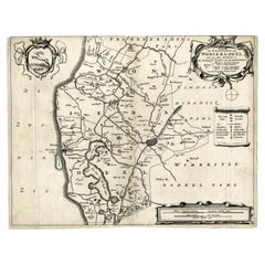
- Antique Map of the Region of Wonseradeel, Friesland in the Netherlands, 1664By B. SchotanusLocated in Langweer, NLAntique map titled 'De Grietenije van Wonsera-deel (..).' Map of the Grietenij of Wonseradeel, Friesland, The Netherlands. Multiple cartouches, key and coat of arms. "Beschrijvinge e...Category
Antique 17th Century Maps
MaterialsPaper
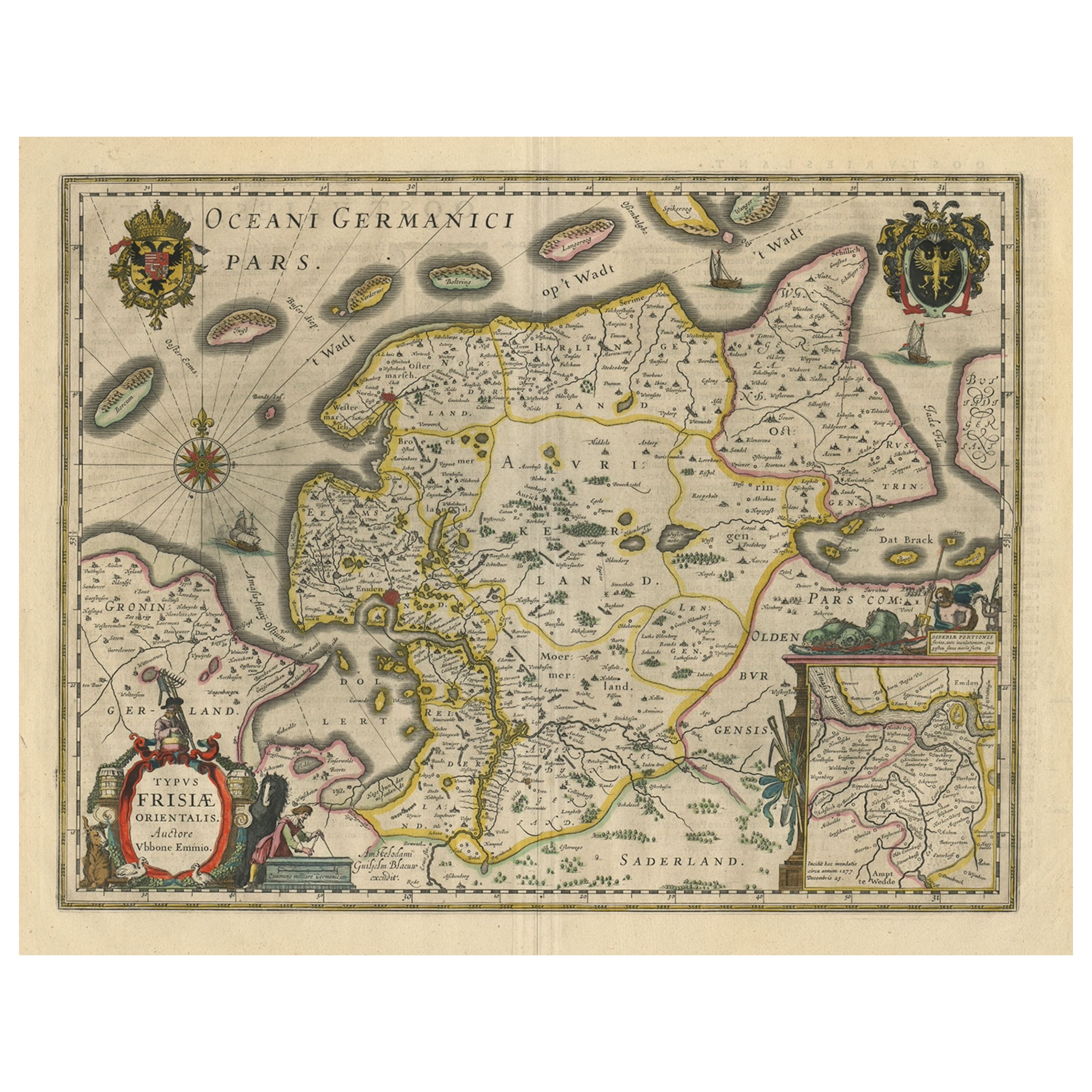
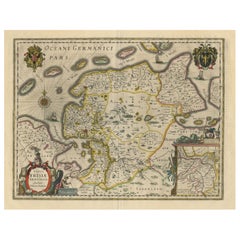
- Map of East Friesland, The Netherlands & the Area Emden & Norden, Germany, 1635Located in Langweer, NLAntique map titled 'Typus Frisiae Orientalis.' Map of East Friesland and the area around Emden and Norden. Large inset map of the mouth of the Amasis River. The map is decorated with a large title cartouche and two large coats of arms...Category
Antique 1630s Maps
MaterialsPaper
- Antique Map of Leeuwarderadeel in Friesland, The Netherlands, 1868Located in Langweer, NLAntique map titled 'Provincie Friesland - Gemeente Leeuwarderadeel'. Map of the township of Leeuwarderadeel including Friesland's Capital Leeuwarden and furthermore: Wirdum, Wytg...Category
Antique 19th Century Maps
MaterialsPaper
- Antique Map of Gaasterland, Friesland in the Netherlands, 1868Located in Langweer, NLAntique map titled 'Provincie Friesland - Gemeente Gaasterland'. Map of the township of Gaasterland including Balk, Bakhuizen, Wijckel, Sloten and many other villages. This map origi...Category
Antique 19th Century Maps
MaterialsPaper


You May Also Like
- Original Antique Map of The Netherlands, Sherwood, Neely & Jones, Dated 1809Located in St Annes, LancashireGreat map of The Netherlands Copper-plate engraving by Cooper Published by Sherwood, Neely & Jones. Dated 1809 Unframed.Category
Antique Early 1800s English Maps
MaterialsPaper
- Original Antique Map of The Netherlands, Engraved by Barlow, Dated 1807Located in St Annes, LancashireGreat map of Netherlands Copper-plate engraving by Barlow Published by Brightly & Kinnersly, Bungay, Suffolk. Dated 1807 Unframed.Category
Antique Early 1800s English Maps
MaterialsPaper
- 17th Century Hand Colored Map of the Liege Region in Belgium by VisscherBy Nicolaes Visscher IILocated in Alamo, CAAn original 17th century map entitled "Leodiensis Episcopatus in omnes Subjacentes Provincias distincté divisusVisscher, Leodiensis Episcopatus" by Nicolaes Visscher II, published in Amsterdam in 1688. The map is centered on Liege, Belgium, includes the area between Antwerp, Turnhout, Roermond, Cologne, Trier and Dinant. This attractive map is presented in a cream-colored mat measuring 30" wide x 27.5" high. There is a central fold, as issued. There is minimal spotting in the upper margin and a tiny spot in the right lower margin, which are under the mat. The map is otherwise in excellent condition. The Visscher family were one of the great cartographic families of the 17th century. Begun by Claes Jansz Visscher...Category
Antique Late 17th Century Dutch Maps
MaterialsPaper
- The Normandy Region of France: A 17th C. Hand-colored Map by Sanson and JaillotBy Nicolas SansonLocated in Alamo, CAThis large hand-colored map entitled "Le Duché et Gouvernement de Normandie divisée en Haute et Basse Normandie en divers Pays; et par evêchez, avec le Gouvernement General du Havre ...Category
Antique 1690s French Maps
MaterialsPaper
- 17th Century Hand-Colored Map of a Region in West Germany by JanssoniusBy Johannes JanssoniusLocated in Alamo, CAThis attractive highly detailed 17th century original hand-colored map is entitled "Archiepiscopatus Maghdeburgensis et Anhaltinus Ducatus cum terris adjacentibus". It was published ...Category
Antique Mid-17th Century Dutch Maps
MaterialsPaper
- Map of the Republic of GenoaLocated in New York, NYFramed antique hand-coloured map of the Republic of Genoa including the duchies of Mantua, Modena, and Parma. Europe, late 18th century. Dimension: 25...Category
Antique Late 18th Century European Maps


Recently Viewed
View AllMore Ways To Browse
Jacob Amsterdam
Jacob 17th
Large Antique Compass
Antique New England Maps
Antique Map New England
Antique Map Of New England
Antique Maps New England
Antique Map Of Greece
Antique Greek Map
Antique Greece Map
Antique Maps Greece
Antique Map Greece
Nautical Chart Nautical Chart
Hemispheres Map
Portugal Map
Used Nautical Charts
Antique Travel Map
Map Of Portugal