Items Similar to Antique Map of the Siege of Groningen by Le Clerc, 1730

Want more images or videos?
Request additional images or videos from the seller
1 of 7
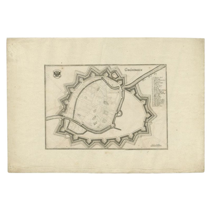
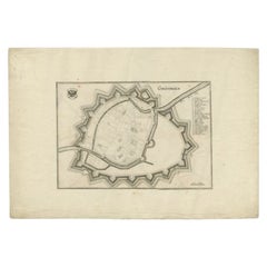
Antique Map of the Siege of Groningen by Le Clerc, 1730
About the Item
Plate : 'Het Belegh der Stadt Groningen in den Jaere MDXCIV '. (The siege of Groningen in the year 1594.) This plate shows the fortified city of Groningen, The Netherlands. With legend. This attractive original old antique print / plate was published in several works by Hugo de Groot ('Nederlandtsche Jaerboeken' published in 1681.), P.C. Hooft ('Nederlandsche Historien ...', published 1703-1704.), P.C. Bor ('Oorsprongk, begin, en vervolgh der Nederlandsche oorlogen', published in 1680.)or Jean Le Clerc. This print originates from: 'Histoire des Provinces-Unies des Pays Bas...', or 'Geschiedenissen der Vereenigde Nederlanden...' by Jean Le Clerc, 1723-1728 or 1730.
Artists and Engravers: The author of this work is Jean Le Clerc / Joannes Clericus (1657-1736). From Hugenot origin, he studied filosophy, hebrew and theology in Geneva and travelled in Europe. He objected the calvinistic orthodoxie and influenced by Grotius, Episcopius, Van Limborch and others, he moved to Amsterdam, where he became a Remonstrant. He became a professor at the Remonstrant seminary, a writer and publisher.
Condition: Good. General age related toning and light to medium soiling. Large tear in middle fold restored and backed by paper. Please study image carefully.
Date: 1730
Overall size: 38 x 31 cm.
Image size: 34.5 x 27 cm.
We sell original antique maps to collectors, historians, educators and interior decorators all over the world. Our collection includes a wide range of authentic antique maps from the 16th to the 20th centuries. Buying and collecting antique maps is a tradition that goes back hundreds of years. Antique maps have proved a richly rewarding investment over the past decade, thanks to a growing appreciation of their unique historical appeal. Today the decorative qualities of antique maps are widely recognized by interior designers who appreciate their beauty and design flexibility. Depending on the individual map, presentation, and context, a rare or antique map can be modern, traditional, abstract, figurative, serious or whimsical. We offer a wide range of authentic antique maps for any budget.
- Dimensions:Height: 12.21 in (31 cm)Width: 14.97 in (38 cm)Depth: 0 in (0.01 mm)
- Materials and Techniques:
- Period:
- Date of Manufacture:1730
- Condition:Good, given age. A few spots in the margins. Original folds as issued. General age-related toning and/or occasional minor defects from handling. Please study image carefully.
- Seller Location:Langweer, NL
- Reference Number:
About the Seller
5.0
Platinum Seller
These expertly vetted sellers are 1stDibs' most experienced sellers and are rated highest by our customers.
Established in 2009
1stDibs seller since 2017
1,928 sales on 1stDibs
Typical response time: <1 hour
- ShippingRetrieving quote...Ships From: Langweer, Netherlands
- Return PolicyA return for this item may be initiated within 14 days of delivery.
More From This SellerView All
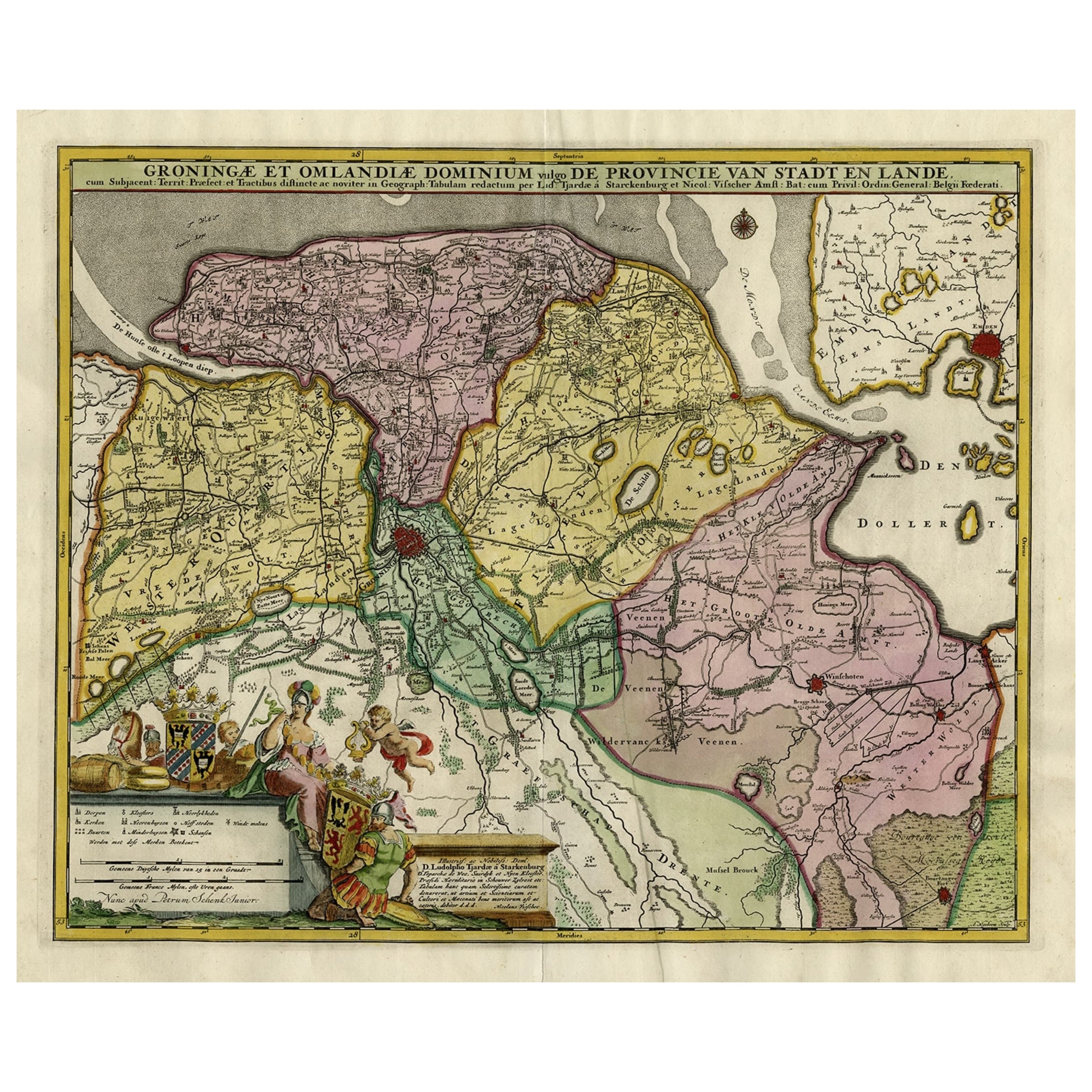
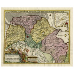
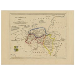
- Decorative Hand-Colored Antique Map of Groningen in the Netherlands, ca.1730Located in Langweer, NLAntique print, titled: 'Groningae et Omlandiae Dominium vulgo de Provincie van Stadt en Lande (…) ' - This map shows Groningen, the Netherlands. Lower left scale sticks in the decora...Category
Antique 1730s Maps
MaterialsPaper
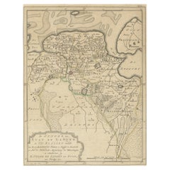
- Antique Map of Groningen, the Netherlands, 1771Located in Langweer, NLAntique map titled 'De Synode van Stad en Landen in VII Klassen verdeeld (..)'. Map of the province of Groningen, the Netherlands. This map originates from 'Nieuwe kerkelyke geogra...Category
Antique 18th Century Maps
MaterialsPaper
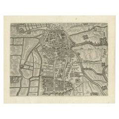
- Antique Map of the City of Groningen by Orlers, 1615Located in Langweer, NLAntique map titled 'Gronenga'. Map of the city of Groningen, the Netherlands. This map originates from 'La genealogie des illustres Comtes de Nassau' by Jan Jansz. Orlers. Artists...Category
Antique 17th Century Maps
MaterialsPaper
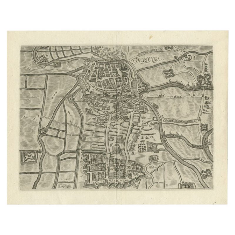
- Antique Map of the City of Groningen by Merian, 1659Located in Langweer, NLAntique map titled 'Gröningen'. This print depicts the city of Groningen, the Netherlands. This print originates from 'Topographia Germaniae Inferioris (..)' by C. Merian. Artist...Category
Antique 17th Century Maps
MaterialsPaper
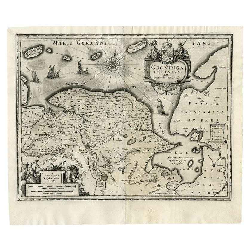
- Antique Map of the Province of Groningen by Blaeu, 1635Located in Langweer, NLAntique map titled 'Groninga Dominium.' A map of the Dutch province Groningen. This includes the Wadden islands Schiermonnikoog, Rottumeroog (Rottumerplaat) and Borkum. With compass ...Category
Antique 17th Century Maps
MaterialsPaper
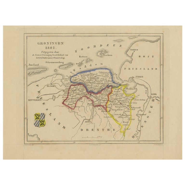
- Antique Map of Groningen by Veelwaard, c.1865Located in Langweer, NLAntique map titled 'Groningen 1861'. Map of Groningen, the Netherlands. Published by 'Gewest. Vereeniging Noord Holland van het Ned. Onderwijzers-Genootschap'. Artists and Engravers:...Category
Antique 19th Century Maps
MaterialsPaper

You May Also Like
- 1861 Topographical Map of the District of Columbia, by Boschke, Antique MapLocated in Colorado Springs, COPresented is an original map of Albert Boschke's extremely sought-after "Topographical Map of the District of Columbia Surveyed in the Years 1856 ...Category
Antique 1860s American Historical Memorabilia
MaterialsPaper
- Matthaus Seutter, Framed 1730 Color Engraving Map of "Belgium Fonderatum"Located in Bridgeport, CTLabel on verso. From Grosser Atlas. The name Belgium comes from the ancient designation "Gallis Belgica". Figural decoration upper left. M. Seutter was a famed German mapmaker in the...Category
Antique 18th Century European Renaissance Maps
MaterialsBrass
- Original Antique Map of The World by Thomas Clerk, 1817Located in St Annes, LancashireGreat map of The Eastern and Western Hemispheres On 2 sheets Copper-plate engraving Drawn and engraved by Thomas Clerk, Edinburgh. Published by Mackenzie And Dent, 1817 ...Category
Antique 1810s English Maps
MaterialsPaper
- Ordeal of the Hermitage, The Siege of Leningrad 1941-1944, First EditionBy Sergei Varshavsky, Boris RestLocated in valatie, NYThe Ordeal of the Hermitage, The Siege of Leningrad 1941-1944. Leningrad: Aurora Art Publishers, 1985. First edition hardcover with dust jacket. 302 pp. A beautifully photographed bo...Category
20th Century Russian Books
MaterialsPaper
- 1907 Map of Colorado, Antique Topographical Map, by Louis NellLocated in Colorado Springs, COThis highly detailed pocket map is a topographical map of the state of Colorado by Louis Nell from 1907. The map "has been complied from all availabl...Category
Antique Early 1900s American Maps
MaterialsPaper
- Original Antique Map of The Netherlands, Engraved by Barlow, Dated 1807Located in St Annes, LancashireGreat map of Netherlands Copper-plate engraving by Barlow Published by Brightly & Kinnersly, Bungay, Suffolk. Dated 1807 Unframed.Category
Antique Early 1800s English Maps
MaterialsPaper


Recently Viewed
View AllMore Ways To Browse
Antique Handcrafted Model Sailboat
Miles Johnston
Toledo Scale Company Antique
Charente Map
F Colton
Ian Maguire
Ithaca Antique Map
Pakistan Antique Map
Antique Map Copenhagen
Antique Map Nova Scotia
Antique Maps Of Ukraine
Armenia Map
Armenian Map
Ecuador Antique Map
Serbia Antique Map
Ukraine Antique Map
Vintage Bartholomew Maps
Albania Map