Items Similar to Antique Map of France by Covens & Son, c.1790


Want more images or videos?
Request additional images or videos from the seller
1 of 5
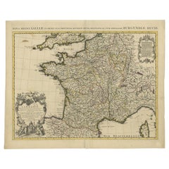
Antique Map of France by Covens & Son, c.1790
About the Item
A detailed description of the 'Carte de France divisée en 83 Departements (..)', an antique map circa 1790, along with information about its publishers, Covens & Mortier:
**Title**: 'Carte de France divisée en 83 Departements (..)'
**Date**: Circa 1790
**Description**: This large map of France, notable for its division into 83 departments, is a significant historical artifact from the late 18th century. It reflects the administrative changes in France that followed the French Revolution, which reorganized the country into departments from the previous provincial structure. The map is extended with text on both sides, providing additional context and detail about the regions depicted. This feature enhances its value as both a cartographic and educational resource.
**Artists and Engravers**: The map was produced by Covens & Mortier, a renowned Dutch publishing firm known for its extensive and successful history in map publishing. The firm was established by Pierre Mortier the Elder (1661-1711), who initially obtained the privilege to distribute the works of French geographers in the Netherlands. After Pierre's widow managed the business for several years, Cornelis Mortier took over in 1719. In 1721, Cornelis forged a partnership with Johannes Covens, who had married Cornelis’ sister, leading to the creation of the Covens & Mortier name. This partnership continued through various family successors, including Johannes Covens II and later Cornelis (son of Johannes Covens II), who integrated Petrus Mortier IV (the great-grandson of Petrus Mortier I) back into the business. In 1794, the company was renamed Mortier, Covens & Zoon, reflecting its enduring legacy and family lineage in the field of map publishing.
**Significance**: The map is a testament to the skill and artistry of Covens & Mortier, showcasing their ability to blend accurate geographic information with detailed and aesthetically pleasing design. As a historical document, it provides insights into the geographical understanding of France during a pivotal period in its history. The map's large format, detailed text, and division into departments make it a valuable resource for historians, collectors, and enthusiasts of cartography.
- Dimensions:Height: 22.64 in (57.5 cm)Width: 50.79 in (129 cm)Depth: 0 in (0.01 mm)
- Materials and Techniques:
- Period:
- Date of Manufacture:circa 1790
- Condition:Condition: Good, extended with text on both sides (joined). General age-related toning, creasing and minor wear. Blank verso, please study image carefully.
- Seller Location:Langweer, NL
- Reference Number:
About the Seller
5.0
Platinum Seller
These expertly vetted sellers are 1stDibs' most experienced sellers and are rated highest by our customers.
Established in 2009
1stDibs seller since 2017
1,928 sales on 1stDibs
Typical response time: <1 hour
- ShippingRetrieving quote...Ships From: Langweer, Netherlands
- Return PolicyA return for this item may be initiated within 14 days of delivery.
More From This SellerView All
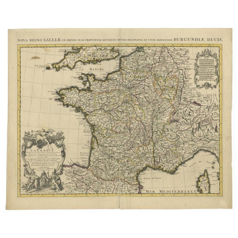
- Antique Map of France by Covens & Mortier, c.1730Located in Langweer, NLAntique map titled 'Nova regni Galliae (..) La France'. Old map of France with large decorative title cartouche. With great detail. Artists and Engravers: Pieter und David Mortie...Category
Antique 18th Century Maps
MaterialsPaper
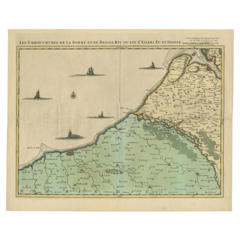
- Antique Map of the French Coast by Covens & Mortier, 1720Located in Langweer, NLAntique map France titled 'Les Embouchures de la Somme et de Bresle Riv. ou est St. Valeri, Eu et Dieppe'. Beautiful map of the French coast, from St. Valeri to Dieppe. Artists a...Category
Antique 18th Century Maps
MaterialsPaper
- Antique Map of Denmark by Covens & Mortier, 1730By Covens & MortierLocated in Langweer, NLAntique Map of Denmark from: 'Atlas Nouveau ... Par Guillaume de l'Isle' Amsterdam, Covens & Mortier, 1730.Category
Antique Mid-18th Century Maps
MaterialsPaper
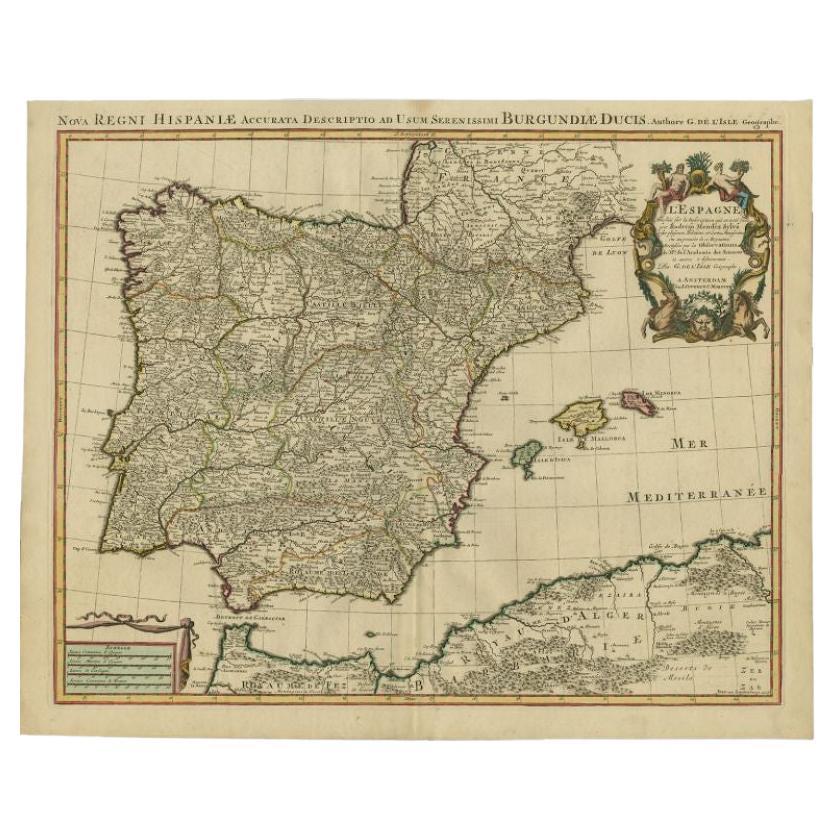
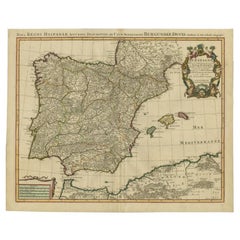
- Antique Map of Spain by Covens & Mortier, c.1740Located in Langweer, NLAntique map Spain titled 'L?Espagne dressée sur la Description qui en a eté faite par Rodrigo Mendez Sylva (..)'. Beautiful map of Spain with decorat...Category
Antique 18th Century Maps
MaterialsPaper
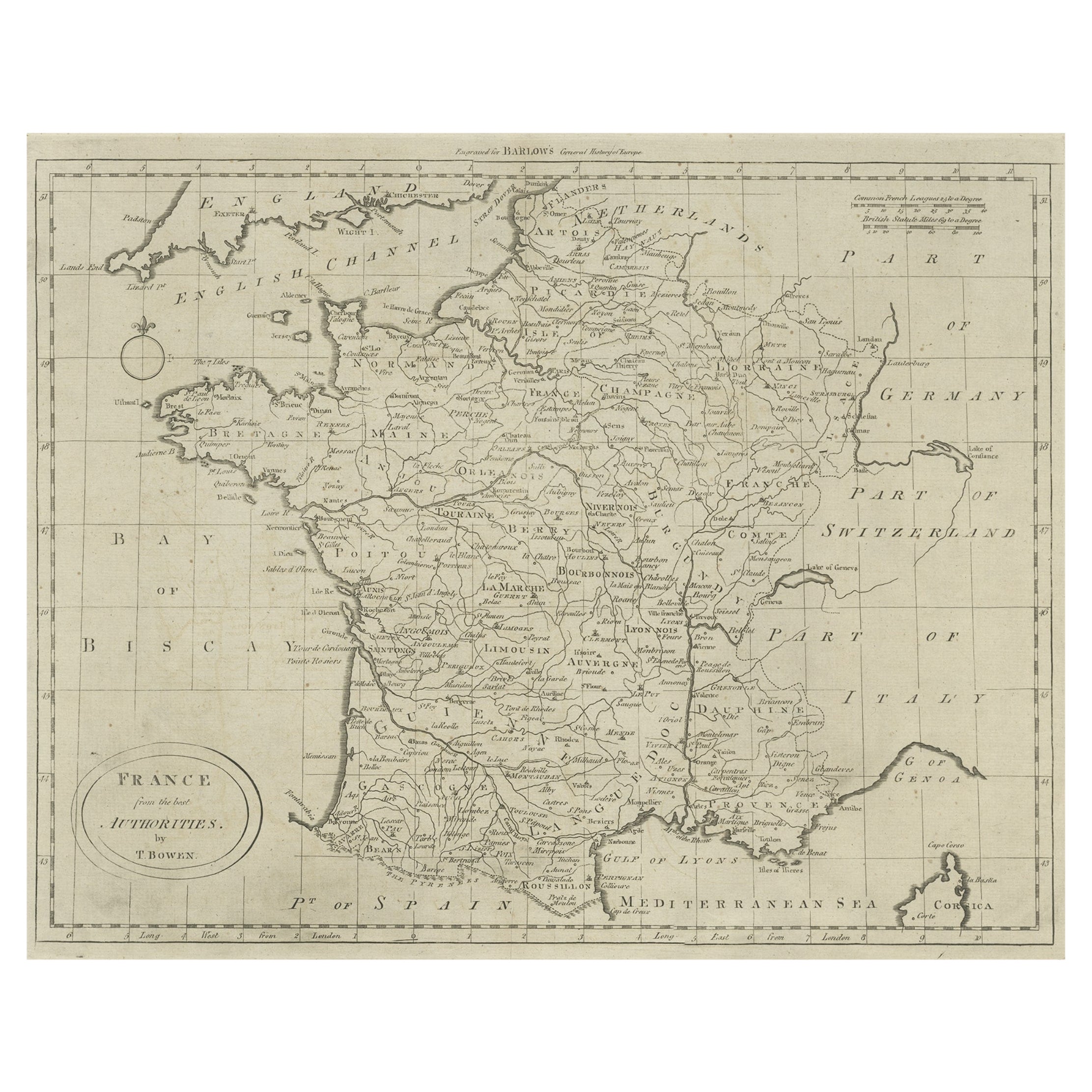
- Antique Map of France by Bowen, c.1790Located in Langweer, NLAntique map titled 'France from the best Authorities'. Original antique map of France. Engraved for Barlow's General history of Europe. Published circa 1790. Artists and Engraver...Category
Antique 18th Century Maps
MaterialsPaper
- Antique Map of Western Russia by Covens & Mortier, 1740Located in Langweer, NLAntique map titled 'Carte de Moscovie'. Antique map of the western portion of Russia. The map centers on Moscow (shown near the top of the lower sheet) and spans from the Sea of Azov...Category
Antique Mid-18th Century Maps
MaterialsPaper


You May Also Like
- Original Antique Map of Spain and Portugal, circa 1790Located in St Annes, LancashireSuper map of Spain and Portugal Copper plate engraving by A. Bell Published, circa 1790. Unframed.Category
Antique 1790s English Other Maps
MaterialsPaper
- Plan of Paris, France, by A. Vuillemin, Antique Map, 1845Located in Colorado Springs, COThis large and detailed plan of Paris was published by Alexandre Vuillemin in 1845. The map conveys a wonderful amount of information and is decorated throughout with pictorial vigne...Category
Antique 1840s American Maps
MaterialsPaper
- Original Antique Map of France, Arrowsmith, 1820Located in St Annes, LancashireGreat map of France Drawn under the direction of Arrowsmith. Copper-plate engraving. Published by Longman, Hurst, Rees, Orme and Brown, 1820 Unframed.Category
Antique 1820s English Maps
MaterialsPaper
- 1861 Topographical Map of the District of Columbia, by Boschke, Antique MapLocated in Colorado Springs, COPresented is an original map of Albert Boschke's extremely sought-after "Topographical Map of the District of Columbia Surveyed in the Years 1856 ...Category
Antique 1860s American Historical Memorabilia
MaterialsPaper
- 1907 Map of Colorado, Antique Topographical Map, by Louis NellLocated in Colorado Springs, COThis highly detailed pocket map is a topographical map of the state of Colorado by Louis Nell from 1907. The map "has been complied from all availabl...Category
Antique Early 1900s American Maps
MaterialsPaper
- Original Large Antique Map of Paris, France by John Dower, 1861Located in St Annes, LancashireFabulous monochrome map of Paris. Vignettes of St Germain En Laye, Saint Cloud, Versailles and Fontainbleau. Unframed. Drawn by J.Dower. Lithography by Weller. 4 sheets j...Category
Antique 1860s English Victorian Maps
MaterialsPaper


Recently Viewed
View AllMore Ways To Browse
Antique Death
Holland And Sons Furniture
Holland And Sons
Holland And Son
18th C Dutch
Large Maps On Paper
France And Son Extending
Heir Antiques
Antique French 18th Century Map
Large Map Of The Netherlands
Mortier Antique
Antique Maps Of London
Antique Map Of London
Antique Maps Amsterdam
Antique And Collectable Fairs
Antique Furniture South London
Antique Map England
Antique Maps England