Items Similar to Original Copper Engraving of a Map of Syria and Lebanon, 1698

Want more images or videos?
Request additional images or videos from the seller
1 of 5
Original Copper Engraving of a Map of Syria and Lebanon, 1698
About the Item
Antique map titled 'Syriae, sive Soriae, Nova et Accurata Descriptio.'
Map of Syria and Lebanon, fully engraved with mountain ranges, forests and cities. Damascus is at the bottom of the map and Edessa (Sanliurfa) is at the top. The coastal cities include Alexandria, Antioch, Tyro, Tripoli, Sidon, and Curco. Source unknown, to be determined.
Artists and Engravers: Made by 'Cornelis de Bruijn' after an anonymous artist. Cornelis de Bruijn (also spelled Cornelius de Bruyn, 1652 - 1726/7) was a Dutch artist and traveler. He made two large tours and published illustrated books with his observations of people, buildings, plants and animals. This is the account of De Bruyn's second voyage. He left The Netherlands in 1701 and sailed to Archangel and on to Moscow, where he lived for more than a year. In 1703 he reached Persia, and after nearly another year in Isfahan, he continued to Persepolis, the ancient Achaemenid palace. His drawings of these ruins were a disappointment to his public as they differed from those they had already become familiar with. By 1705 De Bruyn was in the Dutch Indies, and gives good account of Batavia, Brabant, Bantam, which he illustrates with images of exotic plants, fruits, spices such as pepper, fish and animals, even including a "Filander" or Kangaroo. Best known as a landscape artist, De Bruyn travelled widely from a young age to Vienna, on to Rome then to Smyrna, Constantinople, Egypt, Jerusalem, Syria, Lebanon, and Turkey. Everywhere he went De Bruyn depicted the scenes around him, he was especially interested in places of antiquity or historic interest, and his are the first images of the interior of a pyramid and Jerusalem to be widely available to Westerners. After an eight-year stay in Venice, De Bruyn returned to The Hague in 1693 to publish this first book.
- Dimensions:Height: 12.41 in (31.5 cm)Width: 14.45 in (36.7 cm)Depth: 0 in (0.02 mm)
- Materials and Techniques:
- Period:1690-1699
- Date of Manufacture:1698
- Condition:Condition: Good, given age. Paper with some browning. Irregular edges with some tiny tears; bottom edge reinforced. Some crinkles and creases. Original folds as issued. General age-related toning and/or occasional minor defects from handling.
- Seller Location:Langweer, NL
- Reference Number:
About the Seller
5.0
Platinum Seller
These expertly vetted sellers are 1stDibs' most experienced sellers and are rated highest by our customers.
Established in 2009
1stDibs seller since 2017
1,919 sales on 1stDibs
Typical response time: <1 hour
- ShippingRetrieving quote...Ships From: Langweer, Netherlands
- Return PolicyA return for this item may be initiated within 14 days of delivery.
More From This SellerView All
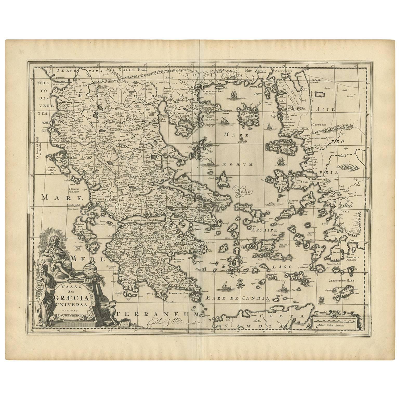
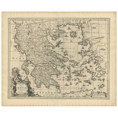
- Antique Map of Greece by Allard (c.1698)Located in Langweer, NLAntique map titled 'Hellas seu Graecia Universa' Detailed map of Greece, with Crete, the Aegean Islands, and part of Turkey. With two cartouches, compass rose and scale. Carolus Alla...Category
Antique Late 17th Century Maps
MaterialsPaper
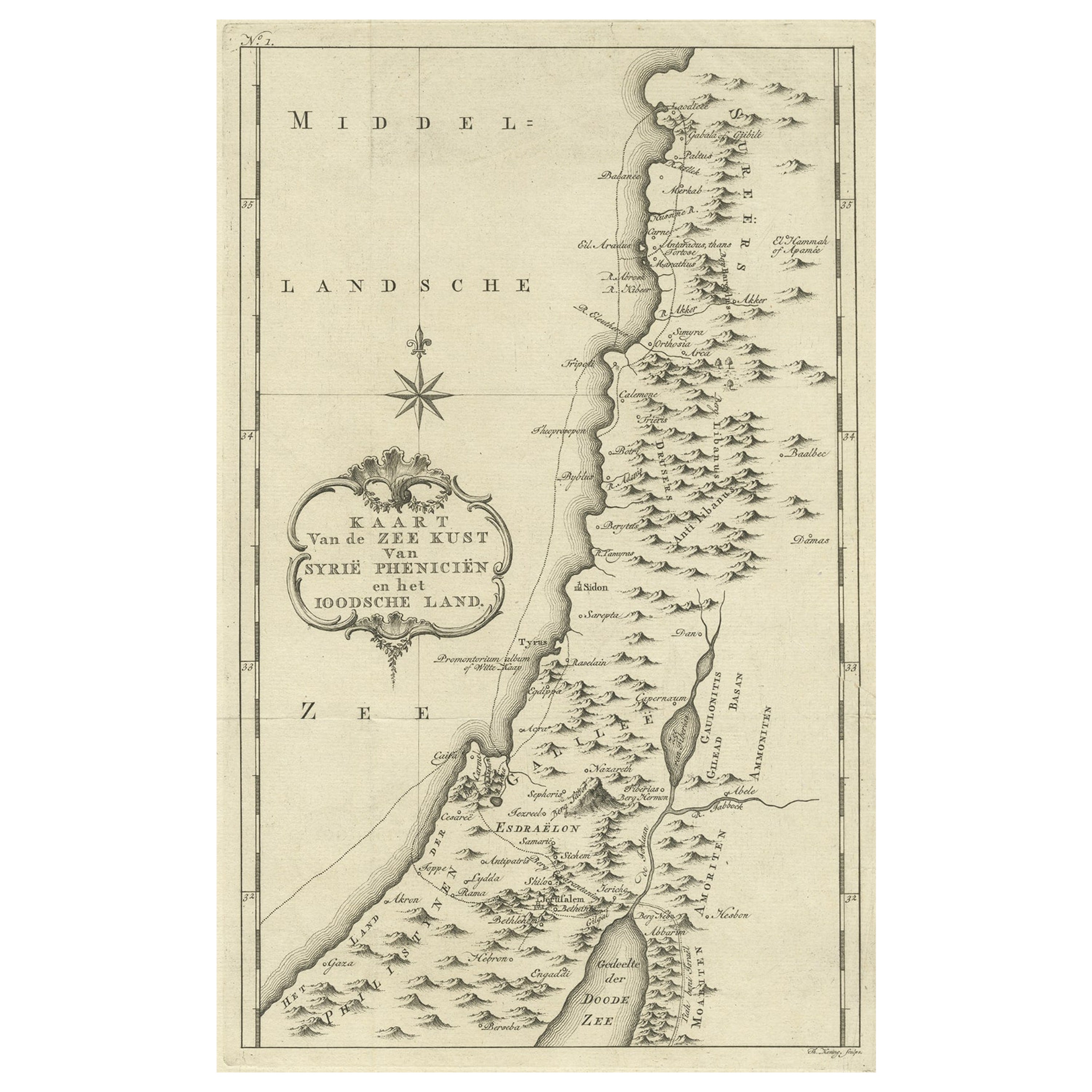
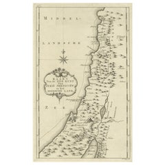
- Original Old Map of the Coast of Syria and Phoenicia, 1773Located in Langweer, NLAntique map titled 'Kaart van de Zee Kust van Syrië (..)'. Old map of the coast of Syria and Phoenicia. Originates from the first Dutch editon of an interesting travel account of...Category
Antique 1770s Maps
MaterialsPaper
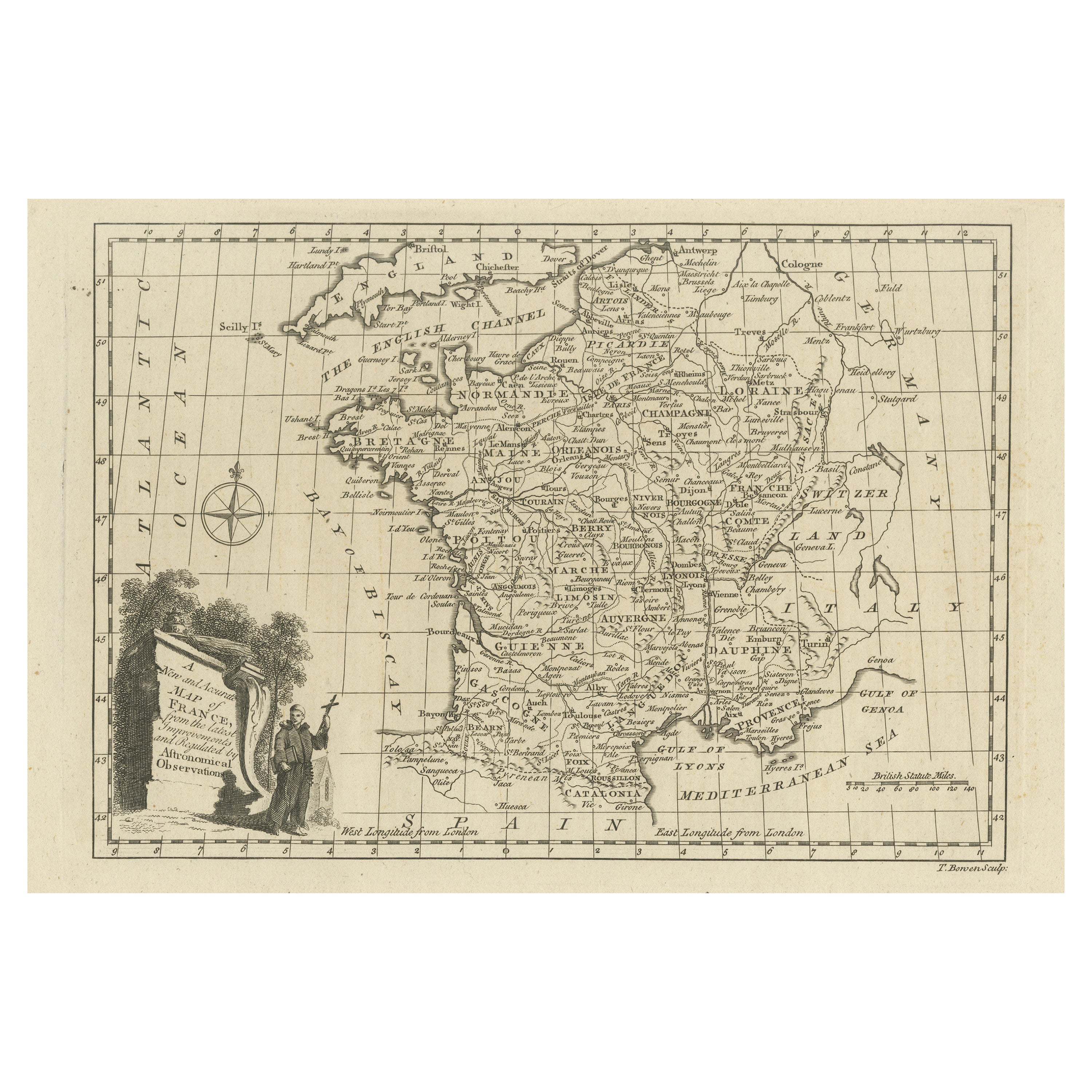
- Original Copper Engraved Map of FranceLocated in Langweer, NLAntique map titled 'New and Accurate Map of France from the latest improvements'. Original copper engraved map of France. Engraved by T. Bowen, published circa 1771.Category
Antique Late 18th Century Maps
MaterialsPaper
- Original Antique Map of Syria Phoenice by Van Dùren '1749'Located in Langweer, NLInteresting Antique map published in Germany titled 'Neue Vorstellung von Phoenice und Syrien (..)' This map is engraved with a lot of details. It is an original antique map of Syria...Category
Antique Mid-18th Century Maps
MaterialsPaper
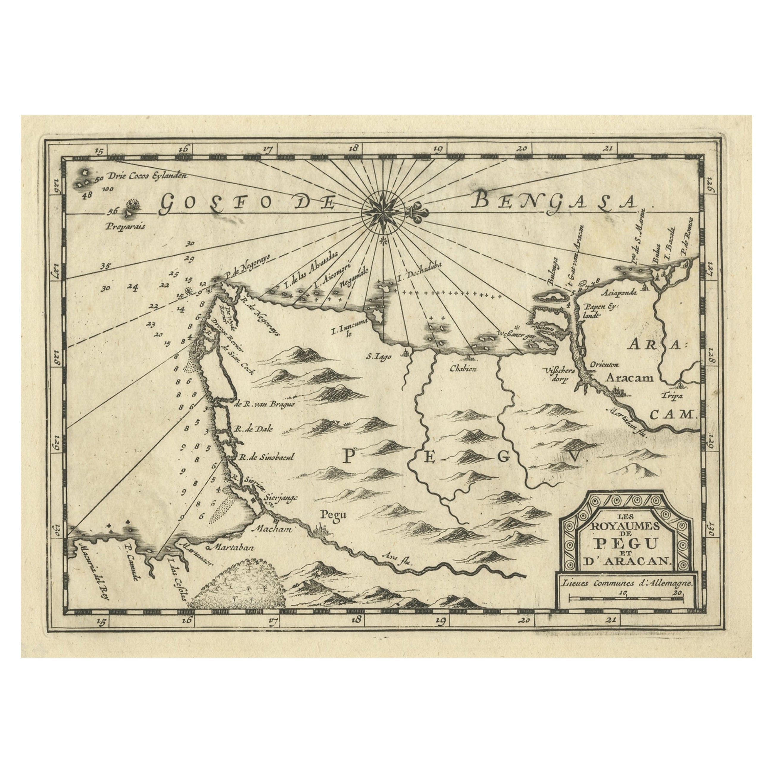
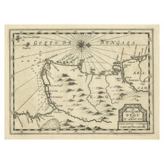
- Rare Antique Copper Engraving of a Map of Pegu and Arakan, Burma (Myanmar), 1714Located in Langweer, NLAntique map Myanmar (Birma) titled 'Les Royaumes de Pegu et d'Aracan'. Rare map of Pegu and Arakan made after a map engraved by Pieter van den Keere and published in the 1628 edi...Category
Antique 1710s Maps
MaterialsPaper
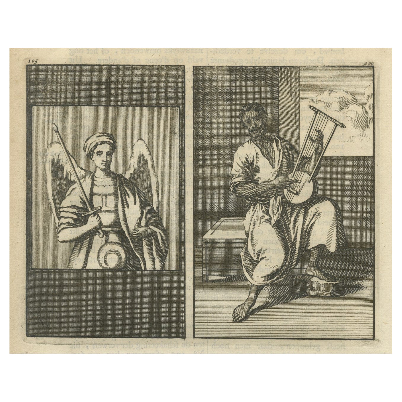
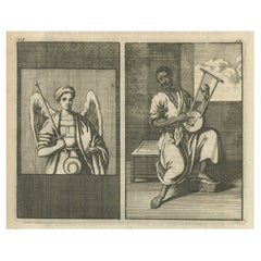
- Antique Engraving of Archangel Michael and an Arab Moor Playing Instrument, 1698Located in Langweer, NLUntitled print of an Arab Moor man playing a stringed instrument 105: Mural in St. Marc's church: the left a painting of the Archangel Michael, said to be painted by S. Lucas. Th...Category
Antique 1690s Religious Items
MaterialsPaper


You May Also Like
- Original Antique Map of Italy. C.1780Located in St Annes, LancashireGreat map of Italy Copper-plate engraving Published C.1780 Unframed.Category
Antique Early 1800s English Georgian Maps
MaterialsPaper

- Original Antique Map of Asia. C.1780Located in St Annes, LancashireGreat map of Asia Copper-plate engraving Published C.1780 Two small worm holes to right side of map Unframed.Category
Antique Early 1800s English Georgian Maps
MaterialsPaper

- Original Antique Map of India. C.1780Located in St Annes, LancashireGreat map of India Copper-plate engraving Published C.1780 Three small worm holes to right side of map and one bottom left corner Unframed.Category
Antique Early 1800s English Georgian Maps
MaterialsPaper

- Original Antique Map of Spain and Portugal, circa 1790Located in St Annes, LancashireSuper map of Spain and Portugal Copper plate engraving by A. Bell Published, circa 1790. Unframed.Category
Antique 1790s English Other Maps
MaterialsPaper
- Original Antique Map of Ireland- Tipperary and Waterford. C.1840Located in St Annes, LancashireGreat map of Tipperary and Waterford Steel engraving Drawn under the direction of A.Adlard Published by How and Parsons, C.1840 Unframed.Category
Antique 1840s English Maps
MaterialsPaper
- Original Antique Map of Sweden and Norway, Grattan and Gilbert, 1843Located in St Annes, LancashireGreat map of Sweden and Norway Drawn and engraved by Archer Published by Grattan and Gilbert Original color Unframed.Category
Antique 1840s English Other Maps
MaterialsPaper


