Items Similar to Original Old Map of the Coast of Syria and Phoenicia, 1773

Want more images or videos?
Request additional images or videos from the seller
1 of 5
Original Old Map of the Coast of Syria and Phoenicia, 1773
About the Item
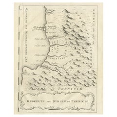
Antique map titled 'Kaart van de Zee Kust van Syrië (..)'.
Old map of the coast of Syria and Phoenicia. Originates from the first Dutch editon of an interesting travel account of Northern Africa titled 'Reizen en Aanmerkingen door en over Barbaryen en het Ooste'.
Artists and Engravers: Author: T. Shaw. Translated by P. Boddaert and published by J. van Schoonhoven.
Condition: Good, general age-related toning. Repair on the right margin (slightly affecting image), please study image carefully.
- Dimensions:Height: 15.75 in (40 cm)Width: 8.67 in (22 cm)Depth: 0 in (0.02 mm)
- Materials and Techniques:
- Period:1770-1779
- Date of Manufacture:1773
- Condition:Repaired: Repair on the right margin (slightly affecting image), please study image carefully.
- Seller Location:Langweer, NL
- Reference Number:
About the Seller
5.0
Platinum Seller
These expertly vetted sellers are 1stDibs' most experienced sellers and are rated highest by our customers.
Established in 2009
1stDibs seller since 2017
1,928 sales on 1stDibs
Typical response time: <1 hour
- ShippingRetrieving quote...Ships From: Langweer, Netherlands
- Return PolicyA return for this item may be initiated within 14 days of delivery.
More From This SellerView All
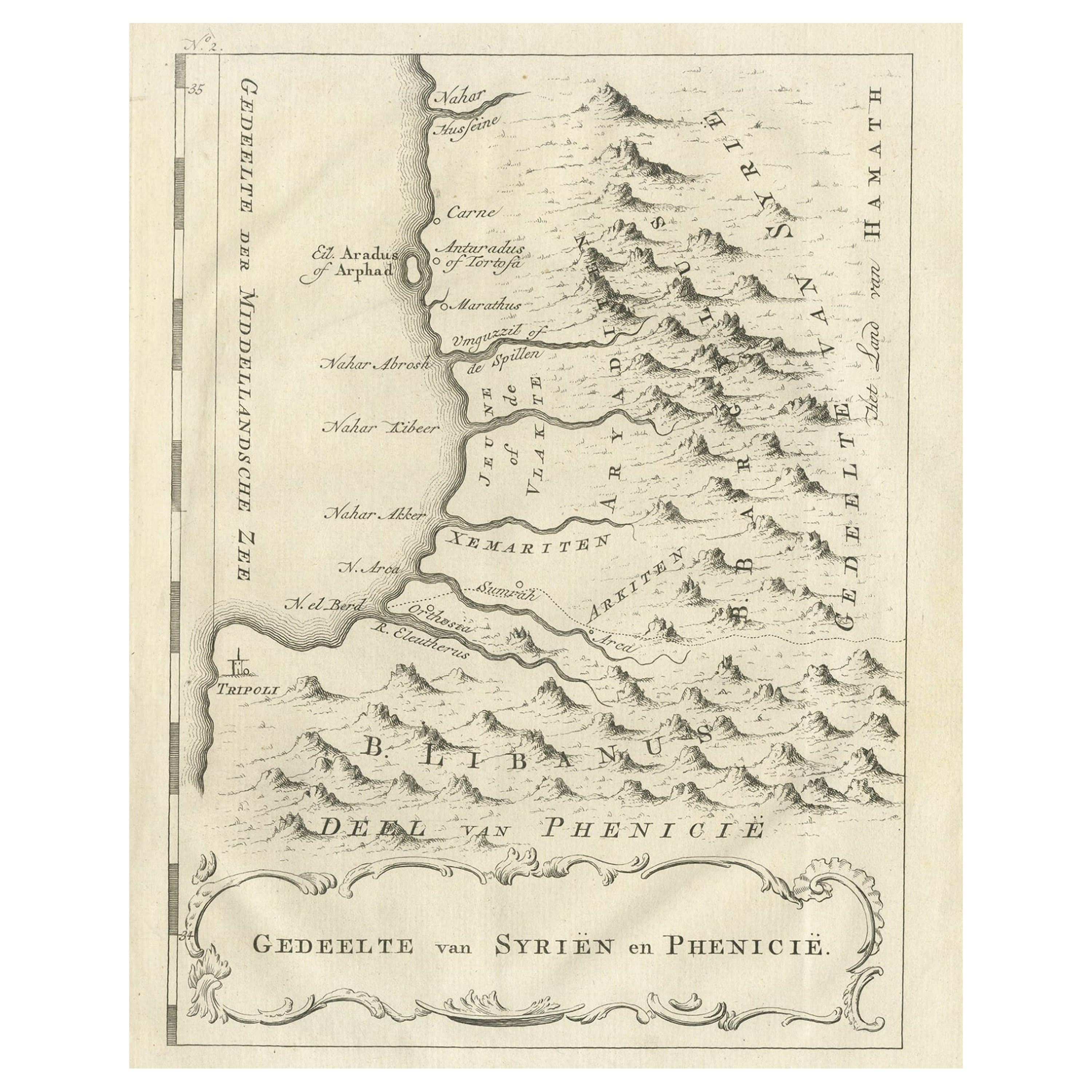
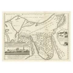
- Old Dutch Map of Part of Syria and Phoenicia, 1773Located in Langweer, NLAntique print titled 'Gedeelte van Syriën en Phenicië'. Old map of part of Syria and Phoenicia. Originates from the first Dutch editon of an interesting travel account of Norther...Category
Antique 1770s Maps
MaterialsPaper
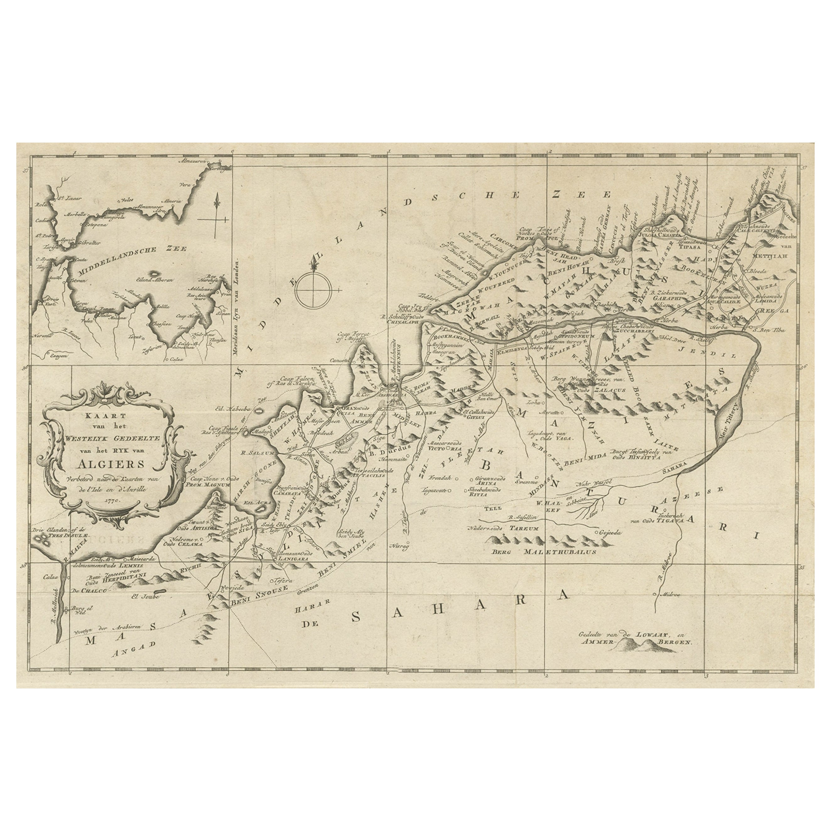
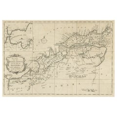
- Detailed Original Old Map of the Southern Region of the Kingdom of Algiers 1773Located in Langweer, NLAntique map titled 'Kaart van het Zuidelyk Gedeelte van het Ryk Algiers'. Old map of the southern region of the Kingdom of Algiers, Algeria. Originates from the first Dutch edito...Category
Antique 18th Century Maps
MaterialsPaper
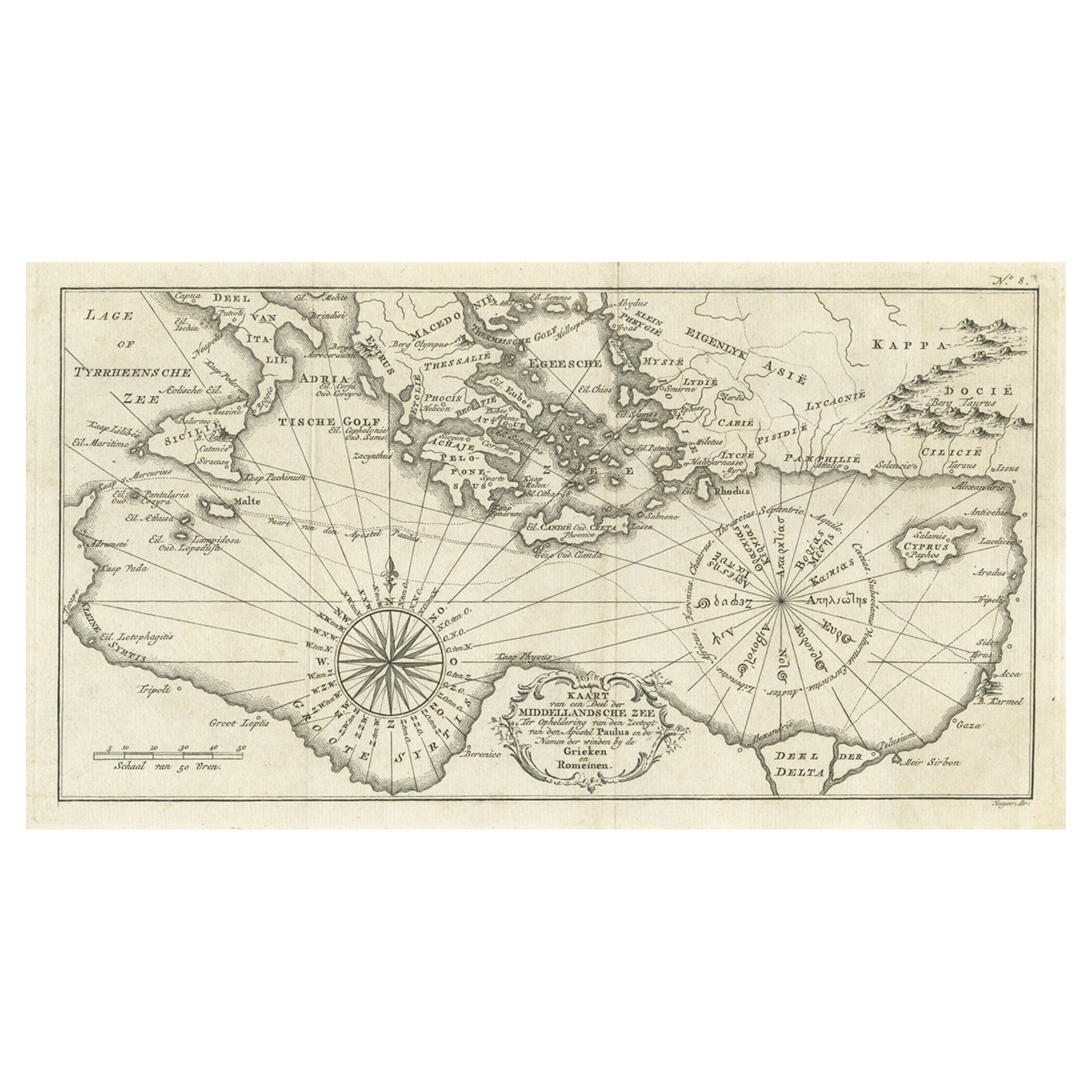
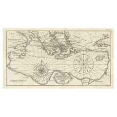
- Old Dutch Map of the Region Around the Mediterranean Sea, 1773Located in Langweer, NLAntique map titled 'Kaart van een Deel der Middelandsche Zee (..)'. Old map of the region around the Mediterranean Sea. Originates from the first Dutch editon of an interesting t...Category
Antique 1770s Maps
MaterialsPaper
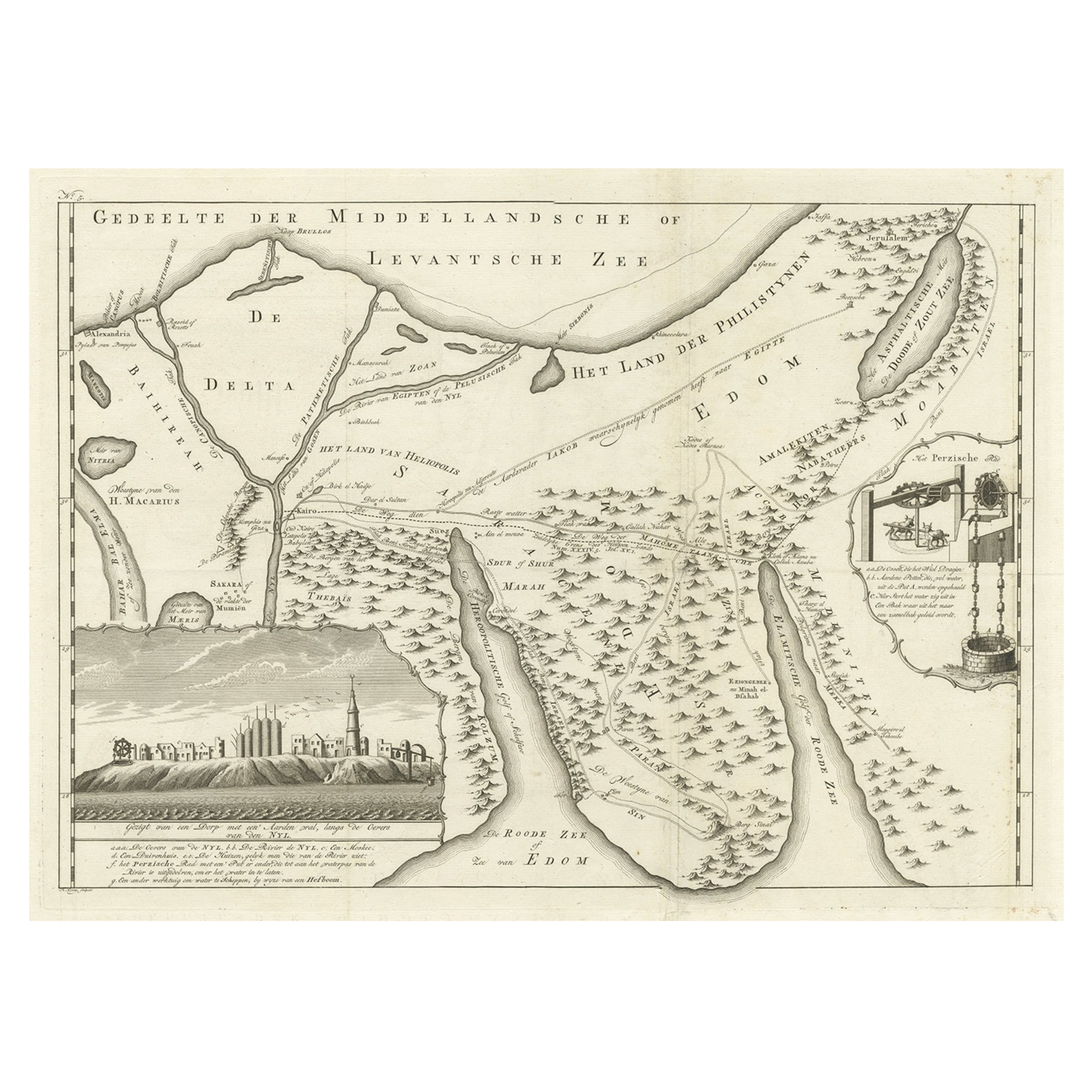
- Old Map of the Sinai Peninsula Showing the Mediterranean and the Red Sea, 1773Located in Langweer, NLAntique map of the Sinai Peninsula showing the Mediterranean Sea to the north and the Red Sea to the south. The map is decorated with images of a Persian wheel and a view of a vi...Category
Antique 1770s Maps
MaterialsPaper
- Old Map of the Western Region of the Kingdom of Algiers, Algeria, 1773Located in Langweer, NLAntique map titled 'Kaart van het Westelyk Gedeelte van het Ryk van Algiers'. Old map of the western region of the Kingdom of Algiers, Algeria. Originates from the first Dutch ed...Category
Antique 1770s Maps
MaterialsPaper
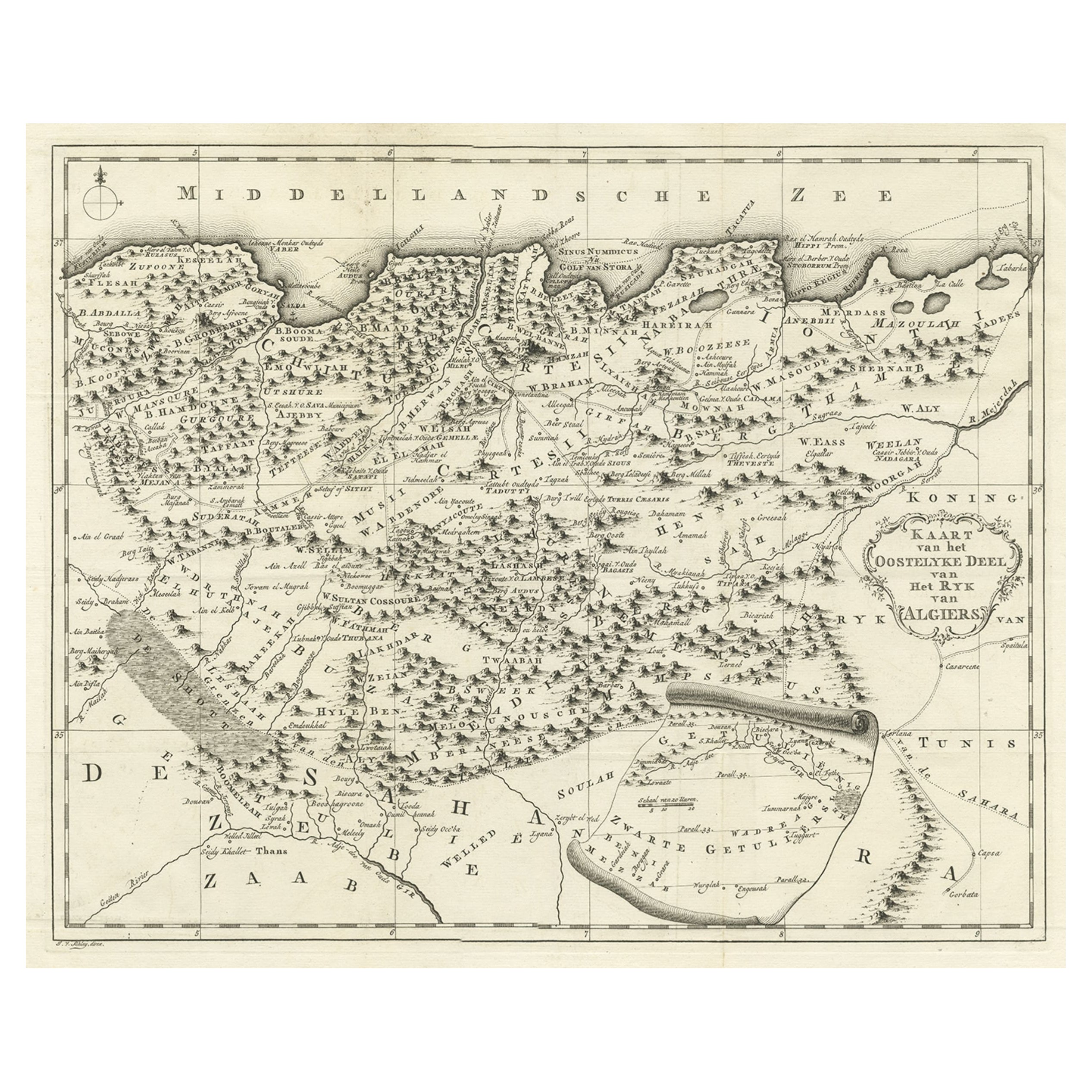
- Old Map of the Eastern Region of the Kingdom of Algiers, Algeria, 1773Located in Langweer, NLAntique map titled 'Kaart van het Oostelyke Deel van het Ryk van Algiers'. Old map of the eastern region of the Kingdom of Algiers, Algeria. Originates from the first Dutch edito...Category
Antique 1770s Maps
MaterialsPaper

You May Also Like
- Old Nautical Map of CorsicaLocated in Alessandria, PiemonteST/556/1 - Old map of Corsica isle, surveyed by Captain Hell, of the French Royal Navy in 1824, engraved and published on 1874, with additions and corre...Category
Antique Early 19th Century English Other Prints
MaterialsPaper
- Old Horizontal Map of EnglandBy TassoLocated in Alessandria, PiemonteST/520 - Old rare Italian map of England, dated 1826-1827 - by Girolamo Tasso, editor in Venise, for the atlas of M.r Le-Sage.Category
Antique Early 19th Century Italian Other Prints
MaterialsPaper
- Map of the Republic of GenoaLocated in New York, NYFramed antique hand-coloured map of the Republic of Genoa including the duchies of Mantua, Modena, and Parma. Europe, late 18th century. Dimension: 25...Category
Antique Late 18th Century European Maps
- Original Antique Map of The World by Thomas Clerk, 1817Located in St Annes, LancashireGreat map of The Eastern and Western Hemispheres On 2 sheets Copper-plate engraving Drawn and engraved by Thomas Clerk, Edinburgh. Published by Mackenzie And Dent, 1817 ...Category
Antique 1810s English Maps
MaterialsPaper
- Original Antique Map of Spain and Portugal, circa 1790Located in St Annes, LancashireSuper map of Spain and Portugal Copper plate engraving by A. Bell Published, circa 1790. Unframed.Category
Antique 1790s English Other Maps
MaterialsPaper
- Original Antique Map of Ireland- Tipperary and Waterford. C.1840Located in St Annes, LancashireGreat map of Tipperary and Waterford Steel engraving Drawn under the direction of A.Adlard Published by How and Parsons, C.1840 Unframed.Category
Antique 1840s English Maps
MaterialsPaper


