Middle East Map
5
to
34
114
35
82
51
30
27
20
20
17
15
15
10
9
8
8
8
8
7
7
6
5
5
4
4
4
3
3
2
2
2
2
2
2
2
2
2
1
1
1
1
1
1
1
11
4
2
2
2
Sort By
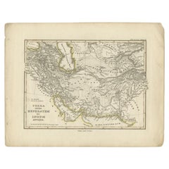
Antique Map of the Middle East by Perthes, 1848
Located in Langweer, NL
Antique map titled 'Terra inter Euphratem et Indum Antiqua'. Old map of the Middle East originating
Category
Antique 19th Century Maps
Materials
Paper
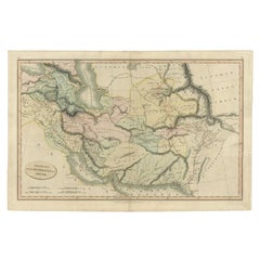
Antique Map of the Middle East by Smith, 1809
Located in Langweer, NL
Antique map titled 'Regiones inter Euphraten et Indum'. Old map of the Middle East showing the
Category
Antique 19th Century Maps
Materials
Paper
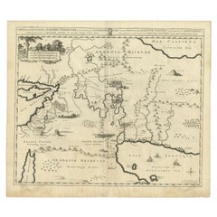
Antique Map of the Middle East by Mortier, 1700
Located in Langweer, NL
and the Middle East, centered on the Garden of Eden and including a large Cyprus. Includes the cities
Category
Antique 18th Century Maps
Materials
Paper
Antique Map of the Middle East by Von Sandrart, 1708
Located in Langweer, NL
Antique map titled 'Die Gegend des Irdlisches Paradieses und des Landes Kanaan.' Map of the Middle
Category
Antique 18th Century Maps
Materials
Paper
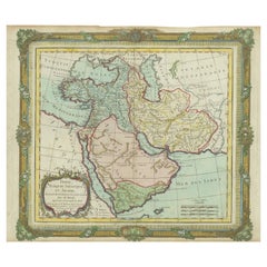
Antique Map of the Middle East with a Large Arabia, 1799
Located in Langweer, NL
Antique map titled 'Perse, Turquie Asiatique et Arabie (..)'. Map of the Middle East with a large
Category
Antique Late 18th Century Maps
Materials
Paper
Free Shipping
H 11.03 in W 15.63 in D 0.02 in
Finely Engraved Historical Map of Middle East and Asia, c.1745
Located in Langweer, NL
historical map with a profusion of details. It shows the Middle East and Asia. Decorative title cartouche and
Category
Antique 1740s Maps
Materials
Paper
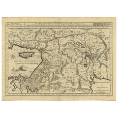
Antique Bible Map of the Middle East by A. Schut, 1743
Located in Langweer, NL
Antique map titled 'De Gelegentheyt van 't Paradys en 't Landt Canaan'. Dutch Bible map covering
Category
Antique Mid-18th Century Maps
Materials
Paper
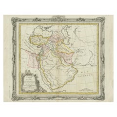
Antique Map of the Middle East by Brion de la Tour '1772'
Located in Langweer, NL
Antique map titled 'Carte des Pays et Principaux Lieux (..)'. Original antique map of Middle East
Category
Antique Late 18th Century Maps
Materials
Paper
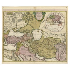
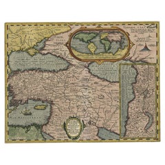
Scarce Antique Map of the Middle East, Surrounded by Latin Text, 1624
Located in Langweer, NL
Antique map titled 'Lumen Historium per Orientem (..).'
Scarce map of the Middle East
Category
Antique 1620s Maps
Materials
Paper
Original Antique Map of the Middle East, Published in Germany, c.1870
Located in Langweer, NL
Antique map titled 'Asia Citerior'. Old map of the Middle East. This map originates from 'Atlas
Category
Antique 19th Century Maps
Materials
Paper
Scarce Map of the Mediterranean and Parts of Europe, Africa & Middle East, 1725
Located in Langweer, NL
, Africa and the Middle East, illustrating the travels of Paul between the Holy Land and Rome, through the
Category
Antique 1720s Maps
Materials
Paper
H 15.75 in W 18.51 in D 0 in
Scarce Middle East and Arabia Map Showing The Exodus of the Israelites, 1725
Located in Langweer, NL
uytgang uyt Egypten, tot den overtogt over de Jordaane.'
Scarce map of the Middle East and Arbabia. It
Category
Antique 1720s Maps
Materials
Paper
H 15.75 in W 18.51 in D 0 in
Highly Decorative Map of The Eastern Mediterranean and The Middle East, ca.1700
Located in Langweer, NL
(..).'
Highly decorative map of the eastern Mediterranean and the Middle East features the tract of St. Paul
Category
Antique Early 1700s Maps
Materials
Paper
Free Shipping
H 16.74 in W 19.89 in D 0 in
Old Engraved Map of the Middle East, Arabia and Part of Greece 'Cyprus', 1706
Located in Langweer, NL
Mogol, opt spoor gevolgd'.
Old map of the Middle East, also depicting part of Greece (Cyprus). This
Category
Antique Early 1700s Maps
Materials
Paper
H 6.7 in W 11.62 in D 0 in
Antique Map of Asia from the Middle East to the Coast of Alaska, 1816
Located in Langweer, NL
""Nouv. Abrége de Géographie"". An engraved map with coloring of Asia from the Middle East to the coast
Category
Antique 19th Century Maps
Materials
Paper
Intriguing Antique Map of Europe, the Middle East and Africa by Scherer, c.1703
Located in Langweer, NL
Antique map depicting part of Africa, Europe and the Middle East. Also showing various cities in
Category
Antique 18th Century Maps
Materials
Paper
H 10.63 in W 8.27 in D 0 in
Antique Map of North and East Asia, 1751
Located in Langweer, NL
Map 2: 'Carte des parties nord et est de L'Asie'. (Map of the Northern parts and East Asia.) Five
Category
Antique 18th Century Maps
Materials
Paper
Antique Map of Batavia, Dutch East Indies, Nowadays Jakarta, Indonesia, ca.1669
Located in Langweer, NL
Antique map titled 'Ware afbeeldinge wegens het Casteel ende Stadt Batavia gelegen opt groot Eylant
Category
Antique 1660s Maps
Materials
Paper
H 12.68 in W 14.77 in D 0 in
Rare and Very Old Antique Map of South East Asia, Published circa 1574
Located in Langweer, NL
A very fine impression of this map of the Malay Peninsula, Sumatra, Java, with Singapore denoted as
Category
Antique 16th Century Maps
Materials
Paper
Free Shipping
H 8.47 in W 12.21 in D 0 in
Original Old Map East of Stockholm, the Island Ljusterö and Värmdö, Sweden, 1720
Located in Langweer, NL
Konigle Schwedisch Haupt und Residentz Stadt Stockholm.'
Map of the area east of Stockholm, embracing
Category
Antique 1720s Maps
Materials
Paper
H 21.11 in W 24.89 in D 0 in
Antique Map Made After a Roman Papyrus Travel Map, Known as Peutinger Map, 1773
Located in Langweer, NL
Iberian Peninsula and the British Isles), North Africa, and parts of Asia, including the Middle East
Category
Antique 18th Century Maps
Materials
Paper
H 15.56 in W 18.51 in D 0 in
Antique Map of Scotland With an Inset Map of the Shetland Islands, 1854
Located in Langweer, NL
Stunning Map of Scotland that will look beautiful in any setting framed on the wall.
Description
Category
Antique 1850s Maps
Materials
Paper
Antique Map of Stavoren by Blaeu, 1649
Located in Langweer, NL
cartographer of the Dutch East India Company. Around 1649 Joan Blaeu published a collection of Dutch city maps
Category
Antique 17th Century Maps
Materials
Paper
Antique Map of Stavoren by Blaeu, 1649
Located in Langweer, NL
cartographer of the Dutch East India Company. Around 1649 Joan Blaeu published a collection of Dutch city maps
Category
Antique 17th Century Maps
Materials
Paper
Antique Map of Stavoren by Blaeu, 1649
Located in Langweer, NL
cartographer of the Dutch East India Company. Around 1649 Joan Blaeu published a collection of Dutch city maps
Category
Antique 17th Century Maps
Materials
Paper
Antique Map of the Eastern Mediterranean, C.1710
Located in Langweer, NL
Antique map Middle East titled 'De Beschryving van de Reysen Pauli en van de Andere Apostelen
Category
Antique 18th Century Maps
Materials
Paper
Antique Map of German Colonies by Meyer, 1895
Located in Langweer, NL
Antique map titled 'Deutsche Kolonien.' Lithographed map of the German Colonies. German East-Africa
Category
Antique 19th Century Maps
Materials
Paper
Antique Map Eastern Mediterranean by D. Stoopendaal 'circa 1710'
Located in Langweer, NL
Antique map Middle East titled 'De Beschryving van de Reysen Pauli en van de Andere Apostelen
Category
Antique Early 18th Century Dutch Maps
Materials
Paper
Antique Map of the Gaspar Strait by Huddart, '1788'
Located in Langweer, NL
Antique map titled 'Sketch of the Straits of Gaspar'. Detailed sea chart of the Gaspar Strait
Category
Antique Late 18th Century Maps
Materials
Paper
Antique Map of the Turkish Empire by Tirion 'c.1760'
Located in Langweer, NL
Southern Europe, the Middle East, Arabia, and Northeastern Africa. Published by I. Tirion, circa 1760.
Category
Antique Mid-18th Century Maps
Materials
Paper
Antique Map of Flanders, Belgium by Homann Heirs, c.1735
Located in Langweer, NL
Antique map titled 'Comitatus Flandriae in omnes ejusdem subjecentes Ditioes (..).' Original
Category
Antique 18th Century Maps
Materials
Paper
Antique Map of the City of Sneek by Blaeu, 1652
Located in Langweer, NL
Antique map titled: 'Sneeck.' Bird's-eye view plan of Sneek, Friesland, The Netherlands. From a
Category
Antique 17th Century Maps
Materials
Paper
Antique Map of the City of Franeker by Blaeu, 1652
Located in Langweer, NL
cartographer of the Dutch East India Company. Around 1649 Joan Blaeu published a collection of Dutch city maps
Category
Antique 17th Century Maps
Materials
Paper
Mediterranean Tapestry: A 19th Century Map of the Mediterranean Shores, 1882
Located in Langweer, NL
the Middle East.
Topographical features such as mountain ranges, valleys, and plateaus are carefully
Category
Antique 1880s Maps
Materials
Paper
H 11.03 in W 14.97 in D 0 in
Antique Engraved Map of Saxonia in Northern Germany, ca.1721-1750
Located in Langweer, NL
Principatus accurate divisus ex conatibus -
A large map of Lower Saxony, extending from Hamburg with the
Category
Antique Mid-18th Century Maps
Materials
Paper
Antique German Map of India and Sri Lanka or Ceylon, 1902
By Meyer
Located in Langweer, NL
Antique map titled 'Ostindien.' (Map of India with an inset map of East-Bengal.) This attractive
Category
20th Century Maps
Materials
Paper
Original Antique Map of Canaan, Armenia, Syria, Mesopotamia and Arabia, 1709
Located in Langweer, NL
, Armenia, Syria, Mesopotamia and Arabia. It displays the Middle East from the eastern Mediterranean Sea to
Category
Antique Early 1700s Maps
Materials
Paper
No Reserve
H 9.85 in W 14.89 in D 0 in
Antique Map of the Moluccas in Indonesia by Janssonius, C.1650
By Johannes Janssonius
Located in Langweer, NL
Antique map titled 'Insularum Moluccarum Nova Descriptio.' Old map of the Moluccas. The famous
Category
Antique 17th Century Maps
Materials
Paper
Large and Detailed Map of the Russian Empire in Asia, ca.1780
Located in Langweer, NL
Description: Antique map titled 'Bowles's New Pocket Map of the East Part of the Russian Empire in
Category
Antique 1780s Maps
Materials
Paper
Original Old Map of Leeuwarden, European Cultural Capital 2018, Holland, 1649
Located in Langweer, NL
Antique print, titled: 'Leoverdia.'
This map shows Leoverdia (Leeuwarden). Bird's-eye view plan
Category
Antique 1640s Maps
Materials
Paper
H 20.87 in W 25.79 in D 0 in
Old Map of Holstein with the Imperial Towns Hamburg & Lubeck, Germany, 1854
Located in Langweer, NL
Antique map titled 'Map of the Duchy of Holstein with the territories of the Imperial Towns Hamburg
Category
Antique 1850s Maps
Materials
Paper
H 22.13 in W 27.96 in D 0 in
Old Map of Indonesian Islands Borneo, Celebes, New Guinea & New Britain, 1792
Located in Langweer, NL
Antique map titled 'Partie de la Nouvelle Grande Carte des Indes Orientales, contenant les Isles de
Category
Antique 1790s Maps
Materials
Paper
No Reserve
H 21.78 in W 25.99 in D 0 in
Large Antique Map of Egypt and the Nile Delta by Wyld, 1854
Located in Langweer, NL
Antique map titled 'Lower Egypt and the adjacent desert, with a part of Palestine to which has been
Category
Antique 19th Century Maps
Materials
Paper
The World in the Assyrian Empire's Era: A Historical Map, Published in 1880
Located in Langweer, NL
at its peak, including detailed territories across the Middle East.
2. **Historical Geography**: It
Category
Antique 1880s Maps
Materials
Paper
Free Shipping
H 15.56 in W 18.51 in D 0 in
Antique Map of the Caspian Sea, Uzbekistan, Northern Persia Etc, C.1735
Located in Langweer, NL
Antique map titled 'Nova Maris Caspii et Regions Usbeck (..).' Detailed map of Central Asia
Category
Antique 18th Century Maps
Materials
Paper
Beautiful Original Antique Map of Antwerp, Belgium by Mapmaker Blaeu, ca.1652
Located in Langweer, NL
Dutch East India Company. Around 1649 Joan Blaeu published a collection of Dutch city maps named Tooneel
Category
Antique 1650s Maps
Materials
Paper
H 19.1 in W 24.53 in D 0 in
Antique Map of the Strait of Malacca, Malay Peninsula & Dutch Indies, c.1670
Located in Langweer, NL
Antique map titled 'Indiae Orientalis, nec non Insularum Adiacentium Nova Descriptio.'
Map of
Category
Antique 1670s Maps
Materials
Paper
H 20.6 in W 24.93 in D 0 in
Antique Map of the Danube River and Surroundings by Homann Heirs, c.1730
By Homann Heirs
Located in Langweer, NL
Bavaria and Bohemia, to Provence in the west, and modern day Albania in the east. This highly detailed map
Category
Antique 18th Century Maps
Materials
Paper
H 21.15 in W 25.01 in D 0 in
Antique Plan of Batavia, Capital of the Dutch East Indies, by Van Der Aa, 1725
By Pieter Van Der Aa
Located in Langweer, NL
Antique map titled 'Plan de Batavia'. (Plan of Batavia.) This plate shows a plan of the city of
Category
Antique 18th Century Maps
Materials
Paper
H 14.97 in W 19.3 in D 0 in
Old Map by Blaeu of the City of Franeker, Friesland, The Netherlands, 1649
Located in Langweer, NL
cartographer of the Dutch East India Company. Around 1649 Joan Blaeu published a collection of Dutch city maps
Category
Antique 1640s Maps
Materials
Paper
H 21.82 in W 25.63 in D 0 in
Original Old Composite of Several Maps of the Ancient World on One Sheet, 1880
Located in Langweer, NL
inset maps. The topmost one appears to show the Arabian Peninsula; the middle one could be depicting the
Category
Antique 1880s Maps
Materials
Paper
Free Shipping
H 15.56 in W 18.51 in D 0 in
Very Decorative Original Antique Map of the World, Published in France in c.1780
By Rigobert Bonne
Located in Langweer, NL
Antique map titled 'L'Ancien Monde Et Le Nouveau en Deux Hemispheres' - Double hemisphere map of
Category
Antique 18th Century Maps
Materials
Paper
H 10.24 in W 17.6 in D 0 in
Old Map of Turkey in Asia with Mosul Environs and Assyrian Ruins Inset , 1859
Located in Langweer, NL
, covering a vast area that includes modern-day Turkey, parts of the Middle East, and extending towards the
Category
Antique Mid-19th Century Maps
Materials
Paper
H 14.57 in W 21.26 in D 0.02 in
Original 1859 Map of Asia from W.G. Blackie's Imperial Atlas of Modern Geography
Located in Langweer, NL
includes regions from the Middle East to the far reaches of East Asia, and from the Arctic shores of
Category
Antique Mid-19th Century Maps
Materials
Paper
H 14.57 in W 21.26 in D 0.02 in
Antique Map of France according to the Treaty of Paris '1815', Published in 1854
Located in Langweer, NL
Antique map titled 'The Kingdom of France, describing the new limits according to the treaty of
Category
Antique 19th Century Maps
Materials
Paper
H 23.04 in W 28.35 in D 0 in
Rare Sea Chart of the East Frisian Islands or Watten and the North Sea, c.1700
Located in Langweer, NL
Description: Antique map titled 'Paskaarte van de rievier de Elve streckende van Oldenbroek tot
Category
Antique Early 1700s Maps
Materials
Paper
H 20.95 in W 24.73 in D 0 in
Antique Map of Asia Minor with Cyprus, Syria and Turkey and the Black Sea, 1747
Located in Langweer, NL
Antique map Middle East titled 'A New and accurate map of Anatolia or Asia Minor, with Syria and
Category
Antique 18th Century Maps
Materials
Paper
H 15.16 in W 18.9 in D 0 in
Antique Carte de De la Perse Saudie Arabia UAE Turkey Qatar Bahrein, 1836
Located in Amsterdam, Noord Holland
Antique Carte de De la Perse Saudie Arabia UAE Turkey Qatar Bahrein, 1836
Very nice map of Middle
Category
Antique 18th Century European Maps
Materials
Paper
H 12.09 in W 16.15 in D 0.04 in
Rare Antique Map of the Middle East, ca.1690
Located in Langweer, NL
Description: Antique print, untitled.
Two decorative maps on one sheet of the middle east in
Category
Antique 1690s Prints
Materials
Paper
Ancient Cartography of the Indian Subcontinent, Published in 1880
Located in Langweer, NL
the Silk Road and maritime paths used by traders to reach Southeast Asia, the Middle East, and East
Category
Antique 1880s Maps
Materials
Paper
Free Shipping
H 15.56 in W 18.51 in D 0 in
- 1
Get Updated with New Arrivals
Save "Middle East Map", and we’ll notify you when there are new listings in this category.
Middle East Map For Sale on 1stDibs
Find many varieties of an authentic middle east map available at 1stDibs. A middle east map — often made from paper, wood and bone — can elevate any home. Whether you’re looking for an older or newer middle east map, there are earlier versions available from the 18th Century and newer variations made as recently as the 20th Century. A middle east map, designed in the mid-century modern or Art Deco style, is generally a popular piece of furniture. You’ll likely find more than one middle east map that is appealing in its simplicity, but Jacques-Nicolas Bellin, Homann Heirs and Johannes Janssonius produced versions that are worth a look.
How Much is a Middle East Map?
Prices for a middle east map start at $60 and top out at $75,000 with the average selling for $755.
More Ways To Browse
Albania Antique Map
Antique Minnesota Map
Antique Maps Of Ukraine
Map Ukraine
Ukraine Antique Map
Mr John Kelly
Yacht Master 2 2 Tone
2 Tone Yacht Master
Folk Art Wooden Sheep
Robert W Meyers
Greek Smyrna
Antique Map Bahamas
Minnesota Map
Peeble Beach
Caucasus Map
B Fritz Oil Painting
Fox Fur Coat Mens
Antique German Dagger
