Items Similar to Scarce Map of the Mediterranean and Parts of Europe, Africa & Middle East, 1725
Want more images or videos?
Request additional images or videos from the seller
1 of 5
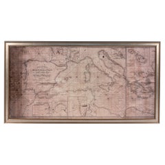
Scarce Map of the Mediterranean and Parts of Europe, Africa & Middle East, 1725
About the Item
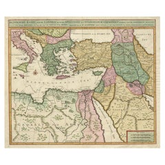
Antique map titled: Byzondere afbeelding der landschappen, van de Apostelen bevaren en doorwandelt, om het Evangelium J.C. te prediken.
Scarce map of the Mediterranean and contiguous parts of Europe, Africa and the Middle East, illustrating the travels of Paul between the Holy Land and Rome, through the Mediterranean. This map originates from: Het algemeen groot historisch, oordeelkundig, chronologisch, geografisch, en letterlyk naam- en woord-boek, van den gantschen H. Bybel by A. Calmet, 1725.
Artists and Engravers: Antoine Augustin Calmet ( 1672 - 1757 ), French Benedictine.
- Dimensions:Height: 15.75 in (40 cm)Width: 18.51 in (47 cm)Depth: 0 in (0.02 mm)
- Materials and Techniques:
- Period:1720-1729
- Date of Manufacture:1725
- Condition:Wear consistent with age and use. Condition: Good, given age. Edges browned. One small spot lower right just above the c of Africa. Original middle fold as issued. General age-related toning and/or occasional minor defects from handling. Please study image carefully.
- Seller Location:Langweer, NL
- Reference Number:
About the Seller
5.0
Platinum Seller
These expertly vetted sellers are 1stDibs' most experienced sellers and are rated highest by our customers.
Established in 2009
1stDibs seller since 2017
1,922 sales on 1stDibs
Typical response time: <1 hour
- ShippingRetrieving quote...Ships From: Langweer, Netherlands
- Return PolicyA return for this item may be initiated within 14 days of delivery.
More From This SellerView All
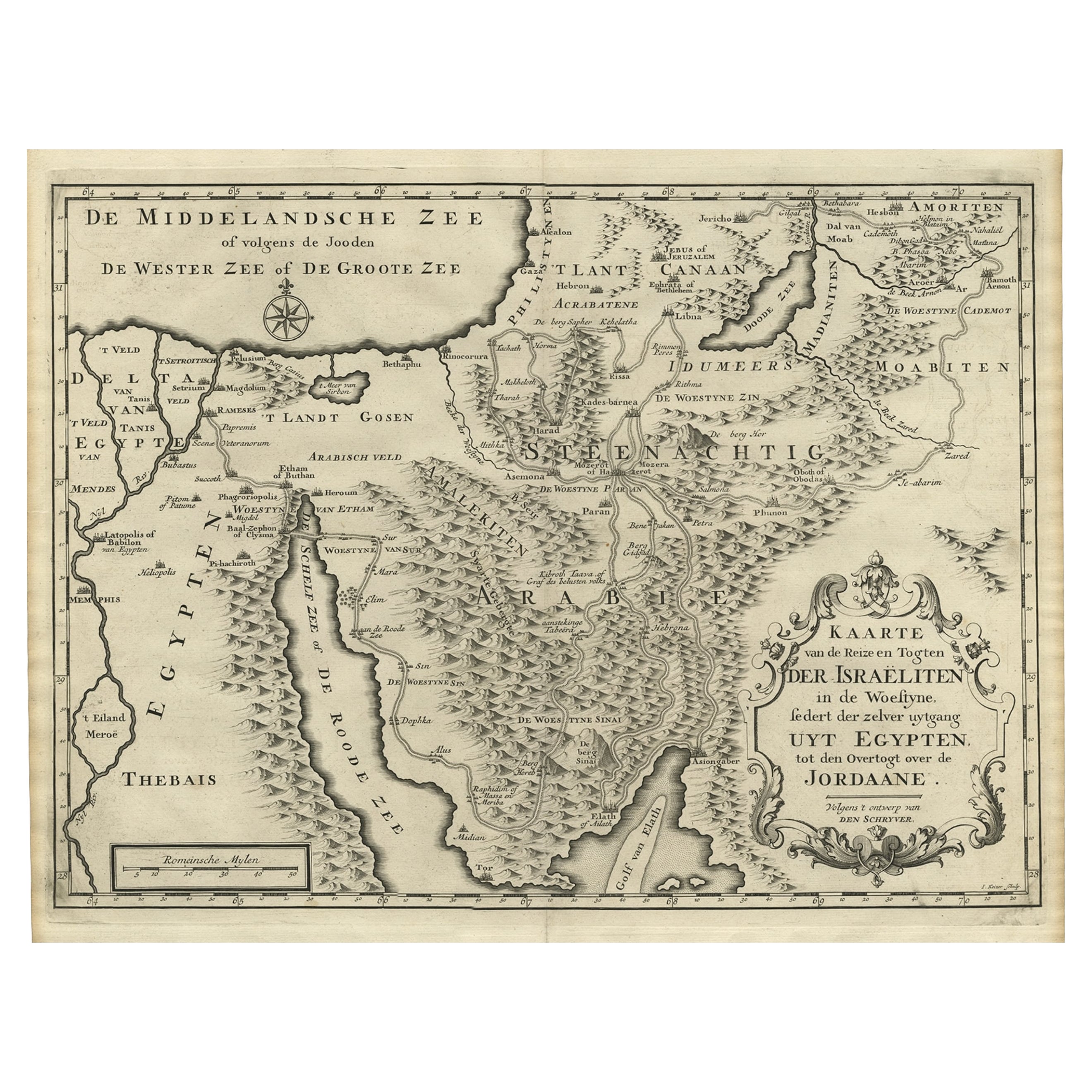
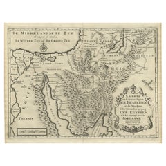
- Scarce Middle East and Arabia Map Showing The Exodus of the Israelites, 1725Located in Langweer, NLAntique map titled 'Kaarte van de reize en togten der Israeliten in de woestyne, sedert der zelver uytgang uyt Egypten, tot den overtogt over de Jordaane.' Scarce map of the Middle East and Arbabia. It shows the exodus...Category
Antique 1720s Maps
MaterialsPaper
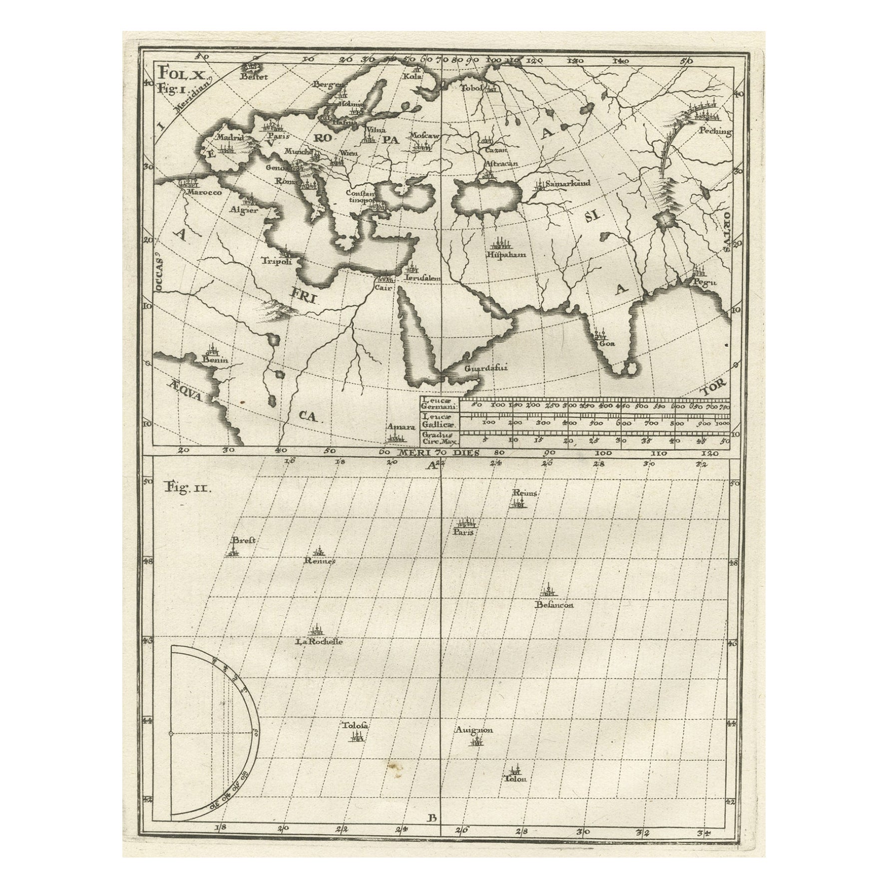
- Intriguing Antique Map of Europe, the Middle East and Africa by Scherer, c.1703Located in Langweer, NLAntique map depicting part of Africa, Europe and the Middle East. Also showing various cities in the lower chart. Printed for Scherer's 'Atlas Novus' (1702-1710). Artists and Eng...Category
Antique 18th Century Maps
MaterialsPaper
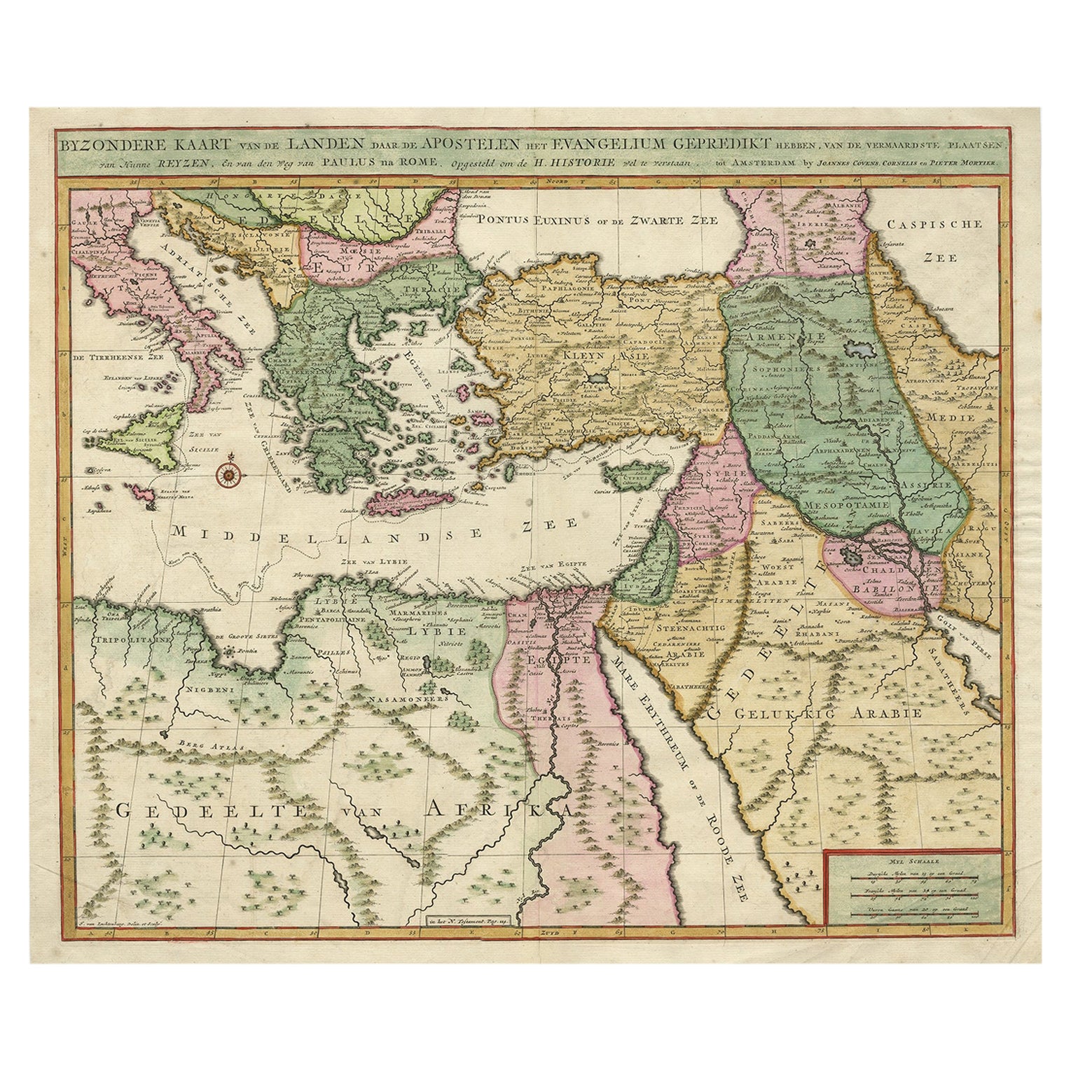
- Highly Decorative Map of The Eastern Mediterranean and The Middle East, ca.1700Located in Langweer, NLAntique map titled 'Byzondere Kaart van de Landen Daar de Apostelen Het Evangelium Gepredikt Hebben (..).' Highly decorative map of the eastern Mediterranean...Category
Antique Early 1700s Maps
MaterialsPaper
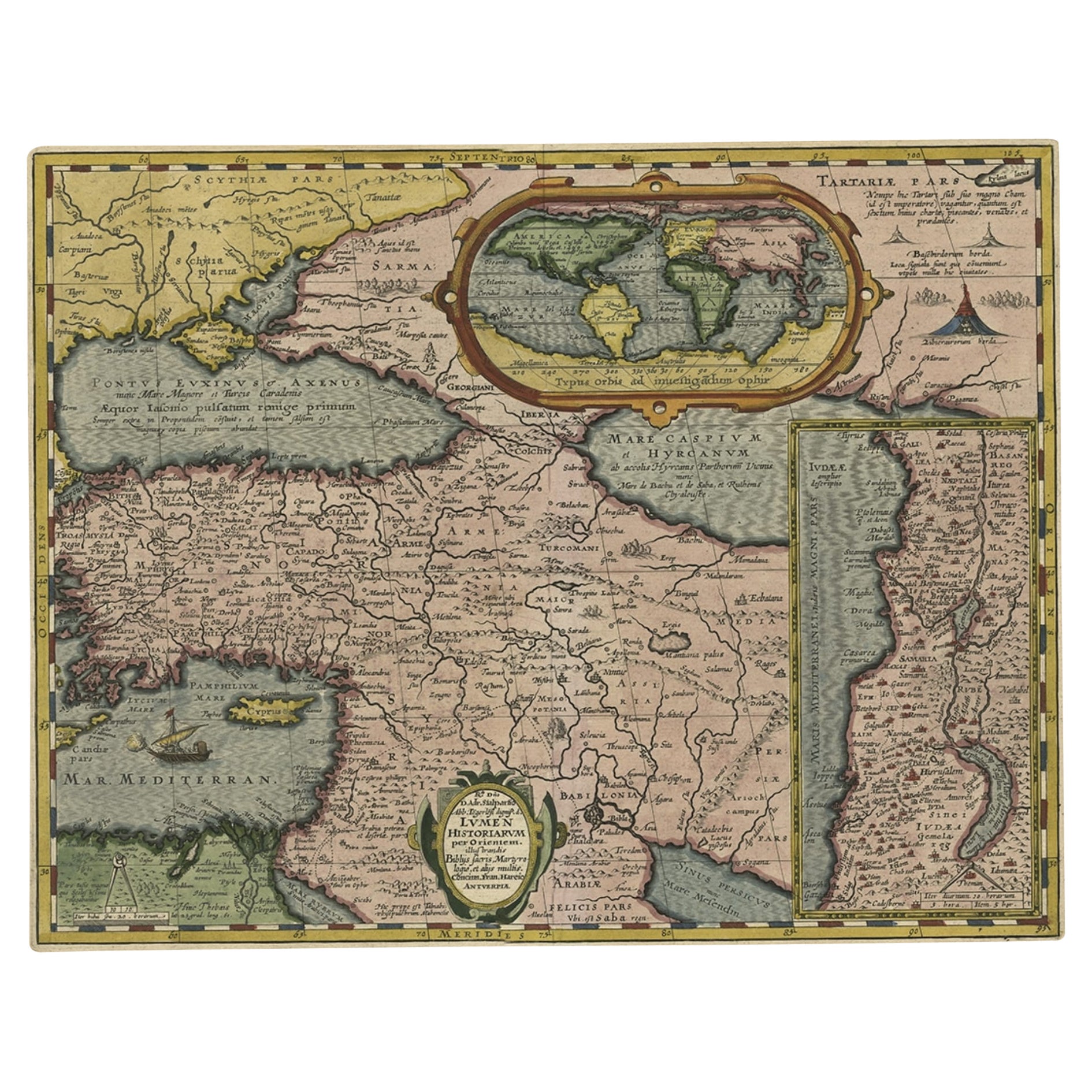
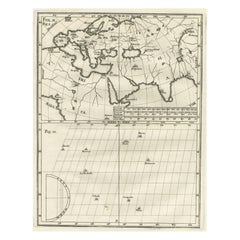
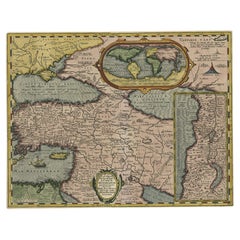
- Scarce Antique Map of the Middle East, Surrounded by Latin Text, 1624Located in Langweer, NLAntique map titled 'Lumen Historium per Orientem (..).' Scarce map of the Middle East, surrounded by Latin text. The two insets show Israel and an oval world map. This map (from the last edition of Ortelius Theatri Orbis Terrarum Parergon, 1624) was engraved by Franciscus Hareio. Later, this map was copied by Hornius for his World Atlas (1653). Artists and Engravers: Franciscus Haraeus (Latinised form of Franciscus Verhaer; also known as Frans Verhaer), (Utrecht 1555? - Leuven, 11 January 1631), was a Dutch theologian, historian, and cartographer. He is best known for his history (from a Catholic point of view) of the Dutch Revolt...Category
Antique 1620s Maps
MaterialsPaper
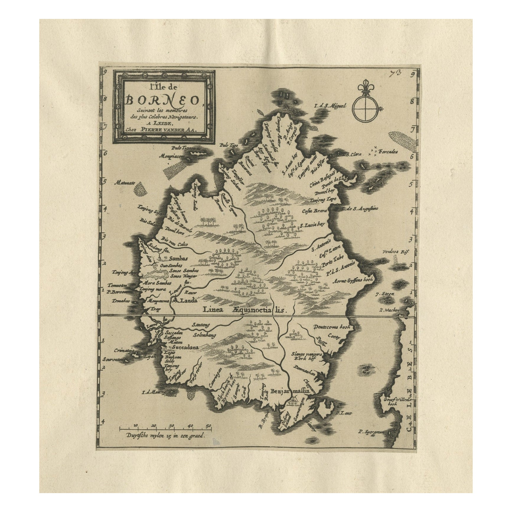
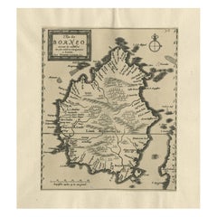
- Extremely Scarce Antique Map of The Island of Borneo, Indonesia, c. 1725Located in Langweer, NLAntique map titled 'L'Ile de Borneo Suivant les memoires des plus Celebres Navigateurs.' A detailed map of the island Borneo, with a small part of Celebes visible. This plate origi...Category
Antique 18th Century Maps
MaterialsPaper
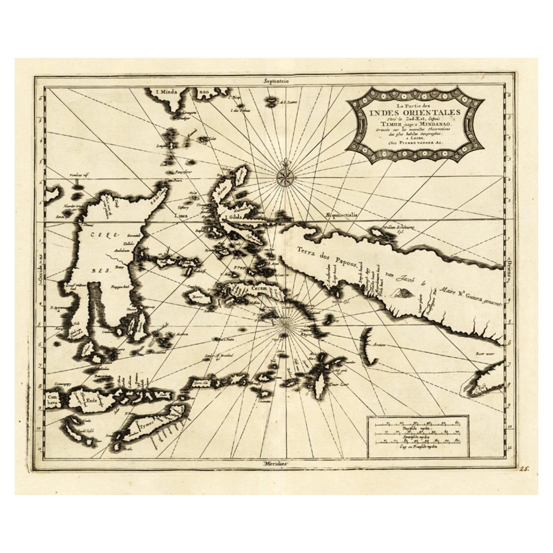
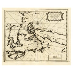
- Extremely Rare Map of the East-Indies towards the South-East 'Indonesia', 1725Located in Langweer, NLAntique map titled 'La partie des Indes Orientales vers le Zud-Est, depuis Timor jusqu'a Midanao (...).' (The part of the East-Indies towards the South-East, from Timor to Mindanao.)...Category
Antique 1720s Maps
MaterialsPaper
You May Also Like
- Large Framed Map of the MediterraneanLocated in New York, NYLarge map/chart chart of The Mediterranean and the Grecian Archipelago showing Italy, Sardinia, Corsica, part of France, etc. in a black frame.Category
20th Century French Mid-Century Modern Maps
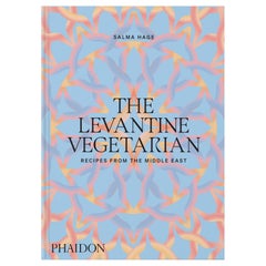
- The Levantine Vegetarian Recipes from the Middle EastLocated in New York City, NYVibrant vegetarian home-cooking recipes, capturing the essence of the Middle East, from the award-winning author of the best-selling The Lebanese Kitchen This glorious celebration of a bold vegetarian cuisine features 140 easy-to-make, bright, uplifting plant-based recipes, including classics such as falafels, hummus, and tabbouleh, as well as unique dishes reflective of region, religion, and culture across the Levant. The food is fresh and delicious, whether it’s garlic-laced mezze dishes, pittas stuffed with pickles, tahini, and grilled vegetables, or sweet and spicy desserts. Covering a vast area straddling Africa, Asia, and the gateway to Europe, the book embraces the culinary traditions of all corners of the Cradle of Civilization. Hage, one of the world’s authorities on Middle Eastern...Category
2010s Chinese Books
MaterialsPaper
- East German MapBy VEB Hermann HaackLocated in Baltimore, MDA brilliantly colourful map of the Leipzig, Karl Marx Stadt and Dresden area in the former German Democratic Republic by VEB Hermann Haack of Gotha.Category
Vintage 1970s German Maps
- London 1744 Published Watercolour Antique Map of East Africa by Eman BowenLocated in GBWe are delighted to offer for sale this New and Accurate Map of Nubia & Abissinia, together with all the Kingdoms Tributary Thereto, and bordering upon them published in 1744 by Emanuel Bowen This is a decorative antique engraved map of East Africa...Category
Antique 1740s English George III Maps
MaterialsPaper
- Two Thousand Years of Textiles the Figured Textiles of Europe and the Near EastLocated in Seguin, TXTwo Thousand Years of Textiles;: The figured textiles of Europe and the Near East by Adele C. Weibel. Published by Hacker Art Books, New York, 1972. Linen cloth binding, many illus...Category
Vintage 1970s American Other Books
MaterialsPaper
- Palace and Mosque : Islamic Art from the Middle East Book by Tim StanleyLocated in North Hollywood, CAPalace and Mosque : Islamic Art from the Middle East Book by Tim Stanley. 1st Edition 2004. Great hardcover table book. This fascinating introduction to Islamic art and culture draws on examples from the world famous collections of the V&A. The illuminating and highly accessible text provides an invaluable overview of a complex subject, exploring the cultural significance of objects in different media, from ceramics, miniature painting and textiles to wood-carving and metalwork, while the superb photographs highlight their unique craftsmanship. The arts of Islam, a great and ancient culture, are presented here in all their astonishing richness and diversity, through the V&A's magnificent collections. From the Middle East came the earliest astrological clocks...Category
21st Century and Contemporary Islamic Books
MaterialsPaper


Recently Viewed
View AllMore Ways To Browse
Middle East Furniture
Mediterranean Antique
Middle East Antiques
Antique Mediterranean Furniture
Holy Land
The Holy Land
Africa Antique Map
Antique Map Africa
Antique Map Of Africa
Antique Maps Of Africa
The Om
Antique Te
Map Of Rome
Map Rome
Rome Maps
Maps Of Mediterranean
Antique Map Mediterranean
Antique Map Of Rome