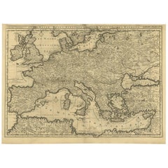
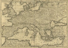
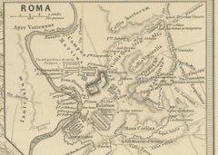
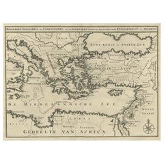
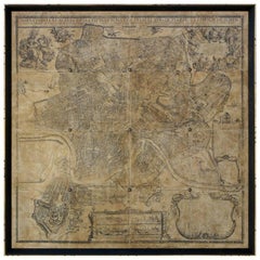
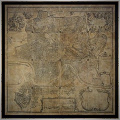
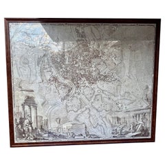
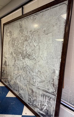
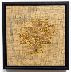
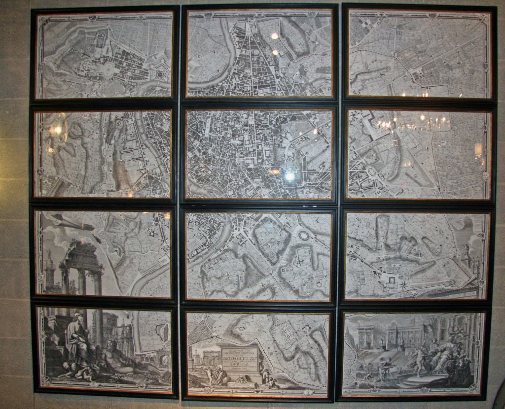
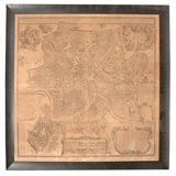
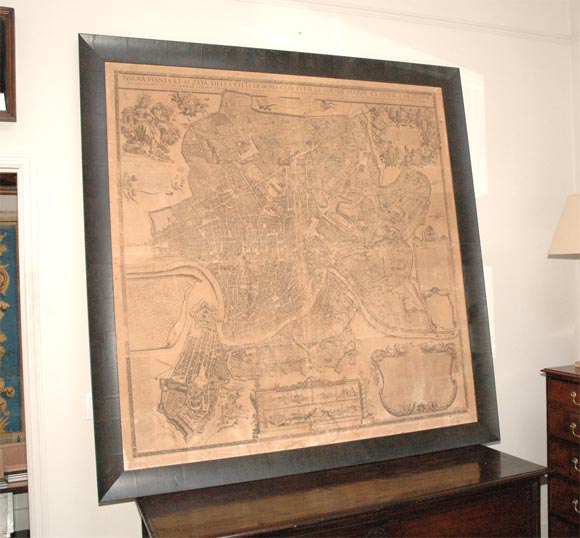
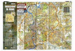
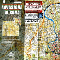
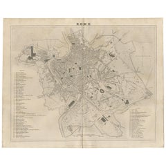
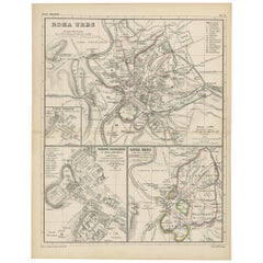
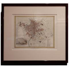
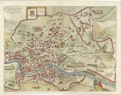
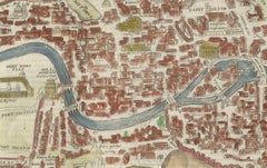
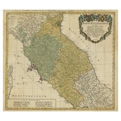
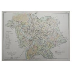
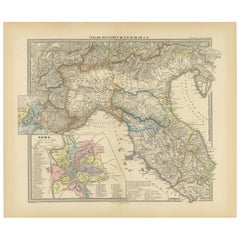
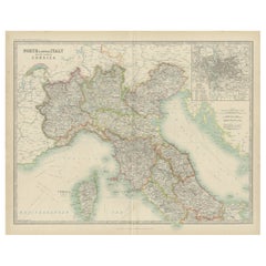
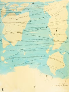
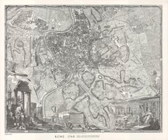
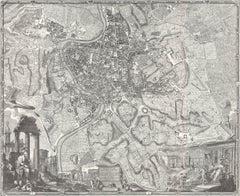
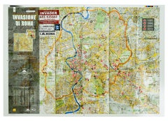
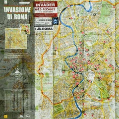
Rome Maps

to
6
48
15
34
22
17
16
12
11
6
5
5
5
3
3
3
3
3
2
2
1
1
1
1
1
1
1
1
1
1
1
1
18
3
3
3
1
Antique Roman Empire Map, Europe Mediterranean, Lapie Tardieu, 1838

Antique Roman Empire Map, Europe Mediterranean, Lapie Tardieu, 1838

Located in Langweer, NL

Particularly effective in a study, library, or as part of a curated gallery wall of historical maps. Keywords: antique Roman Empire map, Lapie atlas 1838, Tardieu engraving, Europe ...

Category

Antique Early 19th Century French Maps

Materials

Paper

Antique Roman Empire Map – Western Mediterranean & Europe, Engraving c.1818

Antique Roman Empire Map – Western Mediterranean & Europe, Engraving c.1818

Located in Langweer, NL

Especially striking when framed as a symmetrical pair with the Eastern Roman Empire sheet. We sell this map unframed. Technique: Engraving with original outline color Maker: Jean-Ba...

Category

Antique Early 19th Century British Maps

Materials

Paper

Roman Empire Map, Europe Mediterranean & Near East, Wilkinson London 1817

Roman Empire Map, Europe Mediterranean & Near East, Wilkinson London 1817

Located in Langweer, NL

Keywords: Roman Empire map, Romanum Imperium, ancient Rome map, classical antiquity map, Europe antique map, Mediterranean map, Britannia Hispania Gallia Italia, Germania Dacia map, ...

Category

Antique Early 19th Century British Maps

Materials

Paper

Antique Map of Rome and Athens by Perthes, 1848

Antique Map of Rome and Athens by Perthes, 1848

Located in Langweer, NL

Old map of Rome, Athens and surroundings originating from 'Orbis Terrarum Antiquus in usum Scholarum'.

Category

Antique 19th Century Maps

Materials

Paper

Antique Map of Italy with an Inset of Rome, 1812

Antique Map of Italy with an Inset of Rome, 1812

Located in Langweer, NL

Antique map titled 'Italie Ancienne'. Old map of ancient Italy, with an inset map of the region of Rome.

Category

Antique 19th Century Maps

Materials

Paper

Antique Map of Central Italy & Early Roman Empire – Wilkinson c.1800

Antique Map of Central Italy & Early Roman Empire – Wilkinson c.1800

Located in Langweer, NL

Keyword block: Romani Imperii Primordia et Recentiora, Roman Empire map, ancient Rome map, central Italy map, Latium map, Etruria map, Picenum map, Campania map, Samnium map, Sabina ...

Category

Antique Early 19th Century British Maps

Materials

Paper

Detailed Original Antique Map of the Region of Rome in Italy, c.1870

Detailed Original Antique Map of the Region of Rome in Italy, c.1870

By Heinrich Kiepert

Located in Langweer, NL

Antique map titled 'Roma Urbs'. Old map of Italy, it shows three inset maps of the region of Rome.

Category

Antique 19th Century Maps

Materials

Paper

Antique Map of Italy with Vignette of Saint Angu Castle in Rome, 1880

Antique Map of Italy with Vignette of Saint Angu Castle in Rome, 1880

Located in Langweer, NL

Antique map titled 'Italie Septentrionale'. Old map of Italy with a decorative vignette of Saint Angu castle in Rome.

Category

Antique 19th Century Maps

Materials

Paper

Map of the Kingdom of Sardinia and Part of the Kingdom of Genoa, Rome

Map of the Kingdom of Sardinia and Part of the Kingdom of Genoa, Rome

By Giovanni Maria Cassini

Located in Hamilton, Ontario

Map of Part of the Kingdom of Sardinia and Part of the Kingdom of Genoa: Rome.

Category

Antique 18th Century Italian Maps

Materials

Paper

Old Coloure Map of North & Central Italy & Corsica with an Inset of Rome, c.1860

Old Coloure Map of North & Central Italy & Corsica with an Inset of Rome, c.1860

Located in Langweer, NL

With an inset map of the region of Rome. Originates from 'The Royal Atlas Of Modern Geography Exhibiting, In A Series Of Entirely Original And Authentic Maps, The Present Condition O...

Category

Antique 1860s Maps

Materials

Paper

Genealogy of the Founders of Rome – Giacomo Lauro Engraving, c.1612

Genealogy of the Founders of Rome – Giacomo Lauro Engraving, c.1612

Located in Langweer, NL

This composition presents a compelling synthesis of mythology, history, and topography, illustrating the legendary origins of Rome through a structured genealogical diagram combined ...

Category

Antique Early 17th Century Italian Maps

Materials

Paper

Antique Map Italy, Bartholomew for Black’s General Atlas, Edinburgh 1884

Antique Map Italy, Bartholomew for Black’s General Atlas, Edinburgh 1884

Located in Langweer, NL

Black, Edinburgh, 1884 Keywords Italy, antique map Italy, Italy map 1884, Bartholomew map Italy, Black’s General Atlas, Italian peninsula map, historical map Italy, Victorian map It...

Category

Antique Late 19th Century Scottish Maps

Materials

Paper

Antique Engraving of the Baths of Titus in Rome, Ruins, Niquet Family, c.1780

Antique Engraving of the Baths of Titus in Rome, Ruins, Niquet Family, c.1780

Located in Langweer, NL

Antique Engraving of the Baths of Titus in Rome, Ruins, Niquet Family, c.1780 This refined late 18th-century engraving presents a picturesque and historically informed view of the r...

Category

Antique Early 17th Century French Maps

Materials

Paper

Antique Map of Ancient Italy – Roman Peninsula & Sicily, Engraving c.1818

Antique Map of Ancient Italy – Roman Peninsula & Sicily, Engraving c.1818

Located in Langweer, NL

Antique Map of Ancient Italy – Roman Peninsula & Sicily, Engraving c.1818 Elegant antique map depicting ancient Italy, showing the Italian peninsula from the Alps to Sicily, includi...

Category

Antique Early 19th Century British Maps

Materials

Paper

Original Italian Antique Map of Asia Minor, Cyprus, Neighboring Regions, 1686

Original Italian Antique Map of Asia Minor, Cyprus, Neighboring Regions, 1686

Located in Langweer, NL

Includes several ornate cartouches and a dedication to the Duke of Modena. Map by Cantelli da Vignola. Published in Rome by Rossi, 1686.

Category

Antique Late 17th Century Italian Maps

Materials

Paper

Italy in the Age of Antiquity – Rigobert Bonne French Map c.1780

Italy in the Age of Antiquity – Rigobert Bonne French Map c.1780

Located in Langweer, NL

Its clarity and balanced composition make it both historically informative and visually refined. KEYWORDS Italy map, Rome Naples Venice Florence, Papal States, Grand Tour Italy, Med...

Category

Antique Late 18th Century French Maps

Materials

Paper

Rare Antique Bible Map of Southern Europe by A. Schut, 1743

Rare Antique Bible Map of Southern Europe by A. Schut, 1743

Located in Langweer, NL

Paul to Rome. This map originates from ‘Biblia Sacra, dat is, de H.

Category

Antique Mid-18th Century Maps

Materials

Paper

Scarce Map of the Mediterranean and Parts of Europe, Africa & Middle East, 1725

Scarce Map of the Mediterranean and Parts of Europe, Africa & Middle East, 1725

Located in Langweer, NL

Scarce map of the Mediterranean and contiguous parts of Europe, Africa and the Middle East, illustrating the travels of Paul between the Holy Land and Rome, through the Mediterranean.

Category

Antique 1720s Dutch Maps

Materials

Paper

Map of Rome
Map of Rome

Map of Rome

$2,875 / item

Map of Rome

Located in Los Angeles, CA

A beautifully reproduced antique map of Rome. A work of remarkable lithographic skill and artistry, the work features a delicate yet bold latin heading and a number of floriated arch...

Category

2010s American Victorian Drawings

Materials

Wood, Paper

Overscaled Framed Nolli Map of Rome

Overscaled Framed Nolli Map of Rome

$2,808Sale Price|20% Off

Overscaled Framed Nolli Map of Rome

Located in New York, NY

The map was used in government planning for the city of Rome until the 1970s.

Category

2010s Renaissance Prints

Materials

Paper

18th Century Map of Rome & Surrounding Vicinity

18th Century Map of Rome & Surrounding Vicinity

Located in New Orleans, LA

Intriguing framed map of Rome and the surrounding vicinity featuring detailed cartography, ornamental illustrations, and text index at the bottom.

Category

Antique 18th Century Italian Antiquities

Materials

Paper

Rome - Paula Scher, Maps, Screenprint, Contemporary Art

Rome - Paula Scher, Maps, Screenprint, Contemporary Art

By Paula Scher

Located in London, GB

Signed in pencil, numbered from the edition of 150. Printed by Alexander Heinrici, New York. Published by ARTContent Editions Limited, Vancouver.

Category

2010s Contemporary Prints and Multiples

Materials

Screen

Little World Map Rome Peking - Olympic Games Beijing 2008

Little World Map Rome Peking - Olympic Games Beijing 2008

By Piero Pizzi Cannella

Located in Roma, IT

Little world map Rome Peking, Olympic Games Beijing 2008 is an original litography print realized by Piero Pizzi Cannella from the portfolio "The Unique Collection for the Olympic Fi...

Category

Early 2000s Contemporary Figurative Prints

Materials

Lithograph

Little World Map Rome Peking - Olympic Games Beijing 2008

Little World Map Rome Peking - Olympic Games Beijing 2008

By Piero Pizzi Cannella

Located in Roma, IT

This artwork is a lithograph made by Piero Pizzi Cannella, from the portfolio The Unique Collection for the Olympic Fine Arts 2008 presented during the Olympic Games and produced in...

Category

Early 2000s Contemporary Figurative Prints

Materials

Lithograph

Little World Map Rome Peking - Olympic Games Beijing 2008

Little World Map Rome Peking - Olympic Games Beijing 2008

By Piero Pizzi Cannella

Located in Roma, IT

This artwork is a lithograph realized by Piero Pizzi Cannella, from the portfolio The Unique Collection for the Olympic Fine Arts 2008 presented during the Olympic Games and produced...

Category

Early 2000s Contemporary Figurative Prints

Materials

Lithograph

Antique Map of The City of Rome by Sebastian Münster, 1549

Antique Map of The City of Rome by Sebastian Münster, 1549

By Sebastian Münster

Located in New York, NY

Sebastian Münster (German, 1488-1552) LA SITUATION DE LA VILLE DE ROME Antique Map of Rome, 1549 Possibly printed in 1964 Print on paper Publisher: Heinrich Petri for Cosmografia Un...

Category

1960s Realist Figurative Prints

Materials

Woodcut

Tom Lollar and Jane Manus "Map of Rome" Rectangular Coffee Table, 2010

Tom Lollar and Jane Manus "Map of Rome" Rectangular Coffee Table, 2010

By Jane Manus, Thomas W. Lollar

Located in New York, NY

Contemporary artists Tom Lollar and Jane Manus' "Map of Rome" Rectangular Coffee Table. Hand-carved marble, Roman fantasy map motif with circular drawings of buildings superimposed o...

Category

21st Century and Contemporary American Modern Coffee and Cocktail Tables

Materials

Marble, Aluminum

A Series of Historical Maps of Italian Cities

A Series of Historical Maps of Italian Cities

Located in New York, NY

Each is a charming reinterpretation of historical city maps (Rome and Venice). We love them for their soft, beautiful coloring and their unusual size.

Category

20th Century Italian Prints

Materials

Paper

Papal Procession at St. Peter’s Basilica, Antique Lithograph, 1869

Papal Procession at St. Peter’s Basilica, Antique Lithograph, 1869

Located in Langweer, NL

Papal Procession at St Peter’s, Rome – Antique Ceremonial Print, 1869 This original antique lithograph, printed in Paris in 1869, captures a solemn papal procession within St Peter’...

Category

Antique 1860s French Prints

Materials

Paper

Stella's Tale: Colorful Abstract Patterned Line Drawing in Yellow

Stella's Tale: Colorful Abstract Patterned Line Drawing in Yellow

By Donise English

Located in Hudson, NY

For example, Italian Cities (Rome) functions as a loose map of the city. It suggests tightly packed buildings, narrow streets, and the Tiber River, which divides Trastevere from the ...

Category

2010s Abstract Geometric Abstract Drawings and Watercolors

Materials

Paper, Gouache, Pencil, Color Pencil

The Lion - Etching by Antonio Tempesta - 1610s

The Lion - Etching by Antonio Tempesta - 1610s

By Antonio Tempesta

Located in Roma, IT

Antonio Tempesta trained in the culture of late Mannerism, with a naturalistic but also calligraphic taste, acquired from the frequentation of Giovanni Stradano, with whom he collabo...

Category

Early 17th Century Figurative Prints

Materials

Etching

Italian Cities (Venice-Madonna dell'Orto): Pale Pink and Graphite Grid

Italian Cities (Venice-Madonna dell'Orto): Pale Pink and Graphite Grid

By Donise English

Located in Hudson, NY

For example, Italian Cities (Rome) functions as a loose map of the city. It suggests tightly packed buildings, narrow streets, and the Tiber River, which divides Trastevere from the ...

Category

2010s Abstract Geometric Abstract Drawings and Watercolors

Materials

Wood, Paper, Gouache, Pencil, Color Pencil

Italian Cities (Pompeii): Abstract Grid Drawing with Color Pencil

Italian Cities (Pompeii): Abstract Grid Drawing with Color Pencil

By Donise English

Located in Hudson, NY

For example, Italian Cities (Rome) functions as a loose map of the city. It suggests tightly packed buildings, narrow streets, and the Tiber River, which divides Trastevere from the ...

Category

2010s Abstract Geometric Abstract Drawings and Watercolors

Materials

Paper, Gouache, Pencil, Color Pencil

Piazza del Popolo con Obelisco Egizio

Piazza del Popolo con Obelisco Egizio

By Giuseppe Vasi

Located in Fairlawn, OH

This comprehensive project provides one of the most complete views of eighteenth-century Rome. It acts as a pictorial supplement to Giovanni Battista Nolli’s famous map of Rome, _Pia...

Category

1750s Old Masters Landscape Prints

Materials

Etching

Camera sepolcrale
Camera sepolcrale

Camera sepolcrale

By Giovanni Battista Piranesi

Located in Fairlawn, OH

There is a small section of Nolli’s map of Rome, entitled La Topografia di Roma di Gio.

Category

1740s Old Masters Interior Prints

Materials

Etching

Ruine di Sepolcro antico

Ruine di Sepolcro antico

By Giovanni Battista Piranesi

Located in Fairlawn, OH

There is a small section of Nolli’s map of Rome, entitled La Topografia di Roma di Gio.

Category

1740s Old Masters Interior Prints

Materials

Etching

Carcere ascura
Carcere ascura

Carcere ascura

By Giovanni Battista Piranesi

Located in Fairlawn, OH

There is a small section of Nolli’s map of Rome, entitled La Topografia di Roma di Gio.

Category

1740s Old Masters Interior Prints

Materials

Etching

Dog - Etching by Antonio Tempesta - 1610s

Dog - Etching by Antonio Tempesta - 1610s

By Antonio Tempesta

Located in Roma, IT

Antonio Tempesta trained in the culture of late Mannerism, with a naturalistic but also calligraphic taste, acquired from the frequentation of Giovanni Stradano, with whom he collabo...

Category

Early 17th Century Figurative Prints

Materials

Etching

Dog -  Etching by Antonio Tempesta - 1610s

Dog - Etching by Antonio Tempesta - 1610s

By Antonio Tempesta

Located in Roma, IT

Antonio Tempesta trained in the culture of late Mannerism, with a naturalistic but also calligraphic taste, acquired from the frequentation of Giovanni Stradano, with whom he collabo...

Category

Early 17th Century Figurative Prints

Materials

Etching

The Buffalo - Etching by Antonio Tempesta - 1610s

The Buffalo - Etching by Antonio Tempesta - 1610s

By Antonio Tempesta

Located in Roma, IT

Antonio Tempesta trained in the culture of late Mannerism, with a naturalistic but also calligraphic taste, acquired from the frequentation of Giovanni Stradano, with whom he collabo...

Category

Early 17th Century Figurative Prints

Materials

Etching

The Horse - Etching by Antonio Tempesta - 1610s

The Horse - Etching by Antonio Tempesta - 1610s

By Antonio Tempesta

Located in Roma, IT

Antonio Tempesta trained in the culture of late Mannerism, with a naturalistic but also calligraphic taste, acquired from the frequentation of Giovanni Stradano, with whom he collabo...

Category

Early 17th Century Figurative Prints

Materials

Etching

Goat - Etching by Antonio Tempesta - 1610s

Goat - Etching by Antonio Tempesta - 1610s

By Antonio Tempesta

Located in Roma, IT

Antonio Tempesta trained in the culture of late Mannerism, with a naturalistic but also calligraphic taste, acquired from the frequentation of Giovanni Stradano, with whom he collabo...

Category

Early 17th Century Figurative Prints

Materials

Etching

The Monkey - Etching by Antonio Tempesta - 1610s

The Monkey - Etching by Antonio Tempesta - 1610s

By Antonio Tempesta

Located in Roma, IT

Antonio Tempesta trained in the culture of late Mannerism, with a naturalistic but also calligraphic taste, acquired from the frequentation of Giovanni Stradano, with whom he collabo...

Category

Early 17th Century Figurative Prints

Materials

Etching

The Fawn - Etching by Antonio Tempesta - 1610s

The Fawn - Etching by Antonio Tempesta - 1610s

By Antonio Tempesta

Located in Roma, IT

Antonio Tempesta trained in the culture of late Mannerism, with a naturalistic but also calligraphic taste, acquired from the frequentation of Giovanni Stradano, with whom he collabo...

Category

Early 17th Century Figurative Prints

Materials

Etching

Ox - Etching by Antonio Tempesta - 1610s

Ox - Etching by Antonio Tempesta - 1610s

By Antonio Tempesta

Located in Roma, IT

Antonio Tempesta trained in the culture of late Mannerism, with a naturalistic but also calligraphic taste, acquired from the frequentation of Giovanni Stradano, with whom he collabo...

Category

Early 17th Century Figurative Prints

Materials

Etching

  • 1

Recent Sales

Early French Louis XVI Mantel Clock 'Hannibal & Hasdrubal, circa 1760

Early French Louis XVI Mantel Clock 'Hannibal & Hasdrubal, circa 1760

Located in Amsterdam, NL

Both are overviewing a map- Pavie - Rome - Naples. French Bronze Casters used this historical scene as one of the first subject ever used on a Louis XVI clock case.

Category

Antique 18th Century and Earlier French Louis XVI Clocks

Materials

Bronze

Italy Map with Sardinia, Sicily and Rome Inset – Nieuwe Hand-Atlas, 1876

Italy Map with Sardinia, Sicily and Rome Inset – Nieuwe Hand-Atlas, 1876

Located in Langweer, NL

Italy Map with Sardinia, Sicily and Rome Inset – Nieuwe Hand-Atlas, 1876 This detailed 19th-century map of Italy, titled “Italië,” was published in 1876 as part of the Nieuwe Hand-A...

Category

Antique 1870s Dutch Maps

Materials

Paper

Antique Map of Ancient Italy with Inset of the Colosseum in Rome, 1880

Antique Map of Ancient Italy with Inset of the Colosseum in Rome, 1880

Located in Langweer, NL

With decorative vignettes of the Colosseum in Rome and the Temple of Sibylla in Tivoli. This map originates from 'Géographie Universelle Atlas-Migeon' by J.

Category

Antique 19th Century Maps

Materials

Paper

Antique Map of the East Indies by Rossi, 1683

Antique Map of the East Indies by Rossi, 1683

Sold

H 13.19 in W 18.51 in D 0 in

Antique Map of the East Indies by Rossi, 1683

Located in Langweer, NL

The brothers expanded the business and by the mid-seventeenth century it was the best-known printing house in Rome. For his maps, Giovanni worked with Giacomo Cantelli da Vignola.

Category

Antique 17th Century Maps

Materials

Paper

Original Antique Plan of the Harbor of Nettuno, Near Rome, by Munster, c.1580

Original Antique Plan of the Harbor of Nettuno, Near Rome, by Munster, c.1580

By Sebastian Münster

Located in Langweer, NL

Antique map titled 'Der Statt Neptun (.).' Detailed plan of the Harbor of Nettuno, near Rome, from Munster's Cosmographia, one of the most influential cartographic works of the 16th ...

Category

Antique 16th Century Maps

Materials

Paper

Map of Rome

Map of Rome

Sold

H 50 in W 50 in D 2 in

Map of Rome

Located in Los Angeles, CA

A reproduction of an antique map of Rome mounted on 16 handcrafted 20" Venetian panels.

Category

21st Century and Contemporary American Contemporary Art

Materials

Paper, Wood

Archival Pigment Print Map of Rome

Archival Pigment Print Map of Rome

Located in Los Angeles, CA

Contemporary re-edition, archival pigment print Find your way to Rome with this fab map!

Category

21st Century and Contemporary Italian Drawings

Giuseppe Agostino Vasi Giant Engraved Map of Rome

Giuseppe Agostino Vasi Giant Engraved Map of Rome

Sold

H 46.07 in W 108.67 in D 1.97 in

Giuseppe Agostino Vasi Giant Engraved Map of Rome

By Giuseppe Vasi

Located in Kastrup, DK

Giuseppe Agostino Vasi (b. Corleone 1710, d. Rome 1782), Italian printmaker and archaeologist. Important large scale panorama view of Rome, by Giuseppe Vasi, 1765. "Prospetto del...

Category

Antique Mid-18th Century Italian Other Prints

Materials

Glass, Wood, Paper

20th Century Reprint of 18th Century Nolli Map of Rome

20th Century Reprint of 18th Century Nolli Map of Rome

Located in Norwalk, CT

The famous 12 part map of Rome, The NOLLI PIANTA GRANDE was completed by Giambattista Nolli in 1748.

Category

20th Century Prints

The NOLLI MAP of ROME of 1748 in FACSIMILE Custom Framed

The NOLLI MAP of ROME of 1748 in FACSIMILE Custom Framed

Located in WEST PALM BEACH, FL

This is a representation of NOLLI MAP of ROME of 1748 in FACSIMILE in 12 sheets, custom framed.

Category

20th Century Italian Other Prints

Materials

Glass, Wood, Paper

Map
Map

Map

Sold

H 73 in W 71.5 in D 2 in

Map

Located in Los Angeles, CA

A map of Rome.

Category

Antique 19th Century Italian Decorative Art

Double Hemisphere Old World Map Print,  Matted & Framed

Double Hemisphere Old World Map Print, Matted & Framed

Located in Plainview, NY

A double hemisphere old world map print. The map is a reproduction of the original of the 1788 Mapa Mondo made in Rome Italy.

Category

20th Century Landscape Prints

Materials

Paper

The Elephant -  Etching by Antonio Tempesta - 1610s

The Elephant - Etching by Antonio Tempesta - 1610s

By Antonio Tempesta

Located in Roma, IT

Antonio Tempesta trained in the culture of late Mannerism, with a naturalistic but also calligraphic taste, acquired from the frequentation of Giovanni Stradano, with whom he collabo...

Category

Early 17th Century Figurative Prints

Materials

Etching

The Horse - Etching by Antonio Tempesta - 1610s

The Horse - Etching by Antonio Tempesta - 1610s

By Antonio Tempesta

Located in Roma, IT

Antonio Tempesta trained in the culture of late Mannerism, with a naturalistic but also calligraphic taste, acquired from the frequentation of Giovanni Stradano, with whom he collabo...

Category

Early 17th Century Figurative Prints

Materials

Etching

Bulgari Divas Dream Diamond Sapphire Rose Gold Automatic Roman Night Watch

Bulgari Divas Dream Diamond Sapphire Rose Gold Automatic Roman Night Watch

By Bulgari

Located in Southampton, PA

Inspired by the magic of a Roman night, the Divas’ Dream watch captures the essence of the city's starry sky with a blue aventurine dial that serves as the backdrop to a diamond cons...

Category

21st Century and Contemporary Italian Wrist Watches

Materials

Diamond, Sapphire, 18k Gold, Rose Gold

INVADER Invasione di Roma (Rome Map) Limited Edition Signed Print

INVADER Invasione di Roma (Rome Map) Limited Edition Signed Print

By Invader

Located in Englishtown, NJ
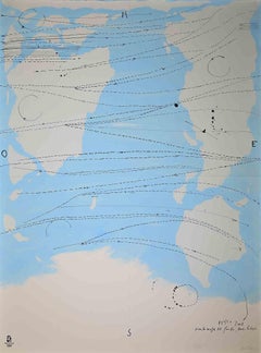
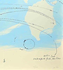
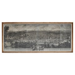
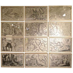
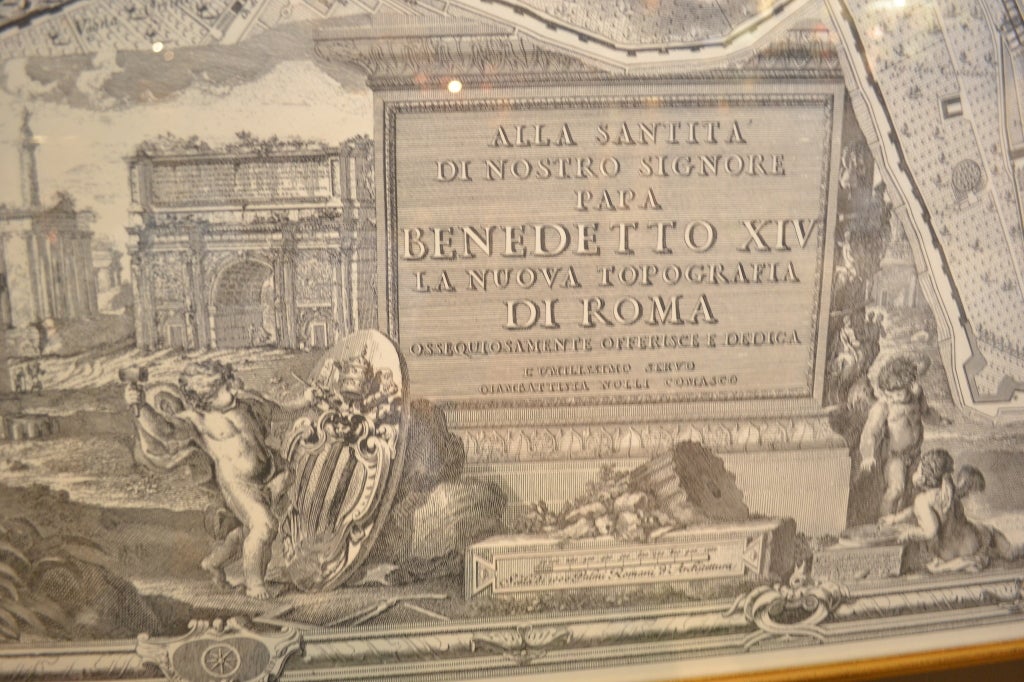
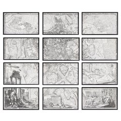
Print version of the Invader Rome Map. Never folded. Hand signed and numbered by Invader.

Category

21st Century and Contemporary Contemporary Prints and Multiples

Materials

Color

1891 Pocket Map of Rome

1891 Pocket Map of Rome

Sold

H 31 in W 39 in D 2 in

1891 Pocket Map of Rome

Located in Colorado Springs, CO

1891 Pocket Map of Roma (Rome) Beautifully presented using the finest archival materials and procedures.

Category

Antique 1890s Maps

Antique Map of Rome and Athens by Funke, 1825

Antique Map of Rome and Athens by Funke, 1825

Sold

H 8.63 in W 10.6 in D 0 in

Antique Map of Rome and Athens by Funke, 1825

Located in Langweer, NL

Antique map titled 'Roma Antiqua, Athenae'. Old map of Rome and Athens originating from 'Atlas der Oude Wereld'.

Category

Antique 19th Century Maps

Materials

Paper

Antique Map of the City of Rome by Balbi '1847'

Antique Map of the City of Rome by Balbi '1847'

Sold

H 9.06 in W 11.23 in D 0.02 in

Antique Map of the City of Rome by Balbi '1847'

Located in Langweer, NL

Antique map titled 'Rome'. Original antique map of the city of Rome, Italy.

Category

Antique Mid-19th Century Maps

Materials

Paper

Antique Map of the City of Rome by Stockdale (1800)

Antique Map of the City of Rome by Stockdale (1800)

Sold

H 15.75 in W 15.95 in D 0.6 in

Antique Map of the City of Rome by Stockdale (1800)

Located in Langweer, NL

Antique map titled 'A Plan of the City of Rome'. Detailed plan of Rome, includes a key locating 165 points of interest.

Category

Antique Early 19th Century Maps

Materials

Paper

Antique Map of Rome 'Italy' by H. Kiepert, circa 1870

Antique Map of Rome 'Italy' by H. Kiepert, circa 1870

By Heinrich Kiepert

Located in Langweer, NL

Antique map titled 'Roma Urbs'. This map originates from 'Atlas Antiquus. Zwölf Karten zur Alten Geschichte' by H. Kiepert. Published in Berlin, circa 187.

Category

Antique Late 19th Century Maps

Materials

Paper

Antique Map of the City of Rome by Dower 'circa 1836'

Antique Map of the City of Rome by Dower 'circa 1836'

Located in Langweer, NL

Antique map titled 'Rome'. Original antique map of the city of Rome, Italy.

Category

Antique Mid-19th Century Maps

Materials

Paper

Rare 1572 Map of Ancient Rome with Monuments by Ligorio, Braun & Hogenberg

Rare 1572 Map of Ancient Rome with Monuments by Ligorio, Braun & Hogenberg

Located in Langweer, NL

Rare 1572 Map of Ancient Rome with Monuments by Ligorio, Braun & Hogenberg This remarkable 16th-century map, *Urbis Romae Situs cum ils quae adhuc Conspiciuntur Veter.

Category

Antique 16th Century German Maps

Materials

Paper

Large Scale Antique Map of Italy with Two Insets, Including Rome, 1764

Large Scale Antique Map of Italy with Two Insets, Including Rome, 1764

Located in Langweer, NL

Antique map titled 'Tabula Italiae Antiquae'. Large scale map of Italy, covers from Lake Geneva to Sicily. Published 1764. Artists and Engravers: Jean-Baptiste Bourguignon d'...

Category

Antique 18th Century Maps

Materials

Paper

Antique Map of the City of Rome 'Italy' by H. Chatelain, circa 1720

Antique Map of the City of Rome 'Italy' by H. Chatelain, circa 1720

Located in Langweer, NL

Antique map titled 'Plan Des Antiquitez De Rome Representes Et Distingues Suivant La Situation De Chacun De Ses Anciens Monuments'.

Category

Antique Early 18th Century Maps

Original Antique City Plan of Rome, Italy, 1889

Original Antique City Plan of Rome, Italy, 1889

Located in St Annes, Lancashire

Great city plan of Rome Drawn and Engraved by W. & A.K. Johnston Published By A & C Black, Edinburgh. Original colour. Unframed.

Category

Antique 1880s Scottish Victorian Maps

Materials

Paper

Ancient Italy: Regions and Rome in the Roman Empire, Published in 1880

Ancient Italy: Regions and Rome in the Roman Empire, Published in 1880

Located in Langweer, NL

Rivers, such as the Tiber (Tiberis Fluvius) and the Po (Padus Fluvius), are prominently marked. 3. **Inset Map of Rome (ROMA)**: There is an inset map of ancient Rome, with color-co...

Category

Antique 1880s Maps

Materials

Paper

Antique Map of North and Central Italy by Johnston '1909'

Antique Map of North and Central Italy by Johnston '1909'

Located in Langweer, NL

With inset map of Rome. This map originates from the ‘Royal Atlas of Modern Geography’.

Category

Early 20th Century Maps

Materials

Paper

Antique Italian Map of Viaggio da Roma a Napoli 1775

Antique Italian Map of Viaggio da Roma a Napoli 1775

Located in Florence, Tuscany

An original print from 1775 showing an early route map of the journey from Rome to Naples. This route map was part of a collection of travellers routes published in a book translated...

Category

Antique 1770s Italian Maps

Materials

Parchment Paper

Antique Map of North and Central Italy by A.K. Johnston, 1865

Antique Map of North and Central Italy by A.K. Johnston, 1865

Located in Langweer, NL

With an inset map of Rome. This map originates from the ‘Royal Atlas of Modern Geography’ by Alexander Keith Johnston.

Category

Antique Mid-19th Century Maps

imaginary map of rome, Painting, Oil on Canvas

imaginary map of rome, Painting, Oil on Canvas

By Federico Cortese

Located in Yardley, PA

From the series “The earth seen from the space”, oil on canvas. 50 x 50 cm, 2014. The first time I used Google Earth was fantastic. I could not believe that someone had photog...

Category

2010s Abstract Abstract Paintings

Materials

Oil

Little world map Rome Peking, Olympic Games Beijing 2008

Little world map Rome Peking, Olympic Games Beijing 2008

By Piero Pizzi Cannella

Located in Roma, IT

Interesting graphic work by Piero Pizzi Cannella, realized in 2008. Edition of 260 prints. numbered and hand signed. Excellent conditions. This work is from the portfolio The Uniq...

Category

Early 2000s Contemporary Figurative Prints

Materials

Lithograph

Giambattista Nolli Rome 1748 Offset Print, Aerial Map, 1997 Edition

Giambattista Nolli Rome 1748 Offset Print, Aerial Map, 1997 Edition

Located in Brooklyn, NY

Nolli’s work is regarded as one of the most accurate and influential maps of Rome ever produced, offering an aerial perspective that meticulously details streets, piazzas, churches, ...

Category

1990s Prints and Multiples

Materials

Offset

The Cinghi - Original Etching by Antonio Tempesta - 1610

The Cinghi - Original Etching by Antonio Tempesta - 1610

By Antonio Tempesta

Located in Roma, IT

Antonio Tempesta trained in the culture of late Mannerism, with a naturalistic but also calligraphic taste, acquired from the frequentation of Giovanni Stradano, with whom he collabo...

Category

1610s Modern Figurative Prints

Materials

Etching

The Monkey - Original Etching by Antonio Tempesta - 1610

The Monkey - Original Etching by Antonio Tempesta - 1610

By Antonio Tempesta

Located in Roma, IT

Antonio Tempesta trained in the culture of late Mannerism, with a naturalistic but also calligraphic taste, acquired from the frequentation of Giovanni Stradano, with whom he collabo...

Category

1610s Modern Figurative Prints

Materials

Etching

Ram - Original Etching by Antonio Tempesta - 1610s

Ram - Original Etching by Antonio Tempesta - 1610s

By Antonio Tempesta

Located in Roma, IT

Antonio Tempesta trained in the culture of late Mannerism, with a naturalistic but also calligraphic taste, acquired from the frequentation of Giovanni Stradano, with whom he collabo...

Category

Early 17th Century Figurative Prints

Materials

Etching

The Lion - Original Etching by Antonio Tempesta - 1610s

The Lion - Original Etching by Antonio Tempesta - 1610s

By Antonio Tempesta

Located in Roma, IT

Antonio Tempesta trained in the culture of late Mannerism, with a naturalistic but also calligraphic taste, acquired from the frequentation of Giovanni Stradano, with whom he collabo...

Category

Early 17th Century Figurative Prints

Materials

Etching

The Tiger - Original Etching by Antonio Tempesta - 1610s

The Tiger - Original Etching by Antonio Tempesta - 1610s

By Antonio Tempesta

Located in Roma, IT

Antonio Tempesta trained in the culture of late Mannerism, with a naturalistic but also calligraphic taste, acquired from the frequentation of Giovanni Stradano, with whom he collabo...

Category

Early 17th Century Figurative Prints

Materials

Etching

The Cheetah - Original Etching by Antonio Tempesta - 1610s

The Cheetah - Original Etching by Antonio Tempesta - 1610s

By Antonio Tempesta

Located in Roma, IT

Antonio Tempesta trained in the culture of late Mannerism, with a naturalistic but also calligraphic taste, acquired from the frequentation of Giovanni Stradano, with whom he collabo...

Category

Early 17th Century Figurative Prints

Materials

Etching

The Goat - Original Etching by Antonio Tempesta - 1610s

The Goat - Original Etching by Antonio Tempesta - 1610s

By Antonio Tempesta

Located in Roma, IT

Antonio Tempesta trained in the culture of late Mannerism, with a naturalistic but also calligraphic taste, acquired from the frequentation of Giovanni Stradano, with whom he collabo...

Category

Early 17th Century Figurative Prints

Materials

Etching

The Lion - Original Etching by Antonio Tempesta - 1610s

The Lion - Original Etching by Antonio Tempesta - 1610s

By Antonio Tempesta

Located in Roma, IT

Antonio Tempesta trained in the culture of late Mannerism, with a naturalistic but also calligraphic taste, acquired from the frequentation of Giovanni Stradano, with whom he collabo...

Category

Early 17th Century Figurative Prints

Materials

Etching

The Lioness - Original Etching by Antonio Tempesta - 1630

The Lioness - Original Etching by Antonio Tempesta - 1630

By Antonio Tempesta

Located in Roma, IT

Antonio Tempesta trained in the culture of late Mannerism, with a naturalistic but also calligraphic taste, acquired from the frequentation of Giovanni Stradano, with whom he collabo...

Category

1630s Old Masters Animal Prints

Materials

Etching

Bear - Original Etching by Antonio Tempesta - 1610

Bear - Original Etching by Antonio Tempesta - 1610

By Antonio Tempesta

Located in Roma, IT

Antonio Tempesta trained in the culture of late Mannerism, with a naturalistic but also calligraphic taste, acquired from the frequentation of Giovanni Stradano, with whom he collabo...

Category

1610s Old Masters Animal Prints

Materials

Etching

The Monkey - Etching by Antonio Tempesta - 1610s

The Monkey - Etching by Antonio Tempesta - 1610s

By Antonio Tempesta

Located in Roma, IT

Antonio Tempesta trained in the culture of late Mannerism, with a naturalistic but also calligraphic taste, acquired from the frequentation of Giovanni Stradano, with whom he collabo...

Category

Early 17th Century Figurative Prints

Materials

Etching

Piazza della Rotunda (The Pantheon in the center background))

Piazza della Rotunda (The Pantheon in the center background))

By Giuseppe Vasi

Located in Fairlawn, OH

This comprehensive project provides one of the most complete views of eighteenth-century Rome. It acts as a pictorial supplement to Giovanni Battista Nolli’s famous map of Rome, _Pia...

Category

1750s Old Masters Landscape Prints

Materials

Etching

Piazza Colona
Piazza Colona

Giuseppe VasiPiazza Colona, 1752

Sold

H 8.25 in W 12.69 in

Piazza Colona

By Giuseppe Vasi

Located in Fairlawn, OH

This comprehensive project provides one of the most complete views of eighteenth-century Rome. It acts as a pictorial supplement to Giovanni Battista Nolli’s famous map of Rome, _Pia...

Category

1750s Old Masters Landscape Prints

Materials

Etching

Piazza Navona allagata solito farsi nelle Feste di Agosto

Piazza Navona allagata solito farsi nelle Feste di Agosto

By Giuseppe Vasi

Located in Fairlawn, OH

This comprehensive project provides one of the most complete views of eighteenth-century Rome. It acts as a pictorial supplement to Giovanni Battista Nolli’s famous map of Rome, _Pia...

Category

1750s Old Masters Landscape Prints

Materials

Etching

Galleria grande di Statue

Galleria grande di Statue

By Giovanni Battista Piranesi

Located in Fairlawn, OH

There is a small section of Nolli’s map of Rome, entitled La Topografia di Roma di Gio.

Category

1740s Old Masters Landscape Prints

Materials

Etching

Hand-Colored Map of Rome, circa 1720

Hand-Colored Map of Rome, circa 1720

Sold

H 20.75 in W 23.5 in D 0.02 in

Hand-Colored Map of Rome, circa 1720

By Johann Baptist Homann

Located in New York, NY

Original engraving hand-colored at publication. The design of this map originates in Giovanni Battista Falda's wall map of 1676, though Johann Baptiste Homann borrowed his illust...

Category

Antique 1720s German Maps

Materials

Paper, Watercolor

Great Italian Screen Map of Rome

Great Italian Screen Map of Rome

Located in New York, NY

Three paneled screen depicting the map of Rome.

Category

Vintage 1940s Italian Screens and Room Dividers

Get Updated with New Arrivals
Save "Rome Maps", and we’ll notify you when there are new listings in this category.

Rome Maps For Sale on 1stDibs

An assortment of rome maps is available at 1stDibs. Frequently made of paper and wood, all rome maps available were constructed with great care. We have 9 antique and vintage rome maps in-stock, while there are 2 modern editions to choose from as well. Rome maps have been produced for many years, with earlier versions available from the 18th Century and newer variations made as recently as the 21st Century. Rome maps bearing Victorian hallmark is very popular at 1stDibs. Rome maps have been a part of the life’s work for many furniture makers, but those produced by Giovanni Maria Cassini and Heinrich Kiepert are consistently popular.

How Much are Rome Maps?

Rome maps can differ in price owing to various characteristics — the average selling price at 1stDibs is $770, while the lowest priced sells for $173 and the highest can go for as much as $3,800.