Items Similar to Antique Map of Italy with an Inset of Rome, 1812


Want more images or videos?
Request additional images or videos from the seller
1 of 5
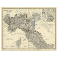
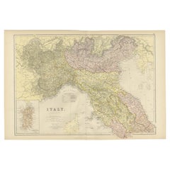
Antique Map of Italy with an Inset of Rome, 1812
About the Item
Antique map titled 'Italie Ancienne'.
Old map of ancient Italy, with an inset map of the region of Rome. This map originates from 'Atlas Supplementaire du Precis de la Geographie Universelle de M. Malte-Brun' by Lapie. Artists and Engravers: Pierre M. Lapie was a French cartographer and engraver. He was the father of cartographer Alexandre Emile Lapie. Lapie was a Colonel in the French army, where he worked in the corps of topographical engineers. Lapie worked closely with his son and published works together and individually. The work of Lapie and his son was influential on German commercial map makers in the 19th century.
Artist: Pierre M. Lapie was a French cartographer and engraver. He was the father of cartographer Alexandre Emile Lapie. Lapie was a Colonel in the French army, where he worked in the corps of topographical engineers. Lapie worked closely with his son and published works together and individually. The work of Lapie and his son was influential on German commercial map makers in the 19th century.
Condition: Good, general age-related toning. Minor wear and soiling, blank verso. Please study image carefully.
Date: 1812
Overall size: 34 x 25 cm.
Image size: 30 x 22 cm.
We sell original antique maps to collectors, historians, educators and interior decorators all over the world. Our collection includes a wide range of authentic antique maps from the 16th to the 20th centuries. Buying and collecting antique maps is a tradition that goes back hundreds of years. Antique maps have proved a richly rewarding investment over the past decade, thanks to a growing appreciation of their unique historical appeal. Today the decorative qualities of antique maps are widely recognized by interior designers who appreciate their beauty and design flexibility. Depending on the individual map, presentation, and context, a rare or antique map can be modern, traditional, abstract, figurative, serious or whimsical. We offer a wide range of authentic antique maps for any budget.
- Dimensions:Height: 13.39 in (34 cm)Width: 9.85 in (25 cm)Depth: 0 in (0.01 mm)
- Materials and Techniques:
- Period:
- Date of Manufacture:1812
- Condition:
- Seller Location:Langweer, NL
- Reference Number:
About the Seller
5.0
Platinum Seller
These expertly vetted sellers are 1stDibs' most experienced sellers and are rated highest by our customers.
Established in 2009
1stDibs seller since 2017
1,916 sales on 1stDibs
Typical response time: <1 hour
- ShippingRetrieving quote...Ships From: Langweer, Netherlands
- Return PolicyA return for this item may be initiated within 14 days of delivery.
More From This SellerView All
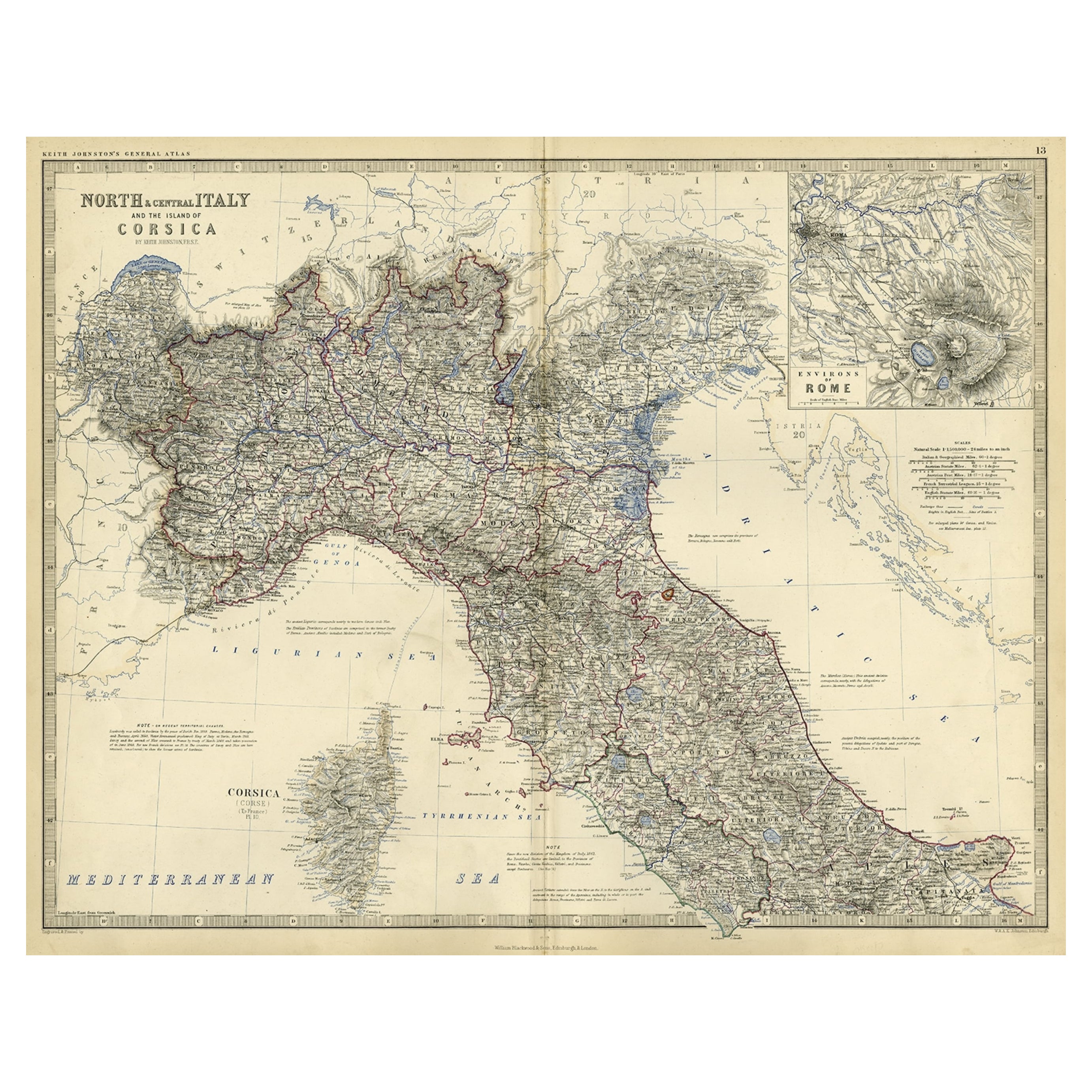
- Old Coloure Map of North & Central Italy & Corsica with an Inset of Rome, c.1860Located in Langweer, NLAntique map titled 'North & Central Italy and the Island of Corsica'. Old map of North and Central Italy, and the island of Corsica. With an inset map of the region of Rome. Orig...Category
Antique 1860s Maps
MaterialsPaper
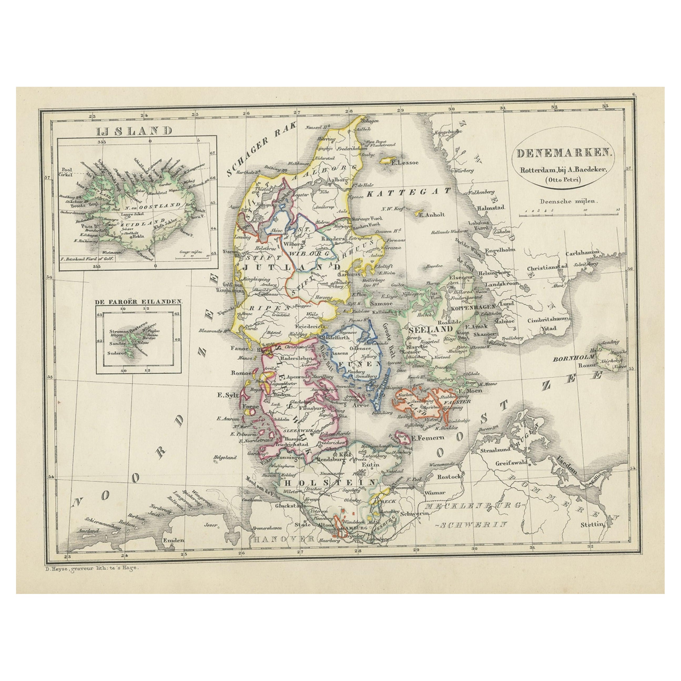
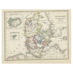
- Antique Map of Denmark with an Inset Map of Iceland, 1832Located in Langweer, NLAntique map titled 'Denmark'. Large map of Denmark with an inset map of Iceland. Artists and Engravers: Published by J. Arrowsmith in London, 1832. Condition: Good, general age...Category
Antique 19th Century Maps
MaterialsPaper
- Antique Map of Greece with an Inset Map of Corfu, 1854Located in Langweer, NLAntique map titled 'Hellas or Greece'. Old map of Greece with an inset map of Corfu. This map orginates from 'General Atlas Of The World: Containing Upwards Of Seventy Maps (..)' by ...Category
Antique 19th Century Maps
MaterialsPaper
- Original Antique Map of Italy with an Inset of Sardinia, 1882Located in Langweer, NLEmbark on a historical odyssey with an original Antique Map of Italy from the esteemed 'Comprehensive Atlas and Geography of the World,' meticulously crafted in 1882. This captivatin...Category
Antique 1880s Maps
MaterialsPaper
- Antique Map of Eastern Canada with an inset Map of Newfoundland, 1882Located in Langweer, NLAntique map titled 'Dominion of Canada'. Old map of Eastern Canada with an inset map of Newfoundland. This map originates from 'The Royal Atlas of Modern Geography, Exhibiting, in a ...Category
Antique 19th Century Maps
MaterialsPaper
- Antique Map of Denmark with An Inset of Iceland, 1852Located in Langweer, NLAntique map titled 'Denemarken'. Map of Denmark, with a small inset map of Iceland. This map originates from 'School-Atlas van alle deelen der Aarde' by Otto Petri...Category
Antique 19th Century Maps
MaterialsPaper


You May Also Like
- 1812 United States Map, by Pierre Tardieu, Antique French Map Depicting the U.S.By Pierre François TardieuLocated in Colorado Springs, CO1812 "United States of Nth America -- Carte des Etats-Unis De L'Amerique Septentrionale" Two-Sheet Map by Tardieu This attractive map, published in Paris in 1812, is one of the most rare large format maps from the period. It features a view of the East Coast of the U.S. from Maryland to just below South Carolina. Additionally, Ellicott’s plan for the City of Washington D.C. is included at the top right and an illustration of Niagara Falls is shown at the bottom right with a description in both French and English. This extremely detailed map not only depicts the mountainous regions of the southeastern U.S., but also includes names of regions, rivers, and towns. Based on the first state of Arrowsmith’s 4-sheet map of the United States, this map is completely engraved by Tardieu in Paris and showcases high quality engravings. This detailed map of the recently independent United States includes one of the largest and earliest examples of the Ellicott plan of Washington DC. The artist, Pierre François Tardieu (PF Tardieu) was a very well-known map engraver, geographer, and illustrator. Awarded a bronze medal by King Louis-Phillipe for the accuracy and beauty of his map-making, Tardieu produced many fine works including maps of Louisiana...Category
Antique 1810s French Maps
MaterialsPaper
- Original Antique Map of Italy. C.1780Located in St Annes, LancashireGreat map of Italy Copper-plate engraving Published C.1780 Unframed.Category
Antique Early 1800s English Georgian Maps
MaterialsPaper

- Original Antique Map of Italy. Arrowsmith. 1820Located in St Annes, LancashireGreat map of Italy Drawn under the direction of Arrowsmith Copper-plate engraving Published by Longman, Hurst, Rees, Orme and Brown, 1820 Unframed.Category
Antique 1820s English Maps
MaterialsPaper
- Antique Map of Italy by Andriveau-Goujon, 1843By Andriveau-GoujonLocated in New York, NYAntique Map of Italy by Andriveau-Goujon, 1843. Map of Italy in two parts by Andriveau-Goujon for the Library of Prince Carini at Palazzo Carini i...Category
Antique 1840s French Maps
MaterialsLinen, Paper
- Map of the Kingdom of Sardinia and Part of the Kingdom of Genoa, RomeBy Giovanni Maria CassiniLocated in Hamilton, Ontario18th century map by Italian engraver Giovanni Maria Cassini (Italy 1745-1824). Map of Part of the Kingdom of Sardinia and Part of the Kingdom of Genoa: Rome. This is a hand colored a...Category
Antique 18th Century Italian Maps
MaterialsPaper
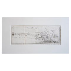
- Antique Italian Map of Viaggio da Roma a Napoli 1775Located in Roma, ITAn original print from 1775 showing an early route map of the journey from Rome to Naples. This route map was part of a collection of travellers routes published in a book translated...Category
Antique 1770s Italian Maps
MaterialsParchment Paper


Recently Viewed
View AllMore Ways To Browse
Antique Furniture Rome
1812 Furniture
Antique Italian Maps
Antique Italy Maps
Antique Maps Italy
Antique Map Italy
Antique Italian Map
Antique Italy Map
Italy Antique Map
Italy Map Antique
Topographical Map
Antique Maps Of Italy
Antique Map Of Italy
Map Of Italy Antique
Alexandre Antiques
Antique Topographic Maps
Map Of Rome
Map Rome