Items Similar to A Series of Historical Maps of Italian Cities
Want more images or videos?
Request additional images or videos from the seller
1 of 13
A Series of Historical Maps of Italian Cities
About the Item
Vintage maps can add so much interest to a space and this group of Italian maps is particularly interesting. Each is a charming reinterpretation of historical city maps (Rome, Venice and Florence). We love them for their soft, beautiful coloring and their unusual size. The maps not only depict the layout of each city, but also offer a glimpse into the way of life in each city by illustrating the people, the waterways, the vegetation, buildings and animals. Each could stand on its own, but they also look lovely in a grouping. Please note these are priced individually.
- Dimensions:Height: 23.5 in (59.69 cm)Width: 51 in (129.54 cm)Depth: 1 in (2.54 cm)
- Materials and Techniques:
- Place of Origin:
- Period:
- Date of Manufacture:Ca. 1950
- Condition:Wear consistent with age and use.
- Seller Location:New York, NY
- Reference Number:1stDibs: LU838736998692
About the Seller
4.8
Vetted Seller
These experienced sellers undergo a comprehensive evaluation by our team of in-house experts.
Established in 2007
1stDibs seller since 2007
209 sales on 1stDibs
Typical response time: 2 hours
- ShippingRetrieving quote...Ships From: Locust Valley, NY
- Return PolicyThis item cannot be returned.
More From This SellerView All
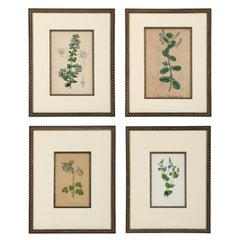
- A Series of Framed Antique Botanical LithographsLocated in New York, NYA series of four 19th-century botanical lithograph that can serve as a lovely layering piece in any room. The lithographs are matted and framed in a metal molded frame, with the add...Category
Antique Late 19th Century English Prints
MaterialsPaint
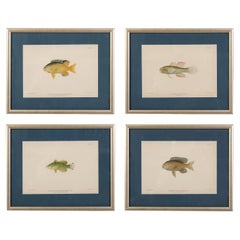
- A Set of Four Fish PrintsLocated in New York, NYA series of four hand-colored lithographs of fish, mostly of Caribbean species. Each is matted in a lovely deep blue and framed in a golden silver frame. Each is lovely on its own...Category
20th Century American Prints
MaterialsPaper
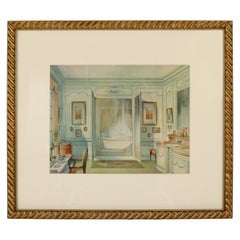
- Print of an Interior BathLocated in New York, NYA lovely print featuring a French "Salle de Bain", matted and finished in a gilt wood frame.Category
20th Century French Louis XVI Prints
MaterialsPaper
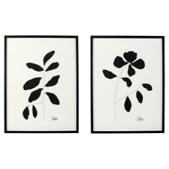
- Black & White Botanical Works on PaperLocated in New York, NYWe love the graphic simplicity of these works of art. Created and signed by Georgia artist Victoria Sides, the works are stylized interpretation of leafy flowers. Each is different, ...Category
21st Century and Contemporary American Prints
MaterialsPaper, Paint
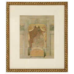
- Interior PrintLocated in New York, NYA framed print of an elegant traditional bed chamber featuring a formal canopy bed; matted and finished in a gilt wood frame.Category
20th Century French Louis XV Prints
MaterialsPaper
- Series of Murano Glass VasesLocated in New York, NYA series of colorful vases in Murano glass, the perfect finishing touch on a table or shelf. The vases range in size from 6 to 10 inches. Small vases are $550 each; larger vases are ...Category
20th Century Italian Glass
MaterialsGlass

You May Also Like
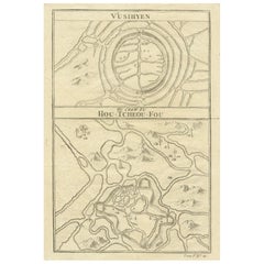
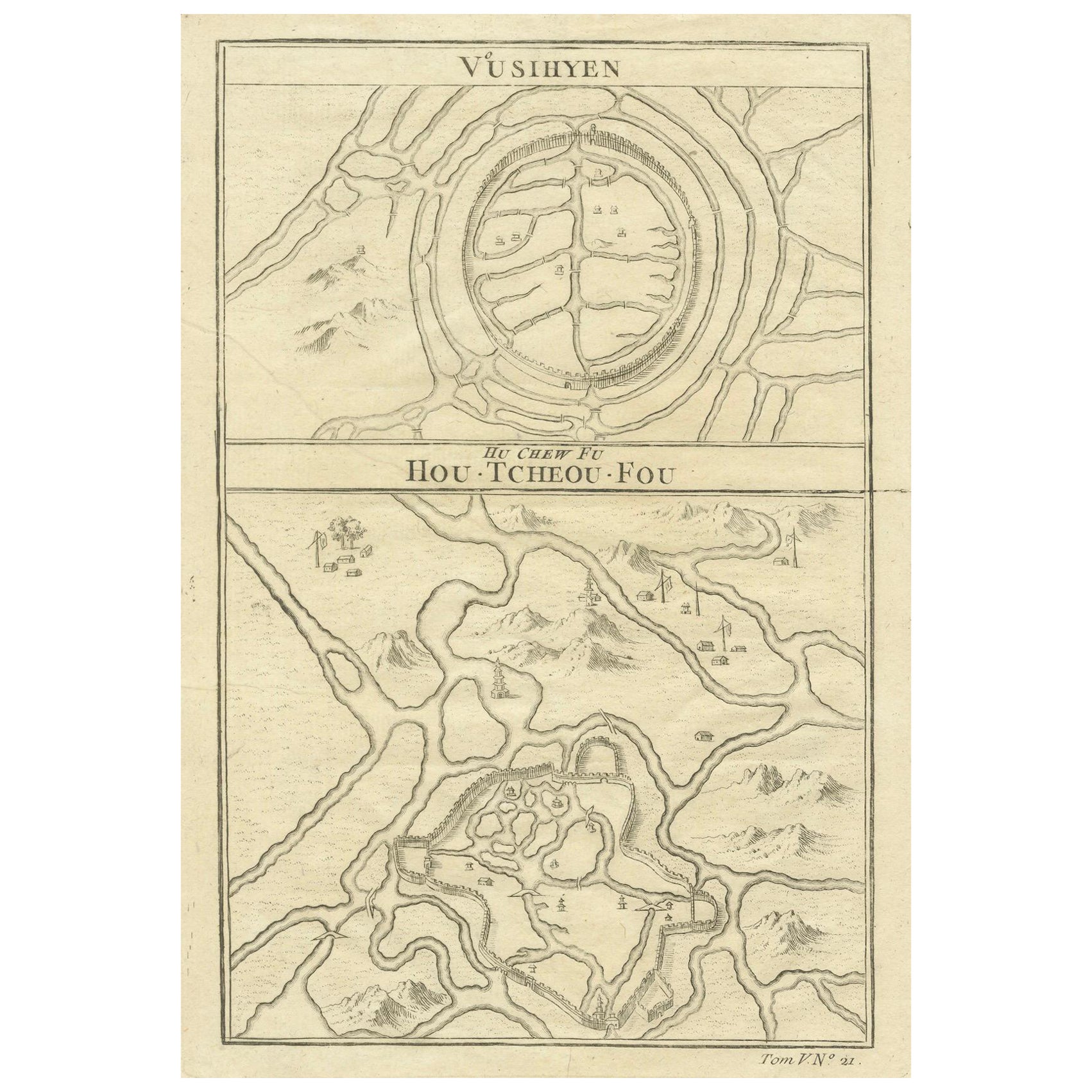
- Map of Vusihyen, Hu Chew Fu and Hou-Tcheou-Fou, Historical Chinese Cities, 1754Located in Langweer, NLGiven these specific names—Vusihyen, Hu Chew Fu, and Hou-Tcheou-Fou—it appears that the map depicts historical Chinese locations. These names are likely transliterations of Chinese names from the period. "Hu Chew Fu" might be an old Western spelling for what is known in modern pinyin as Huzhou, a city near Lake Tai in China. "Hou-Tcheou-Fou" could refer to a historical name for another city or region, also located in China. More research needed. More about the maker: Jacques-Nicolas Bellin's contributions to cartography and hydrography set a precedent in mapmaking during the 18th century. His role as Hydrographer to the French Navy and later as the Official Hydrographer to the French King placed him at the forefront of maritime charting...Category
Antique 1750s Prints
MaterialsPaper
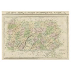
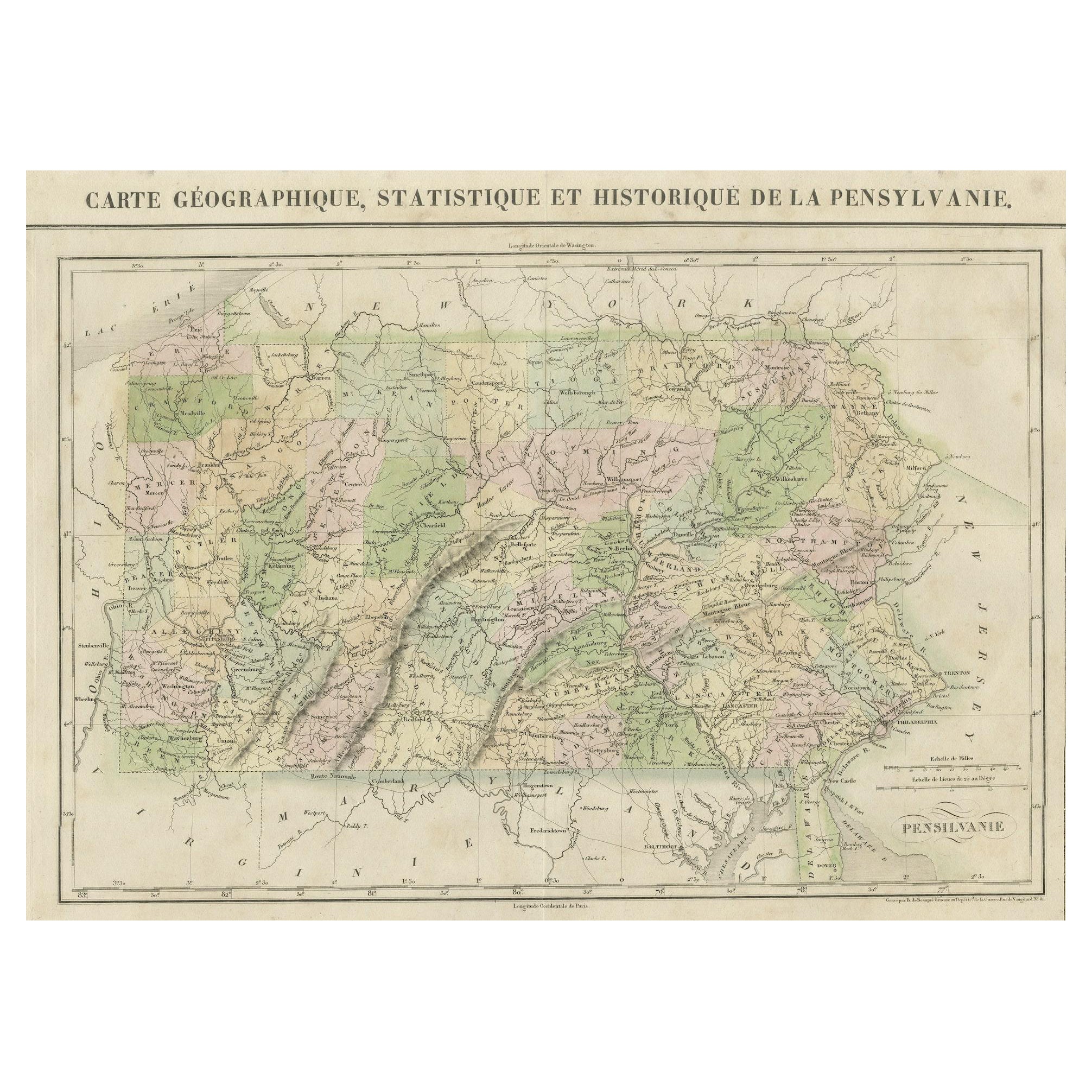
- French Geographical, Statistical and Historical Map of Pensylvania, 1825Located in Langweer, NLTitle: Carte geographique, statistique et historique de la Pensylvanie. Beautiful Hand-Colored 1825 French Map of Pennsylvania, with a List of Prominent Rivers, Descriptions of Mountains, Climate and Government as well as a list of Colonial and post-American Revolution Governors Produced by: J. Carez in Paris. (1825) Hand colored engraved map. Relief shown by hachures. Text and tables at sides and bottom. Prime meridians: Washington and Paris. A very interesting 1825 French hand-colored map of Pennsylvania from Lucas' 1822 map, which breaks down county populations by Whites and Free Blacks. "Carte Geographique, Statistique et Historique de la Pensylvanie" Originally published in 1822 by Carey and Lea and then revised and republished in 1825 by J. A. C. Buchon (1791-1846 ) in a French edition entitled Atlas Geographique des Deux Ameriques, printed by J. Carez. Fielding Lucas, Jr. (1781-1854), a Baltimore mapmaker and publisher, drew the map. original hand-coloring. Shown on the map are parts of Maryland, Delaware, New York and New jersey. Printed on the same page as the map is geographical, statistical, and historical information about Pennsylvania, such as descriptions of the state's important rivers, a list of Governors since its founding as well as important French and Indian...Category
Antique 1820s Maps
MaterialsPaper
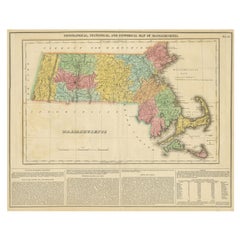
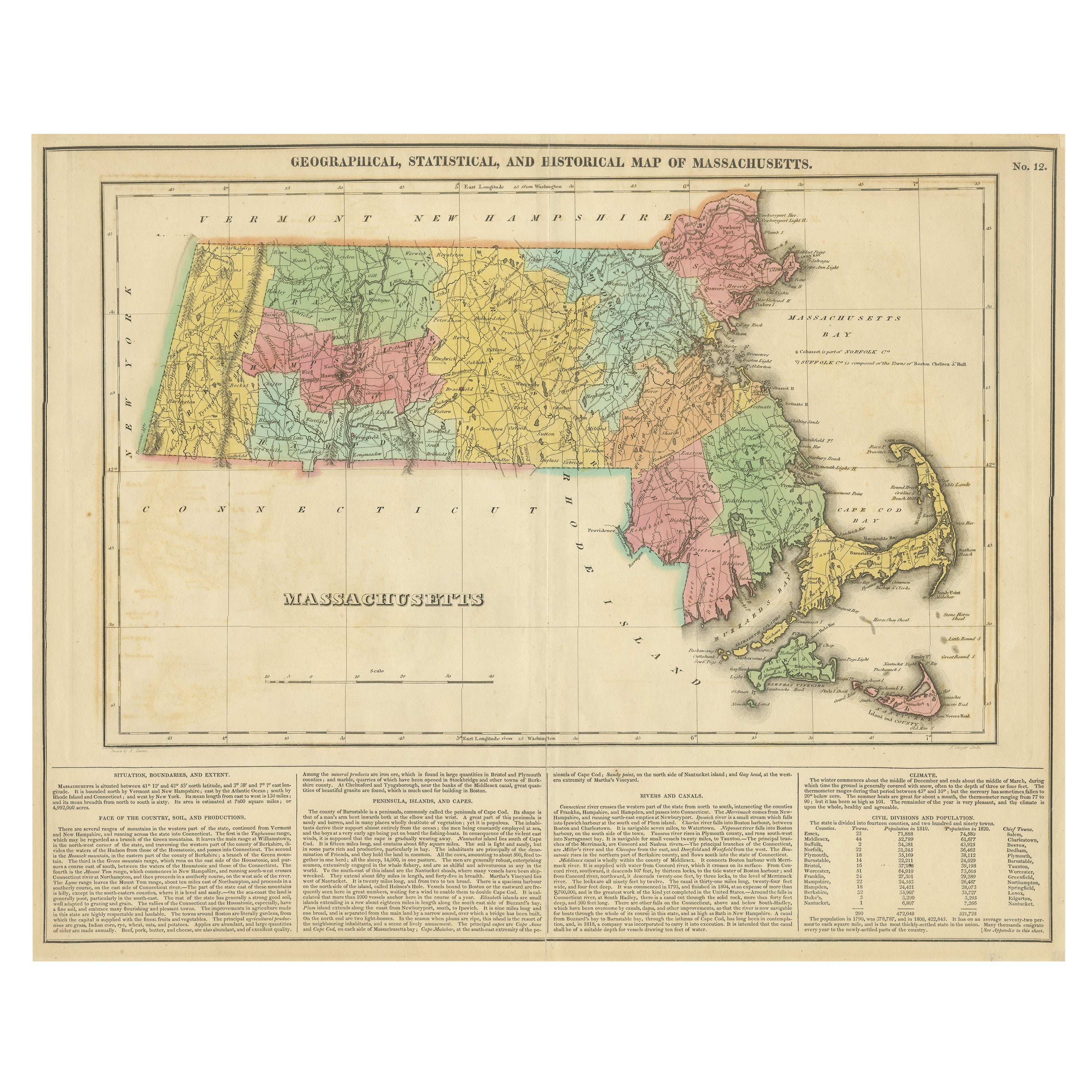
- Antique Geographical, Historical and Statistical Map of Massachusetts, 1822Located in Langweer, NLThis attractive map of Massachusetts presents a finely detailed overview of the state in the first quarter of the 19th century. Transportation ...Category
Antique 1820s Maps
MaterialsPaper
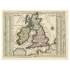
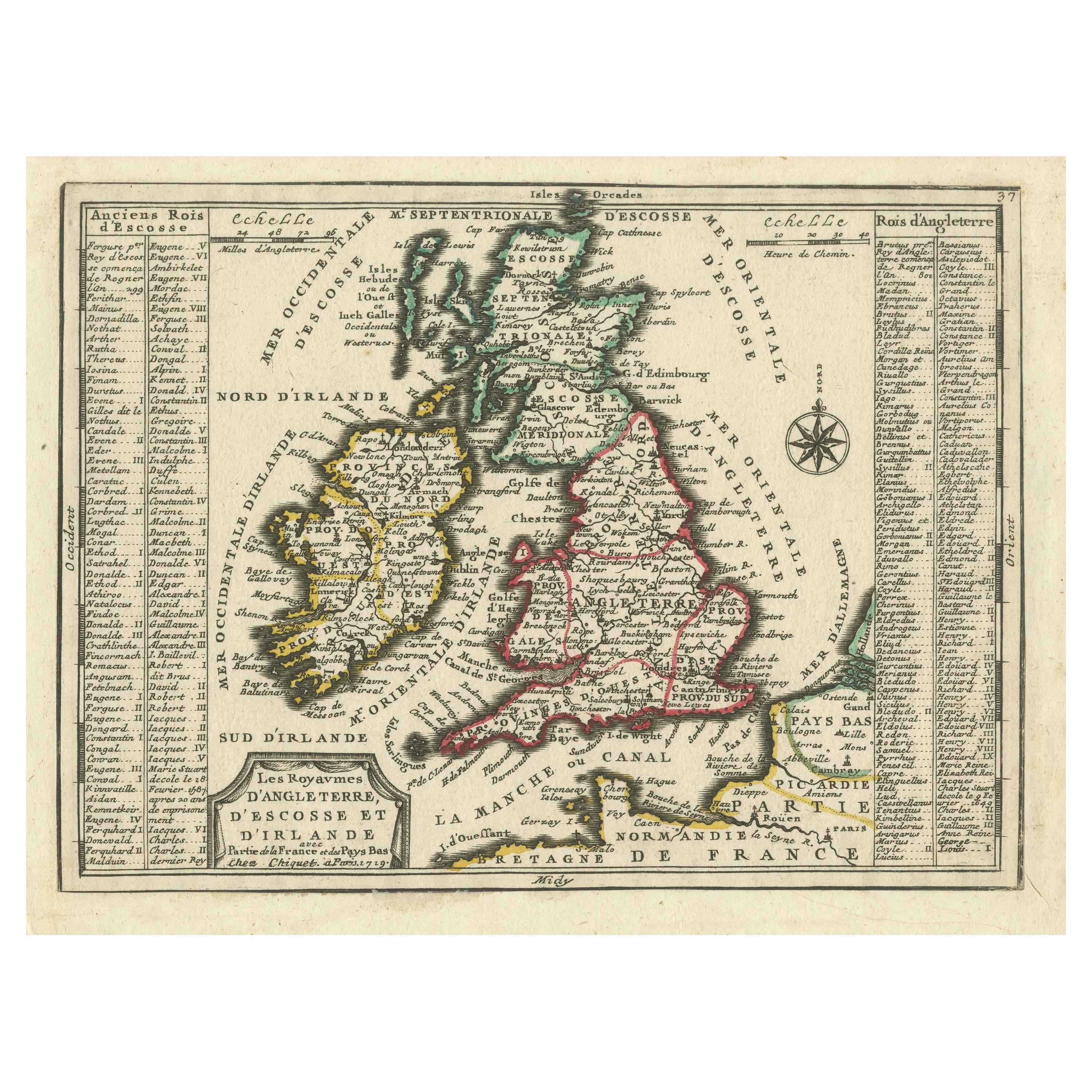
- Map of the British Isles with Historical Kings, 1719Located in Langweer, NLThis antique map, titled "Les Royaumes d'Angleterre d'Escosse et d'Irlande," offers a detailed view of the British Isles, including England, Wales, Scotland, and Ireland. Additionall...Category
Antique Early 18th Century Maps
MaterialsPaper
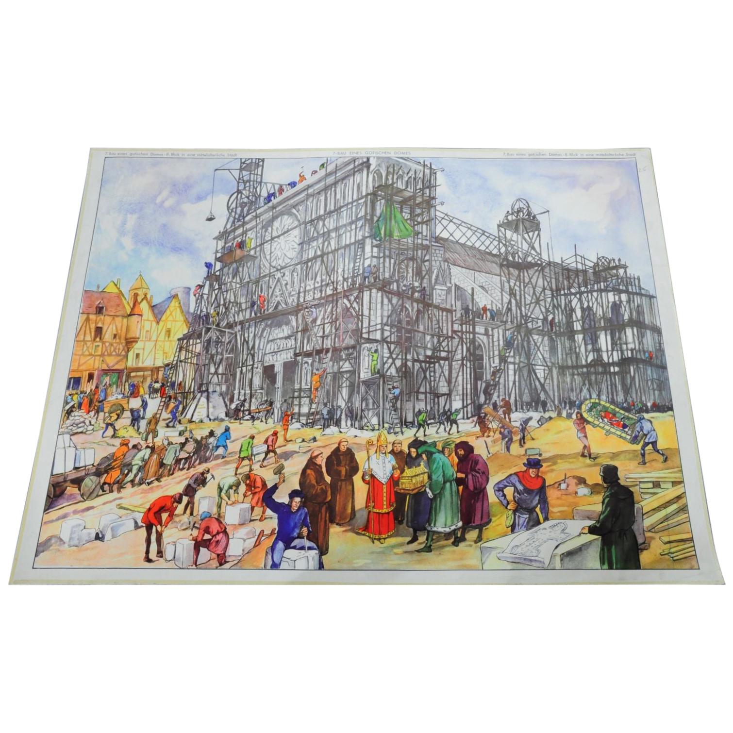
- Vintage Poster Historical Construction Gothic Dome Medieval City Historical SiteLocated in Berghuelen, DEThe double sided poster shows the construction of a Gothic dome and on the backside the view inside a medival city. Colorful print on paper. Measur...Category
Mid-20th Century German Country Prints
MaterialsPaper
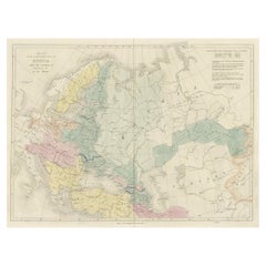
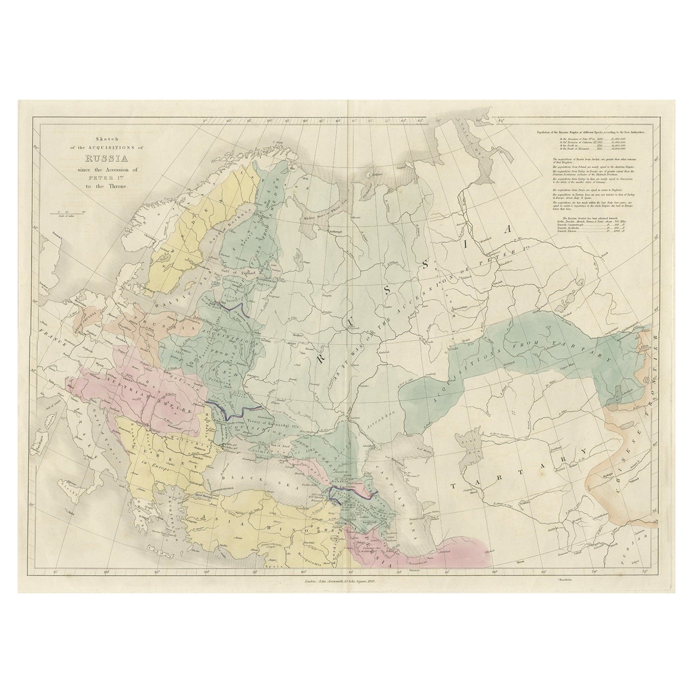
- Historical Antique Map of Russia, Examining the History of Russia, 1838Located in Langweer, NLAntique map titled 'Sketch of the acquisitions of Russia since the Accession of Peter 1st to the Throne'. Historical map of Russia, examining the history o...Category
Antique 1830s Maps
MaterialsPaper