Items Similar to Antique Map of Rome and Athens by Perthes, 1848

Want more images or videos?
Request additional images or videos from the seller
1 of 5
Antique Map of Rome and Athens by Perthes, 1848
About the Item
Antique map titled 'Roma Vetus, Athenae, Urbs, Campus Trojae'. Old map of Rome, Athens and surroundings originating from 'Orbis Terrarum Antiquus in usum Scholarum'. Artists and Engravers: Published by Justus Perthes, 1848.
Artist: Published by Justus Perthes, 1848.
Antique prints have long been appreciated for both their aesthetic and investment value. They were the product of engraved, etched or lithographed plates. These plates were handmade out of wood or metal, which required an incredible level of skill, patience and craftsmanship. Whether you have a house with Victorian furniture or more contemporary decor an old engraving can enhance your living space. We offer a wide range of authentic antique prints for any budget.
- Dimensions:Height: 9.85 in (25 cm)Width: 12.52 in (31.8 cm)Depth: 0 in (0.01 mm)
- Materials and Techniques:
- Period:
- Date of Manufacture:1848
- Condition:Condition: Good, general age-related toning. Minor defects, please study image carefully.
- Seller Location:Langweer, NL
- Reference Number:
About the Seller
5.0
Platinum Seller
These expertly vetted sellers are 1stDibs' most experienced sellers and are rated highest by our customers.
Established in 2009
1stDibs seller since 2017
1,928 sales on 1stDibs
Typical response time: <1 hour
- ShippingRetrieving quote...Ships From: Langweer, Netherlands
- Return PolicyA return for this item may be initiated within 14 days of delivery.
More From This SellerView All
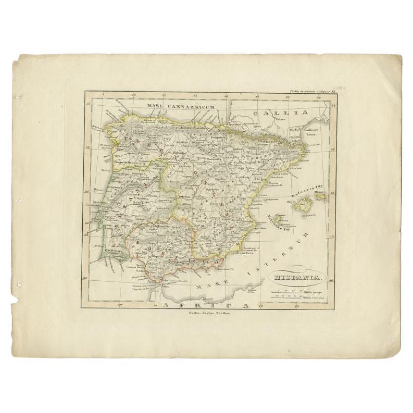
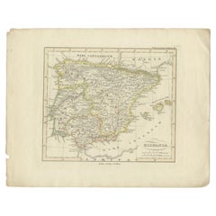
- Antique Map of Spain by Perthes, 1848Located in Langweer, NLAntique map titled 'Hispania'. Old map of Spain originating from 'Orbis Terrarum Antiquus in usum Scholarum'. Artists and Engravers: Published by Justus P...Category
Antique 19th Century Maps
MaterialsPaper
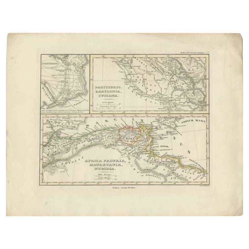
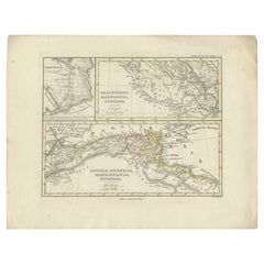
- Antique Map of Northern Africa by Perthes, 1848Located in Langweer, NLAntique map titled 'Africa Propria (..)'. Old map of North Africa and the region of Babylon originating from 'Orbis Terrarum Antiquus in usum Scholarum'. Artists and Engravers: Publi...Category
Antique 19th Century Maps
MaterialsPaper
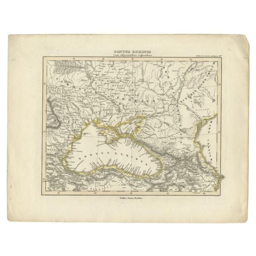
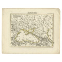
- Antique Map of the Black Sea by Perthes, 1848Located in Langweer, NLAntique map titled 'Pontus Euxinus'. Old map of the Black Sea and surroundings originating from 'Orbis Terrarum Antiquus in usum Scholarum'. Artists and Engravers: Published by Justu...Category
Antique 19th Century Maps
MaterialsPaper
- Antique Map of the Middle East by Perthes, 1848Located in Langweer, NLAntique map titled 'Terra inter Euphratem et Indum Antiqua'. Old map of the Middle East originating from 'Orbis Terrarum Antiquus in usum Scholarum'. Artists and Engravers: Publi...Category
Antique 19th Century Maps
MaterialsPaper
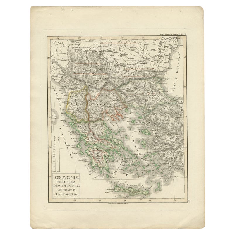
- Antique Map of Greece and Macedonia, 1848Located in Langweer, NLAntique map titled 'Graecia Epirus Macedonia Moesia Thracia'. Old map of Greece originating from 'Orbis Terrarum Antiquus in usum Scholarum'. Artists and Engravers: Published by Just...Category
Antique 19th Century Maps
MaterialsPaper
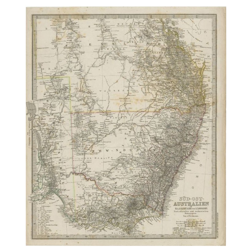
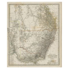
- Antique Map of South East Australia by Stieler, c.1848By Thomas KitchinLocated in Langweer, NLAntique map Australia titled 'Süd-Ost Australien'. Detailed map of South East Australia. Orginates from 'Stieler's Hand Atlas', published in Germ...Category
Antique 19th Century Maps
MaterialsPaper


You May Also Like
- Map of the Kingdom of Sardinia and Part of the Kingdom of Genoa, RomeBy Giovanni Maria CassiniLocated in Hamilton, Ontario18th century map by Italian engraver Giovanni Maria Cassini (Italy 1745-1824). Map of Part of the Kingdom of Sardinia and Part of the Kingdom of Genoa: Rome. This is a hand colored a...Category
Antique 18th Century Italian Maps
MaterialsPaper
- 1861 Topographical Map of the District of Columbia, by Boschke, Antique MapLocated in Colorado Springs, COPresented is an original map of Albert Boschke's extremely sought-after "Topographical Map of the District of Columbia Surveyed in the Years 1856 ...Category
Antique 1860s American Historical Memorabilia
MaterialsPaper
- 1907 Map of Colorado, Antique Topographical Map, by Louis NellLocated in Colorado Springs, COThis highly detailed pocket map is a topographical map of the state of Colorado by Louis Nell from 1907. The map "has been complied from all availabl...Category
Antique Early 1900s American Maps
MaterialsPaper
- 1854 Map of Massachusetts, Connecticut and Rhode Island, Antique Wall MapLocated in Colorado Springs, COThis striking wall map was published in 1854 by Ensign, Bridgman & Fanning and has both full original hand-coloring and original hardware. This impression is both informative and highly decorative. The states are divided into counties, outlined in red, green, and black, and subdivided into towns. Roads, canals, and railroad lines are prominently depicted, although they are not all labeled. The mapmakers also marked lighthouses, banks, churches, and prominent buildings, with a key at right. The map is an informative and comprehensive overview of the infrastructural development of New England prior to the Civil War. Physical geographies depicted include elevation, conveyed with hachure marks, rivers and lakes. The impression features an inset map of Boston...Category
Antique 19th Century American Maps
MaterialsPaper
- Antique Map of Italy by Andriveau-Goujon, 1843By Andriveau-GoujonLocated in New York, NYAntique Map of Italy by Andriveau-Goujon, 1843. Map of Italy in two parts by Andriveau-Goujon for the Library of Prince Carini at Palazzo Carini i...Category
Antique 1840s French Maps
MaterialsLinen, Paper
- Antique Map of Principality of MonacoBy Antonio Vallardi EditoreLocated in Alessandria, PiemonteST/619 - "Old Geographical Atlas of Italy - Topographic map of ex-Principality of Monaco" - ediz Vallardi - Milano - A somewhat special edition ---Category
Antique Late 19th Century Italian Other Prints
MaterialsPaper


Recently Viewed
View AllMore Ways To Browse
Antique Decor And More
Antique Furniture Rome
Athens Furniture
Map Of Rome
Map Rome
Rome Maps
Antique Map Of Rome
Rome Antique Map
Antique Maps Rome
Antique Map Rome
Antique Rome Map
Antique Maps Of Rome
Small Antique Globes
Antique Surveying
Maps United Kingdom
Antique Style Map
Antique City Plans
Antique New York Maps