Maps United Kingdom
39
to
19
356
129
256
133
115
86
68
55
52
48
39
39
36
34
27
25
22
20
14
12
10
10
9
8
7
6
6
5
4
4
4
3
3
3
3
3
2
2
2
2
2
1
1
1
1
1
11
10
9
9
6
Sort By
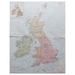
Large Original Vintage Map of the United Kingdom, circa 1920
Located in St Annes, Lancashire
Great map of The United Kingdom
Unframed
Original color
By John Bartholomew and Co
Category
Vintage 1920s British Maps
Materials
Paper
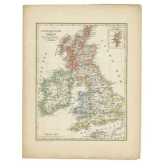
Antique Map of the United Kingdom and Ireland, 1852
Located in Langweer, NL
Antique map titled 'Groot-Brittanje en Ierland'. Map of the United Kingdom and Ireland. This map
Category
Antique 19th Century Maps
Materials
Paper
Large Original Vintage Map of The United Kingdom, circa 1920
Located in St Annes, Lancashire
Great map of The United Kingdom
Original color.
Published by Alexander Gross
Unframed.
Category
Vintage 1920s English Maps
Materials
Paper
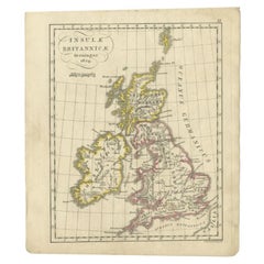
Antique Map of the United Kingdom and Ireland, circa 1825
Located in Langweer, NL
Antique map titled 'Insula Britannicae'. Old map of the United Kingdom and Ireland originating from
Category
Antique 19th Century Maps
Materials
Paper
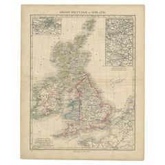
Antique Map of the United Kingdom and Ireland, c.1873
Located in Langweer, NL
Antique map titled 'Groot Brittanje en Ierland'. Old map depicting the United Kingdom and Ireland
Category
Antique 19th Century Maps
Materials
Paper
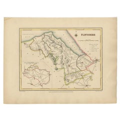
Antique Map of Flintshire in Wales, United Kingdom, c.1850
Located in Langweer, NL
. Flintshire is a principal area of Wales, known as a county, United Kingdom. Drawn and engraved for Lewis
Category
Antique 19th Century Maps
Materials
Paper
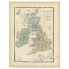
Original Antique Map of the United Kingdom and Ireland, Published in 1875
Located in Langweer, NL
United Kingdom and Ireland. This map originates from 'Atlas de Géographie Moderne Physique et Politique
Category
Antique Late 19th Century Maps
Materials
Paper
H 24.02 in W 18.71 in D 0.02 in
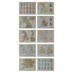
Set of 10 Large Scale Vintage Maps of The United Kingdom, circa 1900
Located in St Annes, Lancashire
Great set of maps of the UK
Lithographs. By John Bartholomew & Co.
Published by The Edinburgh
Category
Antique Early 1900s English Maps
Materials
Paper
No Reserve
H 18 in W 23.5 in D 0.13 in
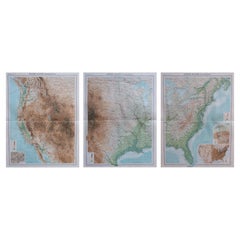
Large Vintage Maps of the United States, in 3 Sections, 1920
Located in St Annes, Lancashire
Great maps of the USA in 3 sections
Unframed
Original color
By John Bartholomew and Co
Category
Vintage 1920s British Maps
Materials
Paper
Map of Lancashire
Located in Cheshire, GB
Saxton Map of Lancashire hand coloured. Encased in an ebonised frame.
Dimensions
Height 21 Inches
Category
Early 20th Century British Maps
Materials
Paper
Saxtons Map of Oxtons, Bucks, Berk
Located in Alton, GB
Framed Saxton’s Map of Oxfordshire, Buckinghamshire, and Berkshire, 1574. Originally published as
Category
Antique 16th Century British Maps
Materials
Paper
Map of Essex by Emanuel Bowen
Located in Cheshire, GB
Map of part of Essex and part of Kent, hand-coloured. Encased in an ebonized and gilded frame
Category
Antique Late 19th Century British Maps
Materials
Paper
Northwest Coast and Isle of Man Map
Located in Cheshire, GB
Greenville Collins Northwest Coast and Isle of Man. hand coloured chart, encased in an ebonised frame.
Dimensions
Height 26.5 Inches
Width 30 Inches
Depth 1 Inches
Category
Early 20th Century British Maps
Materials
Paper
Antique Lithography Map, Bedfordshire, English, Framed Engraving, Cartography
Located in Hele, Devon, GB
This is an antique lithography map of Bedfordshire. An English, framed atlas engraving of
Category
Antique Mid-19th Century British Victorian Maps
Materials
Wood
H 15.75 in W 13.19 in D 0.6 in
Antique Lithography Map, Hertfordshire, English, Framed Engraving, Cartography
Located in Hele, Devon, GB
This is an antique lithography map of Hertfordshire. An English, framed atlas engraving of
Category
Antique Mid-19th Century British Victorian Maps
Materials
Wood
H 13.59 in W 15.75 in D 16.34 in
Antique Lithography Map, Lincolnshire, English, Framed, Engraving, Cartography
Located in Hele, Devon, GB
This is an antique lithography map of Lincolnshire. An English, framed atlas engraving of
Category
Antique Mid-19th Century British Victorian Maps
Materials
Wood
H 15.95 in W 13.39 in D 0.6 in
Antique Lithography Map, Gloucestershire, English, Framed Engraving, Cartography
Located in Hele, Devon, GB
This is an antique lithography map of Gloucestershire. An English, framed atlas engraving of
Category
Antique Mid-19th Century British Victorian Maps
Materials
Wood
H 15.75 in W 13 in D 0.6 in
Antique Lithography Map, Northumberland, English, Framed, Engraving, Cartography
Located in Hele, Devon, GB
This is an antique lithography map of Northumberland. An English, framed atlas engraving of
Category
Antique Mid-19th Century British Victorian Maps
Materials
Wood
H 16.74 in W 13.98 in D 0.6 in
Large Original Vintage Map of Japan, circa 1920
Located in St Annes, Lancashire
Great map of Japan
Unframed
Original color
By John Bartholomew and Co. Edinburgh Geographical
Category
Vintage 1920s British Maps
Materials
Paper
Large Original Vintage Map of Egypt, circa 1920
Located in St Annes, Lancashire
Great map of Egypt
Unframed
Original color
By John Bartholomew and Co. Edinburgh Geographical
Category
Vintage 1920s British Maps
Materials
Paper
Antique Lithography Map, Buckinghamshire, English, Framed Cartography, Victorian
Located in Hele, Devon, GB
This is an antique lithography map of Buckinghamshire. An English, framed atlas engraving of
Category
Antique Mid-19th Century British Victorian Maps
Materials
Wood, Paper
H 16.15 in W 13.19 in D 0.6 in
Antique Lithography Map, Worcestershire, English, Framed Engraving, Cartography
Located in Hele, Devon, GB
This is an antique lithography map of Worcestershire. An English, framed atlas engraving of
Category
Antique Early 19th Century British Regency Maps
Materials
Wood
H 15.95 in W 13.19 in D 0.6 in
Large Original Vintage Map of Mexico, circa 1920
Located in St Annes, Lancashire
Great maps of Mexico.
Unframed.
Original color.
By John Bartholomew and Co. Edinburgh
Category
Vintage 1920s British Maps
Materials
Paper
Antique County Map, Rutlandshire, English, Framed, Cartography, Victorian, 1860
Located in Hele, Devon, GB
This is an antique lithography map of Rutlandshire. An English, framed atlas engraving of
Category
Antique Mid-19th Century British Victorian Maps
Materials
Wood
H 15.75 in W 13.19 in D 0.6 in
Antique Lithography Map of Cheshire, English, Framed, Cartography, Victorian
Located in Hele, Devon, GB
This is an antique lithography map of Cheshire. An English, framed atlas engraving of cartographic
Category
Antique Mid-19th Century British Victorian Maps
Materials
Wood
H 13.59 in W 15.56 in D 0.6 in
Antique Lithography Map, Northamptonshire, English, Framed Cartography, C.1860
Located in Hele, Devon, GB
This is an antique lithography map of Northamptonshire. An English, framed atlas engraving of
Category
Antique Mid-19th Century British Victorian Maps
Materials
Wood
H 15.95 in W 13.19 in D 0.6 in
Antique Lithography Map, Cumbria, English, Framed Cartography Interest, Georgian
Located in Hele, Devon, GB
This is an antique lithography map of Cumbria. An English, framed engraving of cartographic
Category
Antique Early 18th Century British Georgian Maps
Materials
Wood
H 21.86 in W 25.2 in D 0.79 in
Antique Lithography Map, Durham, English, Framed, Cartography, Early Georgian
Located in Hele, Devon, GB
This is an antique lithography map of Durham. An English, framed engraving of cartographic interest
Category
Antique Early 18th Century British Georgian Maps
Materials
Wood
H 20.28 in W 21.86 in D 0.6 in
Antique County Map, Norfolk, English, Framed Lithography, Cartography, Victorian
Located in Hele, Devon, GB
This is an antique lithography map of Norfolk. An English, framed atlas engraving of cartographic
Category
Antique Mid-19th Century British Victorian Maps
Materials
Glass, Wood
H 14.57 in W 16.93 in D 0.6 in
Antique Lithography Map, Western Russia, English, Framed, Cartography, Victorian
Located in Hele, Devon, GB
This is an antique lithography map of Western Russia. An English, framed atlas engraving of
Category
Antique Mid-19th Century British Early Victorian Maps
Materials
Wood
H 21.46 in W 17.33 in D 0.6 in
Antique Lithography Map, West Africa, English, Framed, Cartography, Victorian
Located in Hele, Devon, GB
This is an antique lithography map of Western Africa. An English, framed atlas engraving of
Category
Antique Mid-19th Century British Early Victorian Maps
Materials
Wood
H 17.52 in W 19.89 in D 0.79 in
Antique Lithography Map, Black Sea, English, Framed, Cartography, Victorian
Located in Hele, Devon, GB
This is an antique lithography map of the Black Sea region. An English, framed atlas engraving of
Category
Antique Mid-19th Century British Early Victorian Maps
Materials
Wood
H 17.72 in W 20.48 in D 0.79 in
Antique Lithography Map, South America, English, Framed, Cartography, Victorian
Located in Hele, Devon, GB
This is an antique lithography map of South America. An English, framed atlas engraving of
Category
Antique Mid-19th Century British Early Victorian Maps
Materials
Wood
H 21.86 in W 17.13 in D 0.79 in
Antique Map of South America by Wyld, circa 1850
By J. Wyld
Located in Langweer, NL
Beautiful folding map of South America titled 'Colombia Prima or South America Drawn from the Large
Category
Antique Mid-19th Century British Maps
Materials
Paper
Antique Lithography Map, County Durham, English, Framed Cartography, Victorian
Located in Hele, Devon, GB
This is an antique lithography map of County Durham. An English, framed atlas engraving of
Category
Antique Mid-19th Century British Mid-Century Modern Maps
Materials
Wood
H 13.98 in W 16.15 in D 0.6 in
17th Century John Speed Map of Denbighshire, c.1610
By John Speed
Located in Royal Tunbridge Wells, Kent
Antique early 17th century British very rare and original John Speed, hand coloured map of
Category
Antique 17th Century British Maps
Materials
Wood, Paper
Large Original Vintage Map of Persia / Iran, circa 1920
Located in St Annes, Lancashire
Great maps of Persia.
Unframed.
Original color.
By John Bartholomew and Co. Edinburgh
Category
Vintage 1920s British Maps
Materials
Paper
Large Original Vintage Map of Western Canada, circa 1920
Located in St Annes, Lancashire
Great map of Western Canada
Unframed
Original color
By John Bartholomew and Co. Edinburgh
Category
Vintage 1920s British Maps
Materials
Paper
Large Original Vintage Map of Manitoba, Canada, circa 1920
Located in St Annes, Lancashire
Great map of Manitoba and part of Ontario
Unframed
Original color
By John Bartholomew and
Category
Vintage 1920s British Maps
Materials
Paper
Antique Lithography Map, Isle of Thanet, Kent, English, Cartography, Victorian
Located in Hele, Devon, GB
This is an antique lithography map of The Isle of Thanet in Kent. An English, framed atlas
Category
Antique Mid-19th Century British Victorian Maps
Materials
Wood
H 14.57 in W 16.15 in D 0.6 in
Antique Lithography Map, Cornwall, English Framed Engraving, Cartography, C.1850
Located in Hele, Devon, GB
This is an antique lithography map of the Duchy of Cornwall. An English, framed atlas engraving of
Category
Antique Mid-19th Century British Victorian Maps
Materials
Wood
H 13.98 in W 16.34 in D 0.6 in
Antique Coaching Road Map, Devon, English, Regional Cartography, Georgian, 1720
Located in Hele, Devon, GB
This is an antique coaching road map of Devon. An English, framed lithograph engraving of regional
Category
Antique Early 18th Century British Georgian Maps
Materials
Wood
H 12.21 in W 9.65 in D 0.6 in
Antique Coaching Road Map, South Devon, English, Framed, Cartography, Georgian
Located in Hele, Devon, GB
This is an antique coach road map of South Devon. An English, framed lithograph engraving of
Category
Antique Early 18th Century British Georgian Maps
Materials
Wood
H 12.21 in W 9.65 in D 0.4 in
Antique Lithography Map, Isle of Wight, English, Framed, Engraving, Cartography
Located in Hele, Devon, GB
This is an antique lithography map of the Isle of Wight. An English, framed atlas engraving of
Category
Antique Early 19th Century British Regency Maps
Materials
Wood
H 13.59 in W 15.56 in D 0.6 in
Large Original Vintage Map of the South Pole, circa 1920
Located in St Annes, Lancashire
Great map of the South pole.
Unframed.
Original color.
By John Bartholomew and Co
Category
Vintage 1920s British Maps
Materials
Paper
Large Original Vintage Map of The North Pole, circa 1920
Located in St Annes, Lancashire
Great maps of The North Pole.
Unframed.
Original color.
By John Bartholomew and Co. Edinburgh
Category
Vintage 1920s British Maps
Materials
Paper
Large Original Vintage Map of The Pacific Islands Including Hawaii
Located in St Annes, Lancashire
Great map of The Pacific Islands
Unframed
Original color
By John Bartholomew and Co
Category
Vintage 1920s British Maps
Materials
Paper
No Reserve
H 18 in W 23 in D 0.07 in
Large Original Vintage Map of the Maritimes, Canada, circa 1920
Located in St Annes, Lancashire
Great map of The Maritime provinces
Unframed
Original color
By John Bartholomew and Co
Category
Vintage 1920s British Maps
Materials
Paper
Large Original Vintage Map of British Columbia, Canada, circa 1920
Located in St Annes, Lancashire
Great map of British Columbia
Unframed
Original color
By John Bartholomew and Co
Category
Vintage 1920s British Maps
Materials
Paper
No Reserve
H 18 in W 23 in D 0.07 in
Large Original Vintage Map of Quebec & Ontario, Canada, circa 1920
Located in St Annes, Lancashire
Great map of Quebec and Ontario.
Unframed
Original color
By John Bartholomew and Co
Category
Vintage 1920s British Maps
Materials
Paper
No Reserve
H 18 in W 23 in D 0.07 in
Large Original Vintage Map of Alberta & Saskatchewan, Canada, C.1920
Located in St Annes, Lancashire
Great maps of Alberta and Saskatchewan
Unframed
Original color
By John Bartholomew and Co
Category
Vintage 1920s British Maps
Materials
Paper
No Reserve
H 18 in W 23 in D 0.07 in
Antique Folding London Map, English, Cartography, Historic, Georgian, Dated 1783
Located in Hele, Devon, GB
This is an antique folding London map. An English, paper on linen cartographical study of the
Category
Antique Late 18th Century British Georgian Maps
Materials
Linen, Paper
H 6.3 in W 6.11 in D 0.6 in
Antique Coach Road Map, East Devon, English, Framed, Cartography, Georgian, 1720
Located in Hele, Devon, GB
This is an antique coach road map of East Devon. An English, framed lithograph engraving of
Category
Antique Early 18th Century British Georgian Maps
Materials
Wood
H 12.01 in W 9.45 in D 0.4 in
17th Century John Speed Map of the Barkshire Described, c.1616
By John Speed
Located in Royal Tunbridge Wells, Kent
Antique 17th century British very rare and original John Speed (1551-1629) map of the Barkshire
Category
Antique 17th Century British Maps
Materials
Paper
Free Shipping
H 22.05 in W 26.38 in D 1.19 in
18th Century Emanuel Bowen Map of County of York, c.1740
By Emanuel Bowen
Located in Royal Tunbridge Wells, Kent
Antique 18th century British rare and original Emanuel Bowen (1694-1767) map of the County of York
Category
Antique Early 18th Century British Maps
Materials
Paper
Free Shipping
H 22.64 in W 29.34 in D 0.79 in
Large Original Vintage Map of the Great Lakes, Canada, circa 1920
Located in St Annes, Lancashire
Great map of The Great Lakes.
Unframed.
Original color.
By John Bartholomew and Co
Category
Vintage 1920s British Maps
Materials
Paper
No Reserve
H 18 in W 23 in D 0.07 in
Antique 18th Century Map of the Province of Pensilvania 'Pennsylvania State'
Located in Philadelphia, PA
A fine antique of the colony of Pennsylvania.
Noted at the top of the sheet as a 'Map of the
Category
Antique 18th Century British American Colonial Maps
Materials
Paper
H 10.25 in W 13.25 in D 0.5 in
Antique Map of American Cities, Vignette of New York City, circa 1920
Located in St Annes, Lancashire
Great maps of American Cities
Unframed
Original color
By John Bartholomew and Co
Category
Vintage 1920s British Maps
Materials
Paper
No Reserve
H 18 in W 23 in D 0.07 in
Map Silk Embroidered Western Eastern Hemisphere New Old World Asia America Afri
Located in BUNGAY, SUFFOLK
A rare, late-18th century, silk, embroidered, double hemisphere, world map, blackwork, sampler
Category
Antique 18th Century British Georgian Maps
Materials
Silk
H 0.4 in W 0.4 in D 0.4 in
Map Holy Promise Land Canaan Richard Palmer Richard Blome 1687 Joseph Moxon
Located in BUNGAY, SUFFOLK
English Bible, end of the 17th century.
The map is an exact copy of Nicolaes Visscher's map, with
Category
Antique 17th Century British Baroque Maps
Materials
Paper
H 12.21 in W 19.69 in D 0.4 in
- 1
Get Updated with New Arrivals
Save "Maps United Kingdom", and we’ll notify you when there are new listings in this category.
Maps United Kingdom For Sale on 1stDibs
With a vast inventory of beautiful furniture at 1stDibs, we’ve got just the maps United kingdom you’re looking for. Frequently made of paper, wood and mahogany, every maps United kingdom was constructed with great care. There are 110 variations of the antique or vintage maps United kingdom you’re looking for, while we also have 1 modern editions of this piece to choose from as well. Whether you’re looking for an older or newer maps United kingdom, there are earlier versions available from the 18th Century and newer variations made as recently as the 21st Century. A maps United kingdom, designed in the mid-century modern, Victorian or Georgian style, is generally a popular piece of furniture. Leslie MacDonald Gill, Kerry Lee and Emanuel Bowen each produced at least one beautiful maps United kingdom that is worth considering.
How Much is a Maps United Kingdom?
The average selling price for a maps United kingdom at 1stDibs is $1,181, while they’re typically $40 on the low end and $72,118 for the highest priced.
More Ways To Browse
Antique Maps Scandinavia
Irish Canterbury
Guyana Antique Map
Irish Canterbury Furniture
Antique Map Of Colombia
Rush Seats With Final
Wooden Copper Coat Of Arms
Colombia Map Antique
Gordon Highlanders
Holy English Bible
Fountain Pen Japanese
Bo Peep
Little Bo Peep
Antique Furniture Worcester Ma
King Richard Service For 12
Vintage Aberdeenshire
Antique Maps Ontario
Wicker Baby Carriage

