Items Similar to Large Original Vintage Map of Quebec & Ontario, Canada, circa 1920
Want more images or videos?
Request additional images or videos from the seller
1 of 5
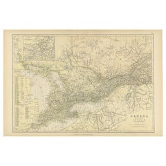
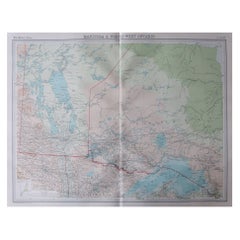
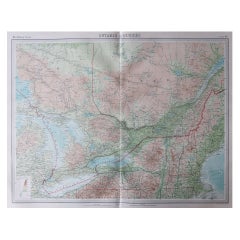
Large Original Vintage Map of Quebec & Ontario, Canada, circa 1920
About the Item
Great map of Quebec and Ontario.
Unframed
Original color
By John Bartholomew and Co. Edinburgh Geographical Institute
Published, circa 1920
Free shipping.
- Dimensions:Height: 18 in (45.72 cm)Width: 23 in (58.42 cm)Depth: 0.07 in (1.78 mm)
- Materials and Techniques:Paper,Other
- Place of Origin:
- Period:
- Date of Manufacture:1920
- Condition:Wear consistent with age and use.
- Seller Location:St Annes, GB
- Reference Number:1stDibs: LU1836327607142
About the Seller
4.9
Platinum Seller
These expertly vetted sellers are 1stDibs' most experienced sellers and are rated highest by our customers.
1stDibs seller since 2016
2,552 sales on 1stDibs
Typical response time: <1 hour
Associations
International Confederation of Art and Antique Dealers' Associations
- ShippingRetrieving quote...Ships From: St Annes, United Kingdom
- Return PolicyA return for this item may be initiated within 3 days of delivery.
Auctions on 1stDibs
Our timed auctions are an opportunity to bid on extraordinary design. We do not charge a Buyer's Premium and shipping is facilitated by 1stDibs and/or the seller. Plus, all auction purchases are covered by our comprehensive Buyer Protection. Learn More
More From This SellerView All
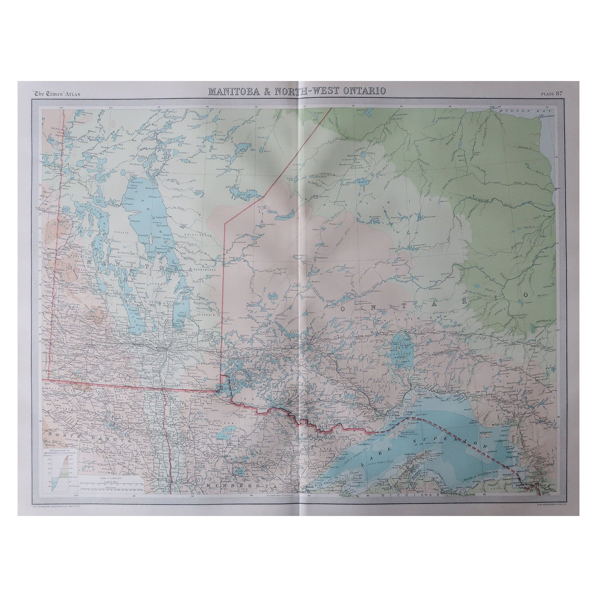
- Large Original Vintage Map of Manitoba, Canada, circa 1920Located in St Annes, LancashireGreat map of Manitoba and part of Ontario Unframed Original color By John Bartholomew and Co. Edinburgh Geographical Institute Published, circa 1920 Free shipping.Category
Vintage 1920s British Maps
MaterialsPaper
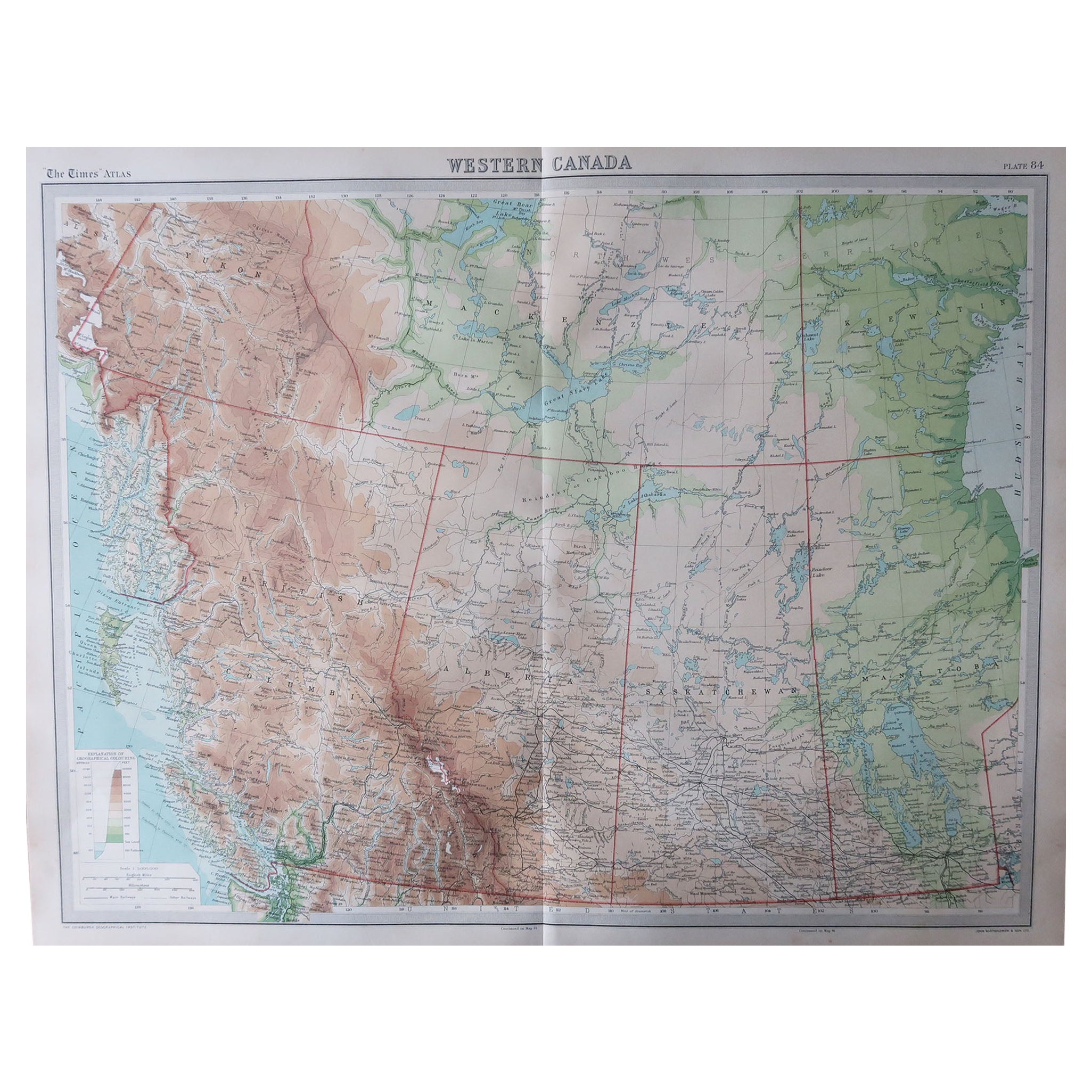
- Large Original Vintage Map of Western Canada, circa 1920Located in St Annes, LancashireGreat map of Western Canada Unframed Original color By John Bartholomew and Co. Edinburgh Geographical Institute Published, circa 1920 Fr...Category
Vintage 1920s British Maps
MaterialsPaper
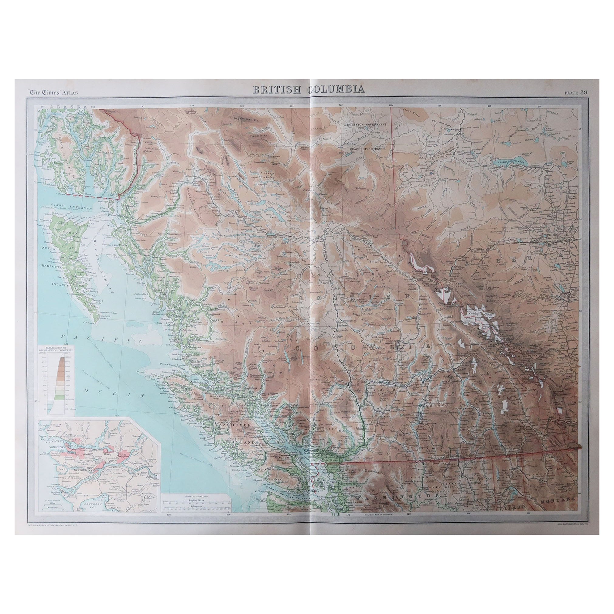
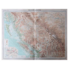
- Large Original Vintage Map of British Columbia, Canada, circa 1920Located in St Annes, LancashireGreat map of British Columbia Unframed Original color By John Bartholomew and Co. Edinburgh Geographical Institute Published, circa 1920 ...Category
Vintage 1920s British Maps
MaterialsPaper
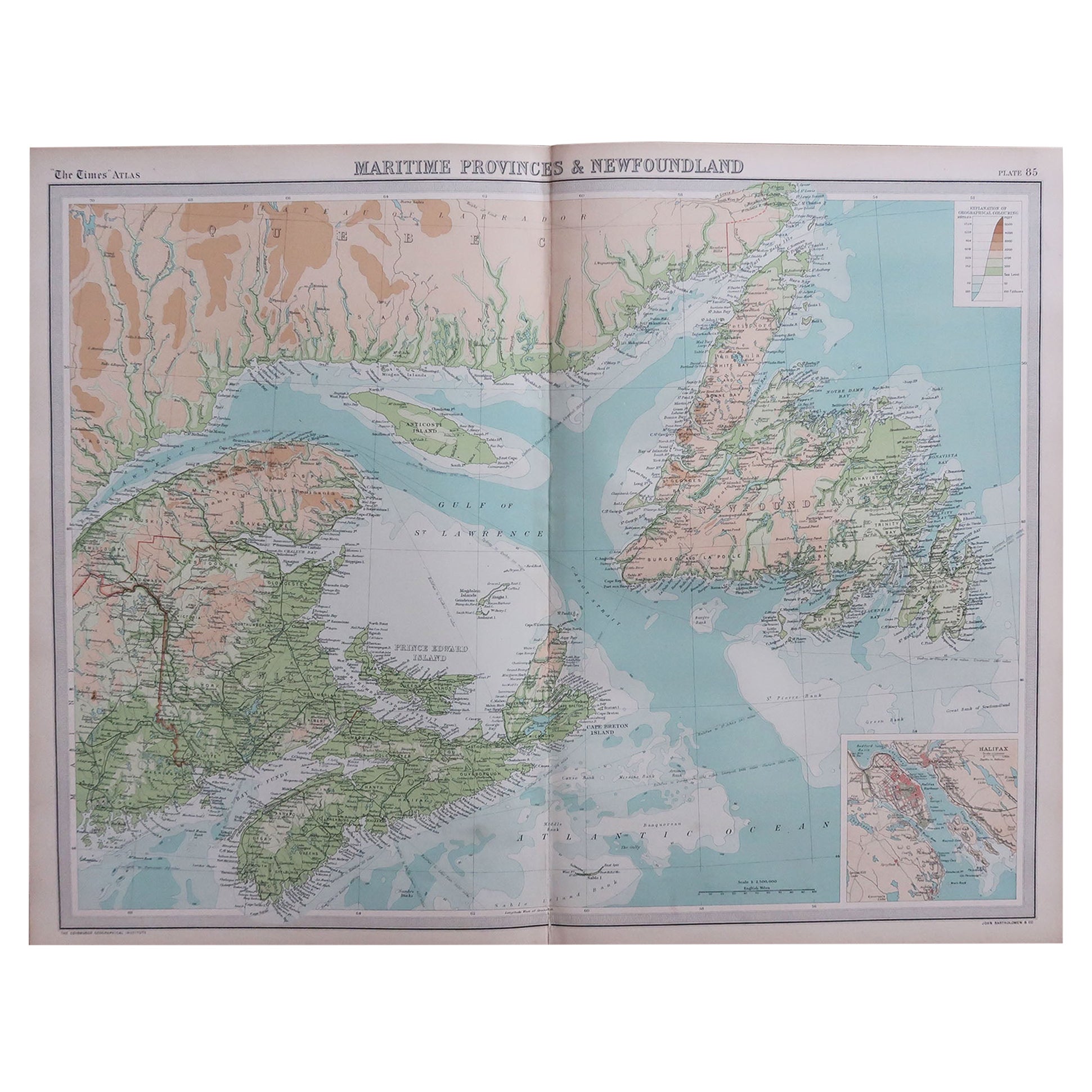
- Large Original Vintage Map of the Maritimes, Canada, circa 1920Located in St Annes, LancashireGreat map of The Maritime provinces Unframed Original color By John Bartholomew and Co. Edinburgh Geographical Institute Published, circa 1920 Free shipping.Category
Vintage 1920s British Maps
MaterialsPaper
- Large Original Vintage Map of the Great Lakes, Canada, circa 1920Located in St Annes, LancashireGreat map of The Great Lakes. Unframed. Original color. By John Bartholomew and Co. Edinburgh Geographical Institute Published, circa 1920 ...Category
Vintage 1920s British Maps
MaterialsPaper
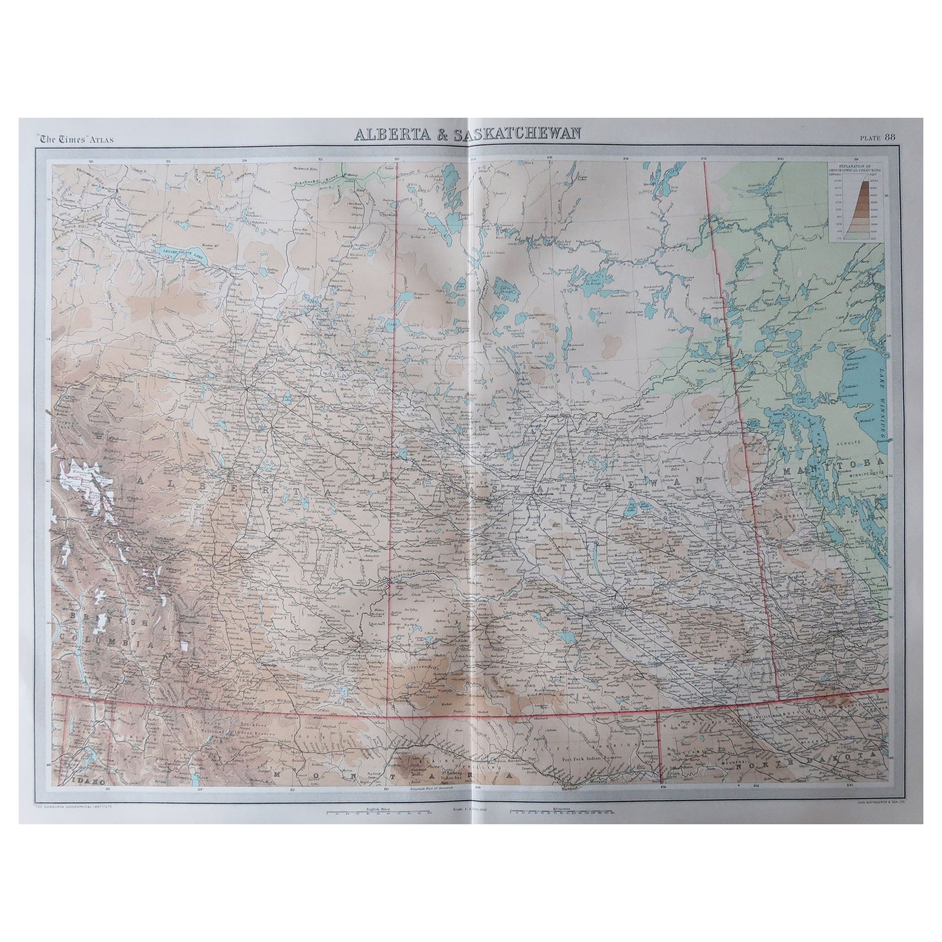
- Large Original Vintage Map of Alberta & Saskatchewan, Canada, C.1920Located in St Annes, LancashireGreat maps of Alberta and Saskatchewan Unframed Original color By John Bartholomew and Co. Edinburgh Geographical Institute Published, circa 1920 Free shipping.Category
Vintage 1920s British Maps
MaterialsPaper


You May Also Like
- Antique Map of Canada, The Province of Ontario and Part of Quebec, 1882Located in Langweer, NLThis is a historical map from the 1882 Blackie Atlas, this time detailing "The Province of Ontario, and Part of Quebec" in Canada. The map presents a detailed illustration of Ontario...Category
Antique 1880s Maps
MaterialsPaper
- Antique Map of Paraguay by A. Montanus, circa 1671By Arnoldus MontanusLocated in Langweer, NLAntique map titled 'Paraquaria Vulgo Paraguay Cum adjacentibus'. Antique map extending from Rio de Janiero to the Rio de la Plata basin. The map include...Category
Antique Mid-17th Century Maps
MaterialsPaper
- Antique Map of Chili by Montanus, circa 1671By Arnoldus MontanusLocated in Langweer, NLAntique map titled 'Chili'. A very attractive map covering the known coastal region of Chile. The Andes are shown prominently, with two live volcanoes in the vicinity of Villarrica. ...Category
Antique Mid-17th Century Maps
MaterialsPaper
- Antique Map of Asia by Dufour, circa 1834Located in Langweer, NLAntique map titled 'Asie par A.H. Dufour'. Uncommon map of Asia. Published by or after A.H. Dufour, circa 1834. Source unknown, to be determined.Category
Antique Mid-19th Century Maps
MaterialsPaper
- Antique Map of Africa by Dufour, circa 1834Located in Langweer, NLAntique map titled 'Afrique'. Uncommon map of Africa. Published by or after A.H. Dufour, circa 1834. Source unknown, to be determined.Category
Antique Mid-19th Century Maps
MaterialsPaper
- Antique Map of North America by Dufour 'circa 1834'Located in Langweer, NLAntique map titled 'Amérique Septentrionale'. Uncommon map of North America. Published by or after A.H. Dufour, circa 1834. Source unknown, to be determined.Category
Antique Mid-19th Century Maps
MaterialsPaper