
Large Vintage Map

6
to
40
379
276
668
411
167
97
83
73
69
46
38
34
40
40
13
9
8
Sort By
Large Framed Map of the Mediterranean
Located in New York, NY
Large map/chart chart of The Mediterranean and the Grecian Archipelago showing Italy, Sardinia
Category

20th Century French Mid-Century Modern Large Vintage Map

Vintage Large Framed Map of the Mediterranean
Large Framed Map of the Mediterranean
H 36 in W 67 in D 0.75 in
Old Map of the American Railroad Network and All Weather Roads on Verso, 1931
Located in Langweer, NL
This is the “New Census Edition” of Clason’s United States Green Guide. It features two large maps
Category

1930s Large Vintage Map

Materials

Paper

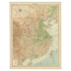
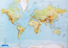
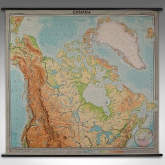
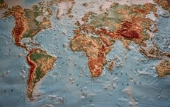
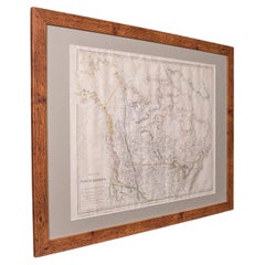
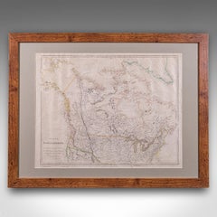
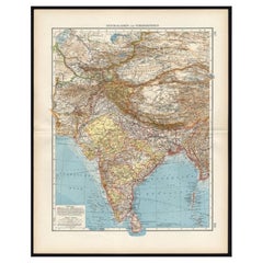
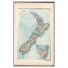
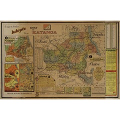
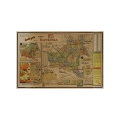
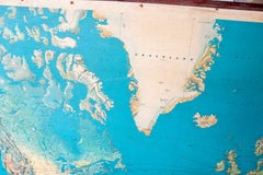
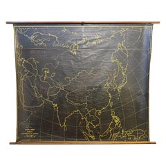
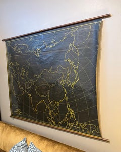
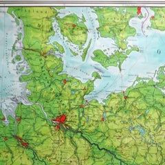
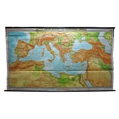
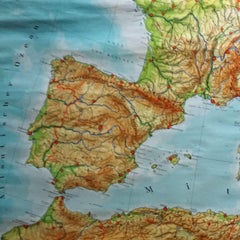
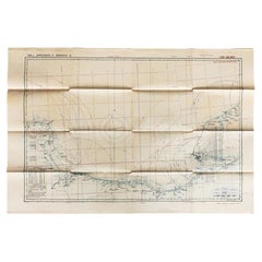
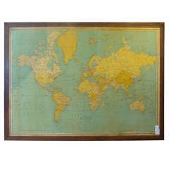
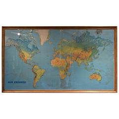
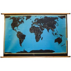
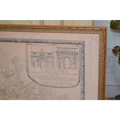
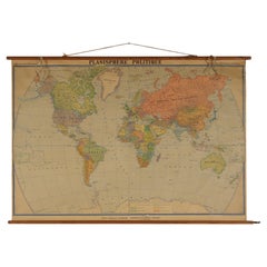
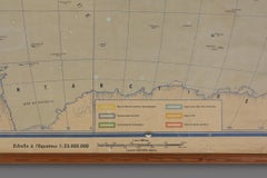
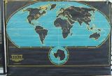
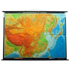
Vintage Picture Poster Wall Chart Rollable Large Map Peoples Republic of China
Located in Berghuelen, DE
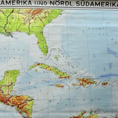
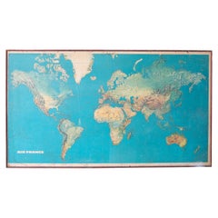
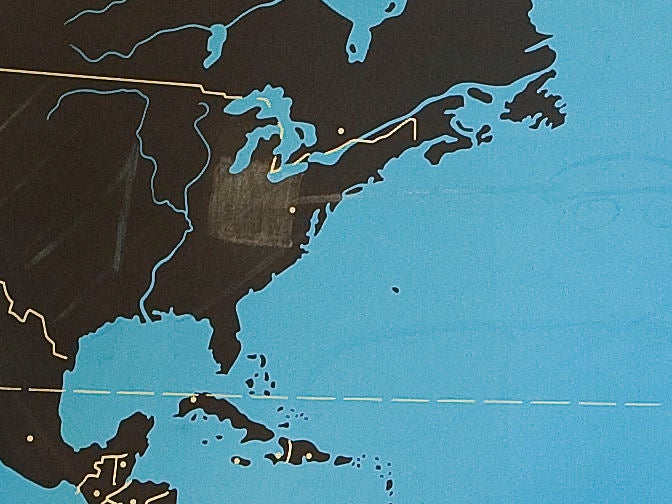
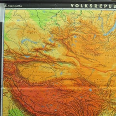
A vintage wall chart illustrating a map of people's republic of china. Used as teaching material in
Category

Late 20th Century German Country Large Vintage Map

Materials

Canvas, Wood, Paper

Original Old Map of Eastern China, Also Depicting Taiwan 'Formosa', 1922
Located in Langweer, NL
Large map of China titled 'China - Peking'. Old map of eastern China depicting Kiangsi, Chekiang
Category

20th Century Large Vintage Map

Materials

Paper

Very Large Vintage Map of Canada, German, Education, Institution, Cartography
Located in Hele, Devon, GB
This is a very large vintage map of Canada. A German, quality printed educational or institution
Category

Mid-20th Century German Large Vintage Map

Materials

Paper

Large Detailed Map of Australia Wint Inset of Tasmania, 1937
Located in Langweer, NL
Antique map titled 'Australia'. Large folding map of Australia. With inset map of Tasmania. Printed
Category

20th Century Large Vintage Map

Materials

Paper

World Relief Map
Located in Antwerp, BE
Large world relief map. Measures: Width 232 cm. Height 158 cm.
Category

Mid-20th Century German Mid-Century Modern Large Vintage Map

Materials

Acrylic

Vintage World Relief Map
World Relief Map
H 62.21 in W 91.34 in D 0.79 in
Large Topographical and Geological Map of the Teshio Oil Field, '1936'
Located in Langweer, NL
Topographical and geological map of the Teshio oil field. Shows location of oil well, oil sand
Category

20th Century Large Vintage Map

Materials

Linen, Paper

German Antique Map of Southeastern Australia, 1904
Located in Langweer, NL
This large antique map is taken from; 'Andrees Allgemeiner Handatlas in 126 Haupt-Und 139
Category

20th Century Large Vintage Map

Materials

Paper

Antique Map of Central Asia and India, 1904
Located in Langweer, NL
Antique map titled 'Zentralasien und Vorderindien'. Map of Central Asia and India. This large
Category

20th Century Large Vintage Map

Materials

Paper

Antique Map of Central Asia and India, 1904
H 22.09 in W 17.45 in D 0.01 in
Antique Map of New Zealand and Tasmania, 1904
Located in Langweer, NL
This large antique map is taken from; 'Andrees Allgemeiner Handatlas in 126 Haupt-Und 139
Category

20th Century Large Vintage Map

Materials

Paper

Antique Map of the Batu Islands by Dornseiffen, 1900
Located in Langweer, NL
Antique map of the Batu Islands with the large title 'Soematra, Bangka en de Riouw-Lingga Archipel
Category

20th Century Large Vintage Map

Materials

Paper

Two Impressive and Huge Midcentury World Map Wall Globes, Austria, 1950s
Located in Vienna, AT
We proudly offer this outstanding pair of very large wall-mounted modernist globes / world maps
Category

Mid-20th Century Austrian Mid-Century Modern Large Vintage Map

Materials

Aluminum, Iron

Antique Map of the War Situation in Europe and Asia, 1944
Located in Langweer, NL
Antique map titled 'Newsmap for the Armed Forces'. This "newsmap" was issued on Monday, December 18
Category

20th Century Large Vintage Map

Materials

Paper

Antique Railroad Map of the United States by Rand, McNally & Co, 1900
Located in Langweer, NL
portions of The Dominion of Canada, The Republic of Mexico and the West Indies'. Large railroad map of the
Category

20th Century Large Vintage Map

Materials

Linen, Paper

16-Inch Terrestrial Globe 1986 National Geographic
By National Geographic
Located in Ottawa, Ontario
A 16-INCH TERRESTRIAL GLOBE 1986 NATIONAL GEOGRAPHIC Large terrestrial globe with paper gores on a
Category

Late 20th Century American Modern Large Vintage Map

Materials

Metal

Luminous Earth Globe on a Chrome Base, Italy, 1980
Located in Paris, FR
Unusual luminous globe on a large chromed metal base, made in Italy by Ricoscope Editions in
Category

1980s Italian Space Age Large Vintage Map

Materials

Chrome

FRAME DRIVING SCHOOL 70 S 20th Century
By Europa Antiques
Located in Madrid, ES
Large Globe 50S THE GLOBE IS IN PLASTIC AND THE FOOT IN WOOD. 1950s. IT HAS LIGHT. GOOD CONDITION
Category

20th Century English Modern Large Vintage Map

Materials

Plastic, Wood

Mid-Century Modern 1970s Paul McCobb Style Brass Stand Replogle Globe
By Replogle Globes, Paul McCobb
Located in St. Louis, MO
wonderful patina. This Globe model is larger 16" diameter - World Classic Series. LeRoy M. Tolman
Category

1970s American Mid-Century Modern Large Vintage Map

Materials

Brass

Antique Poster Dutch East Indies, circa 1940
Located in Langweer, NL
Beautiful poster of the Dutch East Indies titled 'Het Verre Oosten'. This poster includes a large
Category

Mid-20th Century Dutch Large Vintage Map

Materials

Paper

Antique Poster Dutch East Indies, circa 1940
H 36.62 in W 25.79 in D 0.02 in
Original Vintage Poster Union Of South Africa Map Natural & Industrial Resources
Located in London, GB
image of a larger map of Africa marking South Africa in front of the Union flag of South Africa framing
Category

1940s British Large Vintage Map

Materials

Paper

Large French Paris Metro Map 1960s
Located in North Hollywood, CA
Large French Paris Metro Map 1960s. A large Vintage French framed map of the Parisian Metro from
Category

Mid-20th Century French Industrial Large Vintage Map

Materials

Wood, Paper

Large French Paris Metro Map 1960s
H 30.5 in W 37.75 in D 1 in
Large Africa School Map, circa 1950
Located in Meulebeke, BE
Geographical vintage school wall card Africa. The school poster is in a good vintage condition with types of old -age signs that you can see from the product images.
Category

1950s German Mid-Century Modern Large Vintage Map

Materials

Canvas, Wood, Paper

Large Africa School Map, circa 1950
H 82.68 in W 78.75 in D 0.79 in
Large European 1930's Nautical Map Reader Magnifying Glass
Located in Haddonfield, NJ
This European set of two nautical magnifying glass map-readers are quite unusual and rarely found
Category

1930s German Industrial Large Vintage Map

Materials

Metal

Large Vintage France Map, Continental, Historical Cartography, Late 20th Century
Located in Hele, Devon, GB
This is a large vintage map of France. A Continental, framed example of historical cartography
Category

Late 20th Century European Mid-Century Modern Large Vintage Map

Materials

Glass, Wood, Paper

Large Rollable Map Central America Northern South America Wall Chart Poster
Located in Berghuelen, DE
A fantastic pull-down wall chart depicting a map of Central America and Northern South America
Category

Mid-20th Century German Country Large Vintage Map

Materials

Canvas, Wood, Paper

Vintage Geographical Map of the World Map, Vallardi Milan, Early 20th Century
Located in Cuneo, Italy (CN)
Vintage geographical map or planisphere, published by Vallardi publisher for the municipality of
Category

20th Century Italian Large Vintage Map

Materials

Paper

On the Map: Large scale color monotype, Western mountain landscape with blue sky
By Michele Zalopany
Located in New York, NY
Large scale color monotype of a Western landscape with sapphire blue sky, green trees, river
Category

1980s Contemporary Large Vintage Map

Materials

Monotype

Very Large Nest of Three Tables with Rare Zodiac Astrology Maps to the Top
Located in GB
We are delighted to offer for sale this lovely very large nest of three side tables with rare
Category

20th Century English Campaign Large Vintage Map

Materials

Brass

Original WWII Illustrated Map Poster - Time And Tide Map Of The Atlantic Charter
By "Leslie MacDonald ""Max"" Gill"
Located in London, GB
Original vintage illustrated map poster in Spanish by the notable graphic designer, cartographer
Category

1940s British Large Vintage Map

Materials

Paper

Vinland Map and the Tartar Relation
By R.A. Skelton, Thomas E. Marston, George D. Painter
Located in valatie, NY
The Vinland Map and the Tartar Relation. New Haven: Yale University Press, 1965. First edition
Category

20th Century American Large Vintage Map

Materials

Paper

Vinland Map and the Tartar Relation
H 12 in W 9.5 in D 1.75 in
Topographic Three-Dimensional Relief Map of Antarctica
Located in Dallas, TX
An amazing topographic wall mounted three-dimensional map of Antarctica. Midcentury. This
Category

20th Century Large Vintage Map

Materials

Plaster, Wood

USA Map Florida Maine Hawaii Gold Charm
Located in New York, NY
Large octagonal charm. In the center is an applied figural map of the United States, embossed with
Category

1940s American Large Vintage Map

Materials

14k Gold

USA Map Florida Maine Hawaii  Gold Charm
Free Shipping
W 1 in L 1 in
Original 'The Evergreen Playground' Easter Washington State map
Located in Spokane, WA
feature large fir or pine trees. The map legend shows the US and main highways, railroads, and water
Category

1940s American Realist Large Vintage Map

Materials

Lithograph

Pair of MCM Leather Wrapped World Map Bookends
Located in San Diego, CA
Classic pair of large leather wrapped bookends with a midcentury brass world map plaque embedded in
Category

Late 20th Century American Mid-Century Modern Large Vintage Map

Materials

Brass

Unusual Modular , Stacking 1940s Hamiton Blueprint / map display cabinet
Located in Buffalo, NY
Unusual Modular ,Stacking 1940s Hamiton Blueprint / map display cabinet .3 section stacking
Category

1940s Industrial Large Vintage Map

Materials

Metal

Original Vintage Illustrated Map Poster Afrique Equatoriale Francaise Cameroon
Located in London, GB
Original vintage illustrated map poster for Cameroun AOF Afrique Occidentale Francaise / Cameroon
Category

1950s French Large Vintage Map

Materials

Paper

Great Britain Scandinavia Northern France Netherland Germany Mural Map
Located in Berghuelen, DE
The vintage pull-down cottagecore mural map illustrates the North Sea countries with Great Britain
Category

1970s German Country Large Vintage Map

Materials

Canvas, Wood, Paper

Set of 6 Cera Old World Map Double Rocks Glasses
By Cera
Located in Chapel Hill, NC
Set of 6 Cera Old World Map Double Rocks Glasses. These glasses are larger than rerocks glasses
Category

Mid-20th Century American Mid-Century Modern Large Vintage Map

Materials

Glass

Europe Map Vintage Rollable Mural Countrystyle Wall Chart Decoration
Located in Berghuelen, DE
The vintage pull-down map shows the European continent / Europe. Published by Haack-Painke, Justus
Category

1970s German Country Large Vintage Map

Materials

Canvas, Wood, Paper

Vintage Rollable Map Mediterranean Countries Wall Chart Mural Poster
Located in Berghuelen, DE
A decorative countrycore pull-down map depiciting countries surrounding the Mediterranean sea
Category

1970s German Country Large Vintage Map

Materials

Canvas, Wood, Paper

Vintage German Map Rhineland Rollable Wall Chart Poster Print
Located in Berghuelen, DE
A country core vintage pull-down map illustrating the popular German region of the Rhineland
Category

1960s German Country Large Vintage Map

Materials

Canvas, Wood, Paper

Vintage Rollable Map Southeast Asia China Japan Wall Chart
Located in Berghuelen, DE
A classical pull-down school map showing the popular region of Southeast Asia with China and Japan
Category

Late 20th Century German Country Large Vintage Map

Materials

Canvas, Wood, Paper

Original map of Corsica by Carriat-Rolant - Travel poster - Tourism
Located in PARIS, FR
dynamism. Drawn by Gabriel Carriat-Roland, the map presents the urban agglomerations in the form of small
Category

Mid-20th Century Large Vintage Map

Materials

Paper, Lithograph

Nest of Coffee & Side Tables Military Campaign with World Maps
Located in Pulborough, GB
We are delighted to offer for sale this stunning campaign decorative world map nest of tables. A
Category

20th Century British Campaign Large Vintage Map

Materials

Brass

Original Vintage Poster Pictorial Map British Railways Cambridge University City
By Kerry Lee
Located in London, GB
Original vintage pictorial travel map poster for Cambridge published by British Railways Eastern
Category

1960s British Large Vintage Map

Materials

Paper

Original Vintage Poster London Town Pictorial Map Southern Railway Underground
By Kerry Lee
Located in London, GB
Original vintage Travel By Train map poster for London Town by the British artist, illustrator and
Category

1930s British Large Vintage Map

Materials

Paper

Original Vintage Poster General Dynamics Electrodynamics Atomic Energy Map Light
By Erik Nitsche
Located in London, GB
bulb in front of a globe map of the world against a grey background with stylized lettering above and
Category

1950s Swiss Large Vintage Map

Materials

Paper

Original Vintage Africa Travel Poster Belgian Congo Congo Belge Illustrated Map
Located in London, GB
Original vintage Africa travel poster for the Belgian Congo / Congo Belge including a pictorial map
Category

1940s Belgian Large Vintage Map

Materials

Paper

North America Map Economy Wall Chart Rollable Poster Vintage Mural
Located in Berghuelen, DE
A vintage pull-down map showing the economy of North America, published by Harms. Colorful print on
Category

Late 20th Century German Country Large Vintage Map

Materials

Canvas, Wood, Paper

Original Vintage Poster Illustrated Map Madagascar French Colony Industry Travel
Located in London, GB
illustrated map showing the various places on a road route, the cities and towns marked with the highlands and
Category

1930s French Large Vintage Map

Materials

Paper

Southern Hemisphere of the Earth Rollable Map Vintage Wall Chart
Located in Berghuelen, DE
A great pull-down map or vintage wall chart illustrating the southern hemisphere of the earth
Category

Mid-20th Century German Country Large Vintage Map

Materials

Canvas, Wood, Paper

Vintage Rollable Map Northern Germany Poland Seaside Wallchart Baltic Sea
Located in Berghuelen, DE
The large impressive cottagecore pull-down map illustrates Northern Germany, Poland and parts of
Category

Late 20th Century German Country Large Vintage Map

Materials

Canvas, Wood, Paper

Original Vintage London Transport Poster Museums Kensington Map Fred Taylor Art
By Fred Taylor
Located in London, GB
Fred Taylor (1875-1963) depicting an aerial map view of the V&A Victoria and Albert Museum (founded
Category

1930s British Large Vintage Map

Materials

Paper

Cottagecore Wall Chart Spain Landscape Culture Souvenir Rollable Map Poster
Located in Berghuelen, DE
A countrycore vintage pull-down wall chart depicting Spain with a map and coloful pictures of
Category

1960s German Country Large Vintage Map

Materials

Canvas, Wood, Paper

Original Vintage Travel Poster London Underground Map Jubilee Line Paul Garbutt
Located in London, GB
Original vintage tube map poster of The London Underground showing the Central Circle Piccadilly
Category

1970s British Large Vintage Map

Materials

Paper

Vintage Pull-Down Map Germany BRD / DDR History Wall Chart
Located in Berghuelen, DE
A classical rollable vintage wall chart illustrating a map of Germany (Federal Republic of Germany
Category

Mid-20th Century German Country Large Vintage Map

Materials

Canvas, Wood, Paper

Original Vins Des Côtes du Rhône, French Wine Map vintage poster
Located in Spokane, WA
collecting grapes in large baskets where it is a family affair. The center is a map with cities, rivers
Category

Late 20th Century American Modern Large Vintage Map

Materials

Lithograph

An original poster featuring an illustrated map of Tenerife - La Lucha
Located in PARIS, FR
A beautiful poster featuring an illustrated map of Tenerife or Tenerife, an island in Spain that
Category

1950s Large Vintage Map

Materials

Paper, Lithograph

Original Vintage Poster French Equatorial Africa Map Afrique Chad Congo Francais
Located in London, GB
people and an elephant around a map of Africa in the bottom right corner. Large size. Good condition
Category

1950s French Large Vintage Map

Materials

Paper

  • 1
  • ...
Get Updated with New Arrivals
Save "Large Vintage Map", and we’ll notify you when there are new listings in this category.

Large Vintage Map For Sale on 1stDibs

With a vast inventory of beautiful furniture at 1stDibs, we’ve got just the large vintage map you’re looking for. A large vintage map — often made from paper, wood and oak — can elevate any home. You’ve searched high and low for the perfect large vintage map — we have versions that date back to the 20th Century alongside those produced as recently as the 20th Century are available. A large vintage map made by Victorian designers — as well as those associated with Industrial — is very popular.

How Much is a Large Vintage Map?

Prices for a large vintage map can differ depending upon size, time period and other attributes — at 1stDibs, they begin at $67 and can go as high as $3,475, while the average can fetch as much as $71.