Items Similar to Original WWII Illustrated Map Poster - Time And Tide Map Of The Atlantic Charter

Want more images or videos?
Request additional images or videos from the seller
1 of 5
Original WWII Illustrated Map Poster - Time And Tide Map Of The Atlantic Charter
About the Item
Original vintage illustrated map poster in Spanish by the notable graphic designer, cartographer and artist MacDonald Gill (Leslie MacDonald Gill aka Max Gill; 1884-1947) commissioned by the British Time & Tide magazine (1920-1986) following the World War Two Atlantic Charter agreement between the US President Franklin D. Roosevelt and UK Prime Minister Winston Churchill "for a better future for the world" 14 August 1941 - La Carta del Atlantico. Stunning design featuring detailed colorful pictorial depictions of agriculture and food production, Industrial raw materials and traditional life around the world including images of people, animals, trees, cattle, ships at sea, planes flying overhead and markers with a symbol box listing the locations of metals, wine, crops, petroleum, tobacco, sugar, rubber, silk, coffee, fruit, precious stones etc., surrounded by clouds on the sides and the sun shining down from The Atlantic Charter in the text box at the top with a black and white image below of an Industrial metal worker destroying tanks and machinery and a farming family ploughing a field with horses, the cities, countries, continents and quotes in banners with a seal and a compass point on both sides, all framed within a decorative border. Printed in Great Britain by Philip George & Son Ltd London and published in collaboration with the Time and Tide Publishing Company Ltd London. The London Geographical Institute. Horizontal. Large size. Very good condition, restored tears on folds, faint stains in image, backed on linen.
- Creator:"Leslie MacDonald ""Max"" Gill" (Artist)
- Dimensions:Height: 44.89 in (114 cm)Width: 34.85 in (88.5 cm)Depth: 0.04 in (1 mm)
- Materials and Techniques:
- Place of Origin:
- Period:
- Date of Manufacture:1943
- Condition:Repaired: Restored tears on folds, backed on linen. Very good condition, restored tears on folds, faint stains in image, backed on linen.
- Seller Location:London, GB
- Reference Number:1stDibs: LU101268470523
About the Seller
5.0
Platinum Seller
These expertly vetted sellers are 1stDibs' most experienced sellers and are rated highest by our customers.
Established in 2010
1stDibs seller since 2013
501 sales on 1stDibs
Typical response time: <1 hour
Associations
LAPADA - The Association of Arts & Antiques Dealers
- ShippingRetrieving quote...Ships From: London, United Kingdom
- Return PolicyA return for this item may be initiated within 3 days of delivery.
More From This SellerView All
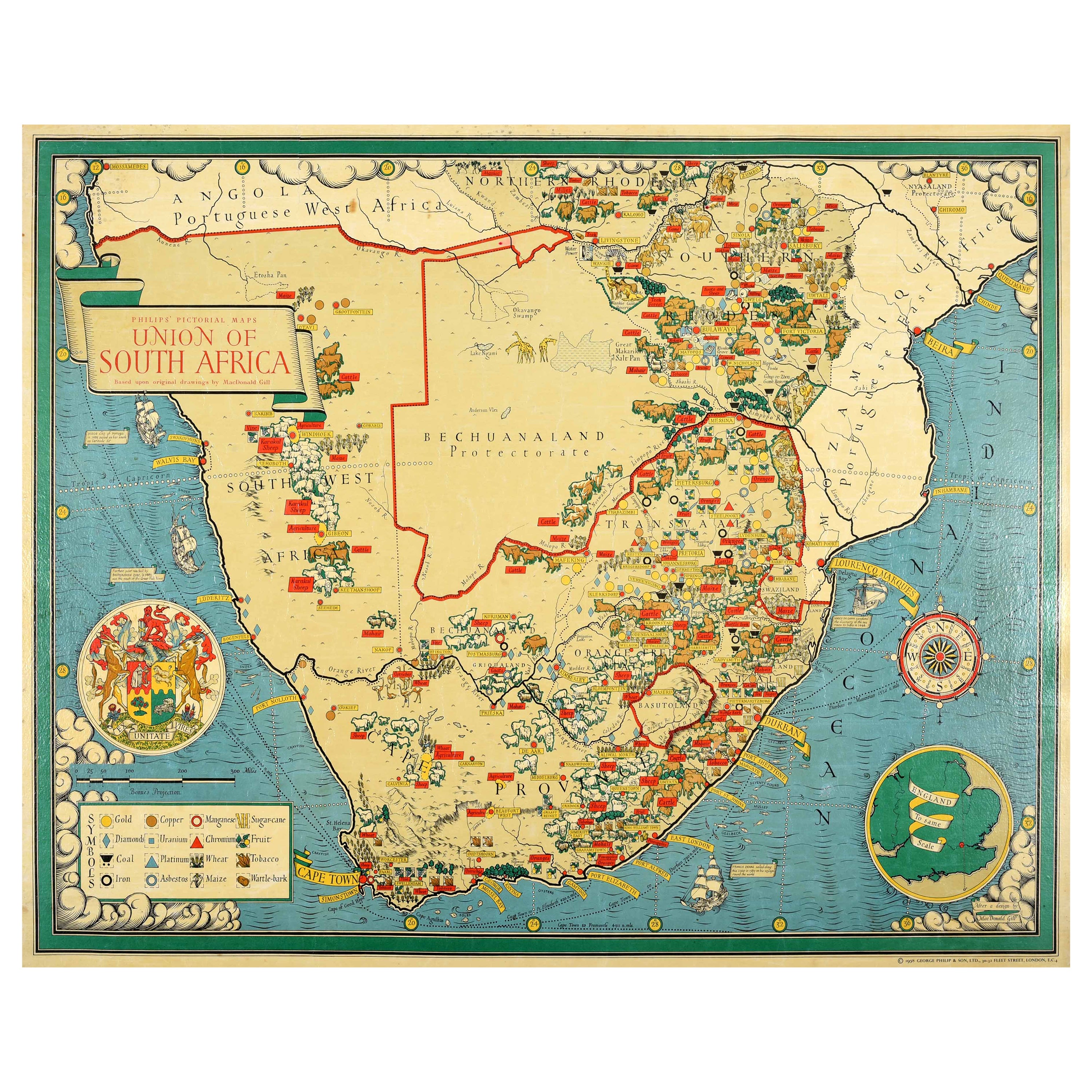
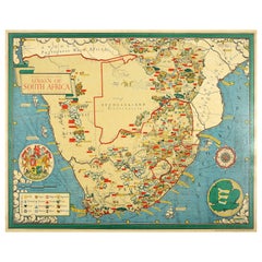
- Original Vintage Illustrated Map Poster Union Of South Africa MacDonald GillBy "Leslie MacDonald ""Max"" Gill"Located in London, GBOriginal vintage illustrated map poster for the Union of South Africa - Philips pictorial map based upon original drawings by notable British ...Category
Vintage 1950s British Posters
MaterialsPaper
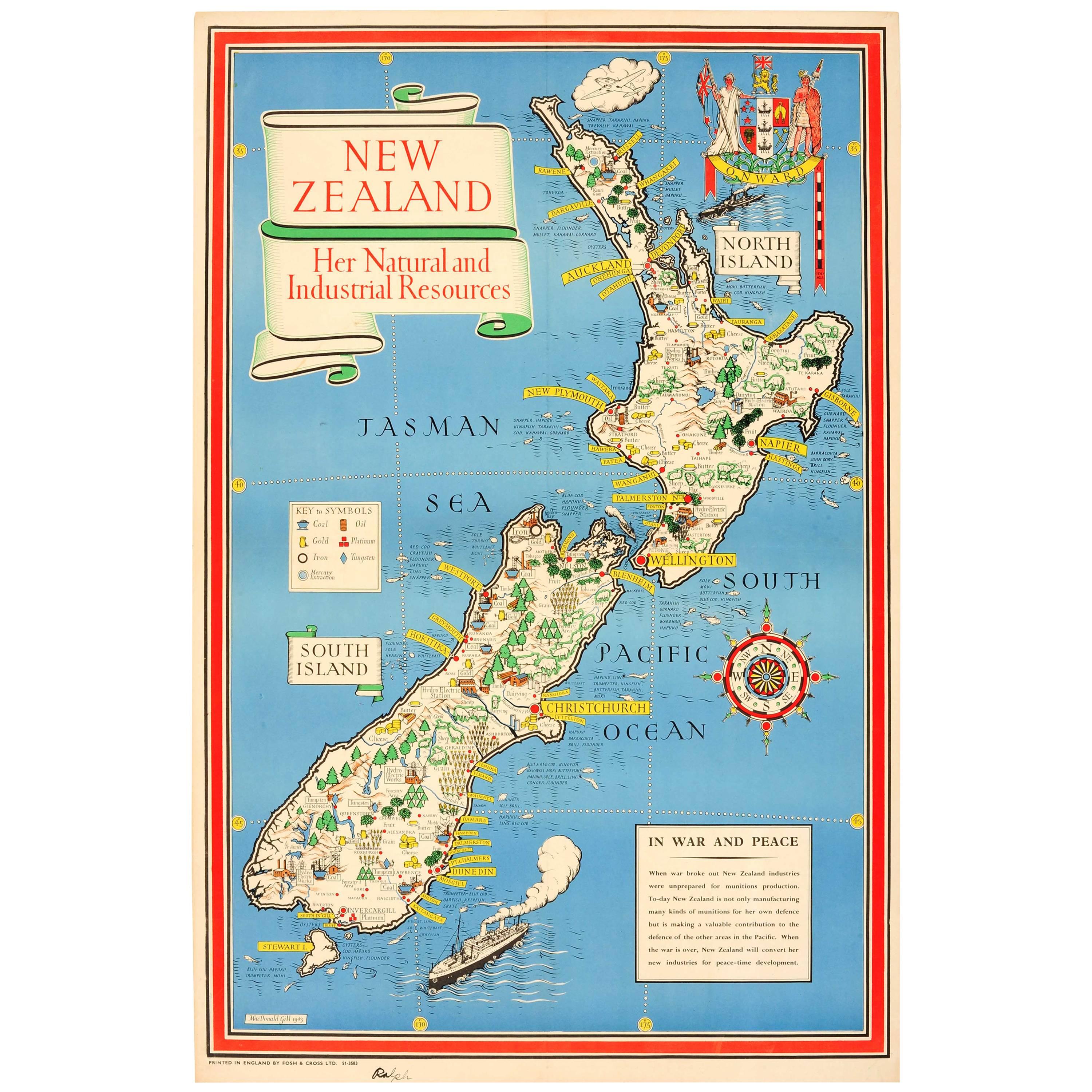
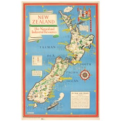
- Original WWII Map of New Zealand - Natural & Industrial Resources in War & PeaceBy "Leslie MacDonald ""Max"" Gill"Located in London, GBOriginal vintage World War Two pictorial map for New Zealand her natural and Industrial resources featuring a great illustration by the notable graphic designer, cartographer and artist MacDonald Gill (Leslie MacDonald Gill aka Max Gill...Category
Vintage 1940s British Posters
MaterialsPaper
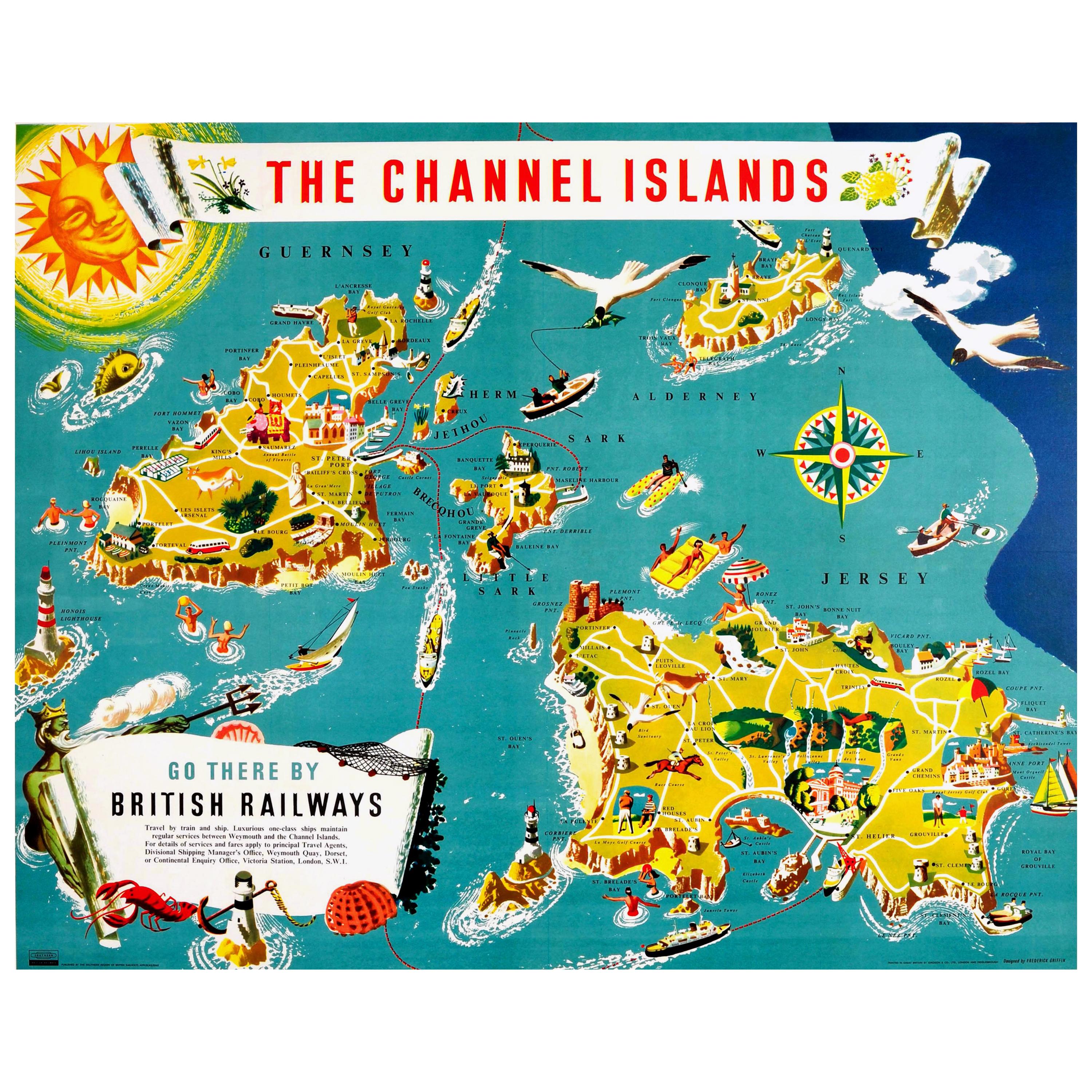
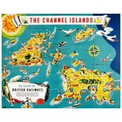
- Original Vintage British Railways Poster Illustrated Map of the Channel IslandsLocated in London, GBOriginal vintage travel advertising poster for The Channel Islands - Go there by British Railways published by the Southern Region of British Railways. Colourful illustrated map of t...Category
Vintage 1950s British Posters
MaterialsPaper
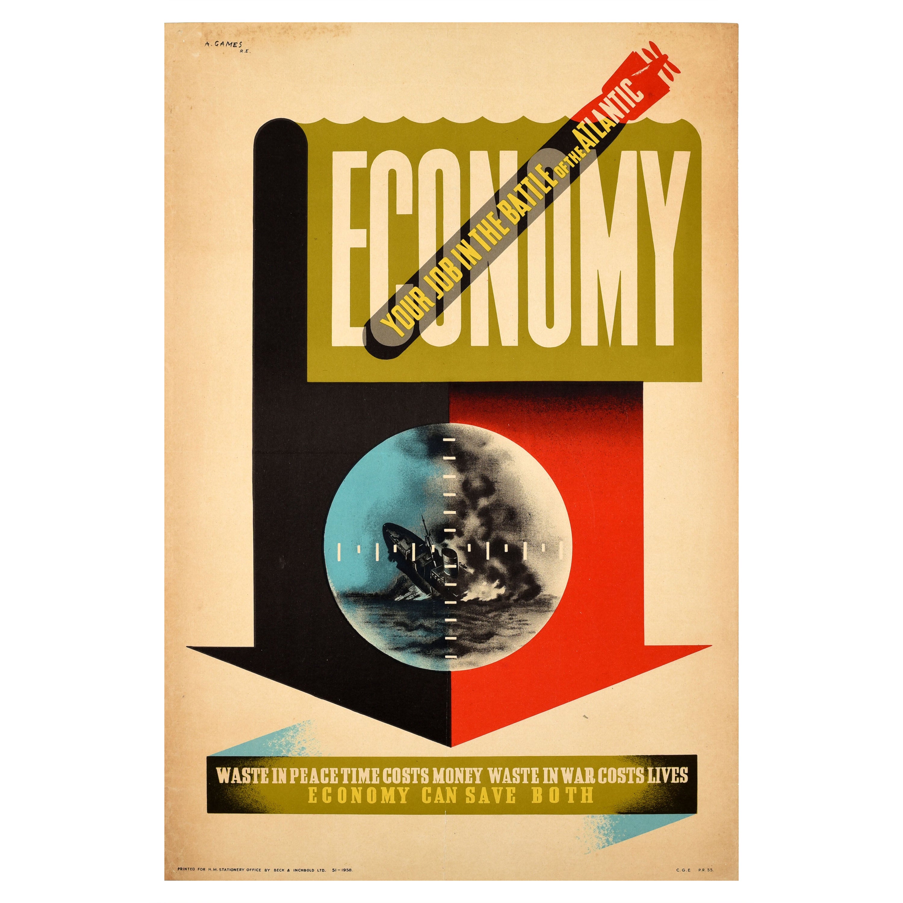
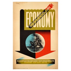
- Original Vintage WWII Poster Economy Save Waste Peace War Battle Of The AtlanticBy Abram GamesLocated in London, GBOriginal vintage propaganda poster to encourage savings - Economy / Your job in the Battle of the Atlantic / Waste in peace time costs money Waste in war costs lives Economy can save both - featuring a dynamic design by the notable British graphic designer Abram Games (Abraham Gamse; 1914-1996) depicting a black and white arrow pointing down with the word Economy on a sea water illustration background at the top and a submarine shape diving down with the Battle of Atlantic text across it, a periscope view in the centre showing a ship being sunk with flames and smoke against a blue and white background, the rest of the text on a stylised banner below. The Battle of the Atlantic between German Nazi U-Boats and Kriegsmarine ships against the Allied navy and merchant shipping forces including the Royal Navy, Royal Canadian Navy...Category
Vintage 1940s British Posters
MaterialsPaper
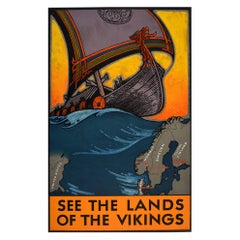
- Original Vintage Travel Poster See The Lands Of The Vikings Atlantic Sailing MapBy Benjamin BlessumLocated in London, GBOriginal vintage travel poster for the Nordic countries marked on a map - Christiania (Oslo) Norway, Stockholm Sweden, Helsinki Finland, and Copenhagen Denmark - below a colourful im...Category
Vintage 1930s Swedish Posters
MaterialsPaper
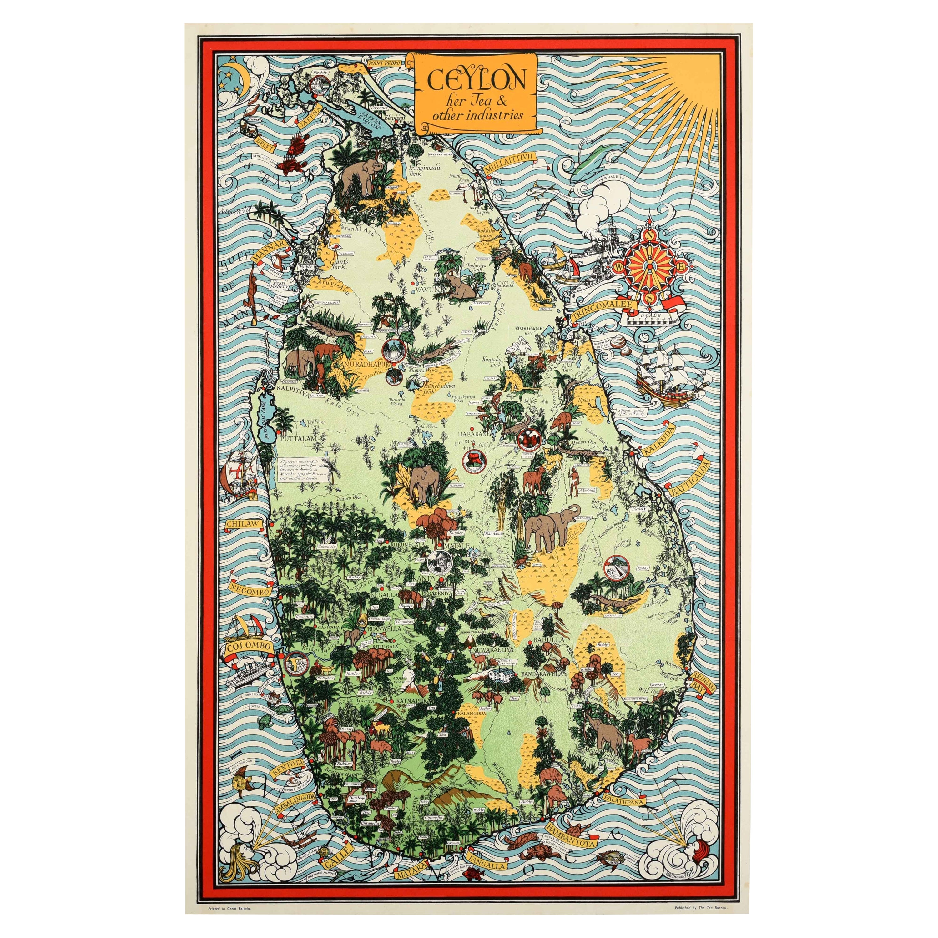
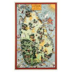
- Original Vintage Pictorial Map Poster Ceylon Tea And Other Industries Sri LankaBy "Leslie MacDonald ""Max"" Gill"Located in London, GBOriginal vintage pictorial map poster for Ceylon Her Tea & Other Industries featuring artwork by the notable British cartographer, graphic design...Category
Vintage 1940s British Posters
MaterialsPaper
You May Also Like
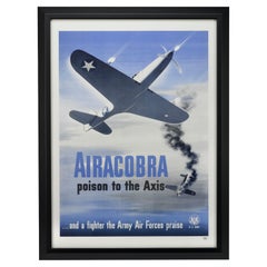
- "Airacobra poison to the Axis" Vintage WWII Poster, 1943Located in Colorado Springs, COPresented is a vintage WWII U.S. Army poster of a P-39 Airacobra fighter plane. The poster was published by the Recruiting Publicity Bureau in 1943. The p...Category
Vintage 1940s American Posters
MaterialsPaper
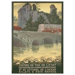
- Original Vintage Poster, Geo Dorival, Sud Vendée, Clisson, Atlantic Ocean, 1912By Geo DorivalLocated in SAINT-OUEN-SUR-SEINE, FROriginal Vintage Poster-Geo Dorival-Sud Vendée-Clisson-Atlantic Ocean, 1912 Original vintage poster representing the old town of Clisson (Loire-Atlantique). The stone bridge at the ...Category
20th Century Art Deco Posters
MaterialsPaper
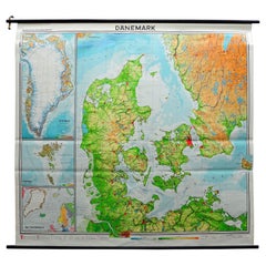
- Denmark Greenland Faroe Islands the North Atlantic Vintage Mural Map Wall ChartLocated in Berghuelen, DEThe vintage pull-down mural map illustrates Denmark with Greenland, the Faroe Islands and the North Atlantic. Published by Westermann. Colorful print on paper reinforced with canvas....Category
Vintage 1970s German Country Posters
MaterialsCanvas, Wood, Paper
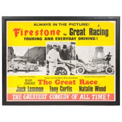
- Great Race Film Poster "The Greatest Comedy of All Time"Located in London, GBThe poster for firestone and the Warner Bros. 1965 slapstick comedy film The Great Race. The film stared Jack Lemmon, Tony Curtis, and Natalie Wood, it w...Category
Mid-20th Century American Posters
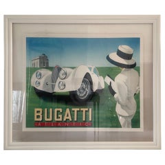
- Rare Framed and Hand Signed Razzia Bugatti Atlantic PosterBy Razzia (Gérard Courbouleix–Dénériaz)Located in Miami, FLLarge original limited edition lithograph poster with linen backing by Razzia, titled Bugatti Atlantic. This rare piece is custom framed in clear museum acrylic...Category
20th Century French Art Deco Posters
MaterialsAcrylic, Wood
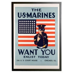
- "The U.S. Marines Want You" Vintage WWII Recruitment Poster, 1940Located in Colorado Springs, COThis is an original World War II Marines recruitment poster, issued in 1940. The poster depicts a no-nonsense Marine drill instructor, pointing directly at the viewer, in front of a ...Category
Vintage 1940s American Mid-Century Modern Posters
MaterialsPaper
Recently Viewed
View AllMore Ways To Browse
Wwii Compass
Leslie Winer
Vintage Horse Plough
Food Poster Wwii
Easy Rider Original Movie Poster
Jungle Book Movie Poster
Vintage Isle Of Wight Posters
Gimme Shelter Poster
I Married A Monster
Vintage Italian Motorcycle Poster
Vintage Posters Air Afrique
Andy Warhol Chanel No 5
Annie Hall Poster
Cat On A Hot Tin Roof Poster
Contratto Poster Vintage
Goldeneye Poster
Goodfellas Poster
Maurin Quina Poster