British Maps
141
263
2
to
5
241
22
265
265
265
42
32
8
6
3
2
1
55
151
57
2
51
1
2
46
1
221
46
8
5
5
479
265
169
118
111
5
4
1
1
1
Place of Origin: British
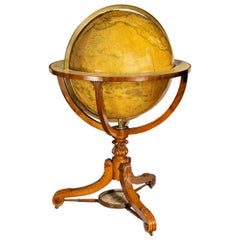
Large and Extremely Rare Terrestrial Globe by Newton
By Newton Globes - Planer & Newton
Located in Lymington, Hampshire
A large and extremely rare 24-inch terrestrial globe by Newton
Our most magnificent and rare globes were a pair of 24-inch Newton globes.
These too were updated in 1852 (terre...
Category
Mid-19th Century Antique British Maps
Materials
Mahogany
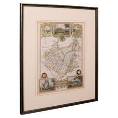
Antique Leicestershire Map, English, Framed Cartographic Interest, Victorian
Located in Hele, Devon, GB
This is an antique lithography map of Leicestershire. An English, framed atlas engraving of cartographic interest, dating to the mid 19th century and later.
Superb lithography of Le...
Category
Mid-19th Century Victorian Antique British Maps
Materials
Wood
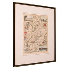
Antique Nottinghamshire Map, English, Framed, Cartographic Interest, Victorian
Located in Hele, Devon, GB
This is an antique lithography map of Nottinghamshire. An English, framed atlas engraving of cartographic interest, dating to the mid 19th century and later.
Superb lithography of ...
Category
Mid-19th Century Victorian Antique British Maps
Materials
Wood
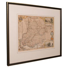
Antique County Map, Essex, English, Framed, Cartographic Interest, Victorian
Located in Hele, Devon, GB
This is an antique lithography map of Essex. An English, framed atlas engraving of cartographic interest, dating to the mid 19th century and later.
Superb lithography of Essex and ...
Category
Mid-19th Century Victorian Antique British Maps
Materials
Wood
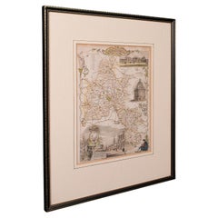
Antique County Map, Oxfordshire, English, Framed Cartography Interest, Victorian
Located in Hele, Devon, GB
This is an antique lithography map of Oxfordshire. An English, framed atlas engraving of cartographic interest, dating to the mid 19th century and later.
Superb lithography of Oxfo...
Category
Mid-19th Century Mid-Century Modern Antique British Maps
Materials
Wood
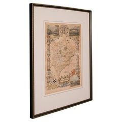
Antique County Map, Rutlandshire, English, Framed, Cartography, Victorian, 1860
Located in Hele, Devon, GB
This is an antique lithography map of Rutlandshire. An English, framed atlas engraving of cartographic interest, dating to the mid 19th century and later.
Superb lithography of Rutl...
Category
Mid-19th Century Victorian Antique British Maps
Materials
Wood
Antique County Map, Norfolk, English, Framed Lithography, Cartography, Victorian
Located in Hele, Devon, GB
This is an antique lithography map of Norfolk. An English, framed atlas engraving of cartographic interest, dating to the mid 19th century and later.
Superb lithography of Norfolk a...
Category
Mid-19th Century Victorian Antique British Maps
Materials
Glass, Wood
Antique Lithography Map, Buckinghamshire, English, Framed Cartography, Victorian
Located in Hele, Devon, GB
This is an antique lithography map of Buckinghamshire. An English, framed atlas engraving of cartographic interest, dating to the mid 19th century and later.
Superb lithography of B...
Category
Mid-19th Century Victorian Antique British Maps
Materials
Wood, Paper
Antique Lithography Map, County Durham, English, Framed Cartography, Victorian
Located in Hele, Devon, GB
This is an antique lithography map of County Durham. An English, framed atlas engraving of cartographic interest, dating to the mid 19th century and later.
Superb lithography of Cou...
Category
Mid-19th Century Mid-Century Modern Antique British Maps
Materials
Wood
Original Antique Map of Cyprus. Circa 1880
Located in St Annes, Lancashire
Great map of Cyprus
Drawn and Engraved by R.Walker
Published W.Mackenzie, London
Original colour
Unframed.
Category
1880s Antique British Maps
Materials
Paper
Original Antique Map of The United States of America, circa 1890
Located in St Annes, Lancashire
Great map of the USA
By The Stanford's Geographical Establishment
Original colour
Unframed.
Category
1890s Victorian Antique British Maps
Materials
Paper
Antique Lithography Map, Western Russia, English, Framed, Cartography, Victorian
Located in Hele, Devon, GB
This is an antique lithography map of Western Russia. An English, framed atlas engraving of cartographic interest by John Rapkin, dating to the early Victorian period and later, circ...
Category
Mid-19th Century Early Victorian Antique British Maps
Materials
Wood
Original Antique Map of the American State of Washington, 1889
Located in St Annes, Lancashire
Great map of Washington
Drawn and Engraved by W. & A.K. Johnston
Published By A & C Black, Edinburgh.
Original colour
Unframed.
Category
1880s Victorian Antique British Maps
Materials
Paper
Antique Lithography Map, Bedfordshire, English, Framed Engraving, Cartography
Located in Hele, Devon, GB
This is an antique lithography map of Bedfordshire. An English, framed atlas engraving of cartographic interest, dating to the mid 19th century and...
Category
Mid-19th Century Victorian Antique British Maps
Materials
Wood
Antique Lithography Map, Isle of Thanet, Kent, English, Cartography, Victorian
Located in Hele, Devon, GB
This is an antique lithography map of The Isle of Thanet in Kent. An English, framed atlas engraving of cartographic interest, dating to the mid 19th century and later.
Superb litho...
Category
Mid-19th Century Victorian Antique British Maps
Materials
Wood
Antique Lithography Map, Hertfordshire, English, Framed Engraving, Cartography
Located in Hele, Devon, GB
This is an antique lithography map of Hertfordshire. An English, framed atlas engraving of cartographic interest, dating to the mid 19th century an...
Category
Mid-19th Century Victorian Antique British Maps
Materials
Wood
Antique Lithography Map, Northamptonshire, English, Framed Cartography, C.1860
Located in Hele, Devon, GB
This is an antique lithography map of Northamptonshire. An English, framed atlas engraving of cartographic interest, dating to the mid 19th century...
Category
Mid-19th Century Victorian Antique British Maps
Materials
Wood
Original Antique Map of South East Asia, Arrowsmith, 1820
Located in St Annes, Lancashire
Great map of South East Asia
Drawn under the direction of Arrowsmith
Copper-plate engraving
Published by Longman, Hurst, Rees, Orme and Brown, 1820
Unframed.
Category
1820s Antique British Maps
Materials
Paper
Antique Lithography Map, Northumberland, English, Framed, Engraving, Cartography
Located in Hele, Devon, GB
This is an antique lithography map of Northumberland. An English, framed atlas engraving of cartographic interest, dating to the mid 19th century a...
Category
Mid-19th Century Victorian Antique British Maps
Materials
Wood
Antique Lithography Map, Gloucestershire, English, Framed Engraving, Cartography
Located in Hele, Devon, GB
This is an antique lithography map of Gloucestershire. An English, framed atlas engraving of cartographic interest, dating to the mid 19th century ...
Category
Mid-19th Century Victorian Antique British Maps
Materials
Wood
Antique Lithography Map, Lincolnshire, English, Framed, Engraving, Cartography
Located in Hele, Devon, GB
This is an antique lithography map of Lincolnshire. An English, framed atlas engraving of cartographic interest, dating to the mid 19th century and...
Category
Mid-19th Century Victorian Antique British Maps
Materials
Wood
Antique Lithography Map, South America, English, Framed, Cartography, Victorian
Located in Hele, Devon, GB
This is an antique lithography map of South America. An English, framed atlas engraving of cartographic interest by John Rapkin , dating to the early Victorian period and later, circ...
Category
Mid-19th Century Early Victorian Antique British Maps
Materials
Wood
Antique Coaching Road Map, Devon, English, Regional Cartography, Georgian, 1720
Located in Hele, Devon, GB
This is an antique coaching road map of Devon. An English, framed lithograph engraving of regional interest, dating to the early 18th century and later.
Fascinating 18th century hig...
Category
Early 18th Century Georgian Antique British Maps
Materials
Wood
Antique Lithography Map, Isle of Wight, English, Framed, Engraving, Cartography
Located in Hele, Devon, GB
This is an antique lithography map of the Isle of Wight. An English, framed atlas engraving of cartographic interest, dating to the early 19th century and later.
Superb lithography ...
Category
Early 19th Century Regency Antique British Maps
Materials
Wood
Antique Coaching Road Map, South Devon, English, Framed, Cartography, Georgian
Located in Hele, Devon, GB
This is an antique coach road map of South Devon. An English, framed lithograph engraving of regional interest, dating to the early 18th century and later.
Delightful early 18th cen...
Category
Early 18th Century Georgian Antique British Maps
Materials
Wood
Antique Lithography Map, Cornwall, English Framed Engraving, Cartography, C.1850
Located in Hele, Devon, GB
This is an antique lithography map of the Duchy of Cornwall. An English, framed atlas engraving of cartographic interest, dating to the early 19th century and later.
Superb lithogra...
Category
Mid-19th Century Victorian Antique British Maps
Materials
Wood
Antique Coach Road Map, East Devon, English, Framed, Cartography, Georgian, 1720
Located in Hele, Devon, GB
This is an antique coach road map of East Devon. An English, framed lithograph engraving of regional interest, dating to the early 18th century and later.
Fascinating 18th century h...
Category
Early 18th Century Georgian Antique British Maps
Materials
Wood
Antique Lithography Map, Worcestershire, English, Framed Engraving, Cartography
Located in Hele, Devon, GB
This is an antique lithography map of Worcestershire. An English, framed atlas engraving of cartographic interest, dating to the early 19th centur...
Category
Early 19th Century Regency Antique British Maps
Materials
Wood
Antique Lithography Map, Black Sea, English, Framed, Cartography, Victorian
Located in Hele, Devon, GB
This is an antique lithography map of the Black Sea region. An English, framed atlas engraving of cartographic interest by John Rapkin, dating to the early Victorian period and later...
Category
Mid-19th Century Early Victorian Antique British Maps
Materials
Wood
Antique Lithography Map, Cumbria, English, Framed Cartography Interest, Georgian
Located in Hele, Devon, GB
This is an antique lithography map of Cumbria. An English, framed engraving of cartographic interest, dating to the early 18th century and later.
...
Category
Early 18th Century Georgian Antique British Maps
Materials
Wood
Antique Lithography Map, West Africa, English, Framed, Cartography, Victorian
Located in Hele, Devon, GB
This is an antique lithography map of Western Africa. An English, framed atlas engraving of cartographic interest by John Rapkin, dating to the early Victorian period and later, circ...
Category
Mid-19th Century Early Victorian Antique British Maps
Materials
Wood
Antique Lithography Map, Durham, English, Framed, Cartography, Early Georgian
Located in Hele, Devon, GB
This is an antique lithography map of Durham. An English, framed engraving of cartographic interest, dating to the early 18th century and later, circa 1720.
Superb lithography of Du...
Category
Early 18th Century Georgian Antique British Maps
Materials
Wood
Framed 1838 Mexico & Gulf of Mexico Map
Located in Stamford, CT
Framed 1838 Mexico & Gulf of Mexico map. Printed by Fisher, Son & Co. of London in 1838. As found framed condition. Map has not been examined outside of th...
Category
1830s American Classical Antique British Maps
Materials
Glass, Wood, Paper
Large Original Vintage Map of Australia, circa 1920
Located in St Annes, Lancashire
Great map of Australia
Original color. Good condition
Published by Alexander Gross
Unframed.
Category
1920s Vintage British Maps
Materials
Paper
Large Original Vintage Map of The World, circa 1920
Located in St Annes, Lancashire
Great map of The World
Original color.
Good condition / minor foxing
Published by Alexander Gross
Unframed.
Category
1920s Vintage British Maps
Materials
Paper
Original Antique Map of the American State of Pennsylvania, 1889
Located in St Annes, Lancashire
Great map of Pennsylvania
Drawn and Engraved by W. & A.K. Johnston
Published By A & C Black, Edinburgh.
Original colour
Unframed.
Repair to a minor tear on bottom edge.
Category
1880s Victorian Antique British Maps
Materials
Paper
Set of 5 Large Original Vintage Sea Charts, circa 1920
Located in St Annes, Lancashire
5 great maps or charts of the oceans
I particularly like the color of these maps
Unframed
Original color
By John Bartholomew and Co. Edinburgh Geographical Institute
Published, ...
Category
1920s Vintage British Maps
Materials
Paper
Large Original Vintage Map of Sweden and Norway circa 1920
Located in St Annes, Lancashire
Great map of Sweden and Norway
Original color. Good condition
Published by Alexander Gross
Unframed.
Category
1920s Victorian Vintage British Maps
Materials
Paper
Large Original Vintage Map of Iceland, circa 1920
Located in St Annes, Lancashire
Great map of Iceland
Original color. Good condition
Published by Alexander Gross
Unframed.
Category
1920s Victorian Vintage British Maps
Materials
Paper
Large Original Antique Map of The World, Fullarton, C.1870
Located in St Annes, Lancashire
Great map of the World. Showing both hemispheres
From the celebrated Royal Illustrated Atlas
Lithograph. Original color.
Published by Fullarton, Edinburgh, C.1870
Unframed.
Rep...
Category
1870s Antique British Maps
Materials
Paper
Large Original Vintage Map of The United Kingdom, circa 1920
Located in St Annes, Lancashire
Great map of The United Kingdom
Original color.
Published by Alexander Gross
Unframed.
Category
1920s Vintage British Maps
Materials
Paper
Large Original Vintage Map of The South Pole, circa 1920
Located in St Annes, Lancashire
Great map of The South Pole
Original color.
Published by Alexander Gross
Unframed.
Repairs to minor edge tears
Category
1920s Vintage British Maps
Materials
Paper
Original Antique Map of India. C.1780
Located in St Annes, Lancashire
Great map of India
Copper-plate engraving
Published C.1780
Three small worm holes to right side of map and one bottom left corner
Unframed.
Category
Early 1800s Georgian Antique British Maps
Materials
Paper
Large Original Vintage Map of Japan, circa 1920
Located in St Annes, Lancashire
Great map of Japan
Unframed
Original color
By John Bartholomew and Co. Edinburgh Geographical Institute
Published, circa 1920
Free shipping.
Category
1920s Vintage British Maps
Materials
Paper
Original Antique Map of Italy. C.1780
Located in St Annes, Lancashire
Great map of Italy
Copper-plate engraving
Published C.1780
Unframed.
Category
Early 1800s Georgian Antique British Maps
Materials
Paper
Original Antique Map of Hungary, Arrowsmith, 1820
Located in St Annes, Lancashire
Great map of Hungary
Drawn under the direction of Arrowsmith.
Copper-plate engraving.
Published by Longman, Hurst, Rees, Orme and Brown, 1820
Unframed.
Category
1820s Antique British Maps
Materials
Paper
Northwest Coast and Isle of Man Map
Located in Cheshire, GB
Greenville Collins Northwest Coast and Isle of Man. hand coloured chart, encased in an ebonised frame.
Dimensions
Height 26.5 Inches
Width 30 Inches
Depth 1 Inches
Category
Early 20th Century British Maps
Materials
Paper
Map of Lancashire
Located in Cheshire, GB
Saxton Map of Lancashire hand coloured. Encased in an ebonised frame.
Dimensions
Height 21 Inches
Width 24 Inches
Depth 1 Inches
Category
Early 20th Century British Maps
Materials
Paper
Chart of the Harbour of Liverpool
Located in Cheshire, GB
PL Burdett A Chart of the Harbour of Liverpool hand coloured. Encased in an ebonised frame.
Dimensions
Height 23.5 Inches
Width 28 Inches
Depth 1 Inches
Category
Early 20th Century British Maps
Materials
Paper
Original Antique Map of the American State of Oregon, 1889
Located in St Annes, Lancashire
Great map of Oregon
Drawn and Engraved by W. & A.K. Johnston
Published By A & C Black, Edinburgh.
Original colour
Unframed.
Category
1880s Victorian Antique British Maps
Materials
Paper
Original Antique Map of Asia. C.1780
Located in St Annes, Lancashire
Great map of Asia
Copper-plate engraving
Published C.1780
Two small worm holes to right side of map
Unframed.
Category
Early 1800s Georgian Antique British Maps
Materials
Paper
Dartmouth, England: A Hand-Colored 17th Century Sea Chart by Captain Collins
By Captain Greenvile Collins
Located in Alamo, CA
This hand-colored sea chart of the area around Dartmouth, England is from "Great Britain's Coasting Pilot. Being a New and Exact Survey of the Sea-Coast of England", first published ...
Category
Late 17th Century Antique British Maps
Materials
Paper
Large Original Vintage Map of Mexico, circa 1920
Located in St Annes, Lancashire
Great map of Mexico
Original color.
Good condition
Published by Alexander Gross
Unframed.
Category
1920s Edwardian Vintage British Maps
Materials
Paper
Large Original Vintage Map of Brazil, circa 1920
Located in St Annes, Lancashire
Great map of Brazil
Original color. Good condition
Published by Alexander Gross
Unframed.
Category
1920s Edwardian Vintage British Maps
Materials
Paper
Original Antique Map of Missouri, 1889
Located in St Annes, Lancashire
Great map of Missouri
Drawn and Engraved by W. & A.K. Johnston
Published By A & C Black, Edinburgh.
Original colour
Unframed.
Category
1880s Victorian Antique British Maps
Materials
Paper
Original Antique Map of South America. C.1780
Located in St Annes, Lancashire
Great map of South America
Copper-plate engraving
Published C.1780
Two small worm holes to left side of map
Unframed.
Category
Early 1800s Georgian Antique British Maps
Materials
Paper
Antique Map of American Cities, Vignette of New York City, circa 1920
Located in St Annes, Lancashire
Great maps of American Cities
Unframed
Original color
By John Bartholomew and Co. Edinburgh Geographical Institute
Published, circa 1920
Category
1920s Vintage British Maps
Materials
Paper
Large Original Antique Map of the World, Fullarton, circa 1870
Located in St Annes, Lancashire
Great map of the World.
From the celebrated Royal Illustrated Atlas
Lithograph. Original color.
Published by Fullarton, Edinburgh, circa 1870.
Unframed.
Category
1870s Antique British Maps
Materials
Paper
Recently Viewed
View AllMore Ways To Browse
Greek Asia Minor
Antique Maps Canada
Antique Map Canada
Canada Antique Map
West Indies Map
Antique Maps Of Canada
Bali Map
Antique Portuguese Plates
Map Huge
Sweden Antique Map
Belgian Army
Antique Map South Africa
Antique Map Of South Africa
South Africa Antique Map
Map Of West Indies
Belgium Army
Cornelius Company
Sea Chart Map
