British Maps
to
11
271
20
291
2
66
34
8
5
4
2
1
1
63
143
85
2
76
2
1
46
27
1
251
69
31
6
5
530
293
179
128
113
293
293
293
4
4
1
1
1
Place of Origin: British
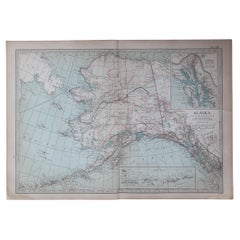
Original Antique Map of the American State of Alaska, 1903
Located in St Annes, Lancashire
Antique map of Alaska
Published By A & C Black. 1903
Original colour
Good condition
Unframed.
Free shipping
Category
Early 1900s Antique British Maps
Materials
Paper
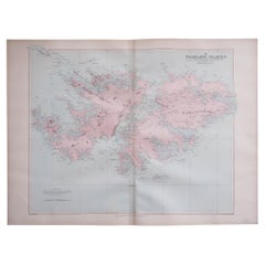
Large Original Antique Map of The Falkland Islands. 1894
Located in St Annes, Lancashire
Superb Antique map of The Falkland Islands
Published Edward Stanford, Charing Cross, London 1894
Original colour
Good condition
Unframed.
Free shipping
Category
1890s Antique British Maps
Materials
Paper
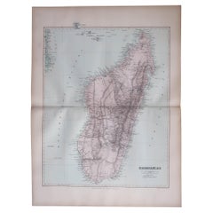
Large Original Antique Map of Madagascar. 1894
Located in St Annes, Lancashire
Superb Antique map of Madagascar
Published Edward Stanford, Charing Cross, London 1894
Original colour
Good condition
Unframed.
Free shipping
Category
1890s Antique British Maps
Materials
Paper
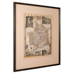
Antique Lithography Map, Monmouthshire, Framed, Welsh Cartography, Victorian
Located in Hele, Devon, GB
This is an antique lithography map of Monmouthshire. An English, framed atlas engraving of cartographic interest, dating to the mid 19th century and later.
Superb lithography of Mo...
Category
Mid-19th Century Victorian Antique British Maps
Materials
Glass, Wood, Paper
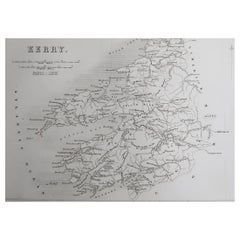
Original Antique Map of Ireland- Kerry. C.1840
Located in St Annes, Lancashire
Great map of Kerry
Steel engraving
Drawn under the direction of A.Adlard
Published by How and Parsons, C.1840
Unframed.
Category
1840s Antique British Maps
Materials
Paper
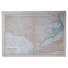
Original Antique Map of the American State of North Carolina, 1903
Located in St Annes, Lancashire
Antique map of North Carolina
Published By A & C Black. 1903
Original colour
Good condition
Unframed.
Free shipping
Category
Early 1900s Antique British Maps
Materials
Paper
Original Antique Map of the American State of Wisconsin, 1903
Located in St Annes, Lancashire
Antique map of Wisconsin
Published By A & C Black. 1903
Original colour
Good condition
Unframed.
Free shipping
Category
Early 1900s Antique British Maps
Materials
Paper
Original Antique Map of the American State of Iowa, 1903
Located in St Annes, Lancashire
Antique map of Iowa
Published By A & C Black. 1903
Original colour
Good condition
Unframed.
Free shipping
Category
Early 1900s Antique British Maps
Materials
Paper
Original Antique Map of the American State of Washington, 1903
Located in St Annes, Lancashire
Antique map of Washington
Published By A & C Black. 1903
Original colour
Good condition
Unframed.
Free shipping
Category
Early 1900s Antique British Maps
Materials
Paper
Original Antique Map of the American State of Nevada & Utah, 1903
Located in St Annes, Lancashire
Antique map of Nevada and Utah
Published By A & C Black. 1903
Original colour
Good condition
Unframed.
Free shipping
Category
Early 1900s Antique British Maps
Materials
Paper
Original Antique Map of the American State of Illinois ( Southern Part ), 1903
Located in St Annes, Lancashire
Antique map of Illinois ( Southern part )
Published By A & C Black. 1903
Original colour
Good condition
Unframed.
Free shipping
Category
Early 1900s Antique British Maps
Materials
Paper
Original Antique Decorative Map of Iceland & Faroe, Fullarton, C.1870
Located in St Annes, Lancashire
Great map of Iceland and The Faroe Islands
Wonderful figural border
From the celebrated Royal Illustrated Atlas
Lithograph. Original color.
Published by Fullarton, Edinb...
Category
1870s Antique British Maps
Materials
Paper
Antique Lithography Map, Huntingdonshire, English, Framed Cartography, Victorian
Located in Hele, Devon, GB
This is an antique lithography map of Huntingdonshire. An English, framed atlas engraving of cartographic interest, dating to the mid 19th century and later.
Superb lithography of ...
Category
Mid-19th Century Victorian Antique British Maps
Materials
Glass, Wood, Paper
Large Original Vintage Map of China, circa 1920
Located in St Annes, Lancashire
Great map of China.
Original color. Good condition.
Published by Alexander Gross
Unframed.
Category
1920s Edwardian Vintage British Maps
Materials
Paper
Large Original Vintage Map of Japan, circa 1920
Located in St Annes, Lancashire
Great map of Japan
Original color. Good condition
Published by Alexander Gross
Unframed.
Category
1920s Vintage British Maps
Materials
Paper
Large Original Vintage Map of North America, circa 1920
Located in St Annes, Lancashire
Great map of North America
Original color. Good condition
Published by Alexander Gross
Unframed.
Category
1920s Edwardian Vintage British Maps
Materials
Paper
Original Antique Map of United States, Grattan and Gilbert, 1843
Located in St Annes, Lancashire
Great map of United States
Drawn and engraved by Archer
Published by Grattan and Gilbert. 1843
Original colour
Unframed.
Category
1840s Antique British Maps
Materials
Paper
Sotheby's The Wardington Library, Important Atlases and Geographies, Part 1 A-K
Located in valatie, NY
Sotheby's: The Wardington Library, Important Atlases and Geographies. Part One: A-K., London, 18 October 2005. 1st Ed hardcover catalog with 244 lots photographed in color and fully ...
Category
Early 2000s British Maps
Materials
Paper
Large Original Antique Map of Europe by Sidney Hall, 1847
Located in St Annes, Lancashire
Great map of Europe
Drawn and engraved by Sidney Hall
Steel engraving
Original colour outline
Published by A & C Black. 1847
Unframed
Free shipping.
Category
1840s Antique British Maps
Materials
Paper
Original Antique Map of the American State of Pennsylvania, 1889
Located in St Annes, Lancashire
Great map of Pennsylvania
Drawn and Engraved by W. & A.K. Johnston
Published By A & C Black, Edinburgh.
Original colour
Unframed.
Repair to a minor tear on bottom edge.
Category
1880s Victorian Antique British Maps
Materials
Paper
Large Original Vintage Map of S.E Asia, with a Vignette of Singapore
Located in St Annes, Lancashire
Great map of South East Asia
Original color. Good condition
Published by Alexander Gross
Unframed.
Category
1920s Vintage British Maps
Materials
Paper
Original Antique Map of Central America / Florida, Arrowsmith, 1820
Located in St Annes, Lancashire
Great map of Central America.
Drawn under the direction of Arrowsmith.
Copper-plate engraving.
Published by Longman, Hurst, Rees, Orme and Brown, 1820
Unframed.
Category
1820s Antique British Maps
Materials
Paper
Antique County Map, Kent, English, Framed, Lithography, Cartography, Victorian
Located in Hele, Devon, GB
This is an antique lithography map of Kent. An English, framed atlas engraving of cartographic interest, dating to the mid 19th century and later.
Superb lithography of Kent and it...
Category
Mid-19th Century Victorian Antique British Maps
Materials
Paper
Antique Lithography Map, Oxfordshire, English, Framed Cartography, Robert Morden
Located in Hele, Devon, GB
This is an antique lithography map of Oxfordshire. An English, framed atlas engraving of cartographic interest by Robert Morden, dating to the late 17th century and later.
Superb l...
Category
Late 17th Century William and Mary Antique British Maps
Materials
Paper
Antique County Map, Sussex, English, Framed Lithography, Cartography, Victorian
Located in Hele, Devon, GB
This is an antique lithography map of Sussex. An English, framed atlas engraving of cartographic interest, dating to the mid 19th century and later.
Superb lithography of Sussex an...
Category
Mid-19th Century Victorian Antique British Maps
Materials
Paper
Original Antique Map of Sweden, Engraved by Barlow, 1806
Located in St Annes, Lancashire
Great map of Sweden
Copper-plate engraving by Barlow
Published by Brightly & Kinnersly, Bungay, Suffolk. 1806
Unframed.
Category
Early 1800s Antique British Maps
Materials
Paper
Large Scale Antique Scroll Map of Lincolnshire, England, Dated 1778
Located in St Annes, Lancashire
Wonderful scroll map of Lincolnshire
By Captain Armstrong, 1778
Copper plate engraving on paper laid on canvas
Original ebonized wood frame with lovely t...
Category
1770s Georgian Antique British Maps
Materials
Wood, Paper
Large Original Vintage Map of Japan, circa 1920
Located in St Annes, Lancashire
Great map of Japan
Unframed
Original color
By John Bartholomew and Co. Edinburgh Geographical Institute
Published, circa 1920
Free shipping.
Category
1920s Vintage British Maps
Materials
Paper
Antique County Map, Oxfordshire, English, Framed Cartography Interest, Victorian
Located in Hele, Devon, GB
This is an antique lithography map of Oxfordshire. An English, framed atlas engraving of cartographic interest, dating to the mid 19th century and later.
Superb lithography of Oxfo...
Category
Mid-19th Century Mid-Century Modern Antique British Maps
Materials
Wood
Large Original Vintage Map of The World, circa 1920
Located in St Annes, Lancashire
Great map of The World
Original color.
Good condition / minor foxing
Published by Alexander Gross
Unframed.
Category
1920s Vintage British Maps
Materials
Paper
Antique Lithography Map, Coastal England, Framed Cartography Interest, Victorian
Located in Hele, Devon, GB
This is an antique lithography map of Coastal England. A Scottish, framed town engraving of cartographic interest, dating to the early Victorian period and later.
Superb lithograph...
Category
Mid-19th Century Early Victorian Antique British Maps
Materials
Glass, Wood
Antique County Map, Surrey, English, Framed Lithograph, Cartography, Victorian
Located in Hele, Devon, GB
This is an antique lithography map of Surrey. An English, framed atlas engraving of cartographic interest, dating to the mid 19th century and later.
Superb lithography of Surrey an...
Category
Mid-19th Century Victorian Antique British Maps
Materials
Paper
Large Original Vintage Map of India, circa 1920
Located in St Annes, Lancashire
Great map of India
Original color.
Good condition / repair to some minor damage just above Sri Lanka. Shown in the last image.
Published by Alexander Gross
Unframed.
Category
1920s Vintage British Maps
Materials
Paper
Large Original Vintage Map of Spain, circa 1920
Located in St Annes, Lancashire
Great map of Spain
Original color.
Good condition
Published by Alexander Gross
Unframed.
Category
1920s Vintage British Maps
Materials
Paper
Large Original Antique Map of Morocco. Edward Weller, 1861
Located in St Annes, Lancashire
Great map of Morocco
Lithograph engraving by Edward Weller
Original colour
Published, 1861
Unframed
Good condition.
Category
1860s Victorian Antique British Maps
Materials
Paper
Original Antique Map of the American State of Oregon, 1889
Located in St Annes, Lancashire
Great map of Oregon
Drawn and Engraved by W. & A.K. Johnston
Published By A & C Black, Edinburgh.
Original colour
Unframed.
Category
1880s Victorian Antique British Maps
Materials
Paper
Large Original Vintage Map of the South Eastern States Inc. Florida, circa 1920
Located in St Annes, Lancashire
Great map of The South Eastern States
Original color. Good condition
Published by Alexander Gross
Unframed.
Category
1920s Vintage British Maps
Materials
Paper
Large Original Vintage Map of Iceland, circa 1920
Located in St Annes, Lancashire
Great map of Iceland
Original color. Good condition
Published by Alexander Gross
Unframed.
Category
1920s Victorian Vintage British Maps
Materials
Paper
Large Original Antique Folding Map of Manchester, England, Dated 1793
Located in St Annes, Lancashire
Superb map of Manchester and Salford
Folding map. Printed on paper laid on to the original canvas
Unframed.
Published by C. Laurent, 1793.
Free shippi...
Category
1790s Georgian Antique British Maps
Materials
Canvas, Paper
Large Original Antique Map of Italy. John Dower, 1861
Located in St Annes, Lancashire
Great map of Italy
Lithograph engraving by John Dower
Original colour
Published, 1861
Unframed
Good condition / repair to top right corner seen in last image
Category
1860s Victorian Antique British Maps
Materials
Paper
Large Original Vintage Map of Egypt, circa 1920
Located in St Annes, Lancashire
Great map of Egypt
Unframed
Original color
By John Bartholomew and Co. Edinburgh Geographical Institute
Published, circa 1920
Free shipping.
Category
1920s Vintage British Maps
Materials
Paper
Small Antique County Map, Northamptonshire, English, Framed, Cartography, C.1850
Located in Hele, Devon, GB
This is a small antique county map of Northamptonshire. An English, framed atlas engraving of cartographic interest, dating to the mid 19th century and later.
Superb lithography of...
Category
Mid-19th Century Victorian Antique British Maps
Materials
Paper
Original Antique Map of the American State of Nevada, 1889
Located in St Annes, Lancashire
Great map of Nevada
Drawn and Engraved by W. & A.K. Johnston
Published By A & C Black, Edinburgh.
Original colour
Unframed.
Category
1880s Victorian Antique British Maps
Materials
Paper
Set of 5 Large Original Vintage Sea Charts, circa 1920
Located in St Annes, Lancashire
5 great maps or charts of the oceans
I particularly like the color of these maps
Unframed
Original color
By John Bartholomew and Co. Edinburgh Geographical Institute
Published, ...
Category
1920s Vintage British Maps
Materials
Paper
Large Original Antique Map of The South of Italy. John Dower, 1861
Located in St Annes, Lancashire
Great map of the South of Italy
Lithograph engraving by John Dower
Original colour
Published, 1861
Unframed
Good condition
Free shipping
Category
1860s Victorian Antique British Maps
Materials
Paper
Large Original Antique Map of The World, Fullarton, C.1870
Located in St Annes, Lancashire
Great map of the World. Showing both hemispheres
From the celebrated Royal Illustrated Atlas
Lithograph. Original color.
Published by Fullarton, Edinburgh, C.1870
Unframed.
Rep...
Category
1870s Antique British Maps
Materials
Paper
Large Original Antique City Plan of Lucknow, India. Edward Weller, 1861
Located in St Annes, Lancashire
Great city plan of Lucknow
Lithograph engraving by Edward Weller
Original colour
Published, 1861
Unframed
Good condition / slight corner loss bottom right shown in last image
...
Category
1860s Victorian Antique British Maps
Materials
Paper
Rare Victorian Mid-19th Century Gothic Revival Library Architects Plan Chest
Located in Worpswede / Bremen, DE
A neo-gothic mid-19th century library plan chest having an arrangement of eleven short and three long drawers to one side, the other side with three short drawers above gothic style linen fold panelling, centred with the carved monogram ‘HP’, further matching panelling to the sides. A stunning plan chest of good propartions and with a nice patina. Provenance: Sherborne School, an independent school in north-west Dorset, England, established in 1550. Among the ‘Old Shirburnians’ are for example the writer John Cowper Powys, the actors Jeremy Irons und Charlie Cox, Chris Martin, leadsinger of the band Coldplay as well as Sheikh Tamim bin Hamad Al Thani...
Category
Mid-19th Century Gothic Revival Antique British Maps
Materials
Oak
Large Original Antique Map of Afghanistan. Edward Weller, 1861
Located in St Annes, Lancashire
Great map of Afghanistan
Lithograph engraving by Edward Weller
Original colour
Published, 1861
Unframed
Good condition
Category
1860s Victorian Antique British Maps
Materials
Paper
Antique Lithography Map, Cambridgeshire, English, Framed Cartography, Victorian
Located in Hele, Devon, GB
This is an antique lithography map of Cambridgeshire. An English, framed atlas engraving of cartographic interest, dating to the mid 19th century and later.
Superb lithography of C...
Category
Mid-19th Century Victorian Antique British Maps
Materials
Glass, Wood, Paper
Large Original Antique Map of Australia by Sidney Hall, 1847
Located in St Annes, Lancashire
Great map of Australia
Drawn and engraved by Sidney Hall
Steel engraving
Original colour outline
Published by A & C Black. 1847
Unframed
Free shipping.
Category
1840s Antique British Maps
Materials
Paper
Large Original Vintage Map of the United Kingdom, circa 1920
Located in St Annes, Lancashire
Great map of The United Kingdom
Unframed
Original color
By John Bartholomew and Co. Edinburgh Geographical Institute
Published, circa 1920
Free shipping.
Category
1920s Vintage British Maps
Materials
Paper
Large 1950's Philips' Hanging Globe
By Philips
Located in Hastings, GB
A superb decorators' interior design piece, this very large hanging globe made by the Philips' company in the 1950's hangs from a brass chain, the ...
Category
1950s Mid-Century Modern Vintage British Maps
Materials
Brass
Large Original Vintage Map of Persia / Iran, circa 1920
Located in St Annes, Lancashire
Great maps of Persia.
Unframed.
Original color.
By John Bartholomew and Co. Edinburgh Geographical Institute.
Published, circa 1920.
Free shipping.
Category
1920s Vintage British Maps
Materials
Paper
Large Original Antique Map of The West Indies by Sidney Hall, 1847
Located in St Annes, Lancashire
Great map of The West Indies
Drawn and engraved by Sidney Hall
Steel engraving
Original colour outline
Published by A & C Black. 1847
Unframed
Free shipping.
Category
1840s Antique British Maps
Materials
Paper
Large Original Antique Map of South Italy and Malta by Sidney Hall, 1847
Located in St Annes, Lancashire
Great map of South Italy and Malta
Drawn by Sidney Hall
Steel engraving by G.Aikman
Original color outline
Published by A & C Black. 1847
Un...
Category
1840s Antique British Maps
Materials
Paper
Antique Lithography Map, South America, English, Framed, Cartography, Victorian
Located in Hele, Devon, GB
This is an antique lithography map of South America. An English, framed atlas engraving of cartographic interest by John Rapkin , dating to the early Victorian period and later, circ...
Category
Mid-19th Century Early Victorian Antique British Maps
Materials
Wood
Large Original Antique Map of Poland by Sidney Hall, 1847
Located in St Annes, Lancashire
Great map of Poland
Drawn and engraved by Sidney Hall
Steel engraving
Original colour outline
Published by A & C Black. 1847
Unframed
...
Category
1840s Antique British Maps
Materials
Paper
