Items Similar to Large Original Vintage Map of Sweden and Norway circa 1920

Want more images or videos?
Request additional images or videos from the seller
1 of 5
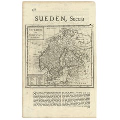
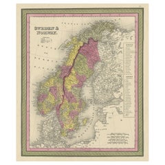
Large Original Vintage Map of Sweden and Norway circa 1920
About the Item
Great map of Sweden and Norway
Original color. Good condition
Published by Alexander Gross
Unframed.
- Dimensions:Height: 25 in (63.5 cm)Width: 19.5 in (49.53 cm)Depth: 0.07 in (1.78 mm)
- Style:Victorian (Of the Period)
- Materials and Techniques:Paper,Other
- Place of Origin:
- Period:
- Date of Manufacture:1920
- Condition:Wear consistent with age and use.
- Seller Location:St Annes, GB
- Reference Number:1stDibs: LU1836337061542
About the Seller
4.9
Platinum Seller
These expertly vetted sellers are 1stDibs' most experienced sellers and are rated highest by our customers.
1stDibs seller since 2016
2,548 sales on 1stDibs
Typical response time: <1 hour
Associations
International Confederation of Art and Antique Dealers' Associations
- ShippingRetrieving quote...Ships From: St Annes, United Kingdom
- Return PolicyA return for this item may be initiated within 3 days of delivery.
Auctions on 1stDibs
Our timed auctions are an opportunity to bid on extraordinary design. We do not charge a Buyer's Premium and shipping is facilitated by 1stDibs and/or the seller. Plus, all auction purchases are covered by our comprehensive Buyer Protection. Learn More
More From This SellerView All
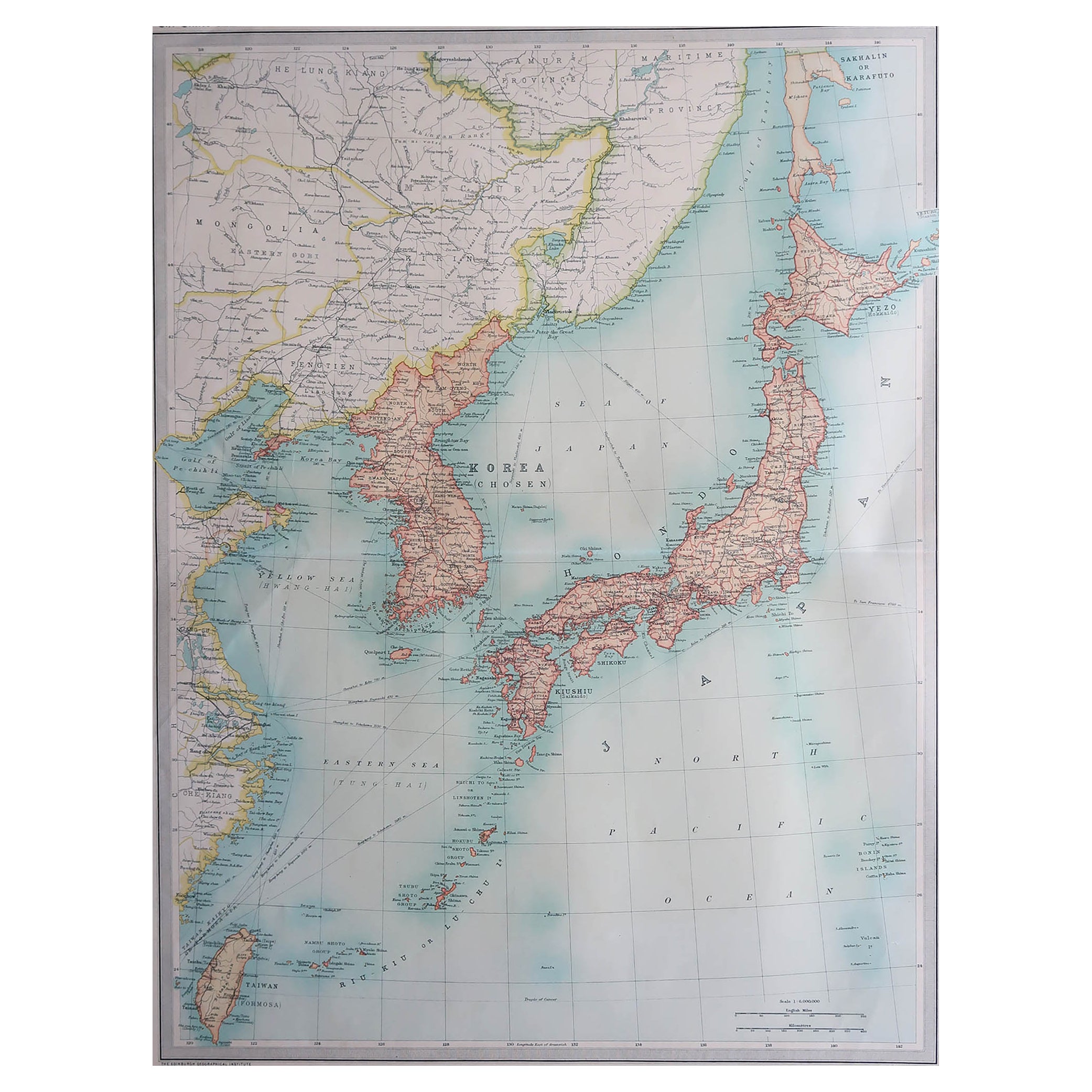
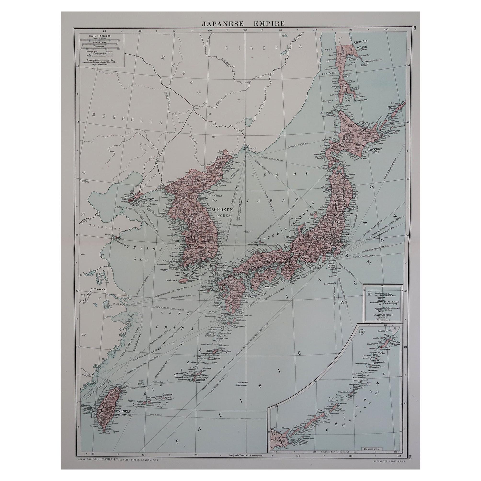
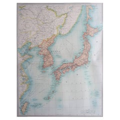
- Large Original Vintage Map of Japan, circa 1920Located in St Annes, LancashireGreat map of Japan Original color. Good condition Published by Alexander Gross Unframed.Category
Vintage 1920s English Victorian Maps
MaterialsPaper
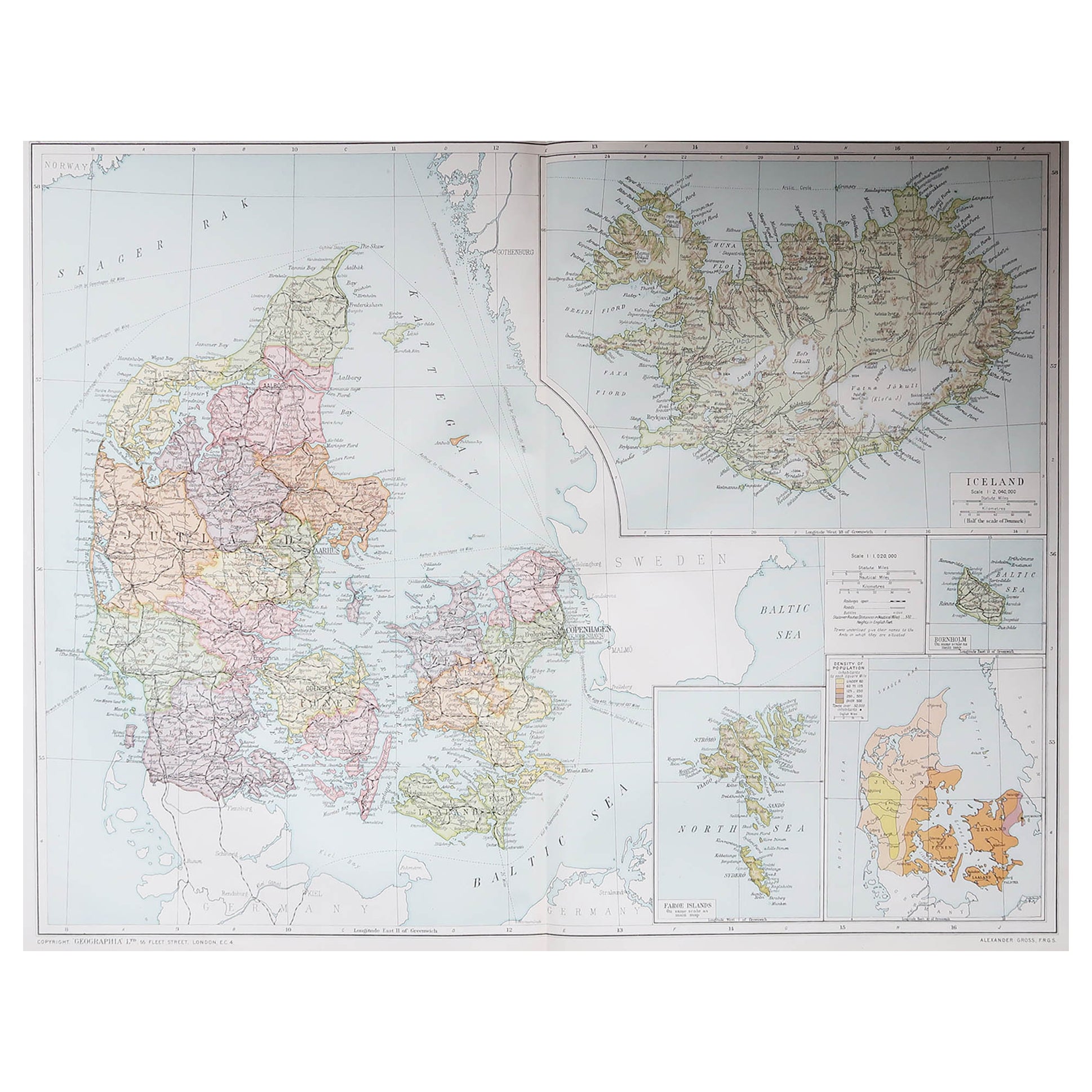
- Large Original Vintage Map of Iceland, circa 1920Located in St Annes, LancashireGreat map of Iceland Original color. Good condition Published by Alexander Gross Unframed.Category
Vintage 1920s English Victorian Maps
MaterialsPaper
- Large Original Vintage Map of China, circa 1920Located in St Annes, LancashireGreat map of China. Original color. Good condition. Published by Alexander Gross Unframed.Category
Vintage 1920s English Edwardian Maps
MaterialsPaper
- Large Original Vintage Map of Japan, circa 1920Located in St Annes, LancashireGreat map of Japan Unframed Original color By John Bartholomew and Co. Edinburgh Geographical Institute Published, circa 1920 Free shipping.Category
Vintage 1920s British Maps
MaterialsPaper
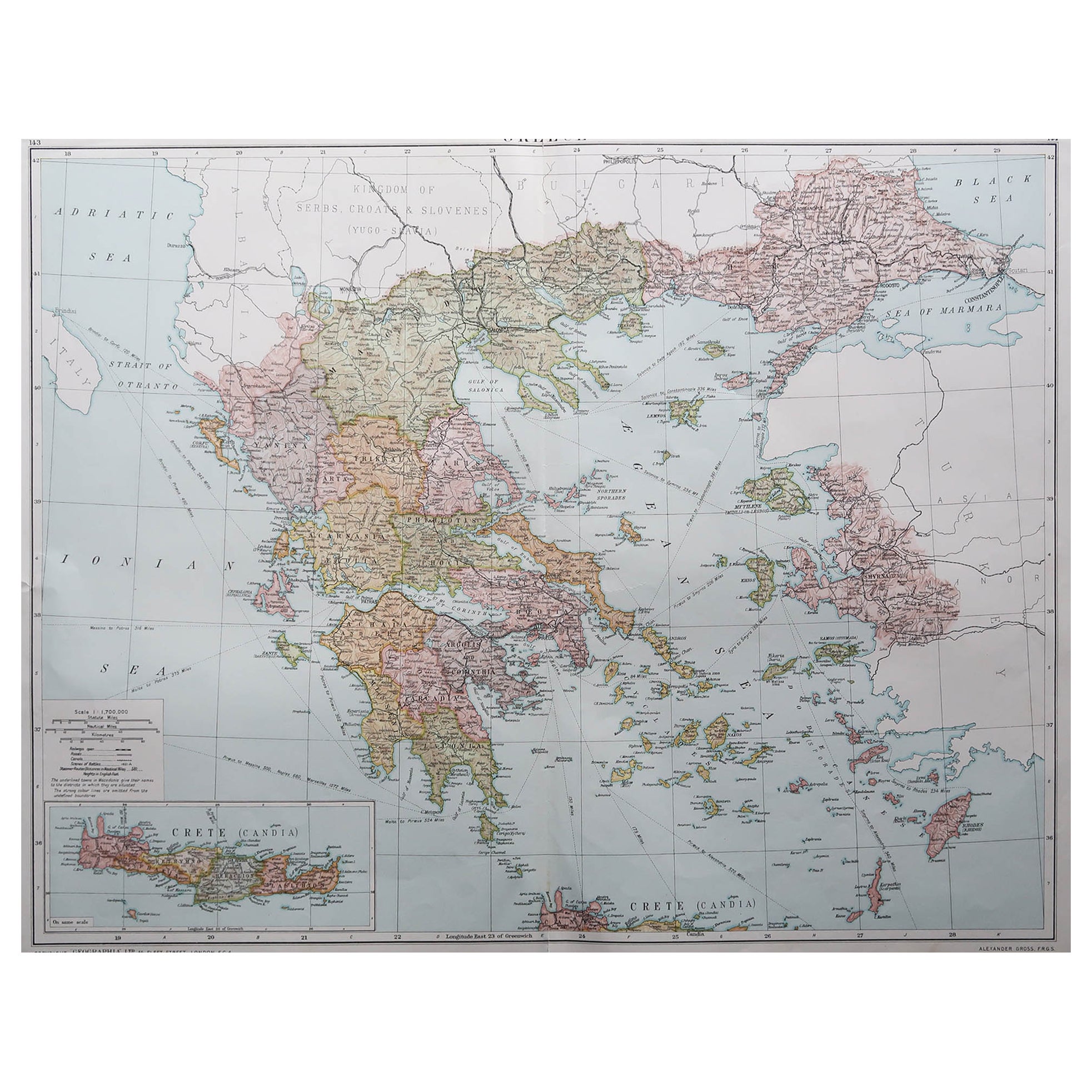
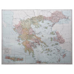
- Large Original Vintage Map of Greece, circa 1920Located in St Annes, LancashireGreat map of Greece Original color. Good condition Published by Alexander Gross Unframed.Category
Vintage 1920s English Maps
MaterialsPaper
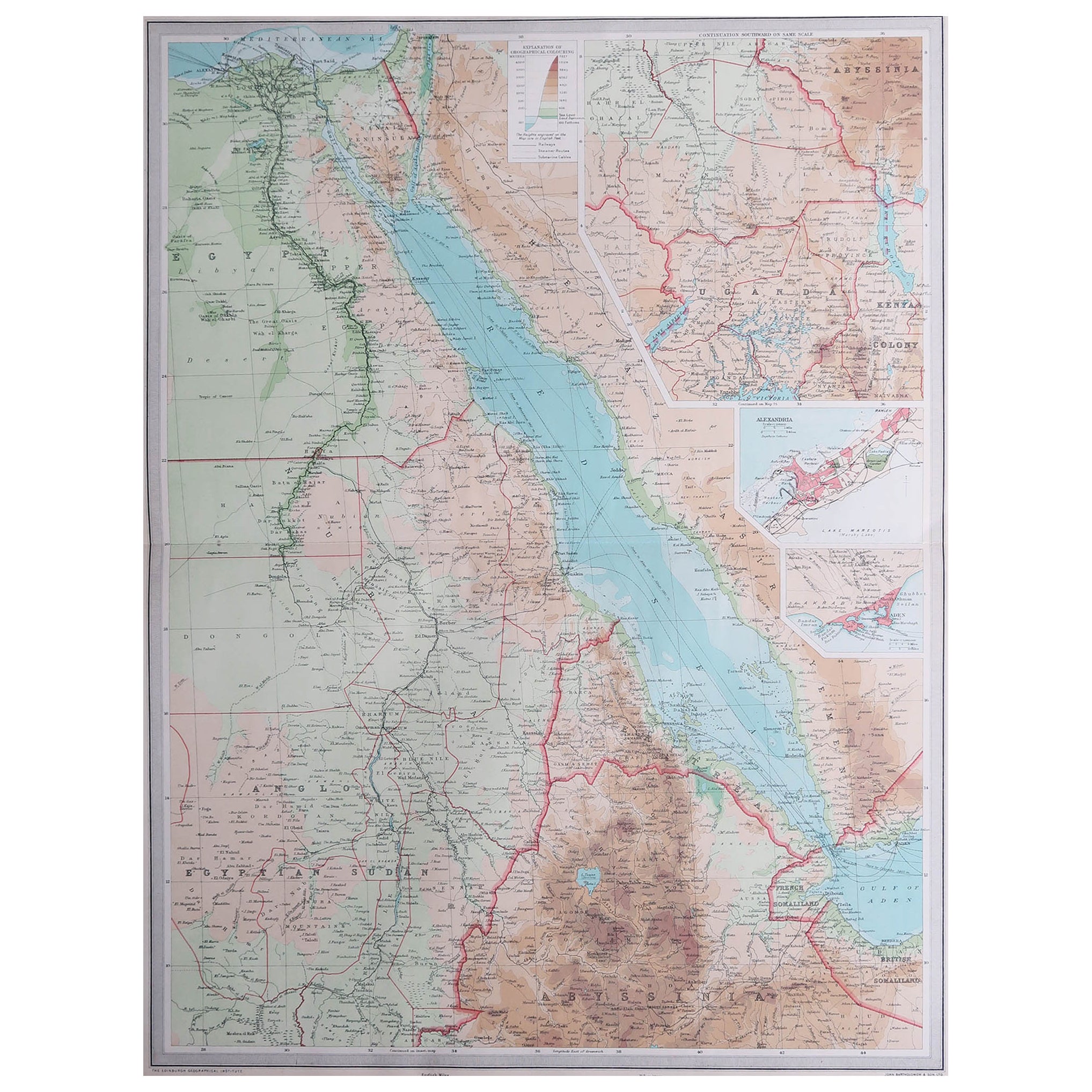
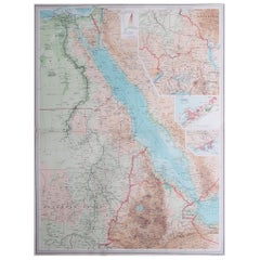
- Large Original Vintage Map of Egypt, circa 1920Located in St Annes, LancashireGreat map of Egypt Unframed Original color By John Bartholomew and Co. Edinburgh Geographical Institute Published, circa 1920 Free shipping.Category
Vintage 1920s British Maps
MaterialsPaper
You May Also Like
- Antique Map of Sweden and Norway by H. Moll, circa 1715Located in Langweer, NLBeautiful and rare map of Sweden and Norway including English text. This map most likely originates from 'The Compleat geographer, or, The chorography and topography of all the known...Category
Antique Early 18th Century Maps
MaterialsPaper
- Original Engraved Antique Map of the World, Colorful and Decorative, C.1780By Pierre François TardieuLocated in Langweer, NLAntique map titled 'Mappemonde en Deux Hemispheres ou l'on a Indique les Nouvelles Decouvertes' - This handsome double hemisphere map presents a ...Category
Antique 18th Century Maps
MaterialsPaper
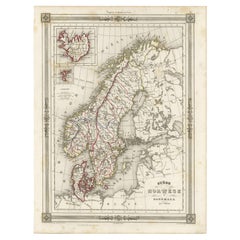
- Old Colourful Map of Sweden and Norway, 1846Located in Langweer, NLAntique map titled 'Sweden & Norway'. Old map of Sweden and Norway. This map originates from 'A New Universal Atlas Containing Maps of the various Em...Category
Antique 1840s Maps
MaterialsPaper
- Antique Map of Scandinavia: Norway, Sweden and DenmarkLocated in Langweer, NLAntique map titled 'Suède, Norwège & Danemark'. Attractive map of Scandinavia, with Sweden, Norway and Denmark. With an inset map of Iceland and th...Category
Antique Mid-19th Century Maps
MaterialsPaper
- Antique Map of Paraguay by A. Montanus, circa 1671By Arnoldus MontanusLocated in Langweer, NLAntique map titled 'Paraquaria Vulgo Paraguay Cum adjacentibus'. Antique map extending from Rio de Janiero to the Rio de la Plata basin. The map include...Category
Antique Mid-17th Century Maps
MaterialsPaper
- Antique Map of Chili by Montanus, circa 1671By Arnoldus MontanusLocated in Langweer, NLAntique map titled 'Chili'. A very attractive map covering the known coastal region of Chile. The Andes are shown prominently, with two live volcanoes in the vicinity of Villarrica. ...Category
Antique Mid-17th Century Maps
MaterialsPaper


Recently Viewed
View AllMore Ways To Browse
Old Prints Of Maps
Arkansas Indian Map
Indian Territory Maps
Historical Balkan Map
Op Ocean Pacific
Brabant Map
Furniture Sellers In Israel
Map Of Edinburgh
Richard Bassett
Mapp Plate
Map Of Kiribati Islands
Mauritius Antique Map
Formosa Vintage Map
Georgetown Map
Vincenzo Coronelli On Sale
Antique Cabbage Cutter
Cartier 1730
Christoph Weigel On Sale