Old Prints Of Maps
16
to
119
1,210
363
736
456
400
307
231
204
147
80
74
62
47
47
44
37
33
32
31
30
27
27
27
24
24
19
18
15
14
14
11
11
11
10
9
9
8
7
7
6
6
6
6
6
6
5
5
5
5
5
4
4
4
4
3
3
3
3
2
2
2
2
1
1
42
42
32
23
23
Sort By
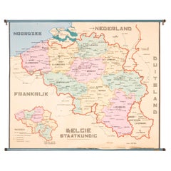
XL Old School Map of Belgium 'Printed by Procure', 1950s
Located in Oostende, BE
XL Old school map of Belgium (Printed by Procure). Presumably from around 1950-1960.
Category
Vintage 1950s Belgian Mid-Century Modern Maps
Materials
Metal
Old Dutch Map of Part of Syria and Phoenicia, 1773
Located in Langweer, NL
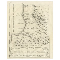
Antique print titled 'Gedeelte van Syriën en Phenicië'.
Old map of part of Syria and Phoenicia
Category
Antique 1770s Maps
Materials
Paper
Old Dutch Map of the City of Oran 'Warran', Algeria, 1773
Located in Langweer, NL
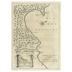
Antique print titled 'Ligging der Stad en Haven van Warran of Oran'.
Old map of the city of
Category
Antique 1770s Maps
Materials
Paper
Old Antique Map of the Province of Friesland, the Netherlands, c.1580
Located in Langweer, NL
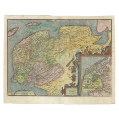
Antique map titled 'Frisia Occidentalis'. Old map of the province of Friesland, the Netherlands
Category
Antique 16th Century Maps
Materials
Paper
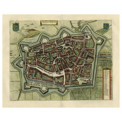
Original Old Map of Leeuwarden, European Cultural Capital 2018, Holland, 1649
Located in Langweer, NL
Antique print, titled: 'Leoverdia.'
This map shows Leoverdia (Leeuwarden). Bird's-eye view plan
Category
Antique 1640s Maps
Materials
Paper
H 20.87 in W 25.79 in D 0 in
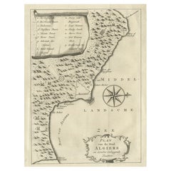
Old Map of Algiers, with Surrounding Cities and the Bay of Algiers, 1773
Located in Langweer, NL
Antique print titled 'Plan van de Stad Algiers'.
Old map of Algiers, also depicting surrounding
Category
Antique 1770s Maps
Materials
Paper
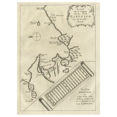
Old Dutch Map of the City of Carthage and the Bay of Carthage, 1773
Located in Langweer, NL
Antique print titled 'Kaart van de Legging van het Oude Karthago'. Old map of the city of Carthage
Category
Antique 1770s Maps
Materials
Paper
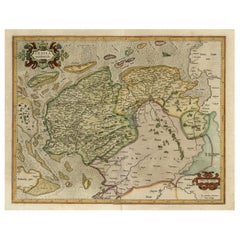
Old Map of the Dutch Provinces of Friesland and Groningen, The Netherlands, 1604
Located in Langweer, NL
Antique print, titled: 'Frisiae Occidentalis.'
Handsome map of the Dutch Provinces of Friesland
Category
Antique Early 1600s Maps
Materials
Paper
H 17.05 in W 21.15 in D 0 in
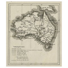
Old Map of Australia Showing The Routes of the Main Explorers, ca.1900
Located in Langweer, NL
Antique print, untitled. This map shows Australia with the routes of explorers in the continent and
Category
Antique Early 1900s Maps
Materials
Paper
Old Map of the Gulf of Bothnia, the Northernmost Arm of the Baltic Sea, 1759
Located in Langweer, NL
Antique map titled 'Carte du Golphe de Bothnie'.
Original antique map of the Gulf of Bothnia
Category
Antique 1750s Maps
Materials
Paper
H 9.85 in W 7.49 in D 0 in
Original Old Map of the Environs of Batavia in the Dutch East Indies (Indonesia)
Located in Langweer, NL
Antique map titled 'Carte des Environs de Batavia'. Map of the environs of Batavia (now Jakarta
Category
Antique Mid-18th Century Maps
Materials
Paper
H 9.85 in W 15.16 in D 0.02 in
Very Old Original Hand-Colored Map of the Basel Region, Switzerland, Ca.1578
Located in Langweer, NL
Antique print titled 'Basiliensis territorii descriptio nova'.
Old map of the Basel region
Category
Antique 16th Century Maps
Materials
Paper
H 39 in W 27.3 in D 0.002 in
Old Map of Persia, incl the Caspian Sea and Part of the Arabian Peninsula, 1726
Located in Langweer, NL
Antique map of Persia. It covers from the Gulf of Suez eastward to Ahmedabad (Amadabad) in modern
Category
Antique 1720s Maps
Materials
Paper
H 13.39 in W 15.75 in D 0 in
Old Map of the Kingdom of Tonga, Also Known as the Friendly Islands, ca.1780
Located in Langweer, NL
Antique print, titled: 'Carte des Isles des Amis.'
Map of the Kingdom of Tonga, also known as
Category
Antique 1780s Maps
Materials
Paper
H 11.42 in W 15.24 in D 0 in
Old Map of the Moluccas, Known as the Famous Spice Islands, Indonesia, ca.1730
Located in Langweer, NL
Antique map titled 'Insularum Moluccarum Nova Descriptio.'
Old map of the Moluccas. The famous
Category
Antique 1730s Maps
Materials
Paper
H 17.33 in W 23 in D 0 in
Interesting Old Map of the Nw Coast of America and the Ne Coast of Asia, ca.1772
Located in Langweer, NL
English cartographer who was the leading map supplier of his day. He engraved and printed maps for
Category
Antique 1770s Maps
Materials
Paper
H 13.78 in W 17.13 in D 0 in
Old Map of the island of Saint Christopher or St. Kitts in the Caribbean, c.1765
Located in Langweer, NL
Antique map titled 'Carte de l'Isle de Saint-Christophe'.
A detailed map of the island of Saint
Category
Antique 18th Century Maps
Materials
Paper
H 10.24 in W 15.67 in D 0 in
Old Map of The Kurile Islands, from Hokkaido, Japan to Kamchatka, Russia, c.1750
Located in Langweer, NL
Antique map titled 'Carte des Iles Kouriles'. Original antique map of the Kuril Islands.
The
Category
Antique 1750s Maps
Materials
Paper
Free Shipping
H 10.67 in W 11.89 in D 0 in
World Map Silver Leaf Print Based on Original Willem Blaeu Wall Map 1571-1638
Located in GB
We are delighted to offer for sale this lovely Antique style pictorial plan map of the globe based
Category
20th Century English Campaign Maps
Materials
Silver Leaf
H 22.05 in W 25.6 in D 0.99 in
Antique Map of Swabia, 1685
Located in Langweer, NL
Antique map titled 'Sueviae quae cis Codanum fuit finum Antiqua defcriptio.' Miniature map of
Category
Antique 17th Century Maps
Materials
Paper
Old Map of Ancient Times covering Egypt Towards Arabia and India to Java, c.1660
Located in Langweer, NL
Description: Antique map titled 'Erythraei Sive Rubri Maris Periplus olim ab arriano descriptus
Category
Antique 1660s Maps
Materials
Paper
H 19.49 in W 22.45 in D 0 in
Old Print with a View of Saint Petersburg, Russia, 1887
Located in Langweer, NL
Description: Antique print titled 'Birds-Eye View of St. Petersburg'.
Old print with a view of
Category
Antique 1880s Maps
Materials
Paper
Old Hand-Colored Print of the Guards of the King of France, 1890
Located in Langweer, NL
Antique print titled 'Gardes-du-Crops du Roi'.
Old print of the Guards of the King of France
Category
Antique 1890s Maps
Materials
Paper
Staffordshire 1645 Hand Colored Antique Print Staffordiensis Comitatvs Map
Located in GB
We are delighted to offer for sale this lovely antique Atlas page map of Staffordshire printed in
Category
Antique Early 1800s English Georgian Maps
Materials
Paper
H 22.45 in W 25.32 in D 0.99 in
Map of North and East coast of Asia with Japan & inset maps of Kamchatka, c1750
Located in Langweer, NL
east coast of Asia, showing an oddly shaped Japan and inset maps of Kamchatka. This old antique print
Category
Antique 1750s Maps
Materials
Paper
H 14.77 in W 17.45 in D 0 in
Old Map the United States and Central America, Including Mexico, ca.1860
Located in Langweer, NL
Antique map titled 'Vereinigte Staaten von Nord America und Mexico'.
Old map the United States
Category
Antique 1860s Maps
Materials
Paper
Antique Map of New Zealand, 1895
Located in Langweer, NL
attractive original old antique print / plate / map originates from 1885-1907 editions of a famous German
Category
Antique 19th Century Maps
Materials
Paper
German Antique Map of Oceania, 1895
Located in Langweer, NL
Antique map titled 'Oceanie.' Map of Oceania. This attractive original old antique print / plate
Category
Antique 19th Century Maps
Materials
Paper
Antique Map of the Westphalia region of Germany
Located in Langweer, NL
Antique map titled 'Circulus Westphaliae (..)'. Original old map of the Westphalia region, Germany
Category
Antique Late 17th Century Maps
Materials
Paper
Antique Map of the Archdiocese of Cologne, Germany
Located in Langweer, NL
Antique map titled 'Archevesche et Eslectorat de Cologne avec ses Enclaves'. Original old map of
Category
Antique Late 17th Century Maps
Materials
Paper
Antique Map of Part of Russia, c.1740
Located in Langweer, NL
Antique map titled 'Ienisensis Provinicia cum adjacentibus Toboliensis & Irkutensis'. Old map of
Category
Antique 18th Century Maps
Materials
Paper
Old Map Guiana, Columbia Venezuela, Andalusia in South America by Bonne, c.1780
Located in Langweer, NL
Antique map titled 'Carte du Nouv. Rme. de Grenade, de la Nou'le Andalousie, et de la Guyane, avec
Category
Antique 18th Century Maps
Materials
Paper
Free Shipping
H 10.24 in W 15.16 in D 0 in
Old Print of the Spanish Conquest of Cusco or Cuzco, Capital of the Incas, c1750
Located in Langweer, NL
Antique print titled 'Grundriss von Cuzco bey der Eroberung von den Spaniern'.
Old plan of the
Category
Antique 1750s Maps
Materials
Paper
H 9.65 in W 7.29 in D 0 in
Old Hand-Colored Print with a View of Marseille, France, ca.1885
Located in Langweer, NL
Antique print titled 'Marseille aus der Vogelschau'.
Old print with a view of Marseille, France
Category
Antique 1850s Maps
Materials
Paper
No Reserve
H 9.26 in W 12.8 in D 0 in
1850 Old French Map Depicting the Entire Earth's Surface Divided into Two Parts
Located in Milan, IT
Geographical map depicting the entire earth’s surface divided into two parts that correspond to the
Category
Antique Mid-19th Century French Maps
Materials
Glass, Wood, Paper
H 18.19 in W 25.87 in D 0.79 in
1850 Old French Map Depicting the Entire Earth's Surface Divided into Two Parts
Located in Milan, IT
Map depicting the entire earth's surface divided into two parts corresponding to the two
Category
Antique Mid-19th Century French Maps
Materials
Glass, Wood, Paper
H 18.51 in W 27.76 in D 0.79 in
Old Map Depicting the Entire Earth's Surface Divided into Six Parts France 1850
Located in Milan, IT
Map depicting the entire earth's surface divided into six parts which depicts the position of
Category
Antique Mid-19th Century French Maps
Materials
Paper, Glass, Wood
H 18.51 in W 27.76 in D 0.79 in
Antique Map of Padang, Sumatra, Indonesia, 1900
Located in Langweer, NL
'. Old map of Padang, Sumatra. This map originates from 'Atlas van Nederlandsch Oost- en West-Indië' by I
Category
20th Century Maps
Materials
Paper
Old Print of a Partridge in Front of The Walled City of Azemmour, Morocco, c1630
Located in Langweer, NL
Antique print, titled: 'Azaamurum.' - Caption in the top reads: 'Foenerari iniustum est'.
A
Category
Antique 1630s Maps
Materials
Paper
H 5.99 in W 7.49 in D 0 in
Double Sided Northamptonshire 1645 Hand Colored Antique Print Map Rare Find
Located in GB
We are delighted to this lovely antique Atlas page map of Northamptonshire printed in 1645
Category
Antique Early 1800s English Georgian Maps
Materials
Paper
H 22.25 in W 25.6 in D 0.79 in
Antique Map of Sneek by Kuyper, 1868
Located in Langweer, NL
Antique map titled 'Provincie Friesland - Gemeente Sneek'. Map of the township of Sneek, Friesland
Category
Antique 19th Century Maps
Materials
Paper
1850 Old French Map Depicting the Entire Earth's Surface Divided into Two Parts
Located in Milan, IT
Geographical map depicting the entire earth's surface divided into two parts that correspond to the
Category
Antique Mid-19th Century French Maps
Materials
Glass, Wood, Paper
H 18.51 in W 25.99 in D 0.79 in
Antique Map of Stavoren by Kuyper, 1868
Located in Langweer, NL
Antique map titled 'Provincie Friesland - Gemeente Stavoren'. Map of the township of Stavoren
Category
Antique 19th Century Maps
Materials
Paper
Antique Map of Sweden by Bowen, 1747
Located in Langweer, NL
Antique map titled 'A New & Accurate Map of Sweden'. This map covers Sweden and Finland (shown as
Category
Antique 18th Century Maps
Materials
Paper
Antique Map of Ooststellingwerf by Kuyper, 1868
Located in Langweer, NL
Antique map titled 'Provincie Friesland - Gemeente Oost-Stellingwerf'. Map of the township of
Category
Antique 19th Century Maps
Materials
Paper
Antique Map of Schoterland by Kuyper, 1868
Located in Langweer, NL
Antique map titled 'Provincie Friesland - Gemeente Schoterland'. Map of the township of Schoterland
Category
Antique 19th Century Maps
Materials
Paper
Antique Map of Oostdongeradeel by Kuyper, 1868
Located in Langweer, NL
Antique map titled 'Provincie Friesland - Gemeente Oost Dongeradeel'. Map of the township of
Category
Antique 19th Century Maps
Materials
Paper
Antique Map of the Baarderadeel Township, 1718
Located in Langweer, NL
Antique map Friesland titled 'Baardera Deel de Vierde Grietenije van Wester Goo (..)'. Old map of
Category
Antique 18th Century Maps
Materials
Paper
Antique Map of the Barradeel Township, 1718
Located in Langweer, NL
Antique map Friesland titled 'De Grietenije van Barra Deel (..)'. Old map of Friesland, the
Category
Antique 18th Century Maps
Materials
Paper
Antique Map of the Baarderadeel Township, 1718
Located in Langweer, NL
Antique map Friesland titled 'Baardera Deel de Vierde Grietenije van Wester Goo (..)'. Old map of
Category
Antique 18th Century Maps
Materials
Paper
Antique Map of Spain by Perthes, 1848
Located in Langweer, NL
Antique map titled 'Hispania'. Old map of Spain originating from 'Orbis Terrarum Antiquus in usum
Category
Antique 19th Century Maps
Materials
Paper
Antique Map of Spain by Funke, 1825
Located in Langweer, NL
Antique map titled 'Hispania'. Old map of Spain originating from 'Atlas der Oude Wereld'. Artists
Category
Antique 19th Century Maps
Materials
Paper
Antique Map of Overijssel by Brugsma, 1864
Located in Langweer, NL
Antique map titled 'De Provincie Overijssel'. Map of the province of Overijssel, the Netherlands
Category
Antique 19th Century Maps
Materials
Paper
Antique Map of Overijssel by Kuyper, 1883
Located in Langweer, NL
Antique map titled 'De Provincie Overijssel'. Map of the province of Overijssel, the Netherlands
Category
Antique 19th Century Maps
Materials
Paper
Antique Map of Smallingerland by Kuyper, 1868
Located in Langweer, NL
Antique map titled 'Provincie Friesland - Gemeente Smallingerland'. Map of the township of
Category
Antique 19th Century Maps
Materials
Paper
Antique Map of Ooststellingwerf by Kuyper, 1868
Located in Langweer, NL
Antique map titled 'Provincie Friesland - Gemeente Oost-Stellingwerf'. Map of the township of
Category
Antique 19th Century Maps
Materials
Paper
Antique Map of Oostdongeradeel by Kuyper, 1868
Located in Langweer, NL
Antique map titled 'Provincie Friesland - Gemeente Oost Dongeradeel'. Map of the township of
Category
Antique 19th Century Maps
Materials
Paper
Antique Map of Peru by Carey, 1822
Located in Langweer, NL
Antique map titled 'Peru'. Geographical, historical, and statistical map of Peru, surrounded by
Category
Antique 19th Century Maps
Materials
Paper
Antique Map of South America, c.1840
Located in Langweer, NL
Antique map titled 'South America'. Original, antique map depicting South America. With outline
Category
Antique 19th Century Maps
Materials
Paper
Antique Map of Sloten by Kuyper, 1868
Located in Langweer, NL
Antique map titled 'Provincie Friesland - Gemeente Sloten'. Map of the township of Sloten
Category
Antique 19th Century Maps
Materials
Paper
- 1
- ...
Get Updated with New Arrivals
Save "Old Prints Of Maps", and we’ll notify you when there are new listings in this category.
Old Prints Of Maps For Sale on 1stDibs
An assortment of old prints of maps is available at 1stDibs. Frequently made of paper, wood and fabric, all old prints of maps available were constructed with great care. Find 1026 antique and vintage old prints of maps at 1stDibs now, or shop our selection of 13 modern versions for a more contemporary example of this long-cherished furniture. Old prints of maps have been produced for many years, with earlier versions available from the 18th Century and newer variations made as recently as the 21st Century. Old prints of maps are generally popular furniture pieces, but mid-century modern, Georgian and Victorian styles are often sought at 1stDibs. Old prints of maps have been a part of the life’s work for many furniture makers, but those produced by F. Valentijn, Thomas Kitchin and Studio Concepcion, LLC are consistently popular.
How Much are Old Prints Of Maps?
The average selling price for at 1stDibs is $388, while they’re typically $0 on the low end and $140,165 highest priced.
