Maps Of Sea
34
to
151
951
350
517
388
290
285
259
218
182
155
97
91
88
72
71
64
63
62
61
54
48
35
34
29
24
24
22
20
18
18
16
16
14
14
14
13
13
12
12
11
10
9
9
7
7
7
6
6
6
5
5
5
5
4
3
3
3
3
3
3
2
2
2
42
42
30
27
21
Sort By
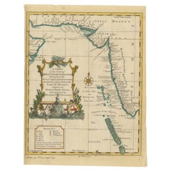
Antique Map of the Region of the Arabian Sea
Located in Langweer, NL
Antique map titled 'A Chart of the Coast of Persia, Guzarat & Malabar'. Old map centered on the
Category
Antique Mid-18th Century Maps
Materials
Paper
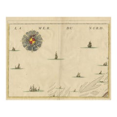
Antique Map of the North Sea and Dunkirk
Located in Langweer, NL
Untitled map of the North Sea, top left a large compass rose, bottom right Dunkirk (Duinkerke
Category
Antique Early 18th Century Maps
Materials
Paper
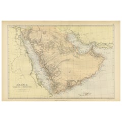
Original 1882 Map of Arabia, Red Sea & Persian Gulf
Located in Langweer, NL
This print is a historically significant map titled "Arabia, the Red Sea, and the Persian Gulf
Category
Antique 1880s Maps
Materials
Paper
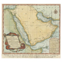
Original Antique Map of Arabia and the Red Sea
Located in Langweer, NL
Dutch version, engraved by J. van Schley, of Bellin's map of Arabia and the Red Sea. The emphasis is the
Category
Antique Mid-18th Century Maps
Materials
Paper
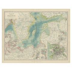
Antique Map of the Baltic Sea by Johnston, '1909'
Located in Langweer, NL
Antique map titled 'Basin of the Baltic'. Original antique map of Baltic Sea. With inset maps of
Category
Early 20th Century Maps
Materials
Paper
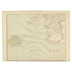
Antique Map of the Java Sea by Dornseiffen, 1900
Located in Langweer, NL
Antique map of the Java Sea. Also depicts Bilitung, the Karimata Islands and Sukadana, Borneo. This
Category
20th Century Maps
Materials
Paper
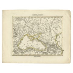
Antique Map of the Black Sea by Perthes, 1848
Located in Langweer, NL
Antique map titled 'Pontus Euxinus'. Old map of the Black Sea and surroundings originating from
Category
Antique 19th Century Maps
Materials
Paper
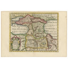
Historical Map of the Black Sea and Surrounding Regions, 1705
Located in Langweer, NL
Title: "Map of Turcomania, Georgia, and Comania"
This print presents an intricately detailed map
Category
Antique Early 1700s Maps
Materials
Paper
Free Shipping
H 8.67 in W 11.89 in D 0 in
Original Antique Engraved Map of Part of the Red Sea, Arabia, 1775
Located in Langweer, NL
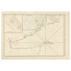
Antique map titled 'Carte de l'Entrée du Golfe de la Mer Rouge'. Uncommon sea chart of the entrance
Category
Antique Late 18th Century Maps
Materials
Paper
Detailed Antique Map of the Black Sea, Balkans and Asia Minor
Located in Langweer, NL
detailed map of the Black Sea, Balkans, and Asia Minor. It is embellished with a simple compass rose and
Category
Antique Mid-18th Century Maps
Materials
Paper
Old Dutch Map of the Region Around the Mediterranean Sea, 1773
Located in Langweer, NL
Antique map titled 'Kaart van een Deel der Middelandsche Zee (..)'.
Old map of the region
Category
Antique 1770s Maps
Materials
Paper
Rare Antique Map of Yam Suph, Egypt and Red Sea, 1773
Located in Langweer, NL
Antique print with two maps titled 'Uittreksel van de Kaart van Egipten en de Roode Zee' and
Category
Antique 18th Century Maps
Materials
Paper
Original Antique Map of Abyssinia, Sudan and the Red Sea, 1749
Located in Langweer, NL
Antique map titled 'Nubie, Abissinie et Cote d'Ajan'.
Map of Abyssinia, Sudan and the Red Sea by
Category
Antique 1740s Maps
Materials
Paper
Antique Map of the Caspian Sea and Surroundings by Bellin, 1764
Located in Langweer, NL
Caspian Sea. This map originates from 'Le Petit Atlas Maritime Recueil De Cartes et Plans' by J.N. Bellin
Category
Antique 18th Century Maps
Materials
Paper
Antique Map of the Black Sea and Surroundings by Sharpe, 1849
Located in Langweer, NL
Antique map titled 'Russia on the Euxine'. Old map of the Black Sea and the surrounding (Russia
Category
Antique 19th Century Maps
Materials
Paper
Antique Map of Italy and Other Regions Near the Adriatic Sea
Located in Langweer, NL
Antique map titled 'Italie et Provinces Autrichnes sur l'Adriatique'. Original old map of Italy and
Category
Antique Mid-19th Century Maps
Materials
Paper
Fabulous Original Antique two-sheet Map of the Caspian Sea, ca.1723
Located in Langweer, NL
Tartarie", Delisle, Guillaume (2 maps)
Subject: Caspian Sea
Period: 1723 (circa)
Publication:
Color: Hand
Category
Antique 1720s Maps
Materials
Paper
Antique Map of Central Asia between the Caspian Sea and Lake Balkhash
Located in Langweer, NL
Antique map titled 'Independent Tartary'. Original steel engraved map of Central Asia. It covers
Category
Antique Mid-19th Century Maps
Materials
Paper
H 10.56 in W 14.73 in D 0.02 in
Uncommon Miniature Map of the Region around the Caspian Sea, ca.1800
Located in Langweer, NL
Uncommon miniature map of the region around the Caspian Sea.
Including the black sea and
Category
Antique Early 1800s Maps
Materials
Paper
Algarve: A Tapestry of Sea and Sunlight in an Antique Map, 1903
Located in Langweer, NL
The image is a historical map of the Algarve, the southernmost region of Portugal. The map is
Category
Antique Early 1900s Maps
Materials
Paper
Free Shipping
H 14.77 in W 20.08 in D 0 in
Mid 19th Century Map of the Black Sea with Decorative Vignettes, 1851
Located in Langweer, NL
Map of the Black Sea and contingent lands, including Turkey, Russia, Georgia, Azerbaijan, Bulgaria
Category
Antique Mid-19th Century Maps
Materials
Paper
Antique Lithography Map, Black Sea, English, Framed, Cartography, Victorian
Located in Hele, Devon, GB
This is an antique lithography map of the Black Sea region. An English, framed atlas engraving of
Category
Antique Mid-19th Century British Early Victorian Maps
Materials
Wood
H 17.72 in W 20.48 in D 0.79 in
Antique Map of the Caspian Sea, Uzbekistan, Northern Persia Etc, C.1735
Located in Langweer, NL
Antique map titled 'Nova Maris Caspii et Regions Usbeck (..).' Detailed map of Central Asia
Category
Antique 18th Century Maps
Materials
Paper
Antique Map of the Shores of The Baltic Sea by W. G. Blackie, 1859
Located in Langweer, NL
Antique map titled 'The shores of The Baltic sea and of the Gulfs of Bothnia & Finland'. Original
Category
Antique Mid-19th Century Maps
Materials
Paper
Old Map of the Gulf of Bothnia, the Northernmost Arm of the Baltic Sea, 1759
Located in Langweer, NL
Antique map titled 'Carte du Golphe de Bothnie'.
Original antique map of the Gulf of Bothnia
Category
Antique 1750s Maps
Materials
Paper
H 9.85 in W 7.49 in D 0 in
Uncommon and Rare Map of the Caspian Sea by Order of the Czar, 1742
Located in Langweer, NL
Antique map, titled: 'Kaert van de Kaspische Zee volgens bevel van den Czaer (…).'
Uncommon map
Category
Antique 1740s Maps
Materials
Paper
Colorful Detailed Antique Map of The British Islands and `The North Sea, 1882
Located in Langweer, NL
Discover 'The British Islands and The North Sea' Map with Insets of Orkney, Shetland, and Channel
Category
Antique 1880s Maps
Materials
Paper
H 14.97 in W 22.45 in D 0 in
Antique Map of the Surroundings of the Baltic Sea by A.K. Johnston, 1865
Located in Langweer, NL
Antique map titled 'Basin of the Baltic'. Depicting, Denmark, Sweden, Finland, Estonia, Poland
Category
Antique Mid-19th Century Maps
Materials
Paper
H 19.1 in W 24.41 in D 0.02 in
Map of Region Near the Baltic Sea, Present Day Bulgaria, Romania & Turkey, c1670
Located in Langweer, NL
the area west of the Baltic Sea, present day Bulgaria, Romania, and Turkey. The map is based on the
Category
Antique 1670s Maps
Materials
Paper
H 20.08 in W 24.41 in D 0 in
Antique Map of the Black Sea and Surroundings by Keizer & de Lat, 1788
Located in Langweer, NL
of the Black Sea and surroundings. This map originates from 'Nieuwe Natuur- Geschied- en
Category
Antique Late 18th Century Maps
Materials
Paper
Antique Map of the Mediterranean Sea and Surroundings by Keizer & de Lat, 1788
Located in Langweer, NL
the Mediterranean Sea and surroundings. This map originates from 'Nieuwe Natuur- Geschied- en
Category
Antique Late 18th Century Maps
Materials
Paper
H 8.08 in W 12.6 in D 0.02 in
Antique Map of the Region Around the Baltic Sea by Cordier, c.1670
Located in Langweer, NL
area west of the Baltic Sea, present day Bulgaria, Romania, and Turkey. The map is based on the
Category
Antique 17th Century Maps
Materials
Paper
Antique Map of The Nile, Egypt and the Red Sea by Bachiene, 1765
Located in Langweer, NL
of Biblical Egypt and the Red Sea. With title cartouche, compass rose and scale. This map originates
Category
Antique 18th Century Maps
Materials
Paper
Original Antique Map of the Region Between the Gulf of Lybia and the Red Sea
Located in Langweer, NL
Original antique map titled 'Aegyptus et Cyrene'. Detailed ancient map of the region between the
Category
Antique Early 18th Century Maps
Materials
Paper
H 7.56 in W 11.15 in D 0.02 in
Antique Map of Europe Stretching from Northern Africa to the Baltic Sea, 1719
Located in Langweer, NL
conquestes'. Original antique map of Europe stretching from northern Africa to the Baltic Sea. It shows the
Category
Antique 18th Century Maps
Materials
Paper
H 17.52 in W 20.28 in D 0 in
Antique Map of Arabia including Nubia and Abyssinia, also shows the Red Sea
Located in Langweer, NL
Antique map titled 'Nubie et Abissinie'. Original antique map of Nubia, a region along the Nile
Category
Antique Late 18th Century Maps
Materials
Paper
H 14.3 in W 20.36 in D 0.02 in
Old Map of Persia, incl the Caspian Sea and Part of the Arabian Peninsula, 1726
Located in Langweer, NL
day western India.
This map, centered on Persia, includes the Caspian Sea and part of the Arabian
Category
Antique 1720s Maps
Materials
Paper
H 13.39 in W 15.75 in D 0 in
Antique Map of 'African' Islands in the Mediterranean Sea and The Atlantic, 1747
Located in Langweer, NL
Antique map titled 'Particular draughts of some of the chief African Islands in the Mediterranean
Category
Antique 18th Century Maps
Materials
Paper
H 19.49 in W 15.16 in D 0 in
Curious Map of the Laptev Sea 'Arctic Ocean' and the Mediterranean, ca.1700
Located in Langweer, NL
Antique map, untitled.
Map of the Laptev Sea (Arctic Ocean) and the Mediterranean, printed for
Category
Antique Early 1700s Maps
Materials
Paper
H 10.63 in W 8.31 in D 0 in
Black Sea in Antiquity: Pontus Euxinus Map, Published in 1880
Located in Langweer, NL
This map, titled "PONTUS EUXINUS," depicts the Black Sea region, historically known as the Pontus
Category
Antique 1880s Maps
Materials
Paper
Free Shipping
H 15.56 in W 18.51 in D 0 in
Antique Map of the British Islands to the White Sea by J. Imray
Located in Langweer, NL
Antique large nautical chart of the British Islands to the White Sea. With insets of Veshnyak
Category
Antique Late 19th Century Maps
Materials
Paper
Antique Engraved Map of the Northern Part of Greece and the Aegean Sea, Ca.1730
Located in Langweer, NL
Title: "GRÆCIÆ PARS Septentrionalis".
Hand Coloured Engraved map by G. Delisle of the northern
Category
Antique 1730s Maps
Materials
Paper
H 16.93 in W 20.08 in D 0 in
Old Ptolemaic Map of the Region Between the Persian Gulf and Caspian Sea, 1598
Located in Langweer, NL
editions contained maps based on his original writings, known as Ptolemaic maps. As geographic knowledge
Category
Antique 16th Century Maps
Materials
Paper
H 7.09 in W 9.81 in D 0 in
Old Map of the Sinai Peninsula Showing the Mediterranean and the Red Sea, 1773
Located in Langweer, NL
Antique map of the Sinai Peninsula showing the Mediterranean Sea to the north and the Red Sea to
Category
Antique 1770s Maps
Materials
Paper
H 17.05 in W 21.19 in D 0 in
Antique Map of Ancient Egypt Also Depicting the Nile River and Red Sea, 1845
Located in Langweer, NL
Antique map Egypt titled 'General Karte von Alt Aegypten von A.H. Brué'. Large map of Egypt also
Category
Antique 19th Century Maps
Materials
Paper
H 22.84 in W 17.92 in D 0 in
Antique Map of the Region Between the Caspian and the Sea of China by Toms, 1799
Located in Langweer, NL
Antique map titled 'Scythia et Serica'. Old map of the region between the Caspian and the Sea of
Category
Antique 18th Century Maps
Materials
Paper
H 10.24 in W 15.36 in D 0 in
Antique Map of the Region Between the Black and Caspian Sea by Cellarius, 1731
Located in Langweer, NL
Antique map titled 'Bosporus, Maeotis, Iberia, Albania, et Sarmatia Asiatica.' Map of the region
Category
Antique 18th Century Maps
Materials
Paper
H 9.45 in W 14.18 in D 0 in
Rare Antique Map of Persia, Incl the Caspian Sea and the Arabian Peninsula, 1726
Located in Langweer, NL
(Amadabad) in modern day western India. This map, centered on Persia, includes the Caspian Sea and part of
Category
Antique 1720s Maps
Materials
Paper
H 13 in W 16.93 in D 0 in
Antique Map of Russia from the Baltic to the Black Sea by Sharpe, 1849
Located in Langweer, NL
the Baltic to the Black Sea. This map originates from 'Sharpe's Corresponding Atlas (..)' by J. Sharpe
Category
Antique 19th Century Maps
Materials
Paper
16th Century Map of Saudi Arabia, the Persian Gulf and Red Sea, ca. 1574
Located in Langweer, NL
Ptolemaic map of the Arabian Peninsula based on the 1548 map of Giacomo Gastaldi. It covers nearly
Category
Antique 16th Century Maps
Materials
Paper
No Reserve
H 7.1 in W 9.8 in D 0.002 in
Hand-Colored 18th Century Homann Map of the Black Sea, Turkey and Asia Minor
By Johann Baptist Homann
Located in Alamo, CA
An attractive original early 18th century hand-colored map of the Black Sea and Turkey entitled
Category
Antique Early 18th Century German Maps
Materials
Paper
H 20 in W 23.63 in D 0.07 in
Hand-Colored 18th Century Homann Map of Denmark and Islands in the Baltic Sea
By Johann Baptist Homann
Located in Alamo, CA
An 18th century copper plate hand-colored map entitled "Insulae Danicae in Mari Balthico Sitae
Category
Antique Early 18th Century German Maps
Materials
Paper
H 20.25 in W 23.25 in D 0.07 in
Antique Map of the North Sea From the English Channel to Norway & Sweden, 1746
Located in Langweer, NL
Antique map titled 'A correct Chart of the German Ocean from the North of Scotland to the Start
Category
Antique 1740s Maps
Materials
Paper
H 20.08 in W 15.75 in D 0 in
Antique Map of the Adriatic Sea and the Balkan by J. Janssonius, circa 1650
Located in Langweer, NL
Striking large-scale map of the Greater Balkans. Decorated with two large-scale cartouches, one
Category
Antique Mid-17th Century Maps
Materials
Paper
H 20.79 in W 24.81 in D 0.02 in
Old Map Depicting Turkey, Persia, Arab and Black Sea Etc, 1778
Located in Langweer, NL
Asia. The map shows all of Turkey and the Black Sea, and extends east to include the Caspian Sea and
Category
Antique 1770s Maps
Materials
Paper
Old Map of the Black Sea, The Krim, Ukraine, Russia, etc in Historic Times, 1848
Located in Langweer, NL
Antique map titled 'Pontus Euxinus'. Old map of the black Sea and surroundings originating from
Category
Antique 1840s Maps
Materials
Paper
H 9.77 in W 12.52 in D 0 in
Antique Map of the Persian Gulf and Caspian Sea Region by R. Bonne, 1780
Located in Langweer, NL
region from the Persian Gulf and Caspian Sea in the west to the edges of China/Tibet in the east. Drawn
Category
Antique Late 18th Century Maps
Materials
Paper
H 10.24 in W 15.12 in D 0.02 in
Antique Map of Moldova to Thessaly and from the Adriatic to the Black Sea, 1880
Located in Langweer, NL
Antique map titled 'Turquie d'Europe'.
Map of the european parts of Turkey. The map covers from
Category
Antique 1880s Maps
Materials
Paper
H 18.71 in W 13.59 in D 0 in
Original Old China Map, From Korea and the Sea of Japan to Teypin Island, 1803
Located in Langweer, NL
Antique map titled 'China, Contains 15 Subject Provinces Including the 2 Islands of Hainan, Formosa
Category
Antique Early 1800s Maps
Materials
Paper
H 10.63 in W 12.01 in D 0 in
Antique Map of Asia Minor with Cyprus, Syria and Turkey and the Black Sea, 1747
Located in Langweer, NL
such other provinces of the Turkish Empire (..)'. Beautiful map of Turkey between the Black Sea and
Category
Antique 18th Century Maps
Materials
Paper
H 15.16 in W 18.9 in D 0 in
- 1
- ...
Get Updated with New Arrivals
Save "Maps Of Sea", and we’ll notify you when there are new listings in this category.
Questions About Maps Of Sea
- What is a sea chest?1 Answer1stDibs ExpertApril 5, 2022A sea chest, typically seen onboard ships, is a storage chest for a sailor’s personal property. The first known sea chest was used in 1613. On 1stDibs, you can find a collection of authentic sea chests from some of the world’s top sellers.
- What is a sea compass called?1 Answer1stDibs ExpertApril 5, 2022A sea compass is known as a gyroscopic compass or gyrocompass. A gyroscopic compass is favored for ships because it’s a non-magnetic compass based on the rotation of the earth to dictate direction, unaffected by the ship’s steel hull. Shop a collection of vintage compasses on 1stDibs.
- How can I tell South Sea pearls?1 Answer1stDibs ExpertApril 5, 2022To identify South Sea pearls, you can compare their size to other pearls. Normally, ones that originate from the South Sea are much larger. Because it can be difficult to determine pearl type based on sight alone, consider using the services of a licensed jewelry appraiser. On 1stDibs, find a selection of expertly vetted South Sea pearl jewelry.
- How much is a Rolex Sea Dweller?1 Answer1stDibs ExpertAugust 17, 2021The Rolex Sea Dweller’s cost varies depending on material. A new Rolex Sea Dweller starts at around $12,000.00. On the secondhand market, the price of these watches varies. Shop different styles of the Rolex Sea Dweller on 1stDibs.
- 1stDibs ExpertApril 5, 2022The Rolex Sea-Dweller Deepsea watch measures 17.7 mm thick and has a diameter of 44mm. The watch also has an incredible water resistance of 3,900 meters, or 12,800 feet. On 1stDibs, find a collection of authentic Rolex watches from some of the world’s top sellers.
More Ways To Browse
Oman Map
Safe Herring
Antique Survey Tools
Antique Surveying Tools
Charles Miner
Yugoslavia Map
Antique Survey Compass
Antique Female Modern Bust
Antique Map Copenhagen
Maps Balkans
Antique Map Of Maine
Ottoman Empire Map
Serbia Antique Map
Antique Maps Of Ukraine
Map Of Cuba
Ukraine Antique Map
Map Of Puerto Rico
Antique Maps Of Lithuania
