Items Similar to Antique Map of Central Asia between the Caspian Sea and Lake Balkhash


Want more images or videos?
Request additional images or videos from the seller
1 of 6
Antique Map of Central Asia between the Caspian Sea and Lake Balkhash
About the Item
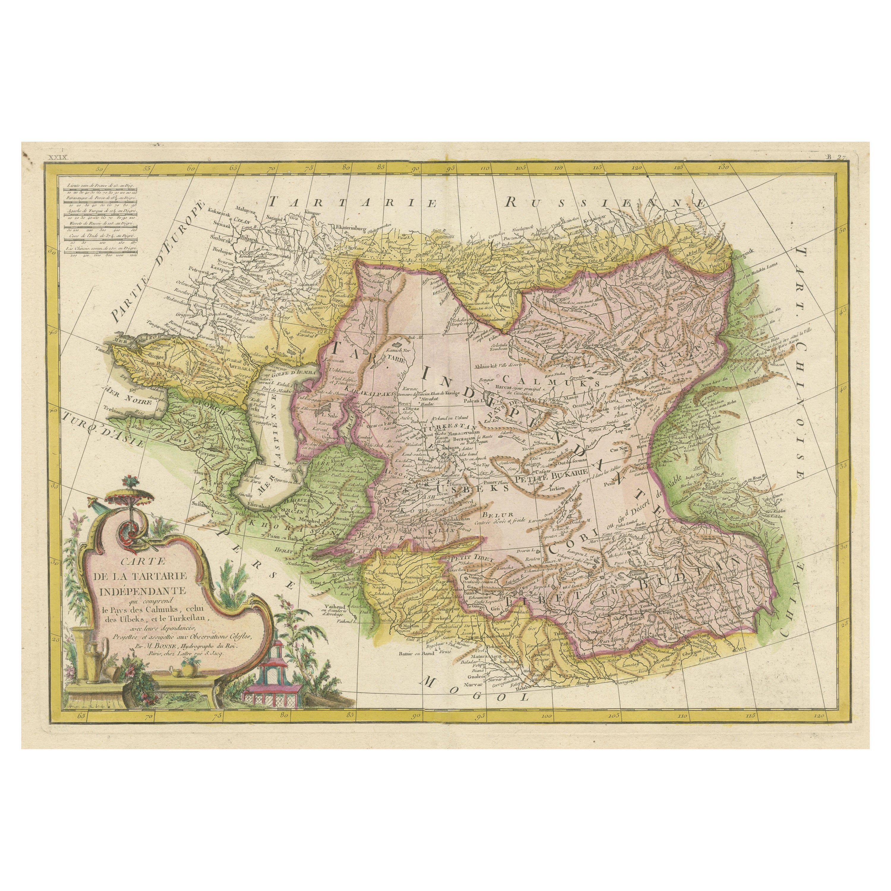
Antique map titled 'Independent Tartary'. Original steel engraved map of Central Asia. It covers the regions between the Caspian Sea and Lake Balkhash and between Russia and Afghanistan. These include the ancient Silk Route kingdoms of Khiva, Tartaria, Kokand, and Bokhara. Today this region roughly includes Kazakhstan, Uzbekistan, Turkmenistan, Kyrgyzstan, and Tajikistan. Three vignettes, including an image of Tartars on a Journey, a horseback Bride Chase, and a tartar campsite. Published circa 1851 by J. & F. Tallis.
- Dimensions:Height: 10.56 in (26.8 cm)Width: 14.73 in (37.4 cm)Depth: 0.02 in (0.5 mm)
- Materials and Techniques:
- Period:
- Date of Manufacture:c.1851
- Condition:Age-related toning. Original outline coloring. Shows some wear and foxing. Few small defects in margins. Blank verso. Please study image carefully.
- Seller Location:Langweer, NL
- Reference Number:
About the Seller
5.0
Platinum Seller
These expertly vetted sellers are 1stDibs' most experienced sellers and are rated highest by our customers.
Established in 2009
1stDibs seller since 2017
1,932 sales on 1stDibs
Typical response time: <1 hour
- ShippingRetrieving quote...Ships From: Langweer, Netherlands
- Return PolicyA return for this item may be initiated within 14 days of delivery.
More From This SellerView All
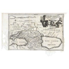
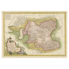
- Antique Map of the Region Between the Black and Caspian Sea by Cellarius, 1731Located in Langweer, NLAntique map titled 'Bosporus, Maeotis, Iberia, Albania, et Sarmatia Asiatica.' Map of the region between the Black and Caspian Seas in early Sarmatian time...Category
Antique 18th Century Maps
MaterialsPaper
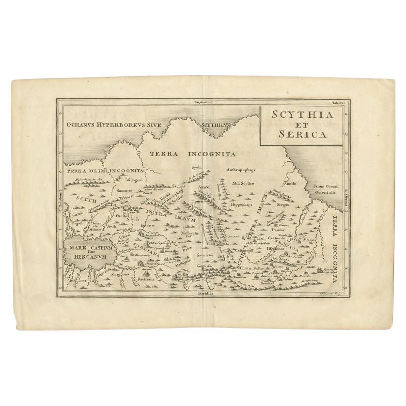
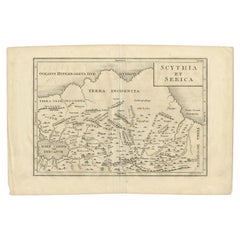
- Antique Map of the Region Between the Caspian and the Sea of China by Toms, 1799Located in Langweer, NLAntique map titled 'Scythia et Serica'. Old map of the region between the Caspian and the Sea of China. Originates from 'Geographia Antiqua (..)'. Artists and Engravers: Engraved ...Category
Antique 18th Century Maps
MaterialsPaper
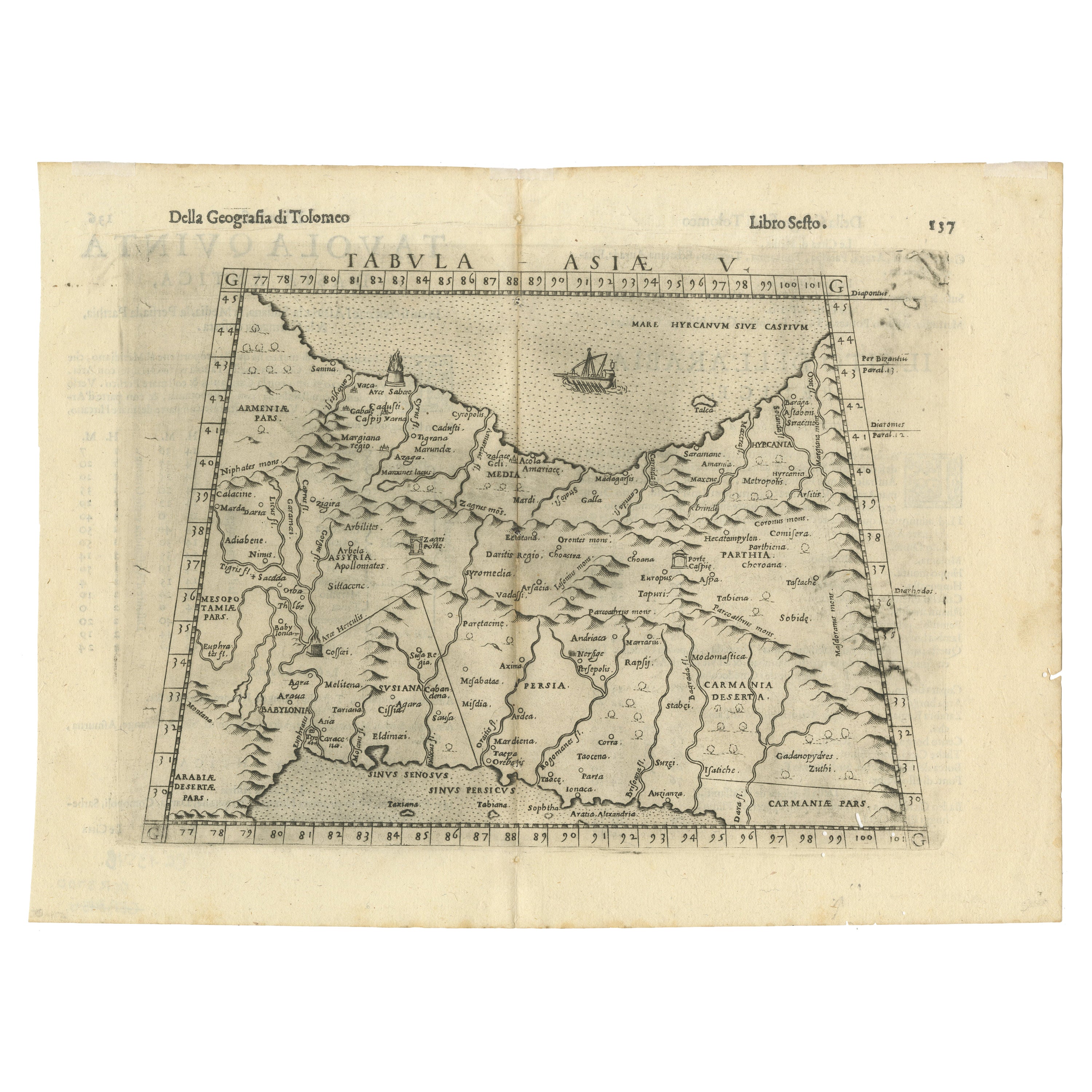
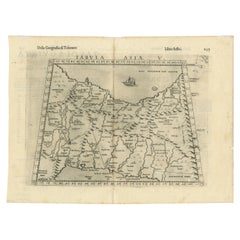
- Old Ptolemaic Map of the Region Between the Persian Gulf and Caspian Sea, 1598Located in Langweer, NL"Tabula Asiae V", Ptolemy/Ruscelli Subject: Persia - Iran Period: 1598 (published) Publication: Geografia di Claudio Tolomeo Allessadrino… Claudius Ptolemy was a mathematician, ast...Category
Antique 16th Century Maps
MaterialsPaper
- Antique Map of the Caspian Sea and Surroundings by Bellin, 1764Located in Langweer, NLAntique map titled 'Carte de la Mer Caspienne et ses Environs'. Old map depicting the region of the Caspian Sea. This map originates from 'Le Petit Atlas M...Category
Antique 18th Century Maps
MaterialsPaper
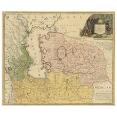
- Antique Map of the Caspian Sea, Uzbekistan, Northern Persia Etc, C.1735Located in Langweer, NLAntique map titled 'Nova Maris Caspii et Regions Usbeck (..).' Detailed map of Central Asia centered on the Caspian Sea, showing Uzbekistan to the east of ...Category
Antique 18th Century Maps
MaterialsPaper
- Decorative Antique Map of Central AsiaLocated in Langweer, NLAntique map titled 'Carte de la Tartarie Indépendante (..)'. Decorative map of Central Asia (Tartary). Covers from the Black Sea south to China, north to Russia, and south to Persia ...Category
Antique Late 18th Century Maps
MaterialsPaper

You May Also Like
- Original Antique Map of Asia. C.1780Located in St Annes, LancashireGreat map of Asia Copper-plate engraving Published C.1780 Two small worm holes to right side of map Unframed.Category
Antique Early 1800s English Georgian Maps
MaterialsPaper

- 1899 Poole Brothers Antique Railroad Map of the Illinois Central RailroadLocated in Colorado Springs, COThis is an 1899 railroad map of the Illinois Central and Yazoo and Mississippi Valley Railroads, published by the Poole Brothers. The map focuses on the continuous United States from the Atlantic to the Pacific Oceans, the Gulf of Mexico, and the Antilles. Remarkably detailed, the rail routes of the Illinois Central RR are marked in red, which each stop labeled. Major stops are overprinted in red, bold letters, with the short rail distances to New York listed above the stop and short rail distances to New Orleans listed below the name. In addition to the Illinois Central network, numerous different rail lines are illustrated and the company running that line is noted along with many stops along each route. Sea routes from New Orleans to locations in Central America, the Caribbean, and Europe are marked and labeled with destination and distance, along with routes originating from Havana. Inset at bottom left is a map of Cuba; an inset map of Puerto Rico...Category
Antique 1890s American Maps
MaterialsPaper
- Hand-Colored 18th Century Homann Map of the Black Sea, Turkey and Asia MinorBy Johann Baptist HomannLocated in Alamo, CAAn attractive original early 18th century hand-colored map of the Black Sea and Turkey entitled "Carte de L'Asie Minevre ou de la Natolie et du Pont Evxin Tiree des Voyages et des Ob...Category
Antique Early 18th Century German Maps
MaterialsPaper
- Original Antique Map of Central America / Florida, Arrowsmith, 1820Located in St Annes, LancashireGreat map of Central America. Drawn under the direction of Arrowsmith. Copper-plate engraving. Published by Longman, Hurst, Rees, Orme and Brown, 1820 Unframed.Category
Antique 1820s English Maps
MaterialsPaper
- Original Antique Map of South East Asia, Arrowsmith, 1820Located in St Annes, LancashireGreat map of South East Asia Drawn under the direction of Arrowsmith Copper-plate engraving Published by Longman, Hurst, Rees, Orme and Brown, 1820 Unframed.Category
Antique 1820s English Maps
MaterialsPaper
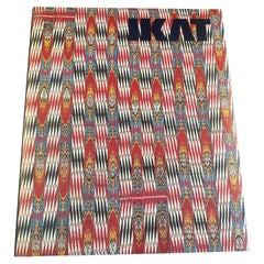
- Ikat, Silks of Central Asia, the Guido Goldman Collection, 1997Located in San Francisco, CAAbr-bandi, the central asian name for the ikat technique, derives from the Persian word abr which means "cloud". The ikat style is not limited to Central Asia, but nowhere have the ikat designs known as abr, or the technique itself proved so enduring or so gloriously inventive as in the ancient centers of Uzbek and Tadjik handicrafts- Bukhara, Samrkand and the towns of the Ferghana Valley. The craftsmanship of the abr masters, the abr bandchi, was their patrimony; their secrets and their repertoire of designs were handed down through the generations. Yet this art form has always been responsive to change and receptive to new weaving methods created to simplify the process without sacrifice of artistry. In the nineteenth century abr designs were used to decorate fabrics made into winter and summer...Category
1990s Belgian Mid-Century Modern Books
MaterialsPaper


Recently Viewed
View AllMore Ways To Browse
Maps Of Sea
Pakistan Antique Map
Johannes Janssonius On Sale
Bolivia Antique Map
Albania Map
Wyld Globes
Ecuador Antique Map
Stock Charts
Antique Arkansas Maps
Antique Barbie Furniture
Carte Egypte Antique
La Syrie Antique
Antique Map Of Puerto Rico
Map Of Wyoming
Antique Citroen
Staffordshire Antique Map
Staffordshire Map
Nicolas De Fer