Items Similar to Antique Map of the Caspian Sea and Surroundings by Bellin, 1764


Want more images or videos?
Request additional images or videos from the seller
1 of 5
Antique Map of the Caspian Sea and Surroundings by Bellin, 1764
About the Item
Antique map titled 'Carte de la Mer Caspienne et ses Environs'. Old map depicting the region of the Caspian Sea. This map originates from 'Le Petit Atlas Maritime Recueil De Cartes et Plans' by J.N. Bellin. Artists and Engravers: Jacques-Nicolas Bellin (1703-1772) was a French hydrographer, geographer and member of The Philosophes. His career, spanning over 50 years, caused an enormous outpt in maps, particular of maritime interest.
Artist: Jacques-Nicolas Bellin (1703-1772) was a French hydrographer, geographer and member of The Philosophes. His career, spanning over 50 years, caused an enormous outpt in maps, particular of maritime interest.
Condition: Good, age-related toning. Piece of tape on upper side of verso. Please study image carefully.
Date: 1764
Overall size: 23 x 21.5 cm.
Image size: 0.001 x 17 x 21.5 cm.
Antique prints have long been appreciated for both their aesthetic and investment value. They were the product of engraved, etched or lithographed plates. These plates were handmade out of wood or metal, which required an incredible level of skill, patience and craftsmanship. Whether you have a house with Victorian furniture or more contemporary decor an old engraving can enhance your living space. We offer a wide range of authentic antique prints for any budget.
- Dimensions:Height: 8.47 in (21.5 cm)Width: 9.06 in (23 cm)Depth: 0 in (0.01 mm)
- Materials and Techniques:
- Period:
- Date of Manufacture:1764
- Condition:
- Seller Location:Langweer, NL
- Reference Number:
About the Seller
5.0
Platinum Seller
These expertly vetted sellers are 1stDibs' most experienced sellers and are rated highest by our customers.
Established in 2009
1stDibs seller since 2017
1,932 sales on 1stDibs
Typical response time: <1 hour
- ShippingRetrieving quote...Ships From: Langweer, Netherlands
- Return PolicyA return for this item may be initiated within 14 days of delivery.
More From This SellerView All
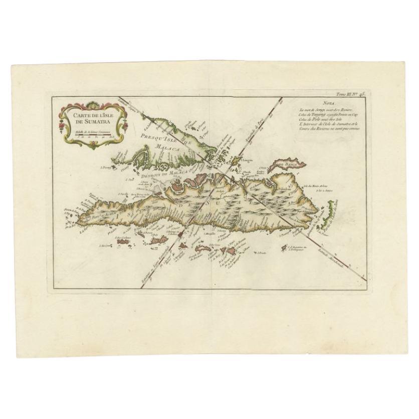
- Antique Map of Sumatra by Bellin, 1764Located in Langweer, NLAntique map Sumatra titled 'Carte de l'Isle de Sumatra'. Old map of Sumatra, Malaysia and the Straits of Malacca, including Singapore. This map originates ...Category
Antique 18th Century Maps
MaterialsPaper
- Antique Map of the Bukhari and Surroundings by Bellin, 1749Located in Langweer, NLAntique map titled 'Carte de la Petite Bukharie et Pays Voisins'. Old map of the Bukhari (Sinkiang in north-western China) and neighboring countries. Artists and Engravers: Jacques-N...Category
Antique 18th Century Maps
MaterialsPaper
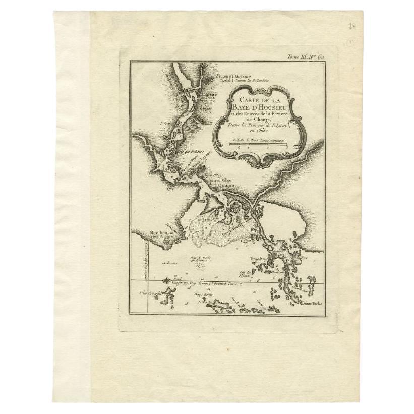
- Antique Map of the Mouth of the Chiang River by Bellin, 1764By Jacques-Nicolas BellinLocated in Langweer, NLAntique map titled ‘Carte de la Baye d'Hocsieu et des Entrees de la Riviere de Chang, Dans la Province de Fokyen en Chine’. This impressive map or sea chart d...Category
Antique 18th Century Maps
MaterialsPaper
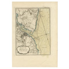
- Antique Map of Boulogne-sur-Mer by Bellin '1764'Located in Langweer, NLAntique map titled 'Plan de la Ville de Boulogne'. Original antique map of Boulogne-sur-Mer, France. This map originates from 'Le petit atlas maritime: recueil de cartes et plans des...Category
Antique Mid-18th Century Maps
MaterialsPaper
- Antique Map of the Tonkin River ‘Vietnam’ by J.N. Bellin, 1764Located in Langweer, NLOne of the maps produced by Bellin for Prevost d'Exiles' influential travel book, ‘L'Histoire Generale des Voyages’. This map depicts part of Southeast Asia, most likely northern Vie...Category
Antique Mid-18th Century Maps
MaterialsPaper
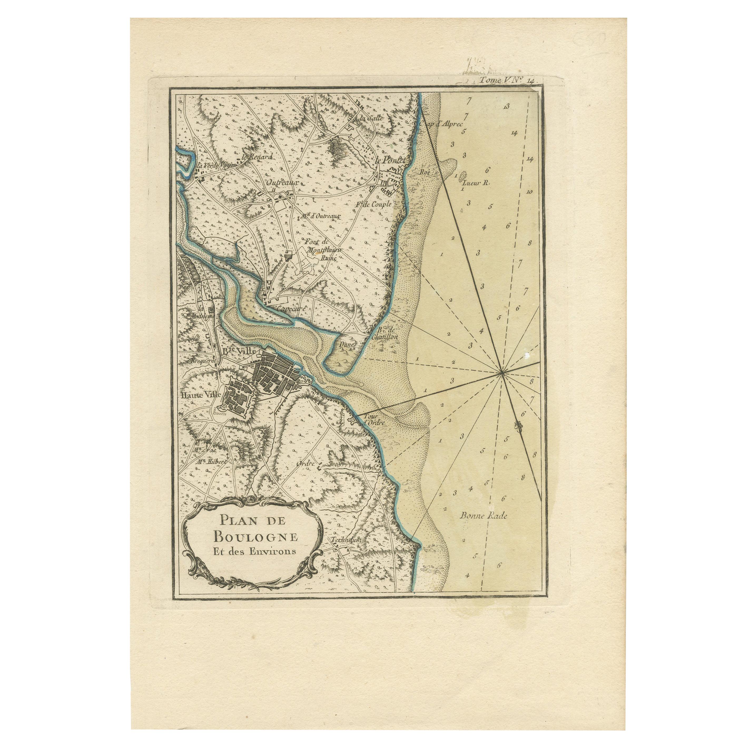
- Antique Map of the Region of Boulogne-sur-Mer by Bellin '1764'Located in Langweer, NLAntique map titled 'Plan de Boulogne et des Environs'. Original antique map of the region of Boulogne-sur-Mer, France. This map originates from 'Le petit atlas maritime: recueil de c...Category
Antique Mid-18th Century Maps
MaterialsPaper


You May Also Like
- Captain Cook's Exploration of Tahiti 18th C. Hand-Colored Map by BellinBy Jacques-Nicolas BellinLocated in Alamo, CAThis beautiful 18th century hand-colored copper plate engraved map is entitled "Carte de l'Isle de Taiti, par le Lieutenant J. Cook" was created by Jacques Nicolas Bellin and publish...Category
Antique Mid-18th Century French Maps
MaterialsPaper
- 1861 Topographical Map of the District of Columbia, by Boschke, Antique MapLocated in Colorado Springs, COPresented is an original map of Albert Boschke's extremely sought-after "Topographical Map of the District of Columbia Surveyed in the Years 1856 ...Category
Antique 1860s American Historical Memorabilia
MaterialsPaper
- West Coast of Africa, Guinea & Sierra Leone: An 18th Century Map by BellinBy Jacques-Nicolas BellinLocated in Alamo, CAJacques Bellin's copper-plate map entitled "Partie de la Coste de Guinee Dupuis la Riviere de Sierra Leona Jusquau Cap das Palmas", depicting the coast of Guinea and Sierra Leone in ...Category
Antique Mid-18th Century French Maps
MaterialsPaper
- Original Antique Map of The World by Thomas Clerk, 1817Located in St Annes, LancashireGreat map of The Eastern and Western Hemispheres On 2 sheets Copper-plate engraving Drawn and engraved by Thomas Clerk, Edinburgh. Published by Mackenzie And Dent, 1817 ...Category
Antique 1810s English Maps
MaterialsPaper
- St. Christophe 'St. Kitts' Island: An 18th Century Hand-colored Map by BellinBy Jacques-Nicolas BellinLocated in Alamo, CAJacques Bellin's copper-plate map of the Caribbean island of Saint Kitts entitled "Carte De De l'Isle St. Christophe Pour servir á l'Histoire Genle. des V...Category
Antique Mid-18th Century French Maps
MaterialsPaper
- 1907 Map of Colorado, Antique Topographical Map, by Louis NellLocated in Colorado Springs, COThis highly detailed pocket map is a topographical map of the state of Colorado by Louis Nell from 1907. The map "has been complied from all availabl...Category
Antique Early 1900s American Maps
MaterialsPaper


Recently Viewed
View AllMore Ways To Browse
Sea Antique
Maritime Antiques
Antique Wood Cart
Petit Antiques
Antique Wood Trolley
Caspian Sea
Victorian Trolley
Antique Metal Carts
Space Age Trolley
Antique Maritime Prints
N J Woods
Victorian Sea Prints
Maritime Map
Nicolas Petit
Antique 16th Century Plates
Antique Caribbean Furniture
17th Century Plate Set
Antique Rose Compass