Items Similar to Antique Map of the Black Sea and Surroundings by Sharpe, 1849

Want more images or videos?
Request additional images or videos from the seller
1 of 5
Antique Map of the Black Sea and Surroundings by Sharpe, 1849
About the Item
Antique map titled 'Russia on the Euxine'. Old map of the Black Sea and the surrounding (Russia). This map originates from 'Sharpe's Corresponding Atlas (..)' by J. Sharpe. Artists and Engravers: Published by Chapman and Hall.
Artist: Published by Chapman and Hall.
Condition: Good, age-related toning. Some creasing of the paper and repair in the left margin (also affecting image). Please study image carefully.
Date: 1849
Overall size: 46.5 x 35 cm.
Image size: 0.001 x 40.5 x 31 cm.
Antique prints have long been appreciated for both their aesthetic and investment value. They were the product of engraved, etched or lithographed plates. These plates were handmade out of wood or metal, which required an incredible level of skill, patience and craftsmanship. Whether you have a house with Victorian furniture or more contemporary decor an old engraving can enhance your living space. We offer a wide range of authentic antique prints for any budget.
- Dimensions:Height: 13.78 in (35 cm)Width: 18.31 in (46.5 cm)Depth: 0 in (0.01 mm)
- Materials and Techniques:
- Period:
- Date of Manufacture:1849
- Condition:
- Seller Location:Langweer, NL
- Reference Number:
About the Seller
5.0
Platinum Seller
These expertly vetted sellers are 1stDibs' most experienced sellers and are rated highest by our customers.
Established in 2009
1stDibs seller since 2017
1,932 sales on 1stDibs
Typical response time: <1 hour
- ShippingRetrieving quote...Ships From: Langweer, Netherlands
- Return PolicyA return for this item may be initiated within 14 days of delivery.
More From This SellerView All
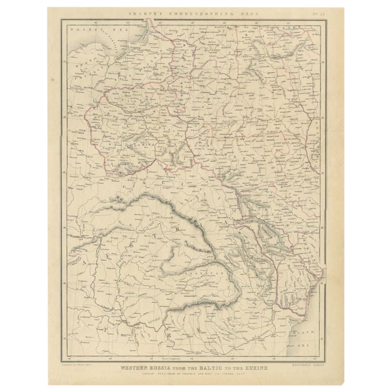
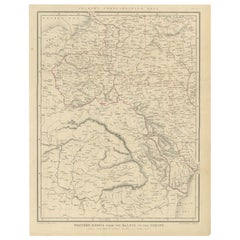
- Antique Map of Russia from the Baltic to the Black Sea by Sharpe, 1849Located in Langweer, NLAntique map titled 'Western Russia from the Baltic to the Euxine'. Old map of Western Russia from the Baltic to the Black Sea. This map originates from 'Sharpe's Corresponding Atlas ...Category
Antique 19th Century Maps
MaterialsPaper
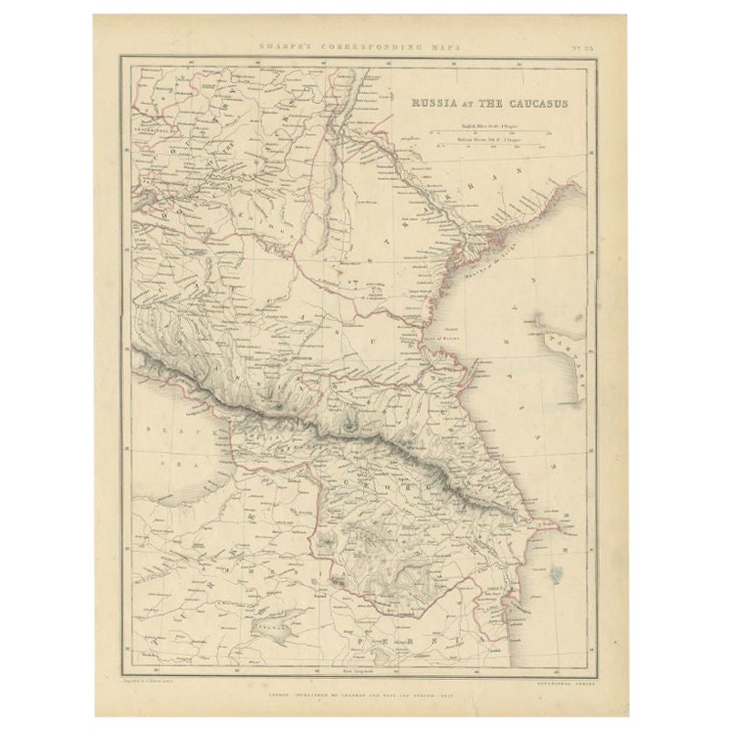
- Antique Map of Russia and the Caucasus by Sharpe, 1849Located in Langweer, NLAntique map titled 'Russia at the Caucasus'. Old map of Russia and the Caucasus, also shows part of the Black Sea and Caspian Sea. This map originates from 'Sharpe's Corresponding Atlas (..)' by J. Sharpe. Artists and Engravers: Published by Chapman and Hall...Category
Antique 19th Century Maps
MaterialsPaper
- Antique Map of the Caspian Sea and Surroundings by Bellin, 1764Located in Langweer, NLAntique map titled 'Carte de la Mer Caspienne et ses Environs'. Old map depicting the region of the Caspian Sea. This map originates from 'Le Petit Atlas M...Category
Antique 18th Century Maps
MaterialsPaper
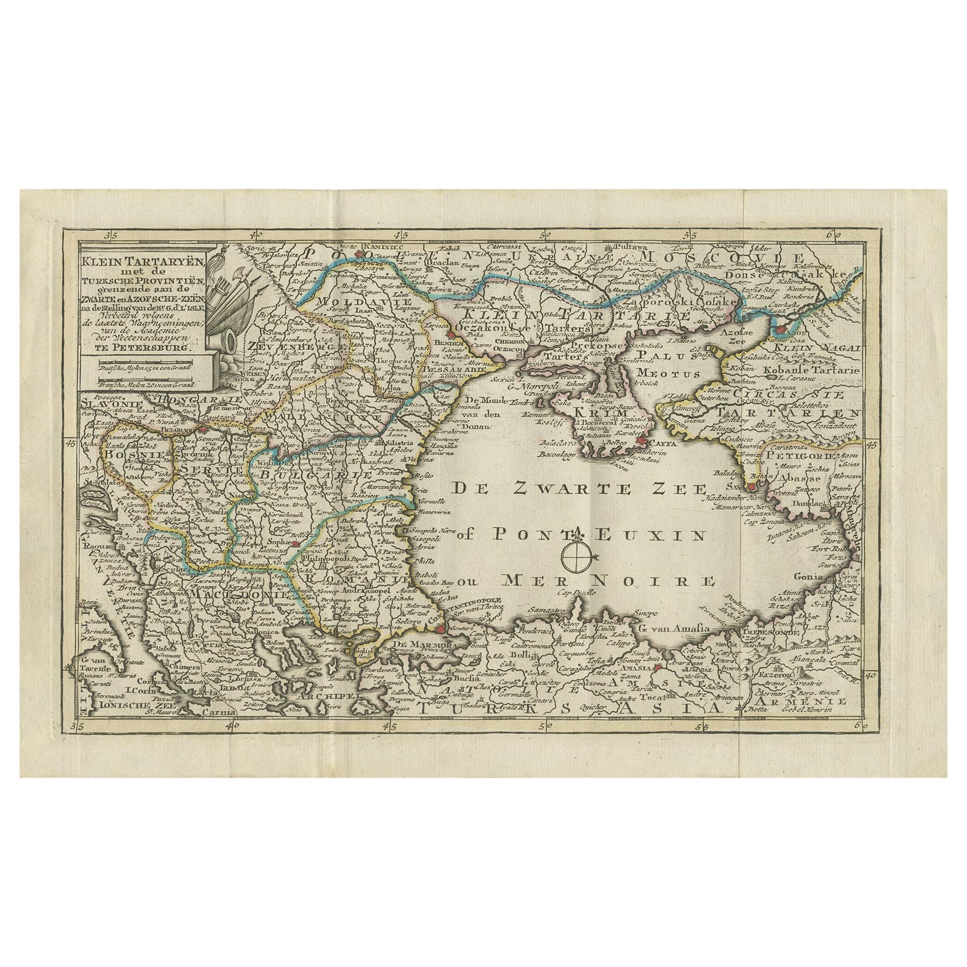
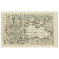
- Antique Map of the Black Sea and Surroundings by Keizer & de Lat, 1788Located in Langweer, NLAntique map titled 'Klein Tartaryën met de Turksche Provintiën (..)'. Uncommon original antique map of the Black Sea and surroundings. This map originates from 'Nieuwe Natuur- Geschi...Category
Antique Late 18th Century Maps
MaterialsPaper
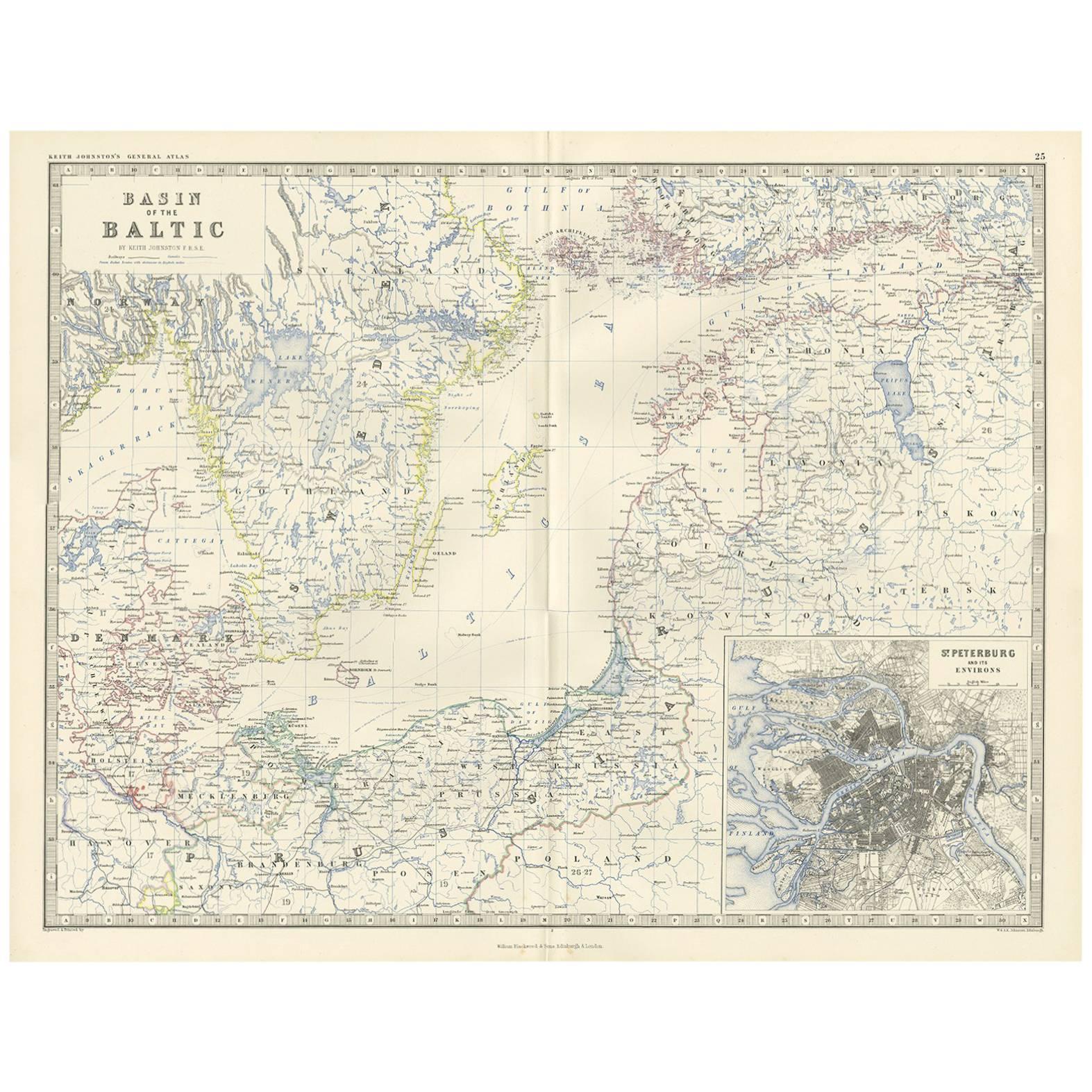
- Antique Map of the Surroundings of the Baltic Sea by A.K. Johnston, 1865Located in Langweer, NLAntique map titled 'Basin of the Baltic'. Depicting, Denmark, Sweden, Finland, Estonia, Poland, Prussia and more. With an inset map of St. Peterburg and environments. This map origin...Category
Antique Mid-19th Century Maps
MaterialsPaper
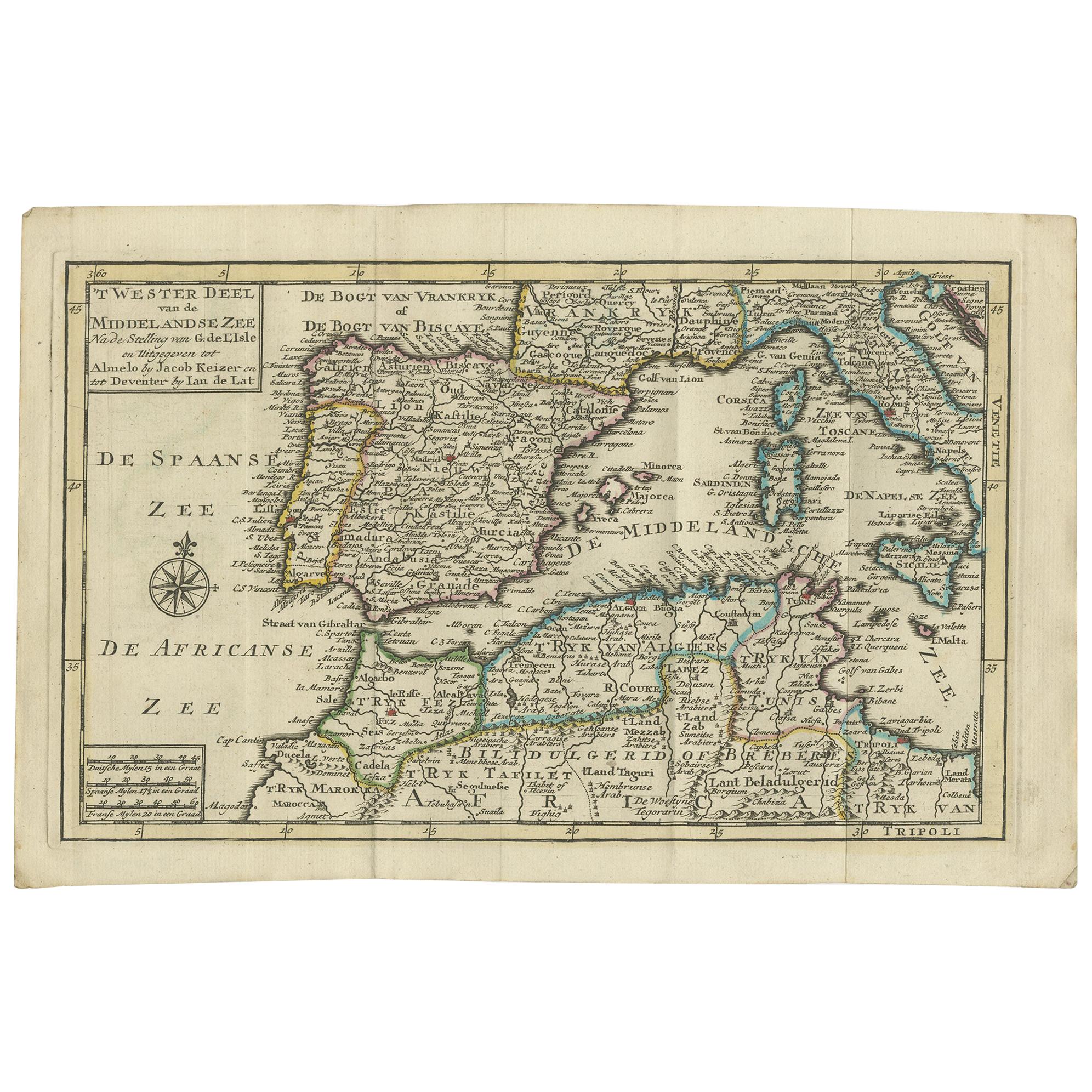
- Antique Map of the Mediterranean Sea and Surroundings by Keizer & de Lat, 1788Located in Langweer, NLAntique map titled 't Wester Deel van de Middelandse Zee (..)'. Uncommon original antique map of the Mediterranean Sea and surroundings. This map originates from 'Nieuwe Natuur- Gesc...Category
Antique Late 18th Century Maps
MaterialsPaper


You May Also Like
- 1849 Map of "Europaische Russland", 'Meyer Map of European Russia', Ric. R017Located in Norton, MA1849 Map of "Europaische Russland" ( Meyer Map of European Russia) Ric.r017 A lovely map of European Russia dating to 1849 by Joseph Meyer. It covers the European portions of...Category
Antique 19th Century Unknown Maps
MaterialsPaper
- 1861 Topographical Map of the District of Columbia, by Boschke, Antique MapLocated in Colorado Springs, COPresented is an original map of Albert Boschke's extremely sought-after "Topographical Map of the District of Columbia Surveyed in the Years 1856 ...Category
Antique 1860s American Historical Memorabilia
MaterialsPaper
- Antique Lithography Map, Black Sea, English, Framed, Cartography, VictorianLocated in Hele, Devon, GBThis is an antique lithography map of the Black Sea region. An English, framed atlas engraving of cartographic interest by John Rapkin, dating to the early Victorian period and later...Category
Antique Mid-19th Century British Early Victorian Maps
MaterialsWood
- Hand-Colored 18th Century Homann Map of the Black Sea, Turkey and Asia MinorBy Johann Baptist HomannLocated in Alamo, CAAn attractive original early 18th century hand-colored map of the Black Sea and Turkey entitled "Carte de L'Asie Minevre ou de la Natolie et du Pont Evxin Tiree des Voyages et des Ob...Category
Antique Early 18th Century German Maps
MaterialsPaper
- Original Antique Map of The World by Thomas Clerk, 1817Located in St Annes, LancashireGreat map of The Eastern and Western Hemispheres On 2 sheets Copper-plate engraving Drawn and engraved by Thomas Clerk, Edinburgh. Published by Mackenzie And Dent, 1817 ...Category
Antique 1810s English Maps
MaterialsPaper
- 1907 Map of Colorado, Antique Topographical Map, by Louis NellLocated in Colorado Springs, COThis highly detailed pocket map is a topographical map of the state of Colorado by Louis Nell from 1907. The map "has been complied from all availabl...Category
Antique Early 1900s American Maps
MaterialsPaper


Recently Viewed
View AllMore Ways To Browse
Sea Antique
Chapman And Hall
Antique Russian Wood Furniture
Antique Russian Wood
Antique Maps Of Russia
Russian Antique Plates
Victorian Sea Prints
J Chapman
Rare Compass
Map Of United Kingdom
Antique Presentation Plates
Antique Mallet
Antique 16th Century Plates
Antique Caribbean Furniture
Antique Booksellers
Antique Bookseller
17th Century Plate Set
Compass Rose Antique