Items Similar to Colorful Detailed Antique Map of The British Islands and `The North Sea, 1882
Want more images or videos?
Request additional images or videos from the seller
1 of 6
Colorful Detailed Antique Map of The British Islands and `The North Sea, 1882
About the Item
Discover 'The British Islands and The North Sea' Map with Insets of Orkney, Shetland, and Channel Islands! This captivating original antique map offers a detailed view of the British Isles and the North Sea region.
Explore this vintage masterpiece showcasing the intricacies of the British Isles, complete with inset maps highlighting the enchanting Orkney, Shetland, and Channel Islands. With exquisite detail and historical accuracy, this map presents a unique perspective on the geographical landscape of these iconic regions, including the coasts of Ireland, Holland, Friesland, Denmark, Belgium, Norway and Northern France.
Perfect for history buffs, cartography enthusiasts, and those passionate about British and maritime history, this map is a treasure trove of information and visual delight. Its depiction of the coastlines, cities, and topography brings to life the rich heritage and geographical nuances of these islands and their surrounding waters.
Whether as a collector's item, a decorative piece for your home or office, or an educational tool for understanding the historical evolution of these regions, this map holds a timeless allure. Step into the past and embark on a visual journey through the British Isles and the North Sea with this captivating antique map at your fingertips!
- Dimensions:Height: 14.97 in (38 cm)Width: 22.45 in (57 cm)Depth: 0 in (0.02 mm)
- Materials and Techniques:
- Period:
- Date of Manufacture:1882
- Condition:Good condition, folding line in the middle. The outer borders are slightly yellowish discolored due to age, but not the image. This map is ideal for framing.
- Seller Location:Langweer, NL
- Reference Number:
About the Seller
5.0
Platinum Seller
These expertly vetted sellers are 1stDibs' most experienced sellers and are rated highest by our customers.
Established in 2009
1stDibs seller since 2017
1,929 sales on 1stDibs
Typical response time: <1 hour
- ShippingRetrieving quote...Ships From: Langweer, Netherlands
- Return PolicyA return for this item may be initiated within 14 days of delivery.
More From This SellerView All
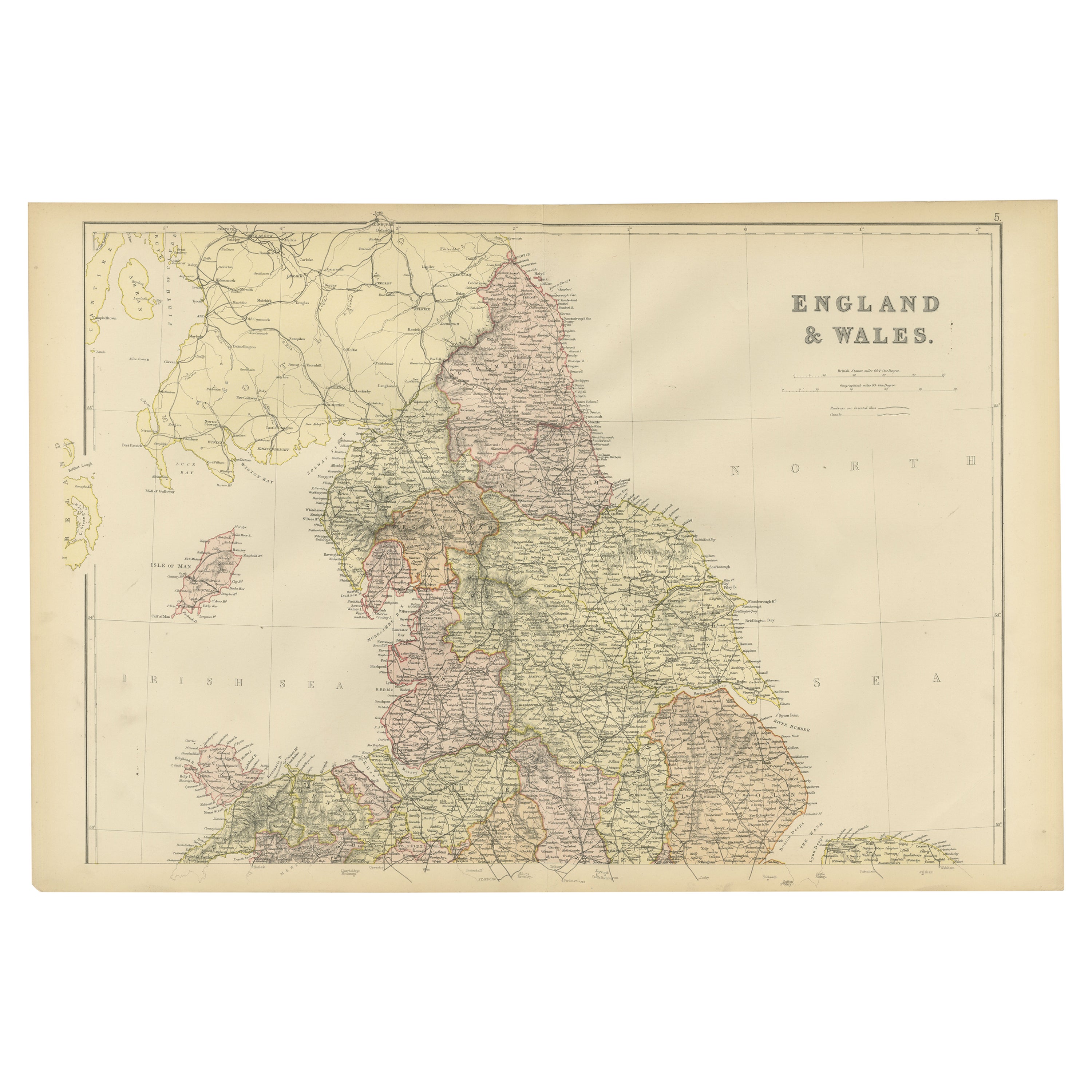
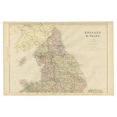
- Colorful Detailed Antique Map of England and Wales, 1882Located in Langweer, NLExplore the Historic Splendor of 'England and Wales' with this Antique Map! Part of a distinguished collection, this map presents a captivating view of the enchanting landscapes, cit...Category
Antique 1880s Maps
MaterialsPaper
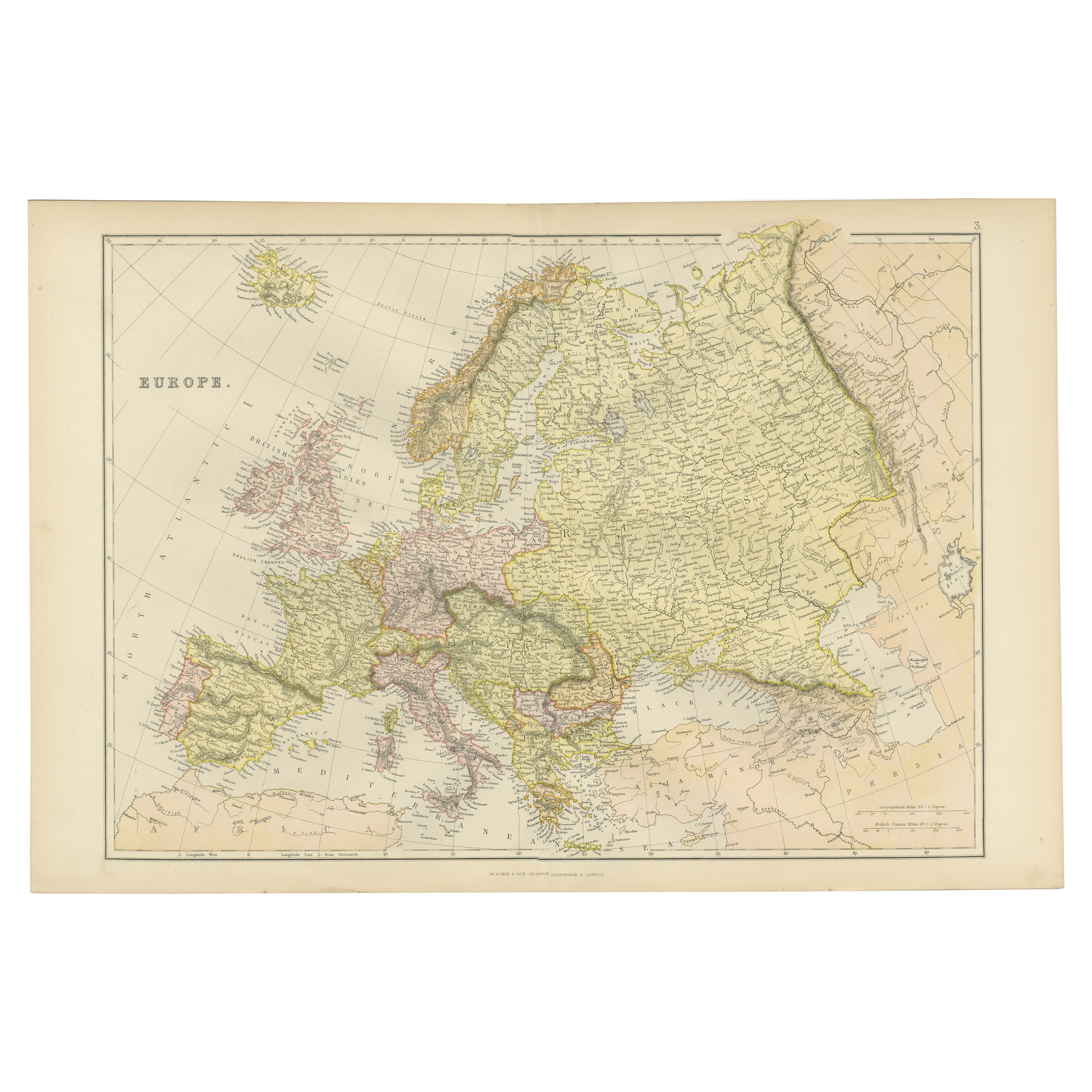
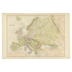
- Colorful Detailed Antique Map of Europe, Published in 1882Located in Langweer, NL"The Antique Map of Europe from 'The Comprehensive Atlas and Geography of the World,' published in 1882 by Blackie & Son, is a testament to meticulous cartography and scholarly preci...Category
Antique 1880s Maps
MaterialsPaper
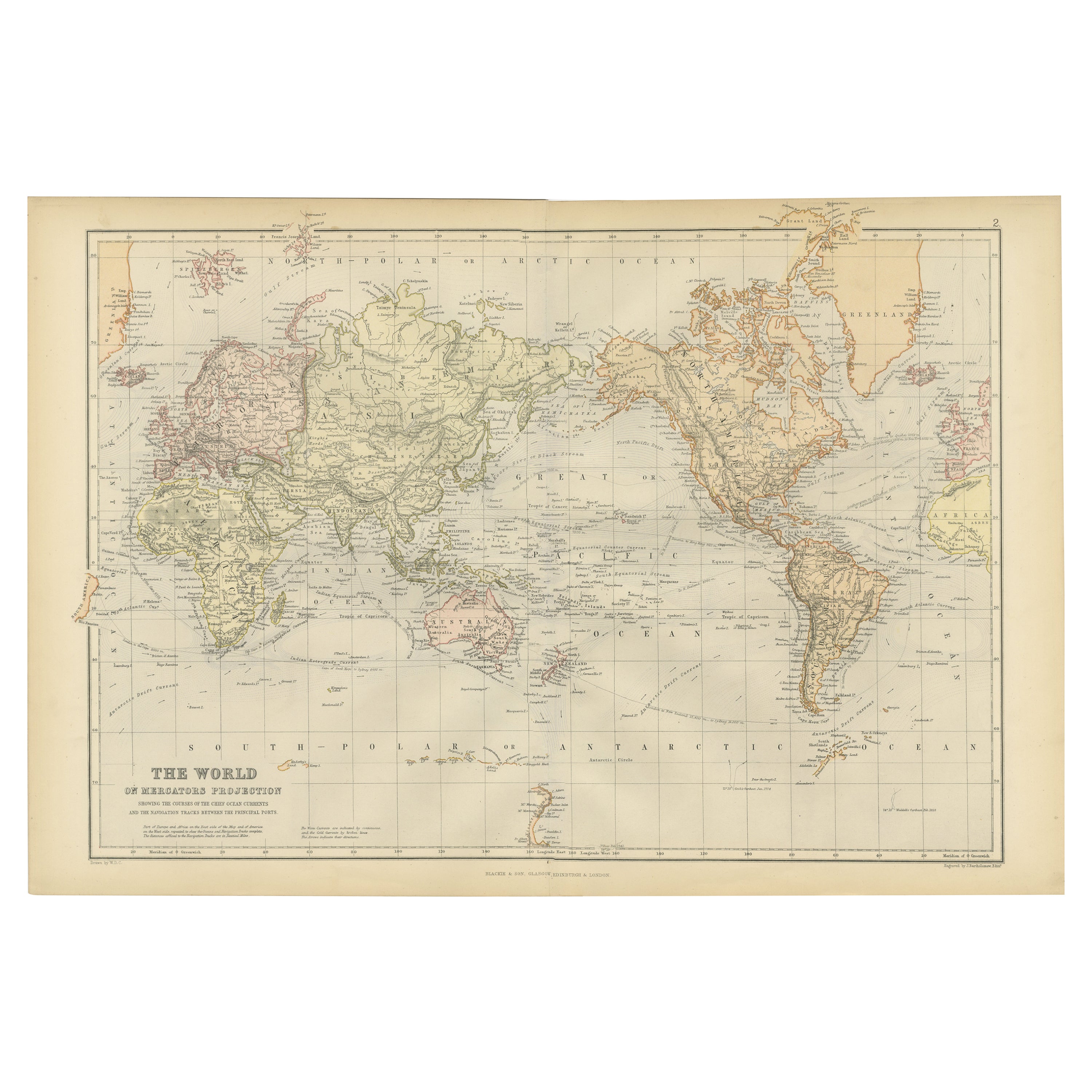
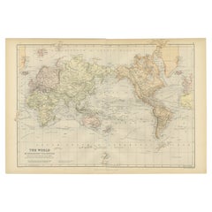
- Colorful Detailed Antique Map of The World on Mercators Projection, 1882Located in Langweer, NLThe 'World of Mercator's Projection' is a map with a stunning portrayal of global geography and maritime navigation from an era steeped in exploration and discovery. With meticulous detail and precision, this map showcases the world's continents on Mercator's famous projection, capturing the essence of a bygone era's cartographic expertise. Illustrating the courses of chief ocean currents and key navigation tracks between major ports, this map doesn't just depict landmasses but also reveals the vital maritime routes that shaped global trade and exploration. Each line and curve represents the pathways of ancient voyages and modern seafaring, connecting distant shores and continents. Crafted with the precision characteristic of Mercator's projection, this map offers a unique perspective on how sailors and explorers navigated the world's vast oceans. It stands as a testament to the artistry and scientific ingenuity of cartographers of that time, showcasing their commitment to accurate representation amid the challenges of mapping a spherical world on a flat surface. This map isn't just a historical document; it's a captivating piece of cartographic art...Category
Antique 1880s Maps
MaterialsPaper
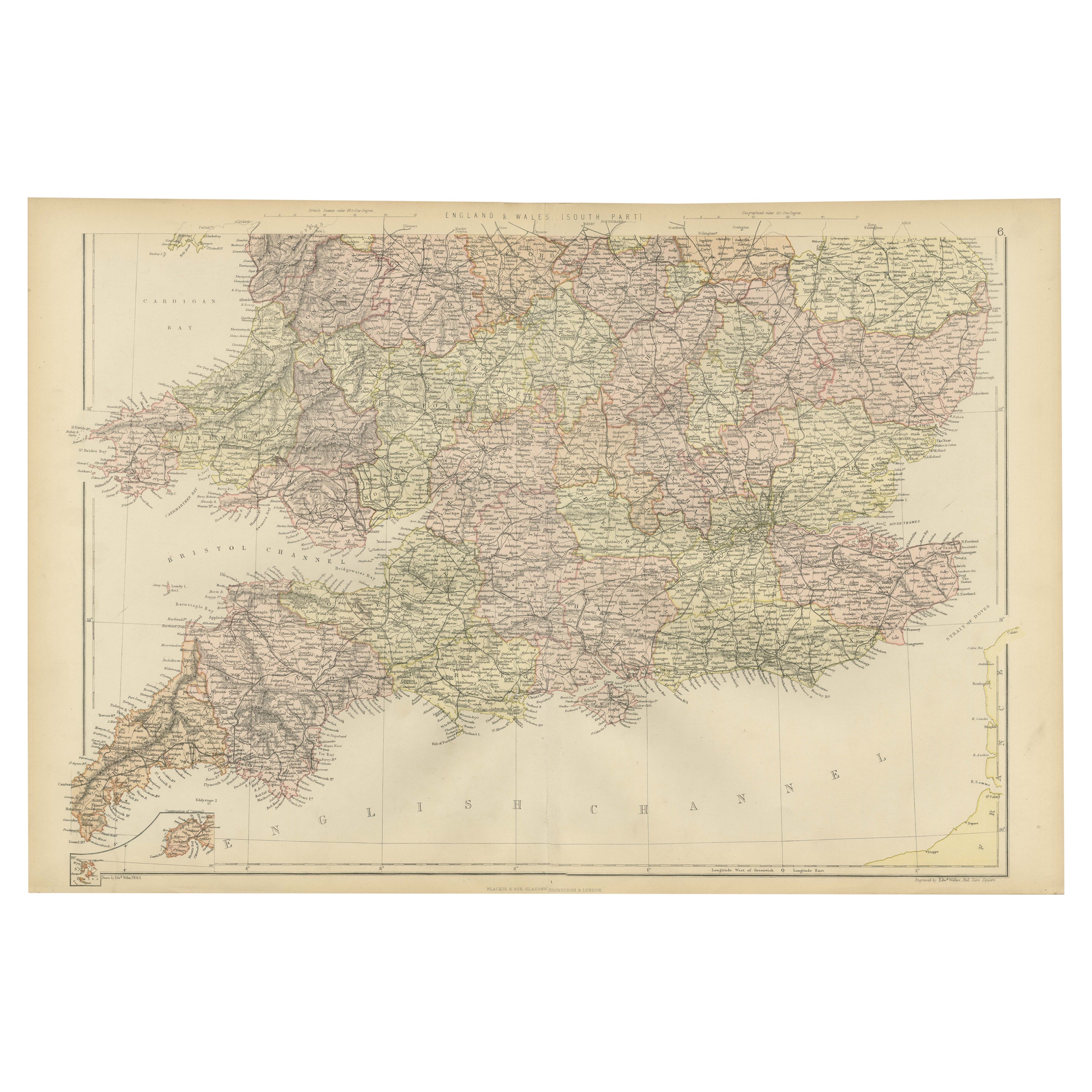
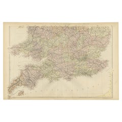
- Colorful Detailed Antique Map of England and Wales (South Part), 1882Located in Langweer, NLEmbark on a Journey Through the Southern Part of 'England and Wales' with this Exquisite Antique Map! This map provides a vivid portrayal of the captivating landscapes and cultural h...Category
Antique 1880s Maps
MaterialsPaper
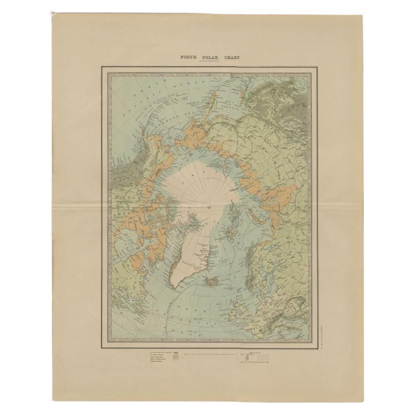
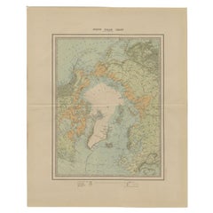
- Antique Map of the North Pole by Johnston, 1882Located in Langweer, NLAntique map titled 'North Pole Chart'. Old map of the North Pole showing the various regions and political boundaries. This map originates from 'The Royal A...Category
Antique 19th Century Maps
MaterialsPaper
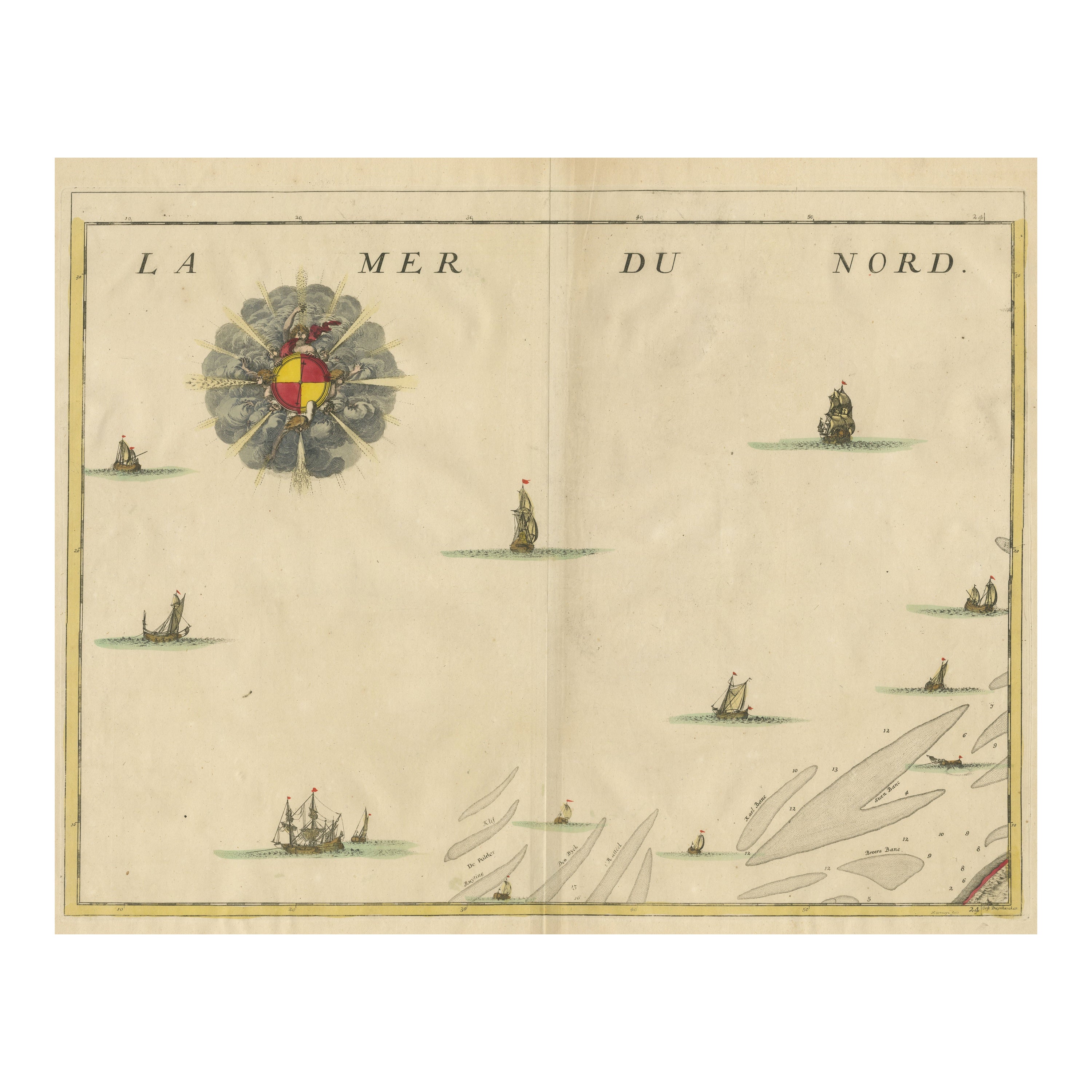
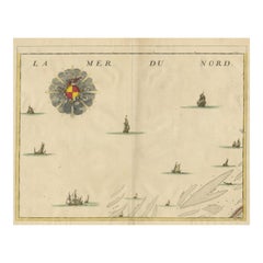
- Antique Map of the North Sea and DunkirkLocated in Langweer, NLUntitled map of the North Sea, top left a large compass rose, bottom right Dunkirk (Duinkerke / Dunkerque), France. Part of a bundled collection of plans of battles and cities renown...Category
Antique Early 18th Century Maps
MaterialsPaper
You May Also Like
- 1854 Map of Massachusetts, Connecticut and Rhode Island, Antique Wall MapLocated in Colorado Springs, COThis striking wall map was published in 1854 by Ensign, Bridgman & Fanning and has both full original hand-coloring and original hardware. This impression is both informative and highly decorative. The states are divided into counties, outlined in red, green, and black, and subdivided into towns. Roads, canals, and railroad lines are prominently depicted, although they are not all labeled. The mapmakers also marked lighthouses, banks, churches, and prominent buildings, with a key at right. The map is an informative and comprehensive overview of the infrastructural development of New England prior to the Civil War. Physical geographies depicted include elevation, conveyed with hachure marks, rivers and lakes. The impression features an inset map of Boston...Category
Antique 19th Century American Maps
MaterialsPaper
- Large Antique 1859 Map of North AmericaLocated in Sag Harbor, NYThis Map was made by Augustus Mitchell in 1859 It is in amazing condition for being 163 years old. This price is for the rolled up easy to ship version of this piece. I will be Frami...Category
Antique Mid-19th Century American Maps
MaterialsCanvas, Paper

- Large Original Vintage Map of New Zealand, North Island, circa 1920Located in St Annes, LancashireGreat map of North Island, New Zealand Original color. Good condition / minor foxing to right edge Published by Alexander Gross Unframed.Category
Vintage 1920s English Edwardian Maps
MaterialsPaper
- Hand-Colored 18th Century Homann Map of Denmark and Islands in the Baltic SeaBy Johann Baptist HomannLocated in Alamo, CAAn 18th century copper plate hand-colored map entitled "Insulae Danicae in Mari Balthico Sitae utpote Zeelandia, Fionia, Langelandia, Lalandia, Falstria, Fembria Mona" created by Joh...Category
Antique Early 18th Century German Maps
MaterialsPaper
- Large Original Vintage Map of British Island Possessions, circa 1920Located in St Annes, LancashireGreat map of British Island Possessions Original color. Good condition Published by Alexander Gross Unframed.Category
Vintage 1920s English Maps
MaterialsPaper
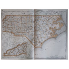
- Large Original Antique Map of North Carolina, USA, 1894By Rand McNally & Co.Located in St Annes, LancashireFabulous map of North Carolina Original color By Rand, McNally & Co. Published, 1894 Unframed Free shipping.Category
Antique 1890s American Maps
MaterialsPaper


Recently Viewed
View AllMore Ways To Browse
Rare Map Of Ireland
Antique European Map Prints
Carl Probst
Mid Century Maps
Levasseur A
Important Map
Asian Bassett
Clivia Ducatus Et Ravestein Dominium
18th Century European Maps
Vintage Nantucket Map
Vintage Nantucket Maps
Rand Mcnally Map Of California
Uruguay Antique Map
Derbyshire Antique Map
Antique Furniture Perth Australia
Tanzania Antique Map
Aigue Marine
Cincinnati Map