Antique European Map Prints
2
to
24
283
82
134
117
103
89
65
39
30
28
27
18
16
15
11
10
9
8
8
8
7
7
7
6
5
5
5
4
4
4
3
3
3
3
3
3
3
3
3
3
2
2
2
2
2
2
1
1
1
1
1
1
1
1
1
42
42
15
4
3
Sort By
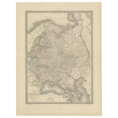
Antique Map of Russia in Europe, 1842
Located in Langweer, NL
Antique map titled 'Carte de la Russie d'Europe'. Map of Russia in Europe. This map originates from
Category
Antique 19th Century Maps
Materials
Paper
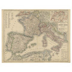
Antique Map of Southwest Europe by Kiepert, c.1870
Located in Langweer, NL
"Antique map titled 'Romanisches Südwest-Europa'. Old map of Southwest Europe. This map originates
Category
Antique 19th Century Maps
Materials
Paper
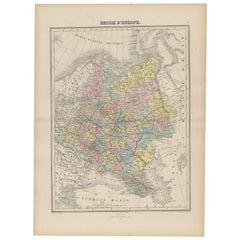
Antique Map of Russia in Europe by Migeon, 1880
Located in Langweer, NL
Antique map titled 'Russie d'Europe'. Old map of Russia in Europe. This map originates from
Category
Antique 19th Century Maps
Materials
Paper
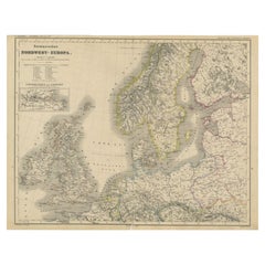
Antique Map of Northwest Europe by Kiepert, c.1870
Located in Langweer, NL
Antique map titled 'Germanisches Nordwest-Europa'. Old map of North-West Europe depicting the
Category
Antique 19th Century Maps
Materials
Paper
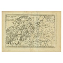
Antique Map of Northern Europe by Bonne, c.1780
Located in Langweer, NL
Antique map titled 'Le Nord de L'Europe, Contenant Le Danemark, La Norwege; La Suede et La Laponie
Category
Antique 18th Century Maps
Materials
Paper
Remarkable Antique Map of West Europe by Scherer, circa 1703
Located in Langweer, NL
Antique map of Western Europe. Depicting Bergen, Stockholm, Dublin, Paris, Wien, Madrid, Rome
Category
Antique 18th Century Maps
Materials
Paper
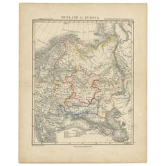
Antique Map of Russia in Europe by Petri, c.1873
Located in Langweer, NL
Antique map titled 'Rusland in Europa'. Old map depicting Russia in Europe. This map originates
Category
Antique 19th Century Maps
Materials
Paper
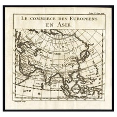
Antique Map of European Trade in Asia by Pluche, 1742
Located in Langweer, NL
Map pag. 444: 'Le commerce des Europeens en Asie.' (The commerce / trade of the Europeans in Asia
Category
Antique 18th Century Maps
Materials
Paper
Antique Map of part of Europe by Scherer, c.1703
Located in Langweer, NL
Untitled map of Europe depicting Calais, Münster, Paris, Lion, Prag, Wien, Berlin, Clermont and
Category
Antique 18th Century Maps
Materials
Paper
Antique Map of Western Europe and Spain by Scherer, circa 1703
Located in Langweer, NL
Untitled map of Western Europe and Spain. Depicting Rome, Edinburgh, Paris, Madrid, Stockholm and
Category
Antique 18th Century Maps
Materials
Paper
Eason's War Map of Europe, circa 1914
Located in Langweer, NL
Antique map titled 'Eason's War Map of Europe'. Printed in Ireland. Source unknown, to be
Category
20th Century Maps
Materials
Paper
Intriguing Antique Map of Europe, Asia and Africa by Scherer, c.1703
Located in Langweer, NL
Two maps on a single sheet showing Europe, Asia and Africa, each depicting nearly the same area. On
Category
Antique 18th Century Maps
Materials
Paper
Rare Antique Map of Part of Europe and Africa by Scherer, C.1703
Located in Langweer, NL
Antique map with two figures. The upper figures showing part of Europe and Africa. Below a chart
Category
Antique 18th Century Maps
Materials
Paper
Intriguing Antique Map of Europe, the Middle East and Africa by Scherer, c.1703
Located in Langweer, NL
Antique map depicting part of Africa, Europe and the Middle East. Also showing various cities in
Category
Antique 18th Century Maps
Materials
Paper
H 10.63 in W 8.27 in D 0 in
Antique Map of the British Isles and Part of Europe by Chatelain, c.1720
Located in Langweer, NL
Antique map titled 'Carte pour l'Intelligence de l'Histoire d'Angleterre (..)'. Decorative map
Category
Antique 18th Century Maps
Materials
Paper
H 16.93 in W 19.89 in D 0 in
Antique Map of Friesland Also Know as the Peacock Map, C.1580
Located in Langweer, NL
Antique map titled ?Frisia Occidentalis?. Original antique map of the province of Friesland, the
Category
Antique 18th Century Maps
Materials
Paper
Original Old Map of Leeuwarden, European Cultural Capital 2018, Holland, 1649
Located in Langweer, NL
Antique print, titled: 'Leoverdia.'
This map shows Leoverdia (Leeuwarden). Bird's-eye view plan
Category
Antique 1640s Maps
Materials
Paper
H 20.87 in W 25.79 in D 0 in
Antique Map of Switzerland by Homann, 1753
Located in Langweer, NL
Antique map Switzerland titled 'Territorium Reipublicae liberae Helveticae Scaphusiensis
Category
Antique 18th Century Maps
Materials
Paper
Antique Map of Friesland by Guicciardini, 1613
Located in Langweer, NL
Antique map titled 'Frisia Occidenta.' (Map of the province of Friesland, the Netherlands.) This
Category
Antique 17th Century Maps
Materials
Paper
Southern & Eastern Europe: A Large 17th C. Hand-colored Map by Sanson & Jaillot
By Nicolas Sanson
Located in Alamo, CA
This large hand-colored map entitled "Estats de L'Empire des Turqs en Europe, ou sont les
Category
Antique 1690s French Maps
Materials
Paper
H 24.88 in W 38 in D 0.13 in
Antique Map of Siberia and Russia, c.1885
Located in Langweer, NL
Antique map titled 'Siberie ou Russie d?Asie'. This is a fine example of J. Migeon's map of Russia
Category
Antique 19th Century Maps
Materials
Paper
Genuine Antique Engraved Map of Helvetia or Switzerland, 1729
Located in Langweer, NL
request.
We ship our antique maps and prints carefully packed across the world with Express Service
Category
Antique 1720s Maps
Materials
Paper
Antique Map Depiciting a Horizon or Hemisphere c.1703
Located in Langweer, NL
Antique map depiciting a horizon/hemisphere. Printed for Scherer's 'Atlas Novus' (1702-1710
Category
Antique 18th Century Maps
Materials
Paper
Antique Map of a Hemisphere by Scherer, c.1703
Located in Langweer, NL
Antique map depiciting a horizon/hemisphere. Printed for Scherer's 'Atlas Novus' (1702-1710
Category
Antique 18th Century Maps
Materials
Paper
Antique Map Illustrating Solar Eclipses by Scherer, C.1703
Located in Langweer, NL
Antique map of an hemisphere and several figures illustrating the position of the earth, moon and
Category
Antique 18th Century Maps
Materials
Paper
Antique Map of East Frisia by Ortelius, c.1595
Located in Langweer, NL
Antique print, titled: 'Frisia Orientalis.' Map of East Frisia originating from 'Theatrum Orbis
Category
Antique 16th Century Maps
Materials
Paper
Antique Map of Russia and Poland by Petri, 1852
Located in Langweer, NL
Antique map titled 'Europeesch Rusland en Polen'. Map of Russia in Europe and Poland. This map
Category
Antique 19th Century Maps
Materials
Paper
Antique Map of Russia and Siberia by Migeon, 1880
Located in Langweer, NL
Antique map titled 'Sibérie ou Russie d'Asie'. Migeon's map covers the Russian empire in Asia from
Category
Antique 19th Century Maps
Materials
Paper
Antique Map of Gelderland and Overijssel by Guicciardini, 1613
Located in Langweer, NL
Antique map titled 'Geldria et Transisulania.' (Map of the provinces of Gelderland and Overijssel
Category
Antique 17th Century Maps
Materials
Paper
Antique Map of Spain and Portugal by Thomson, 1815
Located in Langweer, NL
Antique map titled 'Spain & Portugal.' Map of Spain and Portugal. From Thomson's 'New General Atlas
Category
Antique 19th Century Maps
Materials
Paper
Antique Map of Saxony and Westphalia by Scherer, 1699
Located in Langweer, NL
Antique map titled 'Saxonia et Westphalia varijs in locis sacris erga dei matre est officiosa
Category
Antique 17th Century Maps
Materials
Paper
Antique Map of the Berchtesgaden Region by Scherer, 1699
Located in Langweer, NL
Antique map titled 'Principat et praepositura Berchtesgadensis (..).' Detailed uncommon map of the
Category
Antique 17th Century Maps
Materials
Paper
Antique Map of South America by Scherer, c.1700
By Thomas Kitchin
Located in Langweer, NL
Antique map of part of South America. Two maps on a single sheet, each depicting nearly the same
Category
Antique 18th Century Maps
Materials
Paper
Original Antique Map of the Road from Andover to Crewkerne
Located in Langweer, NL
Antique map titled 'The Continuations of the Road from London to the Lands End'. Original antique
Category
Antique Late 17th Century Maps
Materials
Paper
Antique Map of the Islands Near Ceylon by Baldaeus, 1672
By Philip Baldaeus
Located in Langweer, NL
Antique print, untitled. This original antique print shows the islands Leyden, Middelburg
Category
Antique 17th Century Maps
Materials
Paper
Remarkable Antique Map of Central Africa by Scherer, c.1703
Located in Langweer, NL
27.3 cm.
Image size: 34.5 x 23 cm.
We sell original antique maps to collectors, historians
Category
Antique 18th Century Maps
Materials
Paper
Antique Map of the Spice Islands by Van Linschoten, 1598
Located in Langweer, NL
Antique map titled 'INSVLAE MOLVCCAE celeberrimae/funt ob Maximan aromatum copiam quam totum terr
Category
Antique 16th Century Maps
Materials
Paper
Antique Map of the Siege of Groningen by Le Clerc, 1730
Located in Langweer, NL
original old antique print / plate was published in several works by Hugo de Groot ('Nederlandtsche
Category
Antique 18th Century Maps
Materials
Paper
Antique Map of Banten Bay on Java Island, Indonesia, c.1720
Located in Langweer, NL
Antique map titled 'La Rade de Bantam'. A small early 18th century black and white map of Banten
Category
Antique 18th Century Maps
Materials
Paper
Antique Map of the Bay of Terney by La Pérouse, 1797
Located in Langweer, NL
Antique map titled 'Plan de la Baie de Ternai'. Old map of the north eastern coast of Russia. This
Category
Antique 18th Century Maps
Materials
Paper
Original Antique Map of the Philippines, Malaysia, Indonesia, Singapore, c.1690
Located in Langweer, NL
Antique map titled 'Isole dell' Indie, diuise in Filippine, Molucche e della Sonda'.
Old map of
Category
Antique 1690s Maps
Materials
Paper
Free Shipping
H 19.49 in W 27.56 in D 0 in
Original Antique Hand-Colored Map of Friesland by C. Merian, 1659
Located in Langweer, NL
enthusiasts, those interested in Dutch history, or collectors of antique prints.
If the map is in good
Category
Antique Mid-17th Century Maps
Materials
Paper
Free Shipping
H 11.74 in W 14.3 in D 0.02 in
Antique Map of South Italy, illustrating the Invasion of Naples in, 1806
Located in Langweer, NL
Antique battle map titled 'Map of South Italy, to illustrate the invasion of Naples in 1806 etc
Category
Antique Mid-19th Century Maps
Materials
Paper
H 7.09 in W 8.98 in D 0.02 in
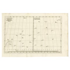
Antique Map of Gallia and Germania on one Sheet, c.1703
Located in Langweer, NL
Antique map depicting France (Gallia) and Germany (Germania). Printed for Scherer's 'Atlas Novus
Category
Antique 18th Century Maps
Materials
Paper
1899 Poole Brothers Antique Railroad Map of the Illinois Central Railroad
Located in Colorado Springs, CO
This is an 1899 railroad map of the Illinois Central and Yazoo and Mississippi Valley Railroads
Category
Antique 1890s American Maps
Materials
Paper
Antique Map of Germany During the Mid-18th Century, Published in 1747
Located in Langweer, NL
Antique map Germany titled 'A New & Accurate Map of Germany'. It covers Germany during the mid-18th
Category
Antique 18th Century Maps
Materials
Paper
Old Antique Map of the Province of Friesland, the Netherlands, c.1580
Located in Langweer, NL
Antique map titled 'Frisia Occidentalis'. Old map of the province of Friesland, the Netherlands
Category
Antique 16th Century Maps
Materials
Paper
Superb Antique Map of the Province of Gelderland, the Netherlands, ca.1575
Located in Langweer, NL
Antique map titled 'Gelriae, Cliviae, Finitimorumque Locorum Verissima Descriptio Christiano Schrot
Category
Antique 16th Century Maps
Materials
Paper
H 16.86 in W 21.97 in D 0 in
Antique Chart of Travelling Distances between European Cities, Ca.1792
Located in Langweer, NL
Antique print Europe titled 'Poliometria Europae Maxime Autem Germaniae ac Finitimorum Locorum
Category
Antique 18th Century Maps
Materials
Paper
Antique Map of Cities of the Province of Che-Kyang in China, 1738
Located in Langweer, NL
Antique print China titled 'Cities of the Province of Che-Kyang'. Old map depicting four walled
Category
Antique 18th Century Maps
Materials
Paper
Antique Map of the Bay of Batavia by Van der Aa, c.1720
Located in Langweer, NL
Antique map titled 'La Rade de Batavia'. A small early 18th century black and white map of the Bay
Category
Antique 18th Century Maps
Materials
Paper
Antique Map of the Cities of the Qing Dynasty Provinces in China, 1738
Located in Langweer, NL
Antique print titled 'Cities of the Province of Kyang-si, Fo-kyen, Shan-Si & Yun-nan'. Old map
Category
Antique 18th Century Maps
Materials
Paper
Antique Map of the Alsace region and Nova Zembla by Scherer, c.1700
Located in Langweer, NL
Antique map titled 'Chorographia Alsatiae.' Map of the Alsace region and Nova Zembla, printed for
Category
Antique 18th Century Maps
Materials
Paper
Antique Map of the Cities of the Province of Quey-Chew by Basire, 1738
Located in Langweer, NL
Antique print titled 'Cities of the Province of Quey-Chew'. Old map depicting four walled cities of
Category
Antique 18th Century Maps
Materials
Paper
Antique Map of the Cities of the Province of Shen-Si by Basire, 1738
Located in Langweer, NL
Antique print titled 'Cities of the Province of Shen-Si'. Old map depicting four walled cities of
Category
Antique 18th Century Maps
Materials
Paper
Antique Map of the Cities of the Province of Hu-Quang by Basire, 1738
Located in Langweer, NL
Antique print titled 'Cities of the Province of Hu-Quang'. Old map depicting four walled cities of
Category
Antique 18th Century Maps
Materials
Paper
Original Antique Map of the Peninsula of India with Part of Ceylon by Wyld, 1844
Located in Langweer, NL
**Dimensions:** Each sheet approximately 590 x 850 mm
This map, printed across two sizable sheets but joined
Category
Antique Mid-18th Century Maps
Materials
Paper
No Reserve
H 33.47 in W 23.23 in D 0 in
Antique Print of the City of Ten-Tchoo-Foo, China, 1796
Located in Langweer, NL
Antique print titled 'View of the City of Ten-Tchoo-Foo from the Anchorage of the Hindostan in the
Category
Antique 1790s Maps
Materials
Paper
"Africa Vetus": a 17th Century Hand-Colored Map by Sanson
By Nicolas Sanson
Located in Alamo, CA
engraved map of Africa is printed on antique hand-made watermarked, laid, chain-linked paper with wide
Category
Antique Late 17th Century French Maps
Materials
Paper
Antique Engraving of a Print with a View of Masulipatam, India, 1672
Located in Langweer, NL
Antique print titled 'Masulipatam'.
Original antique print showing a view of Masulipatam, India
Category
Antique 1670s Maps
Materials
Paper
- 1
Get Updated with New Arrivals
Save "Antique European Map Prints", and we’ll notify you when there are new listings in this category.
More Ways To Browse
Chinese Hunan Province
Rare Map Of Ireland
Mid Century Maps
Authentic Antique Suit Of Armor
Important Map
Azores Map
Moldova Antique Map
Paraguay Antique Map
Elephant Miniature
Alabama Map
Antique Puerto Rico Map
J Beringer
Map Of Ural
Old Prints Of Maps
Antique Old World Maps
Map Of Indonesia
Map Of Edinburgh
Plate Les Ottomans
