Items Similar to Original Antique Map of the Philippines, Malaysia, Indonesia, Singapore, c.1690


Want more images or videos?
Request additional images or videos from the seller
1 of 6
Original Antique Map of the Philippines, Malaysia, Indonesia, Singapore, c.1690
About the Item
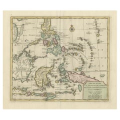
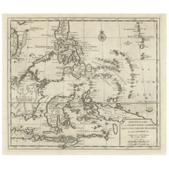
Antique map titled 'Isole dell' Indie, diuise in Filippine, Molucche e della Sonda'.
Old map of the Philippines, Malaysia, Indonesia, Singapore, Northern Australia and contiguous islands. Ornamental cartouche at lower left with title on drape, carried by mermaids. This map originates from 'Atlante Veneto' by Coronelli.
Artists and Engravers: Coronelli was both a cleric and an encyclopedist, with a particular interest in geography and cartography. In 1681 Coronelli served as Royal Cartographer to King Louis XIV in Paris, gaining special access to the most current records on world geography sent in from the colonies, and provided by the French Academy of Sciences. Coronelli returned to Venice in 1684 and founded the Accademia Cosmografica degli Argonauti, a geographical society with membership drawn from the aristocracy and church hierarchy, and a year later he was appointed Cosmographer to the Republic of Venice. He also started a successful publishing career, and was sole author or contributor to over 140 titles and produced several hundred maps, either printed separately or as parts of atlases. By the end of the 17th century, Coronelli was perhaps the most famous map publisher in Europe and received constant requests from his contemporaries for information that would enable them to bring their atlases up to date.
Condition: Good, general age-related toning. Small tear in 'Borneo'. Ugly spots outside the image and outside the plate imprint on the edge of the paper. This map will look clean and very decorative in a frame on the wall. Blank verso, please study image carefully.
- Dimensions:Height: 19.49 in (49.5 cm)Width: 27.56 in (70 cm)Depth: 0 in (0.02 mm)
- Materials and Techniques:
- Period:1690-1699
- Date of Manufacture:circa 1690
- Condition:Condition: Good, general age-related toning. Small tear in 'Borneo'. Ugly spots outside the image and outside the plate imprint on the edge of the paper. This map will look clean and very decorative in a frame on the wall. Blank verso.
- Seller Location:Langweer, NL
- Reference Number:
About the Seller
5.0
Platinum Seller
These expertly vetted sellers are 1stDibs' most experienced sellers and are rated highest by our customers.
Established in 2009
1stDibs seller since 2017
1,916 sales on 1stDibs
Typical response time: <1 hour
- ShippingRetrieving quote...Ships From: Langweer, Netherlands
- Return PolicyA return for this item may be initiated within 14 days of delivery.
More From This SellerView All
- Antique Map of Singapore, Malaysia, Borneo, Sumatra and Java (Indonesia), 1739Located in Langweer, NL"Antique map titled 'Nieuwe kaart van de Sundasche Eilanden als Borneo, Sumatra en Groot Iava & c'. Detailed map of Southeast Asia, extending from the tip of Cambodia to Java. This m...Category
Antique 18th Century Maps
MaterialsPaper
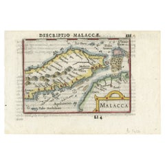
- Rare Original Handcolored Miniature Map of Malaysia and Singapore, 1600Located in Langweer, NLVery handsome original old coloured copper engraving of Malaysia and Singapore, with parts of Sumatra, inc the island of Bangka and Bintam. Title of the map 'Description Malacca'. On...Category
Antique Early 1600s Maps
MaterialsPaper
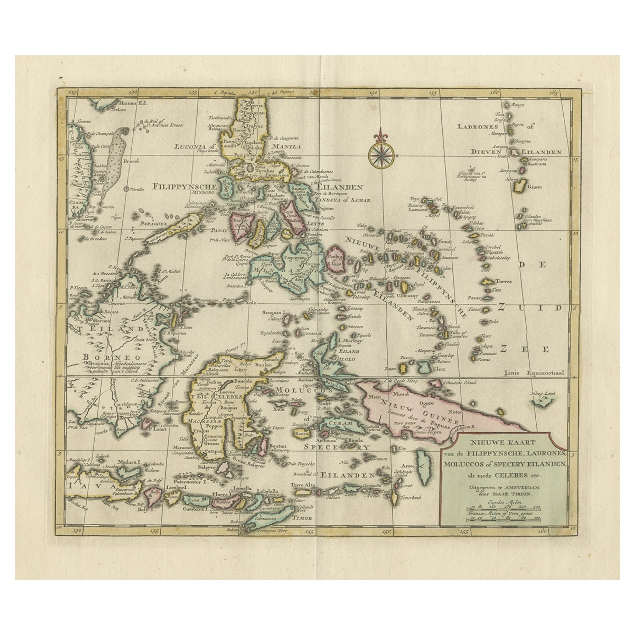
- Old Original Map of the Philippines and Part of Indonesia 'Spice Islands', 1744Located in Langweer, NLAntique map titled 'Nieuwe Kaart van de Filippynsche, Ladrones, Moluccos of Specery Eilanden, als mede Celebes etc'. Old map of the Philippines and part of Indonesia. Originates ...Category
Antique 1740s Maps
MaterialsPaper
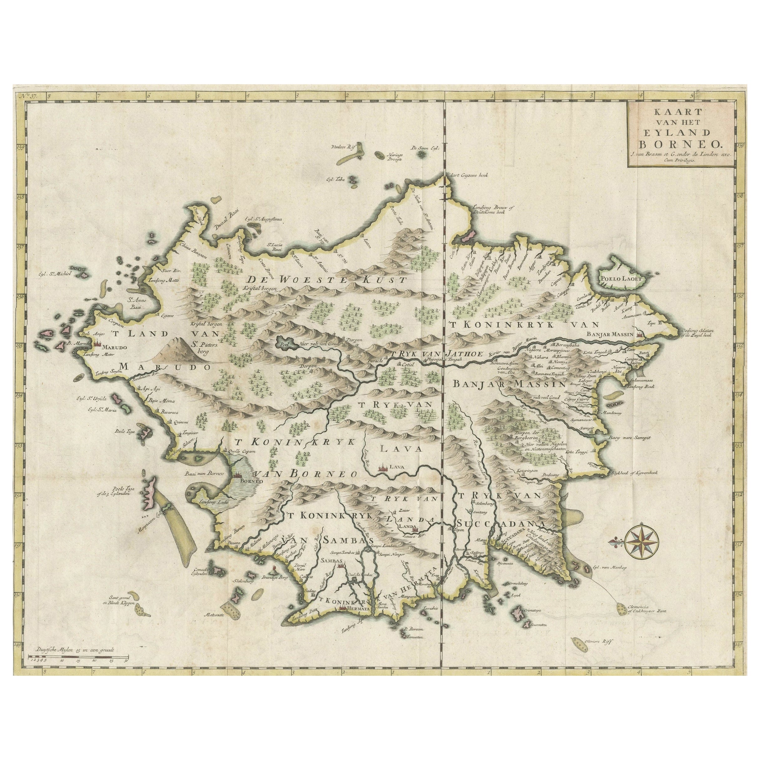
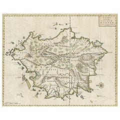
- Old Antique Map of Borneo 'Kalimantan Indonesia, Sabah Malaysia & Brunei'Located in Langweer, NLAntique map titled 'Kaart van het Eyland Borneo'. Original antique map of the island of Borneo. Published 1724-1726 by Joannes van Braam and Gerard Onder de ...Category
Antique Early 18th Century Maps
MaterialsPaper
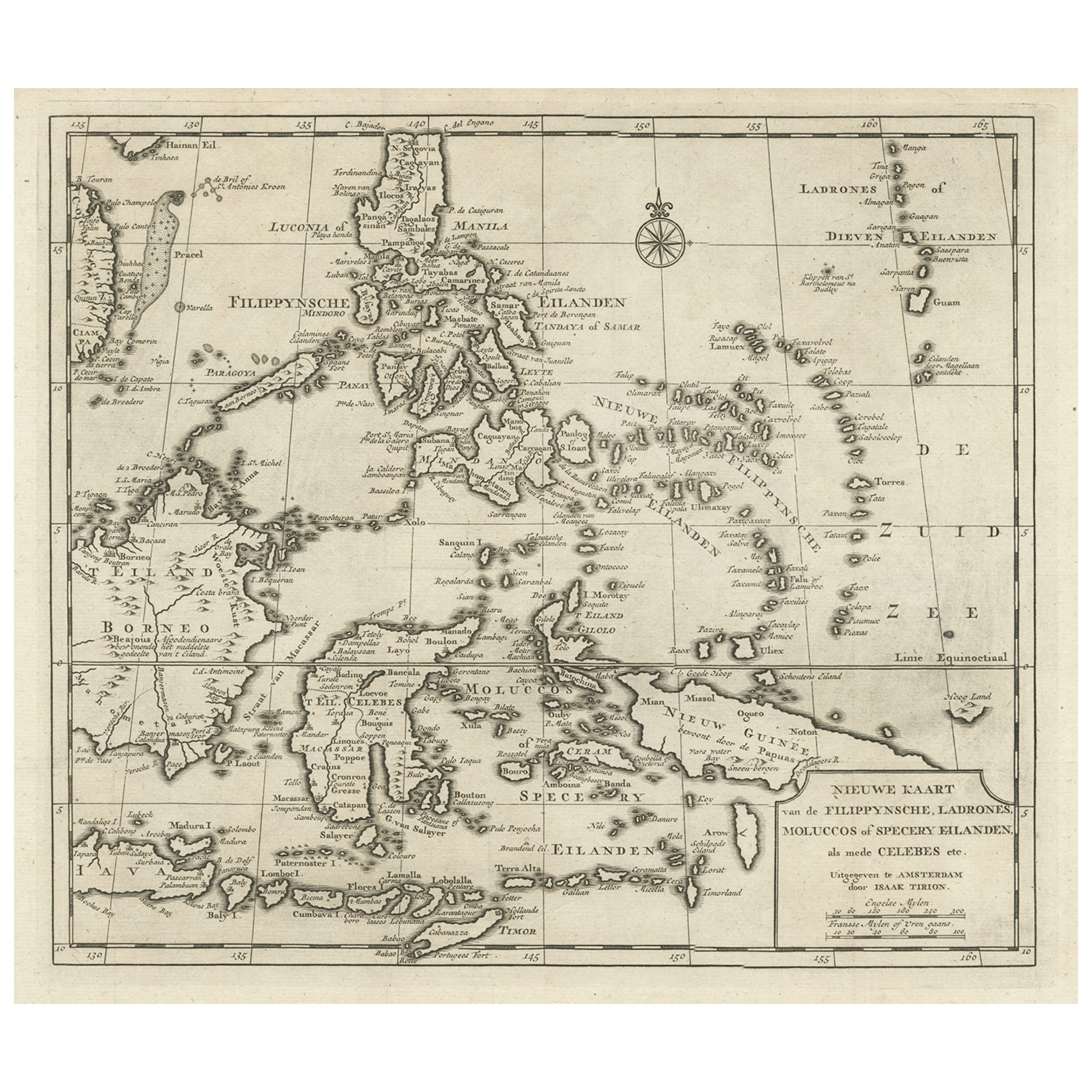
- Old Map of the Philippines and Part of Indonesia 'Spice Islands', 1744Located in Langweer, NLAntique map titled 'Nieuwe Kaart van de Filippynsche, Ladrones, Moluccos of Specery Eilanden, als mede Celebes etc'. Old map of the Philippines and part of Indonesia. Originates ...Category
Antique 1740s Maps
MaterialsPaper
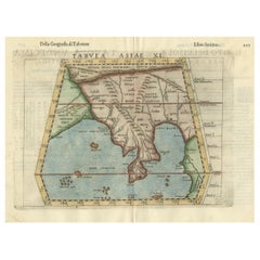
- Original Antique Ptolemaic Map of the Region of Thailand and MalaysiaLocated in Langweer, NLAntique map titled 'Tabula Asiae XI'. Based on the interpretations of Solinus and Munster, this Ptolemaic map covers the region roughly of Thailand and Malaysia. An oddly shaped (Mal...Category
Antique 16th Century Maps
MaterialsPaper

You May Also Like
- Original Antique Map of Italy. C.1780Located in St Annes, LancashireGreat map of Italy Copper-plate engraving Published C.1780 Unframed.Category
Antique Early 1800s English Georgian Maps
MaterialsPaper

- Original Antique Map of Asia. C.1780Located in St Annes, LancashireGreat map of Asia Copper-plate engraving Published C.1780 Two small worm holes to right side of map Unframed.Category
Antique Early 1800s English Georgian Maps
MaterialsPaper

- Original Antique Map of India. C.1780Located in St Annes, LancashireGreat map of India Copper-plate engraving Published C.1780 Three small worm holes to right side of map and one bottom left corner Unframed.Category
Antique Early 1800s English Georgian Maps
MaterialsPaper

- Original Antique Map of Hungary, Arrowsmith, 1820Located in St Annes, LancashireGreat map of Hungary Drawn under the direction of Arrowsmith. Copper-plate engraving. Published by Longman, Hurst, Rees, Orme and Brown, 1820 Unframed.Category
Antique 1820s English Maps
MaterialsPaper
- Original Antique Map of France, Arrowsmith, 1820Located in St Annes, LancashireGreat map of France Drawn under the direction of Arrowsmith. Copper-plate engraving. Published by Longman, Hurst, Rees, Orme and Brown, 1820 Unframed.Category
Antique 1820s English Maps
MaterialsPaper
- Original Antique Map of Canada, Arrowsmith, 1820Located in St Annes, LancashireGreat map of Canada. Drawn under the direction of Arrowsmith. Copper-plate engraving. Published by Longman, Hurst, Rees, Orme and Brown, 1820 ...Category
Antique 1820s English Maps
MaterialsPaper


Recently Viewed
View AllMore Ways To Browse
Antique Old World
Antique Old World Furniture
Filipino Furniture
Map Wall
Antique Wall Map
Antique Wall Maps
Antique World Map Print
Antique Church Collectibles
Philippines Contemporary
Singapore Furniture
World Map Wall
Furniture From Singapore
Map Australia
Maps Of Australia
French Old Paris Plates
Antique Wall World Map
Antique Wall Maps Of The World
French Wall Map