Items Similar to Rare Original Handcolored Miniature Map of Malaysia and Singapore, 1600

Want more images or videos?
Request additional images or videos from the seller
1 of 5
Rare Original Handcolored Miniature Map of Malaysia and Singapore, 1600
About the Item
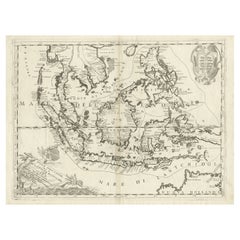
Very handsome original old coloured copper engraving of Malaysia and Singapore, with parts of Sumatra, inc the island of Bangka and Bintam. Title of the map 'Description Malacca'. On the reverse text in Latin.
Singapore is mentioned as 'Sinqapura'.
Very interesting and decorative miniature map of the Malacca Strait over 400 years ago.
- Dimensions:Height: 4.73 in (12 cm)Width: 7.09 in (18 cm)Depth: 0 in (0.02 mm)
- Materials and Techniques:
- Period:1600-1609
- Date of Manufacture:1600
- Condition:The image is fine and nicely coloured.
- Seller Location:Langweer, NL
- Reference Number:
About the Seller
5.0
Platinum Seller
These expertly vetted sellers are 1stDibs' most experienced sellers and are rated highest by our customers.
Established in 2009
1stDibs seller since 2017
1,947 sales on 1stDibs
Typical response time: <1 hour
- ShippingRetrieving quote...Ships From: Langweer, Netherlands
- Return PolicyA return for this item may be initiated within 14 days of delivery.
More From This SellerView All
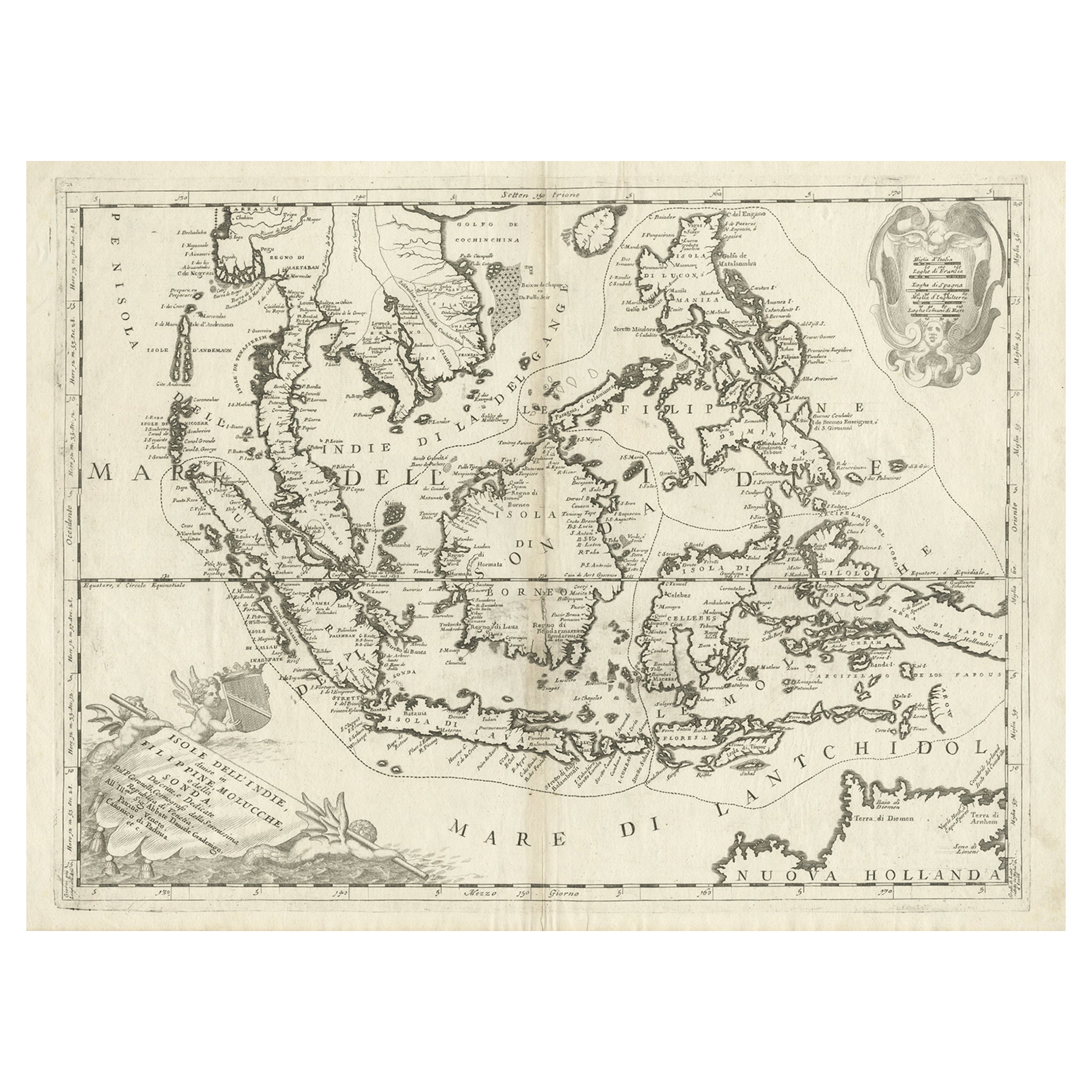
- Original Antique Map of the Philippines, Malaysia, Indonesia, Singapore, c.1690Located in Langweer, NLAntique map titled 'Isole dell' Indie, diuise in Filippine, Molucche e della Sonda'. Old map of the Philippines, Malaysia, Indonesia, Singapore, Northern Australia and contiguous i...Category
Antique 1690s Maps
MaterialsPaper
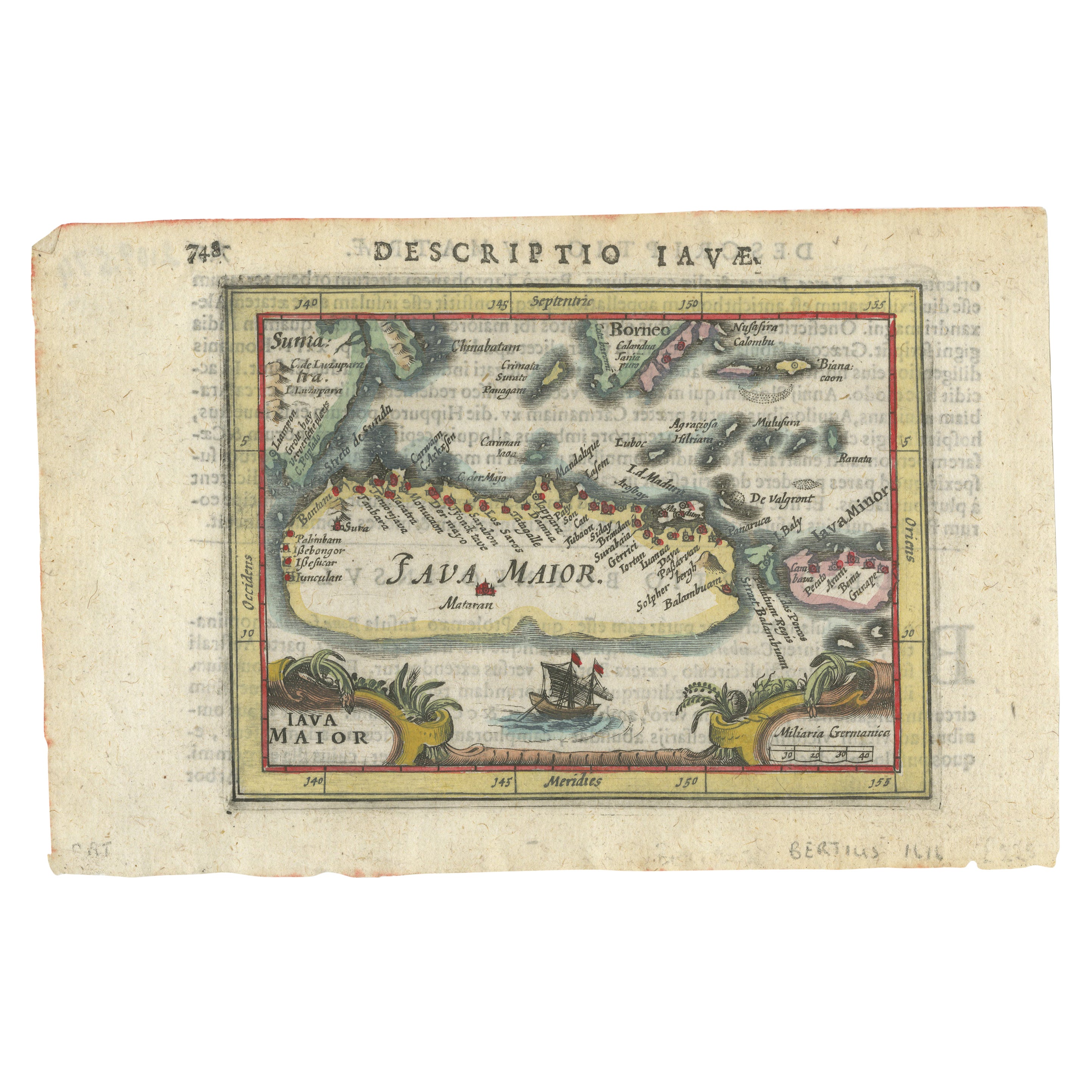
- Rare 16th Century Original Handcolored Miniature Map of Java, Indonesia, 1616Located in Langweer, NLVery handsome original old coloured copper engraving by Bertius of the island of Java in the early days of the Dutch colonisation - at that time named The Dutch East Indies or nowada...Category
Antique 1610s Maps
MaterialsPaper
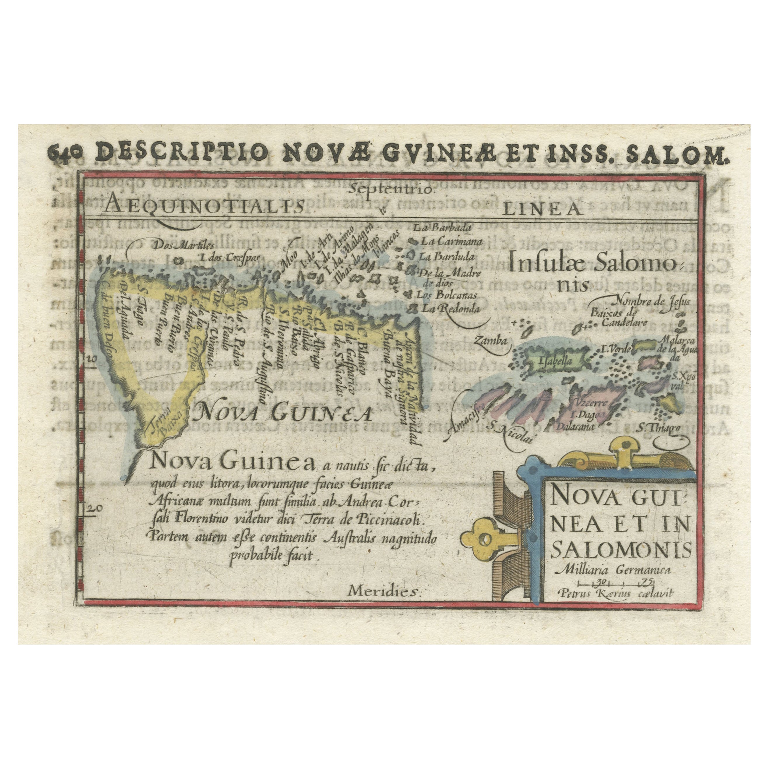
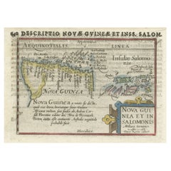
- Rare Original Miniature Map of Papua New Guinea and the Salomon Islands, 1600Located in Langweer, NLVery handsome original old coloured copper engraving of Papua and the Solomon Island. Title of the map 'Descriptio Novae Guneae et Inss. Salom. On the reverse text in Latin. Ve...Category
Antique Early 1600s Maps
MaterialsPaper
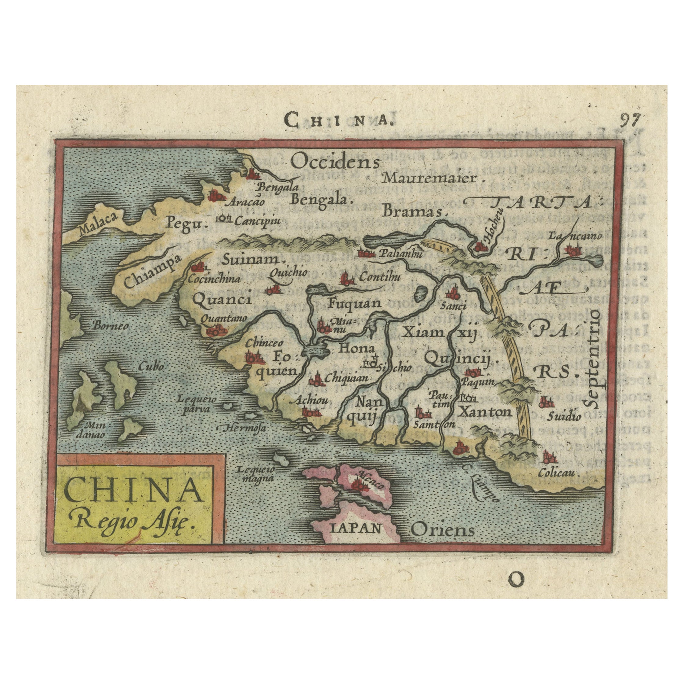
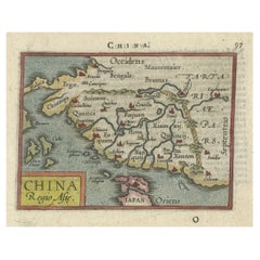
- Rare 16th Century Original Handcolored Miniature Map of China, Published in 1593Located in Langweer, NLVery handsome original old coloured copper engraving of China. The northern part of Japan is projected as well. Many cities and areas are mentioned in the old spelling, incl Malacca,...Category
Antique 16th Century Maps
MaterialsPaper
- Antique Map of Singapore, Malaysia, Borneo, Sumatra and Java (Indonesia), 1739Located in Langweer, NL"Antique map titled 'Nieuwe kaart van de Sundasche Eilanden als Borneo, Sumatra en Groot Iava & c'. Detailed map of Southeast Asia, extending from the tip of Cambodia to Java. This m...Category
Antique 18th Century Maps
MaterialsPaper
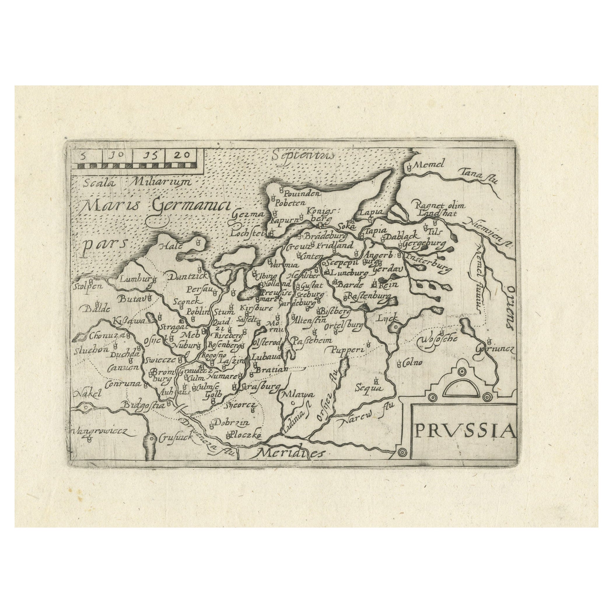
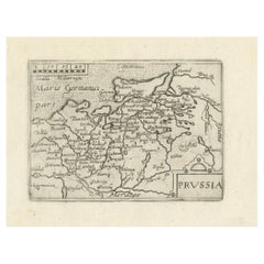
- Extremele Rare, Original Miniature Map of Prussia, ca.1640Located in Langweer, NLAntique map titled 'Prussia'. Extremele rare, original miniature map of Prussia, a historically prominent German state that originated in 1525 with a du...Category
Antique 1640s Maps
MaterialsPaper


You May Also Like
- Original Antique Map of Spain and Portugal, circa 1790Located in St Annes, LancashireSuper map of Spain and Portugal Copper plate engraving by A. Bell Published, circa 1790. Unframed.Category
Antique 1790s English Other Maps
MaterialsPaper
- Original Antique Map of Italy. C.1780Located in St Annes, LancashireGreat map of Italy Copper-plate engraving Published C.1780 Unframed.Category
Antique Early 1800s English Georgian Maps
MaterialsPaper

- Original Antique Map of Asia. C.1780Located in St Annes, LancashireGreat map of Asia Copper-plate engraving Published C.1780 Two small worm holes to right side of map Unframed.Category
Antique Early 1800s English Georgian Maps
MaterialsPaper

- Original Antique Map of India. C.1780Located in St Annes, LancashireGreat map of India Copper-plate engraving Published C.1780 Three small worm holes to right side of map and one bottom left corner Unframed.Category
Antique Early 1800s English Georgian Maps
MaterialsPaper

- Original Antique Map of Sweden and Norway, Grattan and Gilbert, 1843Located in St Annes, LancashireGreat map of Sweden and Norway Drawn and engraved by Archer Published by Grattan and Gilbert Original color Unframed.Category
Antique 1840s English Other Maps
MaterialsPaper
- Original Antique Map of United States, Grattan and Gilbert, 1843Located in St Annes, LancashireGreat map of United States Drawn and engraved by Archer Published by Grattan and Gilbert. 1843 Original colour Unframed.Category
Antique 1840s English Maps
MaterialsPaper


Recently Viewed
View AllMore Ways To Browse
Antique Latin
Singapore Furniture
Antique Malaysia
Malaysian Antique Furniture
Antique Furniture Malaysia
Singapore Antique
Singapore Antique Furniture
Map Of Singapore
Singapore Map
Handcolored Engraving
Malaysian Map
Malaysia Map
Antique Maps Singapore
Antique Maps Inc
Large Antique Compass
Antique New England Maps
Antique Map New England
Antique Map Of New England